


TOPO Via ferrata | CLIMBING7.COM
Publié le
 Partager sur WhatsApp
 Partager sur Twitter
Partager sur Instagram
Partager sur Twitter
Partager sur Instagram

 Partager sur Facebook
 Imprimer le topo
 Laisser un commentaire

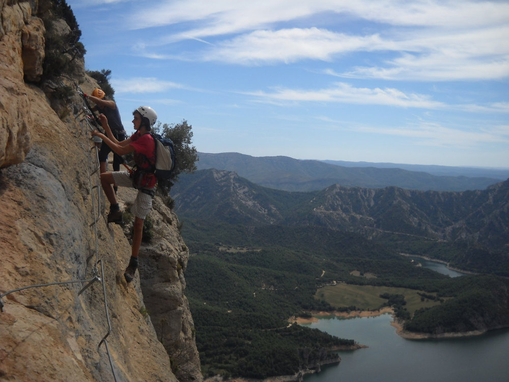
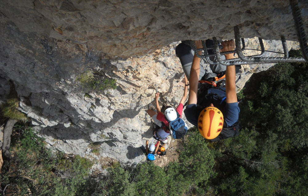
Please note that this ferrata is currently closed (2016) for safety reasons. Let's hope it will be re-equipped soon, as the Regina de Peramola is one of Catalonia's great ferratas, set in exceptional surroundings in the village of Coll de Nargo, just a few kilometers from Andorra. The route is long and difficult, with exposed sections and a 350m vertical drop. Stunning views over Lake Oliana and the Seu d'Urgell valley. The equipment is perfect, almost too much so in places. To sleep in the area, apart from the squat option in the beautiful surrounding fields, you can go as far as Organya, a village 5kms north of Coll de Nargo where there's a very pleasant little campsite, based around the local soccer pitch (approx. 5 euros per person per night). Not far either from the climbing sites, notably on Oliana with the famous Roc del Rumbau. All in all, a great place, a 5-star spot!
❱❱ Technical summary
Type ✦ Via ferrata
Location ✦ Coll de Nargo
Region ✦ Catalunya
Country ✦ Spain
Vertical rise ✦ 450m
Length ✦ 800m
Difficulty ✦ K4
Duration ✦ 4h30 to 5h
❱❱ Access to the place
From Barcelona, head towards Andorra via Ponts and then up towards Seu d'Urgell. The ferrata starts a few kilometers before you reach the village of Coll de Nargo. Arriving from Barcelona, there's a parking lot on the left of the road, before the last series of tunnels, at the Esquella bridge. It's best to turn around after the tunnels and return to the parking lot from Coll de Nargo.
❱❱ Map & topo

❱❱ Itinéraire
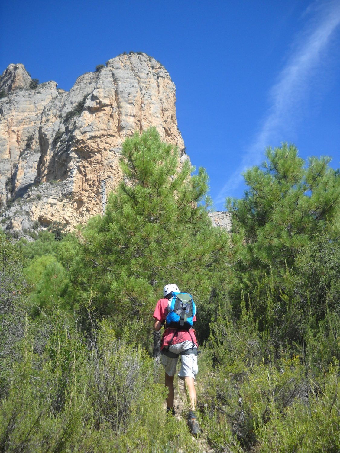
From the parking lot, the path passes the foot of the most advanced rocky peak, skirting it slightly to find the start of the ferrata. Follow a path marked with red dots. Easy to find, with the rock in sight.
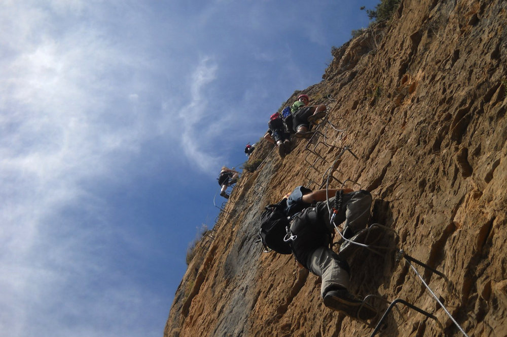
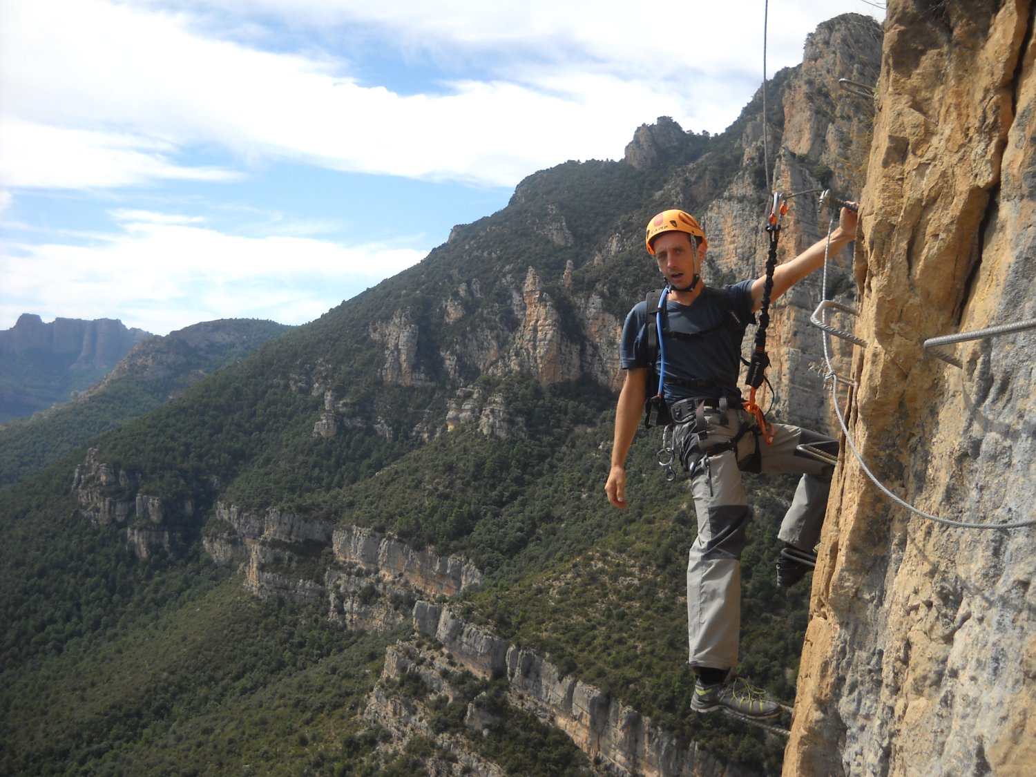
The via ferrata faces south and has a 350m vertical drop. The equipment is good and generous. There are quite a few obstacles, including a very aerial bridge, numerous long vertical pitches and overhangs. The level of difficulty comes more from the gas than from the technical or physical aspects. The route is busy, so it's best to start early to avoid the flow.
There are several ways off the via after the first or second section. Otherwise, from the top, the path descends the massif, skirting the rock with the help of a few chains and bars. In the second section, the path makes a wide loop along immense red cliffs inhabited by vultures.


Leave a Reply