


TOPO Via ferrata | CLIMBING7.COM
Publié le
 Partager sur WhatsApp
 Partager sur Twitter
Partager sur Instagram
Partager sur Twitter
Partager sur Instagram

 Partager sur Facebook
 Imprimer le topo
 Laisser un commentaire

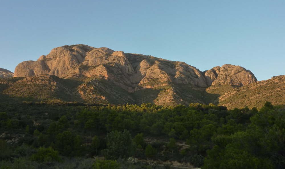
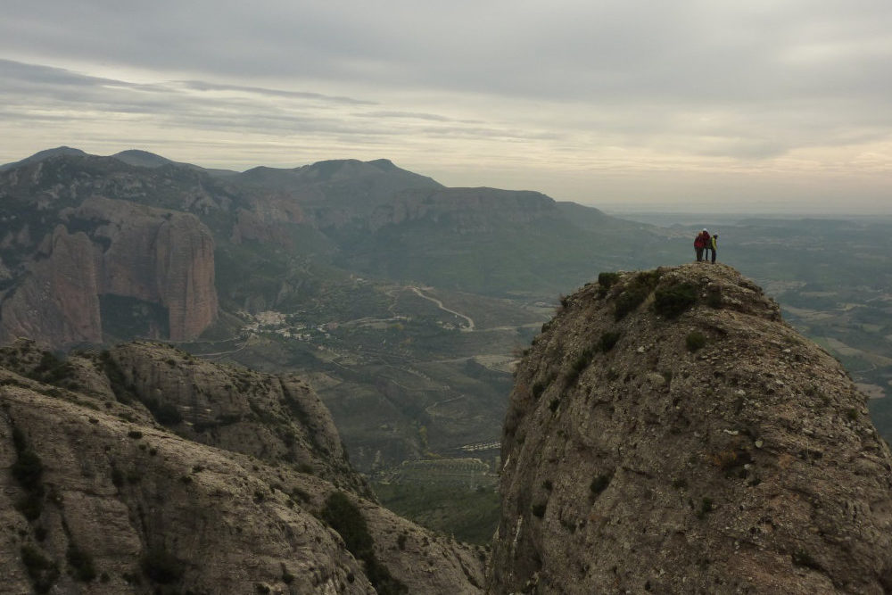
Otra opción para descubrir los Mallos de Riglos, el valle del río Gállego y una magnífica vista de los Pirineos de 3000 m es subir a Peña Rueba (1193 m), situada al oeste de Riglos, por encima del pueblo de Murillo de Gállego. Esta gran mole de dientes rocosos puede escalarse de varias maneras. Nosotros optamos por abordarla desde el oeste por la vía ferrata Varella Portillo, antes de descender por la cara sur por la vía ferrata La Mora. Después de hacerlo, efectivamente nos pareció la mejor opción, ya que la ferrata oeste es más vertical y más interesante de subir y, sobre todo, la ferrata de la Mora es bastante fácil de bajar y nos deja libres para admirar el panorama. Es una ruta muy accesible, aunque larga (el bucle completo dura 4 horas), con magníficas vistas aéreas de la región, los Mallos de Riglos, el Río Gállego, los Pirineos, los Mallos d'Agüero y mucho más.
❱❱ Reseñas técnicas
Tipo ✦ Vía ferrata
Localización ✦ Murillo de Gállego
Región ✦ Aragón
País ✦ España
Desnivel ✦ 500m
Distancia ✦ 5kms
Dificultad ✦ K3
Duración ✦ 4h a 4h30
❱❱ Acceso al sitio
Después de Huesca, continúe por la A-132 en dirección Ayerbe y Pamplona. Después de Ayerbe, llegar hasta Murillo de Gállego. Atravesar el pueblo (de hecho la carretera pasa ligeramente a la derecha) y antes de salir de él, tomar la carretera de la izquierda que sube hacia el "Hostal Virgen de Liena". Suba y siga la 1ª señal morada de "Iglesia de la virgen de Liena". En la 2ª señal que apunta a la izquierda, desvíese a la derecha por la pista de grava. Esta pista bordea un gran muro que rodea una casa y, después de algunas curvas, bordea por la izquierda el primer depósito de agua y, a continuación, el segundo. Continuamos recto por la pista de tierra, que puede estar en muy mal estado según la época del año. El macizo de Peña Rueba es claramente visible. Seguimos esta pista de tierra (o caminamos por ella si no es transitable) durante un corto espacio de tiempo y unos cien metros antes de una gran curva a la izquierda, hay un espacio a la izquierda para aparcar y/o vivaquear. El camino de aproximación comienza unos metros a la derecha (kairn + marcas amarillas y rojas).
❱❱ Mapa & topo

❱❱ Itinéraire
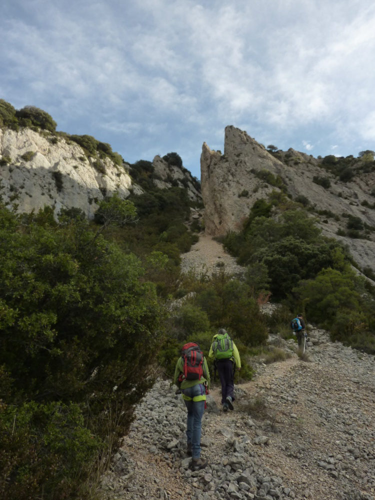
Tomar este camino que se dirige hacia el este a la derecha, luego muy rápidamente girar a la izquierda por un pequeño sendero (mojones, luego triángulos rojos y amarillos) que va directamente a la cueva calva claramente visible (20′). Siga el camino bajo la cueva (si no lo hace, gire a la derecha y rodee la cueva por el lado equivocado), bordee las paredes y siga el camino ampliamente hacia el oeste. Nos alejamos un poco del macizo y descendemos para cruzar un torrente, por el que hay que volver a subir hacia las grandes paredes que se ven arriba. El camino atraviesa la maleza y se retuerce y gira alrededor de un afloramiento rocoso a la derecha hasta llegar al pie de las paredes horizontales (40′).
El camino gira entonces bruscamente hacia el este y pasa por la Faja Varella Portello, una especie de paso natural entre los estratos rocosos. En línea de visión se ve un pico puntiagudo que marca el inicio de la ferrata. Para llegar a ella, hay que seguir la pista por un pequeño valle, subir un poco y salir al pie de una ladera de pedregal que hay que remontar casi hasta la cima. Cruza el pedregal para encontrar el primer equipo de ferrata (30′).
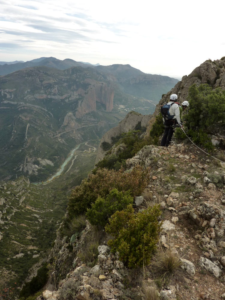
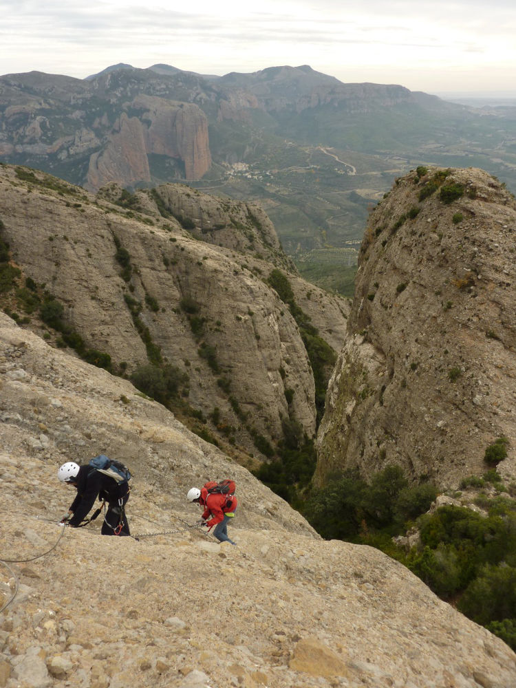
Hay dos vías ferratas: la Varella Portillo, orientada al oeste e inaugurada en 2004, y la Mora, orientada al sur e inaugurada en 2009. El desnivel total es de 500 m. El equipamiento instalado, cadenas y peldaños, es excelente.
Descender desde el mirador y tomar esta vez el camino que continúa hacia el sur, que desciende muy rápidamente mediante cables y algún peldaño inferior para llegar sin dificultad al pie de la ferrata de la Mora (1h desde la cima de Peña Rueba). Tomar el camino de la derecha que bordea el macizo hasta llegar a la cueva calva, luego tomar el camino de aproximación en sentido contrario hasta llegar a la pista de tierra.


Deja una respuesta