


TOPO Canyoning | CLIMBING7.COM
Publié le
 Partager sur WhatsApp
 Partager sur Twitter
Partager sur Instagram
Partager sur Twitter
Partager sur Instagram

 Partager sur Facebook
 Imprimer le topo
 Laisser un commentaire
Massif du Canigou, Day 1 of the Pyrénées Orientales session. A short trip to Ceret, in search of good weather and a chance to warm up before tackling the big canyons in the area. The Gourg des Anelles is a perfect canyon for all these purposes, fairly short, with plenty to jump, slide and recall in a wild and sunny atmosphere, and water at the ideal temperature. In short, it's a descent to remember in the area, though not a crowded one, but well worth the detour.
❱❱ Technical summary
Type ✦ Water canyon
Location ✦ Céret
Region ✦ Pyrénées-Orientales
Country ✦ France
Vertical rise ✦ 70m
Distance ✦ 500m
Difficulty ✦ v4-a4-II
Max abseiling ✦ 15m
Duration ✦ 1h30 to 2h
❱❱ Access to the place
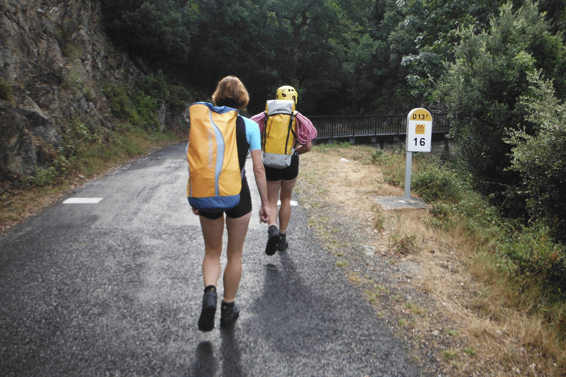
From the village of Ceret (above Perpignan), head towards Fonfrède et Illas. Follow the small road up above Ceret to the km 17 marker. A little further on, before km 16 and a small iron bridge, park before a left-hand bend. There is a small parking lot on either side of the road.
❱❱ Map & topo
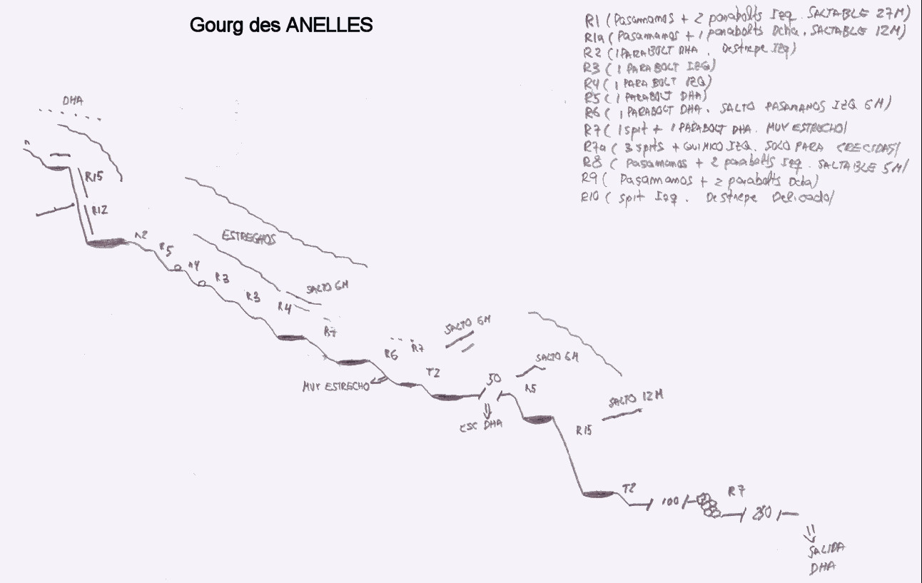
❱❱ Itinéraire
Climb up and pass km16 and the bridge to find a path leading down to the right (well-marked). Wind your way down, then below, take the clear fork on the left, with a small cairn. Continue on through the woods, ending up in the bed of the Gourg des Anelles.
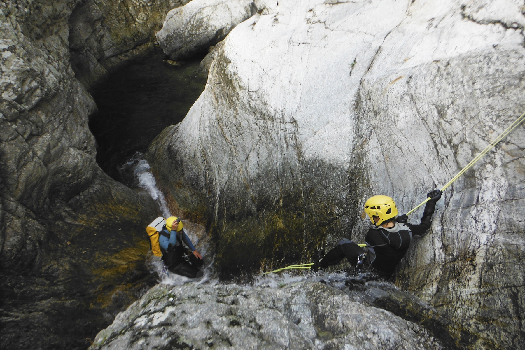
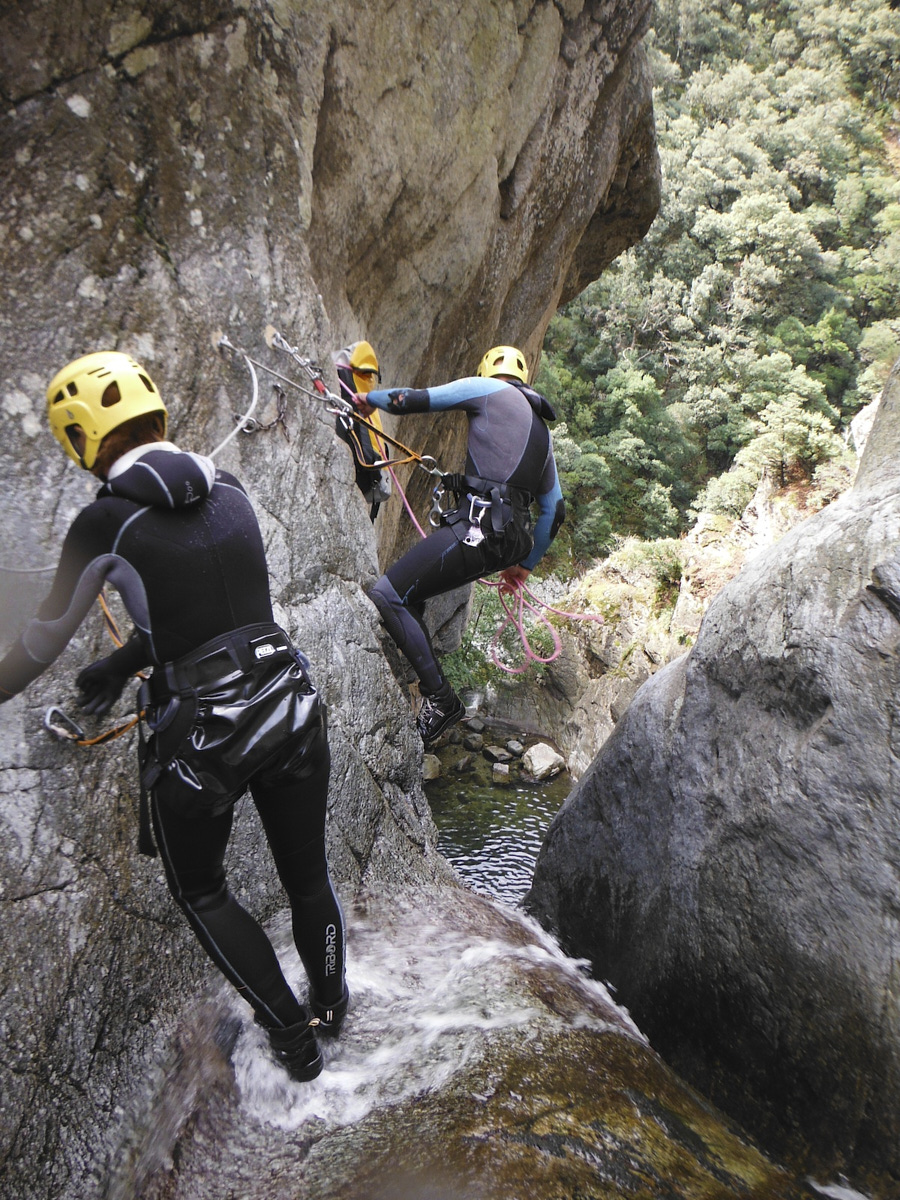
The aquatic canyon, facing north-east, is not very difficult and is perfectly equipped. It's a great way to get into the swing of things.
The first obstacle is an S-shaped waterfall some 20 metres long, leading into a huge basin. You can either abseil down to finish in a slide over the last few metres, or join a handrail on the right for a nice jump of around 10m, dashing far ahead to avoid the rock that comes forward... a little tense.
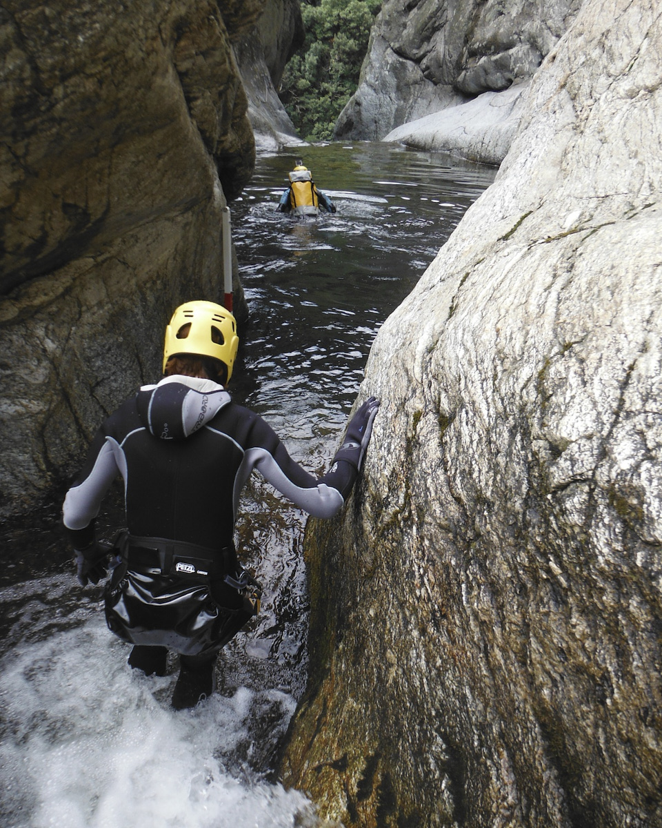
Further down, you come to a large basin which opens onto vegetation, with a large tree lying across it. At this point, you can climb back up to the left to grab a handrail and make another 7-8m jump.
After this, there's an easy aquatic hike before a possible 3rd jump of 5 m, followed by a large slide of around 20 m, also to be triggered on the second part. Finally, there's a passage under a rock with a small knotted rope and, just beyond, a hole through which you can crawl feet-first. End of course.
A little further on, to the right, we enter the trees (vaguely marked path, tangled vegetation). It's a steep climb up to a small pass, then down the other side, passing along a hole. It then climbs back up to join a larger path (the approach path) to the left. Pass the approach fork again and climb back up to the starting point.


Leave a Reply