


TOPO Hiking | CLIMBING7.COM
Publié le
 Partager sur WhatsApp
 Partager sur Twitter
Partager sur Instagram
Partager sur Twitter
Partager sur Instagram

 Partager sur Facebook
 Imprimer le topo
 Laisser un commentaire

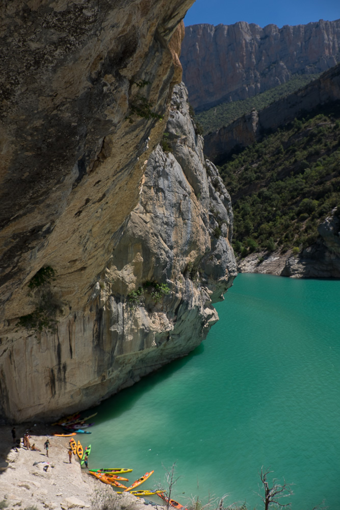
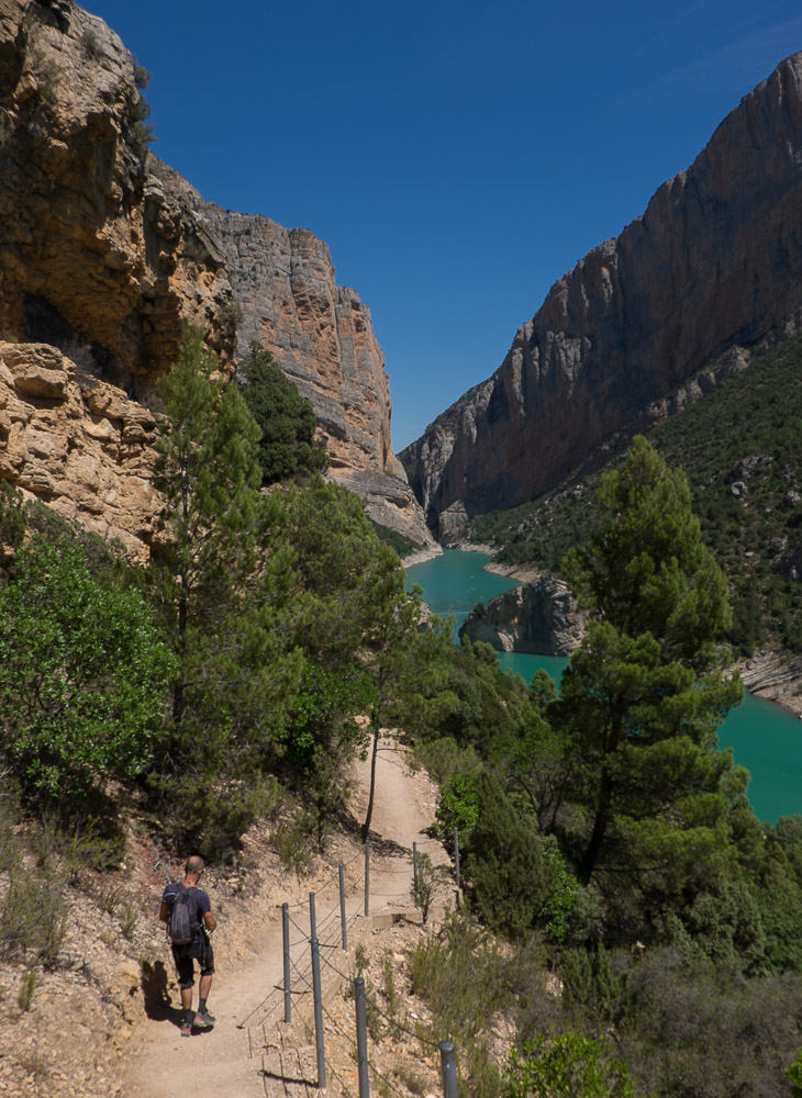
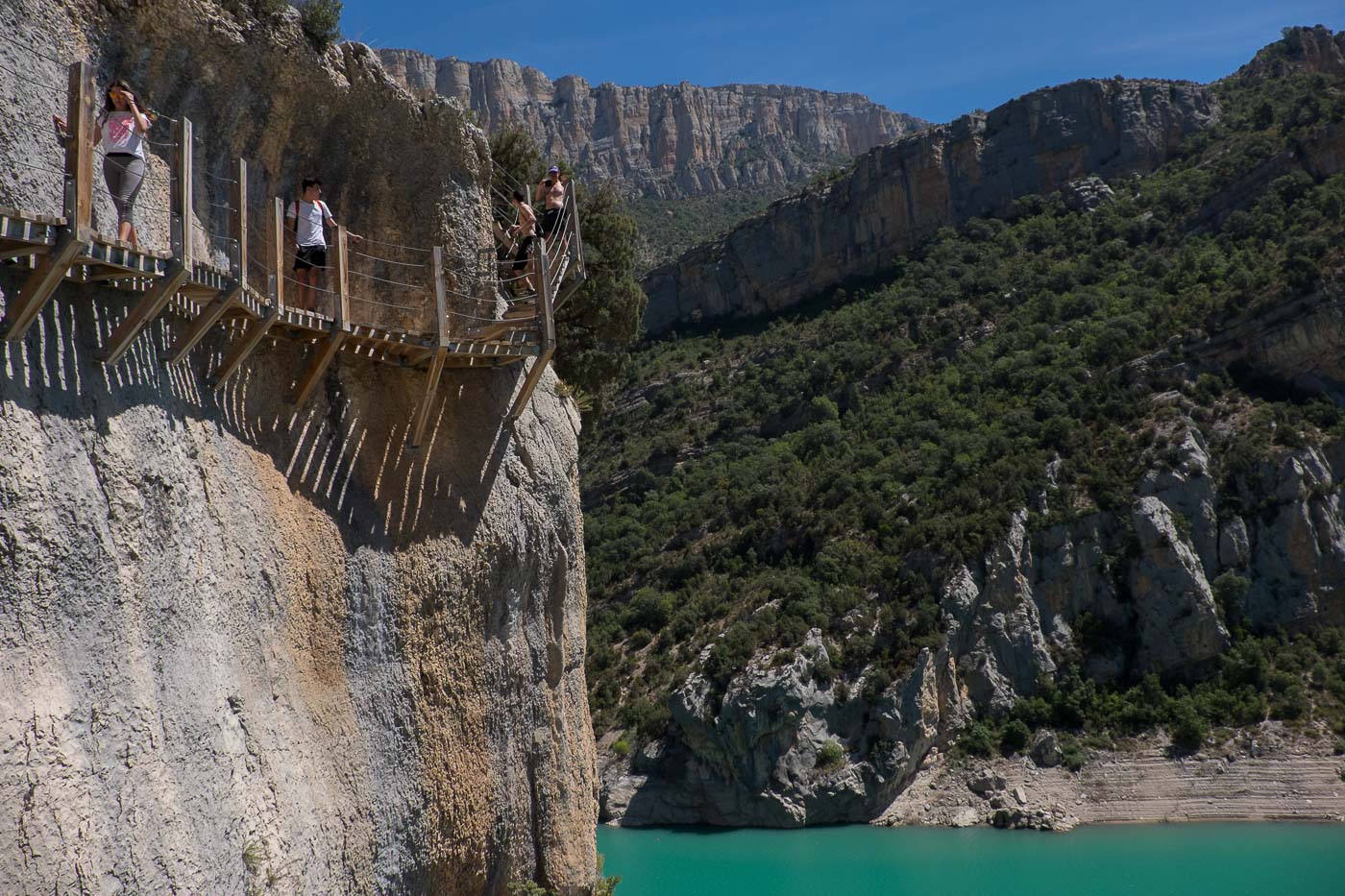
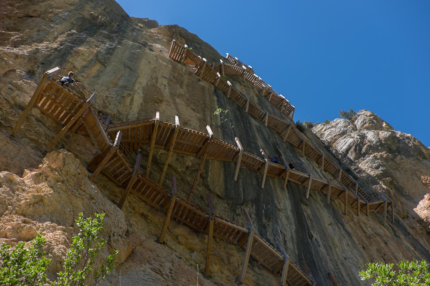
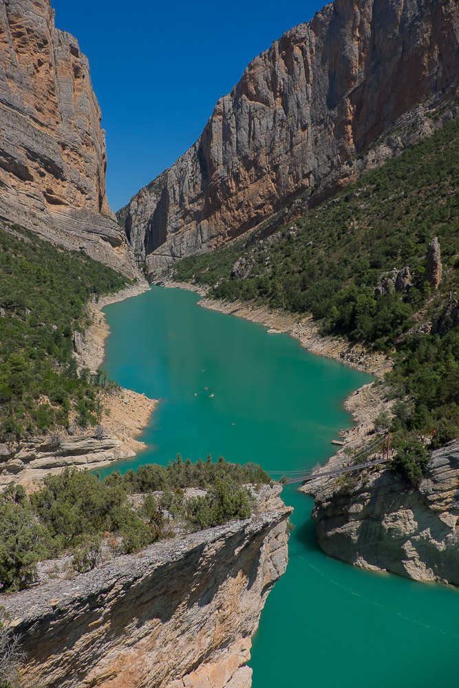
From the small village of Montfalcó, on the shores of Lac de Canelles, on the border between Aragón and Catalunya, Las Pasarelas de Montfalco offers an exceptional itinerary. It takes you to the entrance to the Congost de Montrebei, a fantastic natural gateway to the Pyrenees forming an impressive defile that allows the turquoise waters of the Noguera Ribagorçana to calmly flow between the gigantic walls of Montsec d'Estall and Montes d'Ares. The gorge is accessed via 2 highly original sections equipped with vertiginous wooden footbridges literally suspended along the rock faces. The scenery is splendid, and the panorama of the lake and gorge is breathtaking, in a natural setting of stunning colors. It's obviously a busy place, especially in summer, but that doesn't detract from its appeal, even if a spring or autumn visit would be preferable. The 2 aerial passages pose no difficulty apart from a rapid impression of vertigo, as some of them are narrow and slope slightly towards the void. At the very bottom, you can cross over the bridge that links the 2 provinces and continue to join the Catalan side of the GR, which this time leads into the gorge, or cross over and finish on the other side as far as the Pont de Montanyana (in which case 2 vehicles are required). We simply turned back to complete our tour via the barranco de la Coma and avoid the return trip.
❱❱ Technical summary
Type ✦ Hiking
Location ✦ Montfalcó
Region ✦ Aragon
Country ✦ Spain
Length ✦ 9,5km
Elevation gain ✦ 550m
Difficulty ✦ MD
Duration ✦ 3h to 3h30
Interest ✦ ★★
❱❱ Access to the place
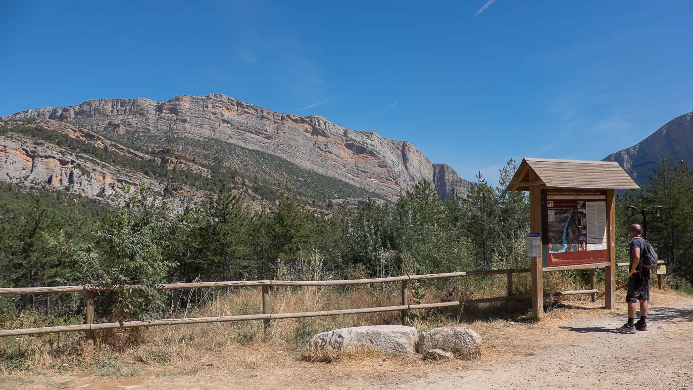
From Barcelona, take the A2 towards Leida and branch off towards Balaguer at Tarrega. Pass Balaguer towards Alfarras on the Aragonese side of the C26, and follow the N230 north to Benabarre. From here, continue north on the N230, passing Tolva and turning right at Viacamp. Pass through the small village and follow the level track to l'Estall. Just before Montfalcó, at a bend in the road, park. This is the return point via the barranco de la Coma.
❱❱ Map & topo

❱❱ Itinéraire
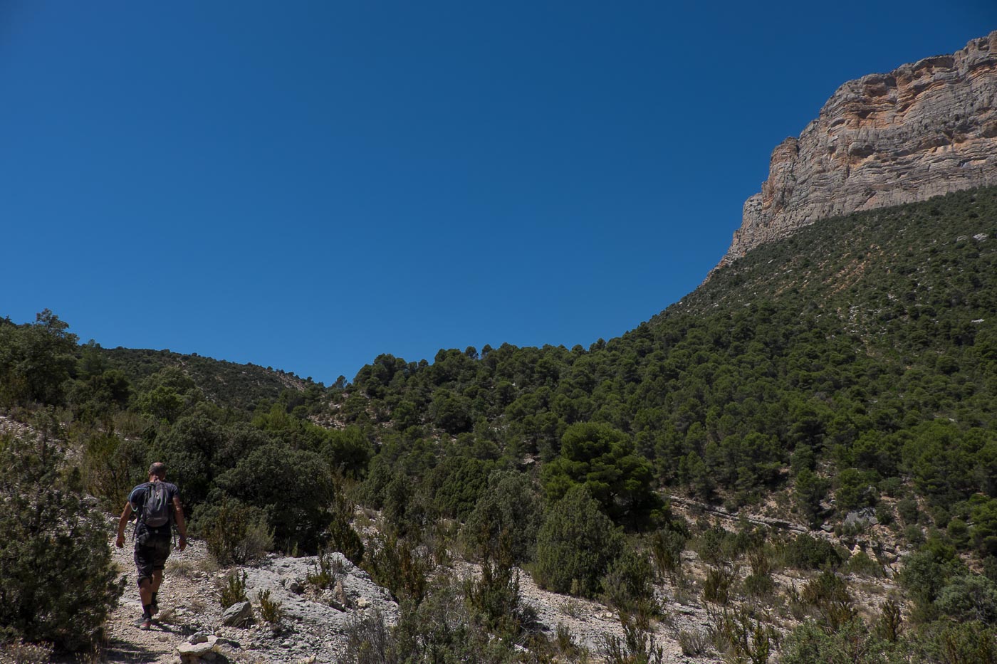
On foot this time, down the track to Montfalco (approx. 3 kms). You start to catch a glimpse of the turquoise waters of the Pantano. At the entrance to the village, it climbs a little. There's a large house with a bar-restaurant and a large sign pointing the way to the Pasarelas de Montfalco on the right.
No equipment is required, as the walkways are completely secure. The trail descends gently into the woods, and is even enhanced by small illustrated signs providing information on the local flora and fauna. The trail crosses stabilized tracks several times, but all you have to do is follow the little red signposts. You gradually emerge from the woods and the view of the lake gradually unfolds. Just before the start of the 1st section of footbridges, a path descends to a small cove beneath a wall for swimming or kayaking.
The climb is fast and narrow, requiring you to stoop a little in places. After a few U-turns, the footbridge overhangs the small cove and joins a small rocky peak. Continue along the path, which is initially flat, then climbs up the opposite side to cross a small pass. The views of the congost are increasingly impressive.
More impressive and higher than the 1st. This time, the footbridges twist and turn on a sometimes slightly sloping wall. We finally come out on another small flat spot, this time with the whole panorama before our eyes. The descent to the suspension bridge between the 2 provinces takes 15′, zigzagging through the rocks. On 2 or 3 occasions, we can shift to the cliff side to get in line with the defile.
From the plateau at the end of the 2nd section, before descending to the bridge, there's a more or less marked path with a cairn at the start. This is the return path to follow in the Tartera Chica, a kind of sunny garrigue, to reach the Barranco de la Coma at the very top. The ascent is steep and sustained, and in this heat, you lose a lot of energy. At the top, you finally reach a wider track which, after 2 or 3 switchbacks, leads back to the main trail and the start parking lot.


Leave a Reply