


TOPO Hiking | CLIMBING7.COM
Publié le
 Partager sur WhatsApp
 Partager sur Twitter
Partager sur Instagram
Partager sur Twitter
Partager sur Instagram

 Partager sur Facebook
 Imprimer le topo
 Laisser un commentaire

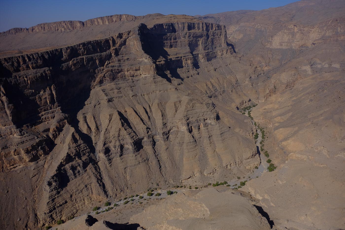
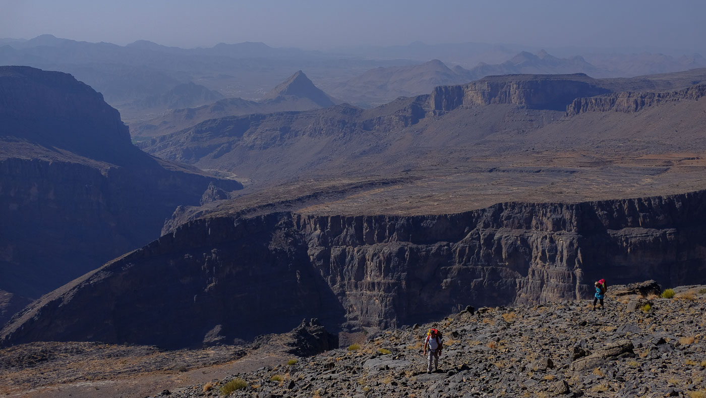
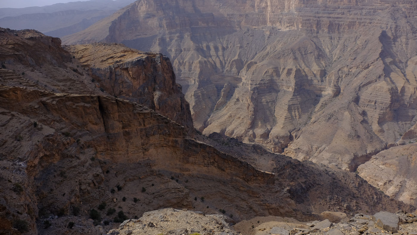
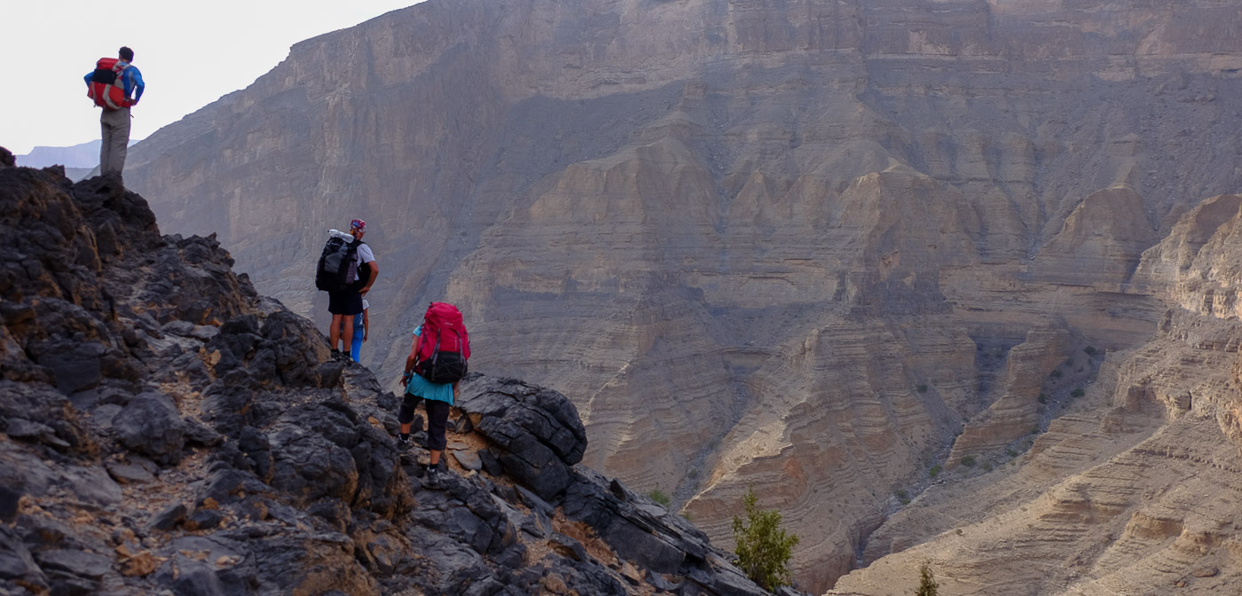
At the far end of Wadi Tanuf, where Wadi Hijri joins Wadi Qasheh, the Qasheh Circuit begins, a magnificent aerial loop that literally flies over the 1000m or so depression, admiring the canyon's geological formations, majestically sculpted from the vertiginous walls of the plateau to the sinuous wadi furrow at the far end, leading to the village of Al Farah. More than 1,200m of ascent, sometimes exposed scrambling passages: the Qasheh circuit is quite demanding, and all the more so when loaded with equipment for bivouacking halfway up and carrying water. While the ascent and upper section are fairly straightforward, the descent is more tricky, particularly after the village of Maqal. Even if the Qasheh circuit loop is announced as possible in 1 day (10 to 11 am?), 2 days seem necessary to avoid running and to be able to fully enjoy the spectacle along the way. A major tour in Oman!
❱❱ Technical summary
Type ✦ Hiking
Location ✦ AL Farah
Region ✦ Sayq Plateau, Jebel Akhdar
Country ✦ Oman
Length ✦ 16kms
Elevation gain ✦ 1200m
Difficulty ✦ D / IV+ / Scrambling
Duration ✦ 14h to 16h, 2 days
Interest ✦ ★★★
❱❱ Access to the place
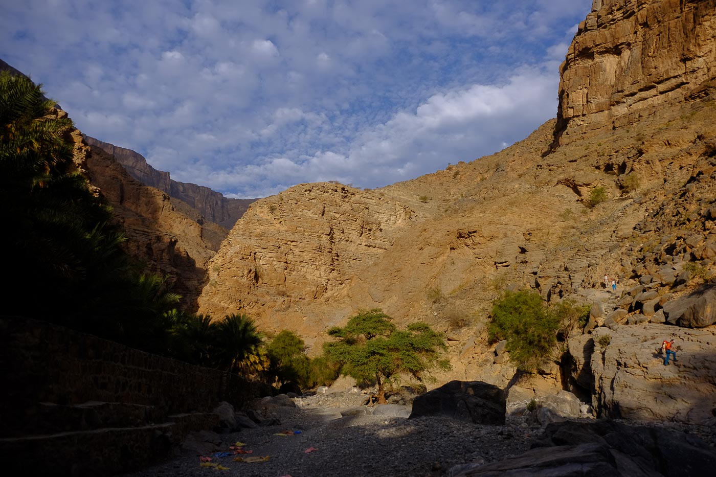
On the road from Al Hamra to Nizza, turn left into Wadi Tanuf. Climb up to reach the small palm grove, the village and just beyond the ruins of the old village, opposite the entrance to the gorge. Turn off towards Al Farah. Follow the track, pass the dam and cross the wadi bed to continue on a stony track.
After about 30′, and before reaching AL Farah, you come to a wide opening with the arrival of the wadi Hijri on your left and a magnificent rocky slab in the form of a ramp opposite. Go right and after the next bend (left), there's a recess for cliff-side parking.
❱❱ Map & topo
The route of the Qasheh circuit in yellow is indicative.

❱❱ Itinéraire
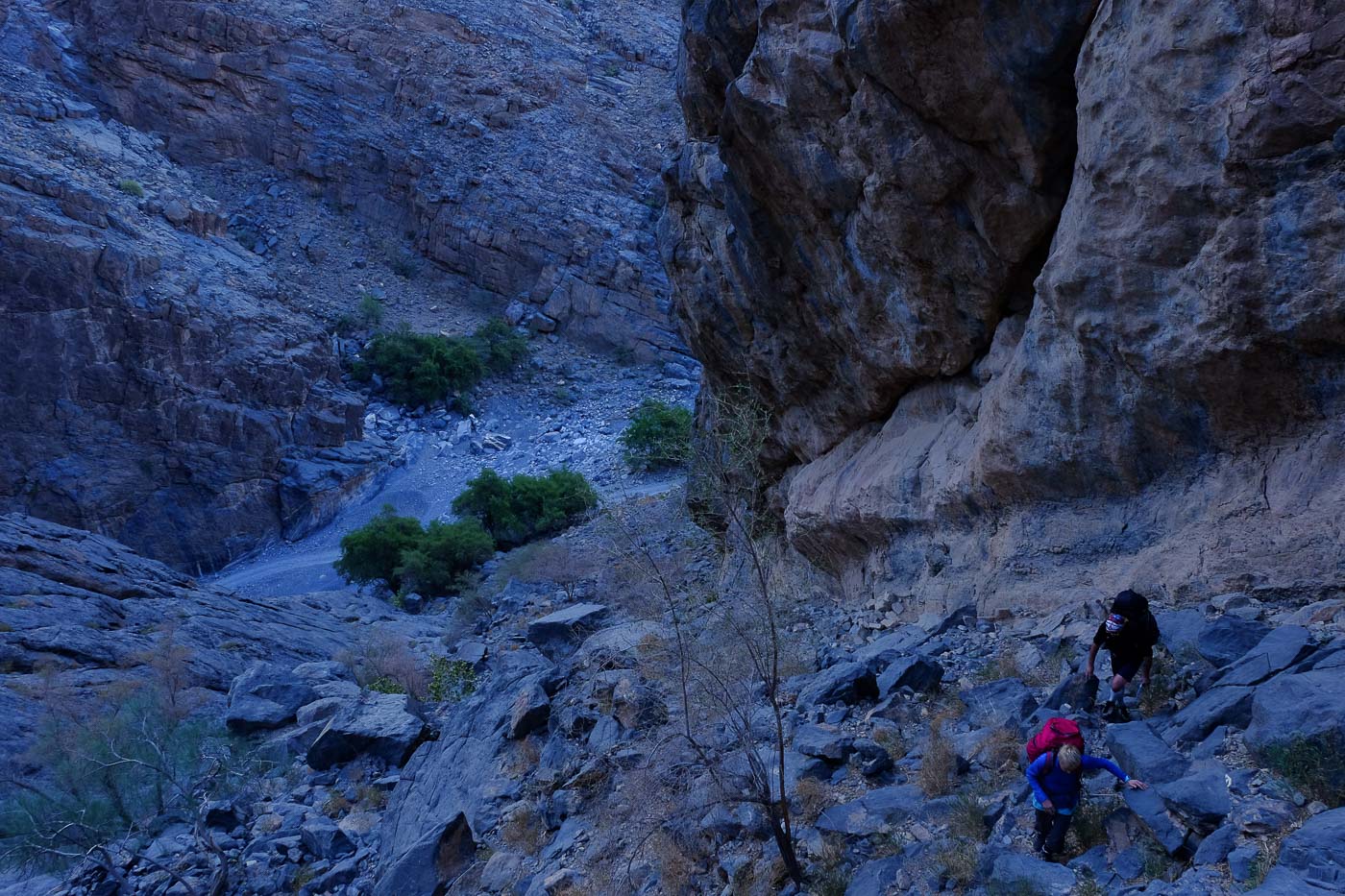
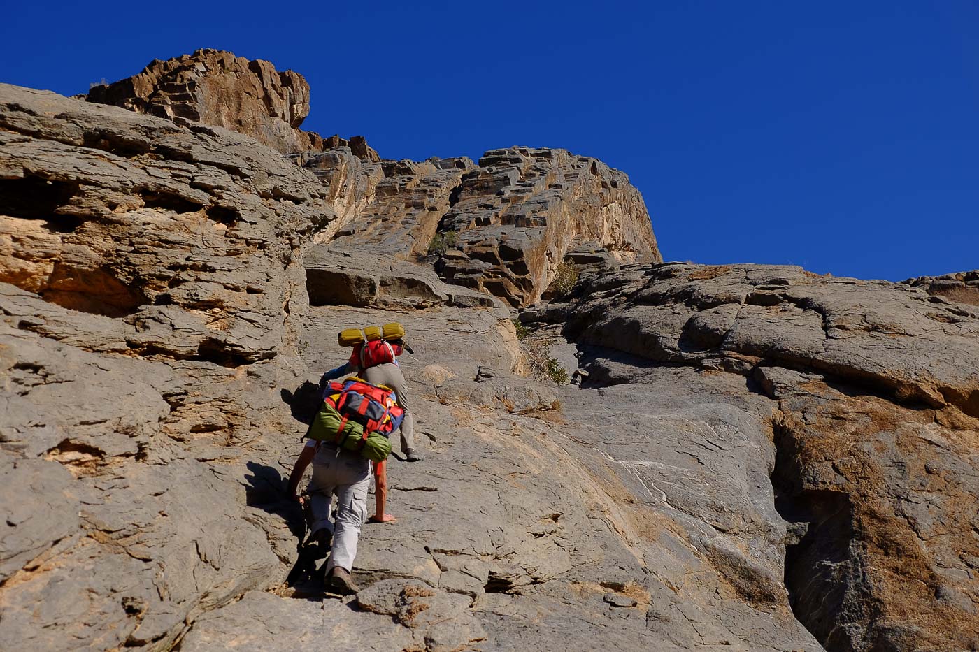
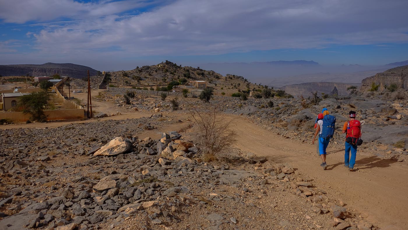
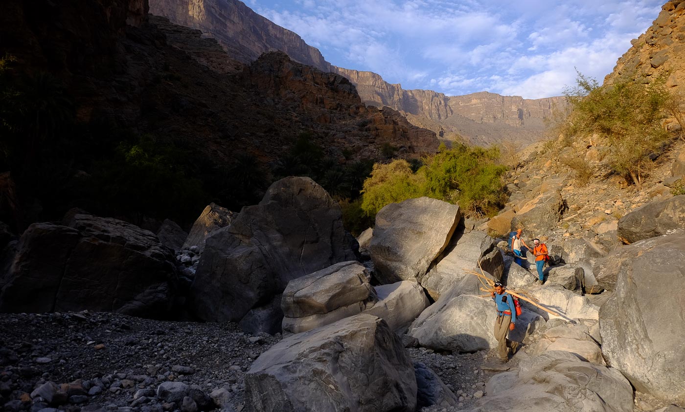
From the parking lot, retrace your steps a hundred metres or so to find the start, on the right, at the bottom of a scree with trees and an obvious ramp up to the large walls above (the only possible exit from the canyon). Start of the Qasheh circuit.
The loop is about 16 kms long and has an ascent of 1200m. No equipment is required other than a helmet (if necessary) and, for the short expo section, a harness and 30m of rope for protection (J1, bolts in place).
Bring plenty of water, although at the bivouac you can find water in the reserves (2 white tanks). Trails are marked in some places, and totally absent in others, where you have to improvise your route.
High physical commitment, exposed aerial passages in places, orientation and route-finding not so obvious on the descent. There is some fear in places and purple markings (especially on J2), but they are not continuous.
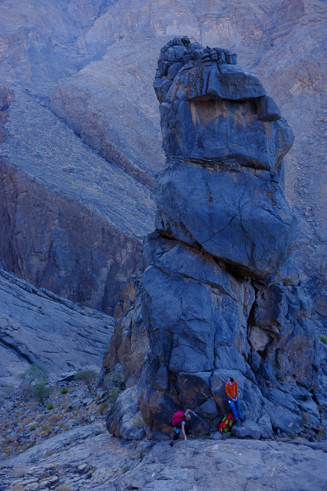
Climb up the gully, keeping to the left, then climb left again to reach a flat spot at the foot of a rocky tower, with a view over the Wadi Tanuf. Continue upwards, walking and occasionally putting your hands down. Above, you'll see a sloping ramp leading up to a large cliff carved in greyish flat tints. You're now overlooking the end of Wadi Hijri. The ramp can be scrambled without too much difficulty (III+) up to a more delicate and exposed passage (IV+), which can be protected with 2 bolts placed at the exit.
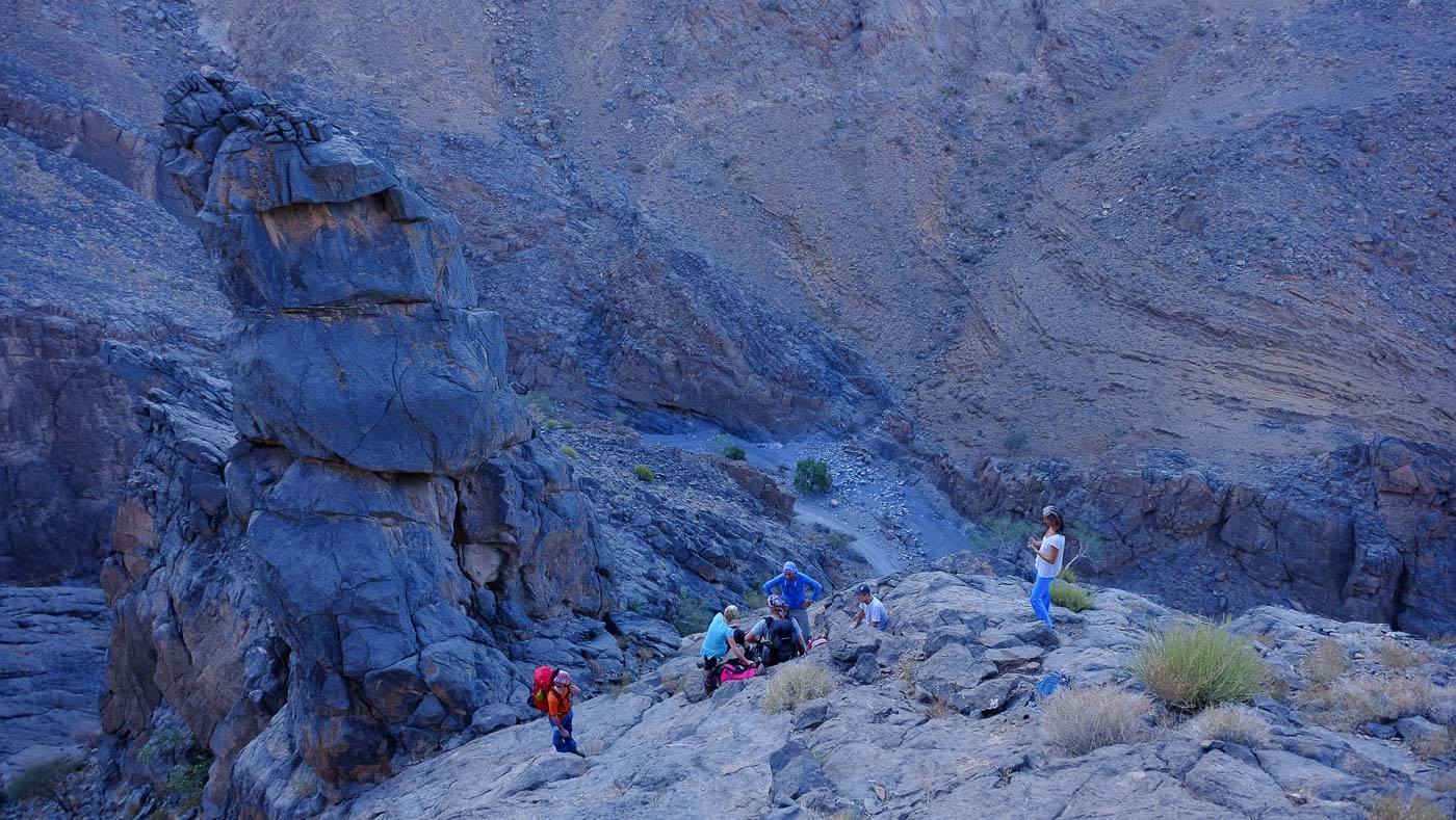
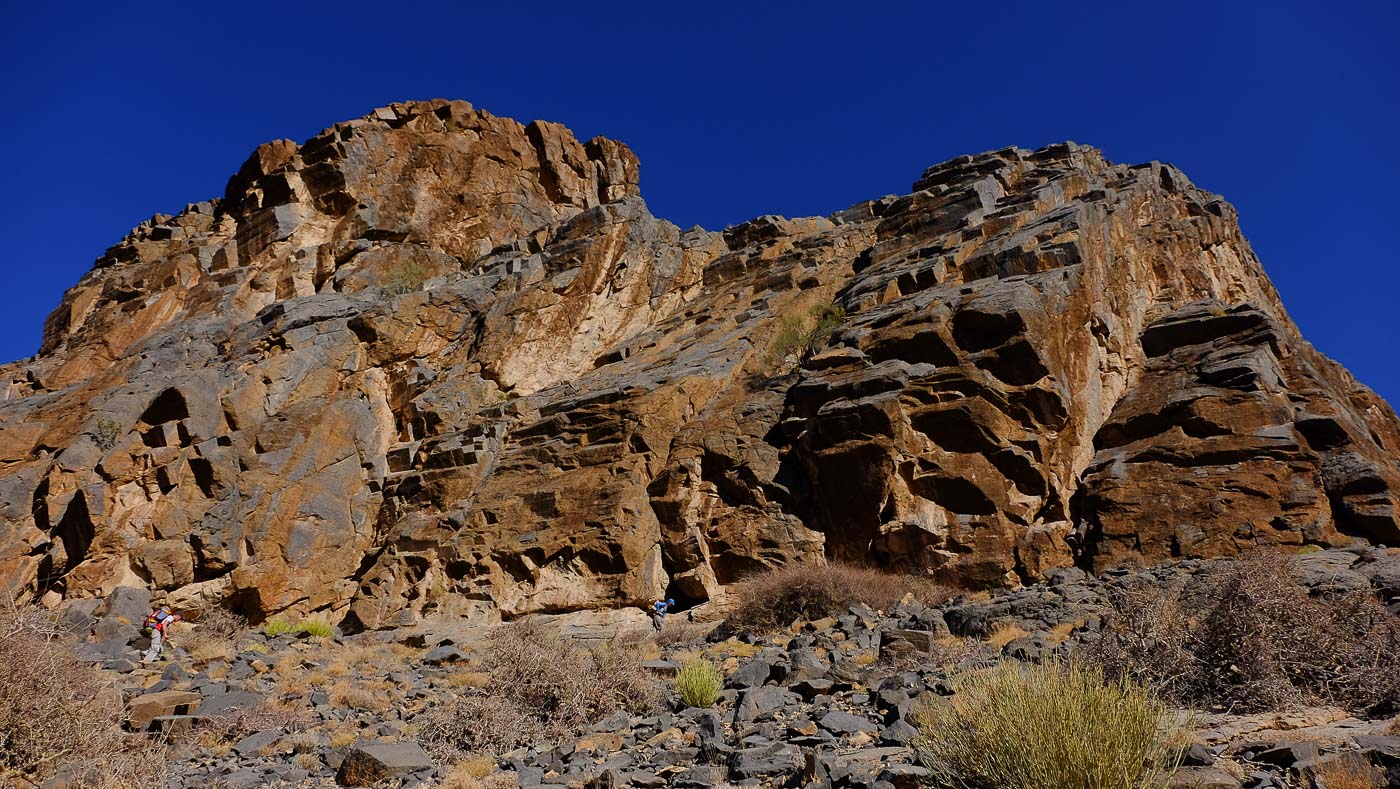
Higher up, reach the base of the cliff and turn left towards Hijri. Follow the cliff for a few hundred metres, crossing it and skirting around it until you reach a characteristic beak-shaped overhang. Immediately afterwards, climb to the right on a path to finally reach the wide, open upper plateau that divides Wadi Hijri and Wadi Qasheh.
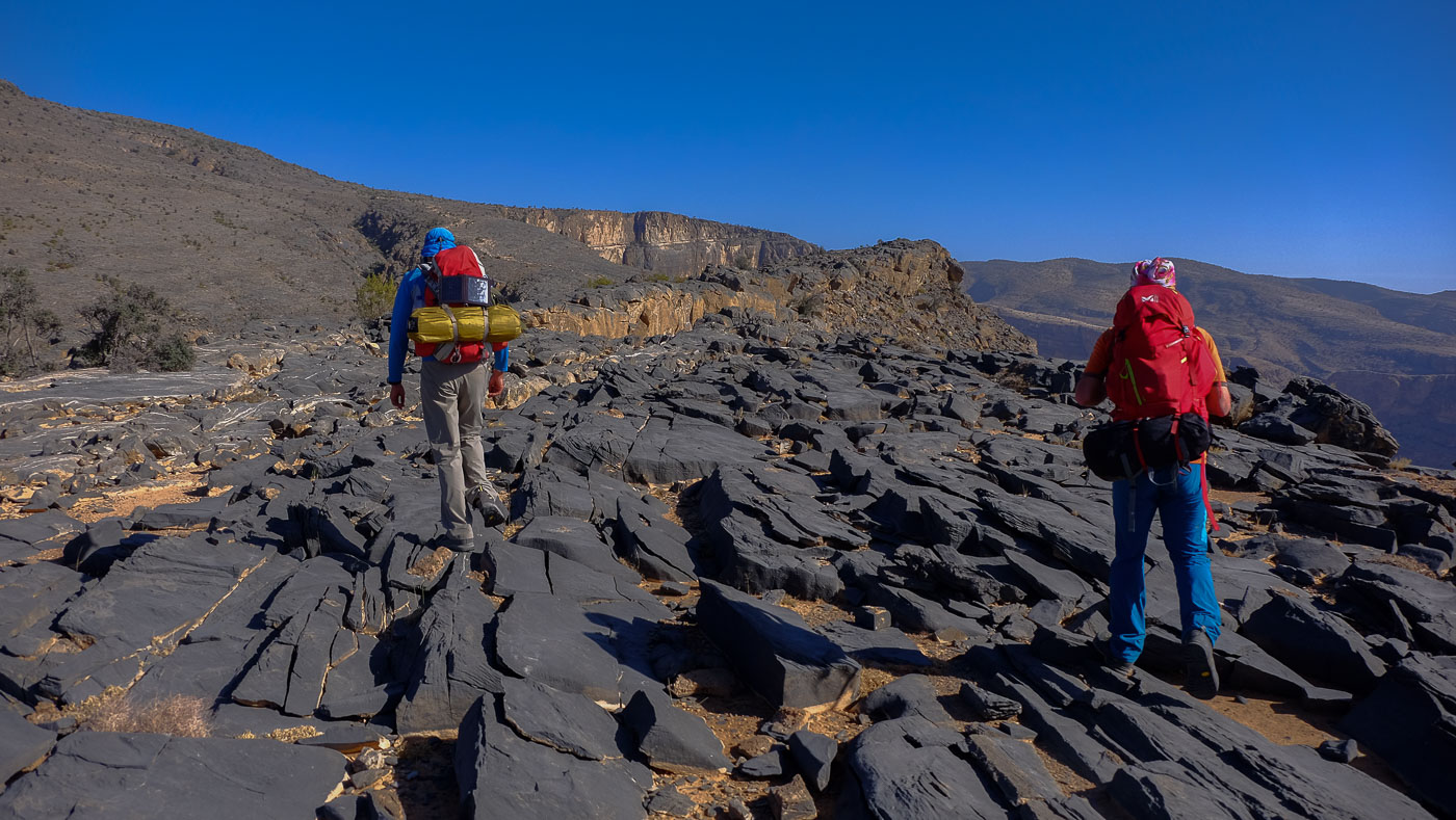
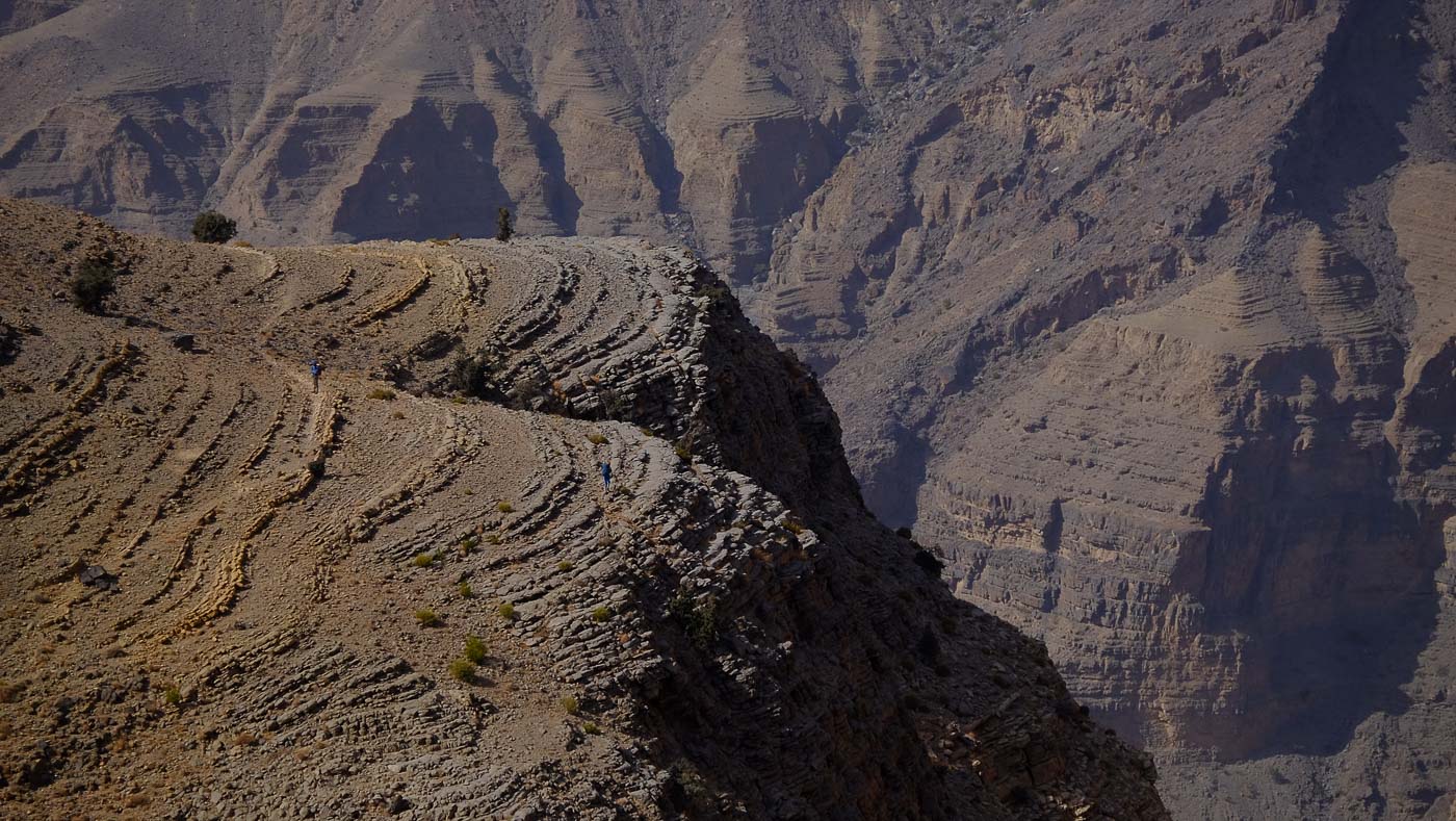
Walk on the plateau and climb up on the left-hand side. You can walk along the edge of the walls overlooking Hijri. Higher up, you come to a gap that gives you another view of Hijri, and from there you head uphill to the right to finally reach the edge of the plateau on the Hijri side, with a 1st, very aerial view of the entire wadi Qasheh and the village of Al Farah at the very bottom. On the opposite side, you can see the village of Maqal and guess at the only natural route back down on day 2.
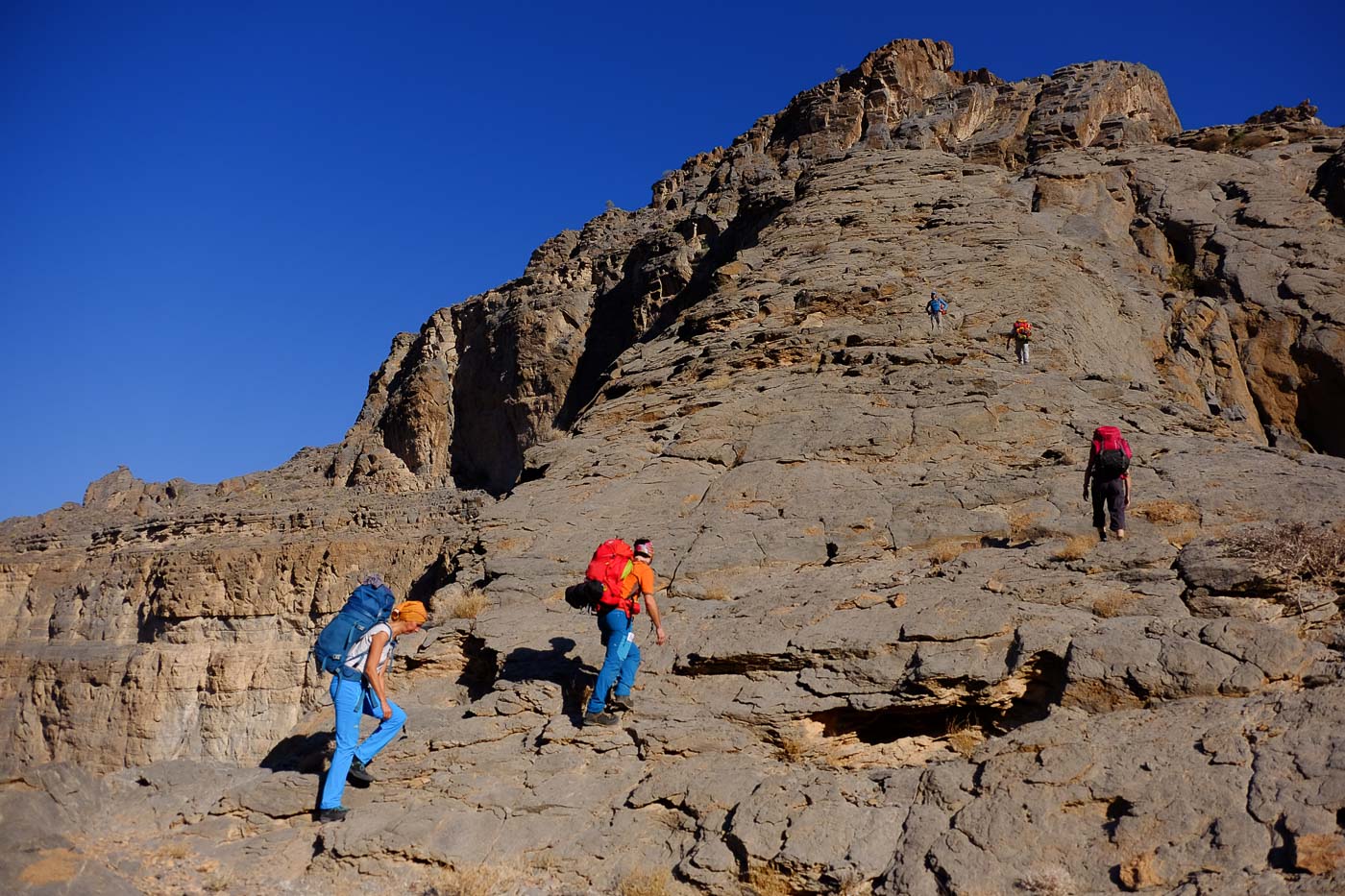
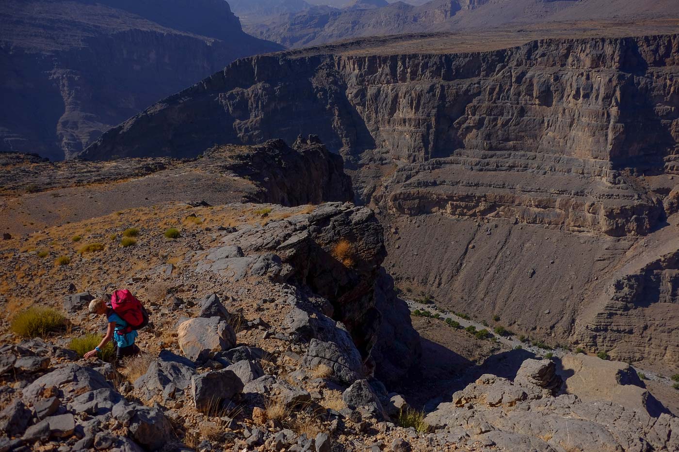
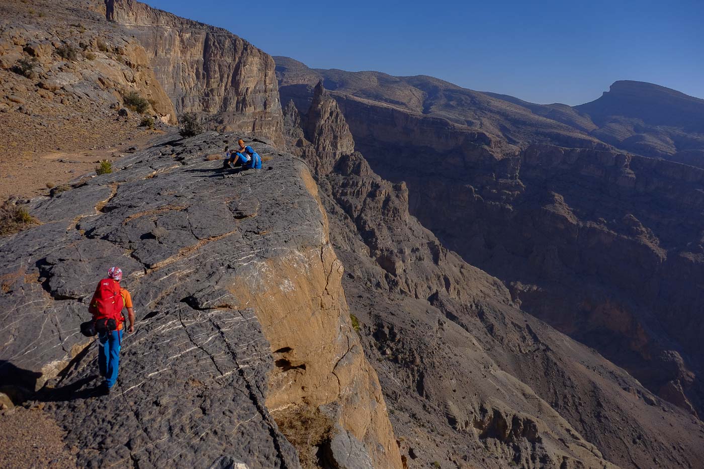
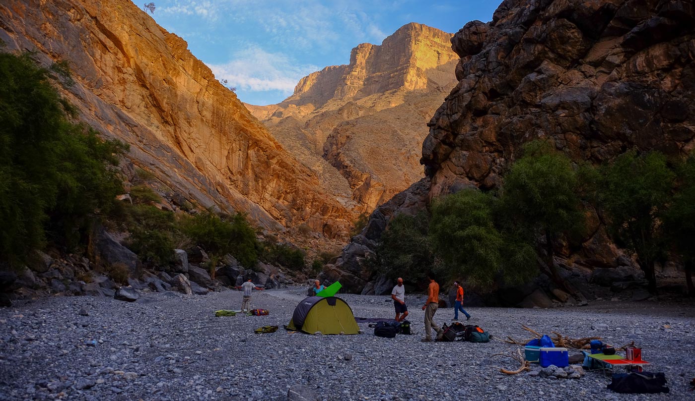
It's easy to follow the edge of the canyon, with magnificent plunging views. It climbs steadily upwards, with a few flat spots, and finally a short ascent on a track leading from the village of Al Farir. At the top, we pass 2 water tanks on the path to replenish our supplies. Turn right towards the village, which can be seen in the distance. Here you'll find a flat area with abandoned ruins, an excellent place to bivouac.
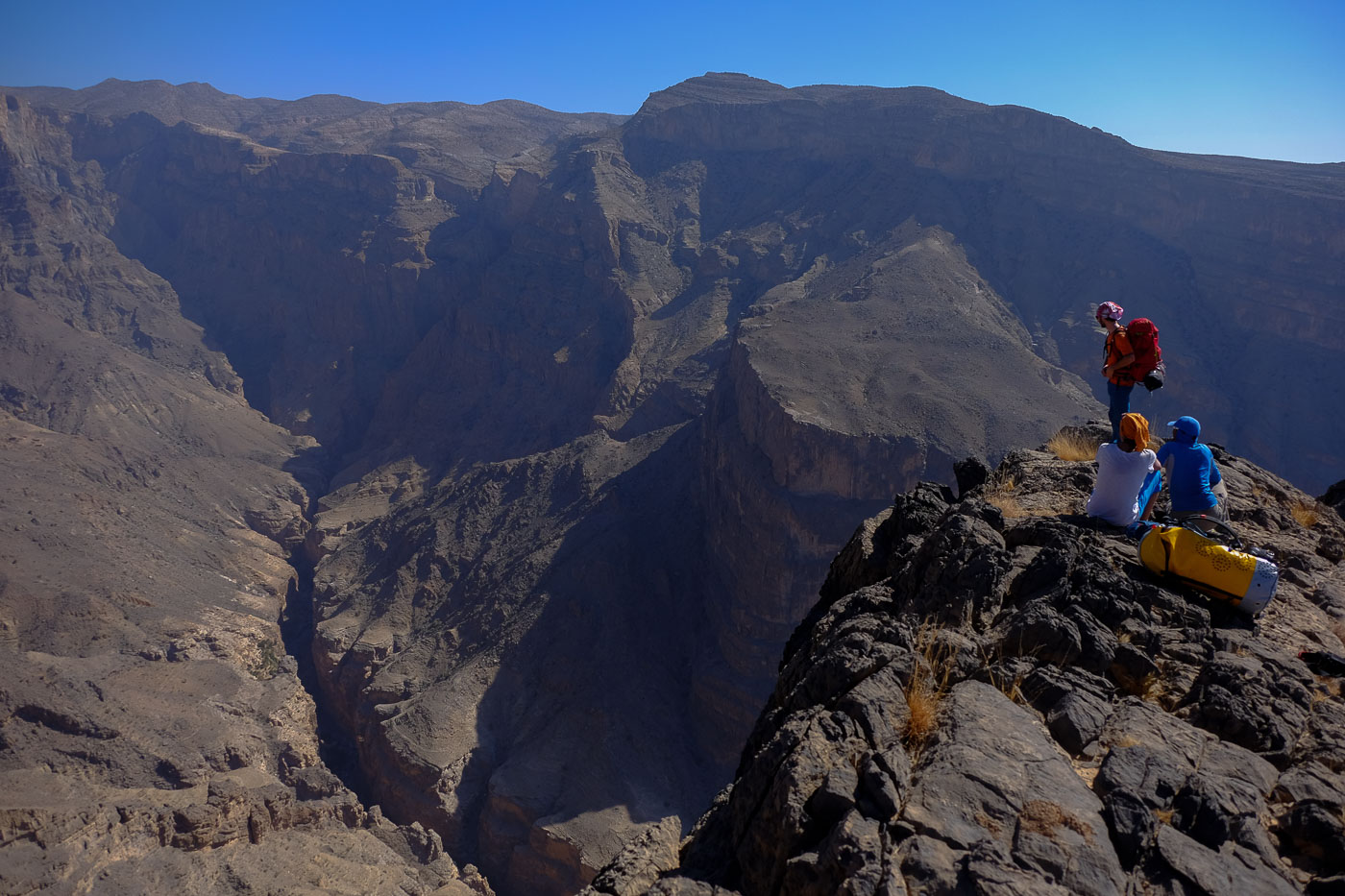
Reach the village of Al Farir on sight. You can first go to the edge of the canyon to get an e1ère view of the Mbint terraces at the far end and see the Qasheh enfilade from above, impressive. Then return to the track and follow it eastwards. At the 1st fork in the road, turn right and descend a small wadi to go up the opposite side into an abandoned village and cross under Al Farir to reach the hamlet bordering the large hole.
Cross the hamlet to find yourself on the opposite side. There's a path leading up to the access steps to Mbint, another aerial view from the start of Qasheh and the terraces. This is exactly the opposite of the previous day's viewpoint.
Continue along the elongated dome heading south. You'll find yourself between Qasheh on the right and another wadi on the left, which flows into Qasheh below. Improvise a path along the ridge until you come to a last imposing rocky outcrop separated by a difficult-to-cross depression.
Turn left to descend to the wadi bed on the left (path more or less marked). At the bottom of the wadi, walk along the bed to the level of small abandoned houses built under the wall. Here, an iron water pipe runs up to the left. Follow it, initially climbing a few steps before heading off along a well-marked path away from it.
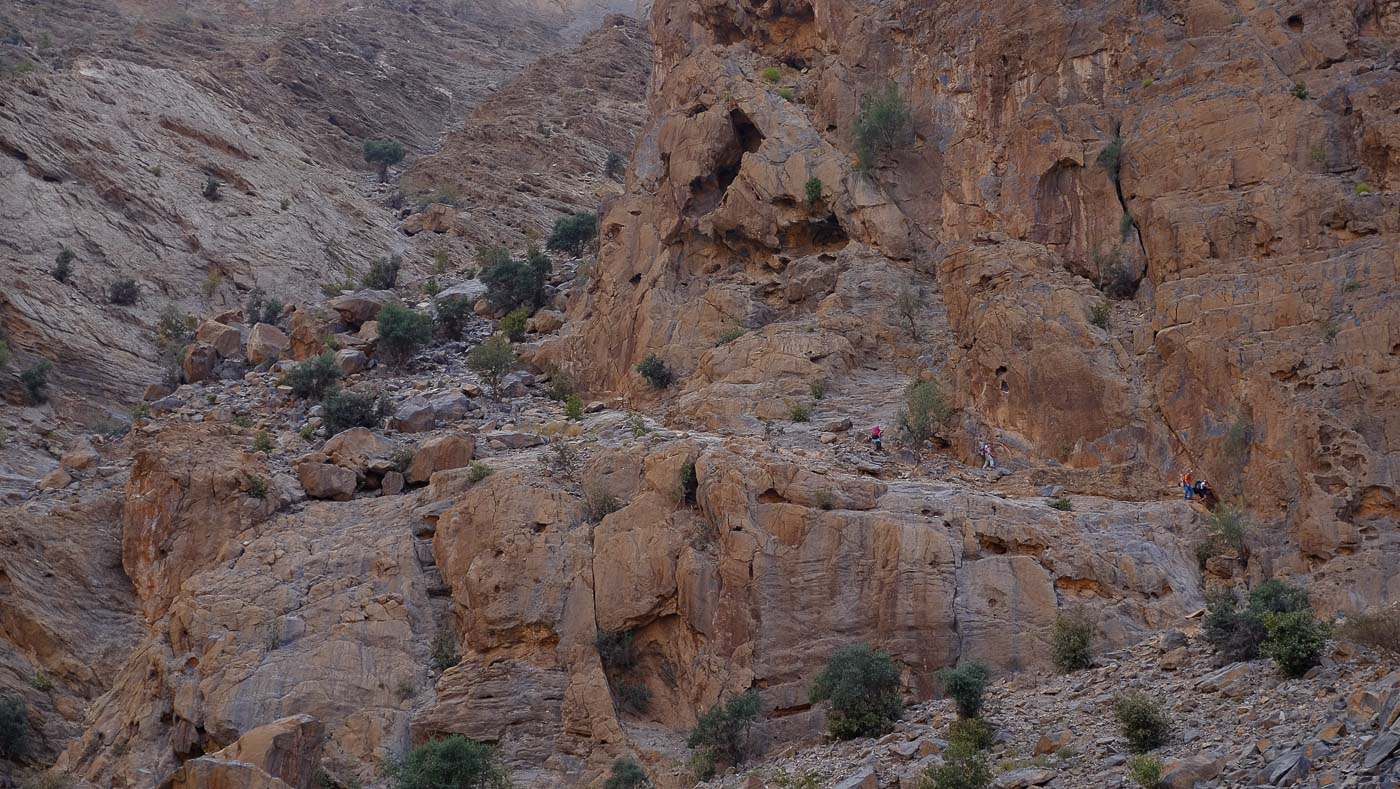
Pass a scrambling wall and follow this path over a wide ledge between 2 cliffs to finally climb to the left and cross the cliff by a sort of natural gate. On the other side, you can see Maqal above. Then descend diagonally to the left over a large slab to reach the bottom of the water conduit (which was straight over the ridge) and a small dam. Cross it and climb to the opposite side, following the path that will eventually lead you to the village of Mahal (first passing through an abandoned village, formerly Maqal?).
Stay below the village and drop down to a clearly visible path that passes over a wide, cambered ridge above Qasheh. Further on, continue along the flank, past rocky shoulders and finally into a sort of large cirque. The path is not clearly visible. On the right are large, impassable cliffs. You then have to continue for a while, staying more or less level, passing several torrents flowing in from the left and finally, at the very end, reaching a scree slope that drops off to the right along a large wall, towards the bottom of Qasheh.
Descend this scree and at the very bottom, staying to the left, you'll find a small passage where you can climb down a few metres to reach a flat area. There are purple, green and red markings that lead logically to the village of AL Farah, in the canyon bed. Just before the village, turn left to find the final trail.
Walk along the wadi bed, passing under the village and its terraces to reach the main track and further on the departure parking lot.


Leave a Reply