


TOPO Climbing | CLIMBING7.COM
Publié le
 Partager sur WhatsApp
 Partager sur Twitter
Partager sur Instagram
Partager sur Twitter
Partager sur Instagram

 Partager sur Facebook
 Imprimer le topo
 Laisser un commentaire

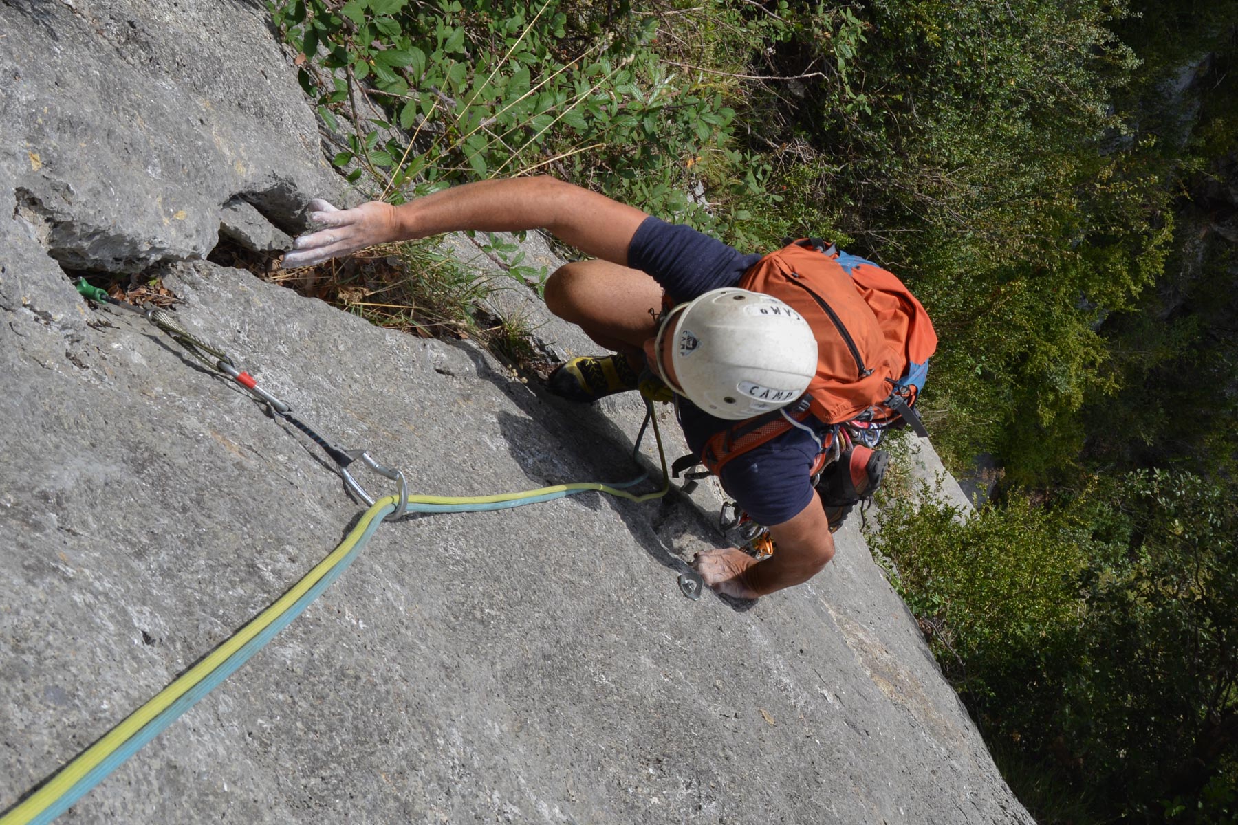
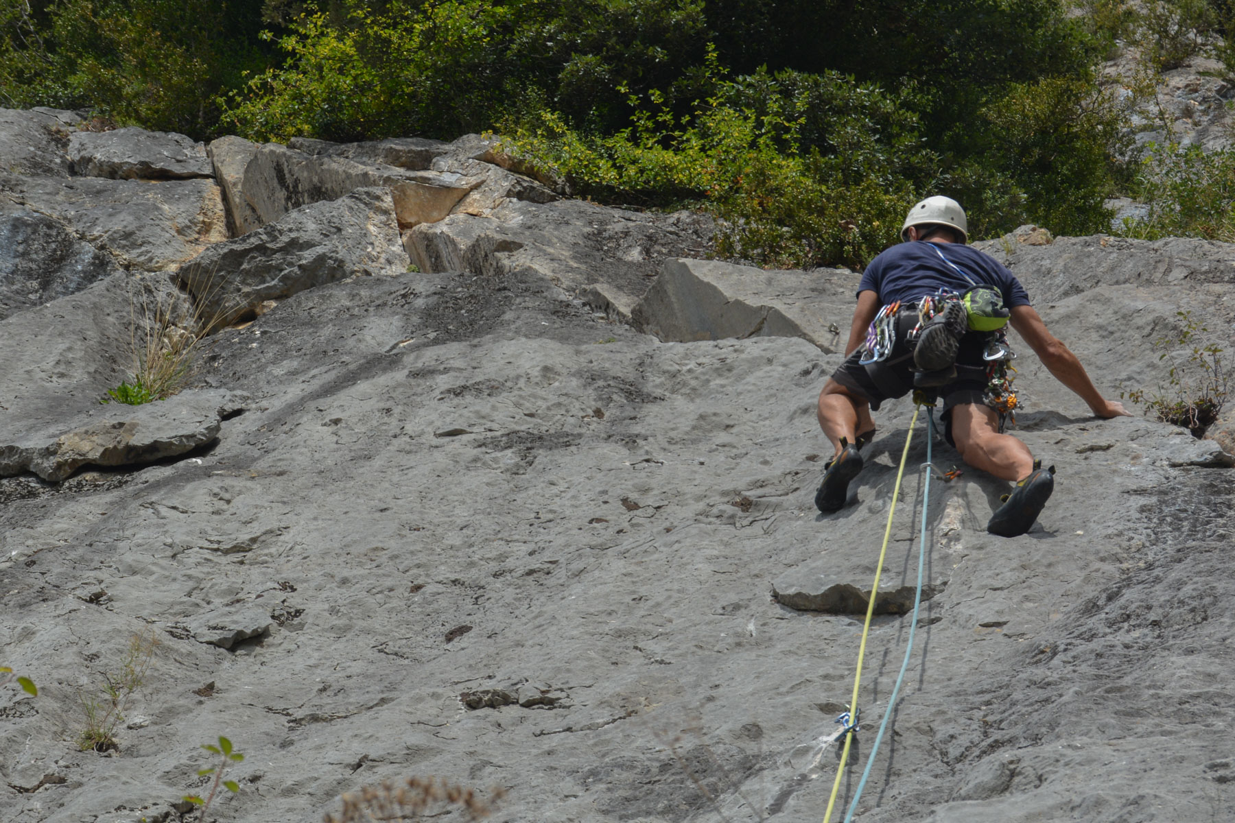
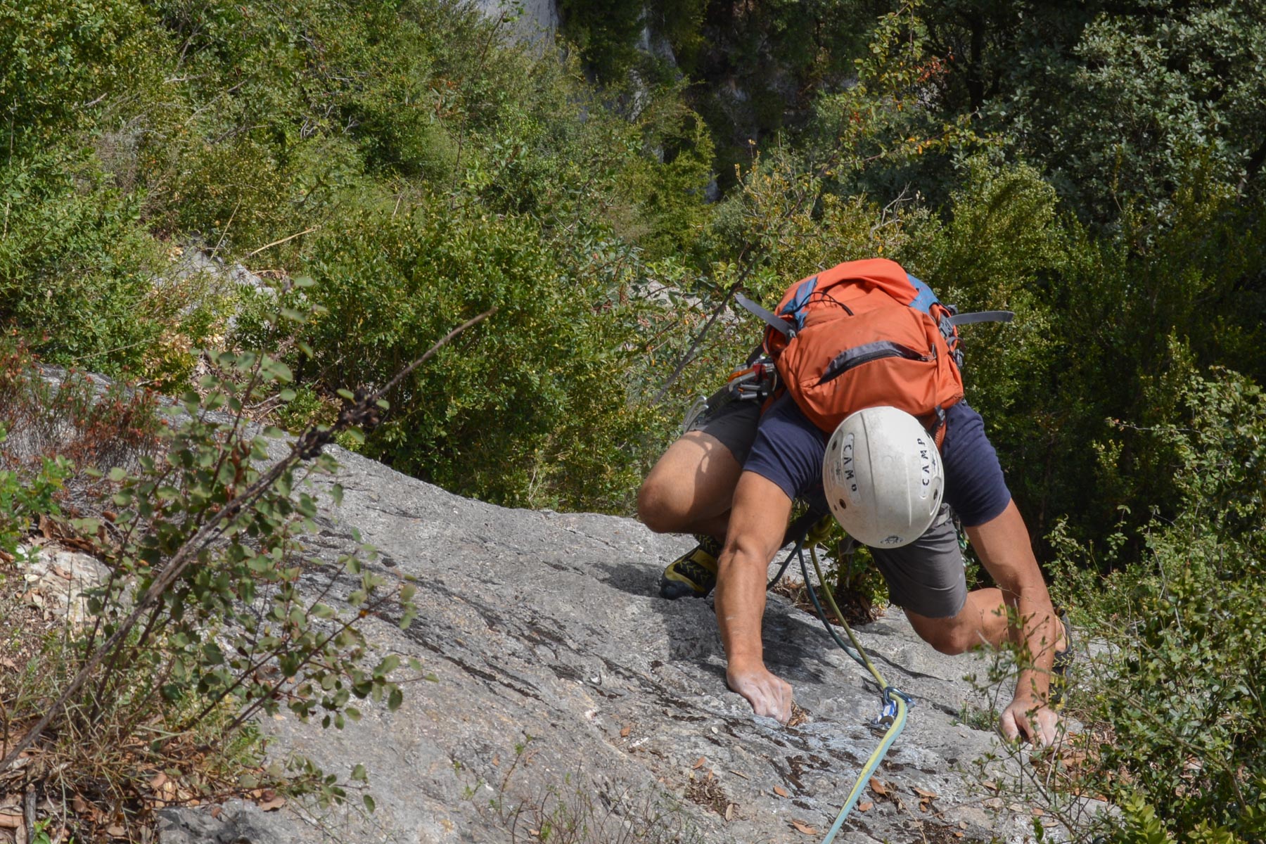
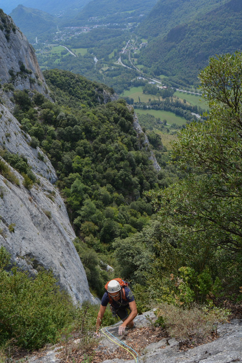
A 1st route on the impressive Quié de Sinsat site overlooking the Ariège valley leading to Ax-Les-Thermes. L'amie Serfouette proposes a very accessible route on a pretty limestone slab, as everywhere around here, but probably not very frequented because of a solid approach walk to reach the Pubis sector. Fully equipped, the points are well spaced out in places, but you can easily, almost everywhere, protect yourself further to fully enjoy the place. Overhead, the magnificent orange cliffs of the Pelle sector just make you want to go higher and come back.
❱❱ Technical summary
Type ✦ Large equipped track
Location ✦ Sinsat
Region ✦ Ariège
Country ✦ France
Length ✦ 4
Vertical drop ✦ 125m
Difficulty max ✦ V+
Duration ✦ 2h to 3h
Interest ✦ ★
❱❱ Access to the place
On the RN20 from Foix to Ax-Les-Thermes, drive past Tarascon-sur-Ariège to Sinsat. In the village, turn left to cross the Ariège, and just after, turn right into a parking lot reserved for climbing.
❱❱ Map & topo
CAF Ariège
The CAF des montagnards ariégeois website offers free access to a large number of topos in the region, making it an essential resource for preparing your sport or big route outings.

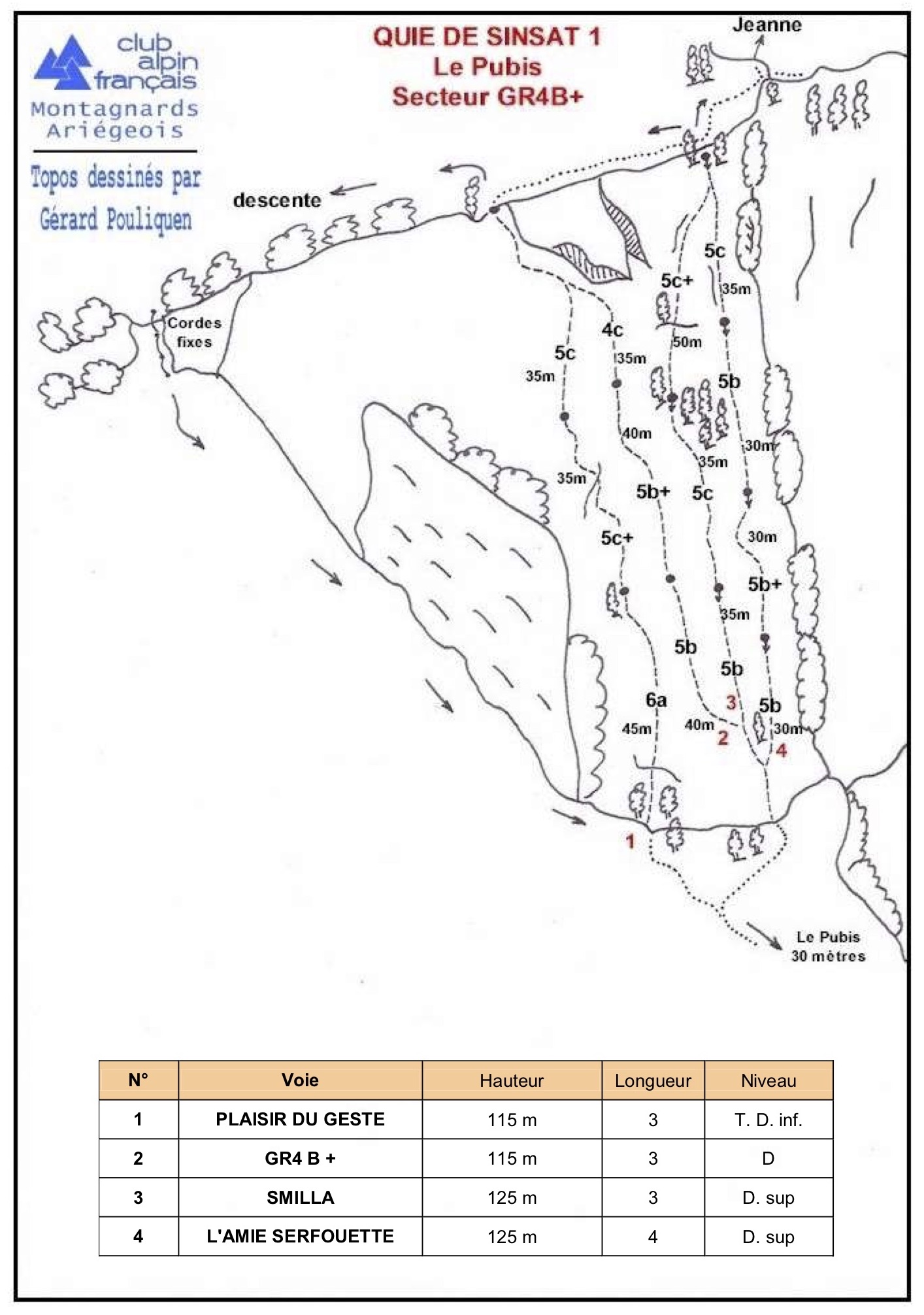
❱❱ Itinéraire
From the parking lot, head back towards the bridge and follow the river to find the path that climbs to the right after the last house. 50′ of steep, unbroken path, with a final section below the Pubis on broken ground that is not very comfortable. Skirt the base of the Pubis to the left and climb just beyond to find the start of the leftmost route 20-30m further on.
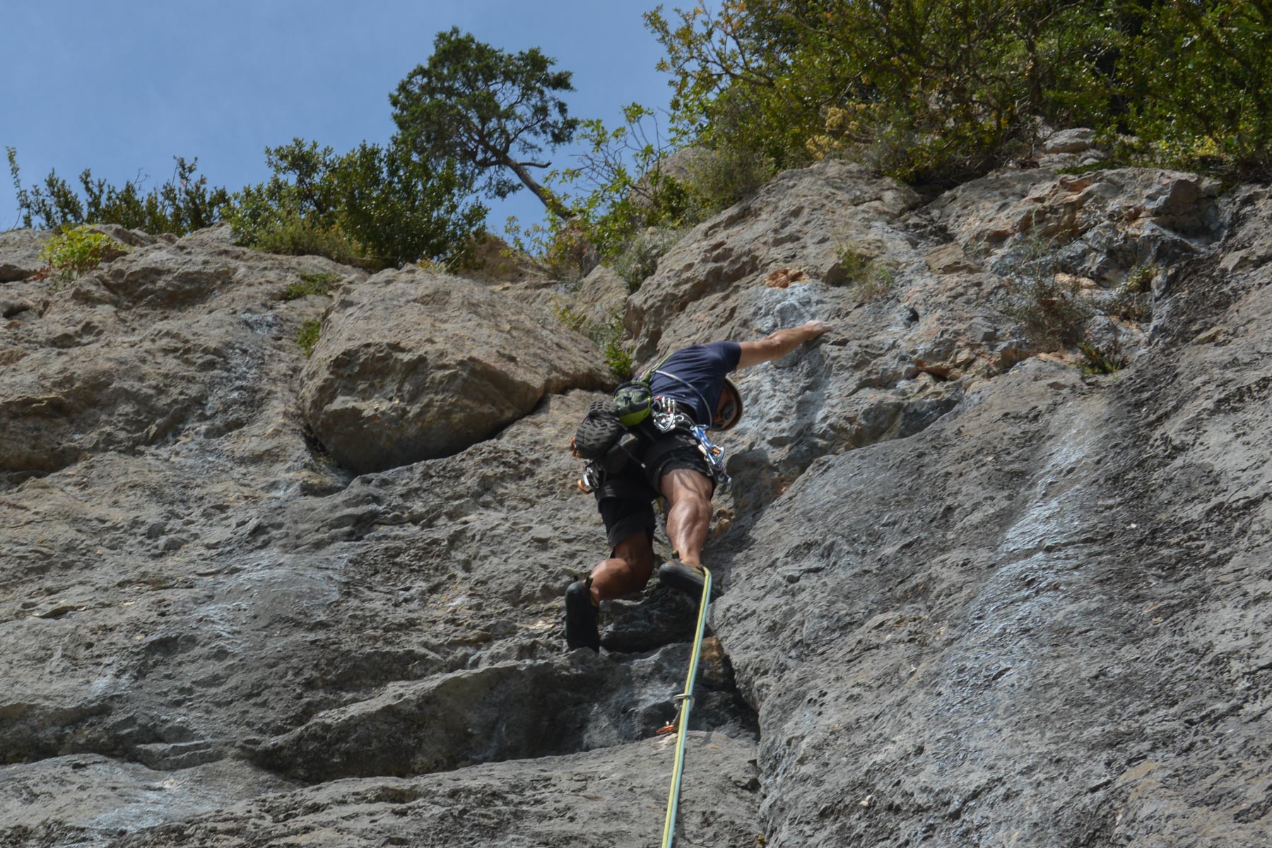
The route is south-facing and 125m long in 4 pitches (30m, 30m, 30m, 35m). The required level is V/V+. Fully equipped, the points are fairly widely spaced, but wedges can be added without too much trouble, except at the start of L2. This is the rightmost route of the GR4 sector, in places a little overgrown. The rock is excellent.
Follow the red dots and descend over the wall. Below, you'll find a passage equipped with fixed ropes, then you'll soon reach the foot of the route (15′). Follow the approach path in the opposite direction to finish.


Leave a Reply