In the upper valley of the Ruisseau d'Orgeix, today's itinerary follows the ridges between the Pic de Canals and the Pic des Perdrix, before descending to the Lac d'Aygue Longue below the Pic de l'Homme. The hike is demanding, with many steep, exposed passages to negotiate off-path, slowing progress. The panoramic views are splendid, particularly of the small cirque formed by the Pic de l'Homme and the impressive needles of the Pic d'Aygue Longue overlooking the lake. This trail is best done in dry weather, as the steep gispet slopes become dangerous if wet or lightly snowed.
❱❱ Technical summary
►Departure point: parking de la Llau, Orgeix, Ariège (09) ►Type of route: alpine loop hike ►Distance to cover: 10 km ►Cumulative elevation gain: +900 m ►Cumulative negative elevation gain: -900 m ►Estimated total time: 5h to 6h ► Min and max altitude: 1410 m / 2310 m ► Marking: yellow at start and return from Lac d'Aygue Longe, everything else off marked trail, see off trail altogether ►Equipment in place: none ►Equipment required: GPS track useful for accessing the Col de Surle.
Difficulties: the ridge between Pic de Canals and Pic des Perdrix is tricky, exposed passages, use of hands to balance, unstable or slippery terrain (gispet). Avoid wet or rainy weather.
❱❱ Access to the place
On the N20 after Ax-les-thermes towards Andorra, turn left into the Orlu valley. Pass Lac de Campauleil and enter Orgeix. Here, cross the Oriège on the small stone bridge and continue straight ahead on the small road leading up to the Llau parking lot. The road becomes a track, not always in good condition, and ends at 1410m. Park in the large parking lot at the trailhead.
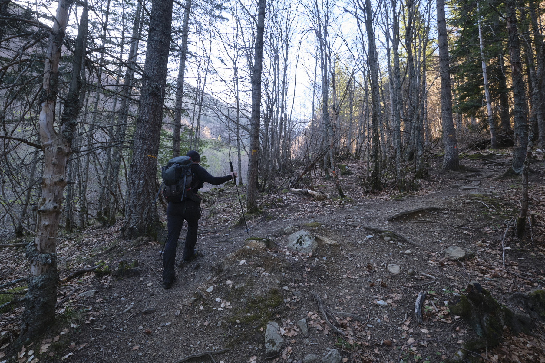
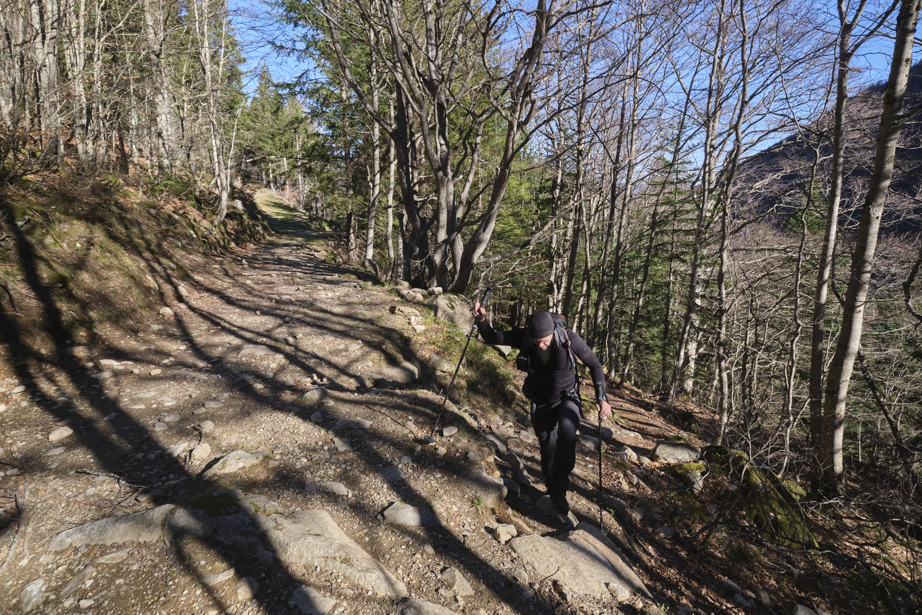
1st part: from the parking lot to the Col de Surle (1782m, 1h)
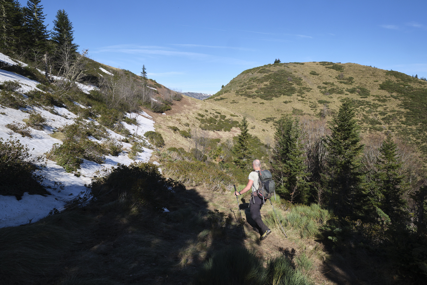
Take the track leading out of the parking lot and quickly turn left onto the yellow-marked path leading up through the forest. The path approaches the torrent, the Orgeix valley stream, then follows it upstream on its left bank. Higher up, you come out onto the track just before the hut and footbridge. At this point, turn right onto the track and 50 m further on leave the main track to take another track on the left.
Walk a little on this secondary track to find, after crossing a torrent, an unmarked but fairly clear path which climbs into the forest on the left. Take this path, which crosses over to the west, and follow it to the end. It's quite visible, although in the first part you need to be careful not to lose it. In the final part, the path is well marked and finally leads to a grassy area at the Col de Surle, below Cap de Carbone.
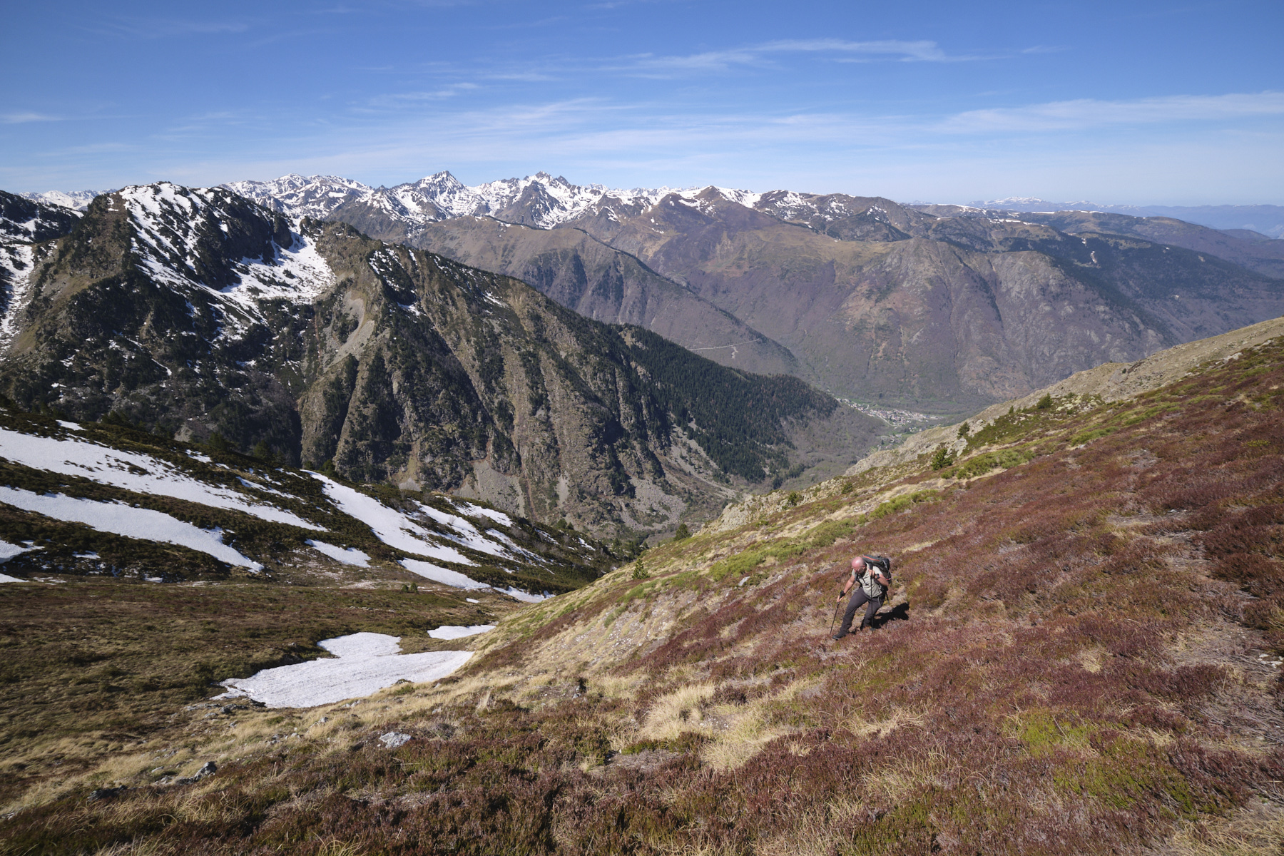
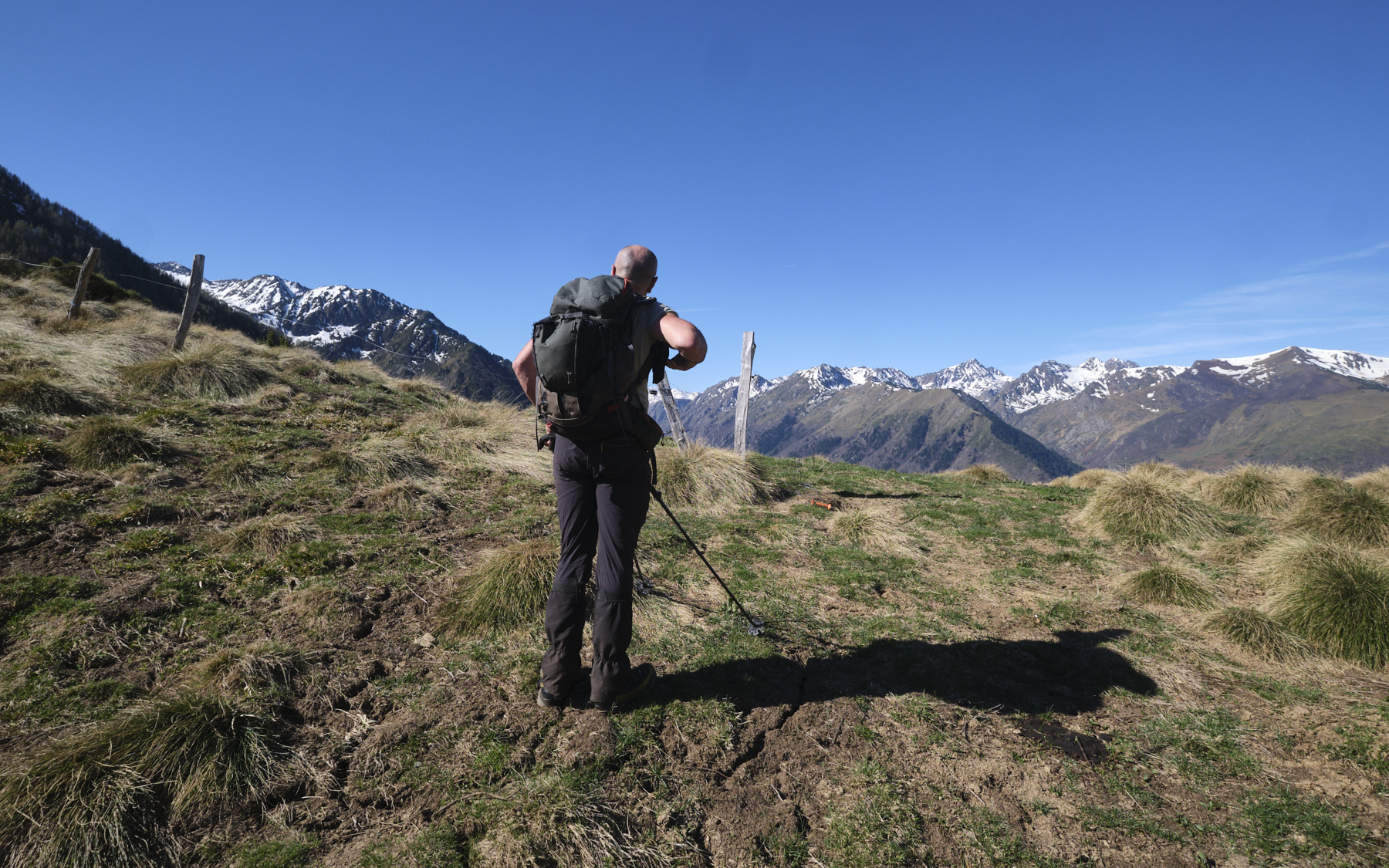
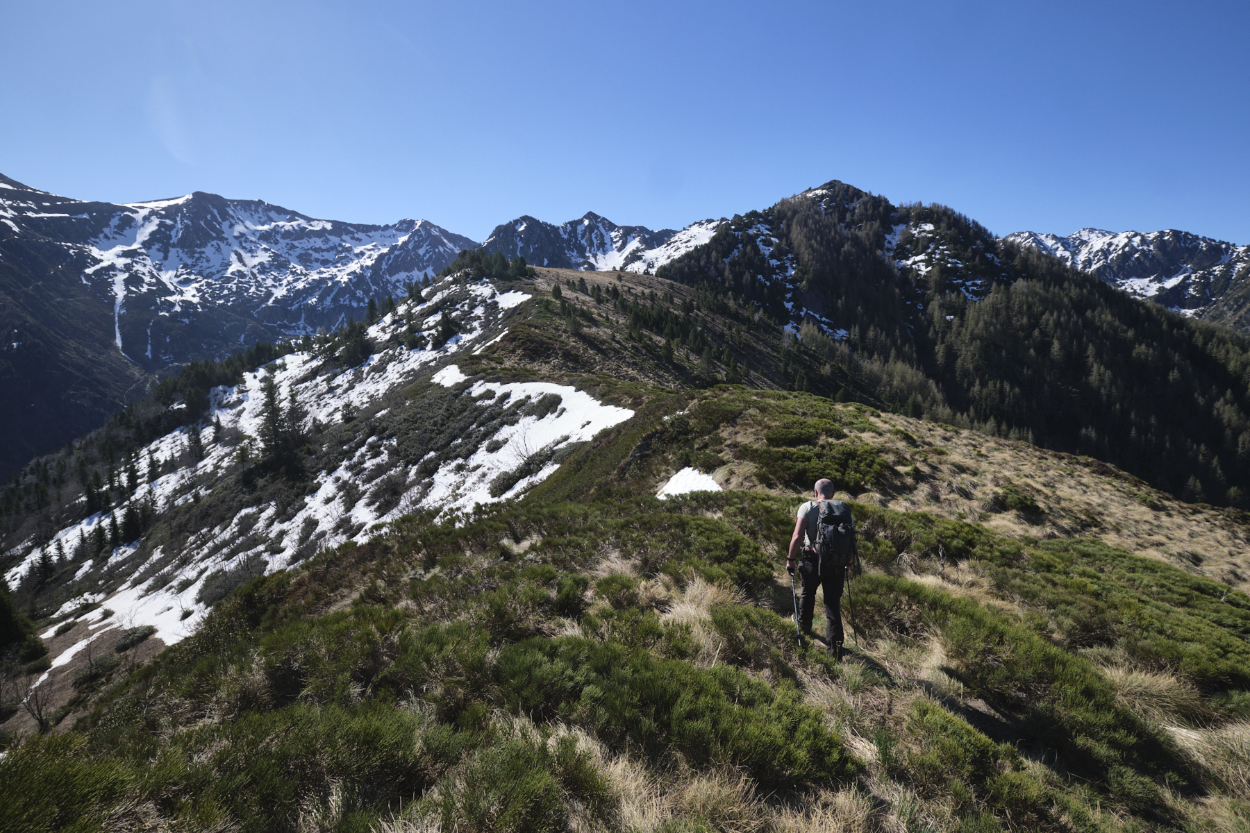
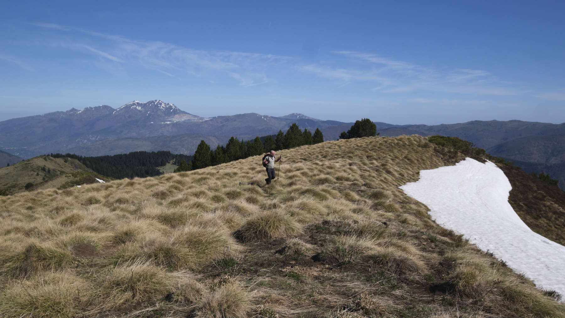
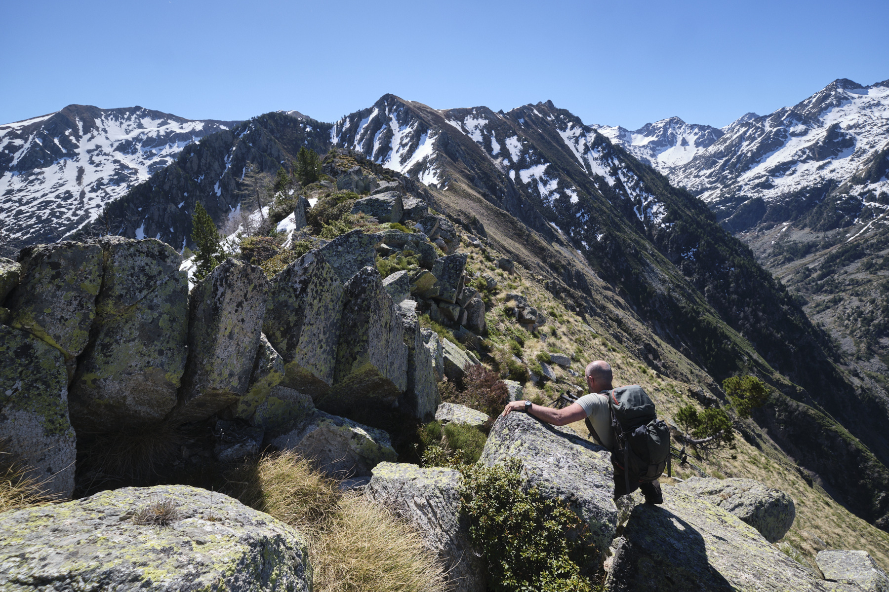
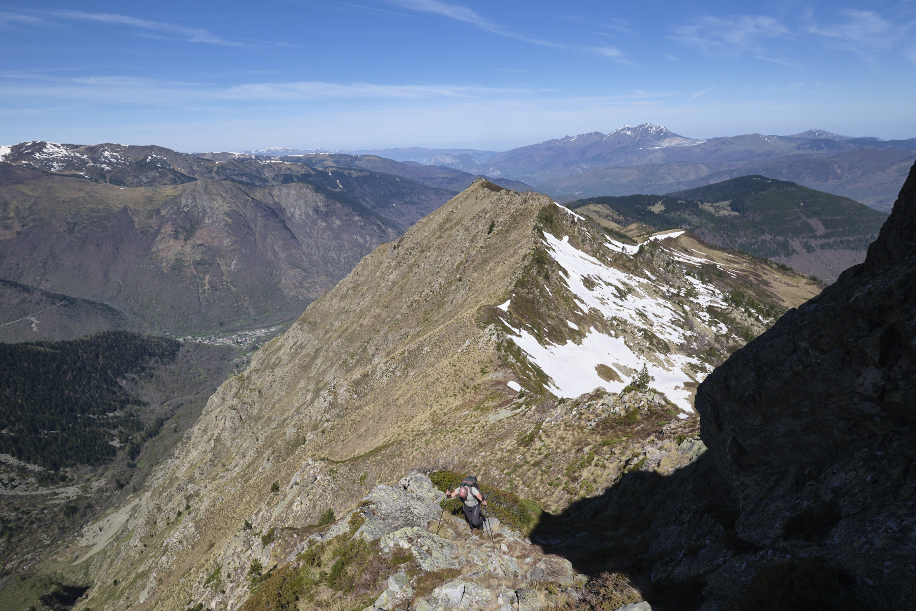
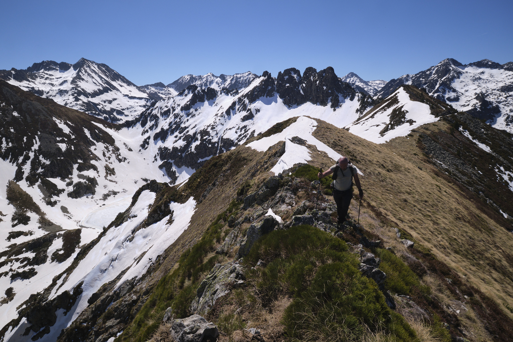
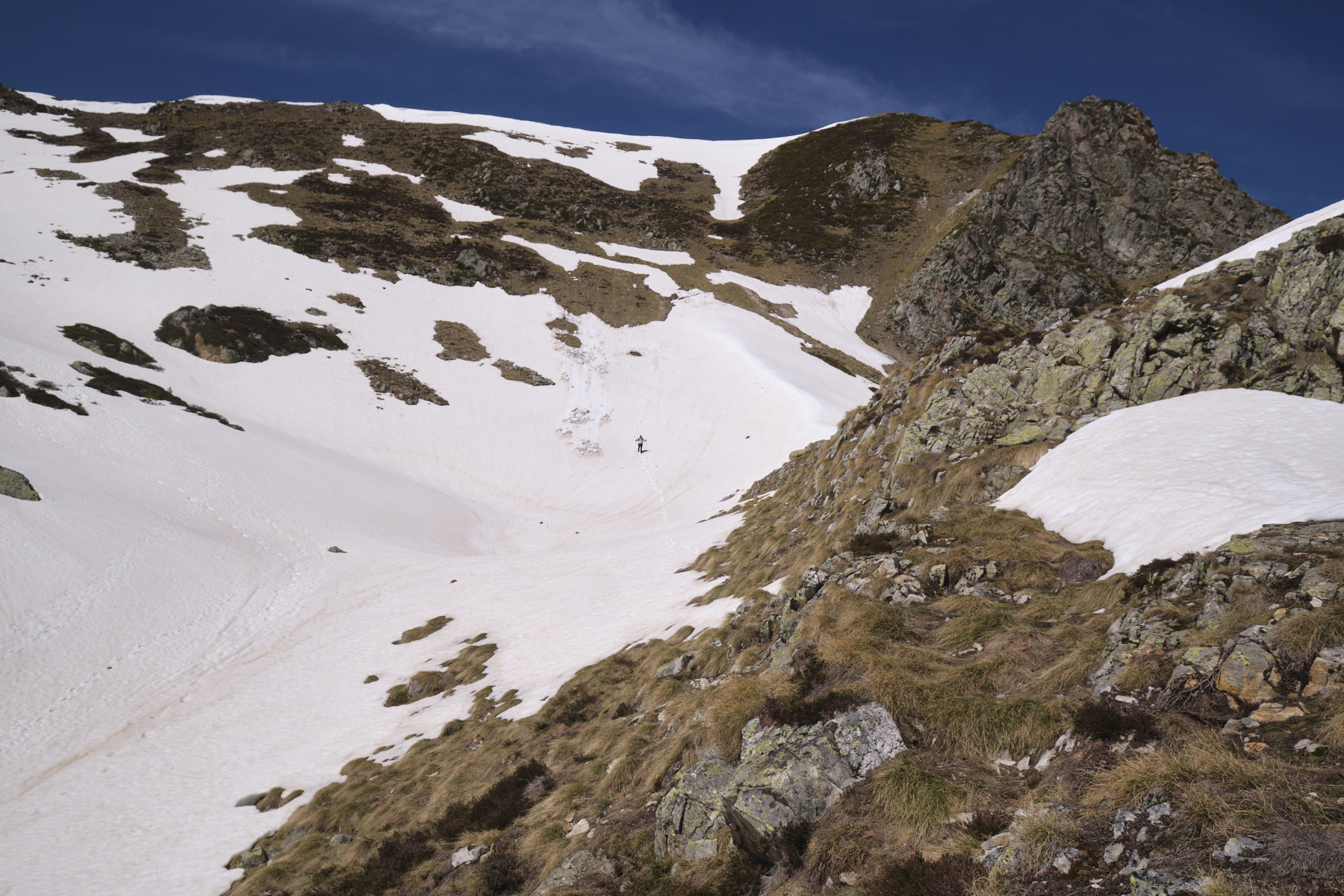
2nd part: the ridges, Pic de Canals and Pic des Perdrix (2310m, 2h)
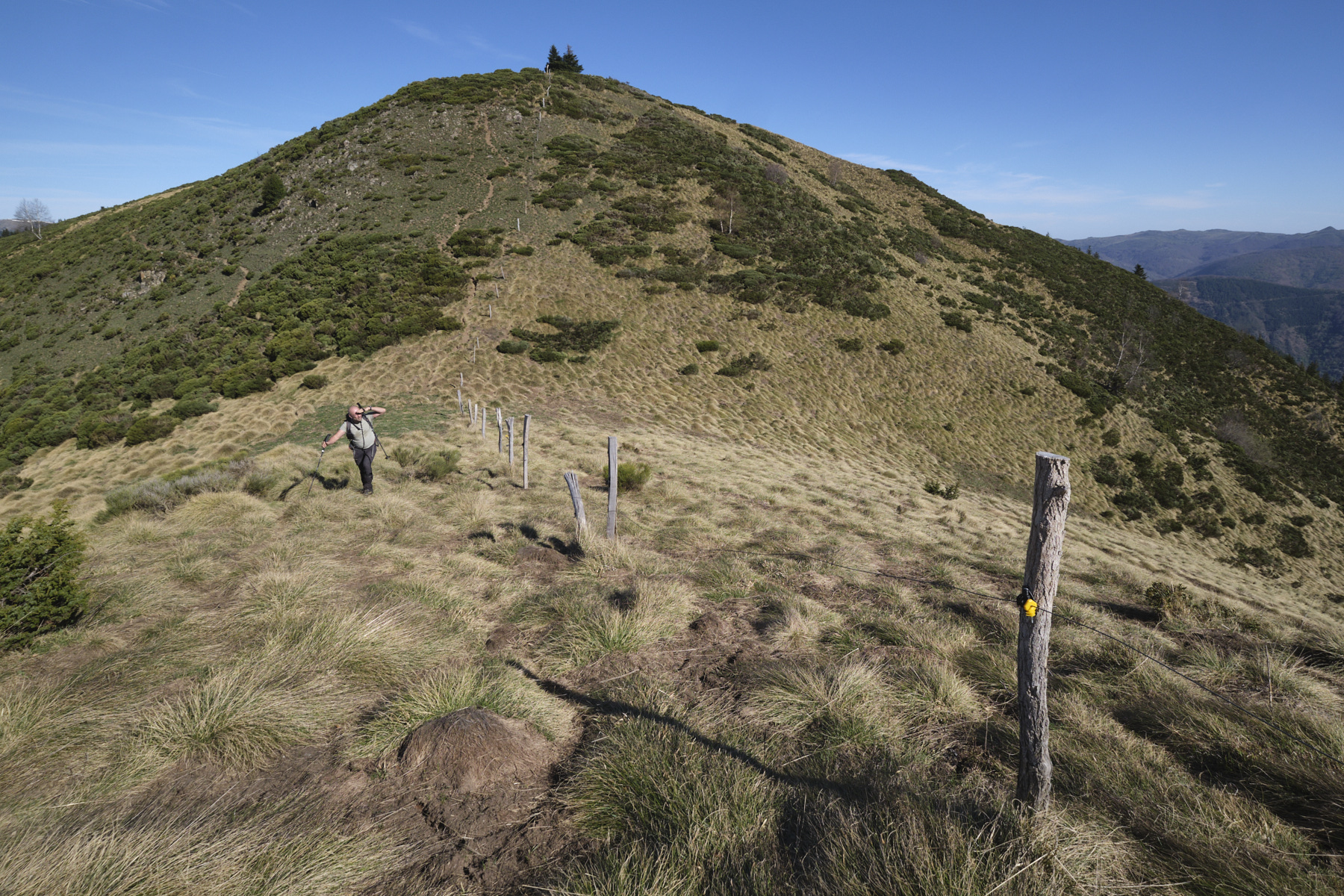
From the Col de Surles, the route follows the ridges in a generally southerly direction. The ascent to the Pic de Canals is to the right of the fence, then higher up on the left. The slope steadily steepens to reach a flatter section higher up. Follow the ridge, which undulates a little and then descends to a small pass at the foot of the Pic de Canals. From here, tackle the forest slope on a steep little path to the summit of Pic de Canals. From here, you can see all the way to the Pic des Perdrix in the distance.
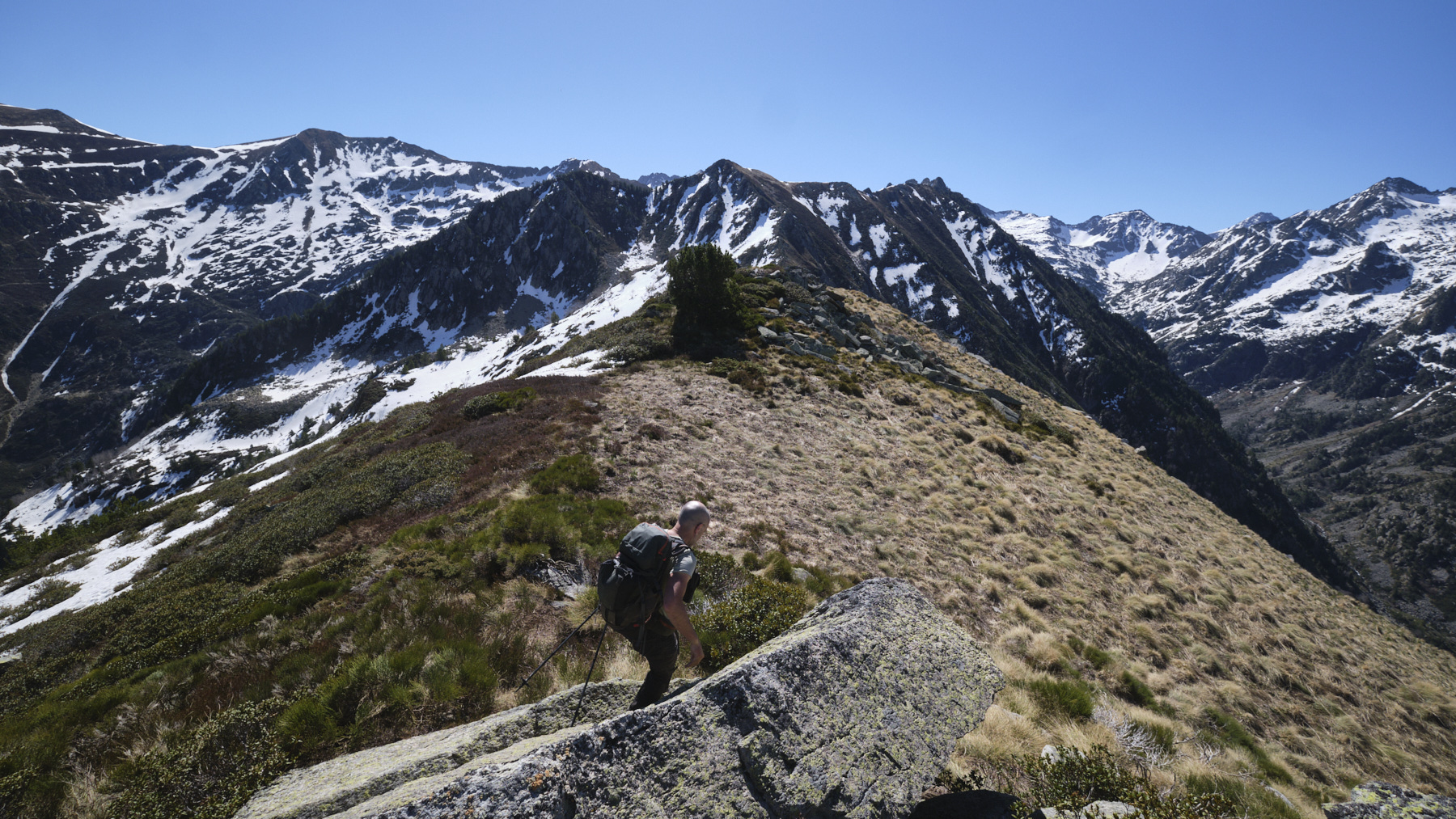
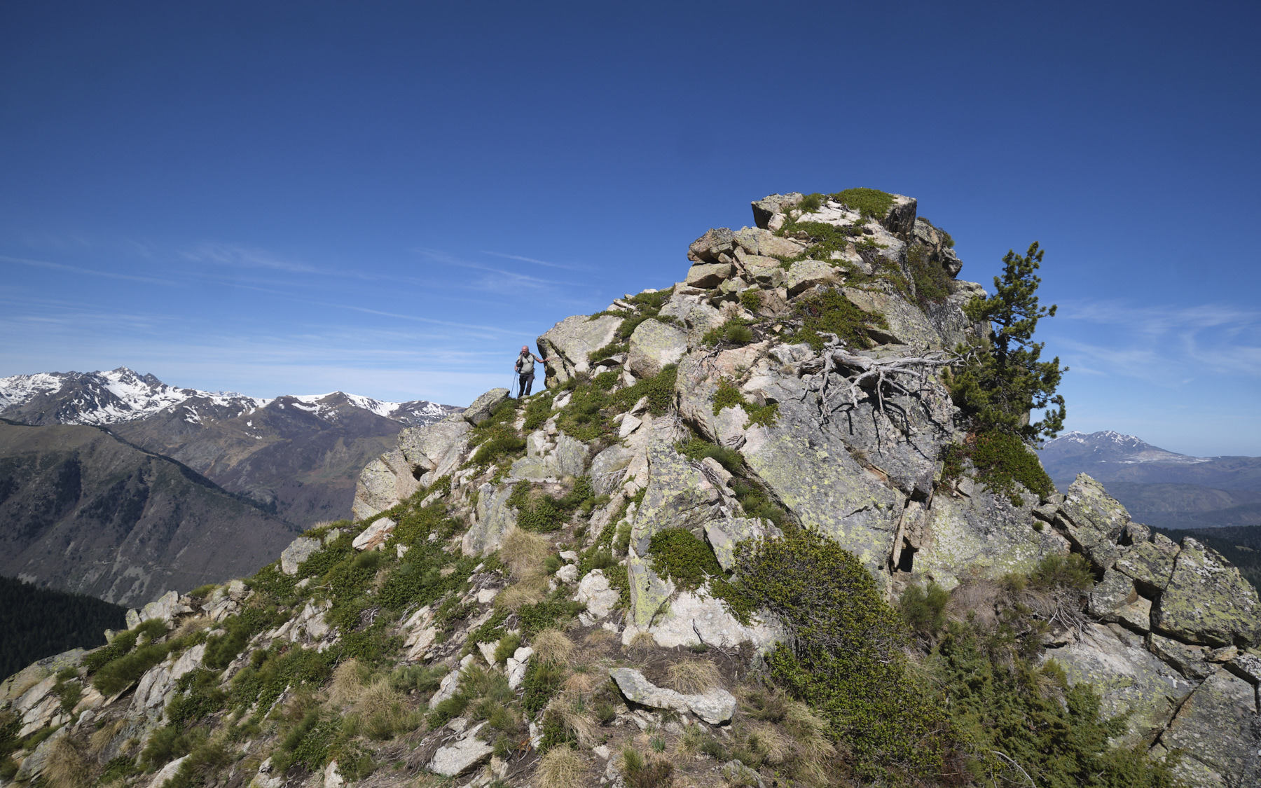
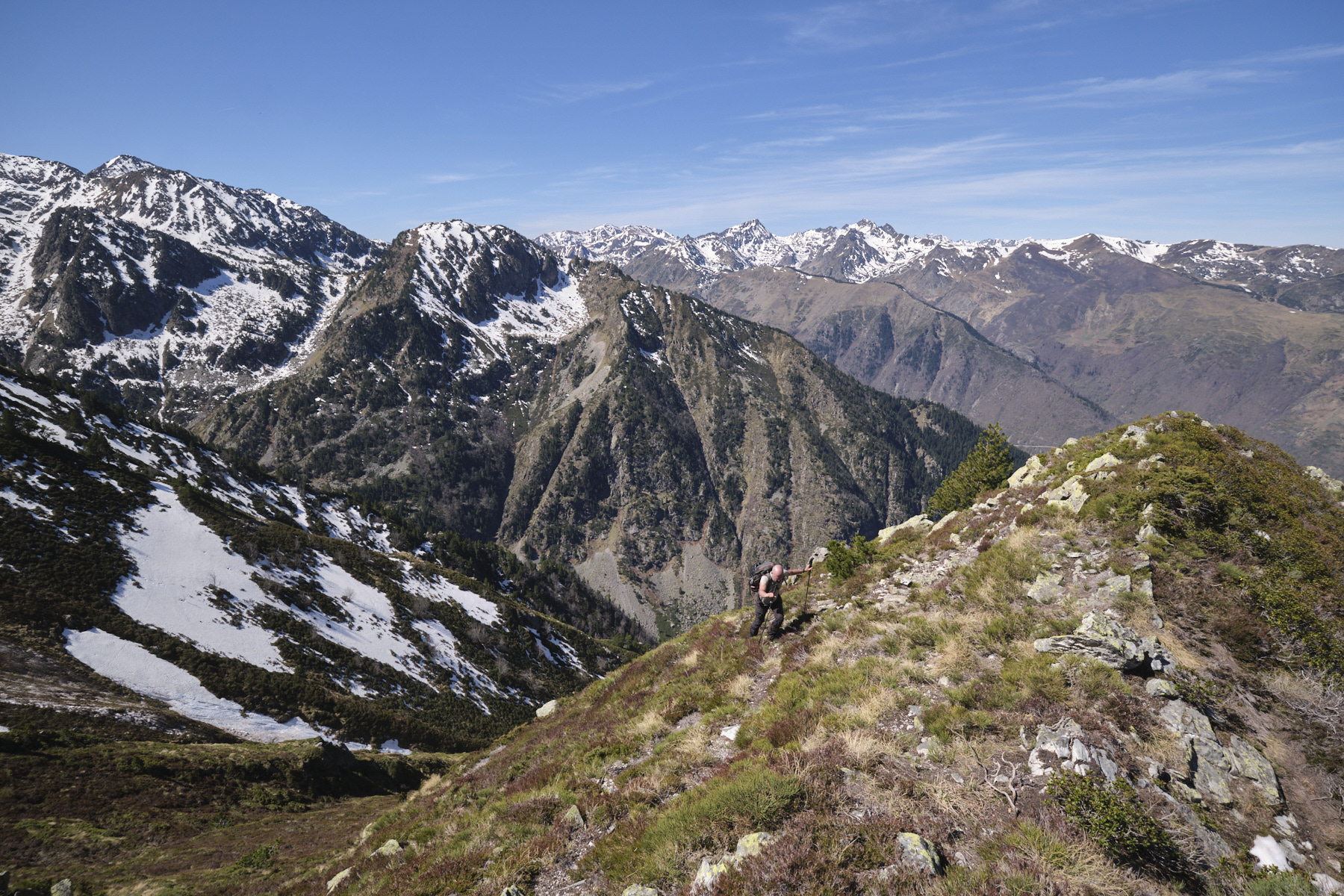
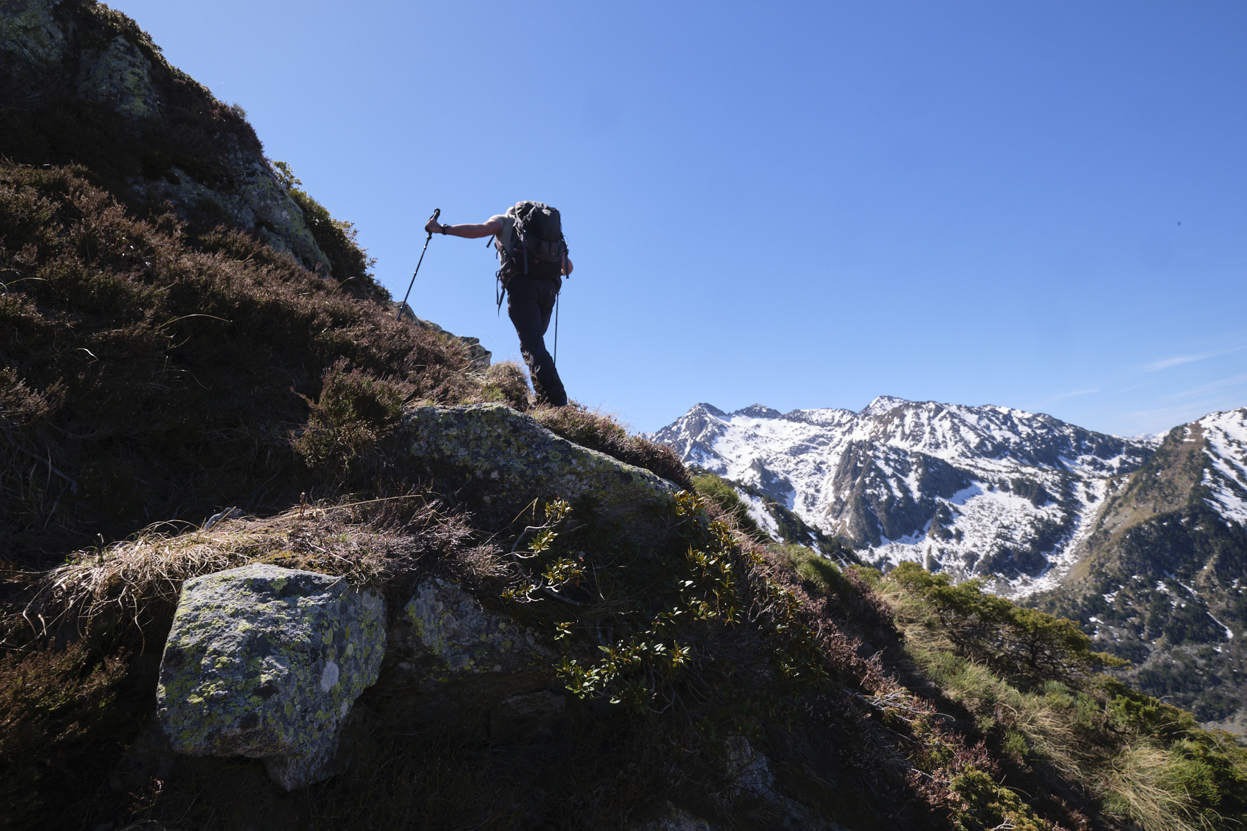
The ridge starts quietly, but soon the west-facing slope becomes steep to very steep. Keep to the edge of the ridge as far as possible, threading your way between boulders without too much difficulty. Further on, there's a more chaotic section that's best avoided by cutting underneath (tricky passages, unstable and steep terrain). Then climb back up to the edge of the ridge and continue slightly downhill until you reach the foot of the northwest ridge of Pic des Perdrix.
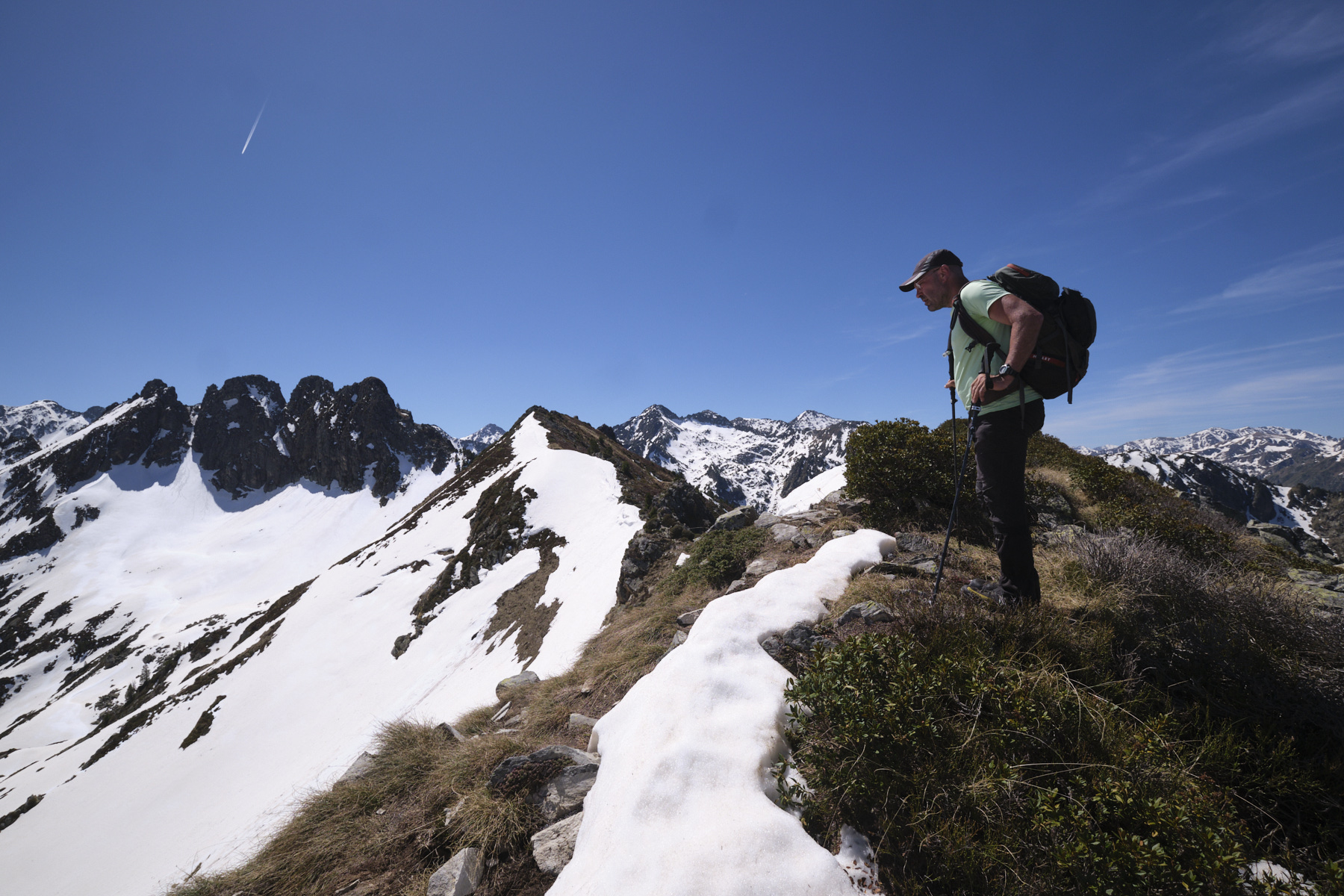
Go straight up the slope on an increasingly steep trail, not very visible but present. Higher up, there's a rocky spur that looks impassable from a distance, but which can be crossed by going right over a small couloir and crossing a small shoulder. Continue on steep, slippery terrain, without crossing too much, but heading for the summit. You'll then reach the Pic des Perdrix, with its splendid views over the valleys and the Pyrenees.
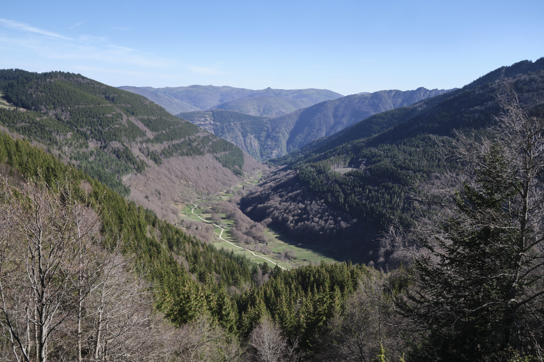
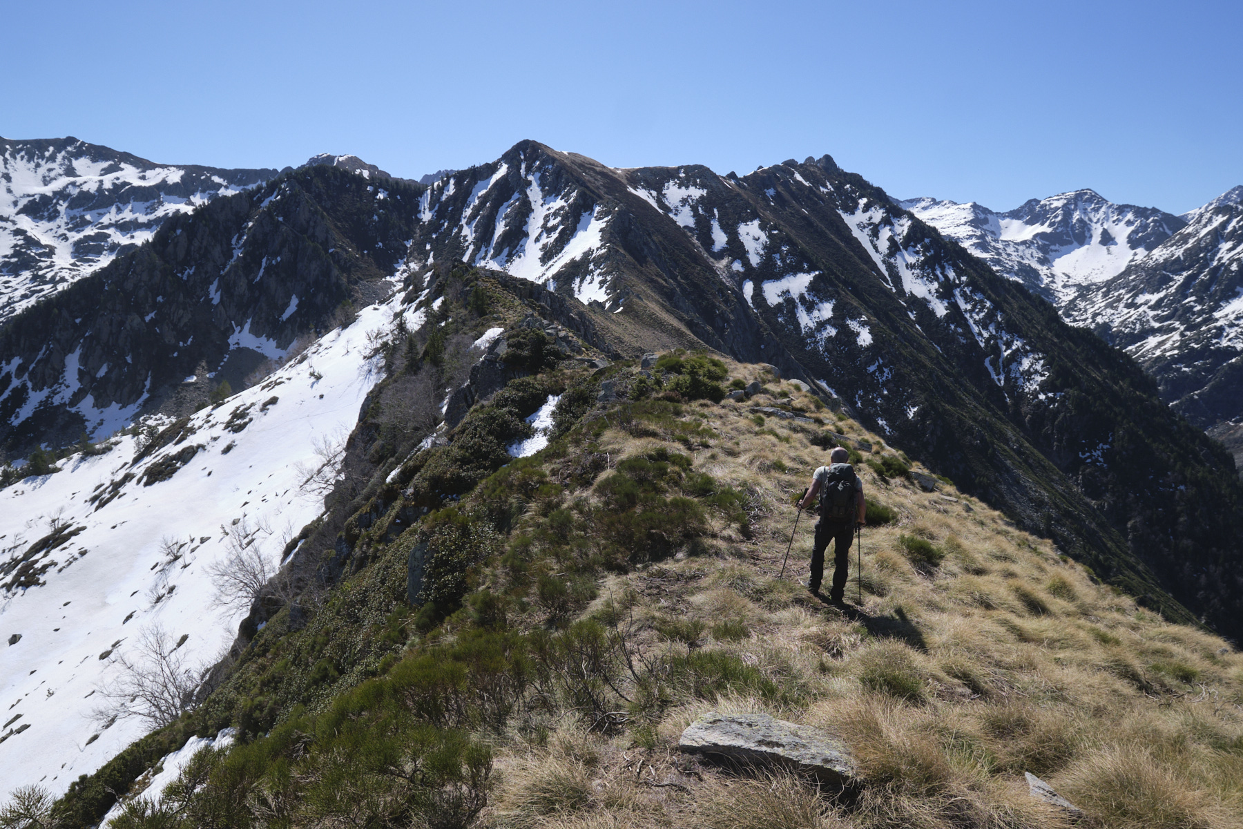
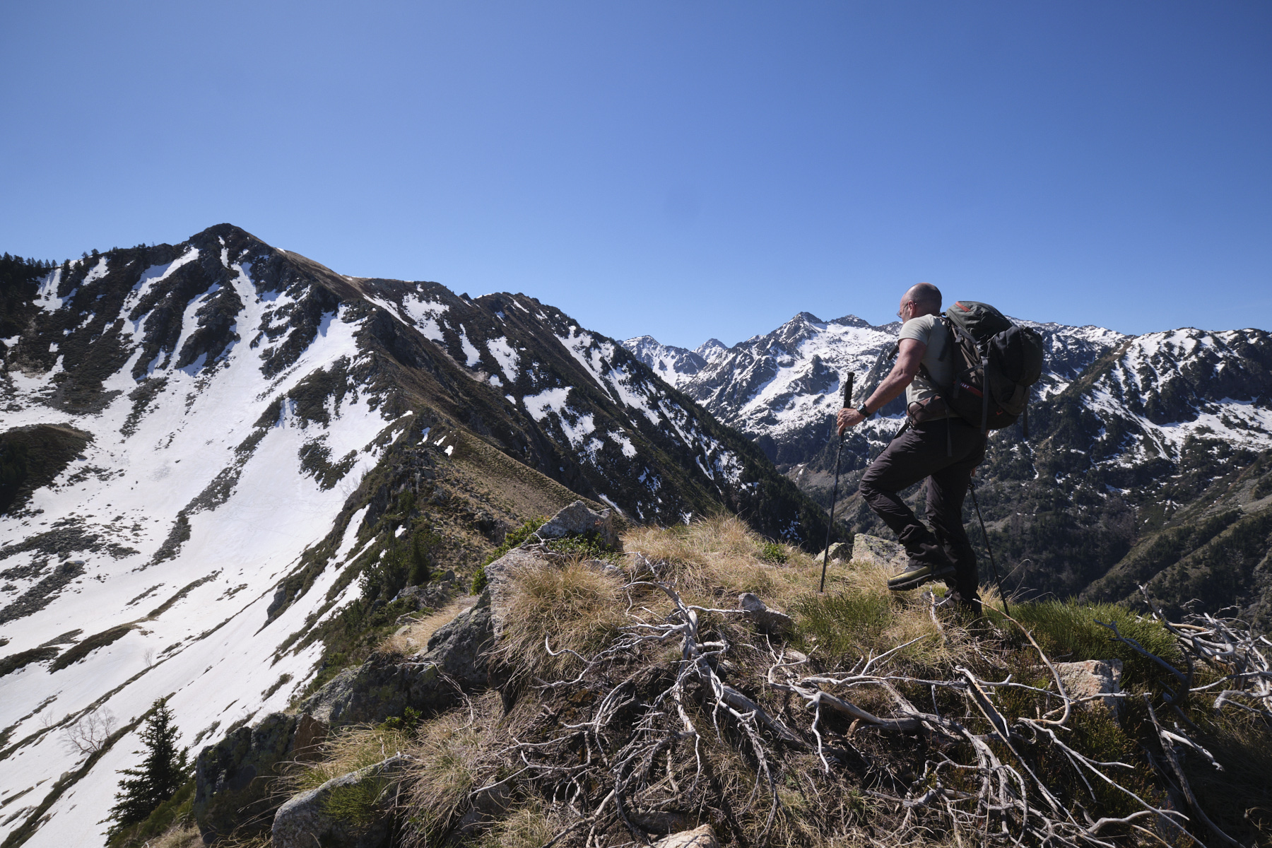
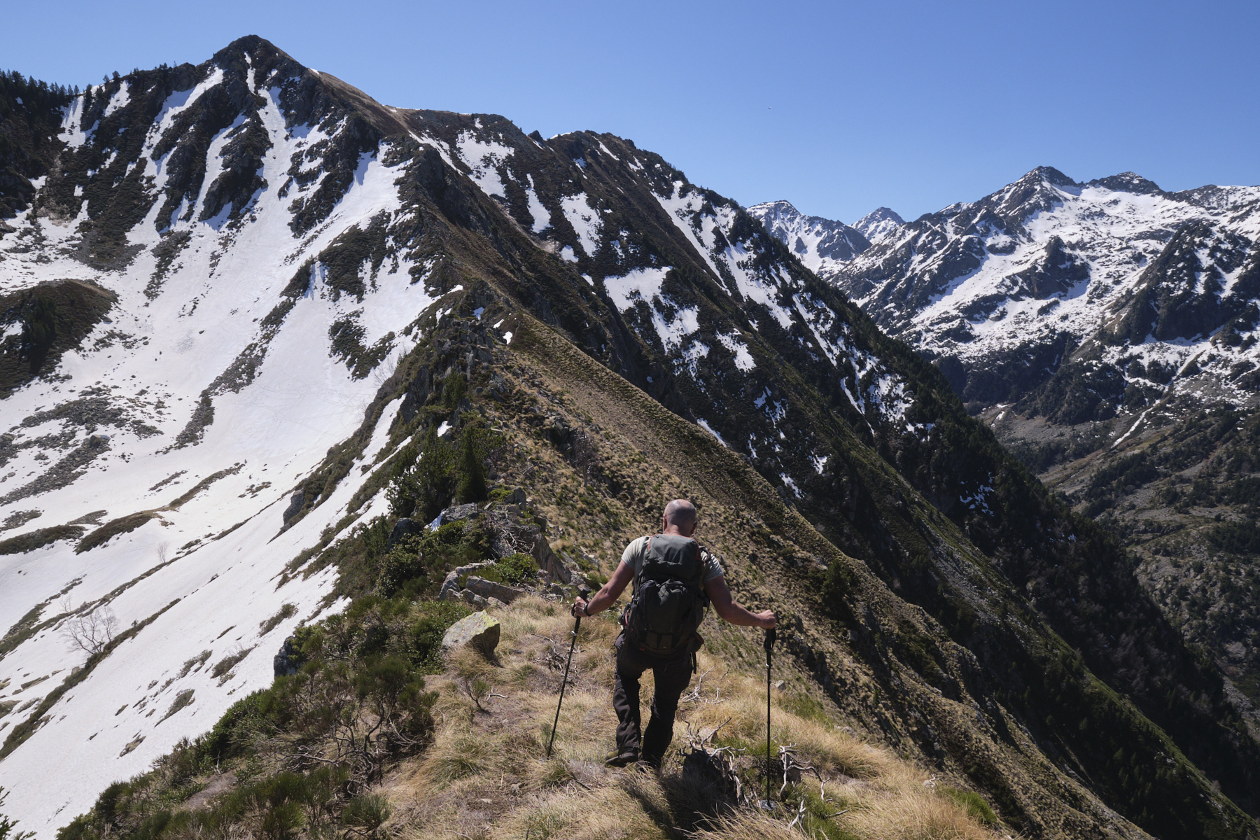
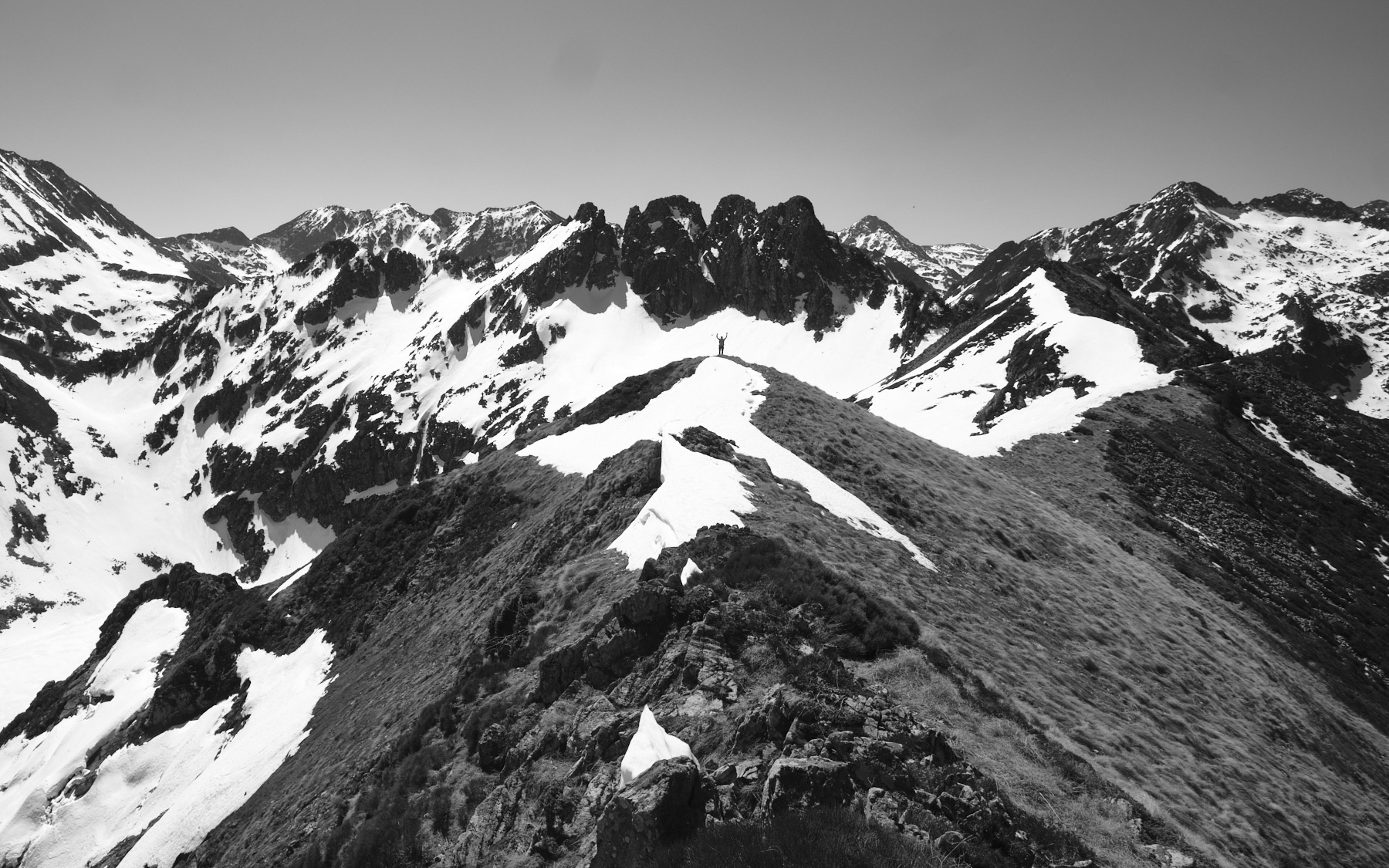
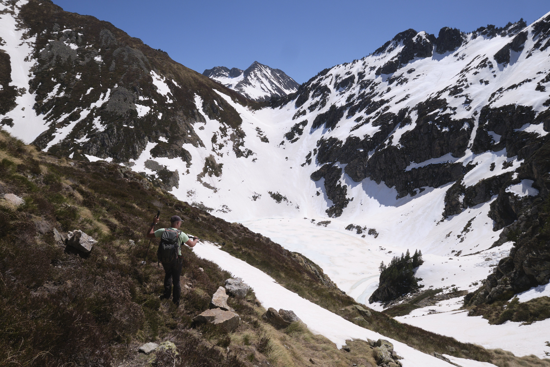
3rd part: descent to Lac d'Aygue Longue and return via the Ruisseau d'Orgeix valley (2h)
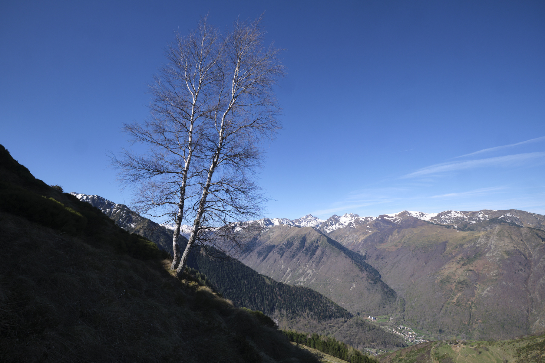
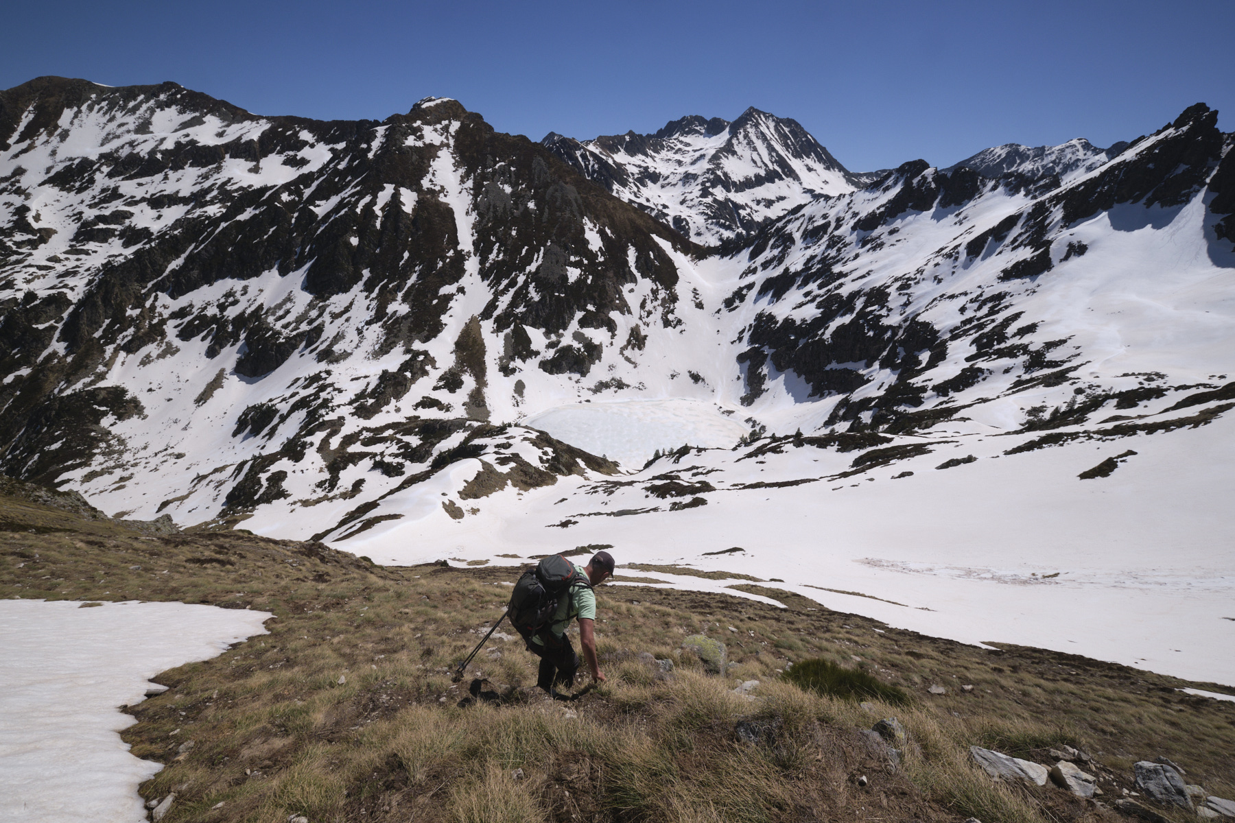
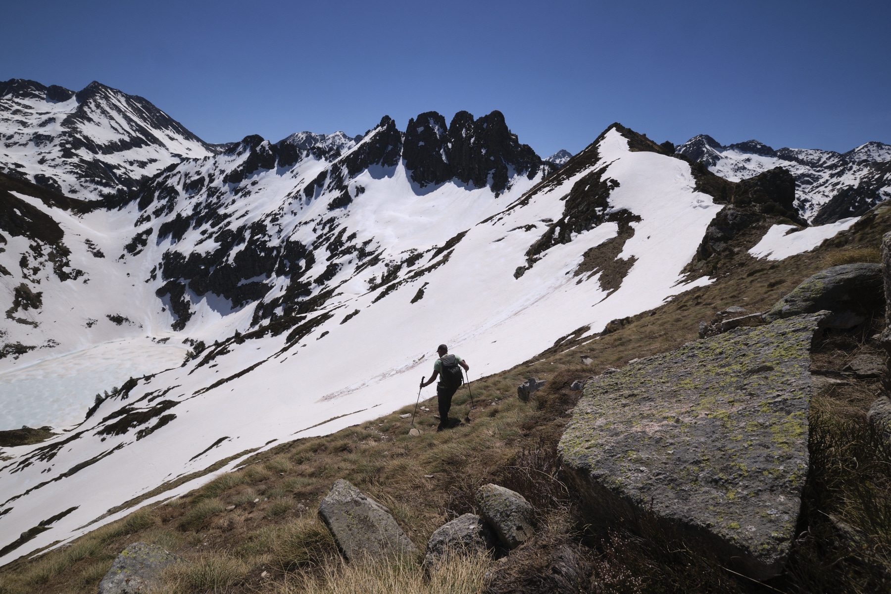
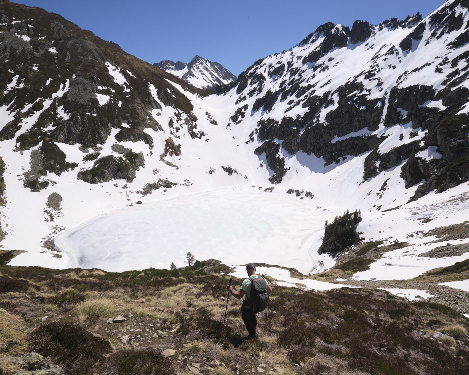
From the summit, walk south along the ridge towards the rocky needles of the Pic d'Aygue Longue, descending to the left as soon as possible on a steep, gispet-covered slope to aim for the Lac d'Aygue Longue at the very bottom. Further down, the slope becomes gentler and you walk into a small valley that plunges down towards the lake. Before reaching the lake, turn left and cross a scree to find the yellow-marked path leading up from La Llau to the lake.
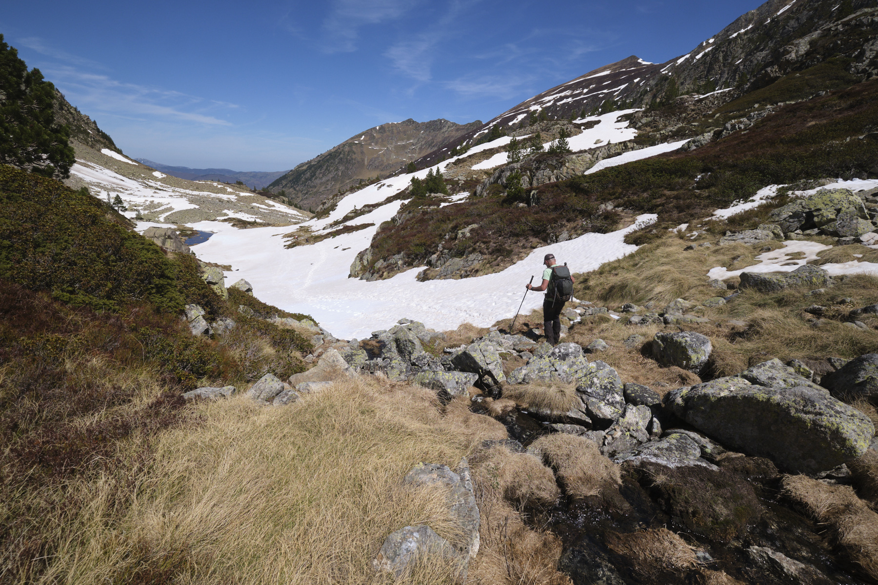
The yellow trail continues down the upper valley of the Orgeix stream to the hut after the footbridge. Then finish in the forest on the path and the îste down to the starting parking lot.
Monte Rotondo, Melo and Capitello, Corte 5 August 2017 From the Restonica Valley, climb Corsica's second highest peak, Monte Rotondo at 2622m, and return via the…


 Partager sur WhatsApp
 Partager sur Twitter
Partager sur Instagram
Partager sur Twitter
Partager sur Instagram

 Partager sur Facebook
 Imprimer le topo
 Laisser un commentaire


![2017-08-05_13-35-40 [Monte Rotondo]](https://climbing7.com/wp-content/uploads/2017/09/2017-08-05_13-35-40-monte-rotondo-1024x683.jpg "Monte Rotondo, Melo and Capitello, Corte")

Leave a Reply