

TOPO Alpinism | CLIMBING7.COM
Publié le

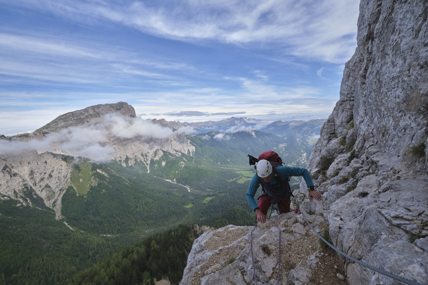
Mont Aiguille in the south of the Vercors is a mythical and historic mountaineering peak, since the first ascent is said to have taken place in 1492! A huge rocky tooth detached from the Vercors massif, it is a real eye-catcher, offering splendid more or less vertical faces on all sides. The West face is more accessible, and this is where you'll find the normal route, which is very popular, and with good reason. The climbing is easy (III+/IV- max), and the entire route is equipped with ferrata-type cable sections to facilitate progress. So you're not alone, but the crowds don't detract from the extraordinary atmosphere of the place and the incredible views over the Vercors and the whole region. At the top, you'll encounter numerous ibex on this plateau suspended between earth and sky.
❱❱ Technical summary
► S tarting point: parking de la Batie, Saint-Michel-les-Portes, Vercors / Trièves, Isère (38)
► Type of route: normal route
► Total / difficulty vertical drop : 960 m / 360 m
► Rock: limestone
► Direction: north (approach/return), northwest (route)
► A pproach/route/return time: 1h30 / 2h / 3h
► Min and max altitude : 1135 m / 2087 m
► Equipment in place: pins, pitons, ferrata-type cables on some sections
► Equipment required: 2x50m, 8 quickdraws, a few medium-weight stoppers
Difficulties: PD+, max rating IV inf, overall in the III, a few more athletic or awkward jumps in the final chimney.
Detailed topo available on camp to camp.
❱❱ Access to the place
Between Gresse-en-Vercors and Saint-Michel-les-Portes, south of the Vercors, on the Mont Aiguille road, at a bend between La Batie and Les Pellas, turn onto the forest road towards the accrobranche park. Park just before the barrier.
❱❱ Map & topo

❱❱ Itinéraire
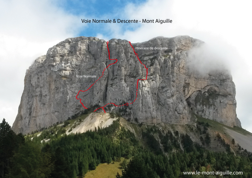
From the parking lot, climb up the track, past the accro-branches park and across the fields. Follow the signs for Col de l'Aupet. The trail then climbs steeply through the forest, yawing to the east and then back to the west. Higher up, you come out at the bottom of a large scree with the west face of Mont Aiguille overhead. Cross under the scree to find the path that crosses it and climbs northwards to reach the base of the wall, on the left-hand side. Gear up on a small flat spot, then start crossing the first steps (II), pulling well to the left to find the start of the normal route at a huge metal pin.
The route is officially divided into 9 fairly short pitches, each equipped with a belay. Given its very accessible level, the entire route can be climbed with a taut rope (a 30m rope is sufficient).
The route first climbs to the north and then back to the south, traversing ramps or inclined dihedrals (L1, L2 and L3). Gradually climb up to just behind the huge aiguille du Gendarme de la Vierge, descending at this point to reach a flat area and a small gap (end of L4). From here, climb 3 or 4m above the gap to reach the main couloir behind (L5, easy).
Climb up this couloir, exiting to the right and stepping onto the first comfortable ledge (L6). Follow this ledge, pass a beautiful fir tree and climb a little higher (L7, big spindles) to find an upper mini ledge, which this time you have to traverse by going back to the left (L8, cable ferrata). Pass under an awkward overhang and come up behind at the foot of the long final chimney (L9).
The chimney is straight ahead, alternating between very easy sections (II) and successive more vertical jumps equipped with cables, but easier to climb on the rock (spindles). L9 is quite long (80m?) and finally ends in an easy couloir that leads straight to the grassy summit plateau.
A path crosses the plateau in the shape of a giant horse saddle to reach the actual summit of Mont Aiguille, with an incredible plunging view of the east pillar.
There are several options, one of which takes you right up to the arch on the west side of the summit. We took the direct option without passing through the arch.
From the end of the route, walk a little to the south-west to find a small descent corridor with a metal crest sealed into the wall. Unclimb or place a rope (fairly exposed). From here, descend to the right and then straight down an obvious but fairly unstable stony couloir. There are a number of impressive but not too difficult ledges to de-escalate (III max). Further down, continue down the couloir, which forms a scree, avoiding it on the right and then reaching a small rocky balcony at the lowest point. Cables provide access to the belays either on the left or right. 30m abseil.
At the bottom of this first abseil, climb slightly to the right to find the second abseil, 45m long, directly on a ledge. The abseil is very aerial and you end up in a narrow gap between the Grand Gendarme and the main wall. You'll then have to de-escalate in this couloir, threading your way under a large jammed boulder to land on the flat. With a 2x60m rope, it's more comfortable as you can rappel all the way down.
From here, follow the path back to the start of the normal route. All that remains is to repeat the approach in the opposite direction to the parking lot.
Leave a Reply