

TOPO Via ferrata | CLIMBING7.COM
Publié le

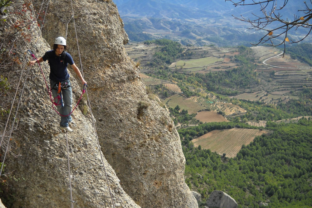
This fun and fairly accessible ferrata is a great way to discover the Serra de Montsant nature park, north of Reus and Tarragona. The route crosses the immense rocky bar of the Serra Major de Montsant in the middle, with a breathtaking aerial view of the valley. There's a beautiful vertical needle to climb and an impressive suspension bridge, but nothing too difficult. The site is very beautiful and faces the Siurana cliffs, the Catalan temple of climbing. It can be combined with equipped or grau routes, such as "El grau dels Tres Esglaons", which we did from Cornedulla.
❱❱ Technical summary
Type ✦ Via ferrata
Location ✦ La Morera de Montsant
Region ✦ Catalunya
Country ✦ Spain
Vertical rise ✦ 150m
Difficulty ✦ K3
Duration ✦ 2h30 to 3h
❱❱ Access to the place
The village of La Morera de Montsant lies to the north-west of Reus (or Tarragona) and opens onto the Serra de Montsant Natural Park. Drive up to Cornudella de Montsant and take a small road that skirts a large, wide rocky barrier and leads to La Morera, a small village built at the foot of the cliffs. Park at the first parking lot at the entrance to the village.
❱❱ Map & topo

❱❱ Itinéraire
Exit on the village side, go up the narrow streets to find a path on the west side leading to the ferrata (2h indicated) and El grau de Salfores (PR marked in yellow and white). Follow this path for about half an hour until you come to a sign indicating a climbing site on the right. Go up this small path, around a huge overhanging slab (marked route!), and continue. Pass through a rocky chaos, a few rungs before you see the start of the via, on a large, slightly pointed rocky slab (see photo) with a scar in the middle. This is where it starts.
The via ferrata, opened in 2002, faces south. 250m of vertical drop and slightly old equipment, with a few rusty, wobbly rungs. Obstacles include a vertical pitch and an aerial suspension bridge. 3 sections interspersed with easy bouldering and walking.
This can be done in 2 ways. From the west, following a small ridge path back to the PR above Grau de Salfores. From the east, which is what we did, following the ridge along a well-marked path. After about 10 minutes, a large kairn indicates the right fork. Descend following the clearly visible kairns and rejoin the main path back down to Morera de Montsant (Grau de la Grallera).
Leave a Reply