


TOPO Via ferrata | CLIMBING7.COM
Publié le
 Partager sur WhatsApp
 Partager sur Twitter
Partager sur Instagram
Partager sur Twitter
Partager sur Instagram

 Partager sur Facebook
 Imprimer le topo
 Laisser un commentaire
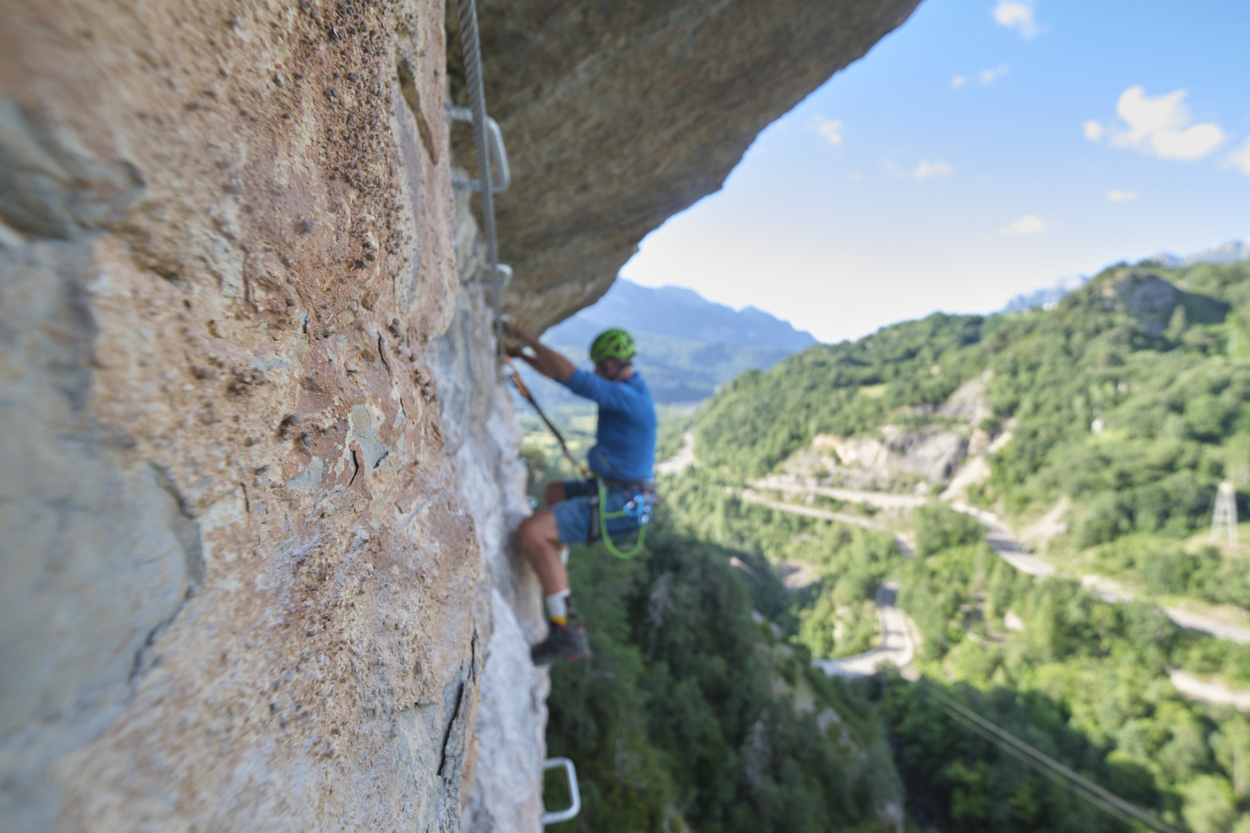
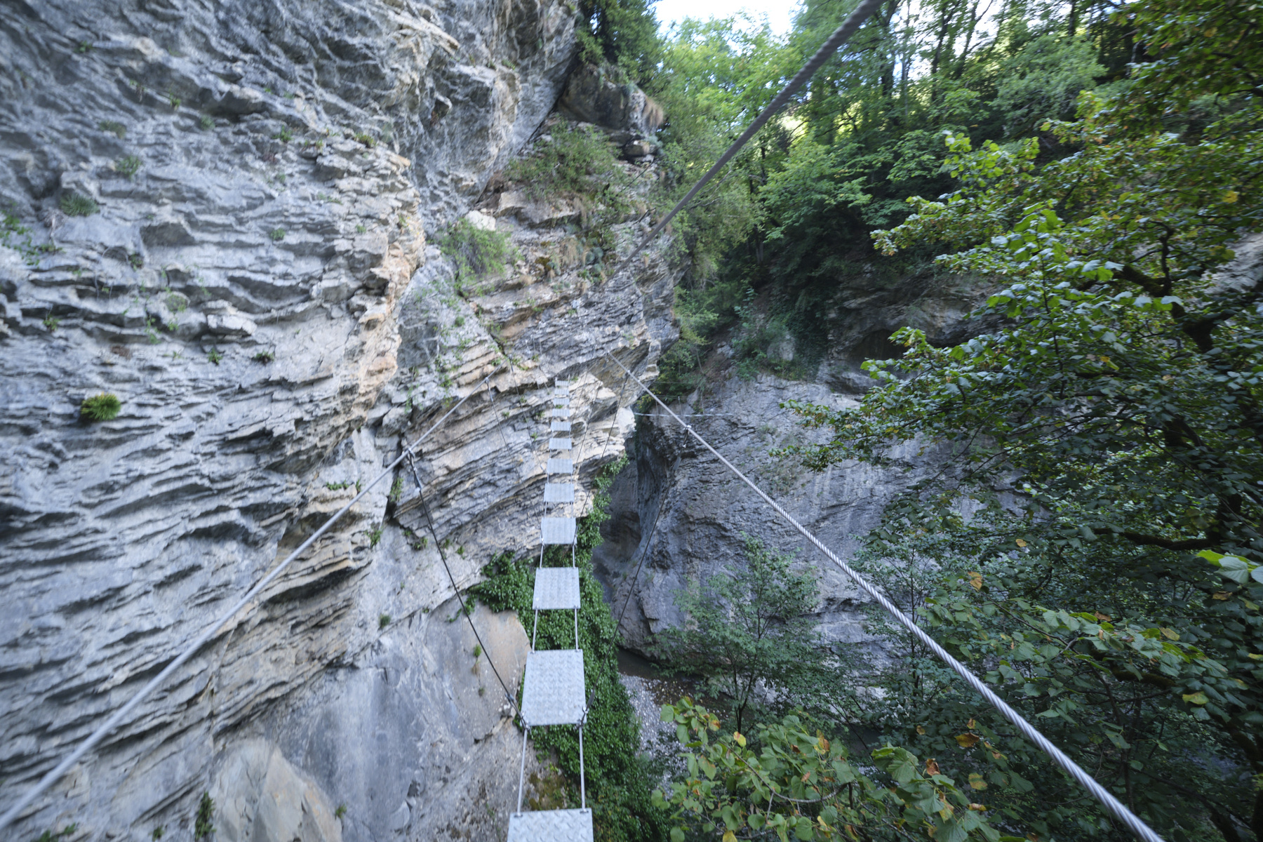
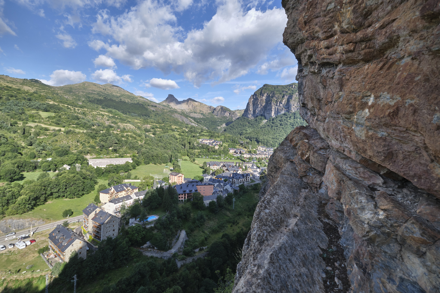
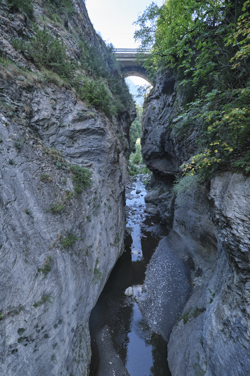
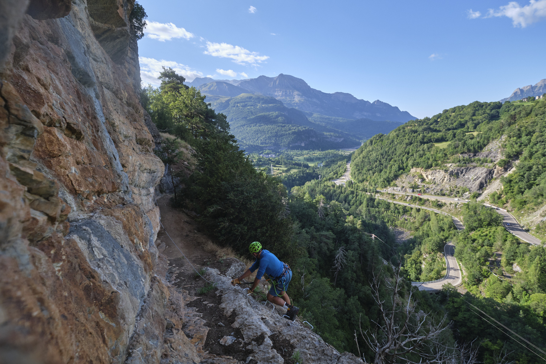
Very recent via ferrata (2022) built from the village of Escarilla, in the upper Rio Gallego valley. The route offers 3 independent sections of increasing difficulty, which can be linked together on the walls overlooking the small gorges formed by the Gallego torrent at this point, between the 2 reservoirs of Lazuna to the north and Bubal to the south. An easy section (K1/K2) is followed by a fairly difficult, aerial section on a high wall (K3) and, after a return loop, the difficult final section (K4) which climbs back up to the village under a small overhanging wall. A short ferrata to discover near Panticosa.
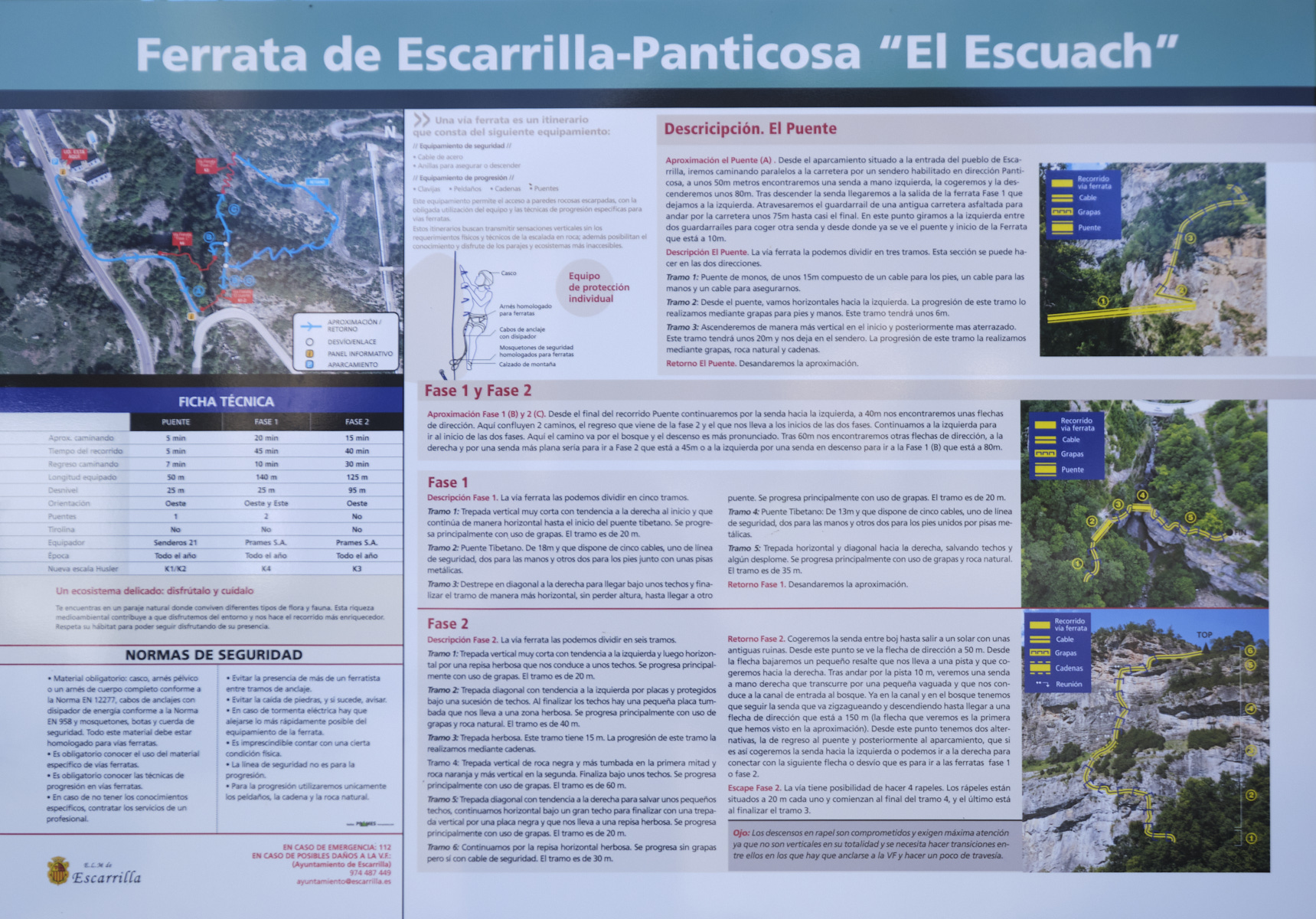
❱❱ Technical summary
■ S tarting point: Escarrilla, Aragon, Spain
■ Type of route: via ferrata in 3 sections: easy (K1/K2), AD (K3) and D (K4)
■ Direction: west and east
■ Fitted length: 50 m (K1/K2), 125 m (K3) and 140 m (K4)
■ Positive vertical drop: +25 m (K1/K2), +25 m (K3), +95 m (K4)
■ Estimated total time: 1h to 1h30
■ Min and max altitude: 1120 m / 1220 m
■ Equipment in place: rungs, chains, 2 Tibetan bridges, 1 monkey bridge, equipped abseils in the K3 section
■ Equipment required: standard equipment
Difficulty: the hardest part is rated Difficult or K4, but it's a small K4 because it's short. The ascent of the big wall is aerial and vertical. The final section is slightly overhanging and pulls on the arms.
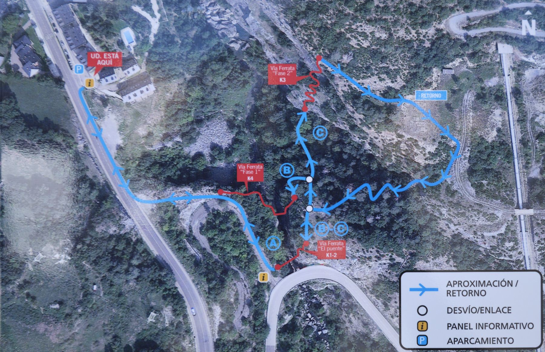
❱❱ Access to the place
On the road between Biescas and the Col du Pourtalet, head for Escarrillas. The village lies between the Lanuza and Bubal reservoirs. Park in the village, ideally in the small parking lot to the south, just outside Escarrillas. This is where you'll find the official ferrata information panel and the start of the approach.
❱❱ Map & topo
❱❱ Itinéraire
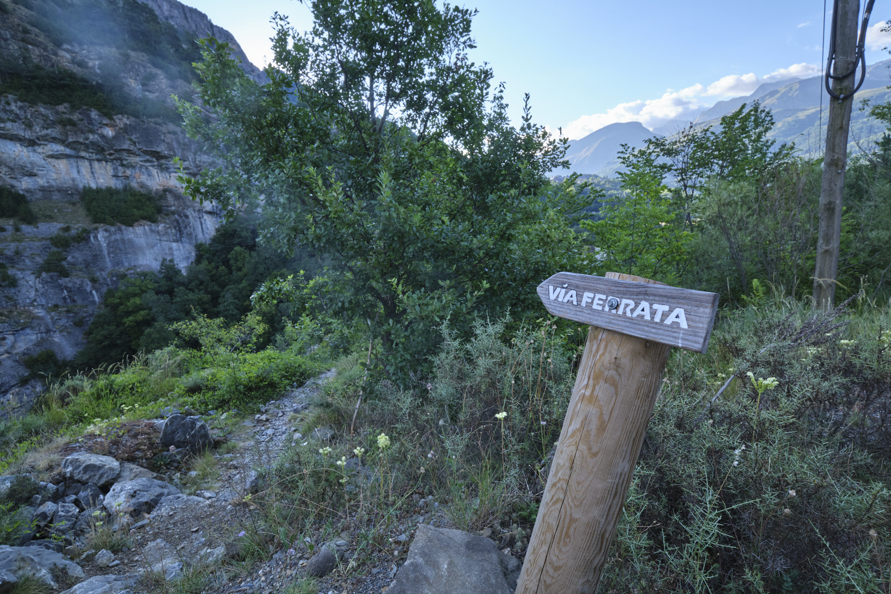
From the parking lot at the southern entrance to the village, walk along the road and descend to the left, following an old road below to find the start of the ferrata with the suspension bridge on the left. Be careful, you'll pass the end of the K4 section just before the old road, which should not be taken as it runs in the opposite direction to the route.
If you link the 3 sections together, the whole route forms a rollercoaster. The logical sequence is in the direction of increasing difficulty, the small K1/K2 section at the start, then the K3 wall and, after a loop, the K4 section to return almost to the village. We cross over the Rio Gallego twice.
Follow the approach path in the opposite direction back to the starting parking lot.


Leave a Reply