


TOPO Via ferrata | CLIMBING7.COM
Publié le
 Partager sur WhatsApp
 Partager sur Twitter
Partager sur Instagram
Partager sur Twitter
Partager sur Instagram

 Partager sur Facebook
 Imprimer le topo
 Laisser un commentaire
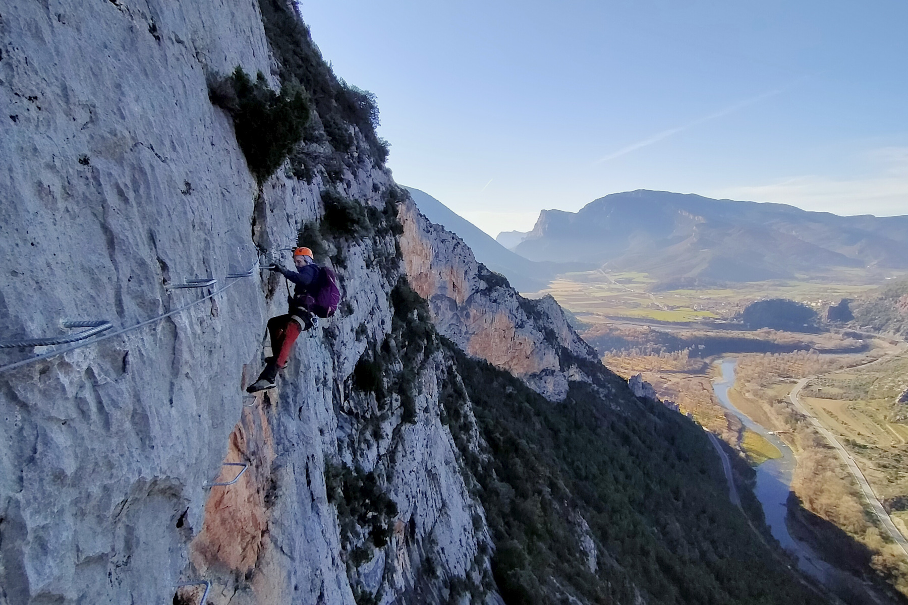
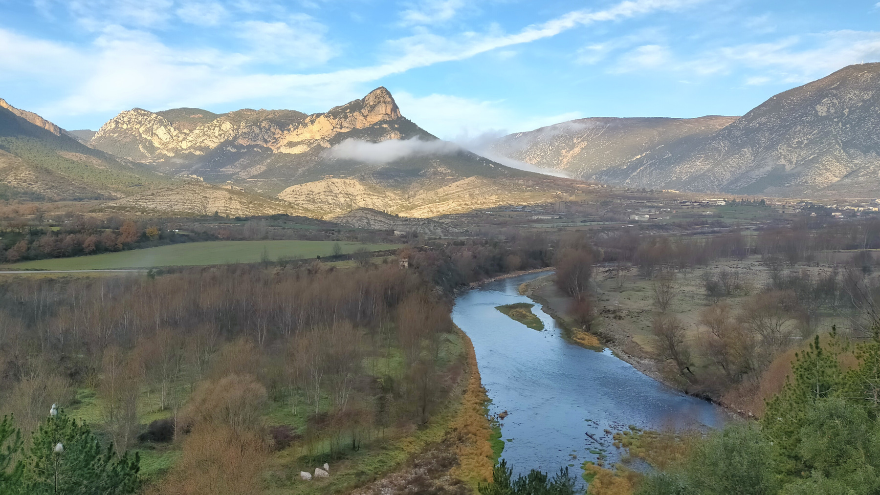
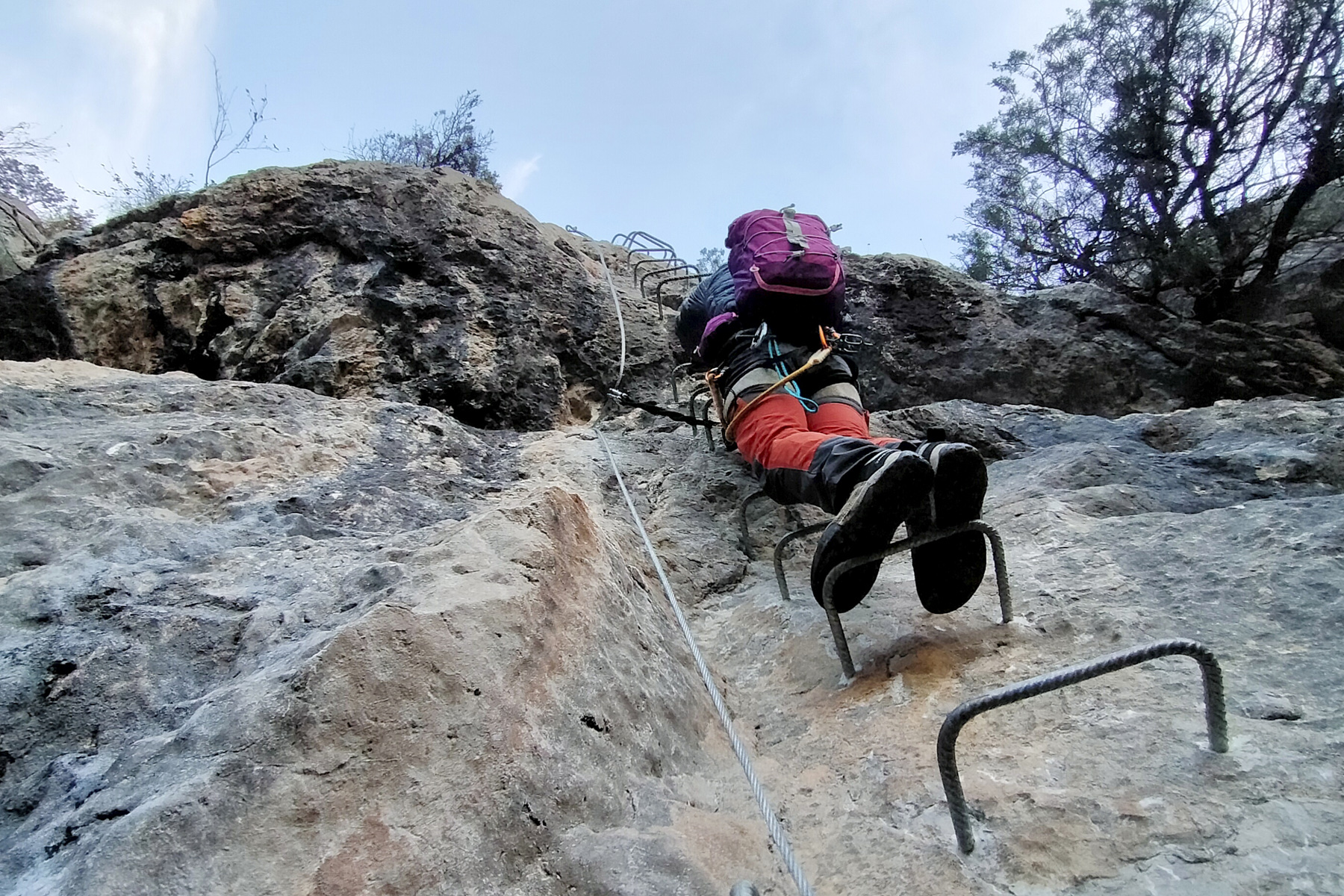
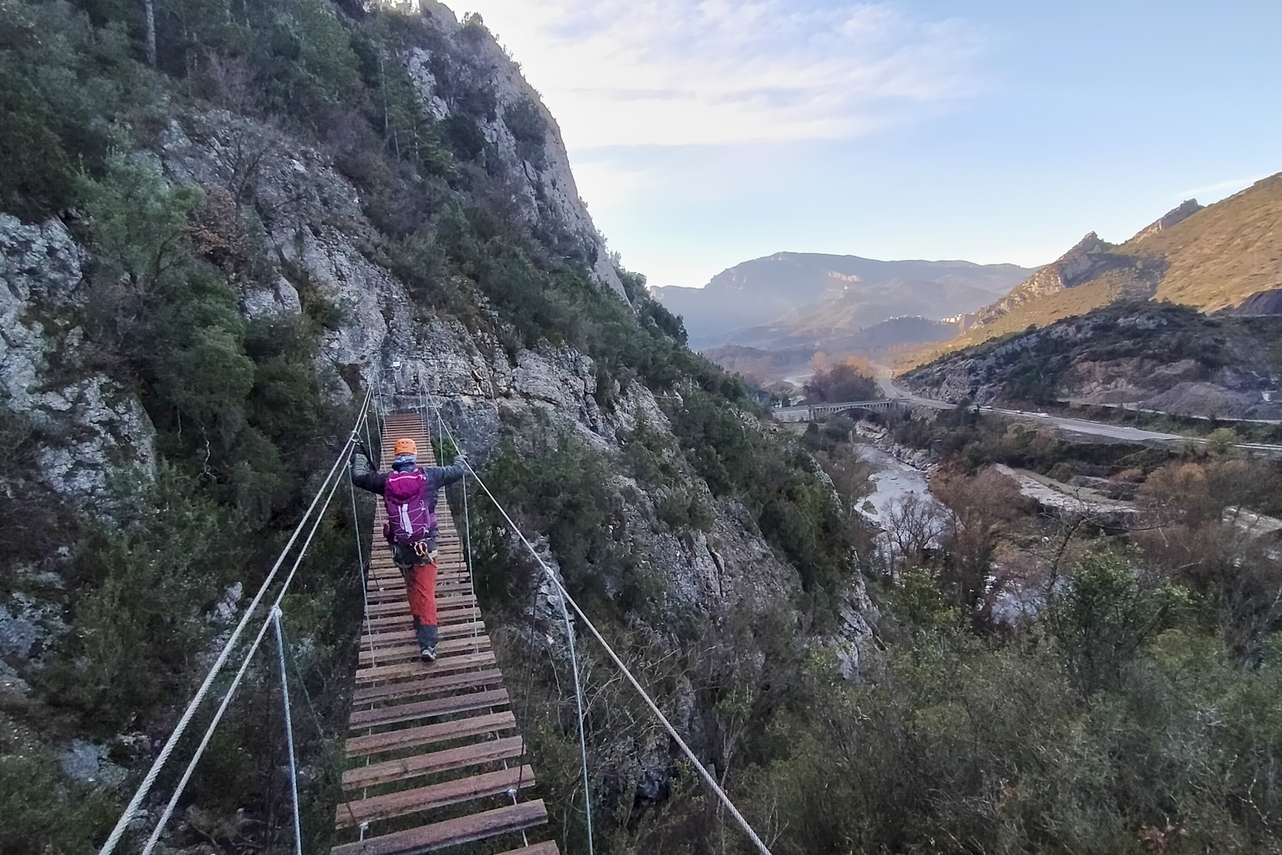
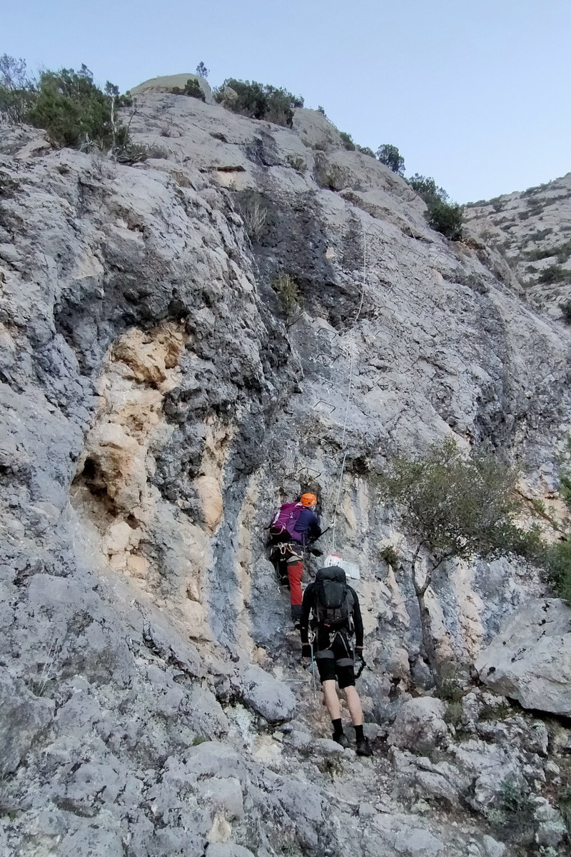
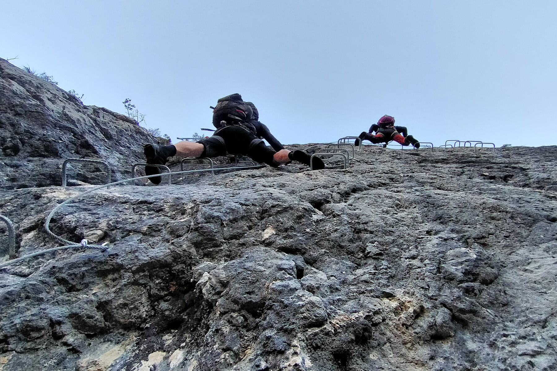
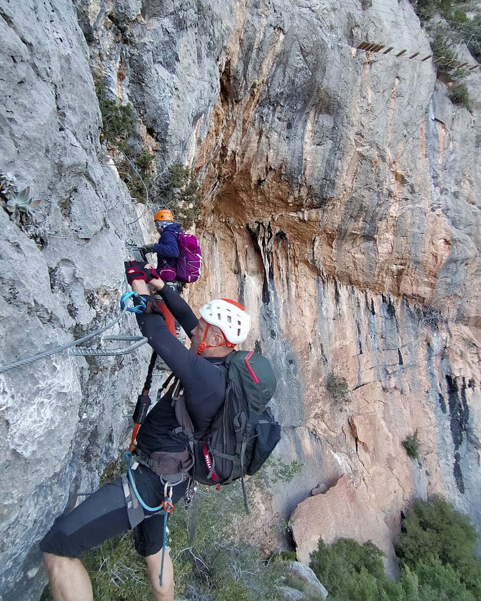
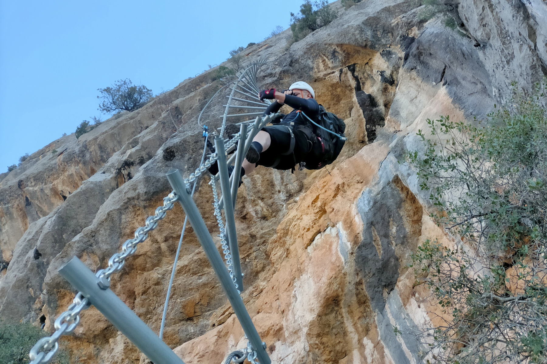
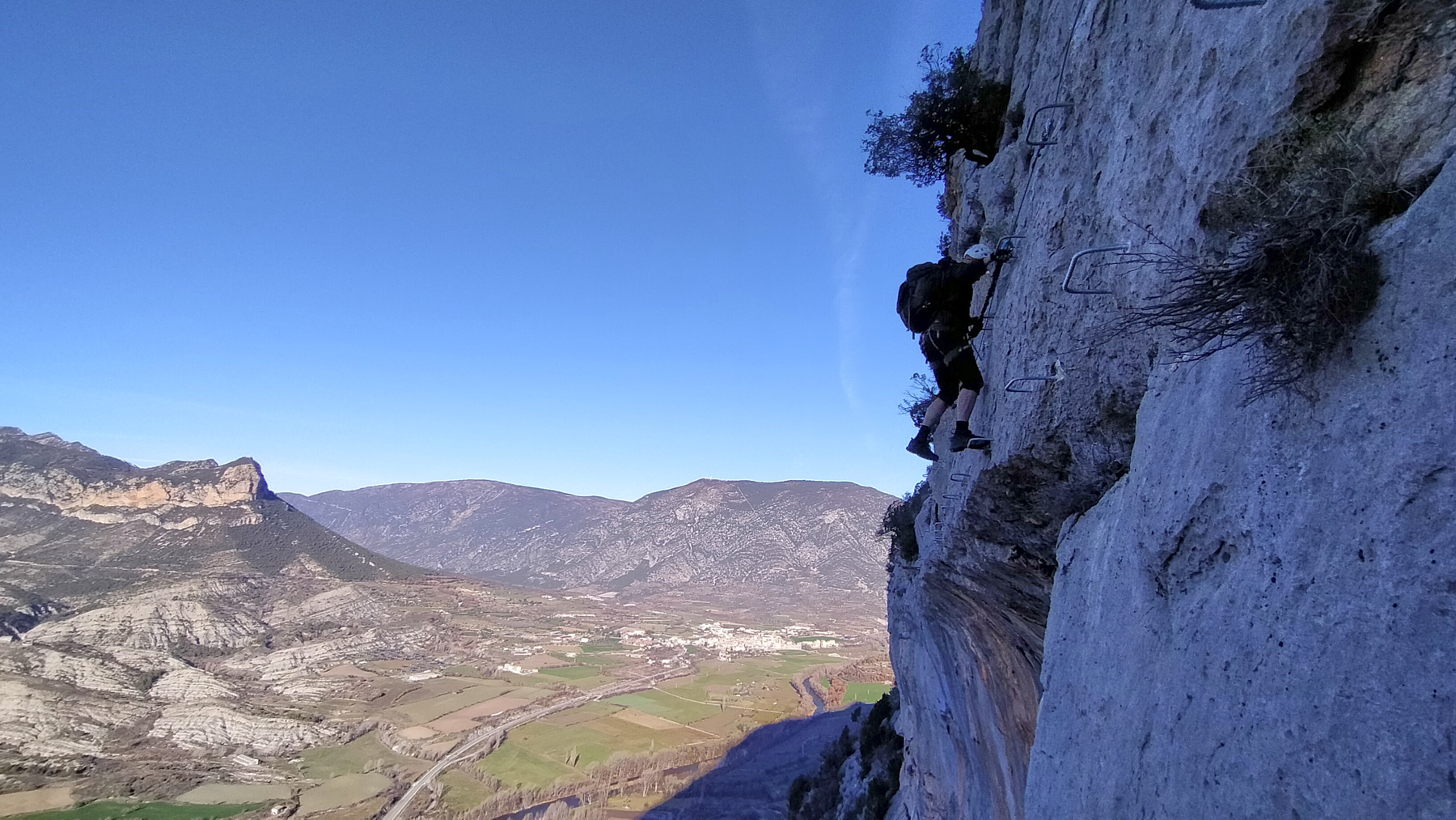
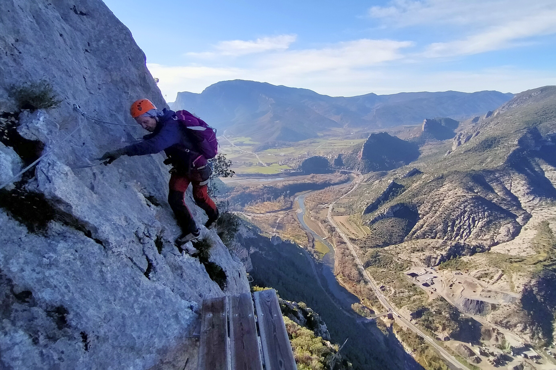
Between Seu d'Urgell and Oliana, above the Segre valley that crosses Alt Urgell, the Roca Narieda via ferrata crosses a series of large walls forming the western foothills of the Tossal de Balinyo. Long, demanding and aerial, the route comprises 2 parts, a first, not-so-obvious family section (K3) and a second, more physical and technical section (K4) with the original climbing of a twisted ladder where balance and placement are required. A large-scale ferrata to try and make up for Regina, in a superb setting despite the slight drawback of the proximity of the C14.
❱❱ Technical summary
■ S tarting point: just before the village of Figols, Alt Urgell, Catalunya, Spain
■ Type of route: via ferrata with a family section (K3) and an optional sports section (K4)
■ Direction: west
■ Equipped length: 1120m
■ Vertical rise: +450 m
■ Estimated total time: 1h30 to 2h
■ Min and max altitude: 550 m / 1120 m
■ Equipment in place: excellent, rungs sometimes quite far apart, chains, 2 footbridges, 1 sign bridge and 1 Nepalese bridge. 3 small suspended wooden platforms
■ Equipment required: standard equipment
Difficulties: the family route is rated K3 (optional start in K4 at least!), the sportive K4. Several small overhanging sections or sustained vertical pitches. Climbing the ladder requires balance and repositioning, but without too much difficulty.
❱❱ Access to the place
On the C14 between Coll de Nargo and Organya, turn east and cross the bridge over the Segre towards Figols and Alinya. Just after the bridge, follow the road to the left towards Figols. Just before the village, there is a large parking area on the left-hand side. The approach starts from the other side of the road.
❱❱ Map & topo
The route of the ferrata is approximate.
Voir en plein écran
❱❱ Itinéraire
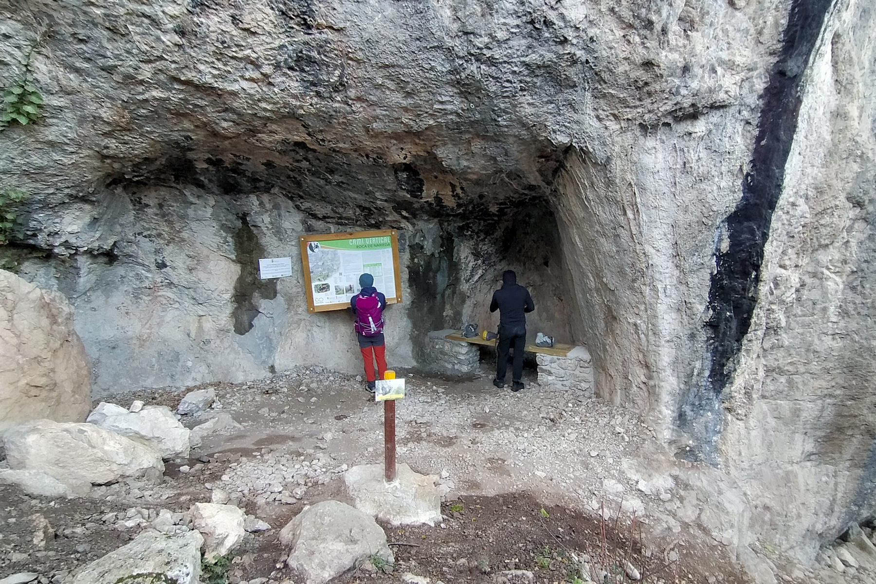
From the parking lot, cross the road and walk slightly uphill on the sloping road, which becomes a track at the first bend. Walk straight towards the large cliff, due south. Further on, you'll find the fork to the right to reach the start of the ferrata (signposted). The route descends a little into the woods, then crosses over to the south-west. You'll find the start under a small wall with the official information panel.
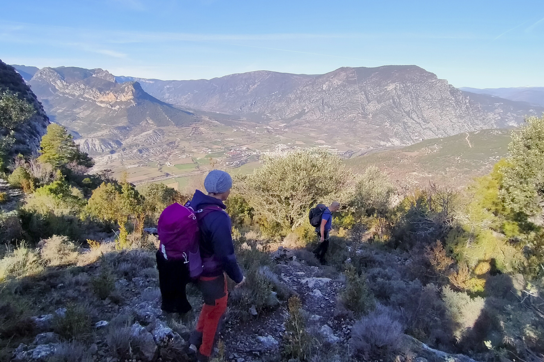
Follow the cairn-marked path uphill to the east to reach an upper plateau. Here you cross the path that leads to the Tossal de Balinyo on the right. Go straight downhill towards Figols. Further on, the path twists and turns down steeper slopes until it reaches Coll d'Escala. Turn left onto the track, taking the shortcuts marked in yellow to return to the starting parking lot.
The reference guide to the Deandar ferrata (in Spanish)


Leave a Reply