


TOPO Via ferrata | CLIMBING7.COM
Publié le
 Partager sur WhatsApp
 Partager sur Twitter
Partager sur Instagram
Partager sur Twitter
Partager sur Instagram

 Partager sur Facebook
 Imprimer le topo
 Laisser un commentaire
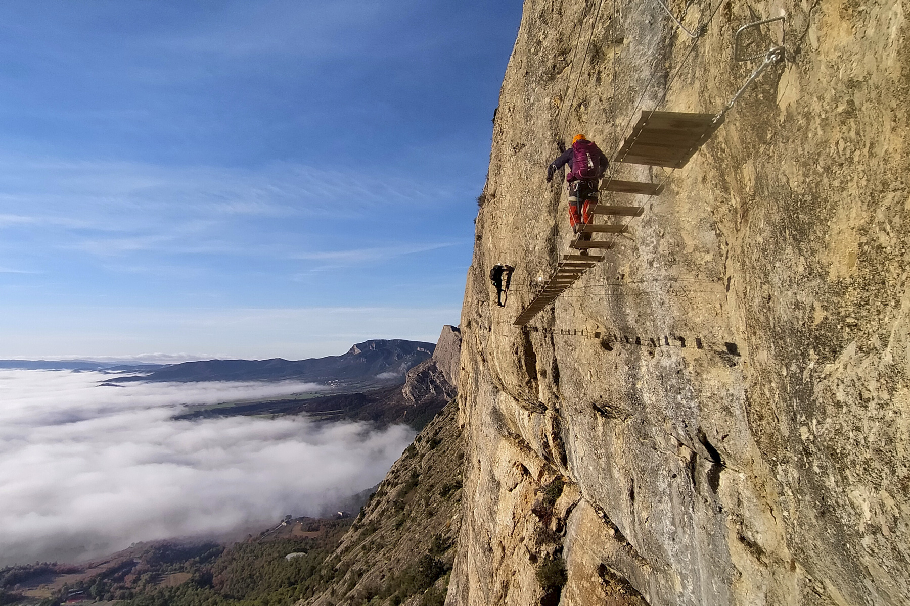
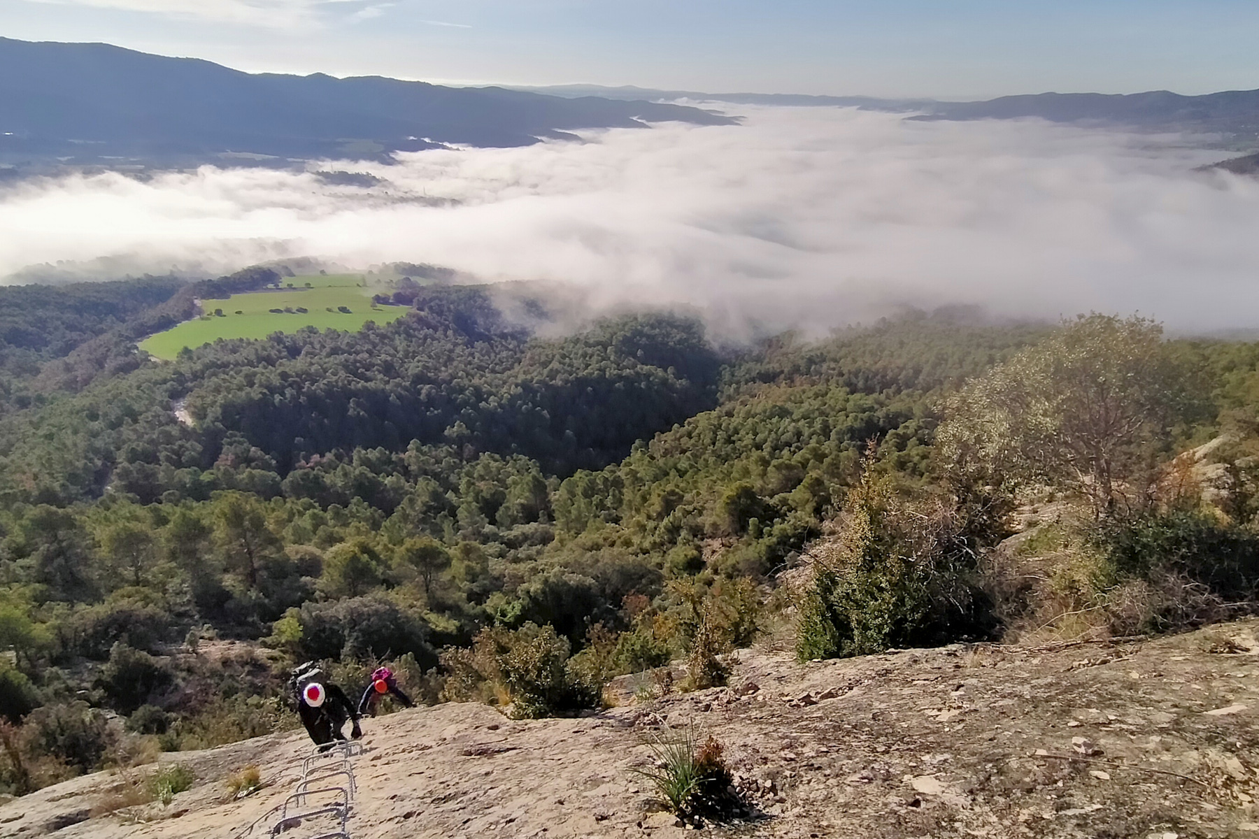
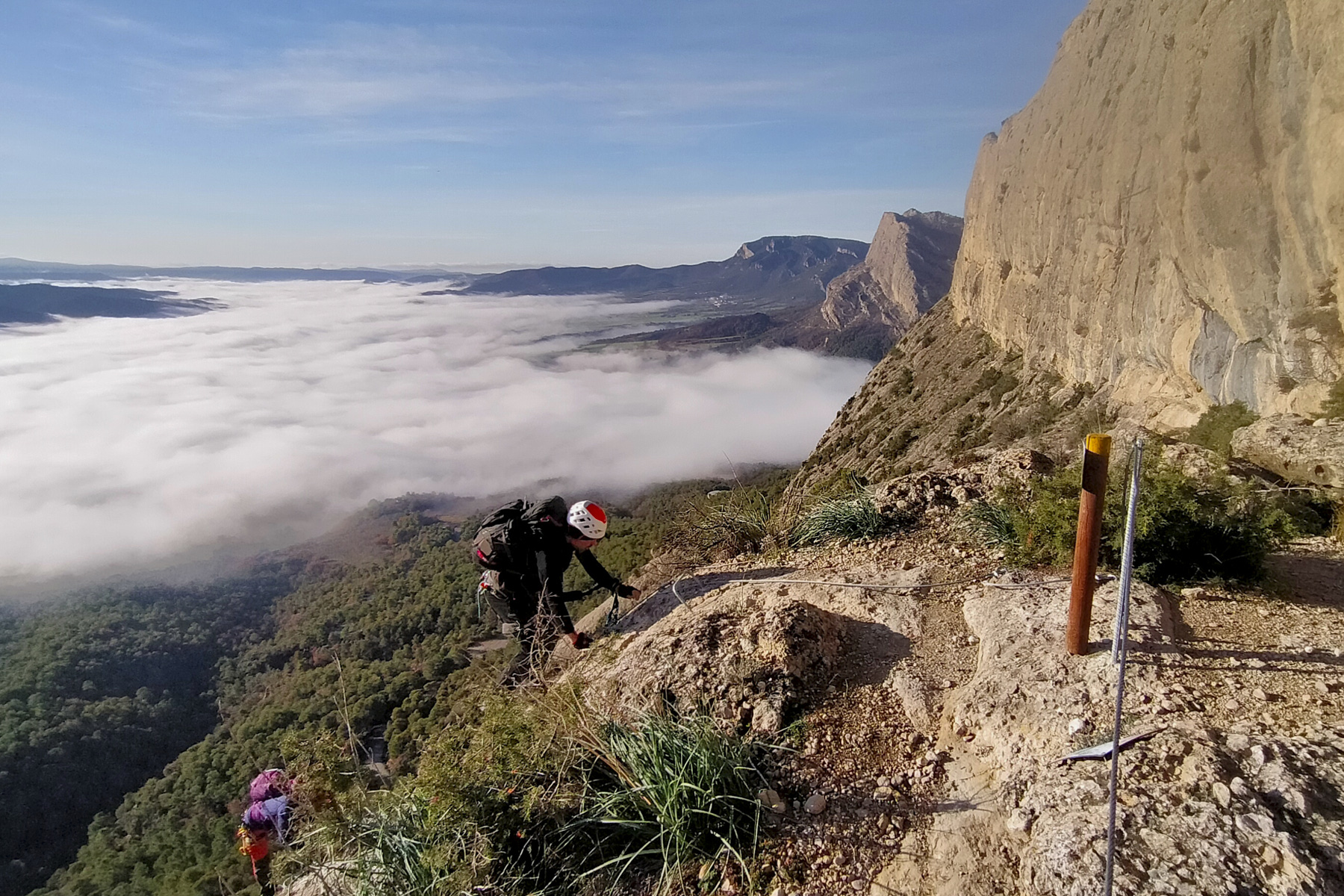
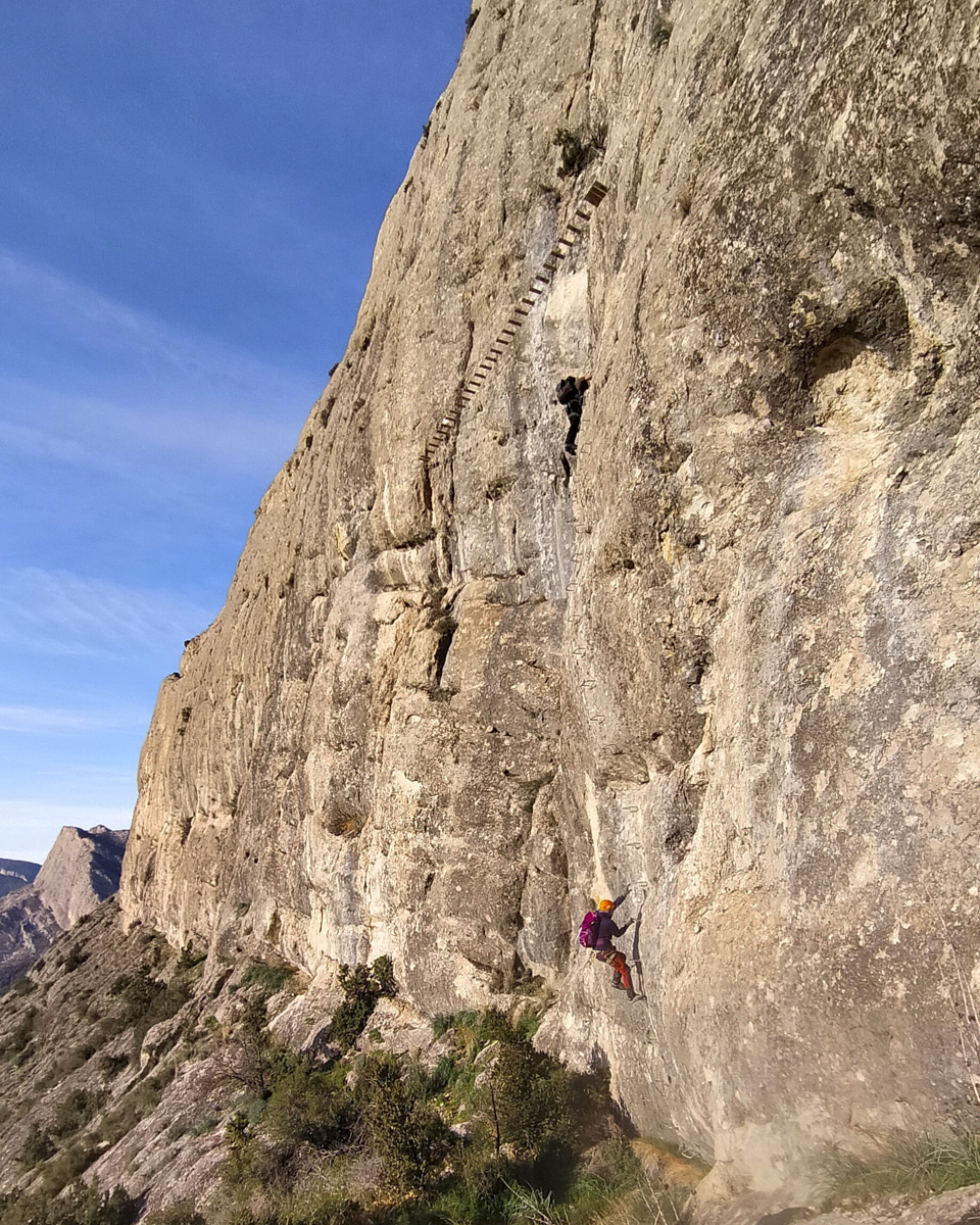
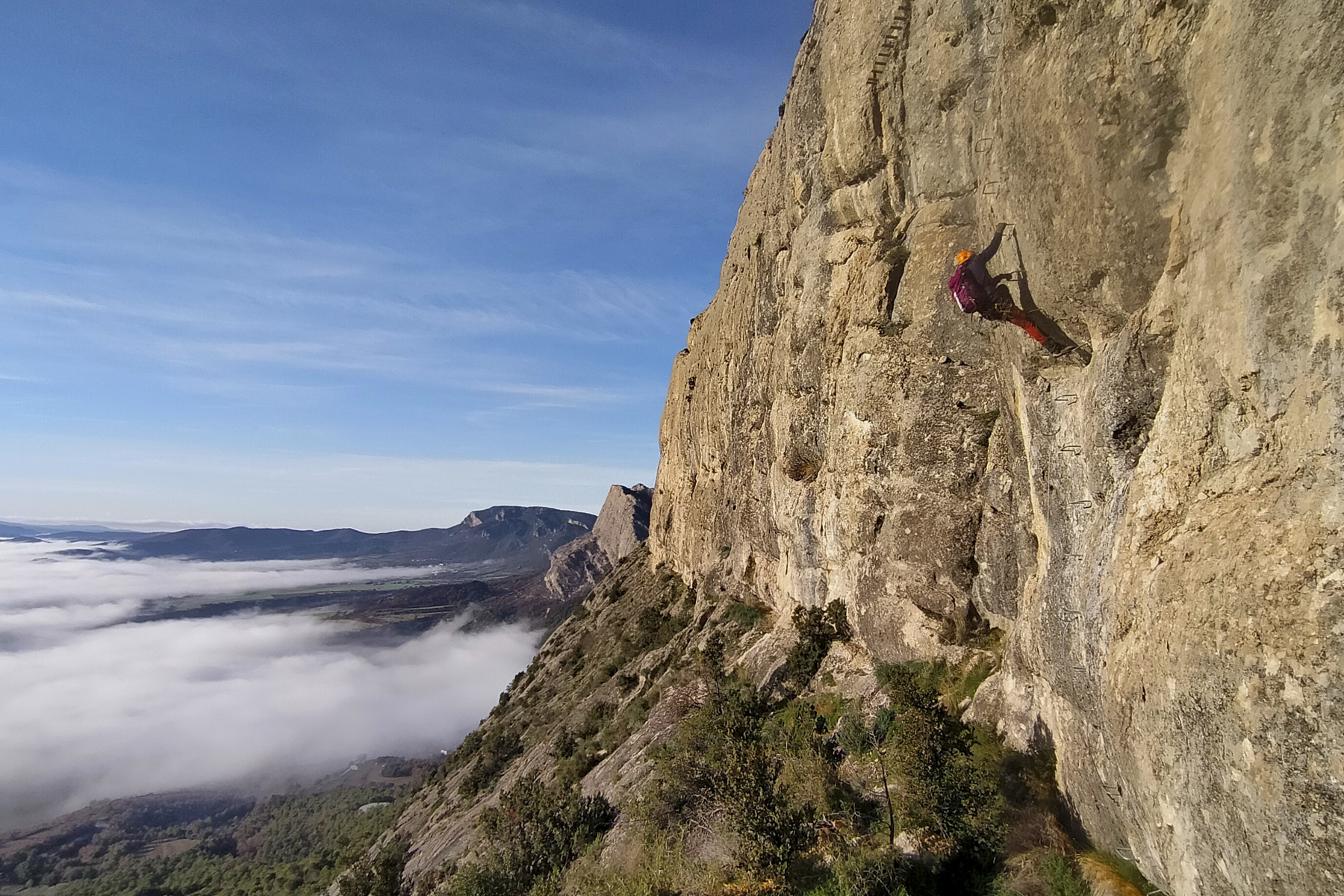
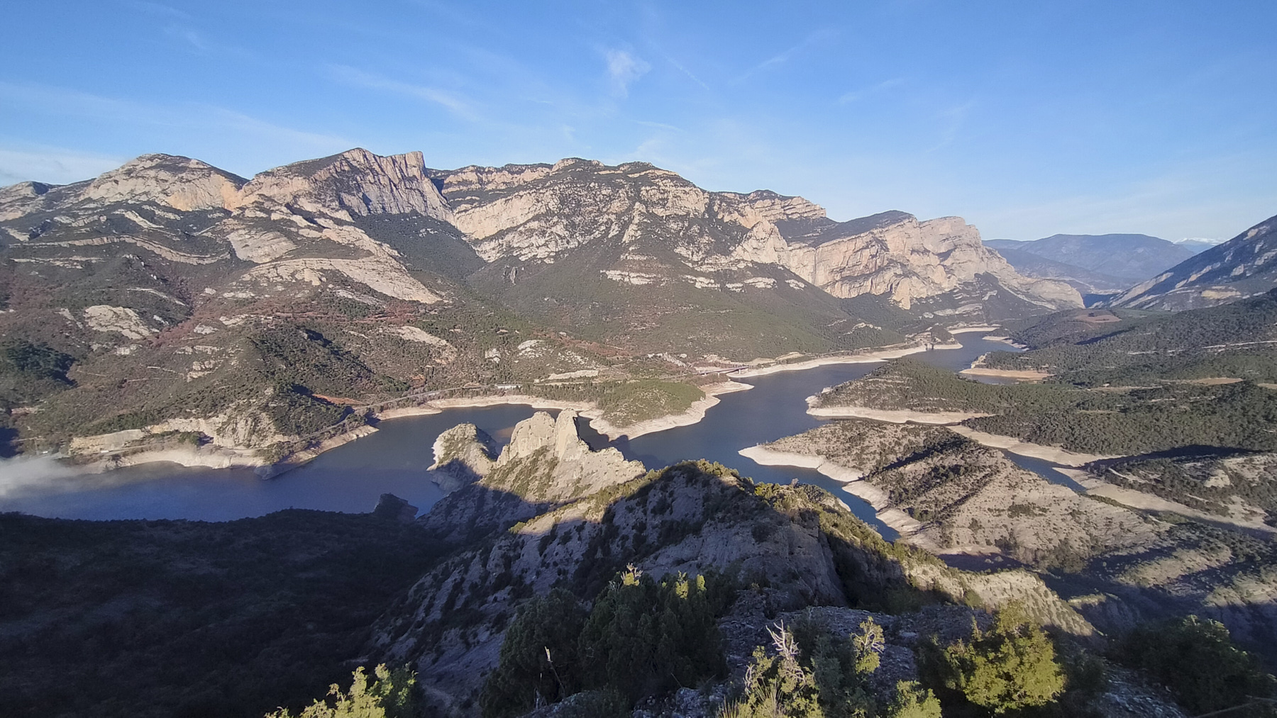
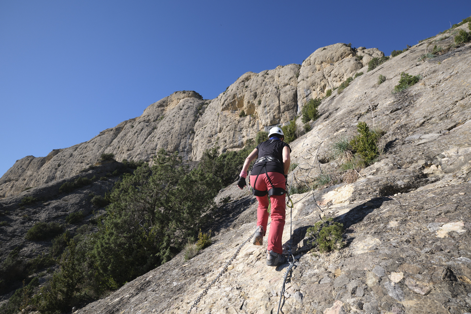
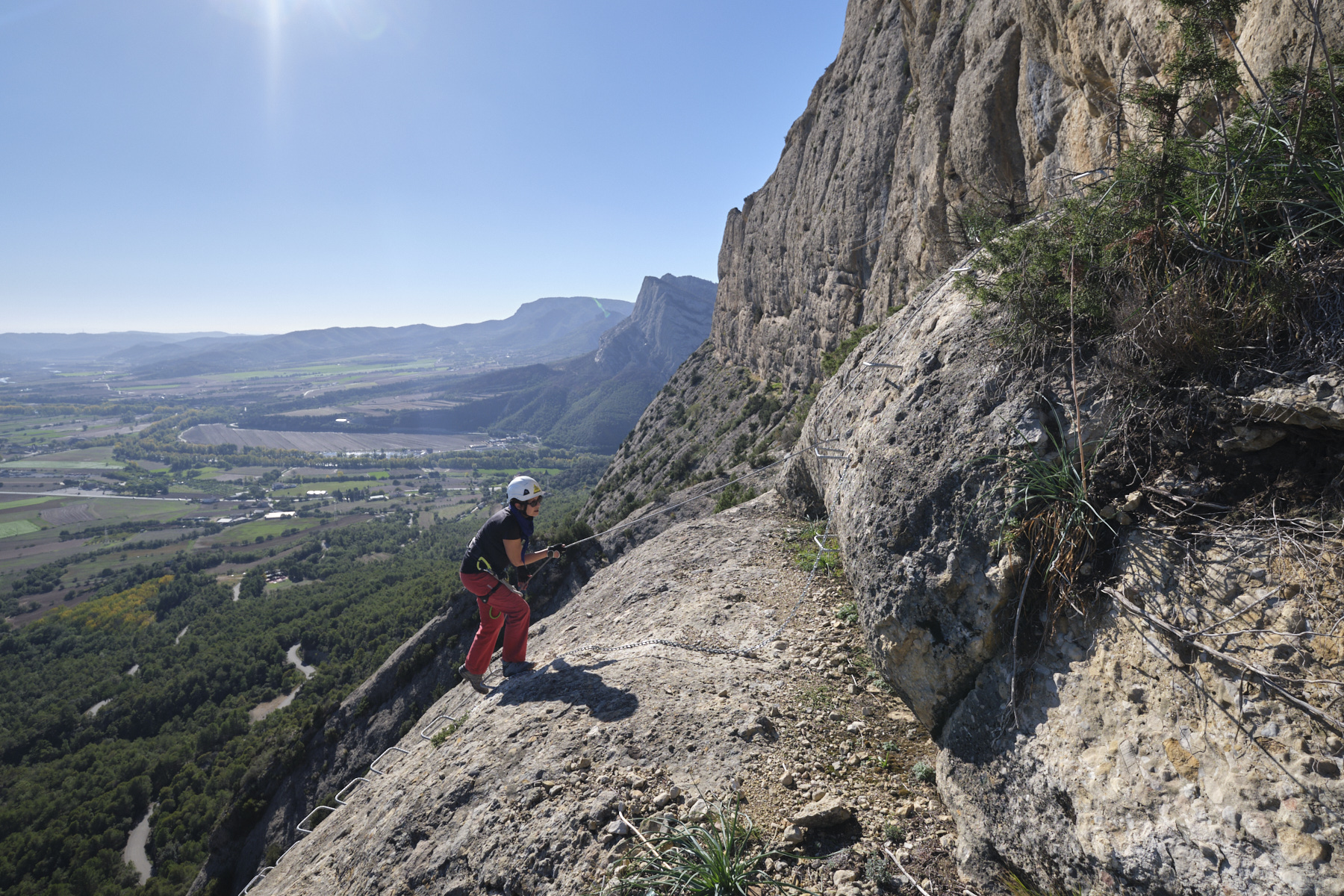
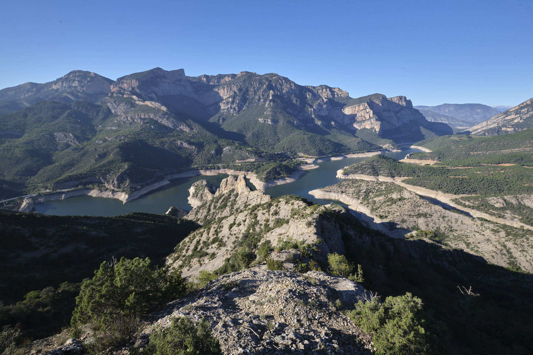
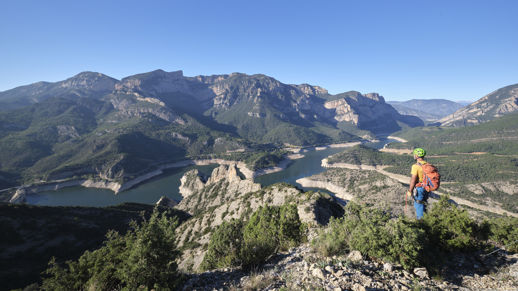
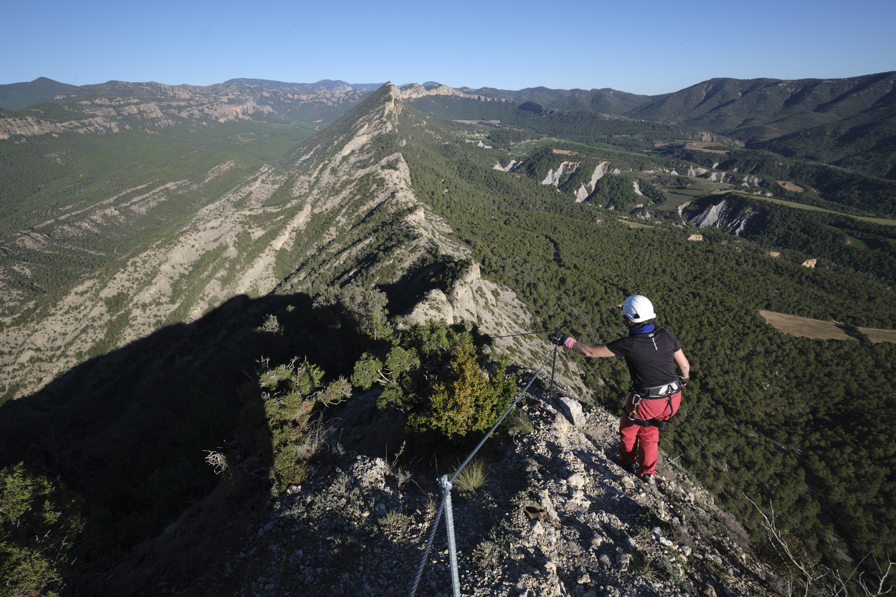
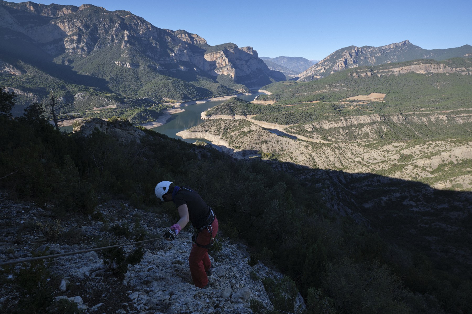
New via ferrata in the spectacular setting of Alt Urgell. Above Oliana, the Serra de les Canals climbs up the south face of the Roc de les Tres Creus to offer exceptional aerial and panoramic views of the Pantano d'Oliana and the great orange walls above. An initial introductory section (K2) to access the ridge, followed by a more demanding, aerial and sporting option to reach the summit (K4). The 3rd part, which consists of traversing the ridges from east to west to find the way back, is also part of the show, with impressive views of both the edge and south slopes. A fine achievement, just a few kilometers from its equally recent neighbor, the Roca Narieda (K4), and to forget the exceptional Regina, whose renovation project seems to have been definitively abandoned.
❱❱ Technical summary
■ S tarting point: route d'Anoves, Oliana, Alt Urgell, Catalunya, Spain
■ Type of route: via ferrata with an initial easy section (K2) and an optional difficult section (K3/K4)
■ Direction: south
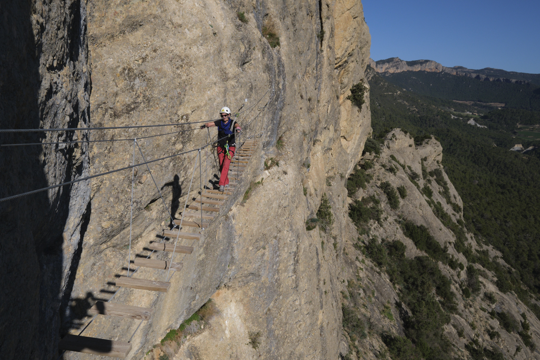
■ Fitted length: 120m (K2) + 150m (K4)
■ Positive vertical drop: + m
■ Estimated total time: 1h30 to 2h
■ Min and max altitude: m / 800 m
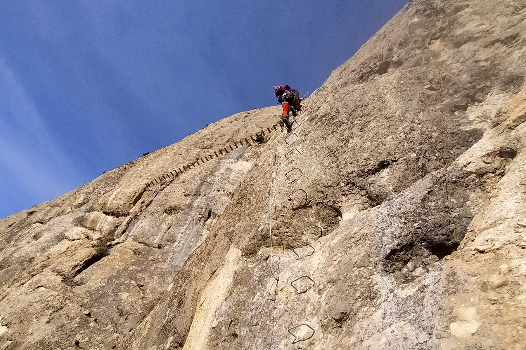
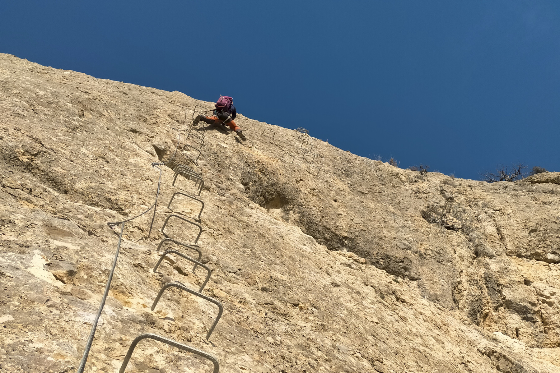
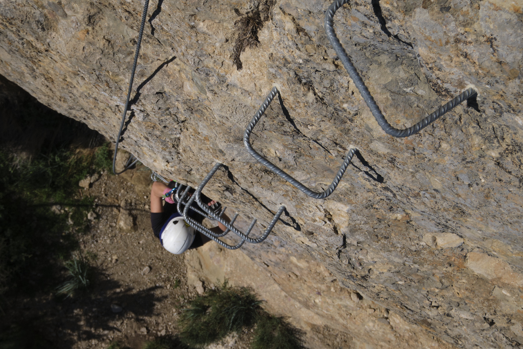
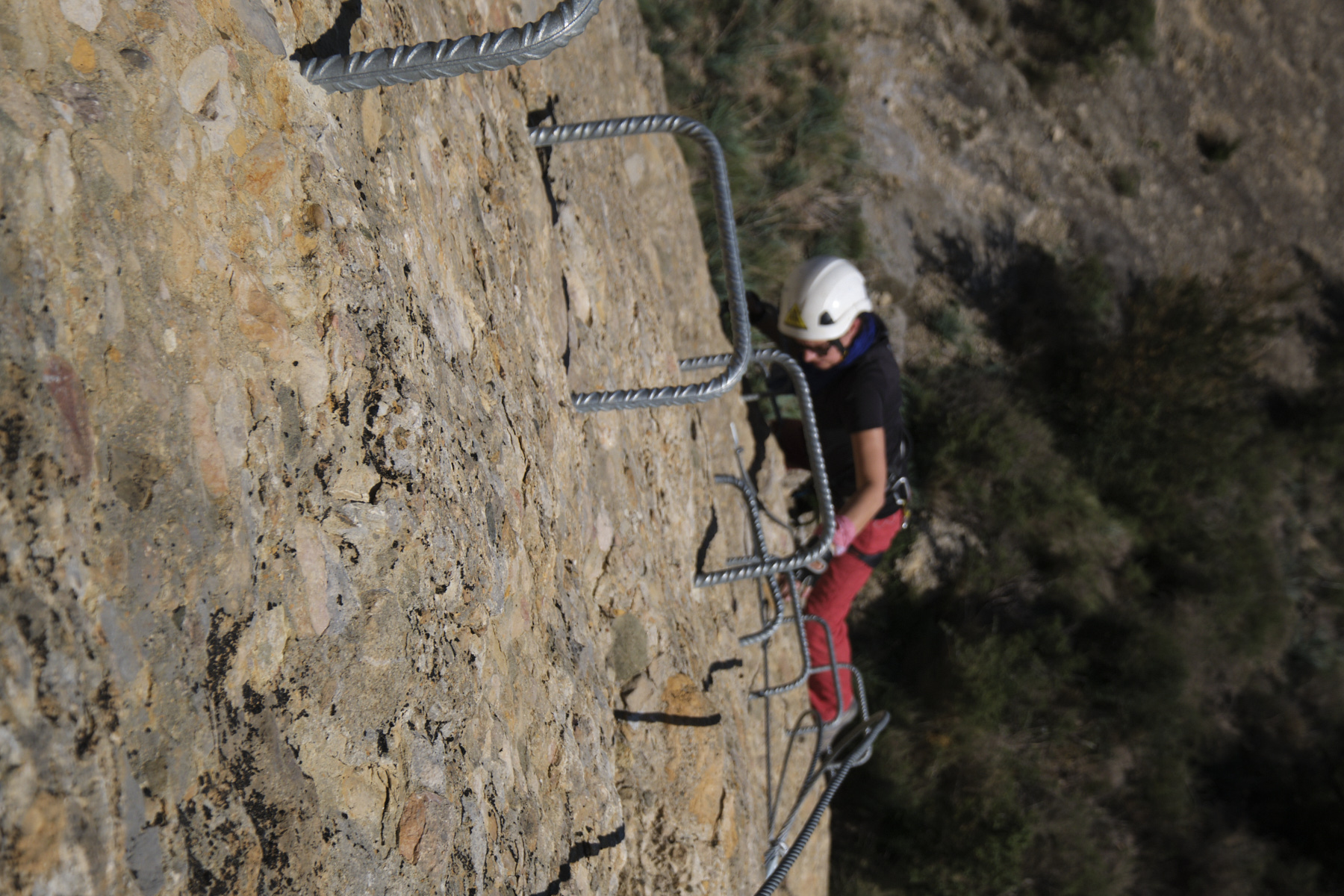
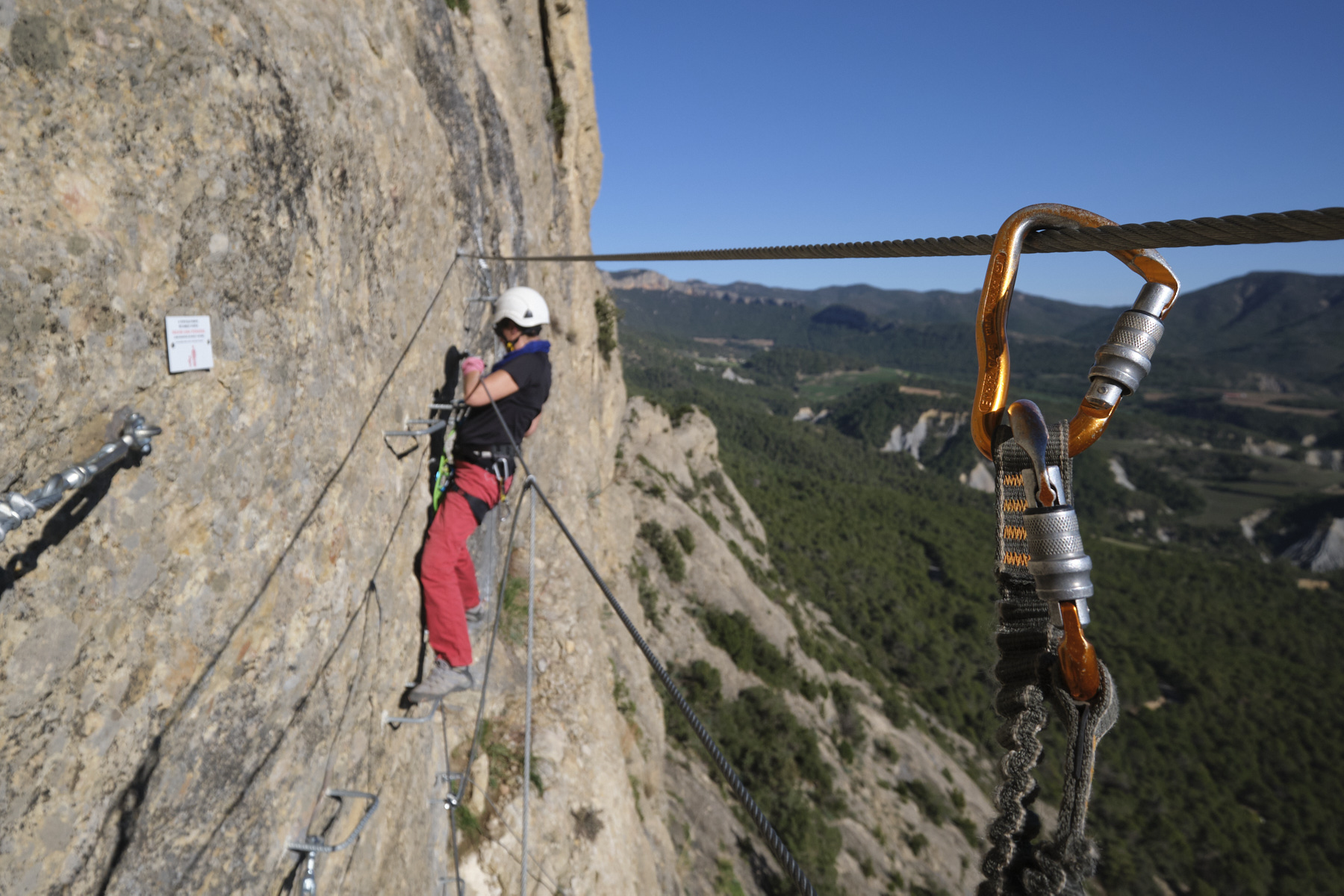
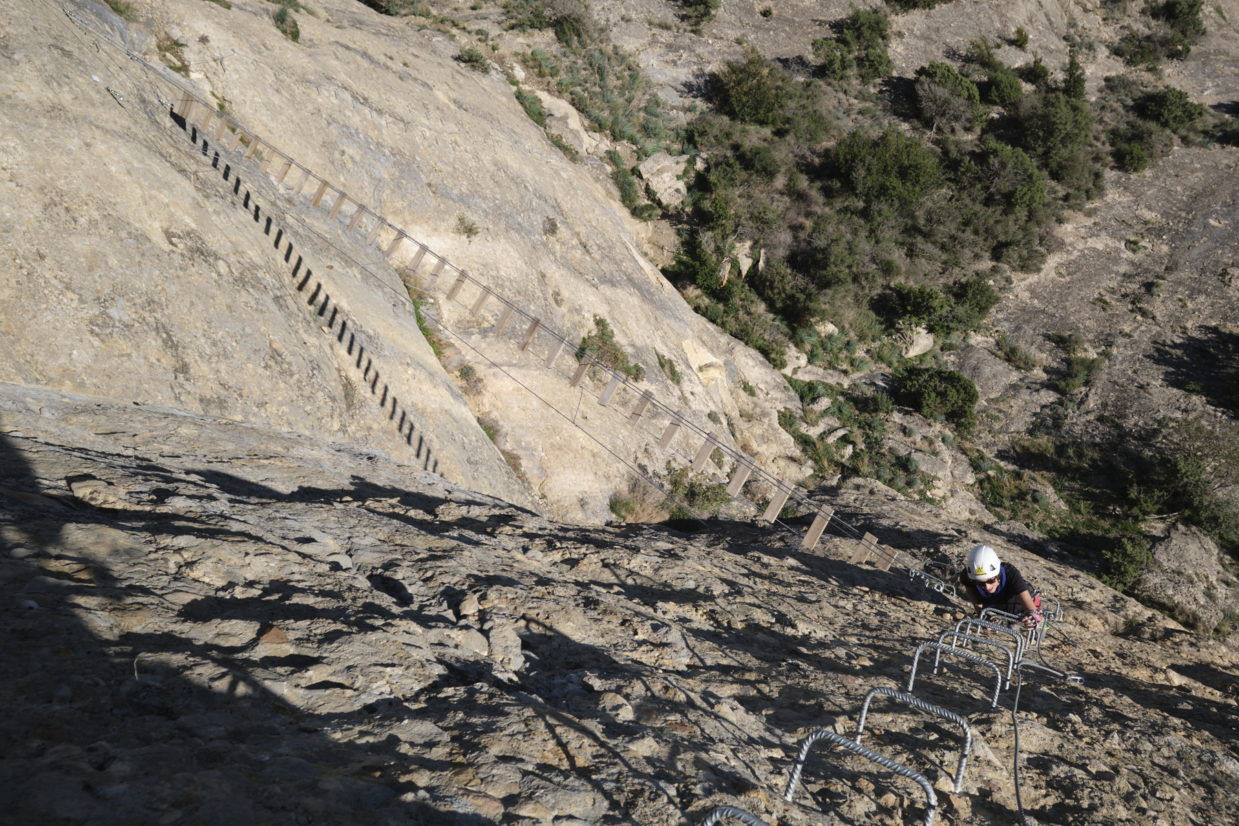
■ Equipment in place: rungs (sometimes quite far apart), chains, 1 footbridge and 1 Nepalese bridge (construction 2020)
■ Equipment required: standard equipment
Difficulties: K3 except for the start in K4 (overhang to be crossed with rungs quite far apart) and the final traverse below the K3+ summit (slightly overhanging and very aerial). Sustained and very vertical.
❱❱ Access to the place
At Oliana, on the C14, head north towards Seu d'Urgell. On leaving the town, turn right towards Les Anoves. Follow and climb the small road, at the 1st Y fork turn right and further up, park in a small parking lot on the right of the road. Opposite is the ferrata information panel.
❱❱ Map & topo
Voir en plein écran
❱❱ Itinéraire
Cross the road and take the path up to the left of the information panel. It climbs quite steeply through the undergrowth to cross to the east at the base of rocky slabs. At the end, you descend a little to find the start of the initiation section and its long series of aligned rungs.
Unclimb the sloping lower slabs using long chains, and you'll find yourself further down on the woodland path which soon returns to the road and the starting point.
Topo of the ferrata on Deandar, from which we organized ourselves (in Spanish).


Leave a Reply