


TOPO Climbing | CLIMBING7.COM
Publié le
 Partager sur WhatsApp
 Partager sur Twitter
Partager sur Instagram
Partager sur Twitter
Partager sur Instagram

 Partager sur Facebook
 Imprimer le topo
 Laisser un commentaire
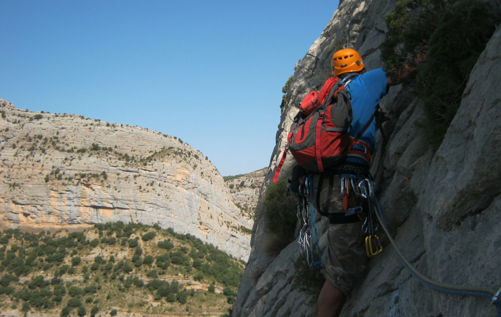
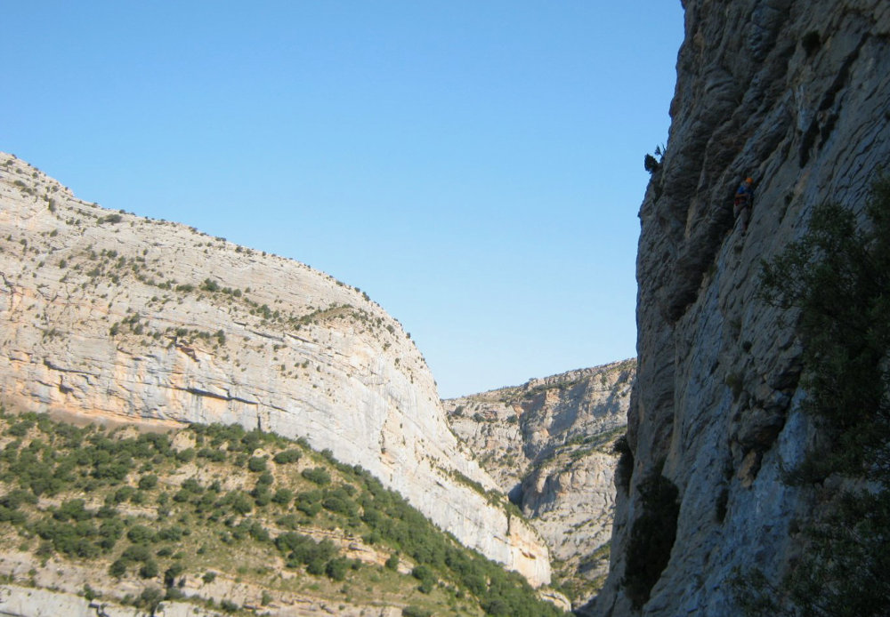
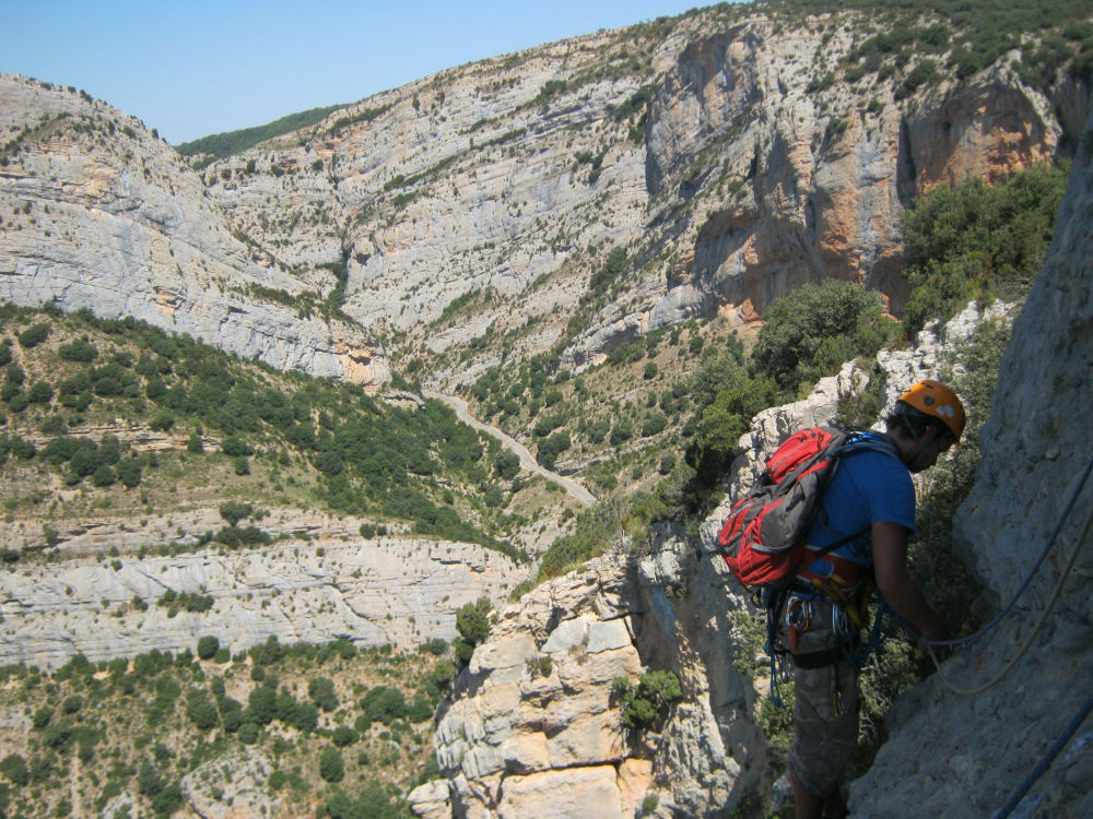
Vilanova de Meïa, above the Segre valley. Paret de Zaratrustra. Traced right next to the Txubaskos Baskos, this great route is superb, certainly better than its neighbor, more varied, well equipped with more levels and always of course a fantastic setting on the Roca dels Arcs and Roca Alta. Access to the wall is fast and the exposure ideal for an early-morning trip in summer. There are a few V+ passages, including a fairly athletic one (starting from L2) and a lovely final 6a pitch that's well worth the detour. You can return via the ridges to take in the incredible environment and the sheer verticality of the impressive Roca dels Arcs wall, should you ever decide to try it. A great route, accessible, in a great atmosphere.
❱❱ Technical summary
❱❱ Access to the place
Go to Vilanova de Meïa, after the towns of Agramunt and Artesa de Segre in Catalonia. Go north through the village (towards Tremp). The narrow road heads straight for the large cliffs. After a few bends, you pass under the Roca dels Arcs with the Font Figuera in one corner. Keep going until you reach Font Blanca (on the right) further up, after a bend that takes you back towards the gorge. We're almost there. Continue along this road and before reaching the bridge, with La Roca dels Arcs on the left, there's a small parking area on the right, then a second, larger one. This is the start of the road to Paret de Zaratrustra, which is then just above us on the right, a large, long cliff heading south.
❱❱ Map & topo

❱❱ Itinéraire
Climb along one of the paths emerging from the shrubbery. Improvise an easy path to the foot of the wall to easily find the start of Txubaskos Baskos (written on the rock). Climb a little further, a few metres behind the tree, to find the start of the route, at the base of the shrub perched at 10m (not to be confused with the nail line further to the left, in the crack).
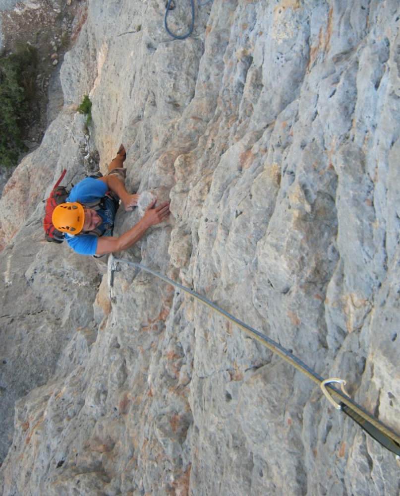
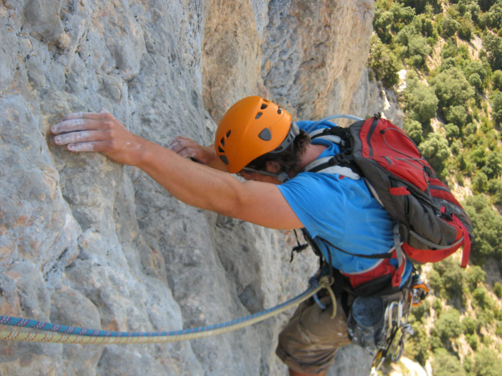
The route, opened in 1992, faces southwest and is 110m long in 4 pitches (25m, 40m, 25m, 20m). Equipment is good (parabolts). Bring 10 quickdraws. Mandatory difficulty is 6a on the last pitch.
L1 (25m, V+)
Go straight up under the perched shrub, around it to the left and straight into a depression in the rock. The route becomes more vertical and there's a more difficult V+ pitch to exit and reach belay R1, located just below the wide, blackish horizontal fault.
L2 (40m, V+)
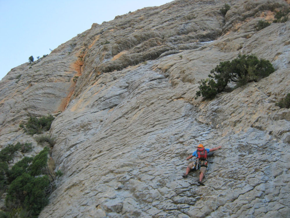
A tonic, aerial and rather athletic exit to the left! It's well equipped and you have to overcome several ledges using large, slightly round, polished holds. Above, a fantastic vertical plate stuffed with tubs, with a small, slightly overhanging passage and some fairly distant points. A more inclined end to the comfortable R2 belay.
L3 (25m , V+)
Exit the belay to the left and climb easily to a flat area. We then link up a small vertical wall with a more delicate step in the middle in V+ before exiting onto a wide ledge where we find relay R3 on the left, below the final peak.
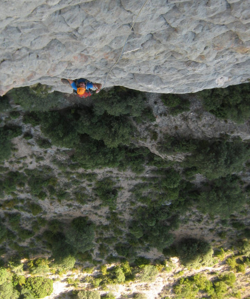
L4 (20m, 6a)
Start out on the left in a recess with round, polished holds and climb up to reach a short dihedral above on the left again. Delicate passage. Regain your footing on the final plate on the left to take 3 or 4 technical steps, looking for solutions on the right and then on the left (zigzagging), a little overhanging at the start, to reach the R4 belay, a little below the ridge.
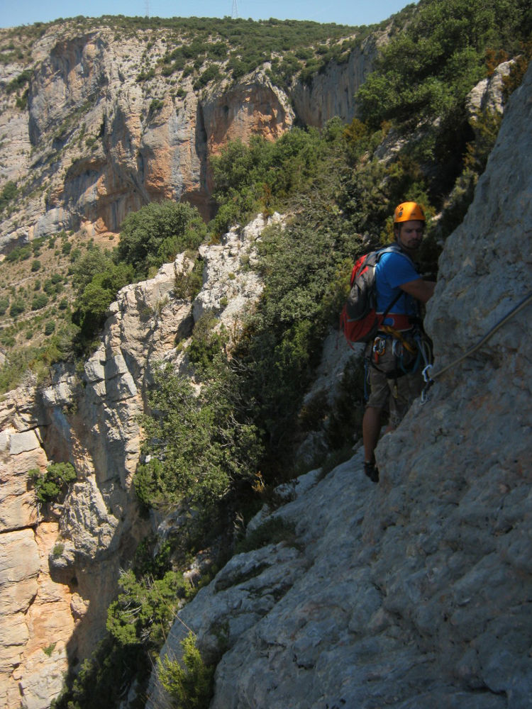
Cross over to the left on a rather expo ledge, pass level with the last Txubaskos Baskos relay then after about 50m of traversing, look above for a more marked path with kains. Follow this path to the right and then upwards to reach the ridge (10′). It's difficult to follow as the kairns disappear, but the main thing is to aim for the electricity pylon. A little ahead, to the left (i.e. to the north), we can make out a trailhead that will lead us down the canal to the road at the very bottom, a little above the parking lot. Quite a physical descent, with broken terrain, scree and vegetation, but easy to find (30′). 2nd option: recall the route with 2 abseils of 60m, let's say, but pendular.


Leave a Reply