


TOPO Climbing | CLIMBING7.COM
Publié le
 Partager sur WhatsApp
 Partager sur Twitter
Partager sur Instagram
Partager sur Twitter
Partager sur Instagram

 Partager sur Facebook
 Imprimer le topo
 Laisser un commentaire
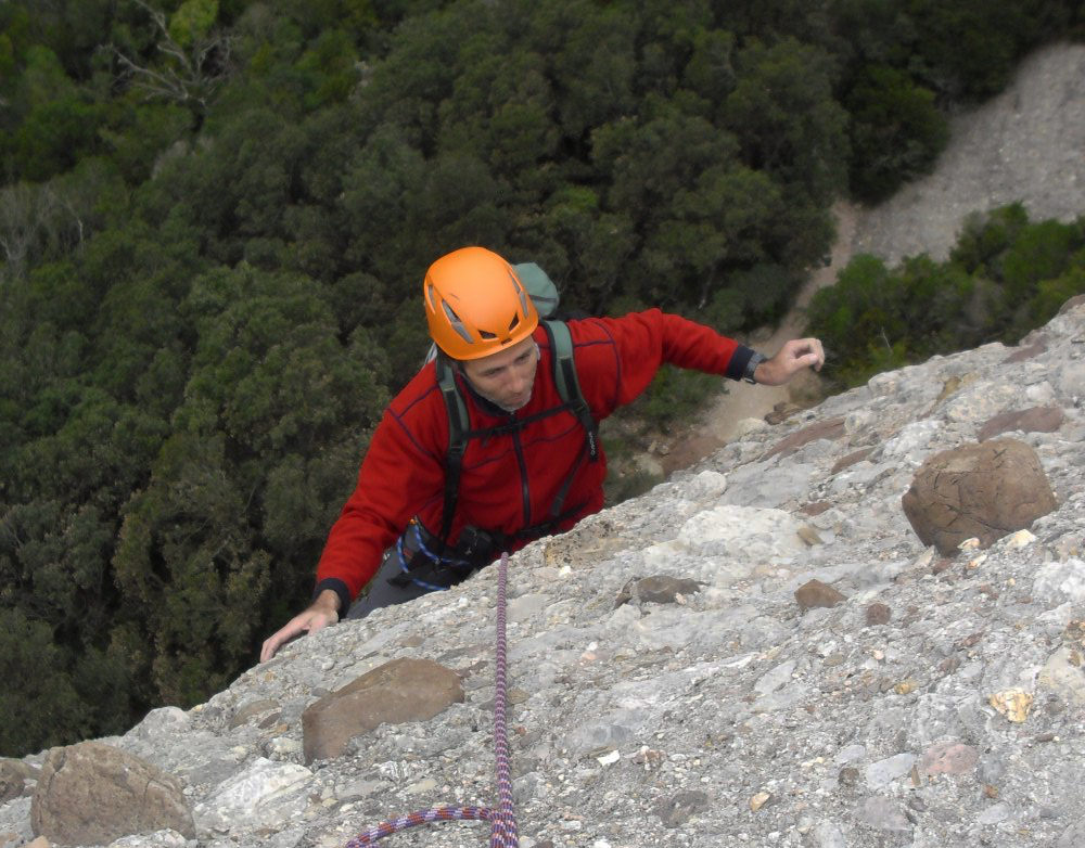
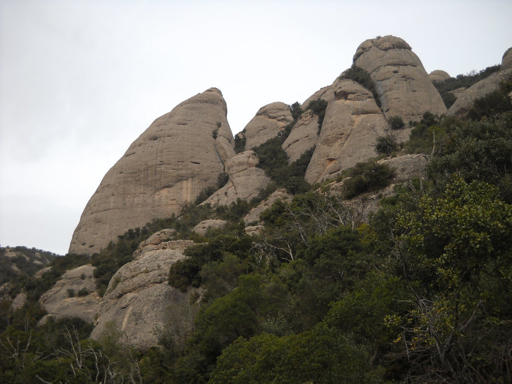
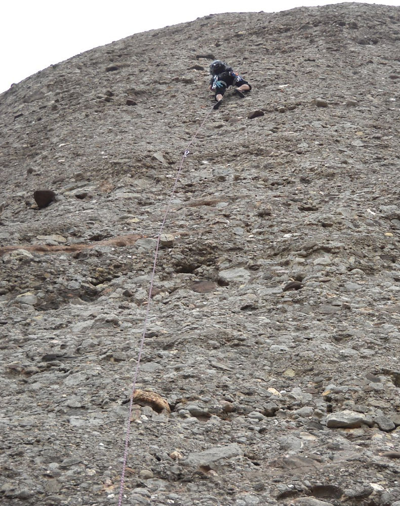
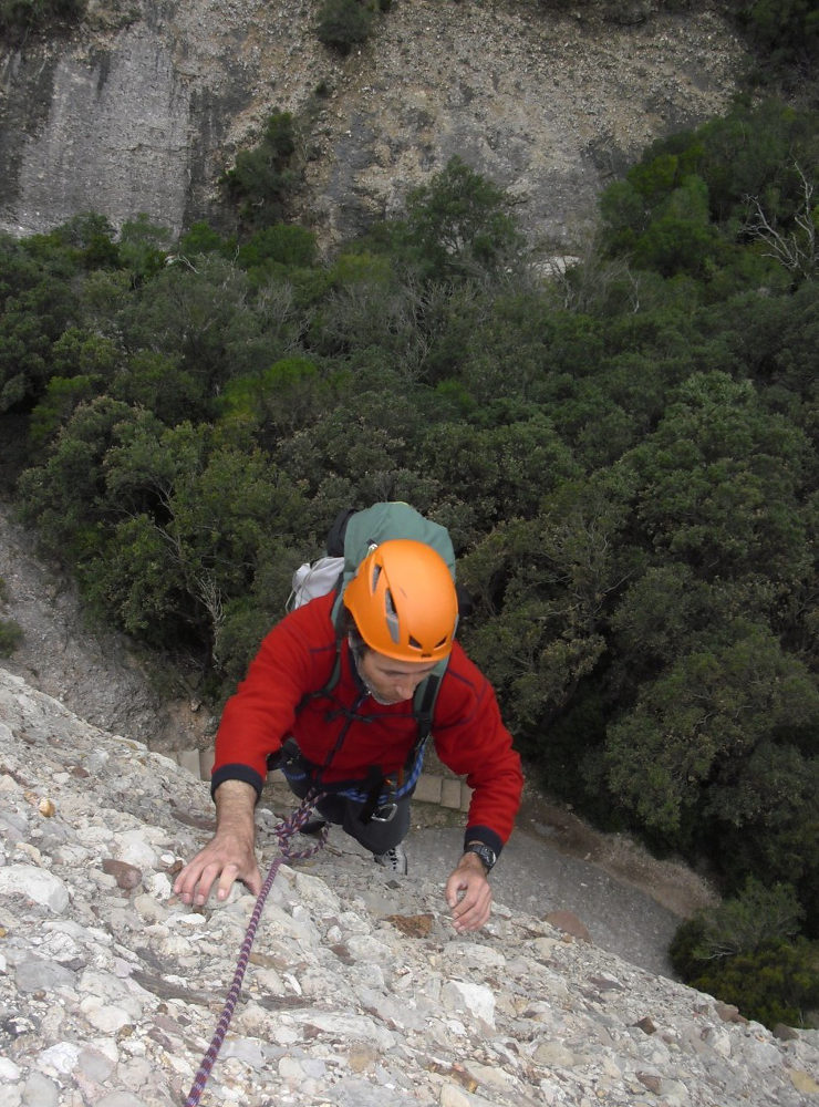
Montserrat, Sant Benet area, in the heart of the massif. This combination of routes climbs the needle of Panxa del Bisbe (the bishop's belly!), one of the most characteristic rocks in the Sant Benet area of Montserrat, just above the monastery. The first pitch is the trickiest, with 1 or 2 V+ pitches. The last two pitches are easier, but hardly equipped at all. Well exposed to the south, for a winter climb in the sun, there are lots of other equipped routes on the same rock, especially on the right, which already makes you want to come back.
❱❱ Technical summary
❱❱ Access to the place
From Barcelona, take the A2 towards Leida and exit at junction 572 after Le Bruc. Then turn off towards Montserrat, Manresa. Cross the Can Maçana pass and turn right along the northern cliffs to the monastery. Park before the entrance or pay 5 euros to park inside.
❱❱ Map & topo

❱❱ Itinéraire
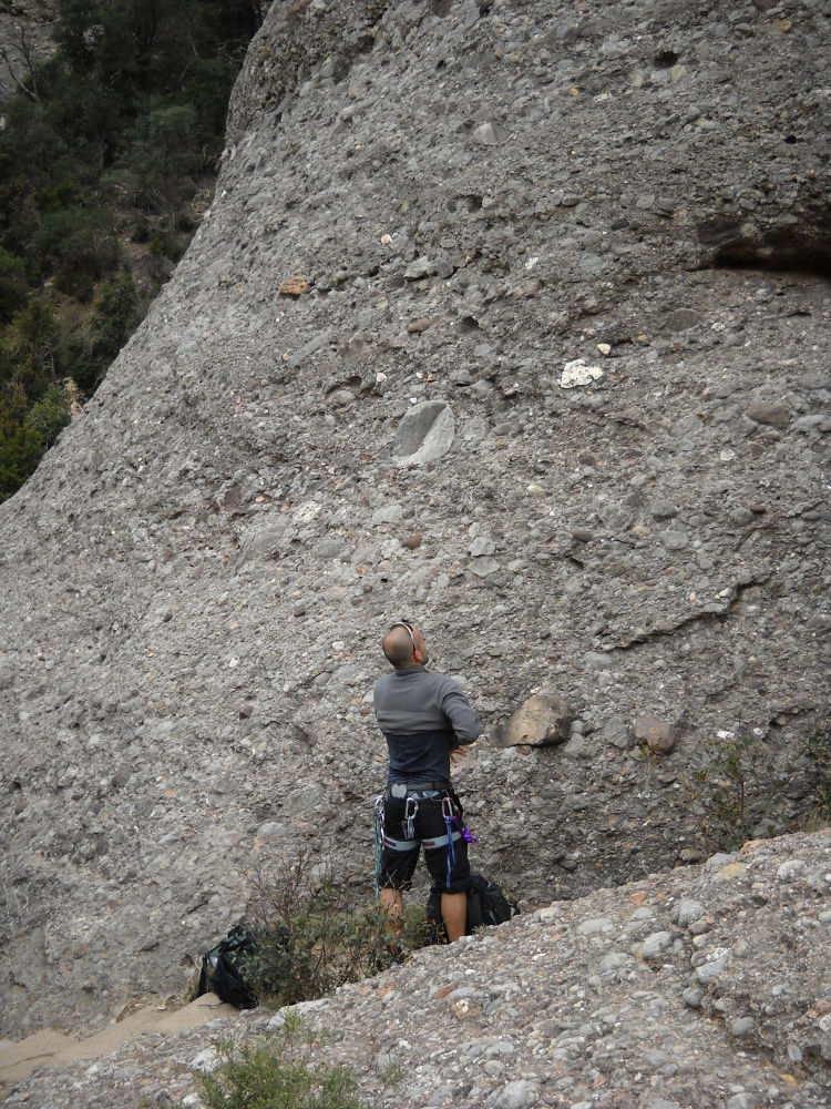
Pass through the monastery to find the start of the GR4 at the end. Climb les escales dels pobres, cross el pas dels francesos to reach the crossroads at plaça de Santa Ana. Leave the GR4 to the right, go straight on and a little further on leave the path to the left (PR C-19). The path then goes straight ahead with a series of steps. The path arrives at the foot of the Pansa, passing under a few trees and a small staircase. The start of the path is in the staircase leading down past the trees. You can see a sort of hole in the rock. The first pitch starts diagonally to the left of this hole.
The route is south-facing and 160m long in 4 pitches (40m, 15m, 50m, 55m). Equipment is widely spaced in places. Bring 12 quickdraws, sabine lanyards and recoverable pads. Compulsory level is V with 1 step in V+.
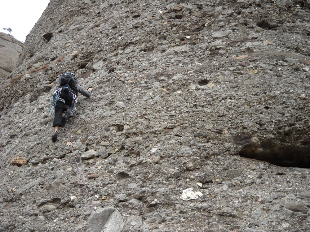
L1 (40m, V+)
Start diagonally to the left of the hole. The first nail is at 10/12m. The route then climbs vertically. You soon reach the trickiest part of the V+ route. There aren't many handholds, but the rock is impeccable and the feet have a very good grip. The route then continues in V and IV until we reach belay no. 1, a very well-equipped and comfortable belay in a hollow in the wall.
L2 (15m, IV+)
A short transition pitch. The first point is near. Go around the hollow to the right, but not too far, then quickly climb straight up and much higher to find the second point. Relay R2 also well equipped.
L3 (50m, V)
A huge pitch that starts in V then ends in IV then III. Set off slightly diagonally and then upwards to find the canalete (a kind of visible gully). Little or no nails in the last 30 meters. Relay 3 is on the tree where there is a flat area with vegetation.
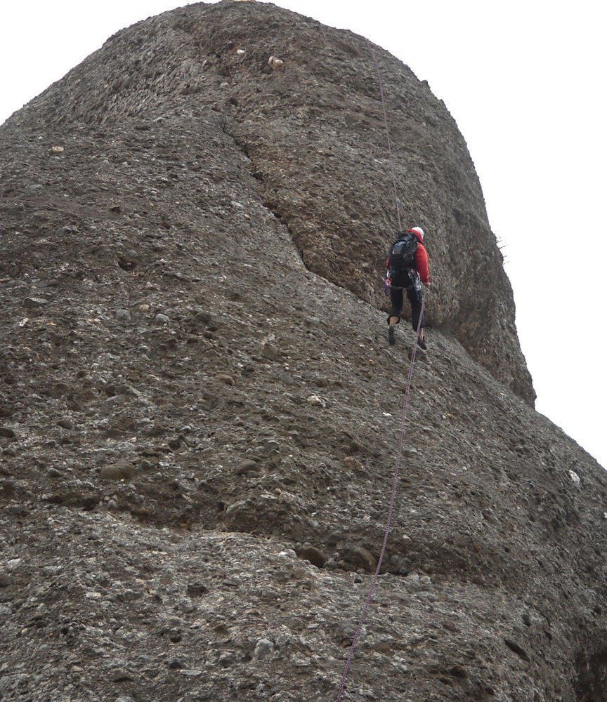
L4 (30m, III)
Go around the bushes to the right, crossing them (a belay point at the corner), then climb straight up to the summit without being able to carabiner! At the top, there are a number of points on the ground that can be equipped with recoverable plates to secure the second climber.
The exit abseil is on the north-west face. After 30m of committed climbing, you land in a small channel that you'll have to climb down a little on your own or by unclimbing the last few meters. In fact, you're almost back where you started, on the path you took on the outward journey. Repeat the approach path in reverse and the GR4 to reach the monastery in 30′.


Leave a Reply