


TOPO Via ferrata | CLIMBING7.COM
Publié le
 Partager sur WhatsApp
 Partager sur Twitter
Partager sur Instagram
Partager sur Twitter
Partager sur Instagram

 Partager sur Facebook
 Imprimer le topo
 Laisser un commentaire

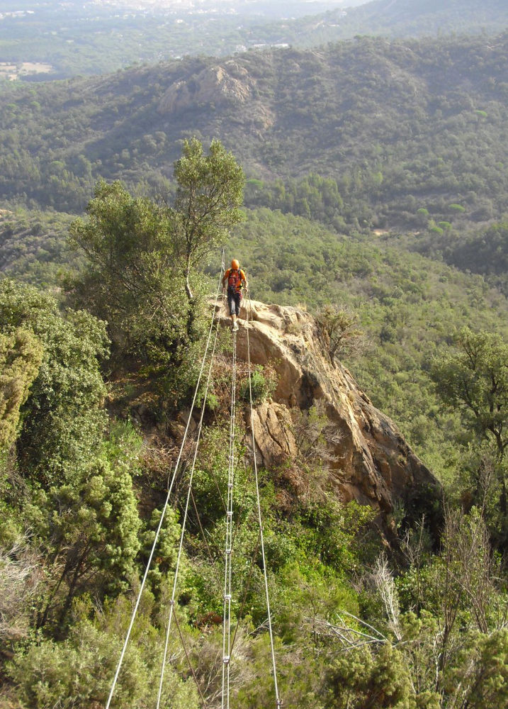
This via ferrata is a veritable acrobatic adventure zone! A very long, physical and technical route from one end to the other, where arms and fingers are severely put to the test. A dozen needles to climb, a dozen abseils and almost as many bridges and zip lines await you, for a great climbing experience just a stone's throw from Sant Feliu de Guixols on the Mediterranean. The pitches to be climbed are strenuous and repetitive, often with wall support for the feet and lots and lots of overhang. In short, it's best to have some basic climbing experience (level V/V+) to better manage the effort. Fortunately, there are a number of exit trails that allow you to cut out the route or leave it along the way.
❱❱ Technical summary
Type ✦ Via ferrata
Location ✦ Solius
Region ✦ Catalunya
Country ✦ Spain
Vertical rise ✦ 300m
Length ✦ 1900m
Difficulty ✦ K5
Duration ✦ 5h30 to 6h30
❱❱ Access to the place
From Barcelona, take the freeway to France and exit at junction 9 towards Sant Feliu de Guixols and Tossa de mar. Leave Tossa on your right and continue on the same dual carriageway towards Sant Feliu. A few kilometers before this village, take the Santa Cristina d'Aro, Solius exit. The road passes over the dual carriageway on the left. A little further on, turn right towards Solius. The road passes under the expressway bridge. One kilometer from Solius, a track leads off to the left into the forest. Follow it. The track crosses a small wooden bridge and at the end, turn right onto the slightly uphill path. Leave a second iron bridge on your right and continue straight up. A few hairpin bends further up, you come to a large farm. Continue for 200 m to find a fork in the path with green hiking signs. You can leave the car there and take the path straight on to the foot of the track. Alternatively, if you climb a little further, you'll find a perfect place to bivouac on the right, ideal for tackling the route early and fresh.
❱❱ Map & topo

❱❱ Itinéraire
From the parking lot, take the path that goes straight up. At the first fork in the road, follow the path to the right, then take a sharp left turn uphill. Here you head straight for the cliffs, which you can see ahead. Follow this path until you come to the large sign indicating the via ferrata (if it's still standing!). Then fork right to follow the tiny path through the trees. The landmark is a small wooden bridge in the first few metres. 15′ of steep, narrow path to find a sign pointing to the foot of the track on the right, just a few minutes away.
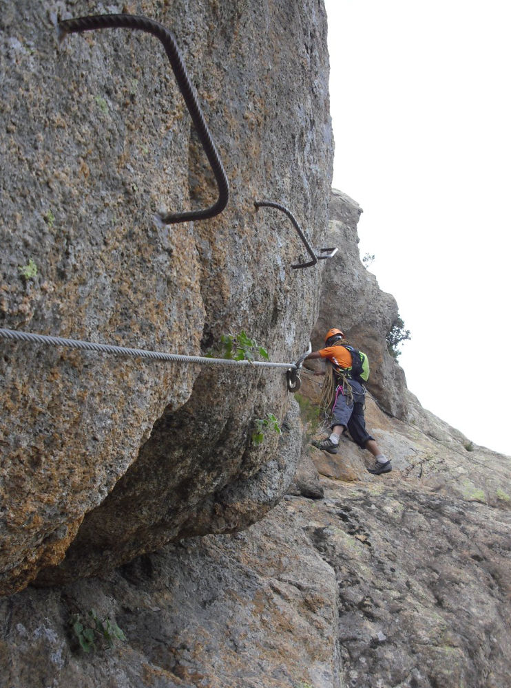
The via ferrata, facing south and then east, was opened in 1996. The equipment is good and varied, and the overall level is TD without any problems, especially for its length. Bring gloves and a pulley for the zip line. It's best to have a general map of the route with you, as it zigzags around and it would take far too long to detail each pitch, abseil and bridge. Allow at least 4 hours, if not 5, to complete the entire route!
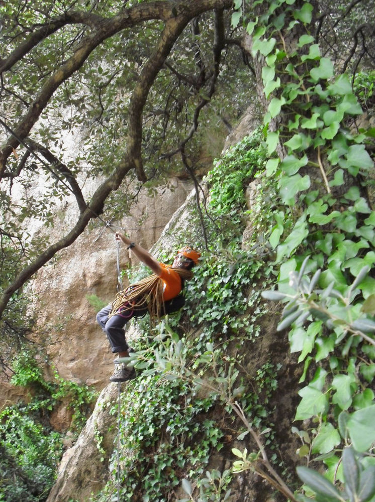
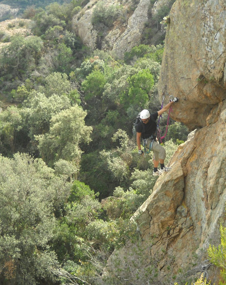
The last 2 thirds of the route are marked with blue dots, making orientation easier. The equipment is good, even if the bridges move around quite a bit and are often only equipped with two cables. The climbing pitches can be short or long, but, with the exception of the first 2 pitches, they present physical and technical difficulties, with overhangs, overhangs to negotiate, foot spacing or adherence to the rock, and diagonal traverses with overhangs. Gloves are not superfluous, to be honest, and the difficulty lies in multiplying these efforts over 5 hours. Even in the last 5 minutes, the steps are exhausting, especially with the accumulated fatigue.
A word about the 30m zip line, 1 cable stretched between 2 rocks. Without a pulley (which was the case for us), it's quite physical, either going the old-fashioned way, hands and feet on the cable, or hanging from a quickdraw (+ safety cow) and progressing by small jumps.
Finally, the abseiling. One half easy, the other more difficult, with vertical abseils, equipped with belays on the side of the wall, feet in the void. Be careful, for some of them you can descend at 2 different points, and only one of them is the right one! There's even an abseil that you have to stop in the middle of the wall to continue the route, otherwise you'll have to climb back up by force of arms...
Follow the blue dots and the path which descends steeply into the woods. The path then climbs up a little to the right, then passes a large boulder before finding the first larger track, which you follow to the left. Follow this track down to the junction with PR-C 102. Turn left again to reach the parking lot below.


Leave a Reply