


TOPO Via ferrata | CLIMBING7.COM
Publié le
 Partager sur WhatsApp
 Partager sur Twitter
Partager sur Instagram
Partager sur Twitter
Partager sur Instagram

 Partager sur Facebook
 Imprimer le topo
 Laisser un commentaire

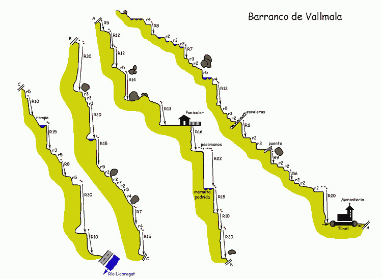
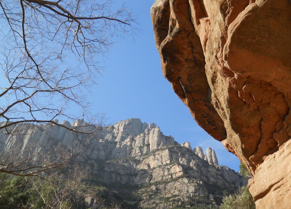
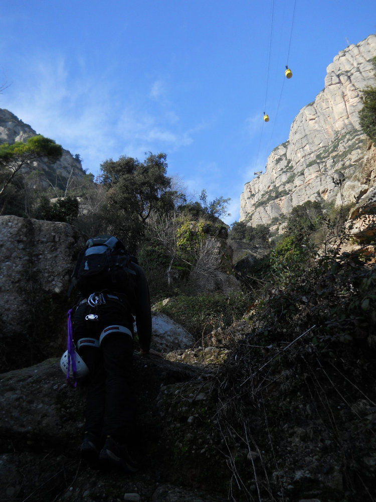
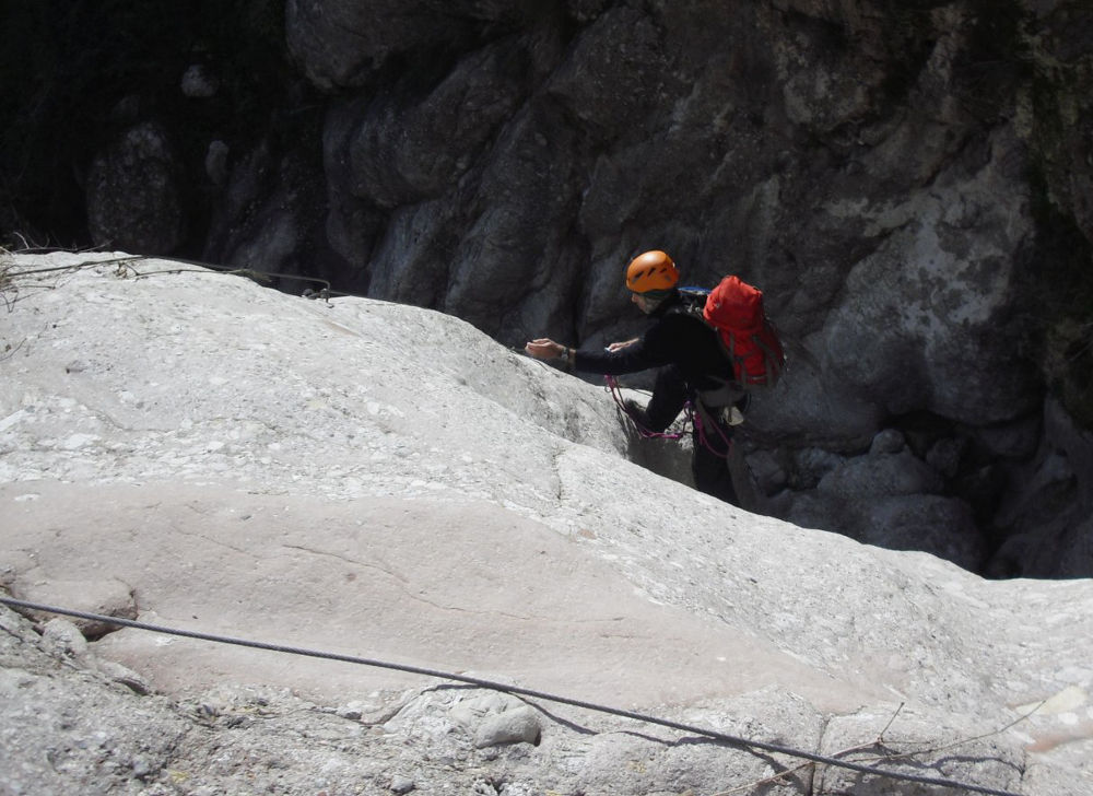
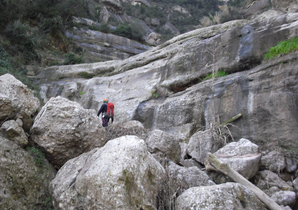
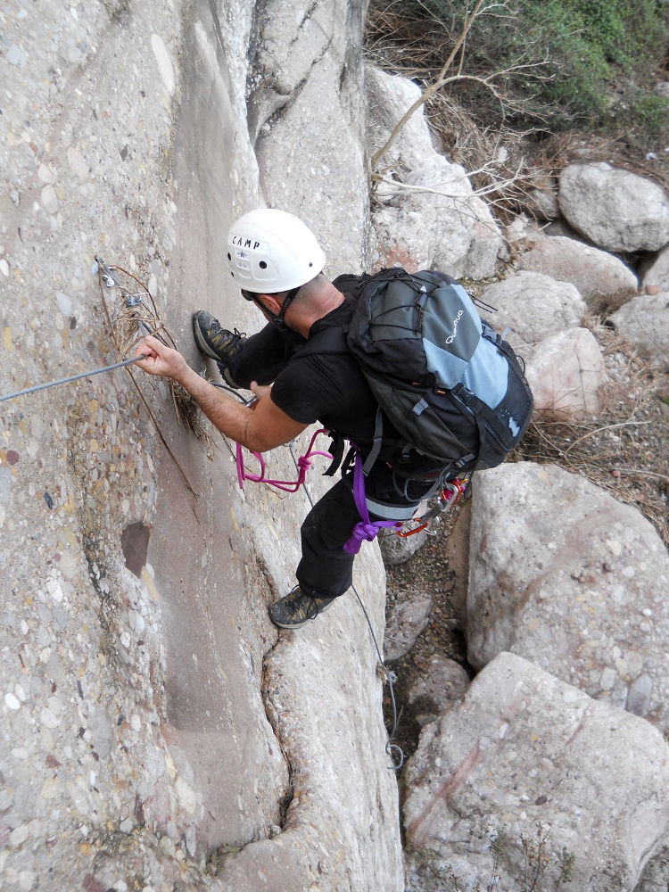
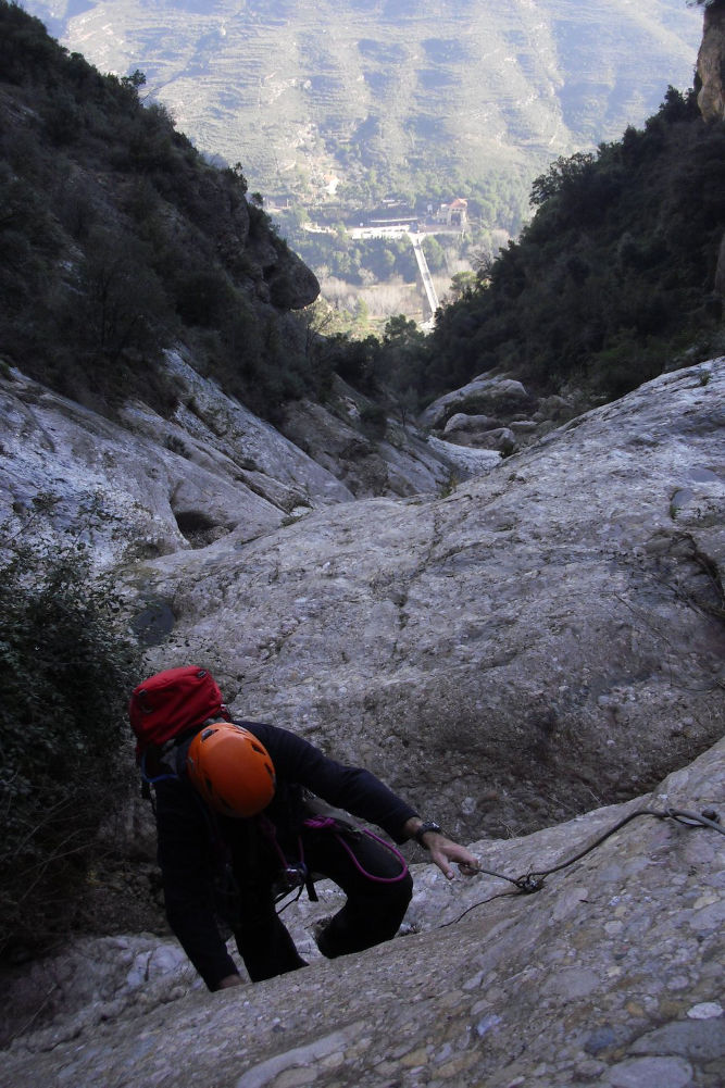
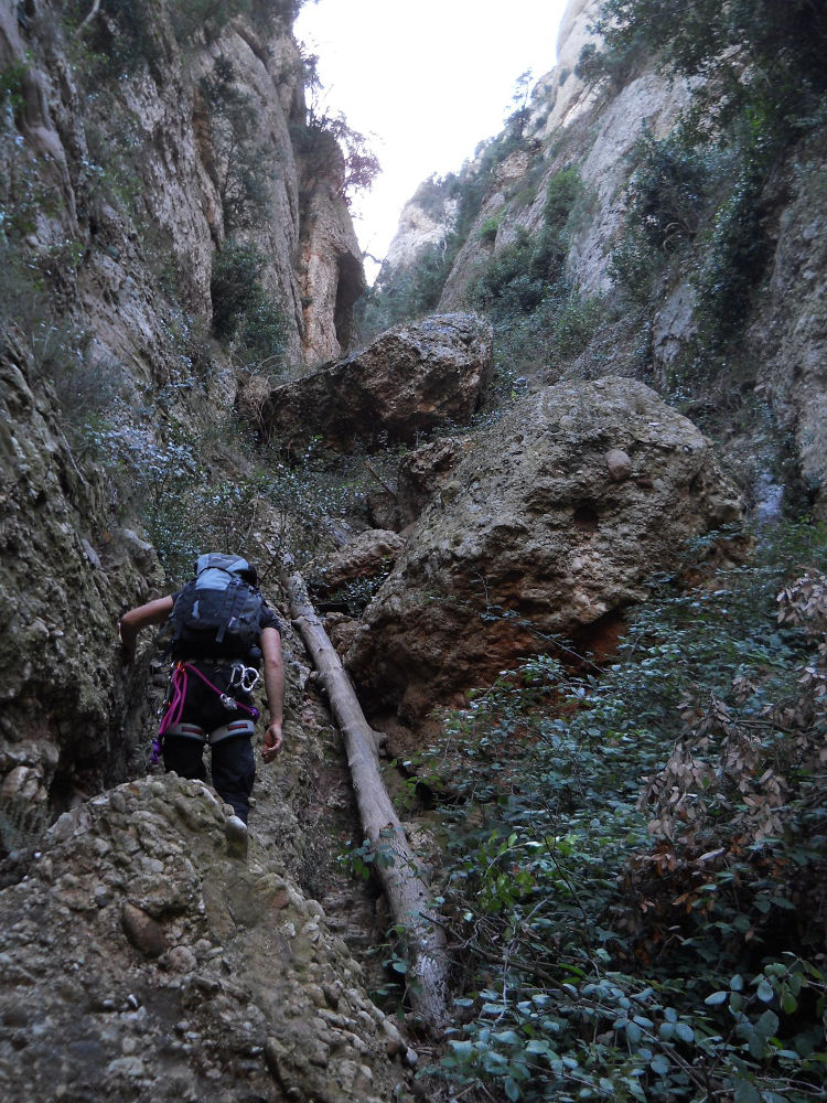
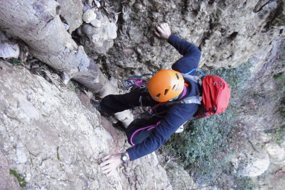
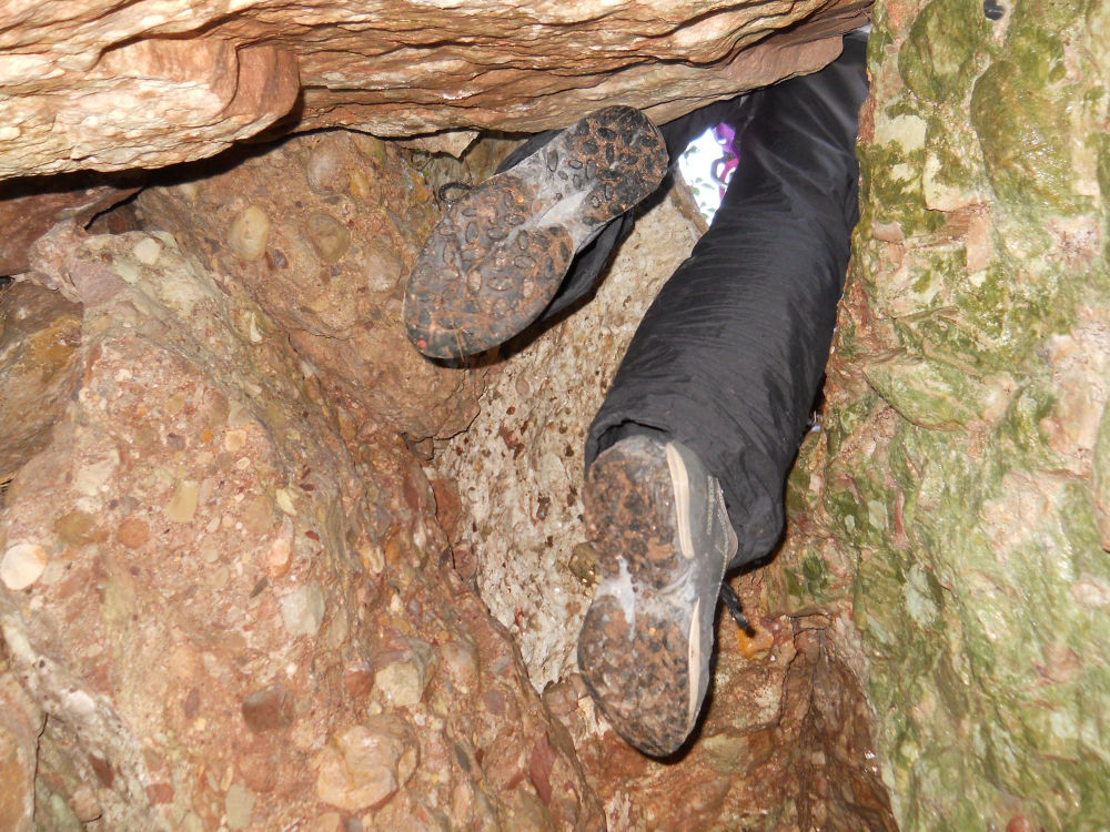
First outing of 2011 to discover this long canal north of Montserrat, under the Aeri cable car that leads to the monastery. The torrent has several names: torrent de Santa Maria or torrent de Vallmala, but is also called Ruta Fuensanta by Juan Miguel Guzmán, one of the directors of this route, in honor of his mother, a certain Fuensanta. A dry canyon typical of the area, very wild, little practised and equipped for the most part but not totally, which gives it its charm and difficulty. The ascent, which is more interesting than the descent (?), is long, varied and difficult, with ferrata-type passages and other boulders to climb. Equipment, when available, is often minimal but acceptable: a cable and chains or small rungs in places, not always in very good condition. Vegetation is abundant and the trail is often lost in brambles. Its northerly exposure and steepness make the rock very wet and slippery in places. A channel to be avoided in wet weather, of course. In conclusion, an original but demanding route.
❱❱ Technical summary
Location ✦ Olesa de Montserrat
Region ✦ Montserrat, Catalunya
Country ✦ Spain
Type ✦ Via ferrata
Vertical rise ✦ 400m
Difficulty ✦ K3
Duration ✦ 3h to 3h30
❱❱ Access to the place
From Barcelona, take the A2 towards Leida, exit at Abrera and take the C55 towards Manresa. Pass by Olesa de Montserrat and continue through the Llobregat Gorge. Further along this road is the parking lot for the Aeri cable car up to the monastery. Park along the road.
❱❱ Map & topo
❱❱ Itinéraire
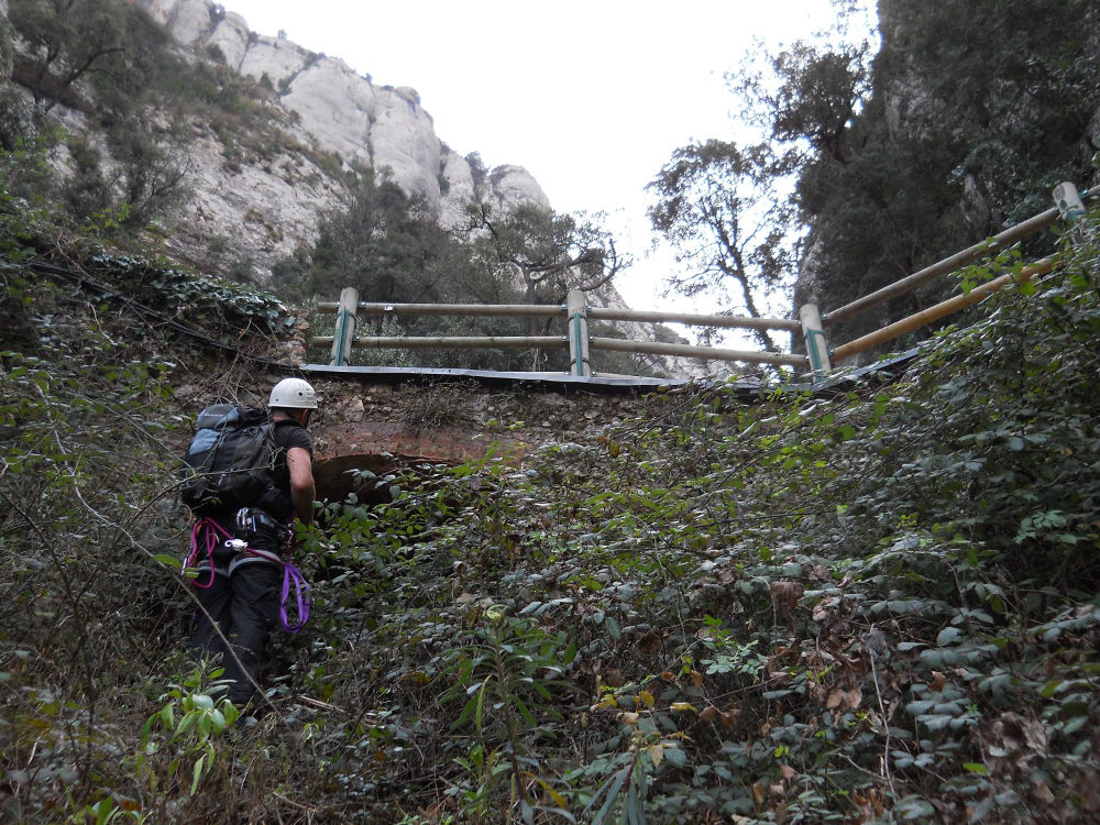
From the parking lot, simply cross the C55 and walk along the small road leading up to Collbato towards the mountain. At the first bend to the left (50m), step over the guardrail to find a small path through the vegetation and a small cairn pointing the way (and perhaps the last ...). Only the part below the funicular is authorized.
The ferrata (or equipped canal) faces north. The difficulty lies largely in the commitment and equipment, which remains minimal. Bring gloves, a 60m safety rope and possibly a machete to open the path through the brambles.
Take this cami to the right to climb up to the monastery. Before reaching the monastery, after passing the funicular station for Santa Cova, turn right onto the GR96 towards Monistrol and GR5. The path skirts the massif and takes us northwards. At the 2nd fork below, turn right again onto the GR5. The path descends steeply to the water station house, where the path is much wider. Continue and after a sharp left-hand bend, pick up the cami de les aigües path which winds down to the C55, 500m from the start parking lot.


Leave a Reply