


TOPO Climbing | CLIMBING7.COM
Publié le
 Partager sur WhatsApp
 Partager sur Twitter
Partager sur Instagram
Partager sur Twitter
Partager sur Instagram

 Partager sur Facebook
 Imprimer le topo
 Laisser un commentaire
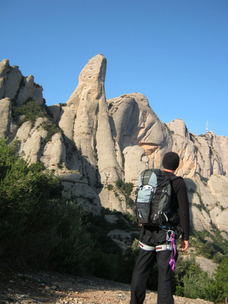
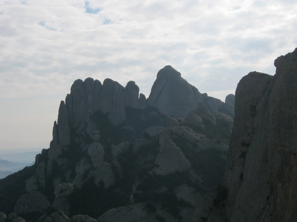
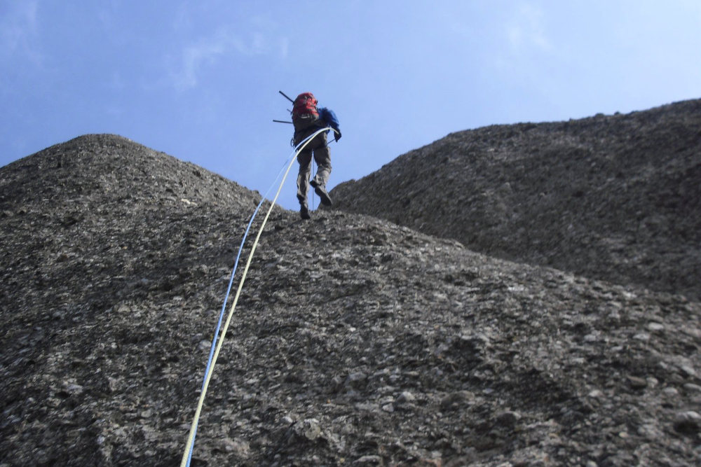
Here we are, cavallistes at last! Today we climbed the imposing and emblematic Rocher de Montserrat, that giant finger pointing skywards, and even taking the via normal, the most accessible via the south face, it's not exactly a walk in the park. It's mainly a fantastic dihedral to climb, with equipment from all eras, certainly with a few pitons from the 30′, pitches that are a little tense in V or even V+ and passages that are, let's say, semi-equipped or poorly equipped that reserve a few drops of sweat, even in winter. Extraordinary atmosphere and magnificent views from the summit. We also caught a glimpse of the great emptiness of the north face, where one or two routes await us, including Punsola-Reniu. It's not for immediate release, but we're thinking about it, and it's a real treat.
❱❱ Technical summary
❱❱ Access to the place
From Barcelona, take the A2 towards Lerida and exit at Hotel du Bruc (exit no. 570). Just after, turn right towards Manresa and Montserrat. The road winds up to the Can Maçana pass. After the pass, turn right to take the road that runs along the northern cliffs of the massif towards the monastery. Park just before the entrance to the monastery parking lot, in a right-hand bend, where there's a low parking area. The approach road is a little further ahead, in the previous bend.
❱❱ Map & topo
❱❱ Itinéraire
Take the cami dels Degotalls (well signposted) at a staircase. Then climb the canal del Pou del Gat (cat's well), which starts after 2 bends in the cami dels Degotalls. The path is narrow and steep, with 2 or 3 easy boulder sections. You cross the forest and after about 25 minutes, you come to a junction with the GR-172. Turn right and follow the GR for a few switchbacks for about 15′.
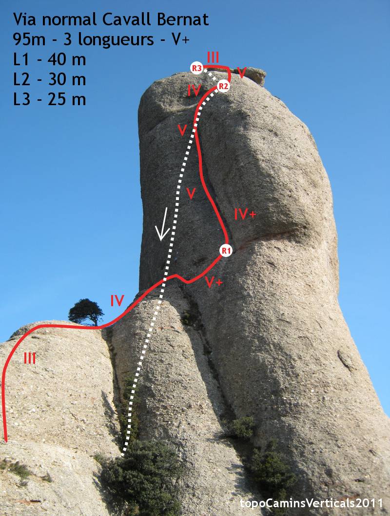
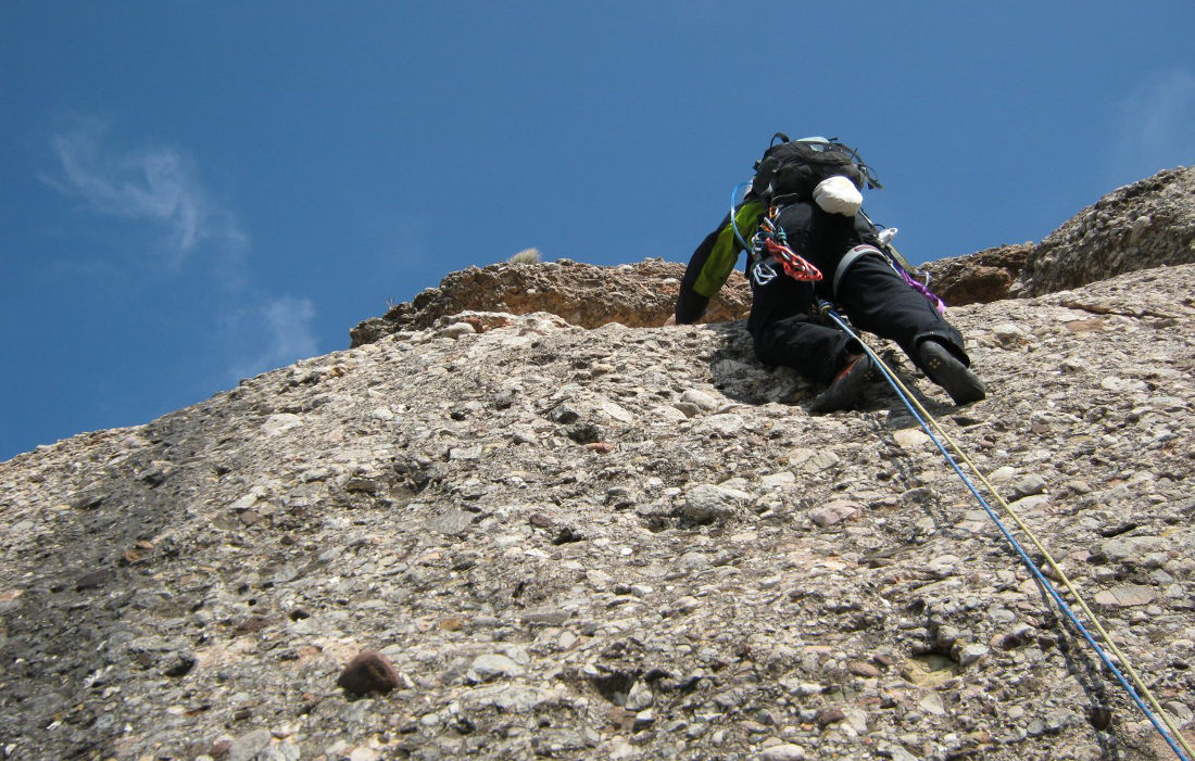
The route, opened in 1935 (!), is south-facing and 90m long (40m, 30m, 25m). A very old route, therefore, one of the 1st in the area, with equipment that bears witness to the different eras. As a result, there's quite a lot of stuff, some of it poorly placed, so bring a dozen quickdraws and a few lanyards and friends to round it out.
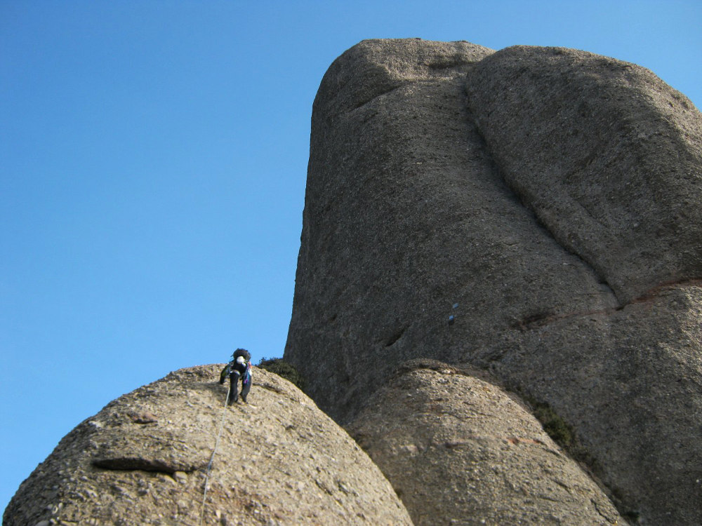
L1 (40m, V+)
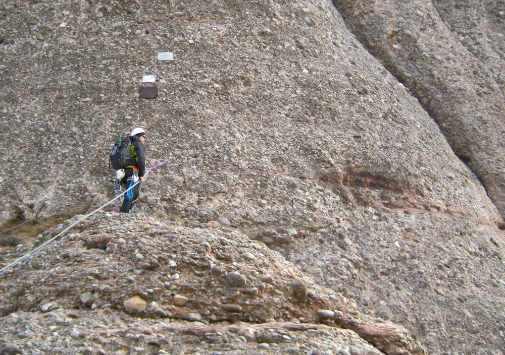
Start out on the sloping ridge that runs along the void on the left. No nails, but you can place 1 or 2 friends on the path and a lanyard in the tree a little higher up, on the flat. Continue, veering a little to the east to reach the foot of the rock. There's a relay station and commemorative plaques. Continue downhill a little, then traverse horizontally to reach relay R1, just below the large dihedral. The traverse is tricky (V/V+) with 2 parabolts. It's best to climb the belay at this point to have a visual of L2 and avoid pulling the rope. Otherwise, cut in half and do an L2 on the 10m traverse.
L2 (30m, V/V+)
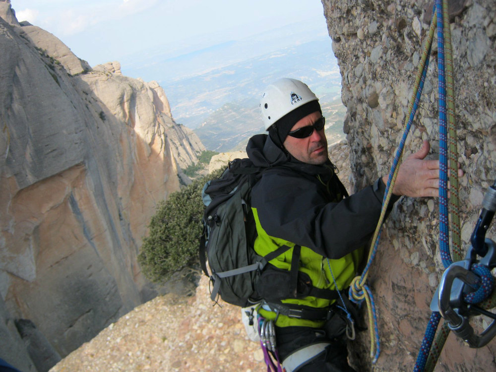
This is the most beautiful part, with a magnificent dihedral that becomes increasingly aerial. There are vintage pitons (1935!) and more recent mega-pitons in the crack. Climb with the help of the large fault, occasionally moving away to find good holds as the rock is polished in places by use. After a few IV+ pitches, we're in good V and the exit from the dihedral with 2 slightly exposed pitches is well worth V+. Relay R2 is located above the dihedral on the right, on an almost flat section.
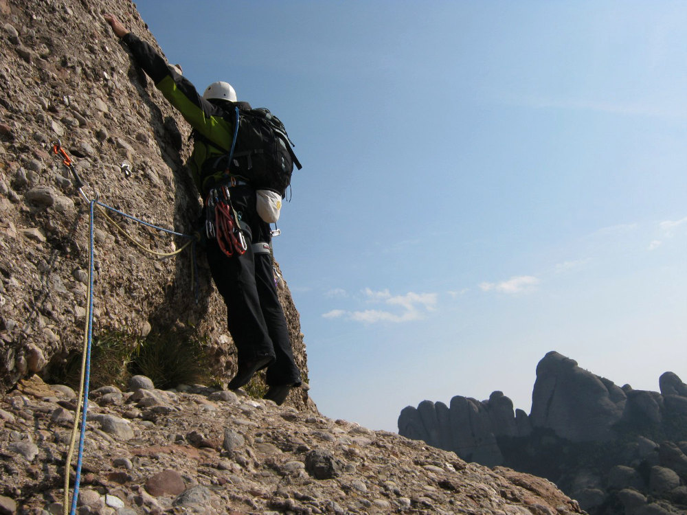
L3 (25m, V)
The relay exit is very poorly secured. Just one poorly placed nail, very close to the ground, and 2 or 3 fine V-shaped starting steps which, in the event of a fall, expose you to a return to the ground. Then it's easier, and we find the R3 belay just before the summit with 2 huge pitons. After a few more metres of walking, you're there! A breathtaking view ahead, to the right and to the left, we don't dawdle, take 2 or 3 photos and abseil down the same route.
With a first abseil of about 30m from the statue (ring) to the R2 belay. Then, if you have a 2x60m, a second abseil straight down, otherwise stop at R1 to cut the final abseil in 2. To get back down, we followed the ridge path due east (great view of the cavall and its east face) to catch the Balaguer torrent channel on the left, not indicated on the map but which descends easily and quickly to the GR. Alternatively, continue along the ridge to take the better-traced cana plana and rejoin the GR. Follow the GR to the right to take the canal del pou del gat in reverse to the parking lot.


Leave a Reply