


TOPO Climbing | CLIMBING7.COM
Publié le
 Partager sur WhatsApp
 Partager sur Twitter
Partager sur Instagram
Partager sur Twitter
Partager sur Instagram

 Partager sur Facebook
 Imprimer le topo
 Laisser un commentaire

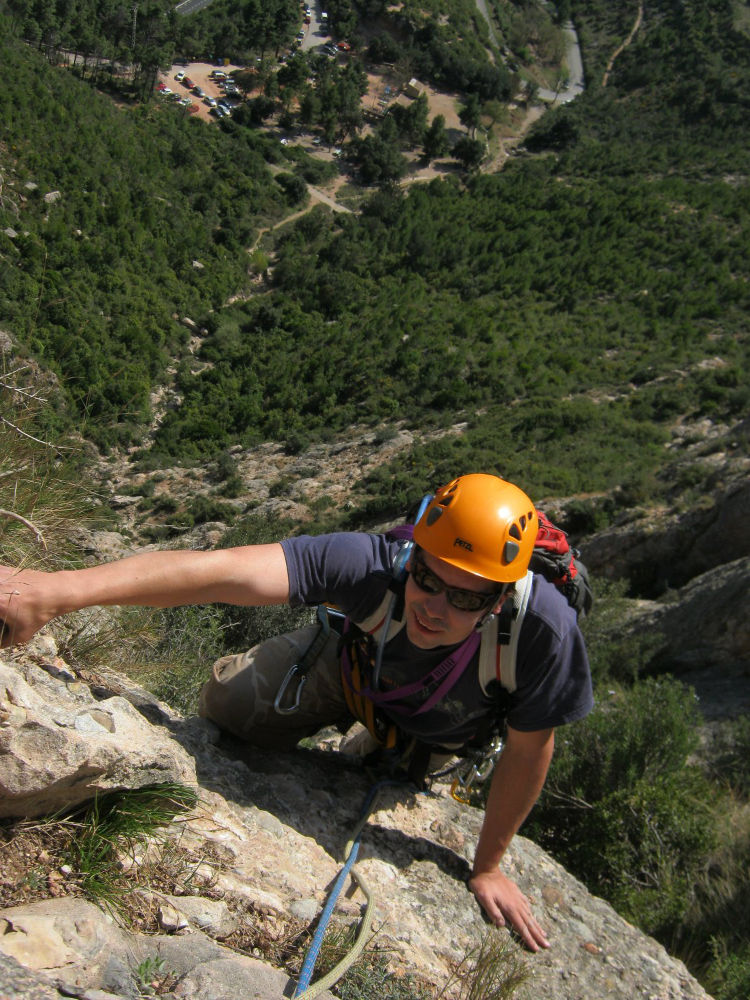
Back to the wide wall of La Codolosa, above Collbató, south of Montserrat, to take advantage of the almost summer sunshine at the beginning of April. Very quick access from l'ermita del salut, the route is pleasant and doesn't pose any difficulties, even if the start of the 1st pitch is rather exposed. An accessible route, short and quick to do, in a level V, for beginners. It's best avoided in summer, otherwise you'll end up fried, because even here, at the beginning of April, we suffered and ended the day with a good heat stroke. You can follow this up with other big routes on the Codolosa (around 15 in all), or move on to the Els Graus sectors, a little further west.
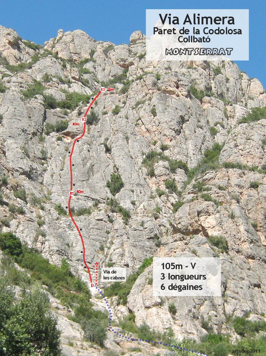
❱❱ Technical summary
❱❱ Access to the place
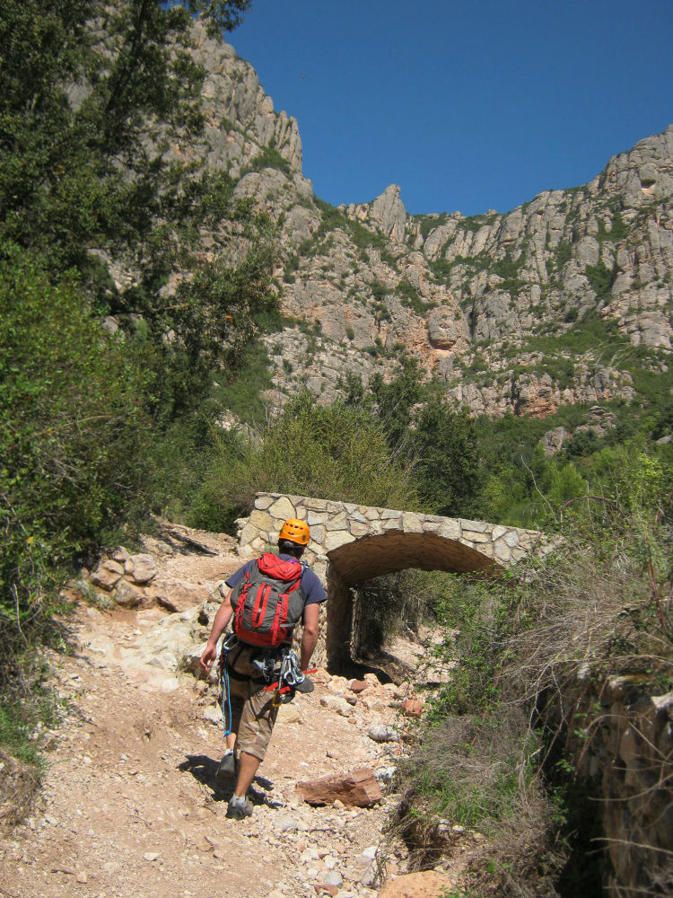
From Barcelona, take the A2 towards Lleida and exit at Collbato. Do not enter the village, but drive straight on towards the coves del Salnitre. Quickly turn left to reach the parking lot for the ermita del Salut, a little further up. There's a parking lot and even a chiringuito. The Codolosa wall is there, just ahead and above.
❱❱ Map & topo
❱❱ Itinéraire
Take the Font Seca torrent path which starts behind the parking lot. The bed of the torrent is clearly visible and all you have to do is climb up it. The overall path follows the course of the torrent, climbing a few rocks across and heading towards the walls. When you reach the Codolosa, fork left to find a path you'll have to invent along the foot of the cliff (we didn't find anything very clear). The via Alimera is almost the 1st route on the wall, on the right. Go around a rocky overhang and climb straight up, into a slight indentation that leads to the foot of the route. On the right, a channel full of vegetation runs diagonally. The name of the route is inscribed in white on the rock. The via de las cabres (also inscribed) starts to the right and runs parallel.
The route, opened in 2002, is south-facing and 105m long in 3 pitches (40m, 40m, 25m). The equipment is good, except on L1, where it's a little lacking. Bring 6 quickdraws.
L1 (40m, V)
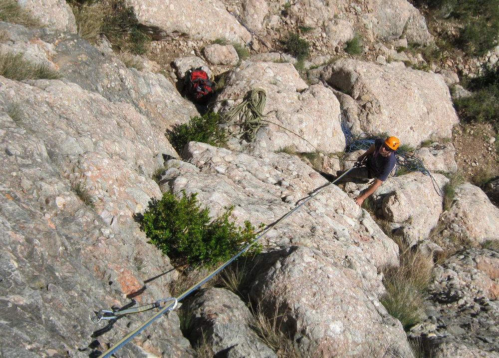
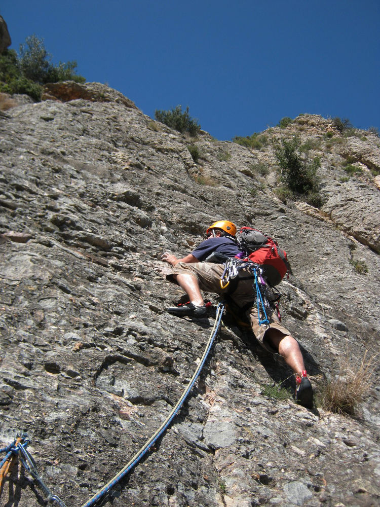
Boulder start to the first high (!) belay point. Then just after, a vertical passage, a small V-shaped slab with very poor protection... The rest of the climb is easy IV/IV+ to a flat area where we walk. A 2nd small wall finishes in V- to reach the very comfortable R1 belay. 4 quickdraws in all.
L2 (40m, V)
The exit from the belay is still exposed to reach the first nail. Next, a long, almost vertical slab to climb, with good holds and holes to help you. Climb up to the rock that forms a sort of roof and go around it to the right in a crack to find the R2 belay above. 4 quickdraws here too.
L3 (25m, IV)
This last pitch is very easy and takes you to the top of the cliff. 2 plates.
Abseil the route. The 1st abseil of almost 60m to return to R1 (if not, do it in 2 stages). The 2nd to the ground. Be careful when abseiling the rope, pull gently and place the rope between the trees.


Leave a Reply