Fleeing the bad weather, there's nothing like a new escapade in Andorra to kick off the summer. It's also a great way to warm up at altitude. The via ferrata starts at the ski resort of Grau Roig and ends at over 2,600 m, close to the Bony d'Envalira peak (2,774 m). It's a beautiful approach with a good difference in altitude, a snow start and a moderately difficult climb, apart from a few passages equipped just right, requiring the use of rock for hands and feet to make progress. At the top, a 360° panorama alone is worth the detour.
Technical summary
Location ✦ Grau Roig
Region ✦ Encamp
Country ✦ Andorra
Type ✦ Via ferrata
Height difference ✦ 625m
Difficulty ✦ K3
Duration ✦ 45′ to 1h
Interest ✦ **
Access to the place
Enter Andorra via the Pas de la Case, continue in the direction of Canillo, pass the Port d'Envalira pass to reach Grau Roig, the ski resort, at the bottom of the hill on the left, after a few hairpin bends. Park there, at the foot of the slopes.
Itinerary description
Hiking to the start 1h
Quite physical. Right from the start you can see the rock, so you can navigate by sight. Climb the main trail to the chairlift arrival point, then fork left to climb alongside a second chairlift. Higher up, at the base of the boulder, turn right onto a path that leads to a hut and a small body of water to be crossed from behind. Climb the scree to the right of the névé to reach the start.
Course 1h
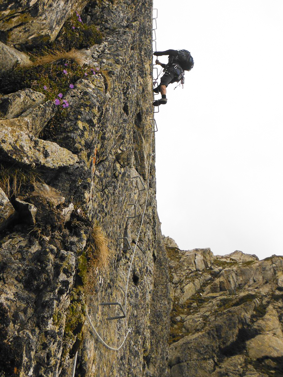
The east-facing via ferrata is actually quite short, equipped with rungs that are sometimes well spaced out, forcing you to climb in, shall we say, IV climbs.
Apparently, it's closed in 2018, according to information on the Deandar.com website.
The first part climbs vertically, zigzagging a little without difficulty. Then there's a short traverse to the right to change wall and move on to the 2nd, shorter part, which starts with a very vertical and aerial section.
The final section is much easier, leading to the ridge where the equipped section ends.
Back
Follow the ridge south to the small pass, then switch to the right and descend a large, wide combe that leads down to the GR7 trail, which you can follow back to our starting point.


Leave a Reply