


TOPO Hiking | CLIMBING7.COM
Publié le
 Partager sur WhatsApp
 Partager sur Twitter
Partager sur Instagram
Partager sur Twitter
Partager sur Instagram

 Partager sur Facebook
 Imprimer le topo
 Laisser un commentaire
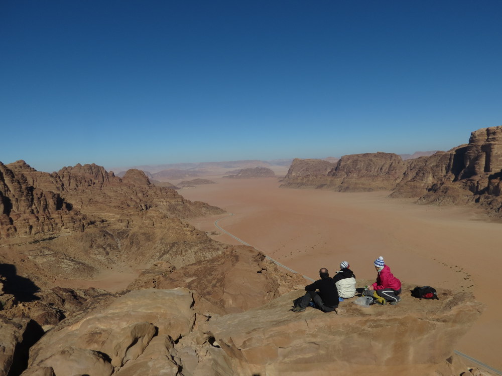
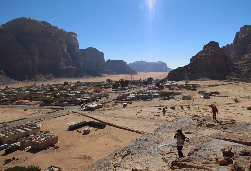
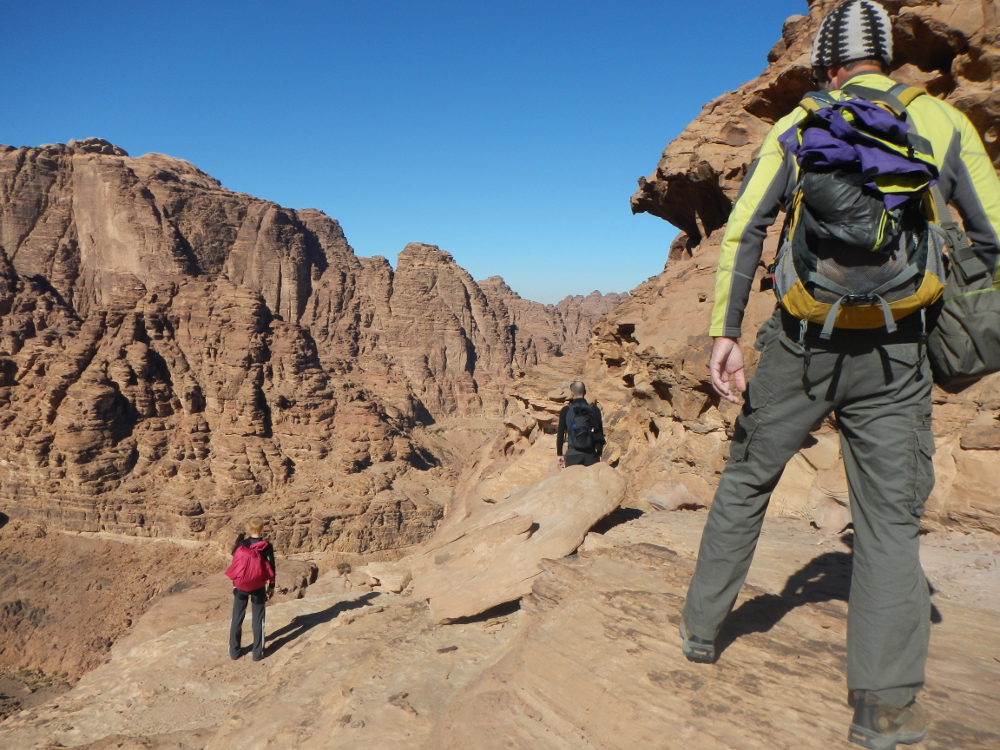
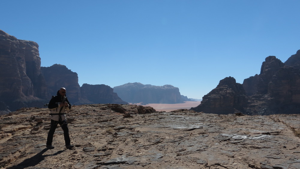
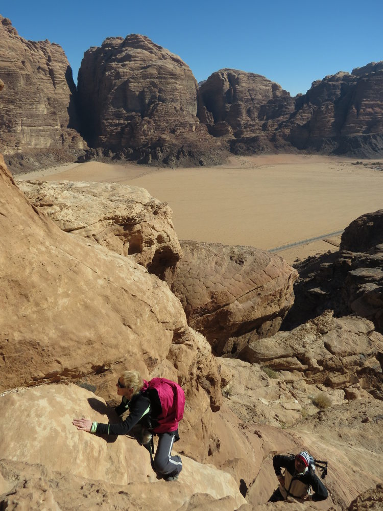
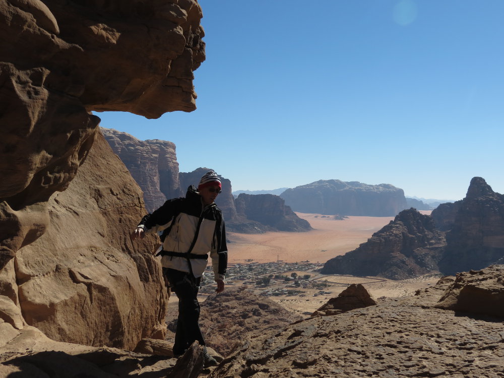
A gentle introduction to wadi Rum, to get the feel of the place and familiarize ourselves with the rock. Just before the village, this little trek goes up a long ridge to reach the summit of jebel Mayeen (1100m), situated against the imposing jebel Rum. No particular difficulty, apart from finding the right route: there are very few markings here, and not many cairns either. The path must therefore be found sometimes by climbing straight up, sometimes by going around to the right or left, and sometimes by going back down for a moment. From the top of the pebble, we become aware of the immensity of the place, with the whole perspective of the sandy corridor at the entrance to Wadi Rum and the village at the gateway to the desert beneath our feet. Returning inland, we skirt the large walls of Jebel Rum, spotting a few great routes to remember, including Black Magic and Gold Finger at the exit opposite the Rest House.
❱❱ Technical summary
❱❱ Access to the place
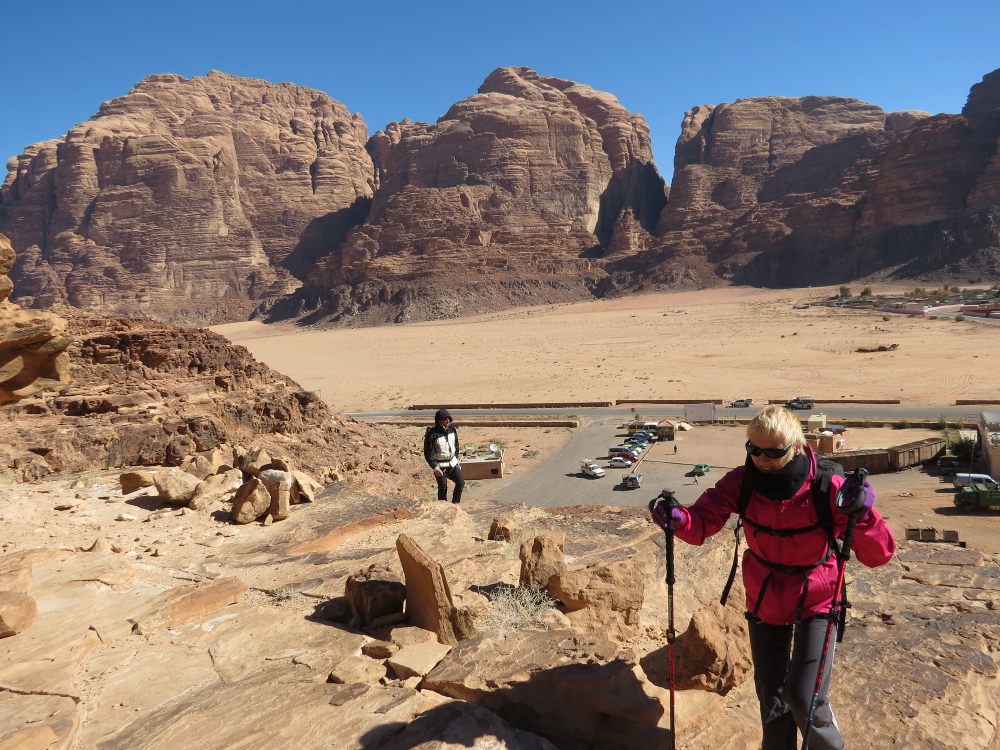
From the desert road between Ma'an and Aqaba. Head for Rum, past the Visitor Center (5 JD for entry per person, 20 JD by car but avoidable) with the 7 Pillars of Wisdom on the left. The narrow road runs due south and after 5 or 6 kms, just before the village e,nitrée, on the right, the Rest House. Park here.
❱❱ Map & topo

❱❱ Itinéraire
Immediately, the route starts just behind the parking lot, on the rocky outcrop.
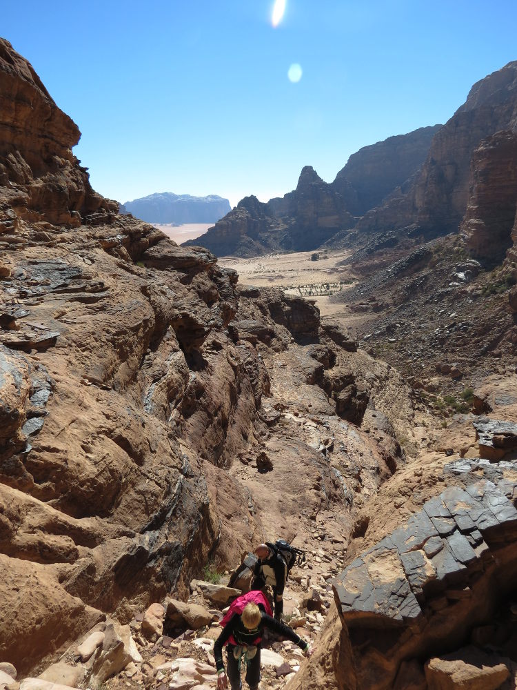
The route is fairly obvious, as it follows the ridge, but the path is only moderately marked, especially at the start. Difficult to describe as there are few really characteristic passages. Zigzagging to find the best place to go, sometimes to the right, sometimes rather to the left, without any real difficulties. 2 or 3 exposed climbs in III or IV on good, solid sandstone. After several landings, a few descents and small passes, we reach the summit with a picture-postcard panorama before our eyes. The detailed Howards topo (cf. 1st photo) is not particularly essential, so follow the most obvious natural passages.
From the summit, descend on the inside to reach a fairly tricky chimney, then continue on a level route. We reach a sort of pass, then join the wide, stony gully that leads back to the parking lot.


Leave a Reply