


TOPO Climbing | CLIMBING7.COM
Publié le
 Partager sur WhatsApp
 Partager sur Twitter
Partager sur Instagram
Partager sur Twitter
Partager sur Instagram

 Partager sur Facebook
 Imprimer le topo
 Laisser un commentaire

The idea is to cross Jebel Rum from west to east, via the summit of Wadi Rum at 1754m. After a first attempt in December to access the Nabatean Route, Sabbah's Route, which starts at the same point, is a long and complex route that combines trekking, scrambling and trad climbing, even if a few pins have been placed along the way. A typical Bedouin route, the difficulty lies mainly in the many very exposed passages and a not-so-obvious itinerary with little to guide us other than natural logic. The climbing pitches are accessible (V max), but orientation on the domes is tricky, despite the presence of numerous (sometimes misleading) cairns. Last but not least, the route is worth it for the absolutely incredible panoramic view over Wadi Rum, a breathtaking mineral landscape! The descent follows logically on the Hammad's Route, which completes the crossing on the east side. Allow 2 days with a bivouac on the domes to enjoy the spectacle and avoid a marathon day.
❱❱ Technical summary
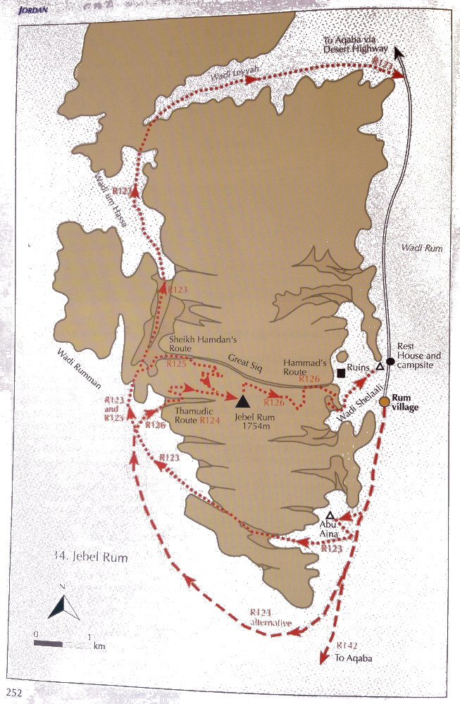 topo jebel Rum
❱❱ Access to the place
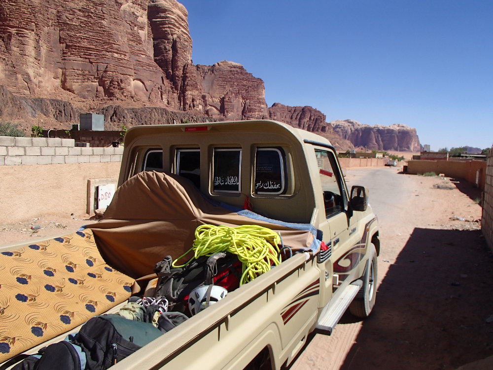
From the village of Rum by 4×4 to the south of the Jebel Rum massif. The area to the west of the jebel, the wadi Rumman, has recently been closed and regulated to protect local wildlife from hunting. It is therefore necessary to make arrangements with local guides to arrange passage and to be driven to the foot of the track (approx. 20JD).
❱❱ Map & topo
❱❱ Itinéraire
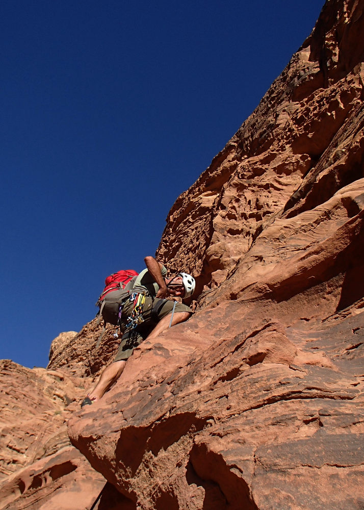
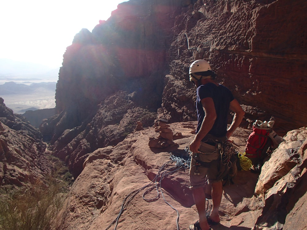
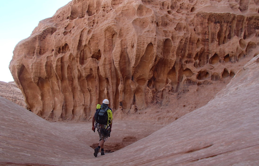
Climb the long scree slope to reach the top of a strip of black rock and cross due north. At the corner, you enter a deep gorge. Follow the cairns to climb up several flights of steps on the right-hand side, some easy scrambling. You rise fairly quickly before going deeper and deeper into the gorge. There's a rope-equipped step, then further ahead, exposed slabs to climb (III/IV), and finally a large 2-part ledge. At the end, after negotiating a final inclined slab, there's a dead end and a wall with holes above.
The climbing section of the route is 4 pitches long (30m, 40m, 35m, 35m) and faces north and west. Broaches in place and a few emergency belays (lunules). Bring a full set of friends and several long straps. The topo is taken from Howard's book "Treks and climbs in Wadi Rum, Jordan".
L1 (30m, IV+)
Start at the very end of the ledge, aim for a 1st pin on a slight diagonal at 11 o'clock then continue in the same direction for a 2d point and exit onto a fairly narrow ledge with a 3rd point. A few useful friends before the 1st point, which is very high. On the ledge, walk to reach L2 opposite.
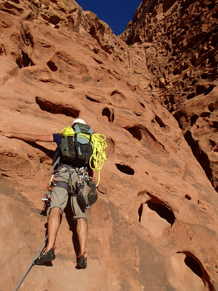
L2 (40m, IV+/V)
4 pins for the length on a slab with big holes and a crack to finish. A few friends are also welcome to protect between the points. Then continue climbing on another sloping slab that's not so easy, to reach a bivouac area under the rock (where we camped as night fell...).
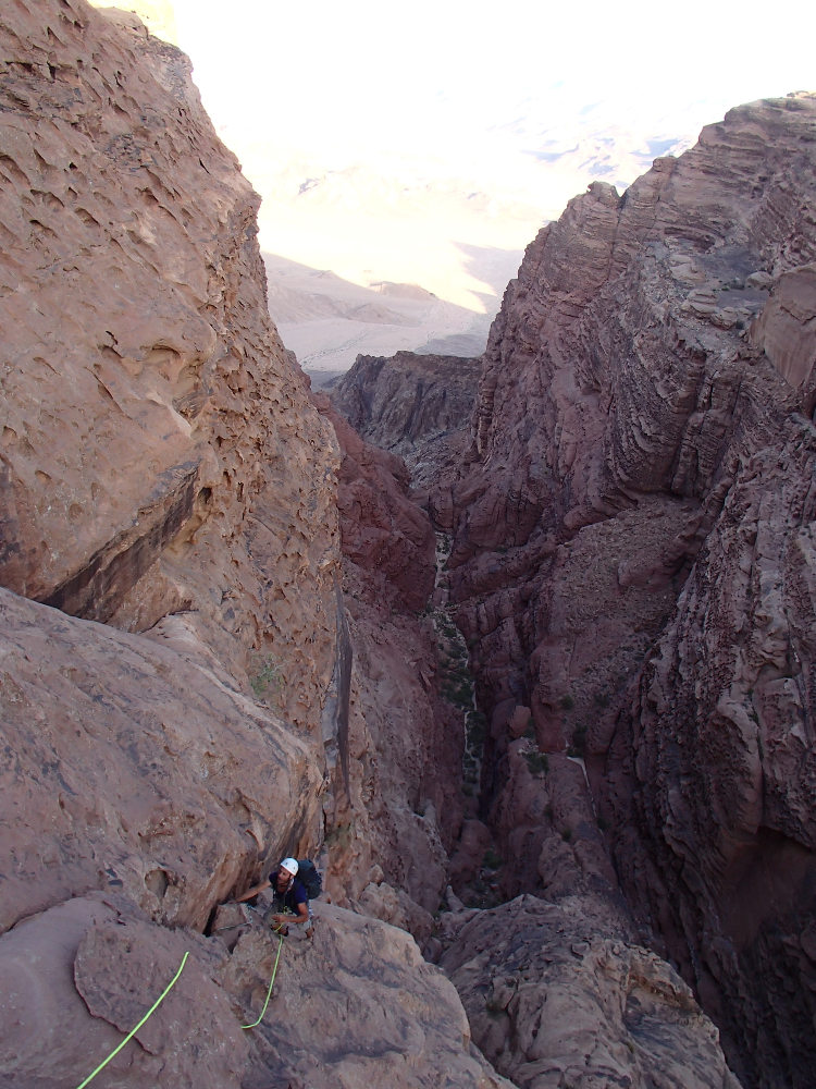
L3 (35m, III+)
Above the camp, a wall with a hole and on the right a very black plaque. Climb the gorge side before crossing almost horizontally over the void to reach an inclined dihedral that can be seen between the carved wall and an ascending black plaque. Easy to install lunulas for protection (no equipment required).
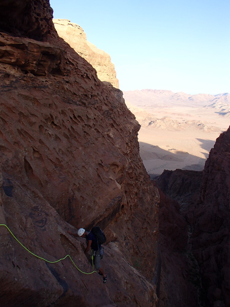
L4 (35m, V)
Climb the airy dihedral with good holds. A harder step to recover on a high step and then, before the summit, pass over the slab on the right and finish on a small plateau to climb the belay. A set of friends and straps for protection. The first white domes can be seen from here. Another option for arriving at more or less the same point would be to continue on the sloping slabs at L3 level to pass a fitted pitch leading to the top of L4 (arrival pins seen).
Part 3: Domes to Jebel Rum (1754m)
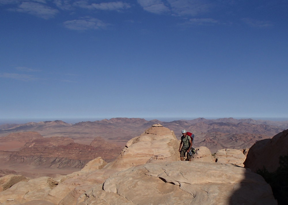
Climb up between the 2 small domes on the right and take a ramp that leads to a ledge that can be seen heading west. Go around to the west and back to the first domes. The summit of Jebel Rum can now be seen in the distance on the east side. The route to reach it is still long and not very obvious, in any case impossible to describe here. Follow the cairns, the route heading due east and then due north to reach the summit. Jordanian flag painted on the ground and 360° view of Wadi Rum: impressive!
This can probably be done in several different ways. We opted for the classic Hammad's Route, which takes you completely across the jebel and back to the village of Rum (4 to 5 hours, another complex route with abseils, including one of 40m and another of 45m).


Leave a Reply