


TOPO Canyoning | CLIMBING7.COM
Publié le
 Partager sur WhatsApp
 Partager sur Twitter
Partager sur Instagram
Partager sur Twitter
Partager sur Instagram

 Partager sur Facebook
 Imprimer le topo
 Laisser un commentaire
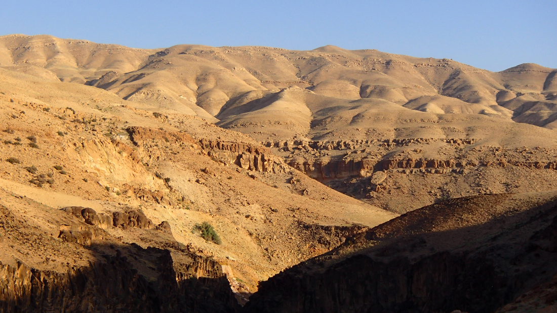
The mountainous region of Moab, the former kingdom of Jordan, lies to the west of the Dead Sea, stretching northwards a little below Madaba with the Wala, Hidan and Mujib wadis, and southwards with the very long Wadi Hasa. We took advantage of our arrival in the area to discover the upper section of wadi El Hidan, which can be done on your own, whereas the lower part requires authorization and the exit at the very bottom in Mujib Siq requires the paid accompaniment of a local guide (45 JD or almost 50 euros... so much for giving up). The area is superb, and the upper section offers a refreshing water trail ideal for getting into the swing of things. The descent and return loop takes around 4 hours, and we spend a good deal of time in the water, which is welcome given the seasonal heat.
❱❱ Technical summary
Region ✦ Madaba
Country ✦ Jordan
Diet ✦ aquatic
Difficulty ✦ v2-a2-II
Duration ✦ 4h to 4h30
Distance ✦ 5 kms
❱❱ Access to the place
From Madaba on the King's Road, turn right to descend to Wadi Wala. Drive 18 km along Wadi Wala to reach the point at the very bottom where the first black basalt rocks appear (easily visible from the road). At this point, take the small track approaching the stream and park (100m from the road);
❱❱ Map & topo

❱❱ Itinéraire
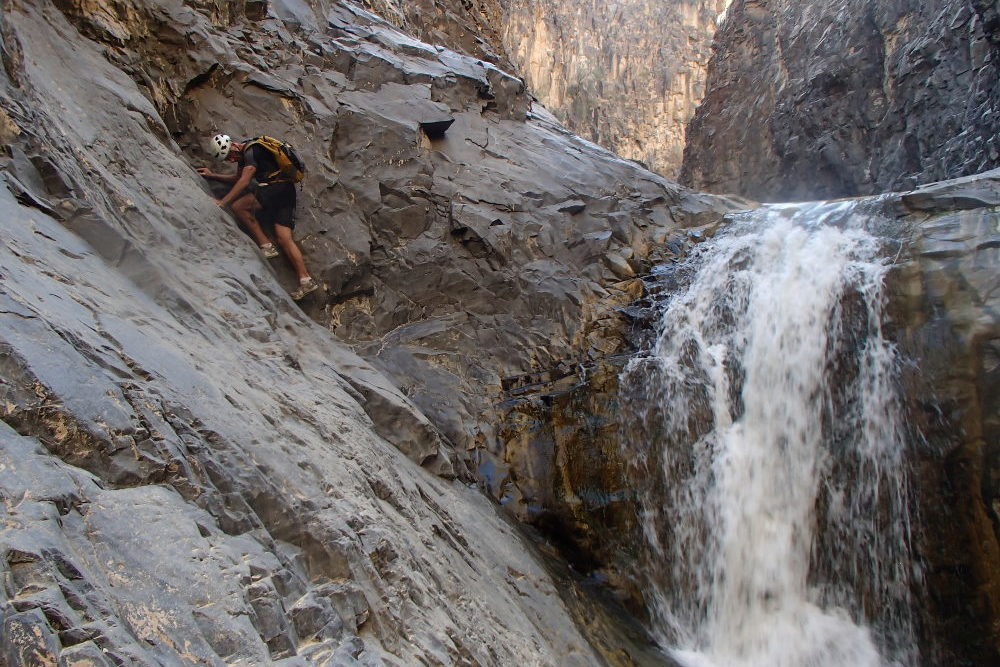
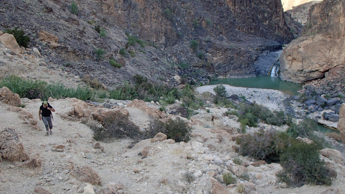
Follow the basalt to a beautiful waterfall, which you can avoid by turning right and finding a path to the bed of the wadi a little further on.
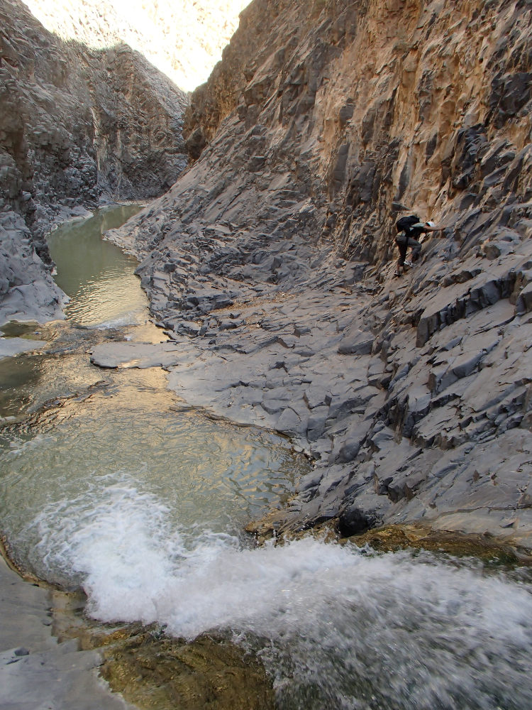
The upper part of the canyon doesn't present any major difficulties, although 2 or 3 de-escalation sections (each time bypassing waterfalls on the right) are quite tricky and exposed.
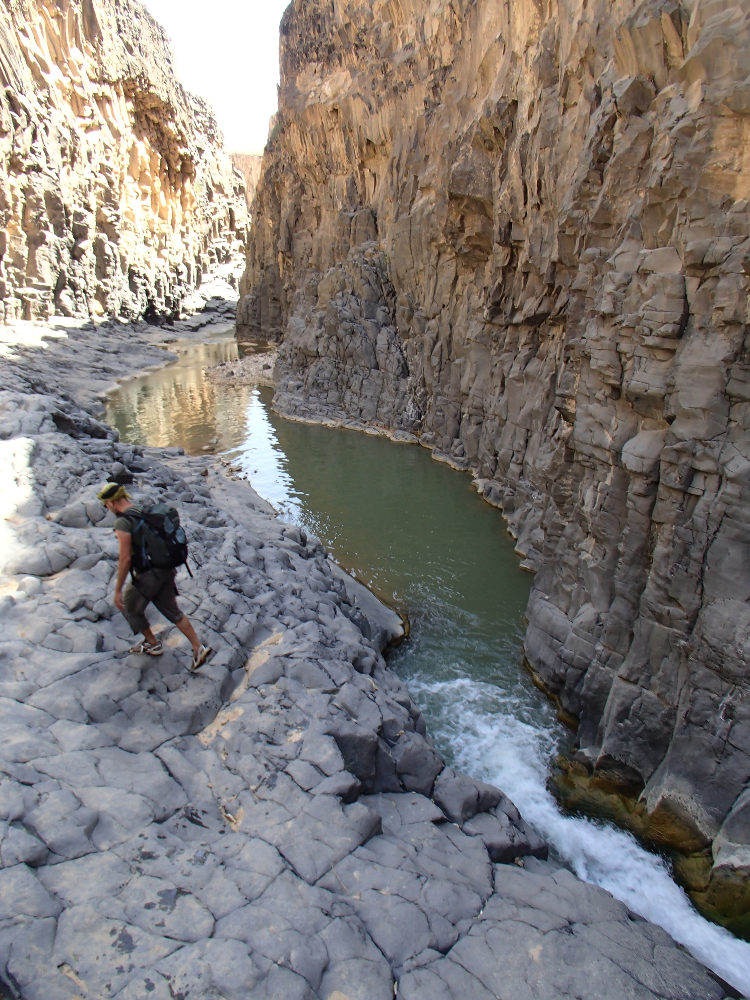
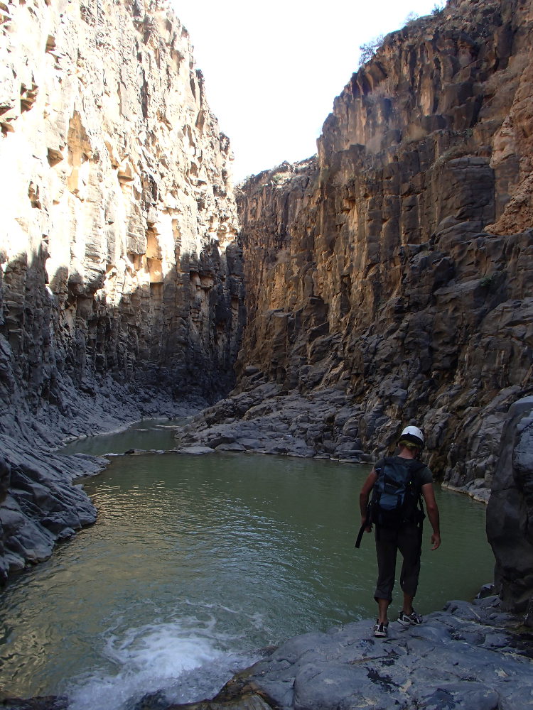
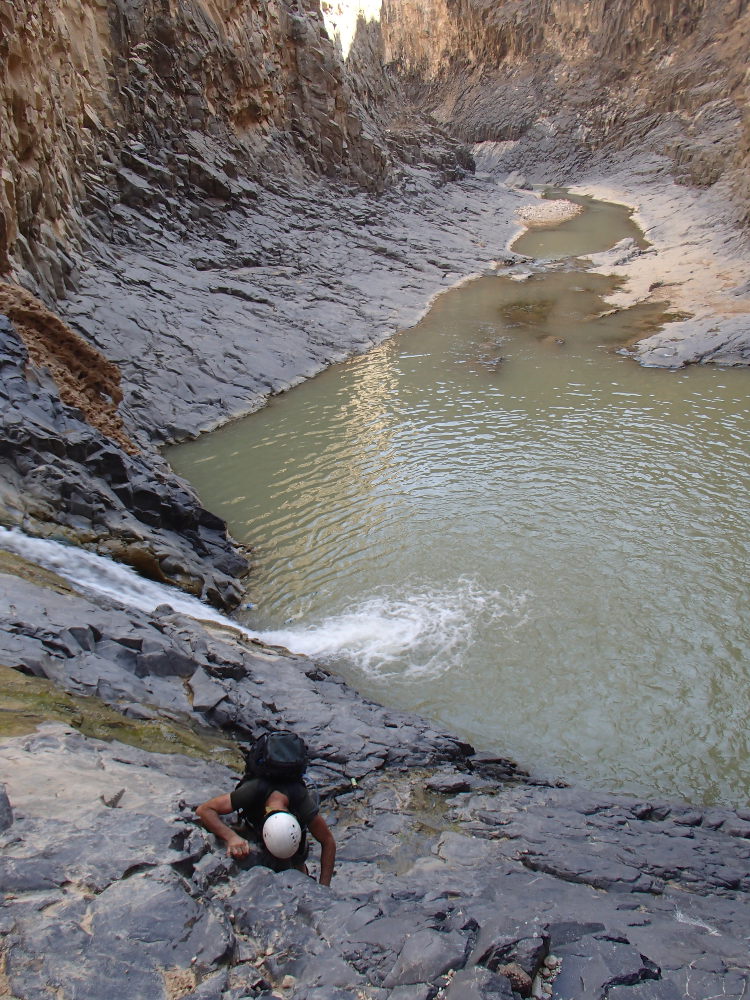
There's a lot of water, and certainly more in wet weather, so it's a very aquatic route, requiring swimming in several places, and a nice jump in the final double cascade. A gently winding parade of sculpted black basalt, not very steep but quite long (5 or 6 kms). No equipment required (none in place, or not seen), but a pair of shorts, even in summer, is more comfortable, given the time spent in the water, in the shade of the walls. A good introduction to the region's major canyons.
The topo is taken from the guide "Jordan, Walks, treks, Caves, Climbs and Canyons" by Di Taylor and Tony Howard, published by Cicerone (2nd edition 2008).
After the final double waterfall, climb up the right flank to reach the plateau (more or less marked path) and the road that runs alongside the wadi from the top. Follow the asphalt back to the car.


Leave a Reply