


TOPO Hiking | CLIMBING7.COM
Publié le
 Partager sur WhatsApp
 Partager sur Twitter
Partager sur Instagram
Partager sur Twitter
Partager sur Instagram

 Partager sur Facebook
 Imprimer le topo
 Laisser un commentaire
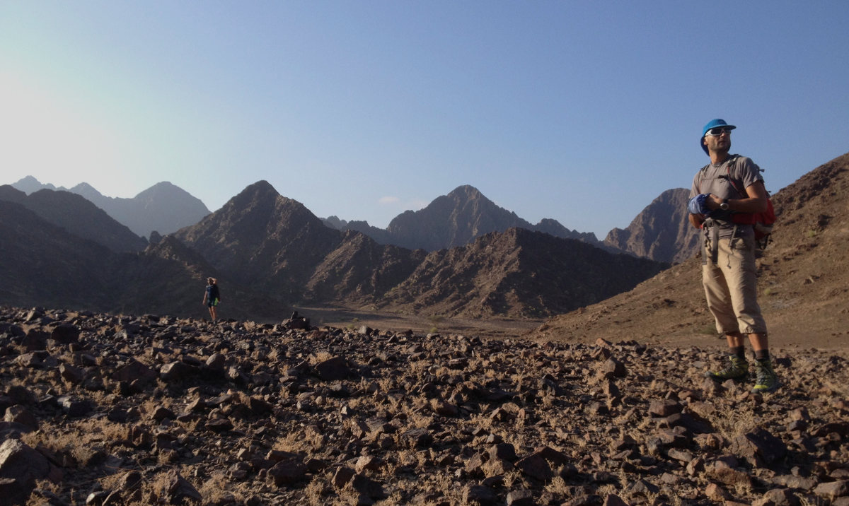
Huge trek to reach the summit of jebel Hatta from the north, or almost, on a magnificent but demanding, long and rather complex route. 10h of hiking, almost 22 kms of trekking, it's better to be in good health. Mike's original approach allows you to dominate the long, winding wadi before beginning the long ascent that leads to the final assault and finally reaching the ridge at around 1250m that borders jebel Hata. Rocky landscapes, lunar plains, deep canyons, pools and waterfalls (with little water at this time of year, a pity), numerous scrambling passages, it's all there with a spectacular view at the summit and some more or less offensive encounters to boot. The way back, however, is in the opposite direction, and the last part, this time following the wadi bed to the end, is quite interminable. Thanks Mike! Cheers!
❱❱ Technical summary
❱❱ Access to the place
Take the Dubai Hatta road, pass the 1st checkpoint (to enter Oman) and just before the second checkpoint (to return to the UAE), turn right towards Hafat. Once in the village, turn right at the T and quickly continue on a good track. Follow the main track to the bivouac, the starting point of the trek (you could go further by 4×4, but there are some tricky stretches just outside the village). Technically, we're in Oman, even if we haven't crossed any borders. The trek then passes back into the UAE up to the summit, almost on the border.
Bivouac GPS: N 24° 47.608′ E 056° 01.364′
❱❱ Map & topo

❱❱ Itinéraire
Follow the main track past the village, then continue along the wide wadi, which meanders a little and then bends to the right. You'll come to a junction with a green tree on the left and a conglomerate cliff at an angle opposite. If you go straight on (the return path), you'll reach the 3rd section (2 or 3 large waterfalls to be climbed on the sides, sometimes a little exposed, but much longer). Prefer the left-hand side for the route des cols, which is more uneven but much more direct (and more beautiful).
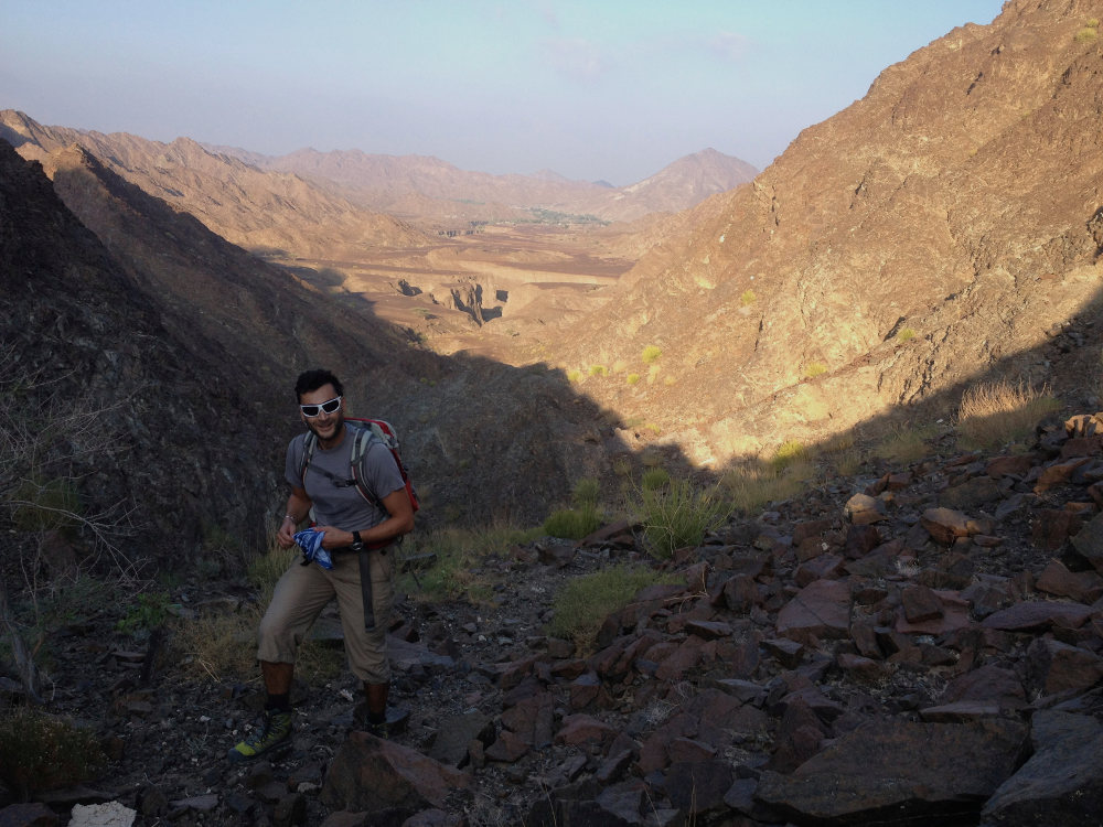
The trek is very long, so bring enough water for the period (4 to 6 liters per person). No equipment is required, but a helmet and a 30m safety rope (+ harness and descender) may be useful. Most of the route is in the shade, in the wadi or in north-facing mountain gullies. Allow around 5 hours if you don't drag your feet.
The trek can be broken down into 4 parts.
Part 1: Le trou de la Mouche
Turning left, the path immediately becomes narrower and more incised. Climb up and walk across a small plateau to reach the 1st small pass. Then descend and tackle the 2nd pass in quick succession, with a view of Jebel Hatta in the distance. Descend again and cross a large, rocky plateau that looks a little like a moon. At the end, continue slightly to the left to reach a 3rd small pass with a hole in the rock: the fly hole. Beautiful view over the central plateau with the wadi, which forms sinuous galleries in a depression like an immense snake.
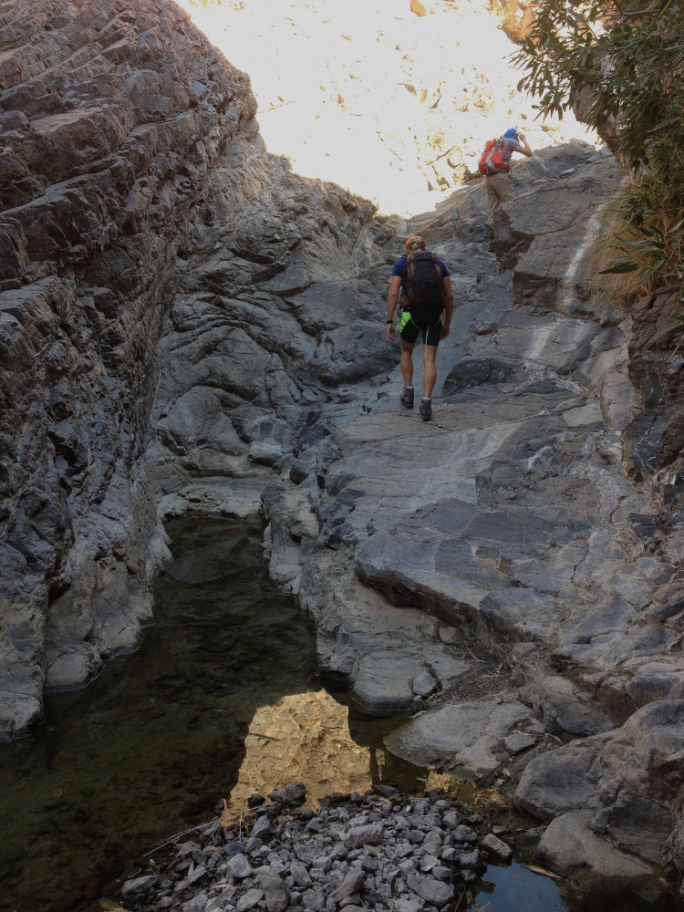
Part 2: The belly of the snake
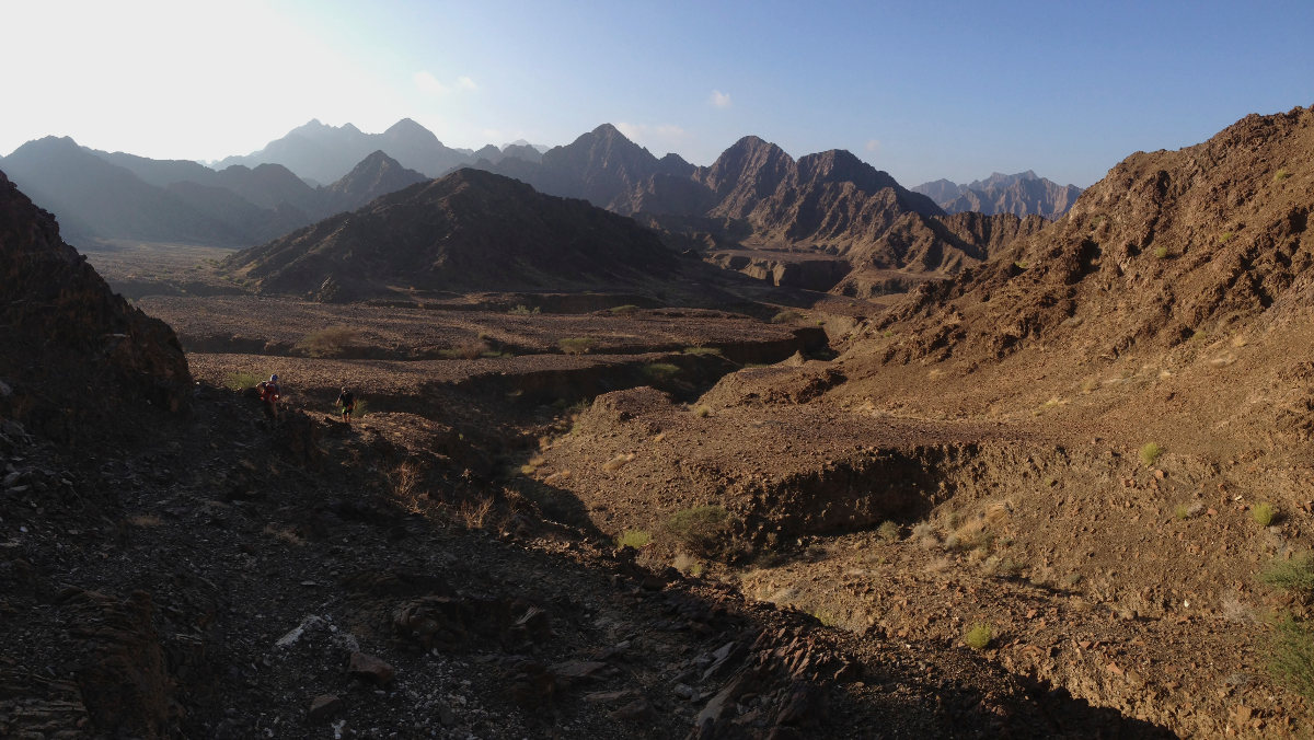
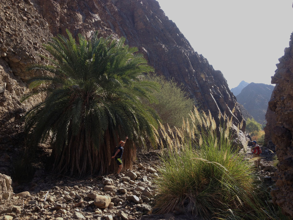
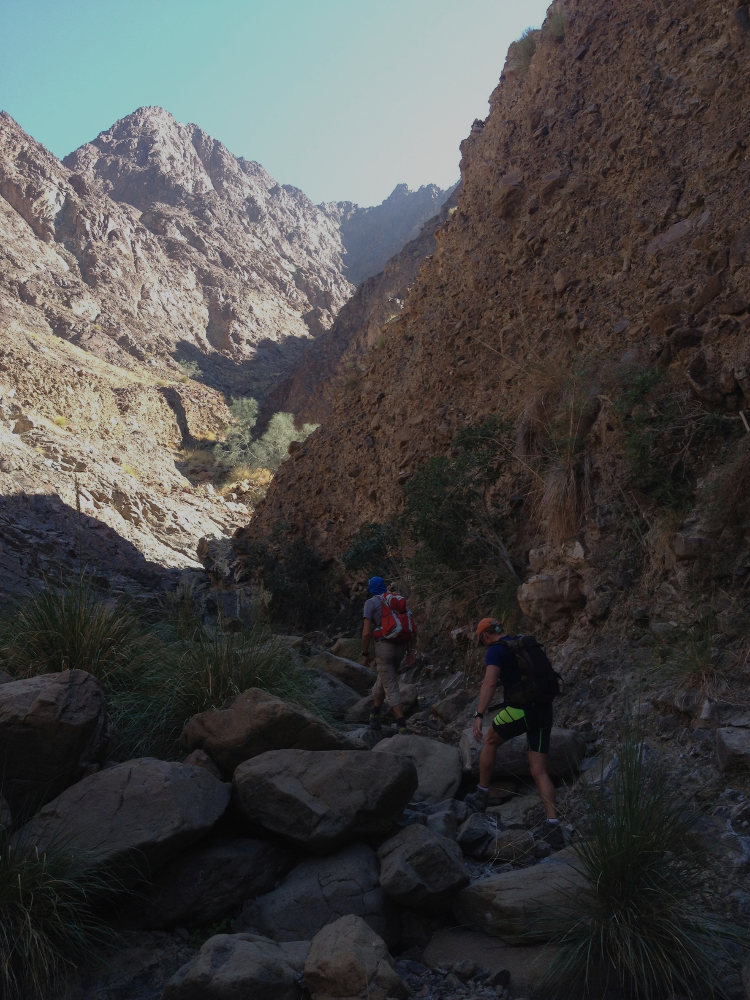
Cross this plateau, avoid one or two lateral depressions, then follow the main bed as it curves to the left and finally descends to the bottom of the canyon. Walk along simply following the main wadi, past the characteristic "tree in the parting", around a pretty pool of water to the right (bathing possible) and back into the torrent bed... A waterfall to climb further on in IV, a second small pool to go around to the left this time, past 2 beautiful palm trees with charred trunks, then the "ball palm tree" and finally the "wicket gate" which almost marks the end of part 3. Further on, the canyon widens. Turn left to follow the canyon in its much narrower upper section.
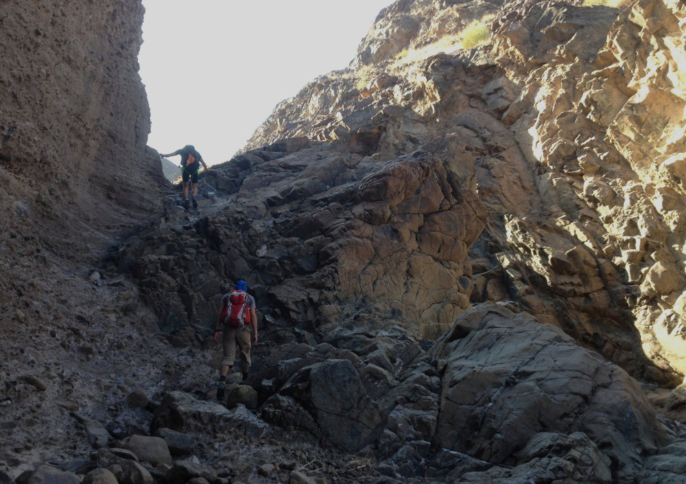
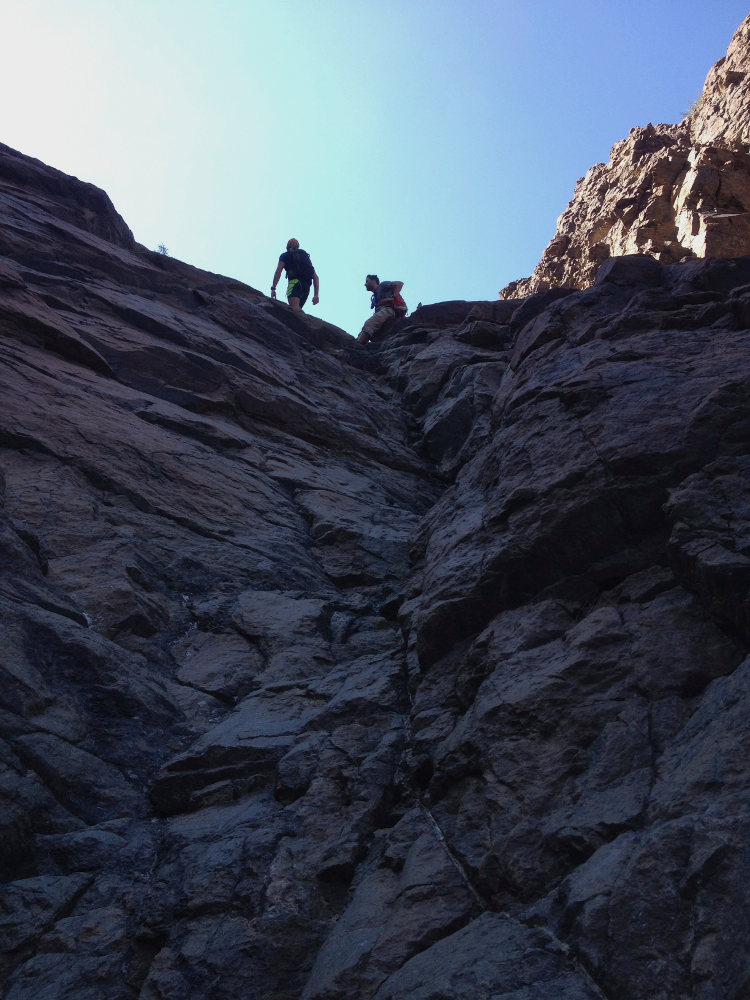
Part 3: The waterfalls
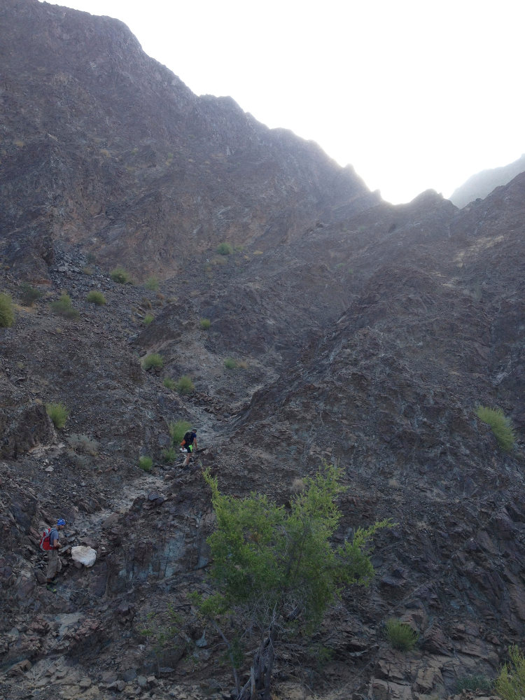
We walk quickly over rock, and have to pass several small waterfalls in IV+ max. It's long, but gradually uphill, with several secondary arrivals on the right. The path is marked from here on. There's a bit of water on the way, but the pools can be avoided without difficulty, which could be more complicated in wet weather. After a while, don't miss the fork to the right, with clearly visible cairns, to tackle the final section leading to the ridge and summit.
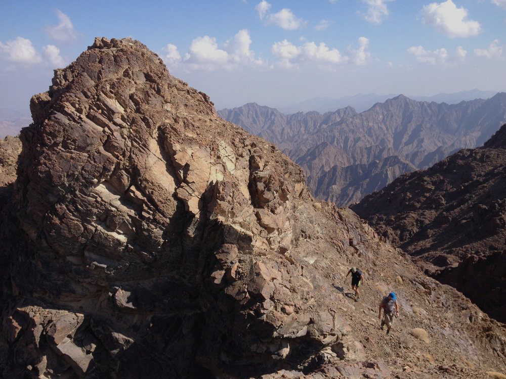
Part 4: The final assault
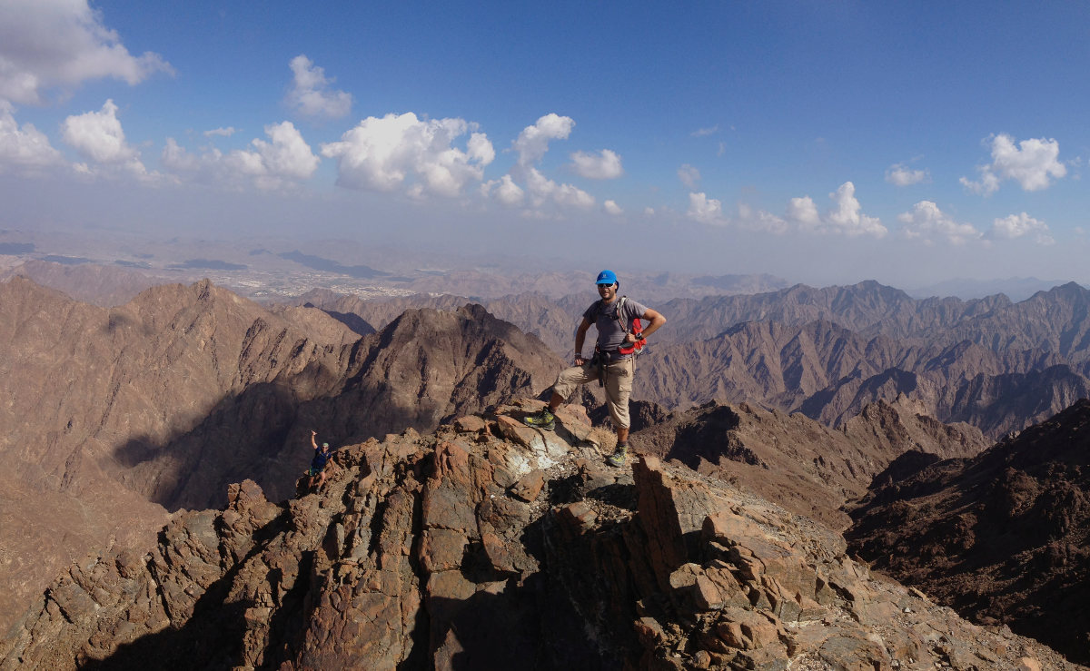
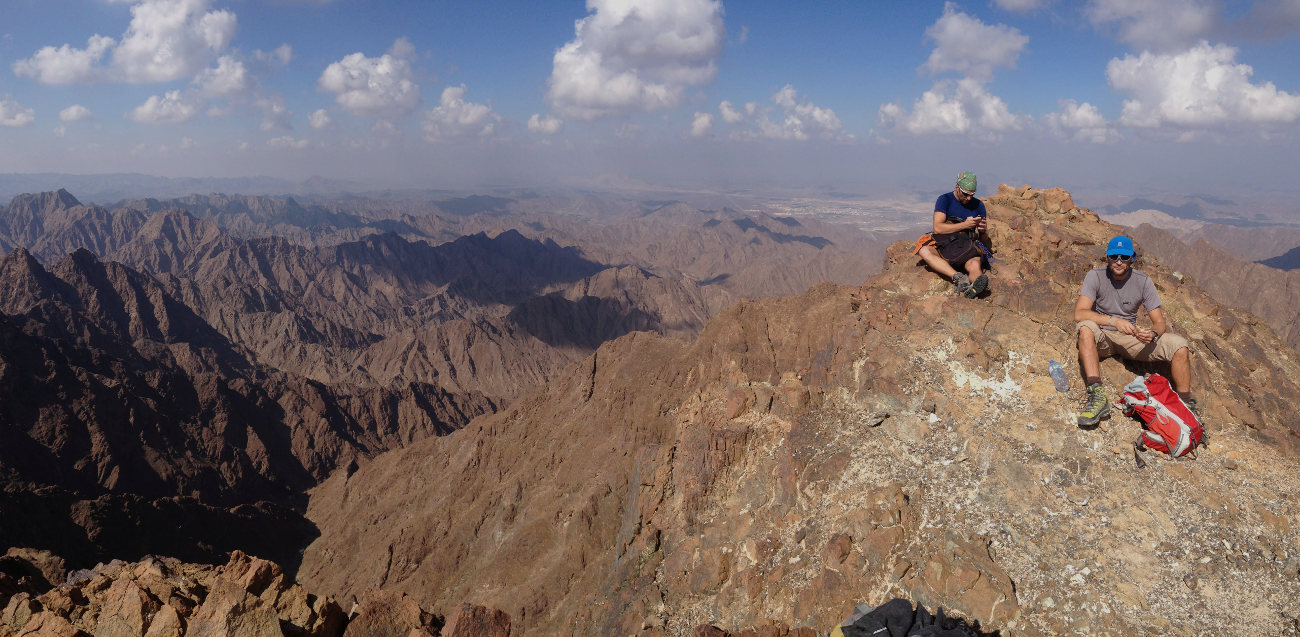
At this point, the climb becomes much harder, and the trek becomes scrambling without being too difficult (III/IV+), but sometimes a little expo. Follow the main gully to a characteristic white tree where, to avoid impassable waterfalls, you must turn left and climb. Continue and reach a gully on the right that leads to the ridge. Finish in a narrow, slightly broken corridor to reach the summit. We're 200m as the crow flies from Jebel Hatta and the antenna. Impressive panoramic view. From here, you can see the starting point, due north, and measure the distance covered (and to be covered on the way back... arrrgh!).
Descend in the opposite direction, and the final section is the most complex for the increasingly delicate de-escalation and for finding the less obvious route from the top. Find the white tree, then further down the fork to the left in the upper part of the canyon. The descent is easy but the end is very long. Pass the gate, the ball tree, the pools, the tree in the ray and this time follow the canyon bed to the end (don't do the 3 passes again unless you're really fit!). The wadi takes huge detours to get back to the starting point, with 3 or 4 steep waterfalls that are not easy to get around (one of them is an expo) and the end is really in-ter-mi-na-ble!!! On arrival at the camp, an aperitif is the order of the day.


Leave a Reply