


TOPO Hiking | CLIMBING7.COM
Publié le
 Partager sur WhatsApp
 Partager sur Twitter
Partager sur Instagram
Partager sur Twitter
Partager sur Instagram

 Partager sur Facebook
 Imprimer le topo
 Laisser un commentaire

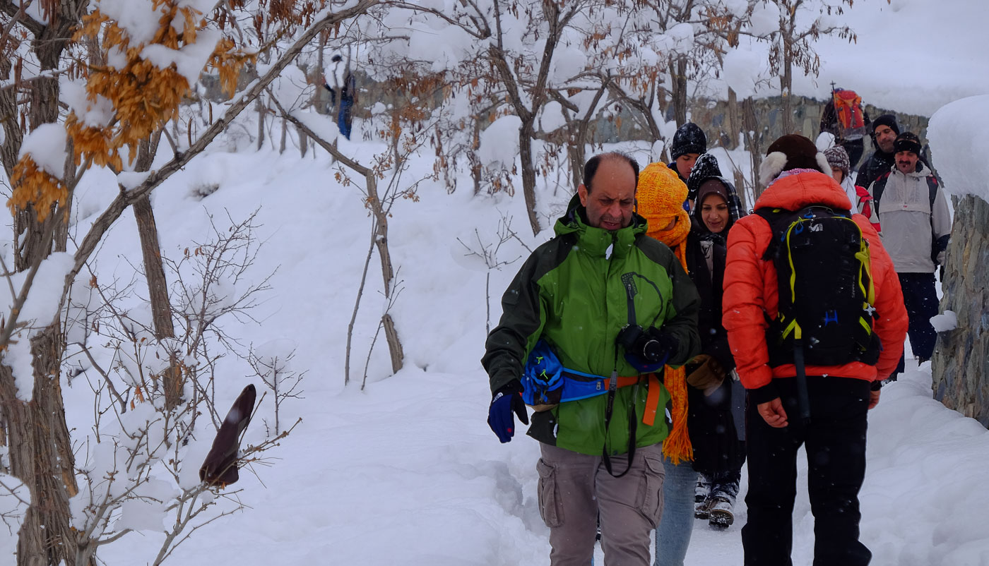
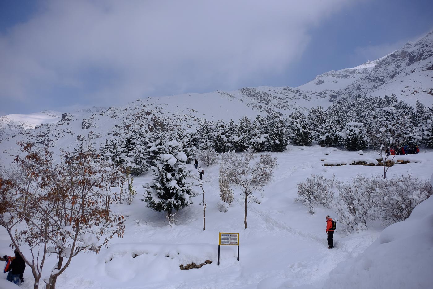
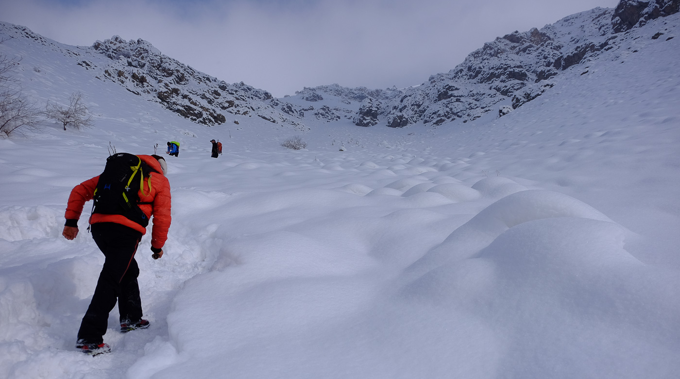
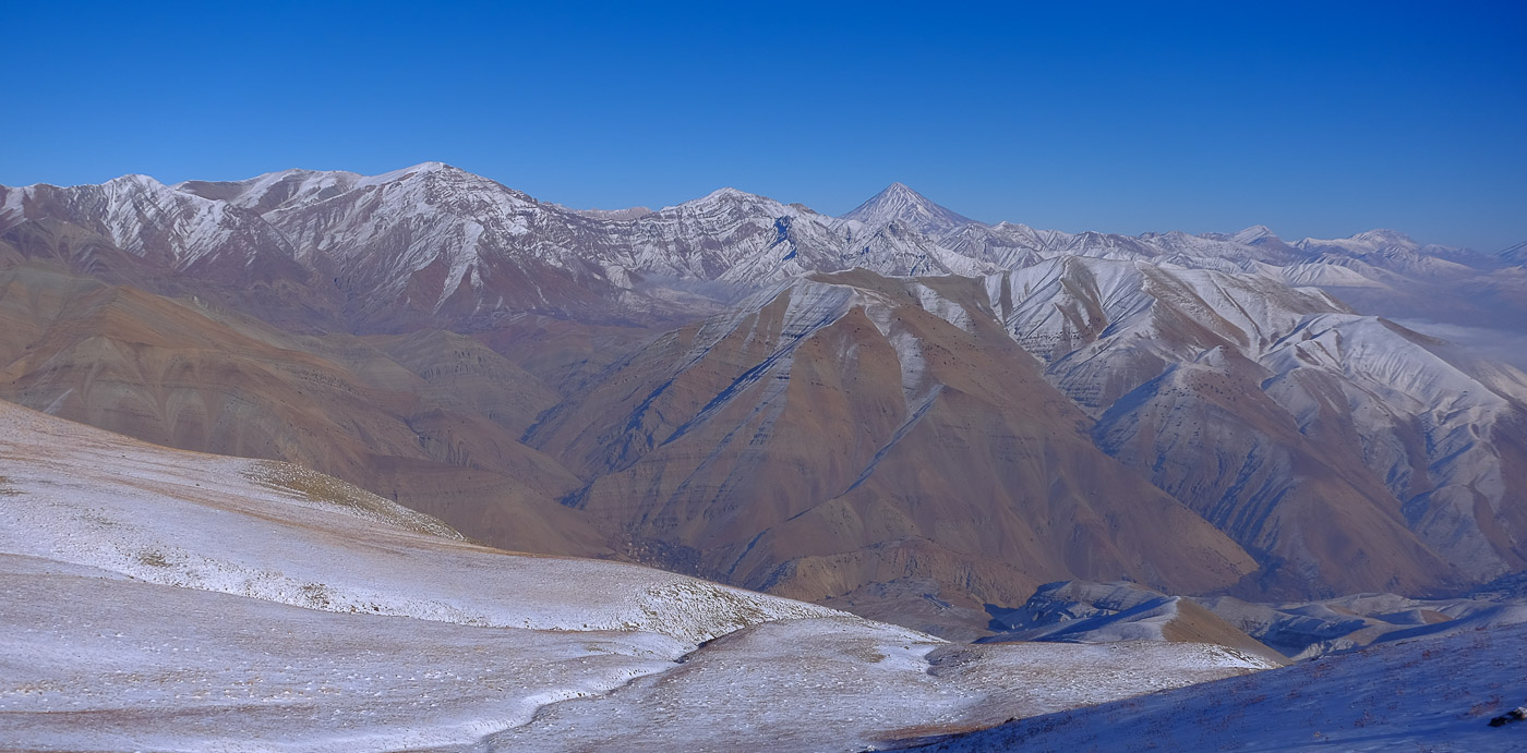
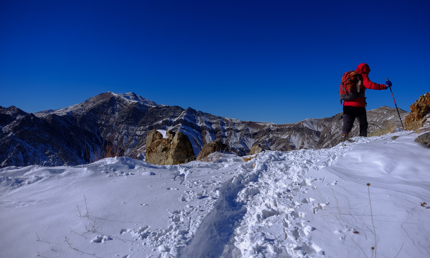
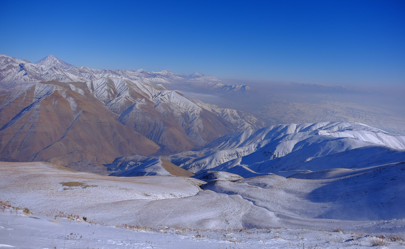
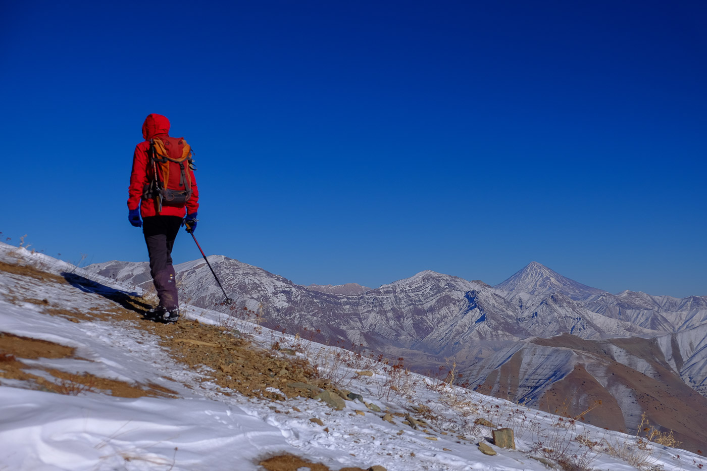
The Tochal massif overlooking the city of Teheran is completely covered in snow. A nice surprise today, with 20 to 30 cm of snow in the streets of the city, but it did complicate the day's program a little: the ascent of Darabad Peak, the easternmost ridge of the massif, at over 3000m. Fortunately, the trail had been opened up by a number of early-morning passages, and it was possible to reach the summit without too much difficulty, even without special equipment. The hike is an out-and-back over an altitude difference of around 1,400m, starting from Darabad, Tehran's northeastern district. The aerial views of the city gradually give way to those of the heart of the massif. The final section on the ridge is superb, with exceptional views of Tochal on the west side and the Damavan massif on the east.
❱❱ Technical summary
Type ✦ Hiking
Location ✦ Darabad, Mount Tochal
Region ✦ Tehran
Country ✦ Iran
Length ✦ 12,5kms
Elevation gain ✦ 1445m
Difficulty ✦ MD
Max altitude ✦ 3196m
Duration ✦ 5h to 6h
Interest ✦ ★★
❱❱ Access to the place
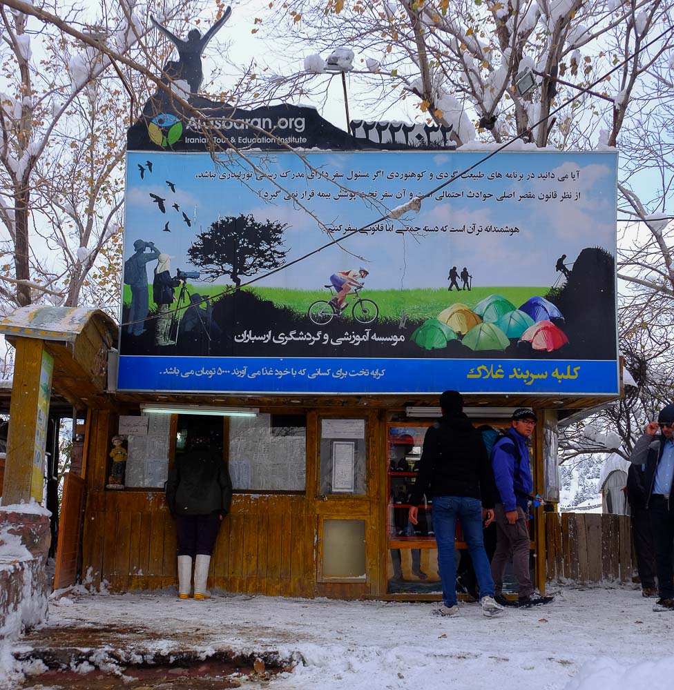
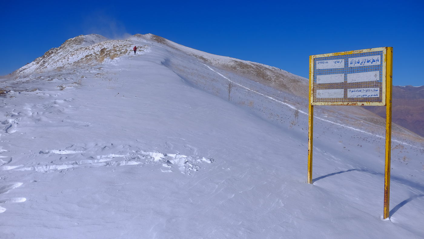
Take a cab to the north-east of Tehran, in the Darabad district. Walk up the streets until you find the main trailhead at the end of a cul de sac. After a few minutes' walk, you'll come to the actual start of the trek, with a large painted sign showing the paths to the peak and the loops to be made on the way back.
❱❱ Map & topo

❱❱ Itinéraire
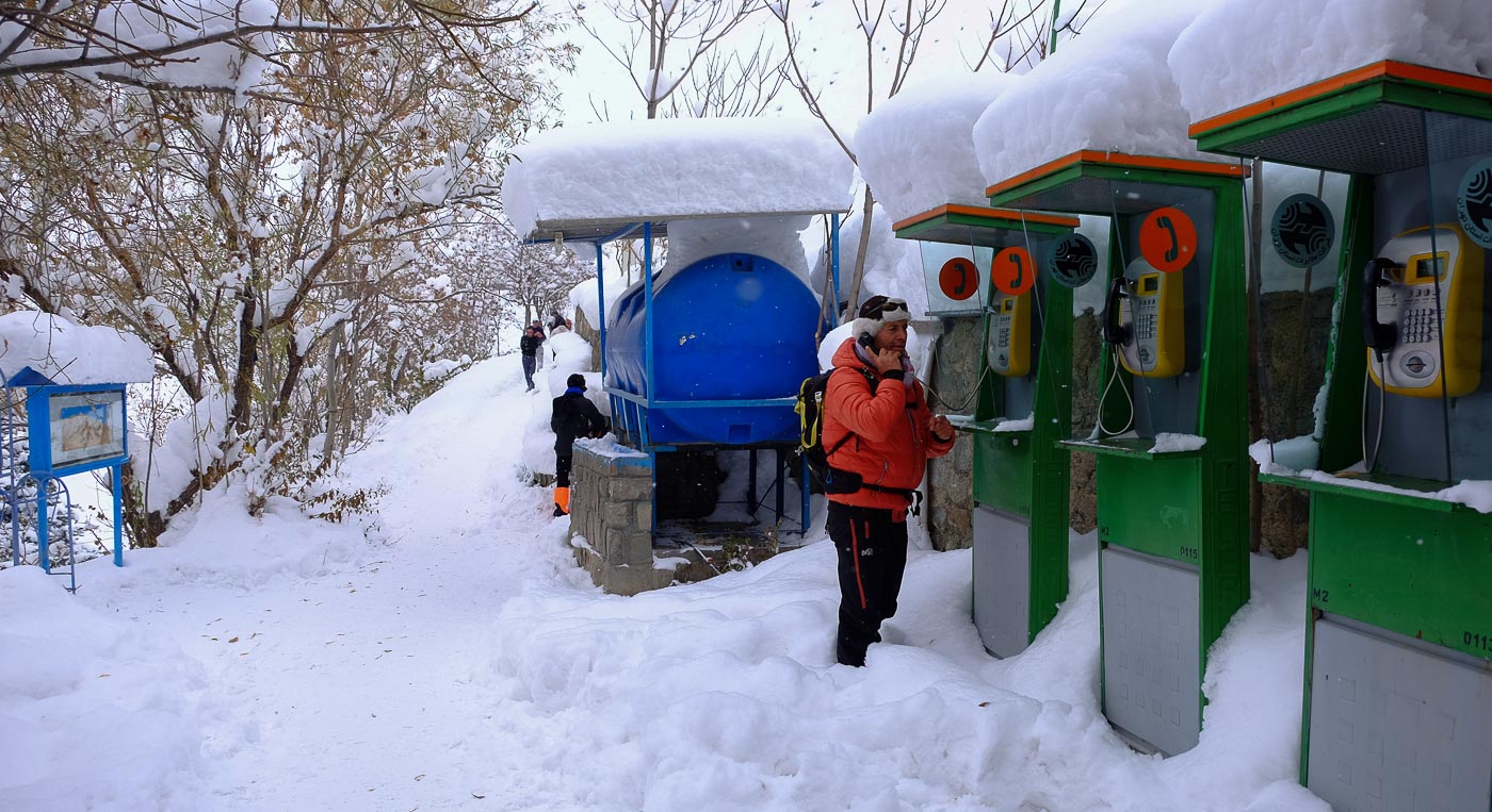
Follow the wide, landscaped path up the winding road to the last small tea kiosk. There are even telephone booths if you need them! Continue along the main path. There's a view of the valley and the peaks. After just a few minutes, at the large bend in the road, there's a fork to the right which you need to take to begin the ascent of Darabad Peak.
The trek is generally south-facing. There are no technical difficulties, although today's snow made some passages tricky. The route is obvious and easy to follow (thanks to the openers). The return journey takes the same route. The ascent can also be made via an even more easterly ridge from the bottom, to avoid the round trip, but impossible to find today with the snow (see trekking map).
Climb through the fir trees in small laces and exit above on a 1st ridge. Climb again, passing small rocky promontories. At 2160m, there's a signpost and you have to fork right, leaving the path that runs to the left towards the valley. Higher up, you come across a wide track coming from the east. Cross it and continue straight ahead.
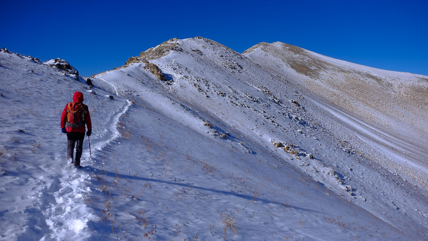
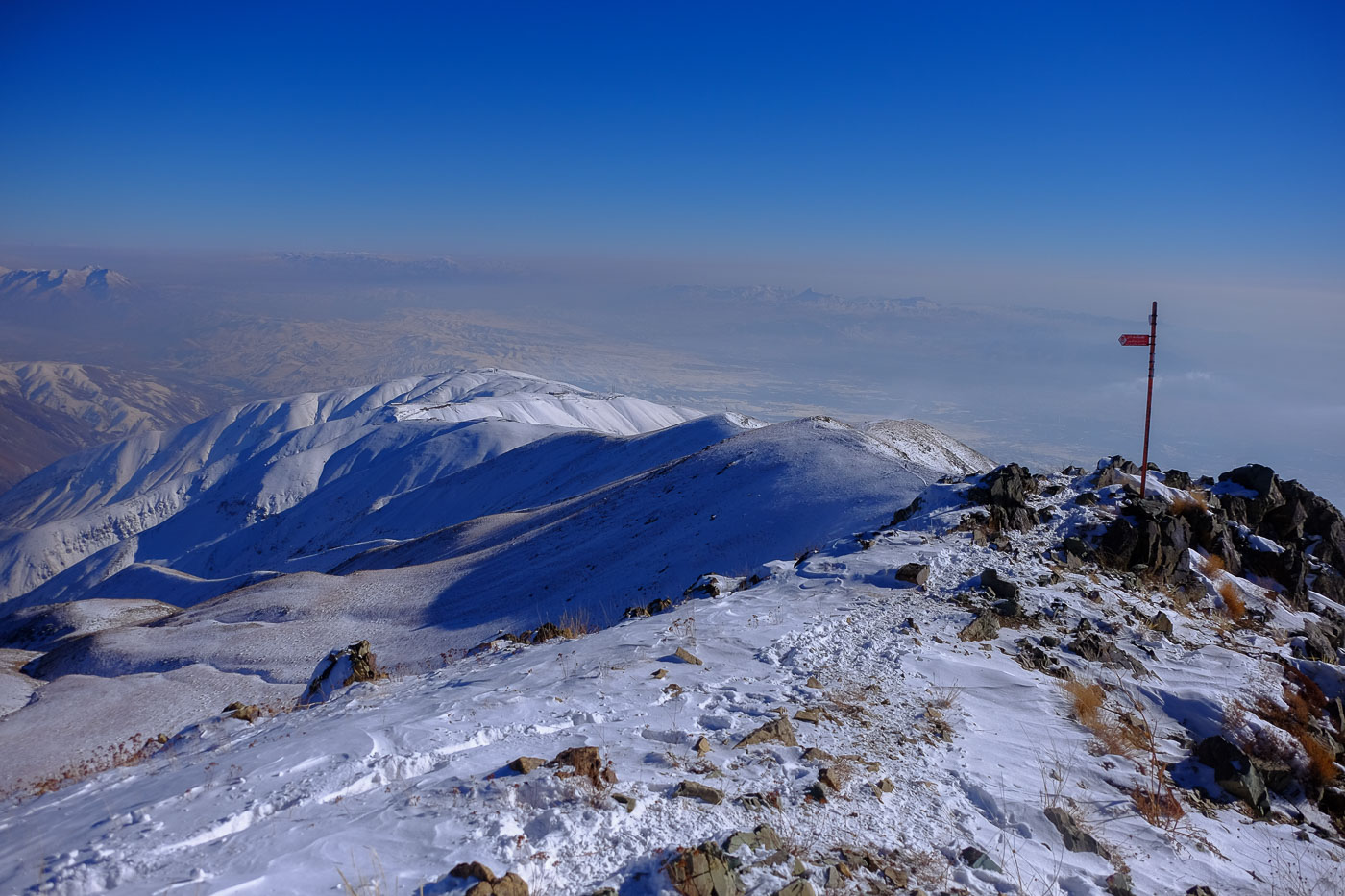
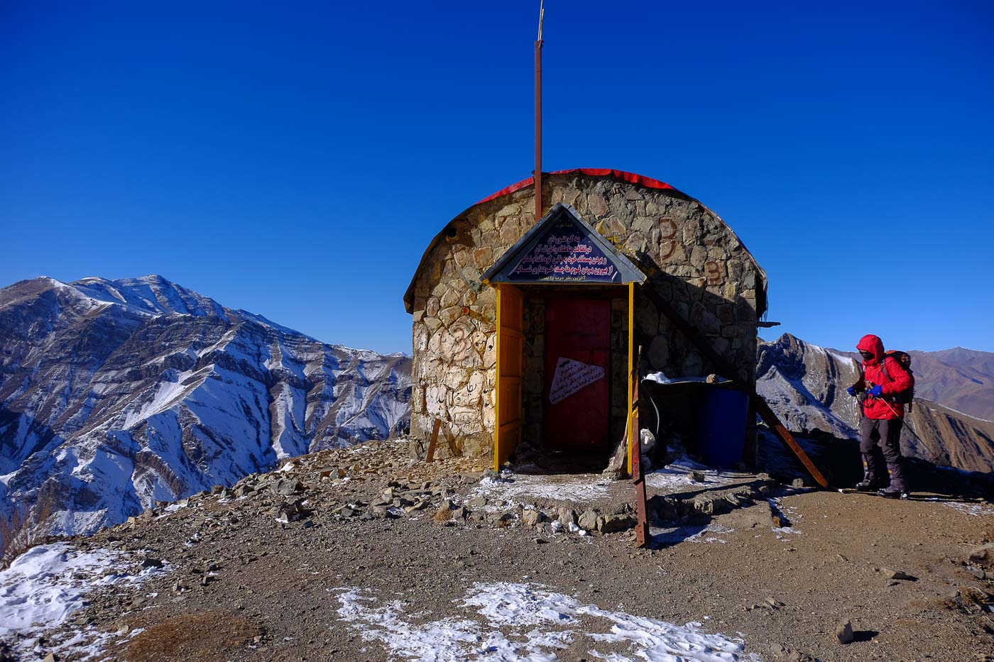
Keep climbing, staying more or less on the ridge. Finally, the trail heads further east, crossing an old rusty barbed-wire fence to reach the main ridge leading to the summit of Darabad Peak. On the right, you can see the trail coming up from below (the easternmost ridge option). Then follow the obvious path over the dome to reach a kind of refuge, which in fact used to be a military hut.
Continue above the refuge, passing a 1st small summit with an iron post and a new view of the valley and Damavan in the background. Follow the ridge down to the east. The summit comes into view. Climb again to pass a second summit, then continue along the ridge, which undulates a little, before climbing the final steps to the red-roofed summit hut. The 360° view is splendid.
From the summit, simply follow the trail in the opposite direction. Loops back inland are probably possible from below the refuge, but impossible or tricky on a snowy day like today.


Leave a Reply