


TOPO Hiking | CLIMBING7.COM
Publié le
 Partager sur WhatsApp
 Partager sur Twitter
Partager sur Instagram
Partager sur Twitter
Partager sur Instagram

 Partager sur Facebook
 Imprimer le topo
 Laisser un commentaire

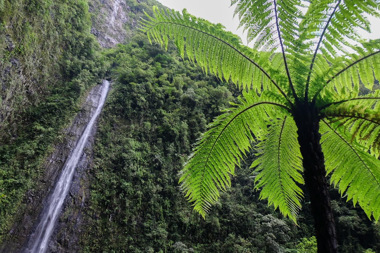
A lovely little hike in the wild, green heart of the eastern part of the island to admire the splendid ramparts forming an immense cirque from which gush and spill endless waterfalls over 200m high. The view over the large pond is not bad either. An ideal little trek for a return trip, family outing or half-day trip.
❱❱ Technical summary
Type ✦ Hiking
Location ✦ Grand Étang
Region ✦ Saint-Benoit
Country ✦ La Réunion
Length ✦ 8kms
Dénivelé ✦ 140m
Difficulty ✦ F
Duration ✦ 3h to 3h30
Interest ✦ ★
❱❱ Access to the place
From Saint-Benoit, take the N3 road towards Plaines des Palmistes. After a few kilometers and before a series of hairpin bends, turn right towards Grand Étang. Follow the minor roads and park at the final parking lot.
❱❱ Map & topo
❱❱ Itinéraire
The trail starts from the parking lot.
The trek is very accessible and the route obvious. The trail, vaguely marked in places, is easy to follow and you head towards the waterfalls on sight. A short climb on a rockier, wetter path leads to the waterfalls. Leave early to hope for good weather, as the area is very rainy and quickly becomes overcast during the day.
The path is wide at first, winding quietly into the forest with a few easy ascents/descents. After about 15′, there's a fork to the right to reach a 1st viewpoint over the lake. Retrace your steps and take the path towards the pond. After 35 to 40′ you reach the banks of the Grand étang with a magnificent view of the cirque reflected on the surface of the water.
Follow the path to the edge of the lake, skirting it to the right and finally reaching the other side, which gives access to the path to the waterfalls.
Fork right and leave the trail that continues around the lake. It climbs more and there are a few steeper, narrower passages further on. You then approach the gigantic waterfalls and, after a final short climb through the vegetation, access the pools, which are watered by impressive jets of water.
Either follow the path in the opposite direction or loop around to the other side of the big pond (blue line).


Leave a Reply