


TOPO Hiking | CLIMBING7.COM
Publié le
 Partager sur WhatsApp
 Partager sur Twitter
Partager sur Instagram
Partager sur Twitter
Partager sur Instagram

 Partager sur Facebook
 Imprimer le topo
 Laisser un commentaire
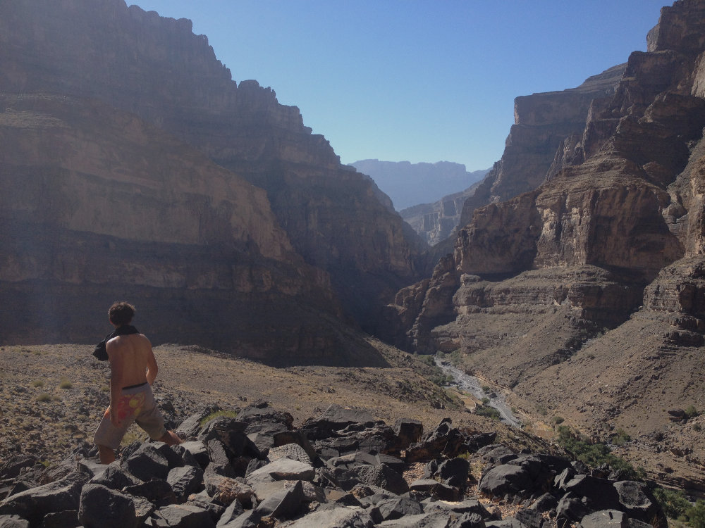
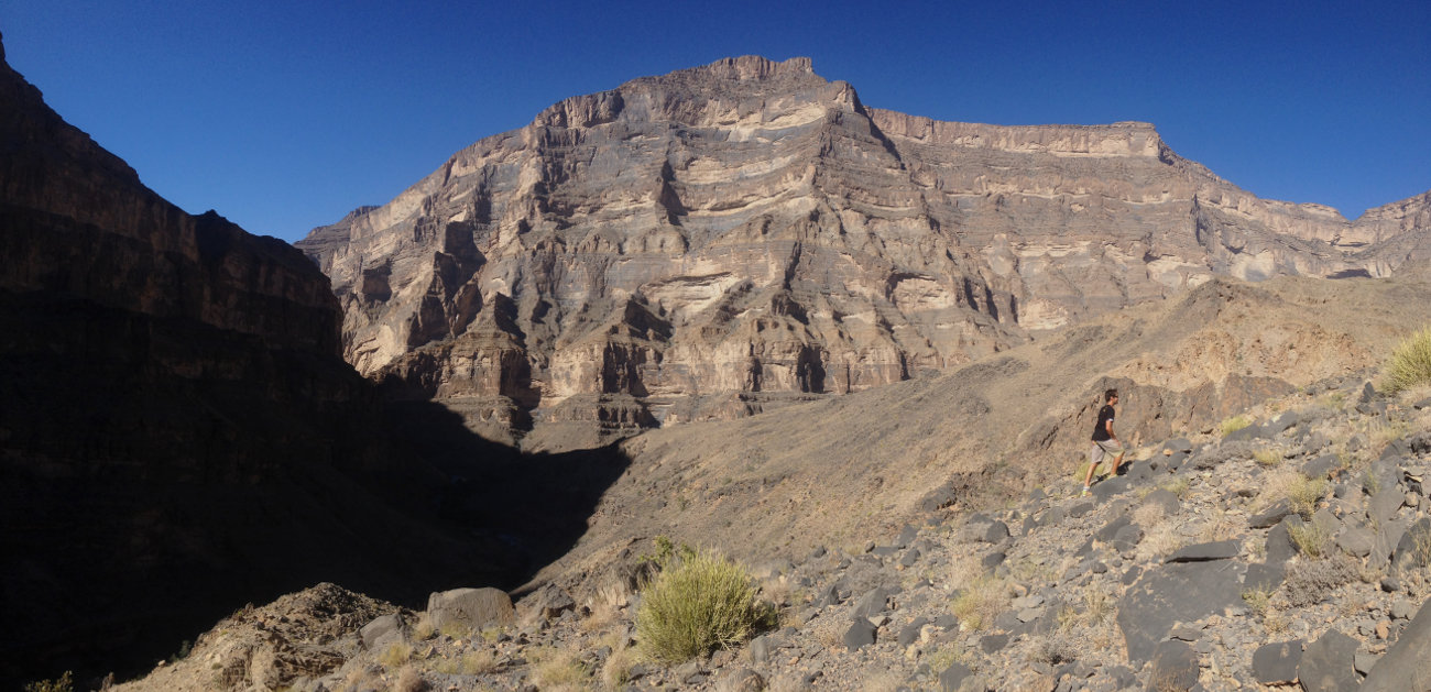
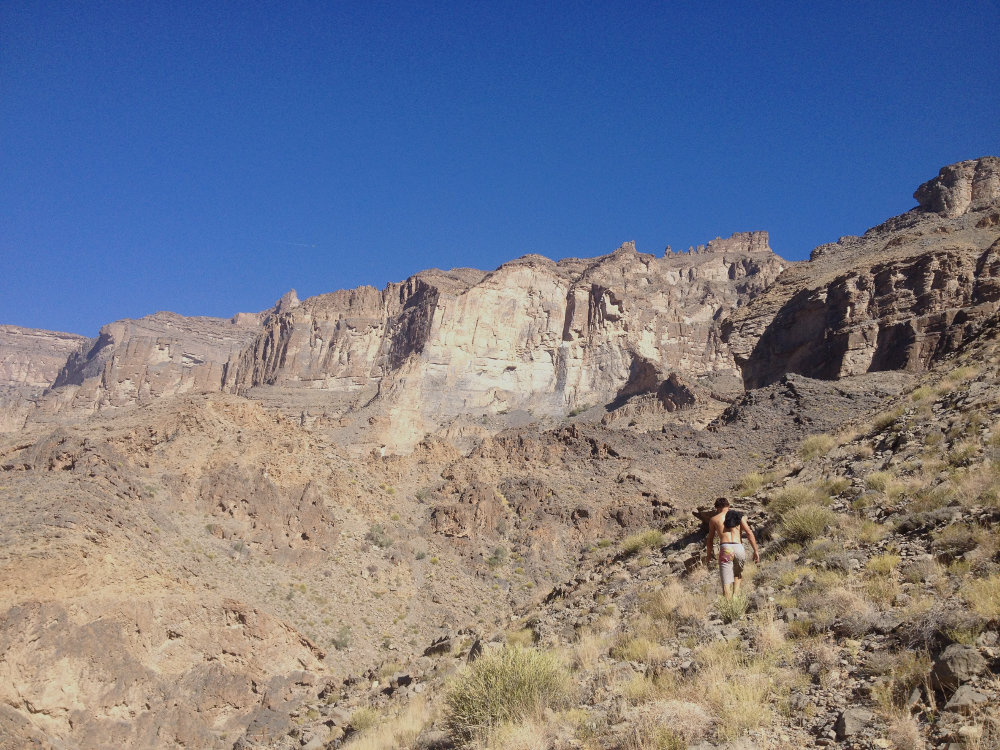
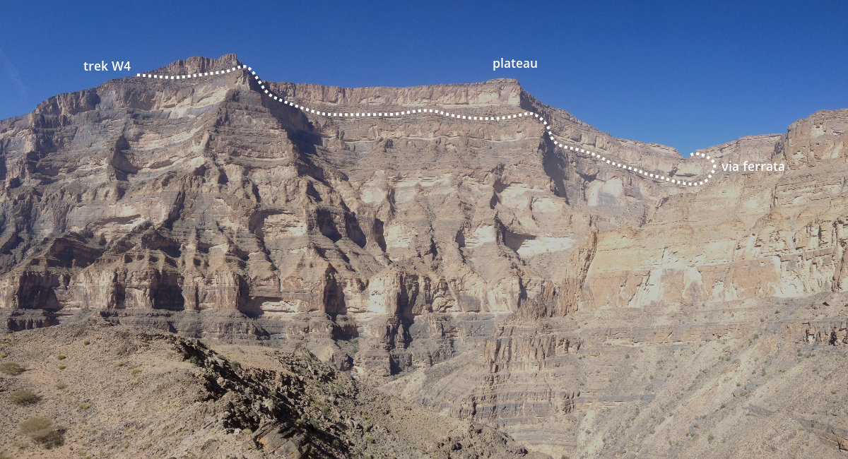
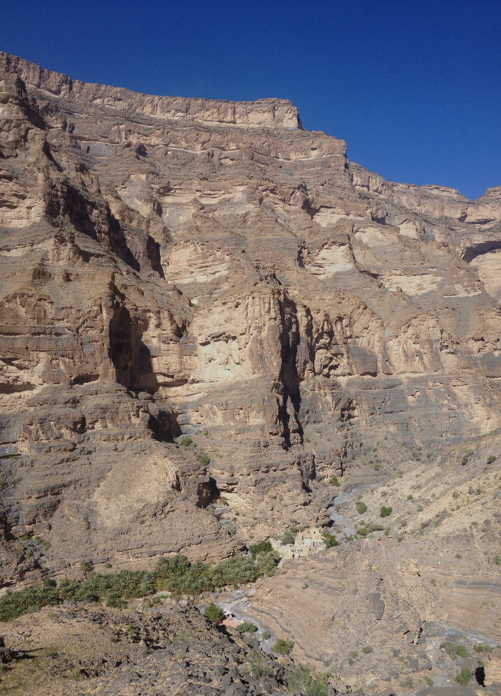
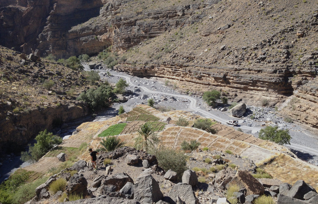
Fingers rest after a little more wear and tear on the splendid but aggressive rock of Al Hamra Tower. We then reach the village of Ghul at the entrance to the Grand Canyon, which unfurls, gigantic and sprawling, in the heart of the Shams jebel. 7 km of tracks in an impressive defile under 1000m of walls to reach the hamlet of Nakhur, set at the very bottom of this immense crater. A nice bivouac on the village terraces is the starting point for an impromptu trek. The walk is splendid and not very difficult, even if there are a few scrambling passages and exposed ledges. The route forms a loop that returns via the ridges to finally overlook the village of Nakhur. Impressive views, vertiginous scenery, perfect view of the approach to the via ferrata on Jebel Shams, a few hundred metres above. The topo below is indicative but gives an idea of the route, with of course other possible options to lengthen or shorten the walk.
❱❱ Technical summary
❱❱ Access to the place
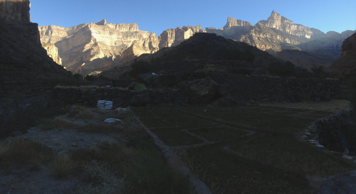
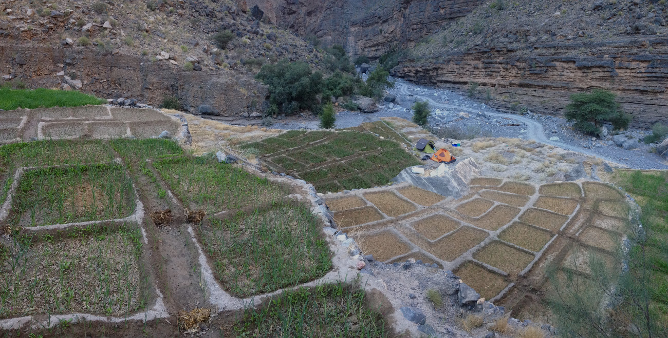
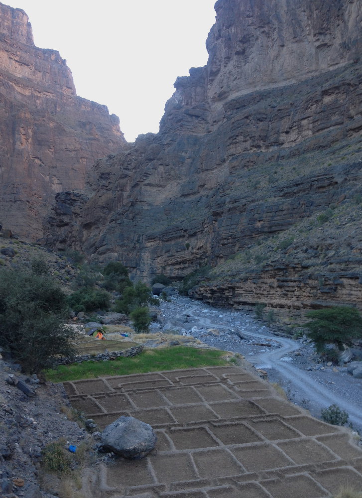
From Al Hamra, cross the town to the west and take the Wadi Ghul road to the grand canyon plateau. After a few kilometers, you reach the entrance to the grand canyon with the abandoned village of Ghul and its palm grove. Descend into the bed of the wadi and take the track that winds its way through the successive defiles (4×4 obligatory). After about 30′, just before reaching the last village, there are terraces on the right. The first is abandoned (the others are cultivated) and provides a 5-star bivouac. This is the starting point for the trek.
❱❱ Map & topo
☰S ee Google map of access to wadi Nakhur and indicative trek topo

❱❱ Itinéraire
The trek, which lasts around 2h30, can be divided into 3 parts:
Part 1
Climb up the secondary wadi bed to the right of the bivouac and terraces. After several bends, the wadi deepens with a large horizontal slab. Climb up on the left to follow a system of ledges at the edge of the canyon. We cross a small wadi on the left, continue along the ledges and a little further on, we can't go any further, so we have to climb to the left to reach a 1st ridge.
Part 2
Staying on the flank, cross to the north and finally turn east, following the contour of the mountain without losing altitude. This leads downhill to another secondary wadi. Cross it and climb back up, again aiming for the ridge (scrambling on sloping orange rock to avoid the scree). Continue along the flank to reach the next ridge, which offers a 1st view of the village of Nakhur.
Part 3
Descend the ridge towards the village and a large square cairn that can be seen in the distance. You're now almost right above the village. At the end, you return to the starting point along the gradually descending ridge. More terraces appear on the right. Follow to the end, staying as high as possible, then finish by descending above the starting terraces.


Leave a Reply