


TOPO Hiking | CLIMBING7.COM
Publié le
 Partager sur WhatsApp
 Partager sur Twitter
Partager sur Instagram
Partager sur Twitter
Partager sur Instagram

 Partager sur Facebook
 Imprimer le topo
 Laisser un commentaire

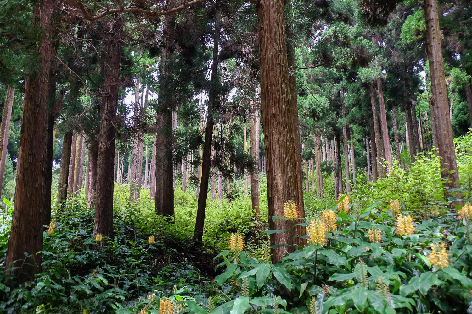
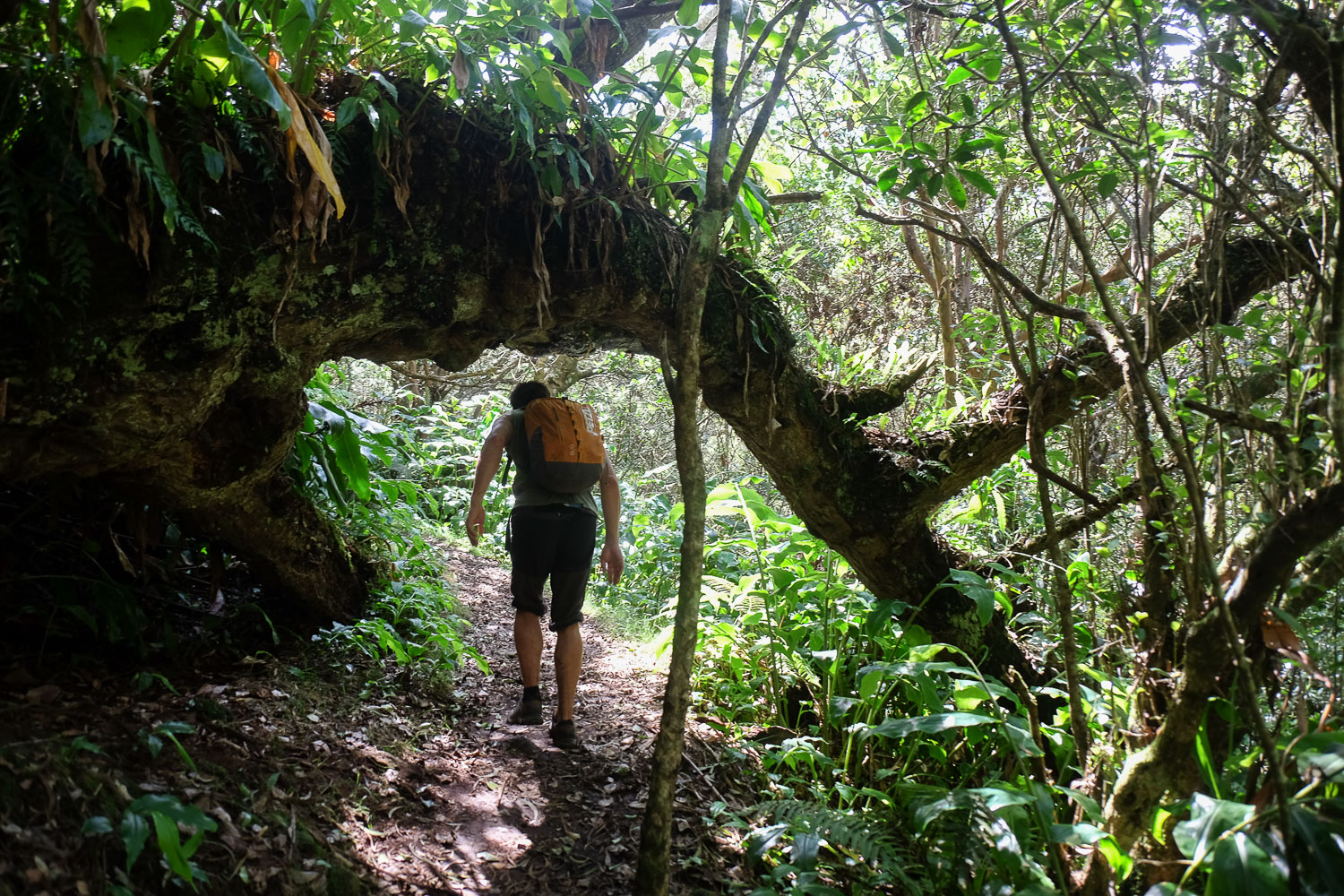
Below Le Maïdo, a forest road winds its way into the heart of the Sans-Soucis forest. From here, there are several possible routes to reach Îlet Alcide, a sort of promontory overlooking the Rivière des Galets at the entrance to Mafate, and above all Les Terrasses a little further on, with its aerial panorama over the heart of Mafate. Even if the weather wasn't to our liking, the crossing of the forest is quite extraordinary, with its tropical atmosphere and sumptuous Tamarind trees with twisted, flat-lying trunks, except for the Roi des Tamarins, which stands 19m and 400 years tall. A fine loop, which can be continued towards Maïdo via the ramparts in fine weather.
❱❱ Technical summary
Type ✦ Hiking
Location ✦ Maïdo
Region ✦ Saint-Paul
Country ✦ La Réunion
Length ✦ 8kms
Dénivelé ✦ 540m
Difficulty ✦ MD
Duration ✦ 2h30 to 3h
Interest ✦ ★
❱❱ Access to the place
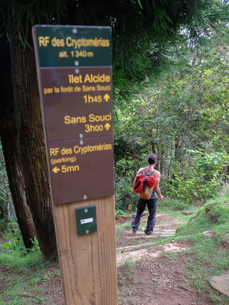
From Saint-Paul, climb towards Bellemène, then follow Le Guillaume and climb towards Le Maïdo. Before reaching it, turn left towards the Sans Soucis forest. Follow the route des Cryptomérias for 5 km and park in the final parking lot (cul de sac).
❱❱ Map & topo
❱❱ Itinéraire
From the parking lot, take the only stabilized path in line with the road. Turn right a little and you'll soon reach a small area with a table, the starting point for the trek.
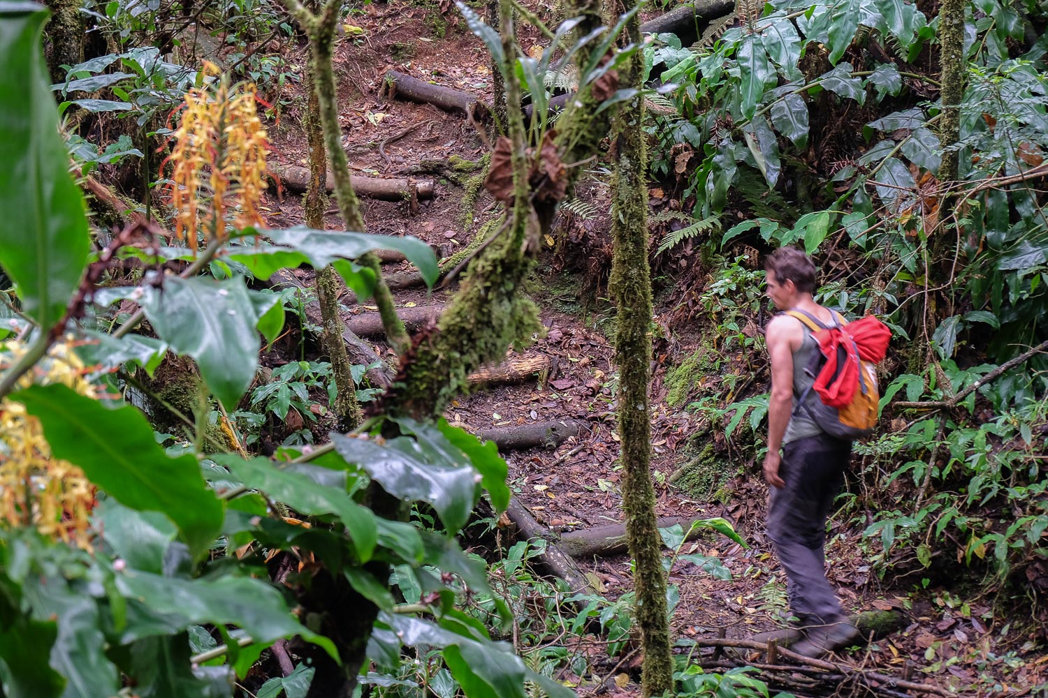
The loop was chosen to avoid a round trip. No serious difficulty other than orientation in the transition between the1st and2nd sections. Not much of an elevation gain, and the forest trail is narrow in places, but well marked.
Turn left down the wooden steps from the starting point and follow the well-marked but unmarked path through the forest. It goes up and down, past small gullies and in places is narrow. After about 45′, mostly downhill, you come to a fork where the path to Îlet Alcide is signposted on the right, a possible route to avoid the tricky transition below. Otherwise, continue downhill. Further on, the road opens up a little and there are a few tin shacks with a few crops. At this point, fork right and then left to cross a lost wasteland, where the path is almost invisible in places. After 10′, you come out on a wider, better-marked path, the one leading to the islet on the right.
Follow this path as it rises steadily. We can make out the Rivières des Galets below and probably the relief on the opposite side, but invisible to us because of the low clouds. We pass the junction with the shortcut mentioned above. Keep going uphill until you find the sign on the left for Ilet Alcide. We're still in the forest and lush vegetation, and finally come to a small clearing with a table and 2 or 3 small ponds. This is Îlet Alcide. To enjoy the view over Mafate, continue following the signposts. At Les Terrasses, at 1510m, you can glimpse the heart of the cirque without actually reaching the edge of the rampart.
This route back to the starting point is very well signposted all the way and always passes through the same forest. Small climbs, small descents and torrent crossings with no real difficulty. We pass the foot of the Roi des Tamarins, which sits at the heart of the forest at 19m and is 400 years old. We finally get back to the starting area.
Simply drive in the opposite direction back to the parking lot.


Leave a Reply