

TOPO Hiking | CLIMBING7.COM
Publié le

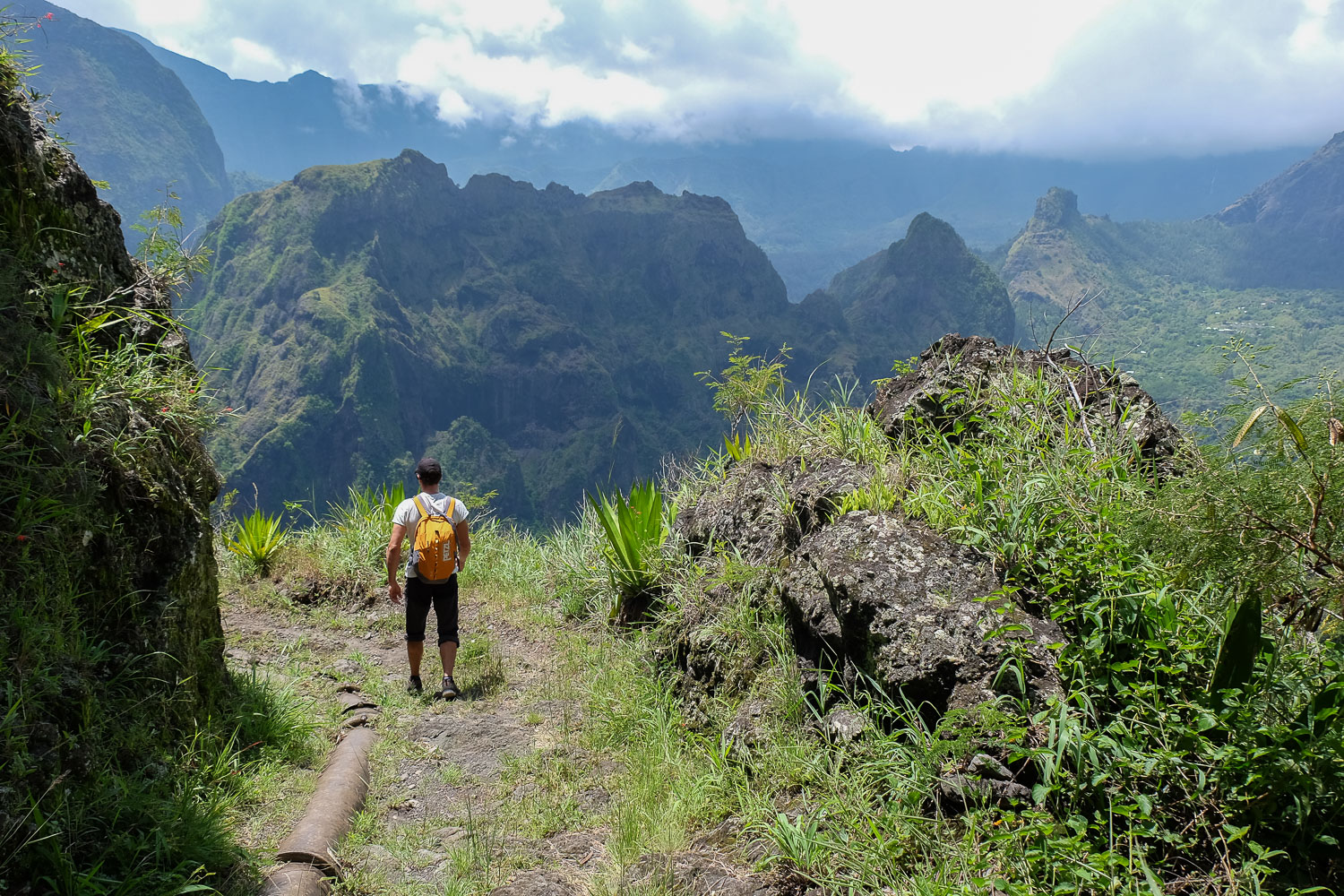
Extraordinary hike along the Orangers canalisation in the heart of the Mafate cirque! Starting from the top of the rampart at Le Maïdo, you begin with a vertiginous descent of over 1,000m, with impressive views. Once you've passed the village of Îlet des Orangers, you reach the Orangers channel a little further down, a long, very long passage that crosses the western ramparts of Mafate several hundred metres up the Rivière des Galets. 3 days after the passage of cyclone Dumazile, the vegetation is luxuriant and waterfalls tumble down huge walls everywhere. A continuous spectacle guaranteed, with magnificent views over the heart of the cirque. A highly recommended trek, demanding in terms of mileage but not to be missed.
❱❱ Technical summary
Type ✦ Hiking
Location ✦ Saint-Paul, Maïdo
Region ✦ Cirque de Mafate
Country ✦ La Réunion
Length ✦ 22kms
Elevation gain ✦ 1800m
Difficulty ✦ D
Max altitude ✦ 2030m
Duration ✦ 6h30 to 7h
Interest ✦ ★★★
❱❱ Access to the place
Set down a 1st vehicle at Sans-Soucis, on arrival, at a red cistern. Then drive to Le Maïdo, above Saint-Paul. Shortly before reaching the final parking lot at Le Maïdo, park at the signposted departure point for the trails to the cirque de Mafate.
❱❱ Map & topo
❱❱ Itinéraire
Head straight up along a path vaguely marked with white arrows on the rock. You soon reach the rampart. From here, the descent to Ilet aux Orangers begins.
The trek is over 20kms long and generally downhill. The difficulty lies mainly in the distance, the difference in altitude and, for those who are sensitive to it, the vertiginous dimension of the ridge, at times exposed to the void. The route could be done in the opposite direction, with a greater physical effort on the ascent to Maïdo.
The path literally winds down the wall in steep switchbacks. The slope is steady and the rocky ground makes for fairly comfortable walking. Large switchbacks then a southward traverse to press under the Maïdo before plunging back down to the bottom of Mafate. After 40′, there's a lovely view of the cirque on the south side. Further down, a flat area and then La Brèche (1295m), junction with the GR leading to Roche Plate.
We turn left on the north side and descend on a very rocky path with steps. We're on the GR. It twists and turns downhill until we finally cross a sort of canyon and climb up to the village of Ilet aux Orangers, with a few tin shacks between the walls.
Cross over the village and follow the sign for the pipeline. Just after the village, follow downwards (although there is also a path to the left). This leads into a narrow, winding canyon, now with a lot of water! At the end of the narrow canyon, the canalisation path begins.
It couldn't be easier to follow this route, which follows all the contours of the wall, remaining almost level all the way to the end. Fairly wide, the route becomes narrower in places, with 1.50m to 2m leading directly into several hundred meters of open space. The views over the Rivière des Galets and the relief of the cirque de Mafate are breathtaking: Piton Tortue, Piton Carré, Piton Cabris and the splendid waterfalls that rise from the top of the ramparts to the bed of the Rivière des Galets. It's long, very long. On the ground, you can see in places the large pipe that corresponds to the pipeline in question. The vire follows the Rivière des Galets and gradually leaves the cirque de Mafate.
Once you've left the vein, simply wind your way down the wide, winding path. 2 or 3 paths cut through the last bends before you reach the road again at the red cistern.
Leave a Reply