


TOPO Barranquismo | CLIMBING7.COM
Publié le
 Partager sur WhatsApp
 Partager sur Twitter
Partager sur Instagram
Partager sur Twitter
Partager sur Instagram

 Partager sur Facebook
 Imprimer le topo
 Laisser un commentaire

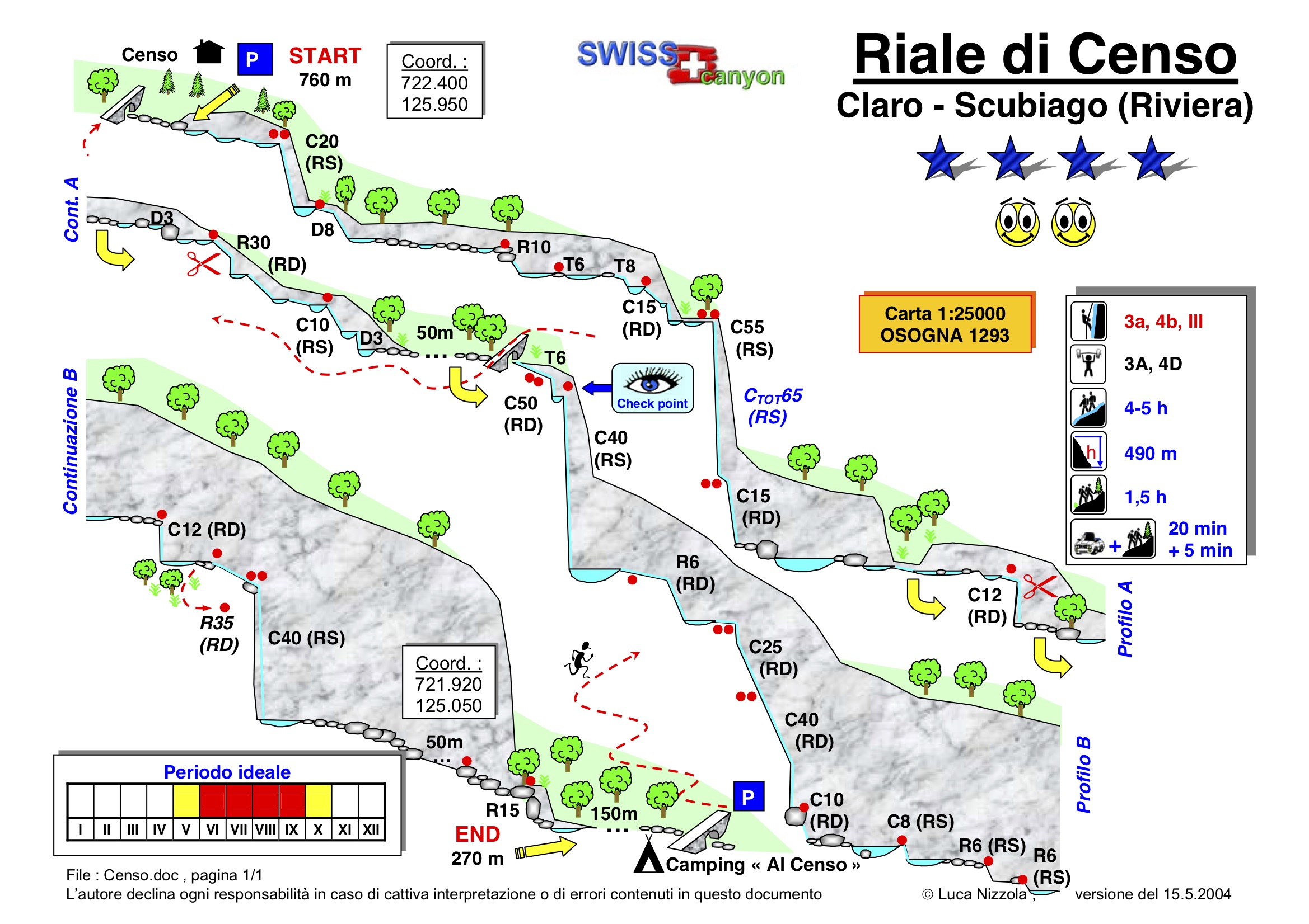
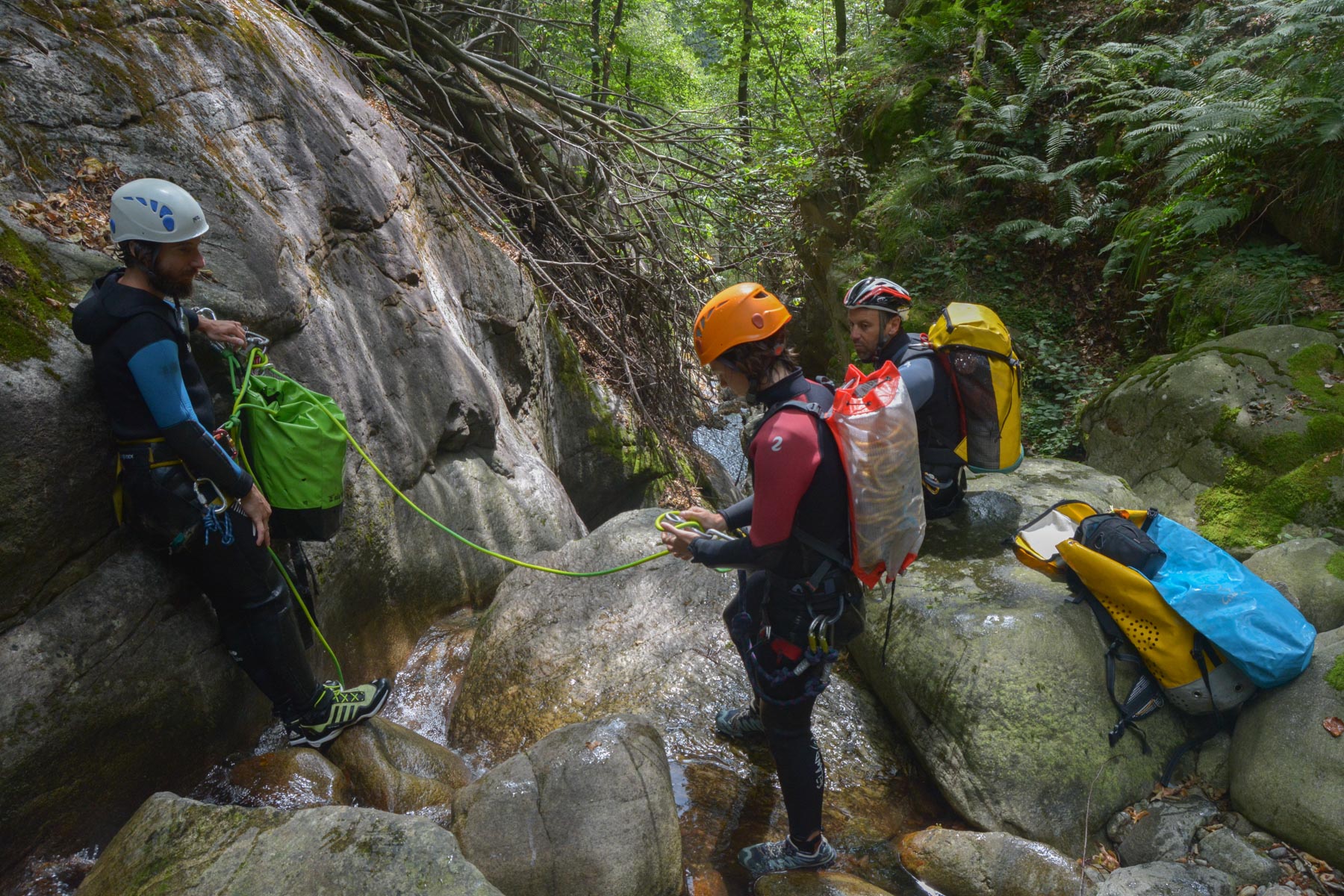
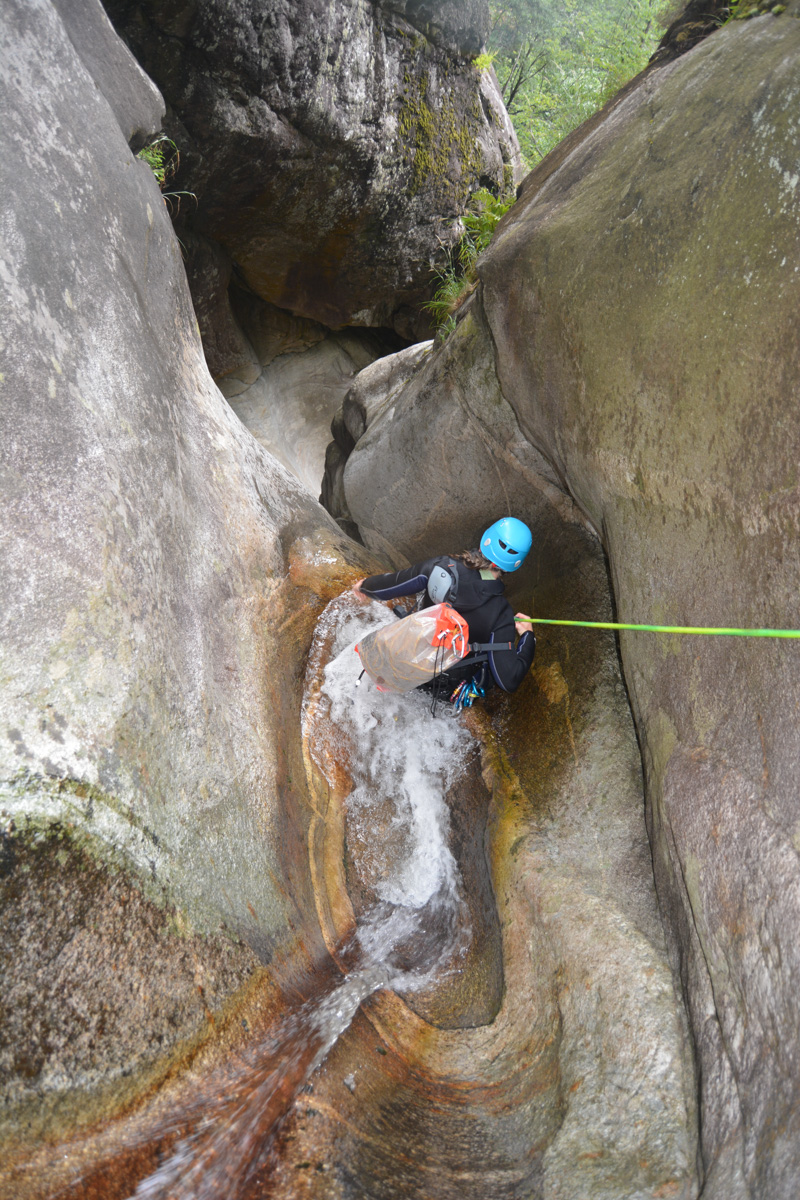
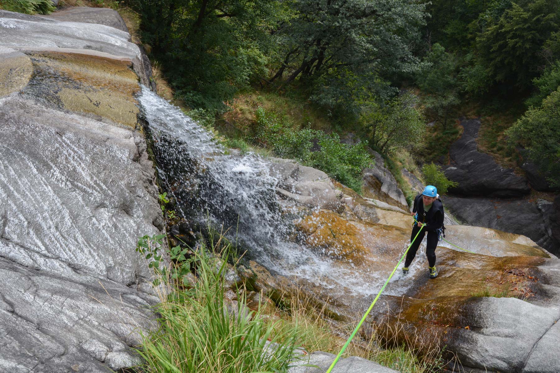
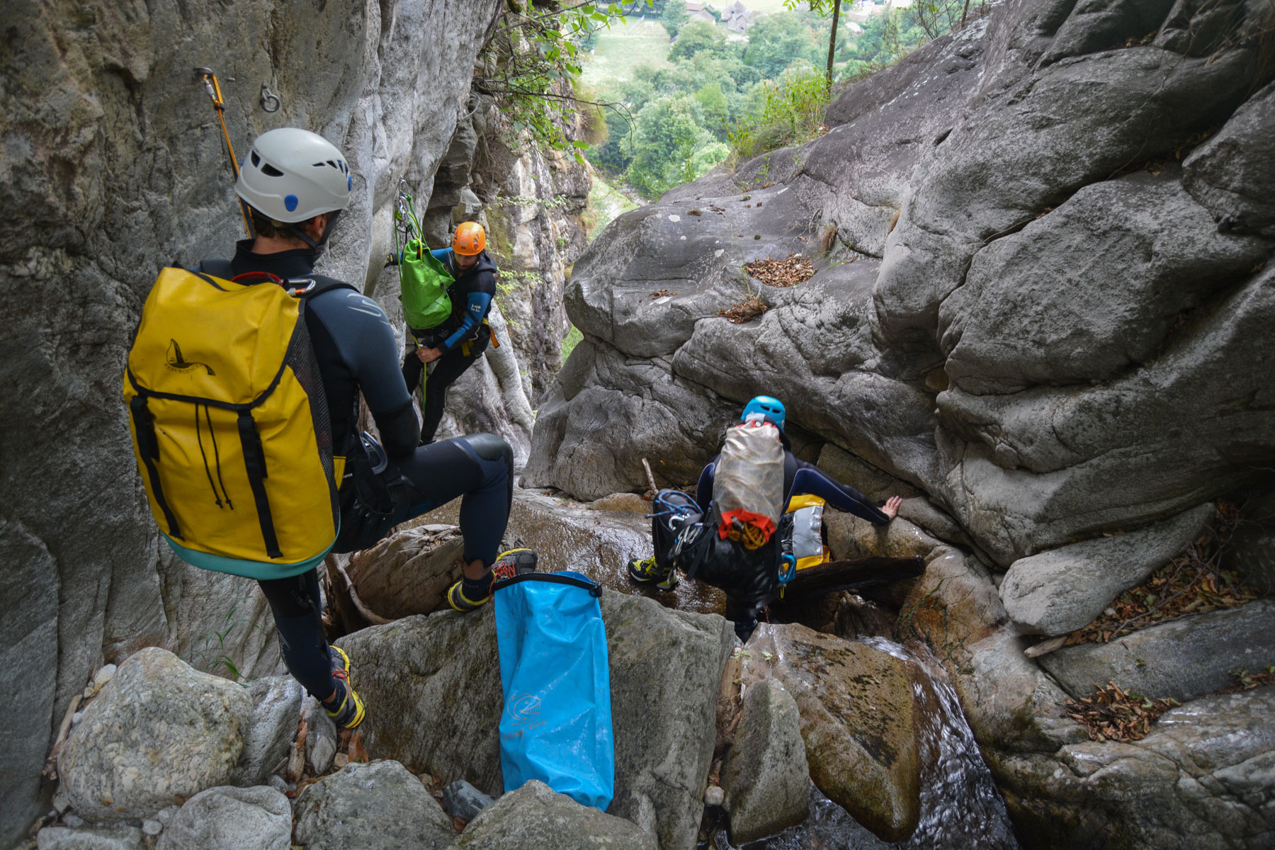
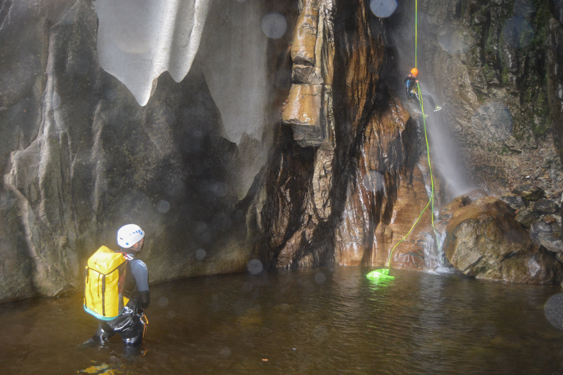
1ª salida en el Tesino, el Eldorado del barranquismo en el sur de Suiza. El Riale di Censo es uno de los clásicos locales. Largo y variado, con una primera parte en el bosque y una segunda más abierta al valle, el descenso es agradable pero a fin de cuentas bastante físico. La sucesión de cascadas y obstáculos es casi ininterrumpida, con una bonita verticalidad sobre todo en la parte central, justo después del puente de mitad de recorrido. Algunos toboganes y rápeles en la parte activa también forman parte del programa.
❱❱ Reseñas técnicas
Tipo ✦ Cañón de agua
Localidad ✦ Claro
Región ✦ Tesino
País ✦ Suiza
Longitud ✦ 1100m
Desnivel ✦ 460m
Dificultad ✦ v5-a4-III
Máximo descenso en rápel ✦ 55m
Duración ✦ 5h a 6h
Interés ✦ ★★★
❱❱ Acceso al sitio
Después de Locarno y Bellinzona, cerca del pueblo de Claro, justo encima del camping Al Censo. Aparque justo fuera del camping, en el puente que marca la salida del cañón.
❱❱ Mapa & topo
❱❱ Itinéraire
Desde el puente, tomar la carretera serpenteante hacia arriba y, una vez en el pueblo, tomar la pista forestal que sube gradualmente, señalizada con puntos naranjas y balizas suizas blancas y rojas. Tras unos 30′ se pasa por un puente que cruza el lecho del cañón. Sube otros 30′ aproximadamente para bifurcarte en un camino marcado con una flecha y 2 ondas azules que indica el inicio del cañón 5′ más adelante.
El cañón desciende de este a oeste en una distancia total de más de 1 km con un desnivel de 460 m. El equipamiento existente es satisfactorio, con rápeles en su mayoría en 2 puntos.
Inmediato, al salir del puente y entrar en el aparcamiento.


Deja una respuesta