


TOPO Barranquismo | CLIMBING7.COM
Publié le
 Partager sur WhatsApp
 Partager sur Twitter
Partager sur Instagram
Partager sur Twitter
Partager sur Instagram

 Partager sur Facebook
 Imprimer le topo
 Laisser un commentaire

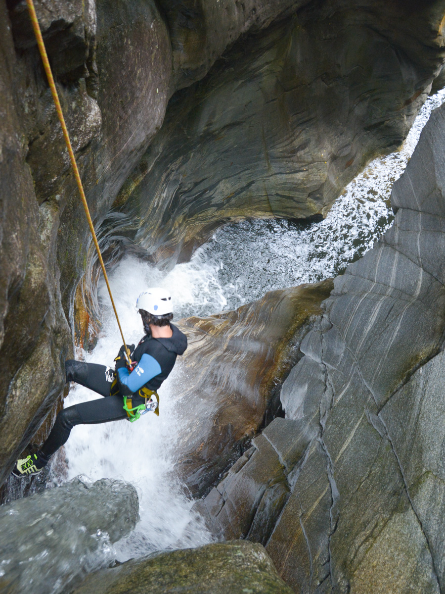
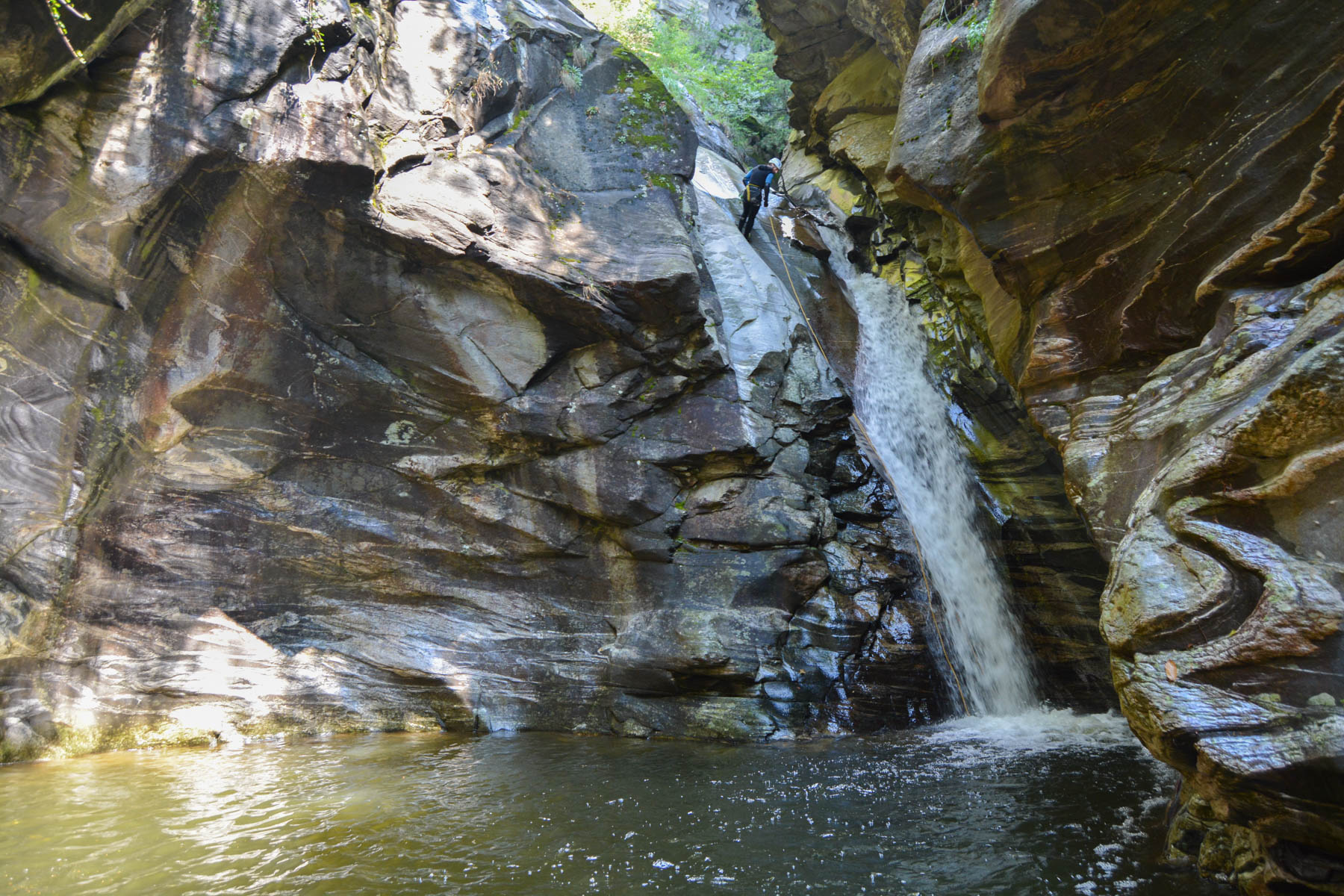
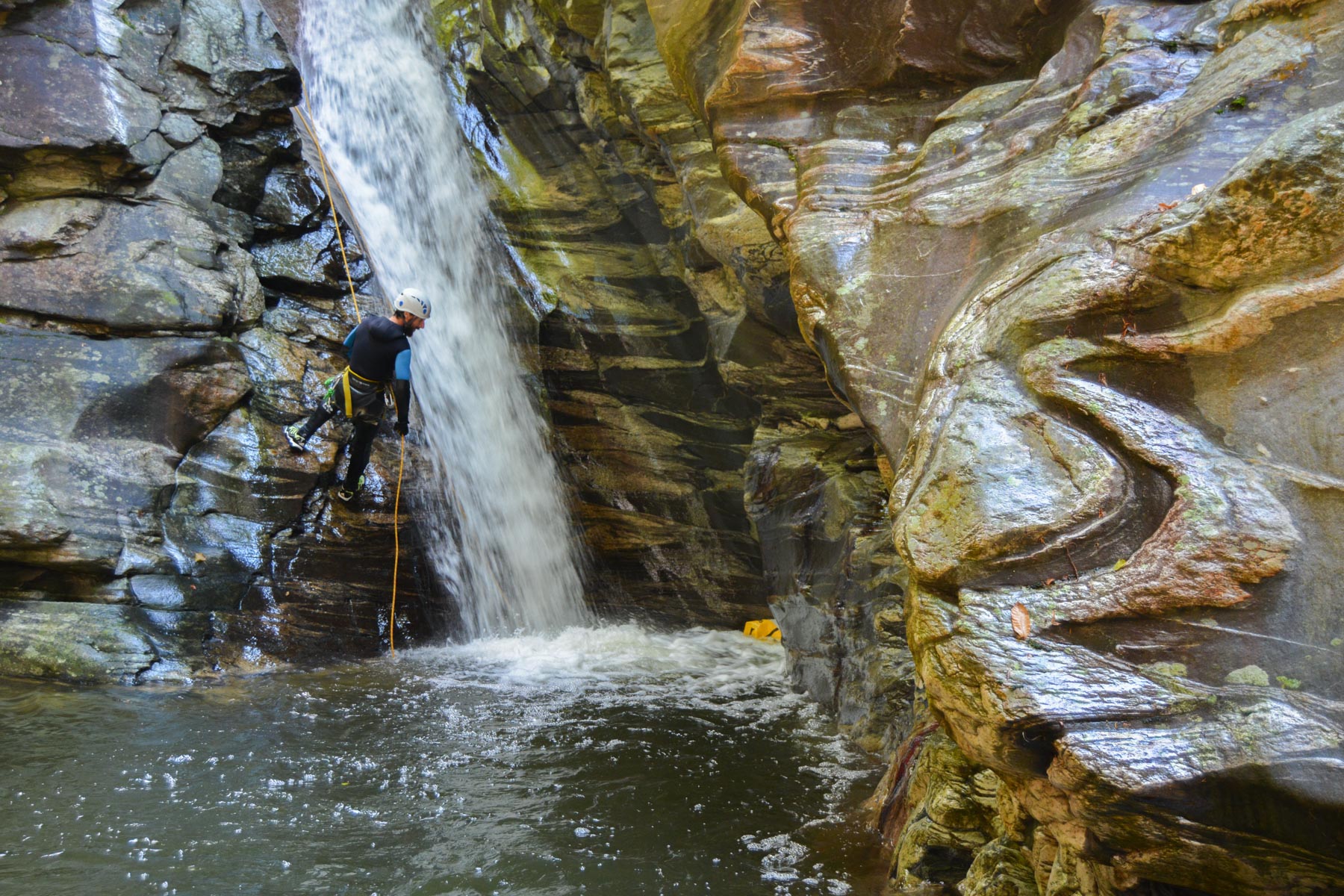
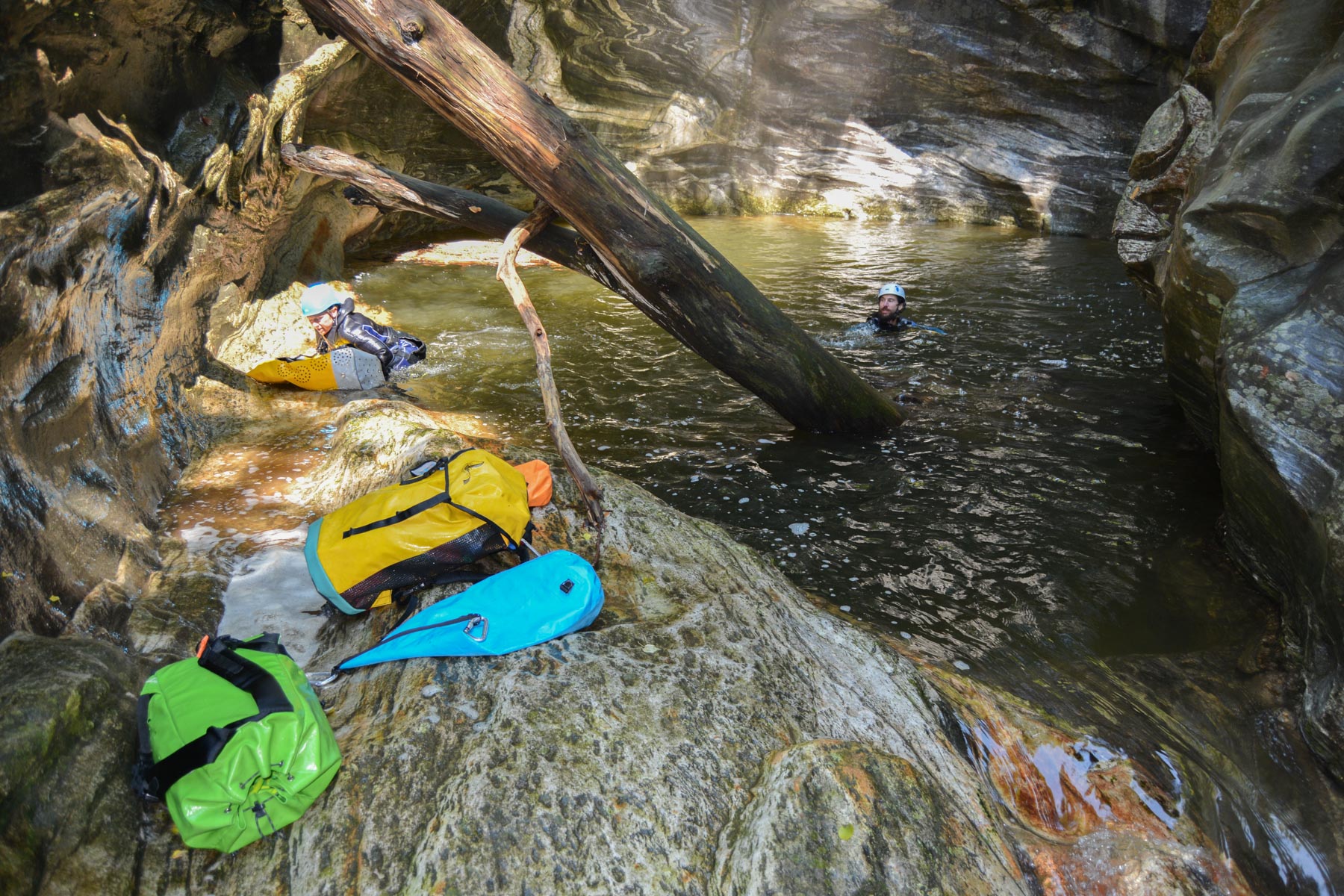
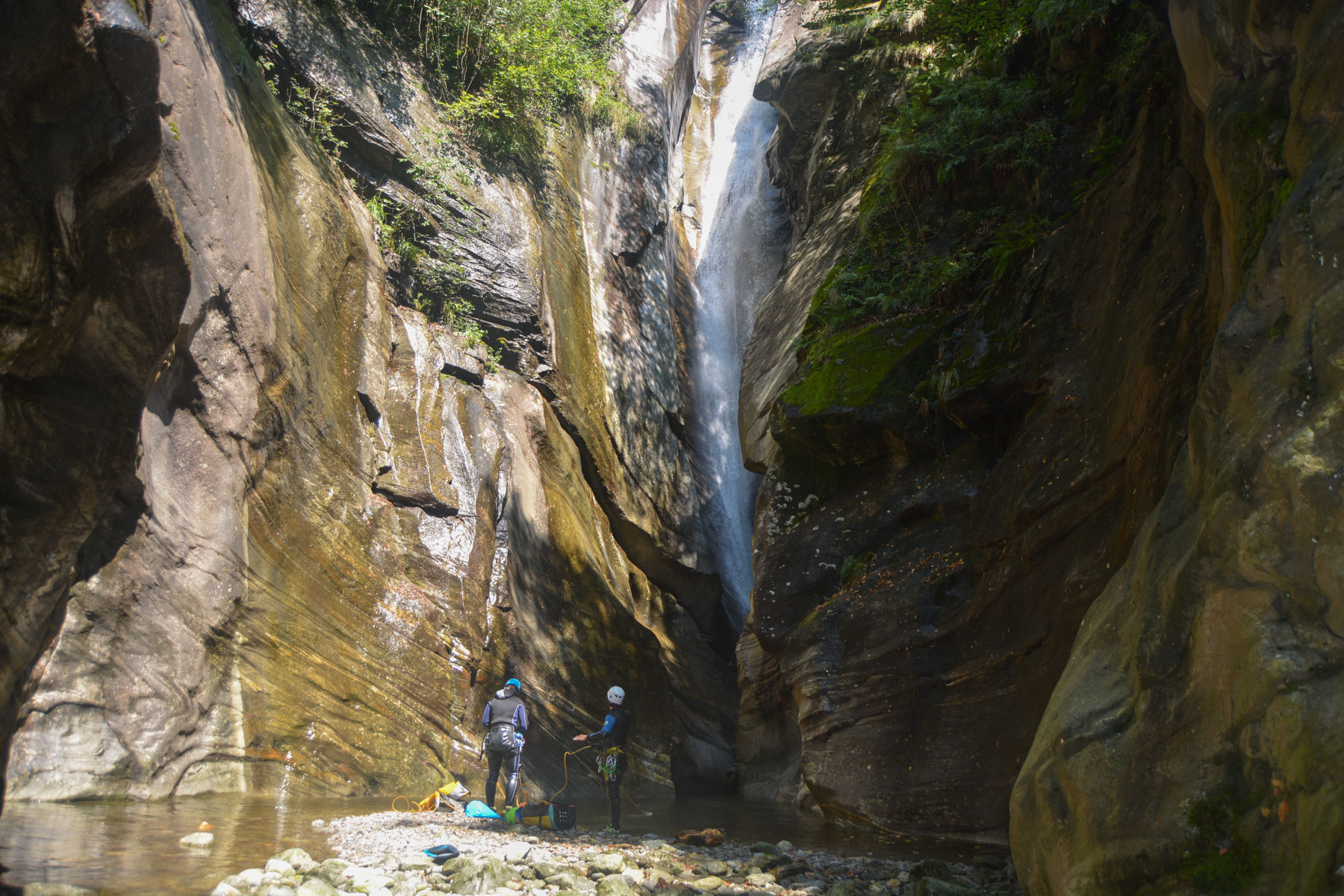
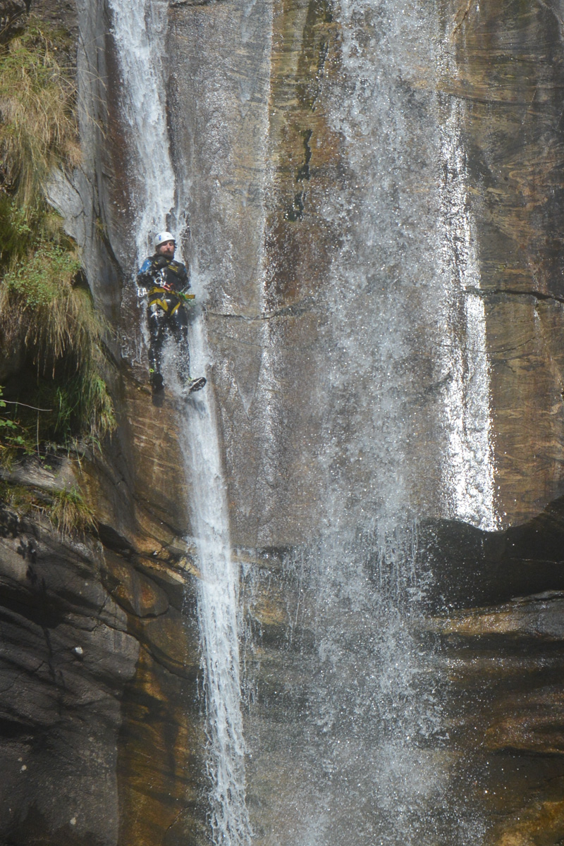
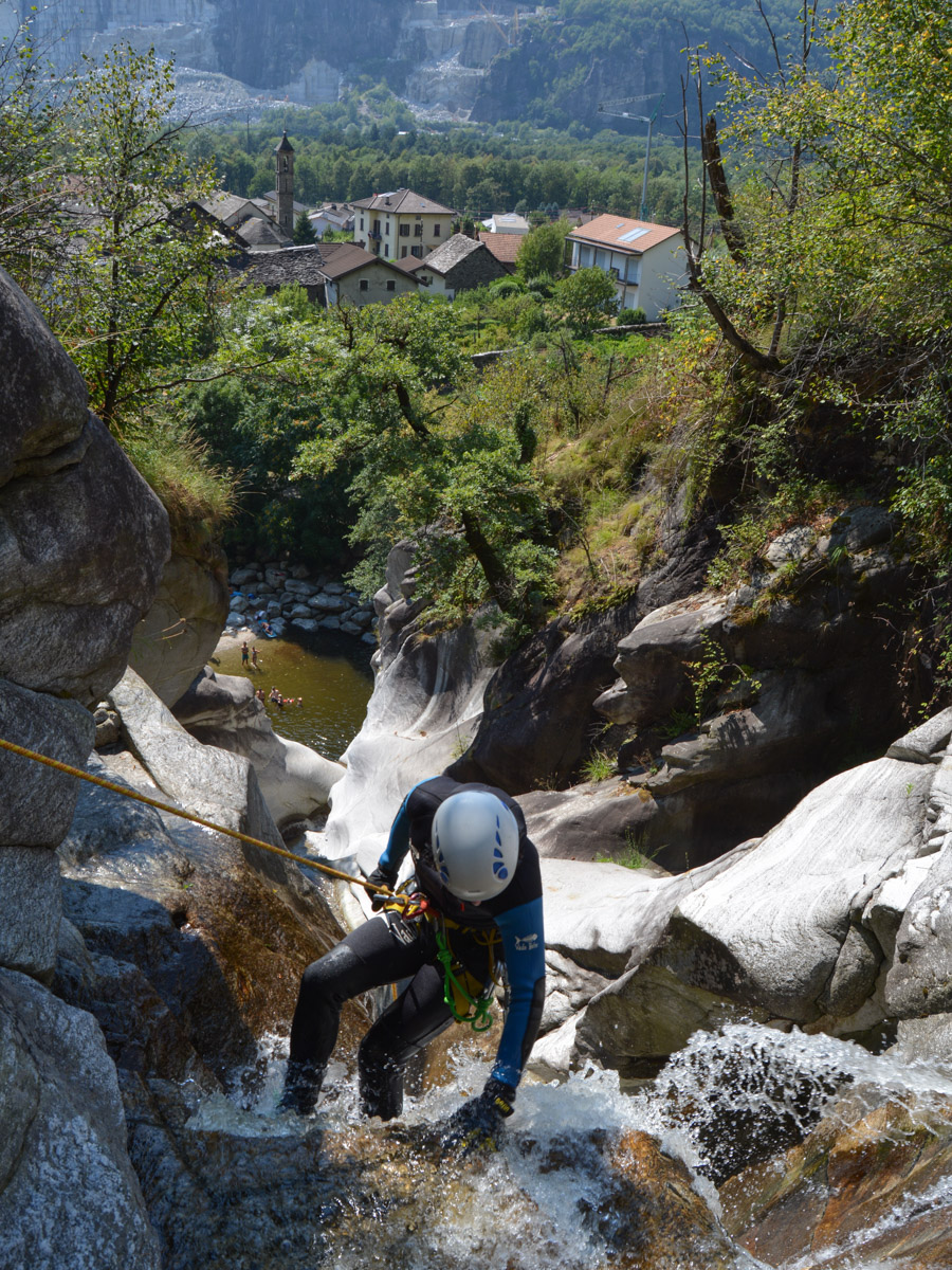
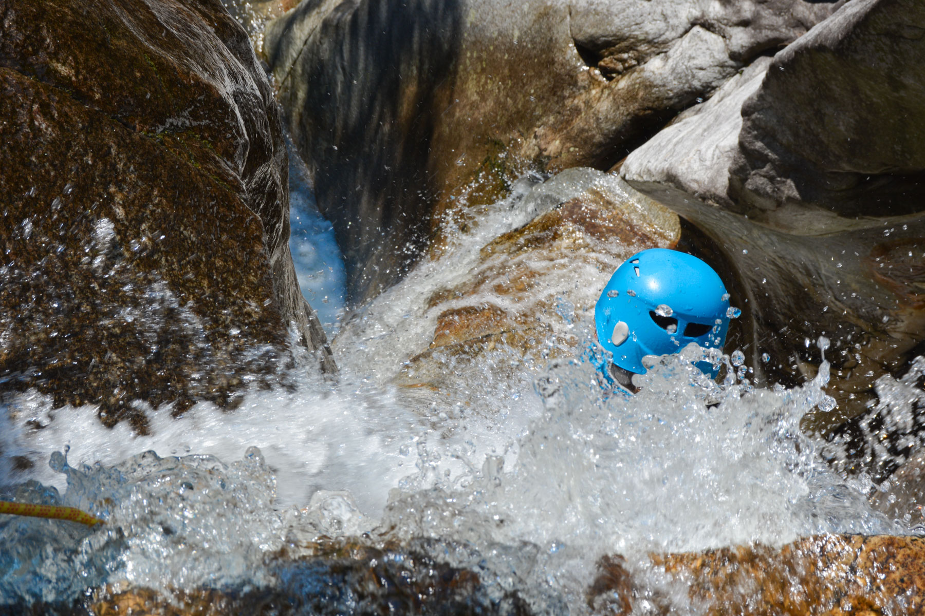
Un descenso extraordinario, probablemente uno de los más bellos del Tesino. La parte baja del Riale di Nala ofrece tanto un recorrido técnico y muy acuático como un entorno salvaje y mineral de extraordinaria belleza. La sucesión de obstáculos es continua y la mayor parte de los rápeles se realizan en el medio activo, con algunos de ellos totalmente sumergidos en el agua rompiente. La roca, esculpida, plegada y modelada por la erosión y el tiempo, adquiere en algunos puntos tonalidades grises o rojo anaranjadas, formando un magnífico conjunto cristalino con el agua verde translúcida. Aunque la parte baja esté masificada, se trata de un itinerario muy recomendable para descubrir el Tesino.
❱❱ Reseñas técnicas
Tipo ✦ Cañón de agua
Localidad ✦ Osogna
Región ✦ Tesino
País ✦ Suiza
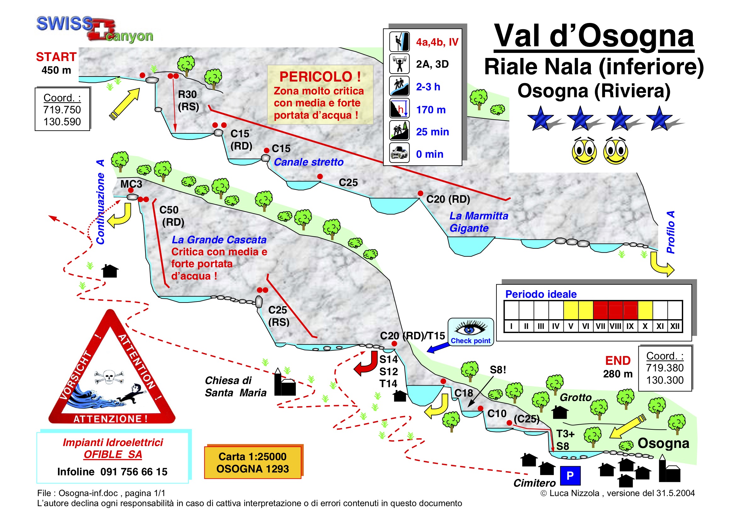
Longitud ✦ 450m
Desnivel ✦ 180m
Dificultad ✦ v4-a4-II
Máximo descenso en rápel ✦ 50m
Duración ✦ 4h a 4h30
Interés ✦ ★★★
❱❱ Acceso al sitio
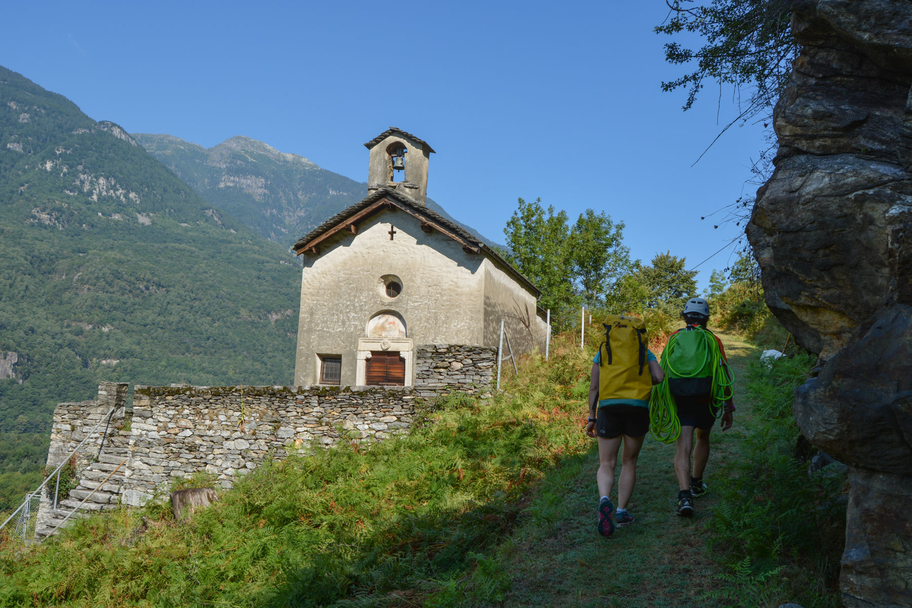
Viniendo de Bellinzona en dirección a Biasca, entrar en el pueblo de Osogna, frente a Lodrino. Aparque en el aparcamiento situado al norte, junto al cementerio.
❱❱ Mapa & topo
❱❱ Itinéraire
Desde el aparcamiento, suba hacia el camino de Santa Maria del Castello. Pasar por delante de la iglesia y, en la cima, bifurcarse para seguir el minicamino de la derecha y llegar al inicio de la parte baja del cañón (justo después de un pequeño paso equipado con un cable y una pequeña escalera).
El cañón es bastante corto en distancia, pero la sucesión directa de todos los obstáculos hace que el avance sea lento. Hay mucha agua, sobre todo en la cascada inicial y en la cascada de 50 m de longitud, que está extremadamente húmeda.
El equipamiento en el lugar es impecable excepto en el rápel o salto final donde el acceso a los puntos de aseguramiento está expuesto, especialmente con el flujo de agua (a menos que hayamos perdido un punto más alto para llegar allí). El rápel más largo mide 50 m. Antes de salir, llame a la Infoline al +41 91 756 66 15 para obtener información sobre la previsión de desembalses de la presa aguas arriba.
Salir a la derecha para llegar al pueblo. Baje hasta encontrar la carretera de acceso y camine 5′ hasta el aparcamiento.


Deja una respuesta