


TOPO Via ferrata | CLIMBING7.COM
Publié le
 Partager sur WhatsApp
 Partager sur Twitter
Partager sur Instagram
Partager sur Twitter
Partager sur Instagram

 Partager sur Facebook
 Imprimer le topo
 Laisser un commentaire

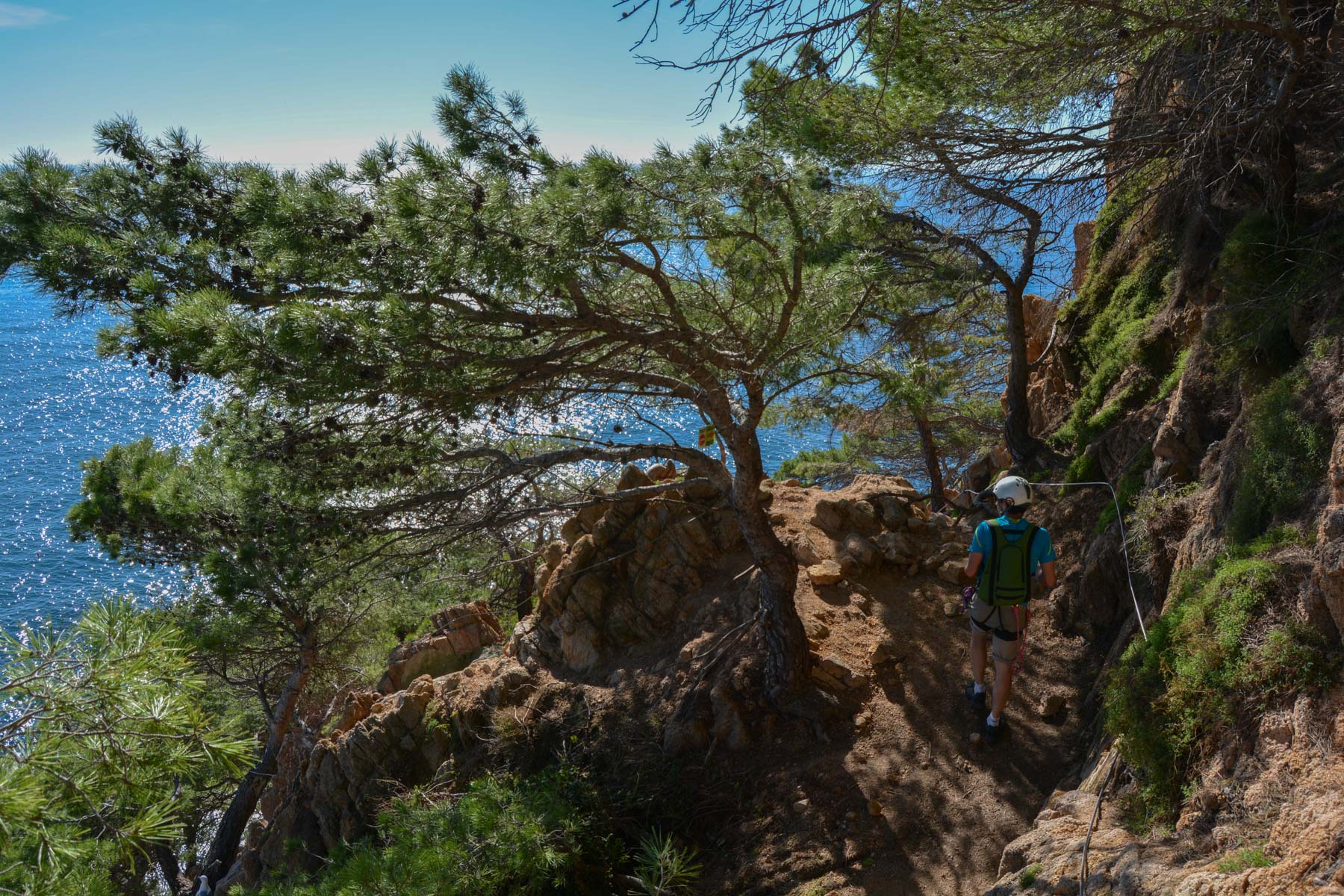
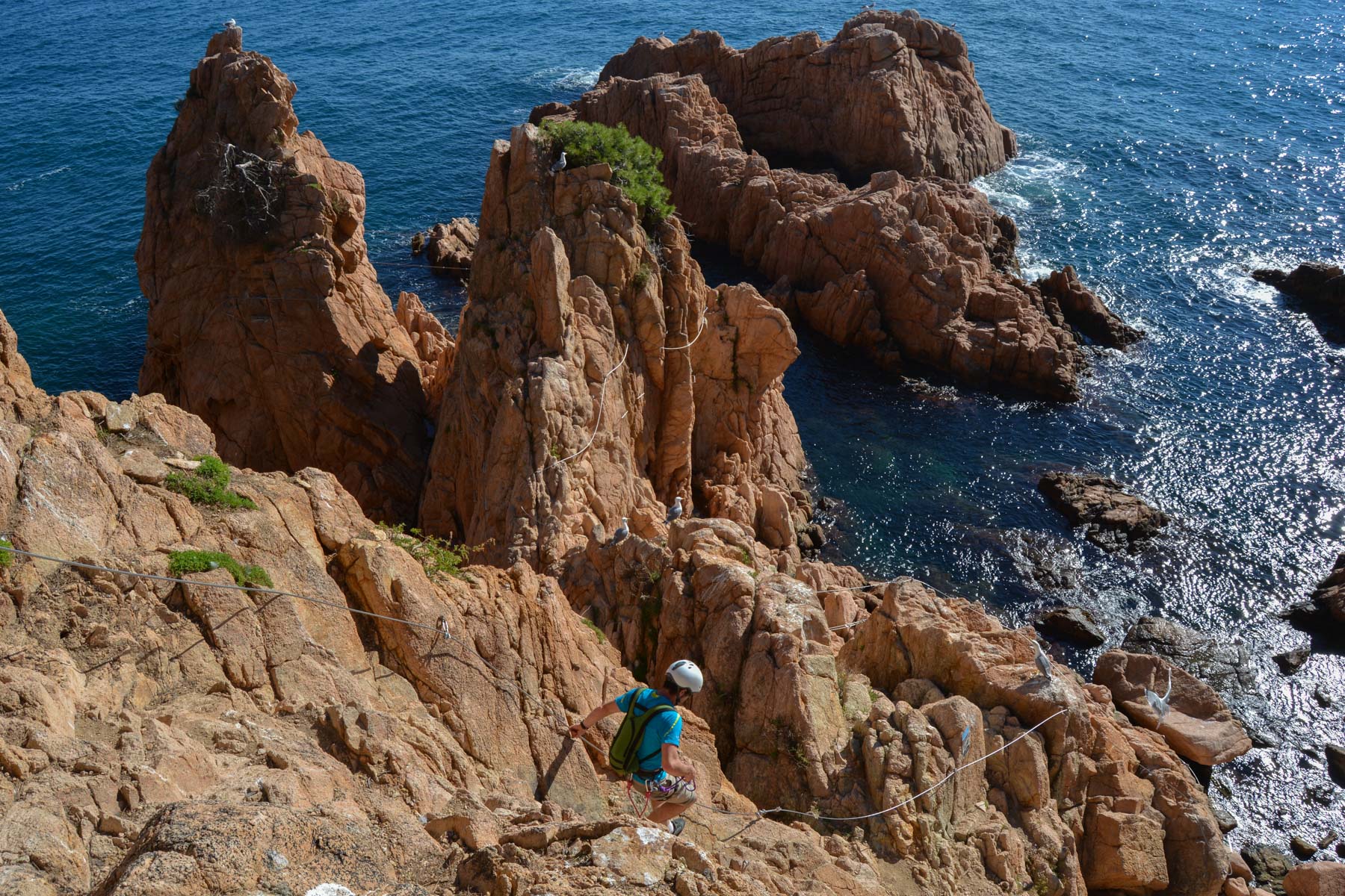
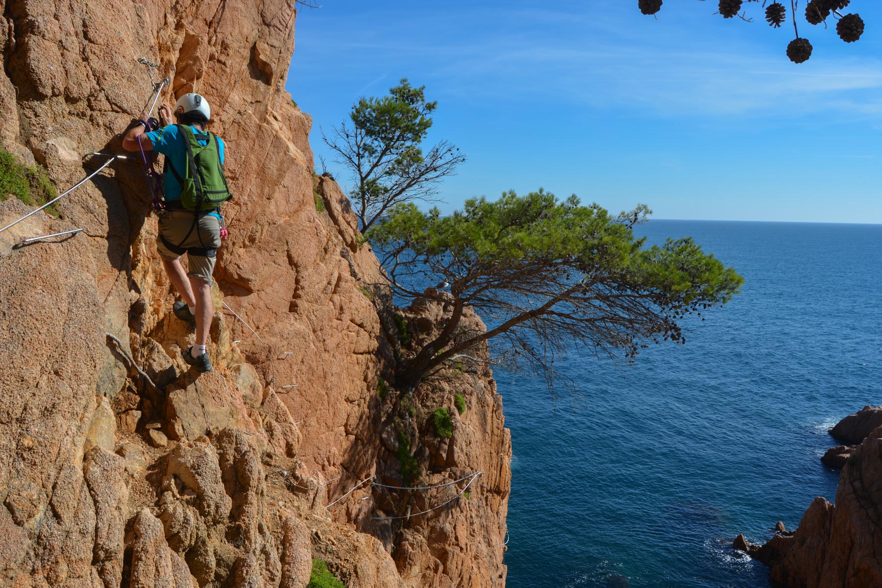
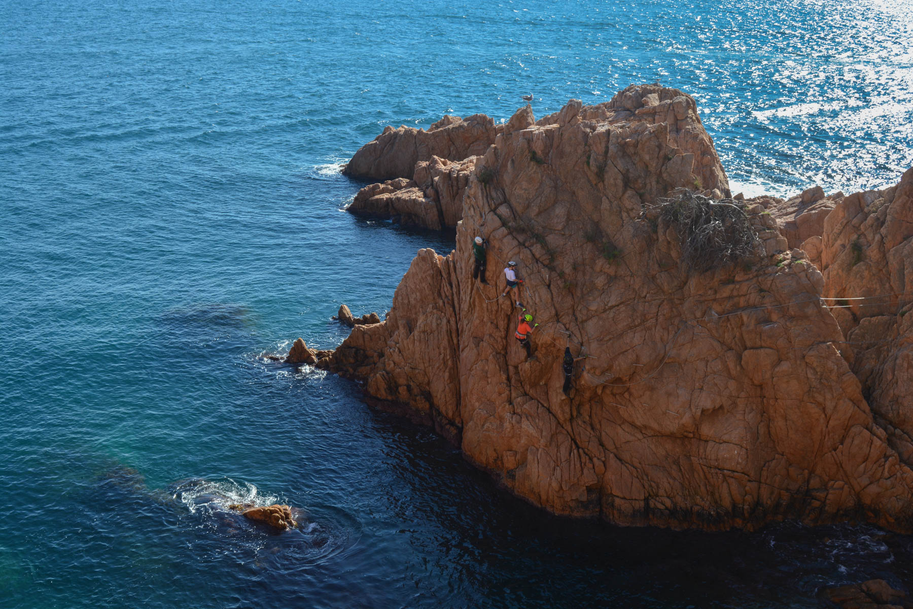
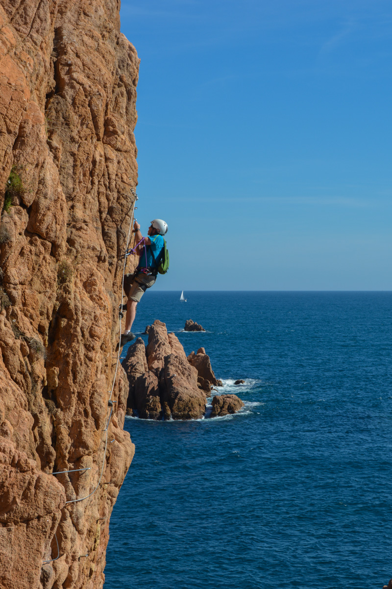
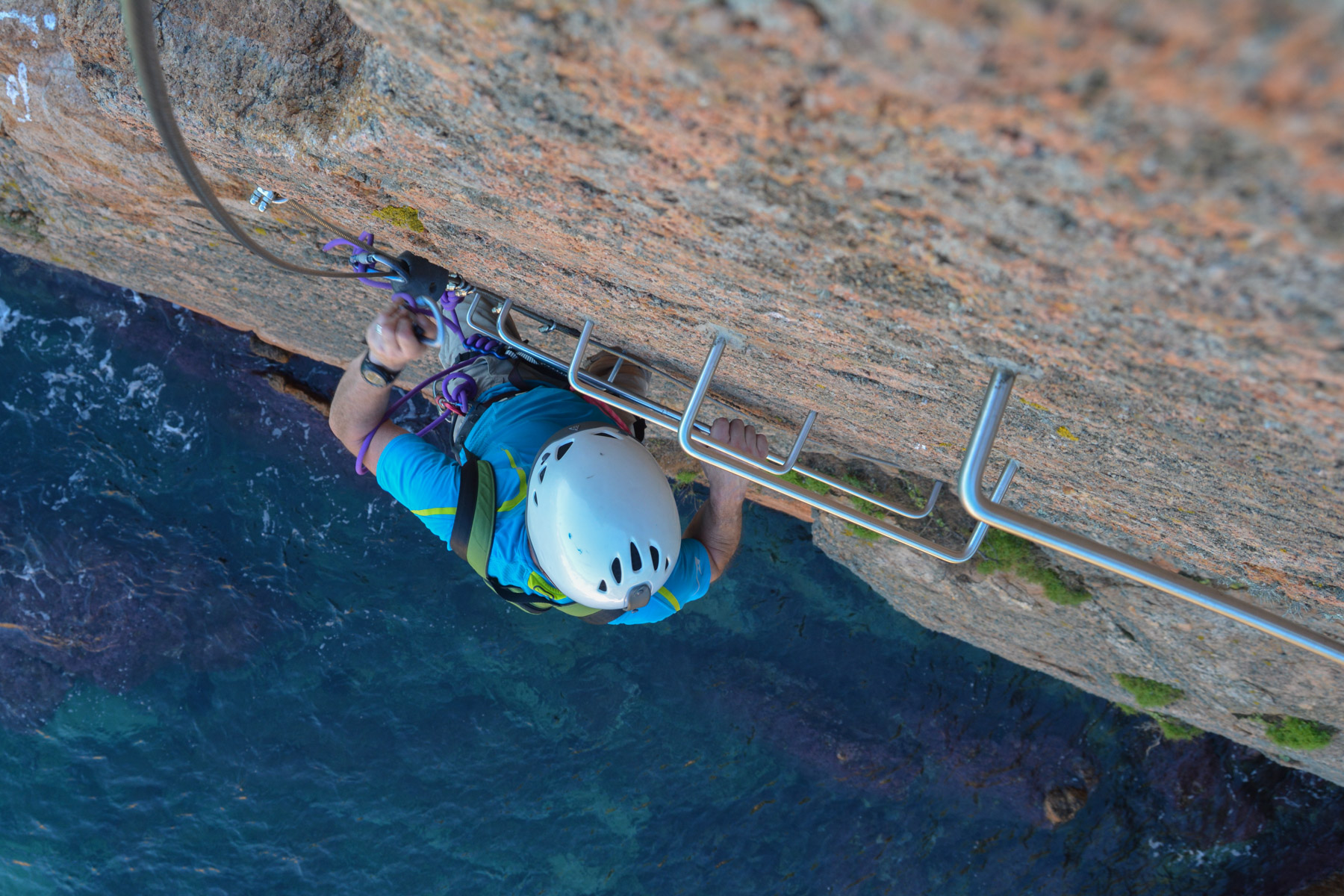
The Cala del Molí route, recently re-equipped and re-opened, offers an original itinerary above the Mediterranean, overlooking pretty little coves, still unspoilt, in the warm colors of Indian summer. Not very difficult and not very aerial, there are nevertheless several slightly overhanging passages that require a more sustained effort. The equipment is excellent, though perhaps too much so, with more rungs than necessary in places, although the rock itself offers plenty of hand and foot holds. It's a great atmosphere, even if the route goes back and forth in a rather concentrated space. Best done outside weekends, to avoid overcrowding.
❱❱ Technical summary
■ S tarting point: Sant-Feliu de Guixols, Catalunya, Spain
■ Course type: via ferrata above the sea
■ Direction: south-east
■ Fitted length: 580 m
■ Vertical rise: +20 m
■ Estimated total time: 1h30 to 2h
■ Min and max altitude: 0 m / 20 m
■ Equipment in place: suspension bridges, rungs, abseiling points
■ Equipment required: standard equipment, headlamp if necessary
Difficulty: K3 or AD, with several slightly overhanging sections, fairly sustained but not too long. An escape route halfway along the route.
❱❱ Access to the place
On the AP7 freeway between Barcelona and Girona, take exit 9A for Sant Feliu de Guixols. Once there, cross the town towards the port and park nearby.
❱❱ Map & topo

❱❱ Itinéraire
Time depends on where you park, about 20′ if you're coming from the center. Join the marina and walk along it in a north-easterly direction. At the end, you'll find the GR marking, which you follow to reach the start of the ferrata under the miradors trail.
Follow the path in the opposite direction, or continue on the GR to reach San Pol beach via the cliffs and coves. From here, to complete the loop, you can return via the voie verte, an old railroad line that runs inland to the town center.


Leave a Reply