North of Barcelona, just below Cerdagne and Puigmal, the Nuria and Freser torrents meet. The Canal del Freser, a diversion canal for the waters of the 2 valleys, was built at an altitude of almost 1,600 m, on the side of a rock face, and then descends to feed the Daïo power station. The route proposed here generally follows this canal from west to east, offering an aerial path and an almost permanent panorama over the Freser valley. Equipped, the route is protected at all exposed points with life lines and bypass bridges. In short, an original loop that can be completed over a weekend with the Gorges de Nuria canyon, in exactly the same place.
❱❱ Technical summary
■ S tarting point: Centrale de Daïo, Queralbs, Ribes de Freser, Catalunya, Spain
■ Type of route: mid-mountain loop hike, crossing on equipped trail
■ Distance: 14 km
■ Cumulative elevation gain: +780 m
■ Cumulative negative altitude gain: -780 m
■ Estimated total time: 4h to 5h ■ Min and max altitude: 1190 m / 1720 m
■ Beaconing: no
■ Equipment in place: none
■ Equipment required: none
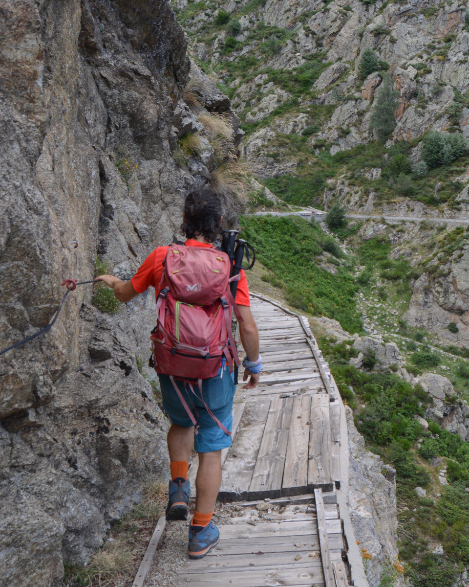
Difficulties: the traverse is in places aerial and in the most exposed passages equipped with a lifeline or protected by some sort of fencing.
❱❱ Access to the place
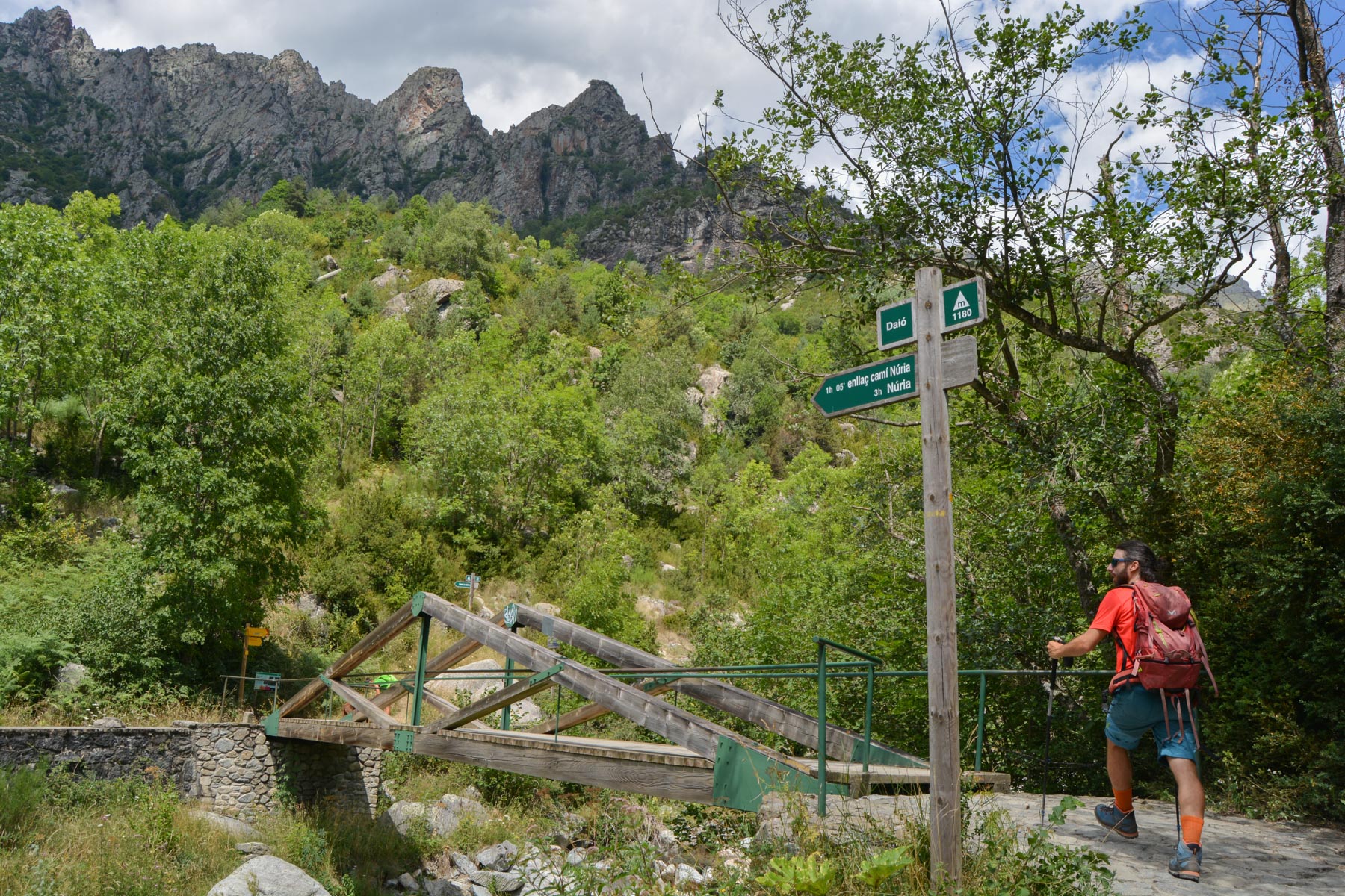
Go to Ribes de Freser, above Ripoll, and climb the road to Vall de Nuria. Just before reaching Queralbs, turn right on a curve at La Farga to take the kilometer-long cement road to the Daïo power station. Space is limited in summer, so park in the curve before heading for the power station.
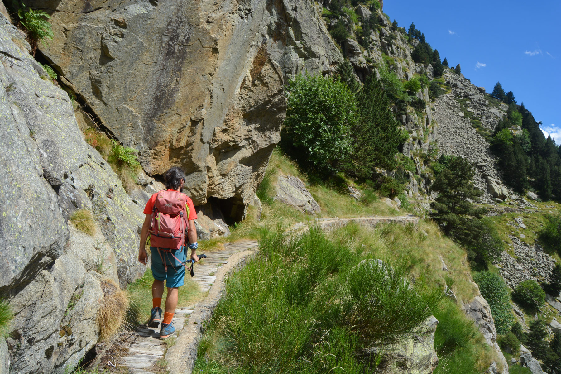
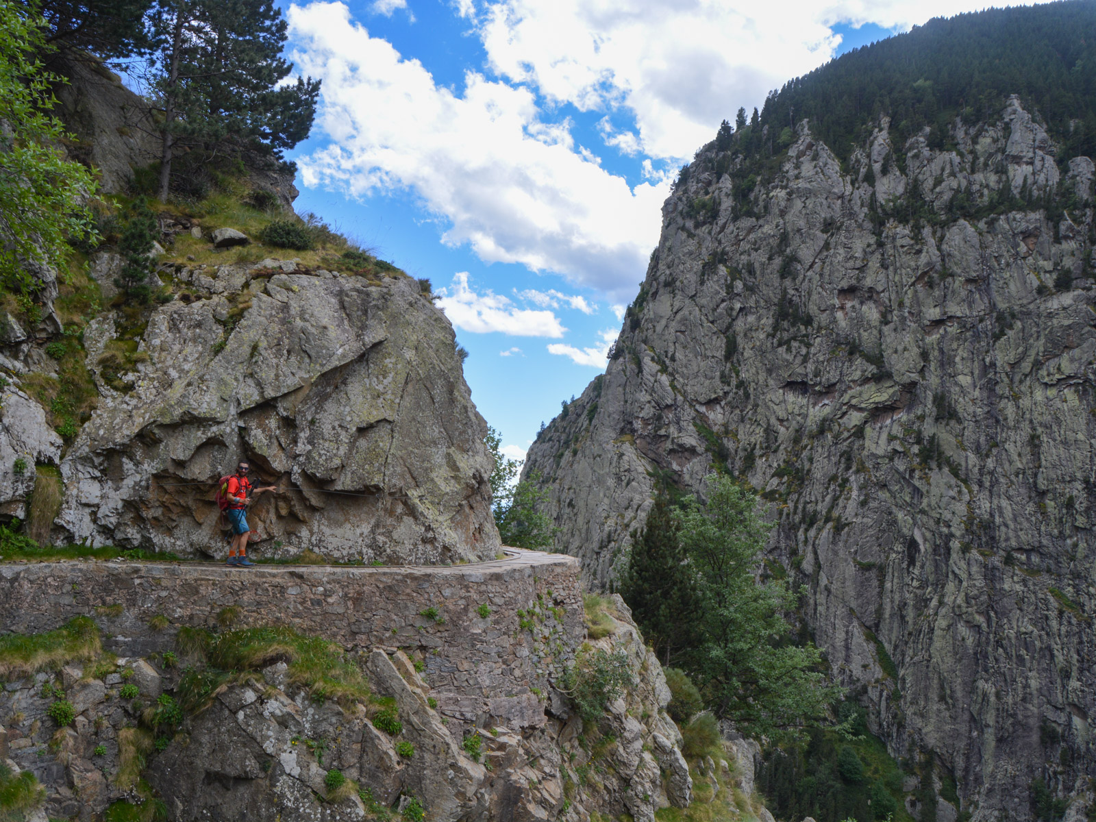
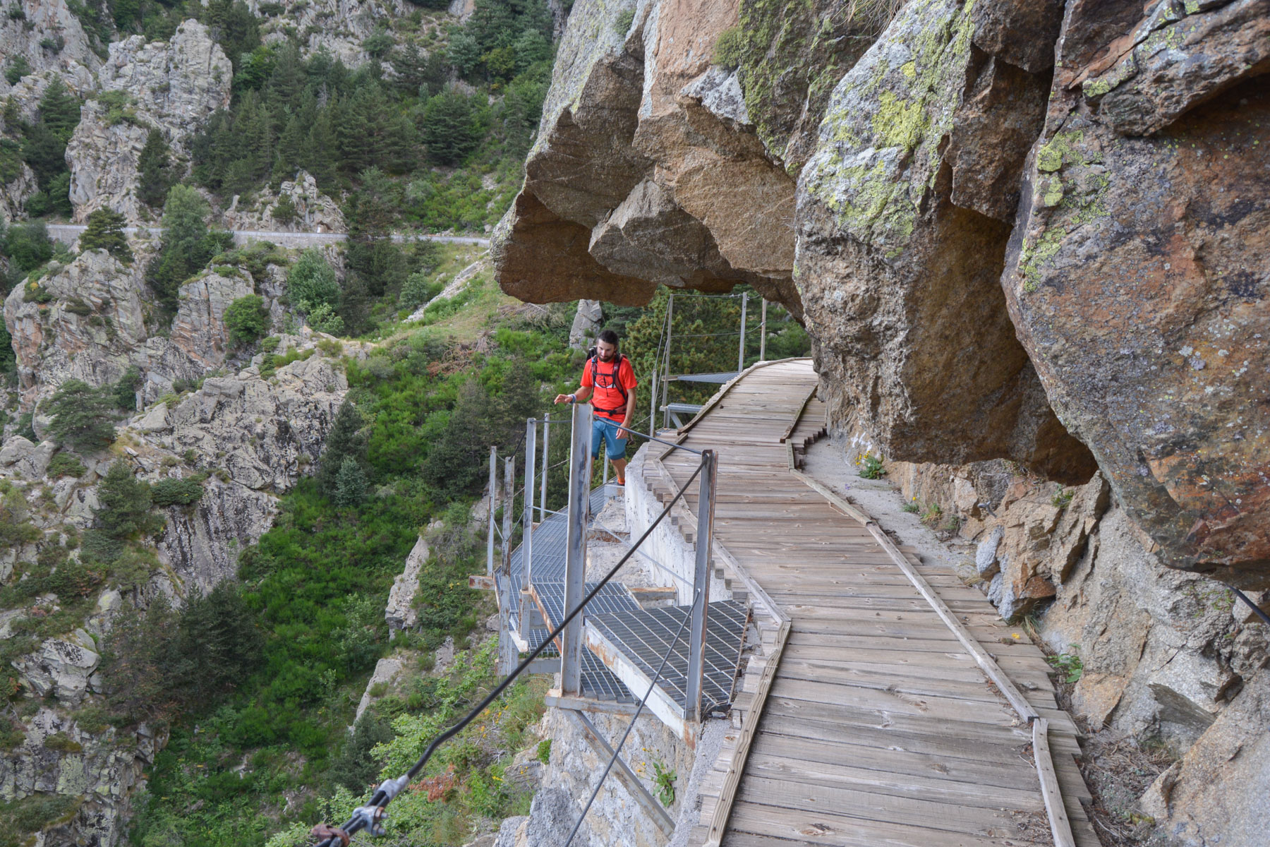
This hike is unusual in that it's actually a trail along a water diversion canal that follows the slope from west to east. There are no technical difficulties and the gradient is reasonable, but much of the route is aerial.
All exposed sections are well equipped with lifelines, some of which are a little old but generally in good condition, and some of which are very recent (see photo). The cement channel is usually covered by a wooden slatted floor. In some places, the planks are damaged or broken, so you need to be careful where you step.
1st part: from the power station to the entrance to the Freser canal (1h to 1h15, 1650m)
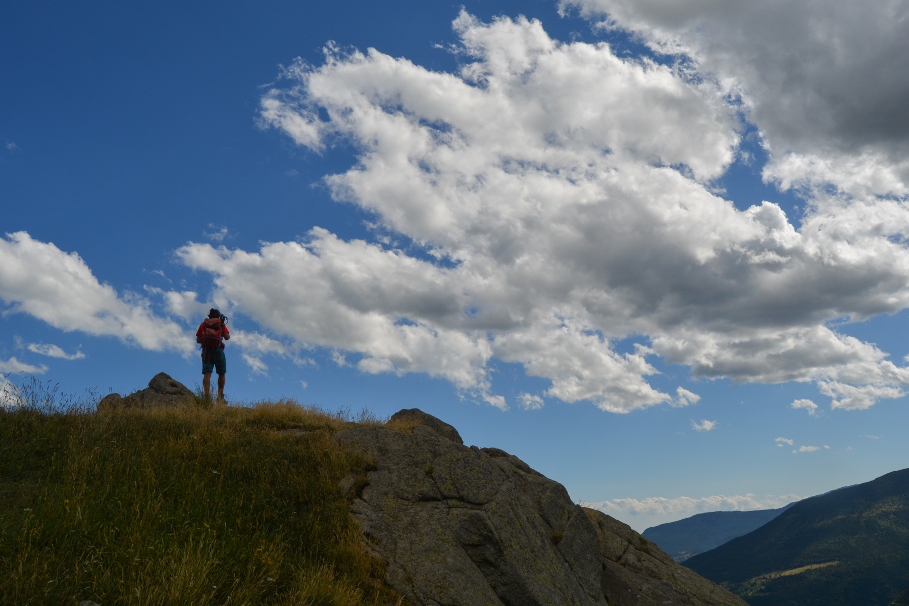
From the power station, cross the bridge over the Freser and head uphill on the Nuria path. It climbs steadily but fairly gradually through the undergrowth, crossing small scree slopes higher up, then, at the Marrades de Toltomon, 1500m, cross due west to join the bed of the Nuria torrent and finally arrive at the Cremal bridge at 1495m. From here, continue on the left bank (to the right as you go up) on the path with stone steps and wind up to the Pont de Sastre, which can be seen below. After 7 or 8 bends, the path crosses the canal. This is the entrance at around 1650m altitude.
2nd part: the Freser canal from east to west (2h to 2h30)
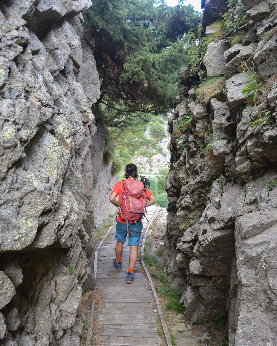
The itinerary follows the canal in its entirety, but on several occasions the canal sinks into the wall and you are obliged to take a detour at the bottom or the top to rejoin it a little further on, which adds to the height difference with some steep up-and-down sections. These detours are marked with red paint (dots, arrows, dashes), but are obviously seldom used as they are overgrown with nettles and brambles (pants welcome!).
Difficult to divide the route into sections. Watch out for the 1st detour down marked with a red arrow before a bramble-covered passage and where the canal disappears into the rock. This 1st detour is important. The second will be upwards and so on. Further on, after crossing a bridge with a large painted pipe and climbing down a metal ladder, you finally reach some small buildings where the Nuria and Freser canals join to descend to the power station. Continue with a detour at the bottom and then a short one at the top, to return to the canal to the east, then head north and cross the bed of the Salt del Grill.
This is followed by a long section of walking on the canal with lovely views over the Freser valley, and after several bends the canal sinks again and you have to climb steeply to pass a shoulder (path visible from a distance) and come down on the other side. A final, long section of canal remains, with several steep passages where you thread your way under the rock or over small suspended footbridges. You gradually approach the valley floor and the Freser, which you can see descending, a white trail through the forest. Finally, the canal reaches a cottage.
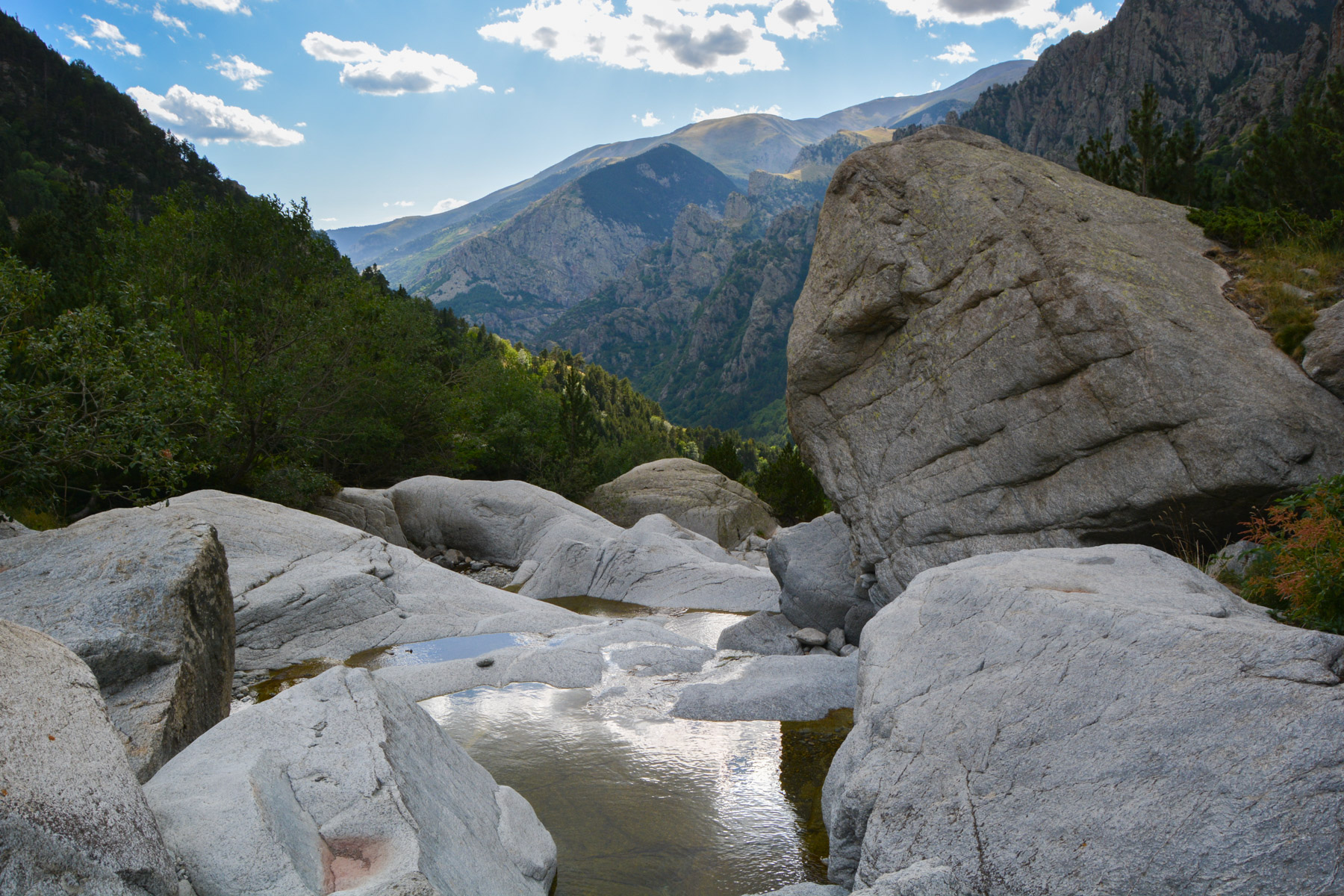
3rd part: return via Coma de Vaca (1h to 1h15)
In front of the house, find a small path that joins the bed of the torrent, which you cross without difficulty. On the opposite side, climb back up to cross at a fairly high altitude (cairns) and finally join the main Coma de Vaca path. There's then almost 5 km of descent along the Freser to return to the power station and parking lot.


 Partager sur WhatsApp
 Partager sur Twitter
Partager sur Instagram
Partager sur Twitter
Partager sur Instagram

 Partager sur Facebook
 Imprimer le topo
 Laisser un commentaire


Leave a Reply