


TOPO Hiking | CLIMBING7.COM
Publié le
 Partager sur WhatsApp
 Partager sur Twitter
Partager sur Instagram
Partager sur Twitter
Partager sur Instagram

 Partager sur Facebook
 Imprimer le topo
 Laisser un commentaire

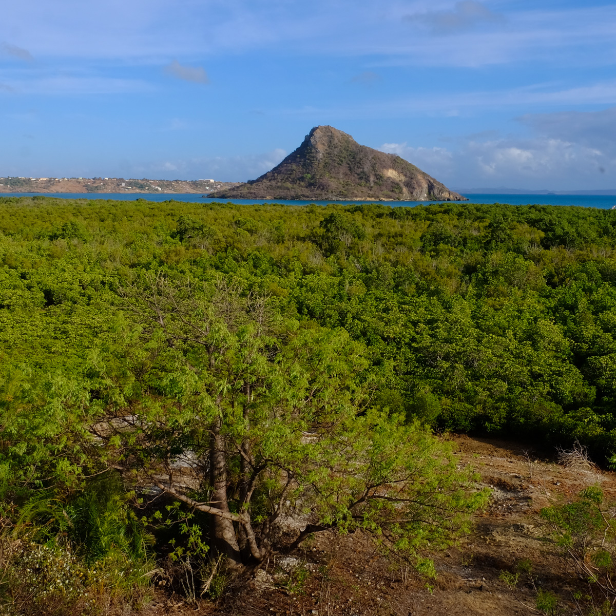
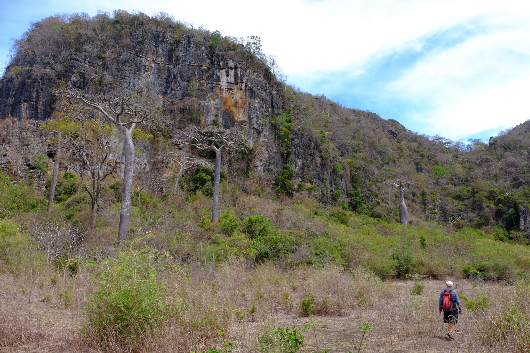
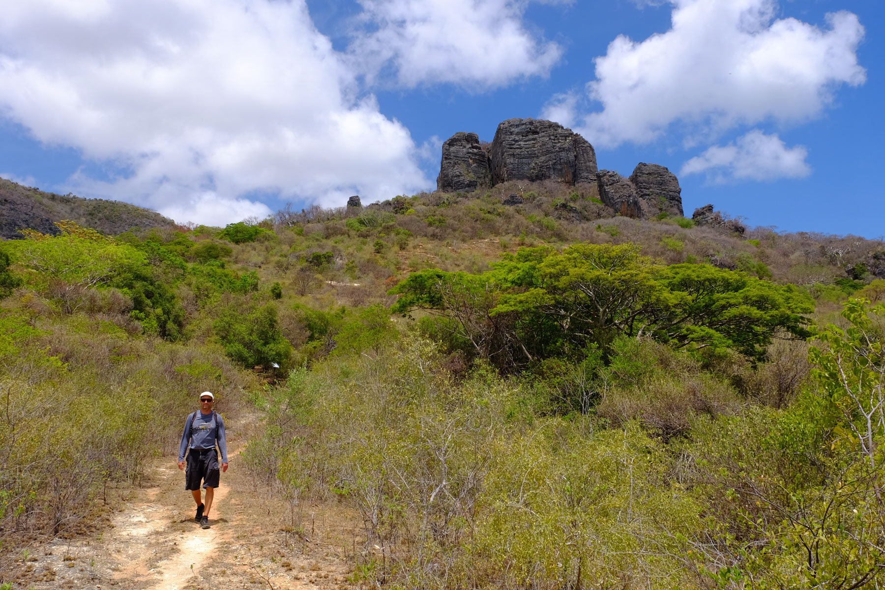
Tsing'obab, between Tsingy and Baobab. From the panoramic summit of Montagne des Français, south-east of Diego-Suarez, the route gradually descends into a jungle of limestone and vegetation. In the bowels of the jagged limestone, you'll discover the giant roots of an incredible 30m Baobab tree, cleverly wedged between the Tsingy walls. It's like Indiana Jones! Caves, underground passages, rocky faults, tangled vegetation and lianas: brilliant! Some passages are equipped with knotted ropes, while others require climbing or unclimbing, without difficulty but a little exposed. Then we enter the wild and beautiful Vallée des Perroquets, where there are no parrots, but rather splendid baobabs planted in the savannah amidst zebus. A major hike just a stone's throw from Diego, which has nothing to envy the Tsingy de Bemaraha.
❱❱ Technical summary
Type ✦ Jungle hiking
Location ✦ Diego-Suarez
Region ✦ Montagne des français, Diana
Country ✦ Madagascar
Length ✦ 14kms
Elevation gain ✦ 450m
Difficulty ✦ AD
Duration ✦ 5h to 6h
Interest ✦ ★★
❱❱ Access to the place
From Diego, take the road to Ramena. A few kilometers before the village, on the right, at the foot of Montagne des Français, is the parking lot and official park entrance.
❱❱ Map & topo
❱❱ Itinéraire
Once you've paid the entrance fee of 15,000 ariarys (2019), the trail immediately begins on a Way of the Cross that leads up to the walls.
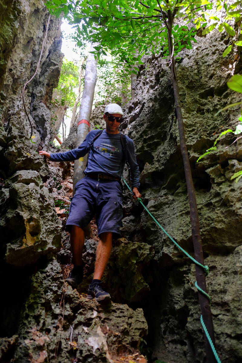
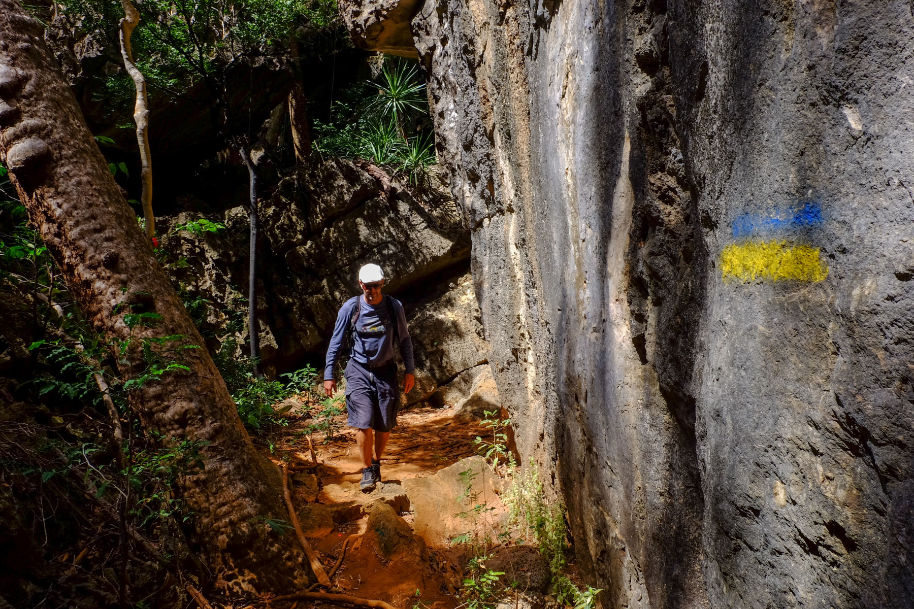
The route is officially listed as the Vallée des Perroquets. It crosses the Montagne des Français from west to east. The central part of the Tsingy is equipped in places, for the more exposed passages.
The trail is fairly well marked, with yellow dots between the platform and the Vallée des Perroquets.
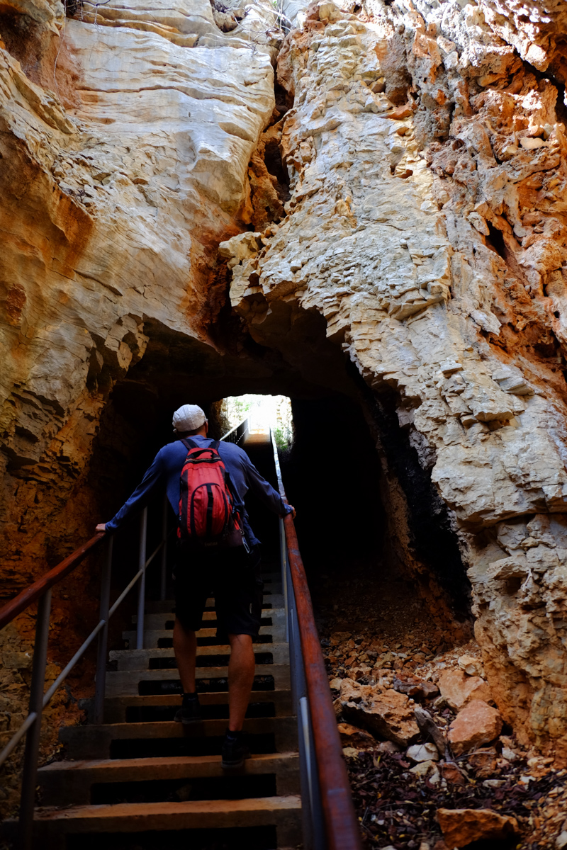
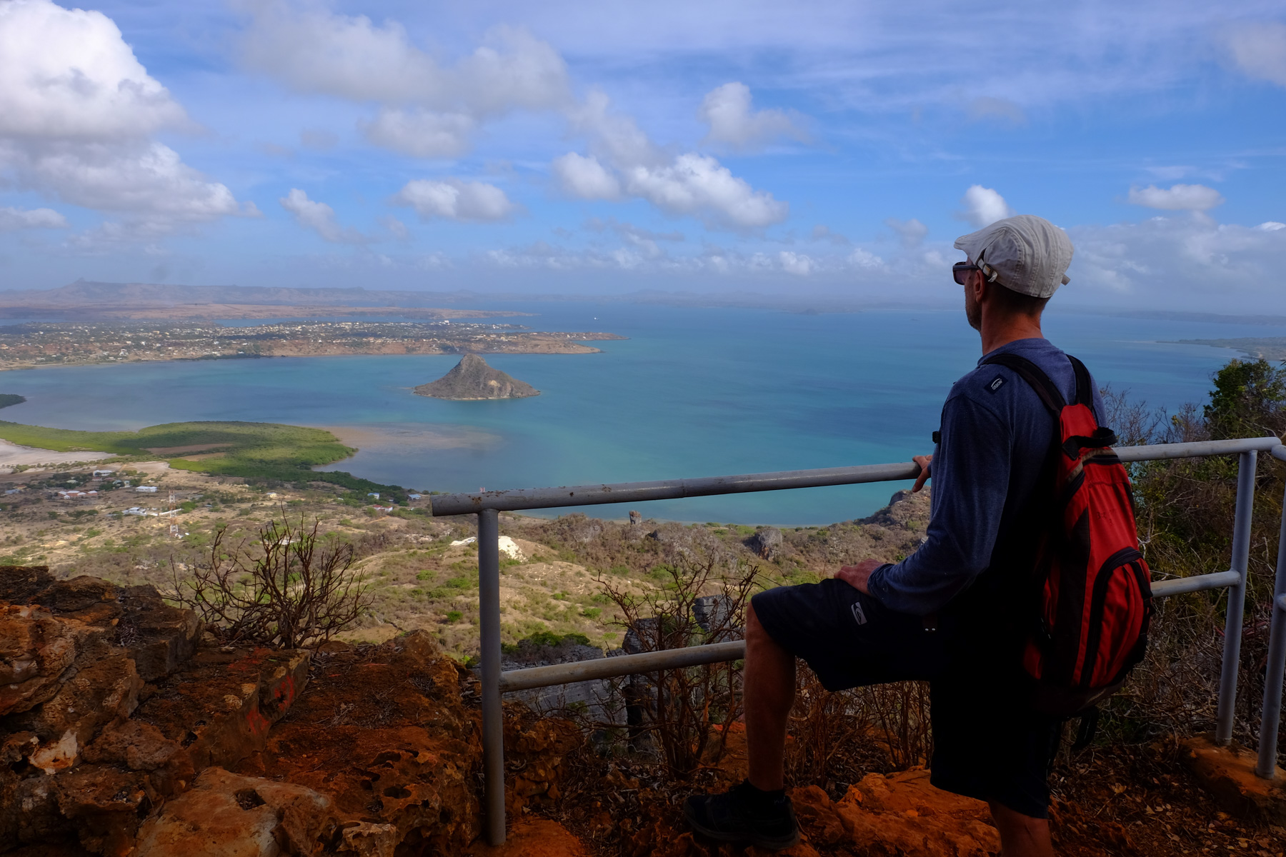
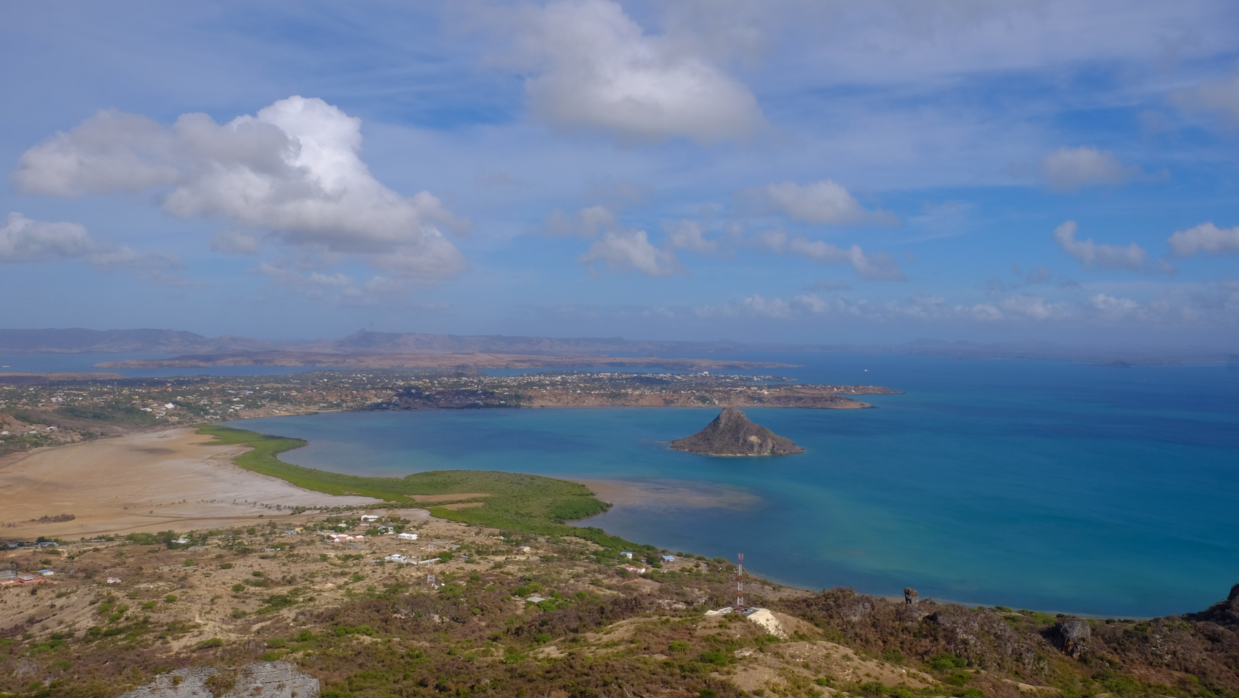
This 1st section follows the path of the cross that climbs through the park towards the cliffs. Once at the foot of the cliffs, the path winds its way to a huge 600-step staircase that literally cuts through the mountain to emerge below the summit. Here you'll find remnants of the colonial era, including the ruins of a French Foreign Legion fort. Soon after, a 1st panoramic balcony overlooks Diego Bay and its sugar loaf.
From here, climb up to the upper platform for a 360° view of the region, possibly by walking on the ruins of the old fortification wall that loops around the summit.
The part that makes all the difference! From the 360° platform, retrace your steps a little to find the path that leads past the commandant's house. Just beyond, a T. To the left is the way back to the park entrance, to the right the path to new adventures!
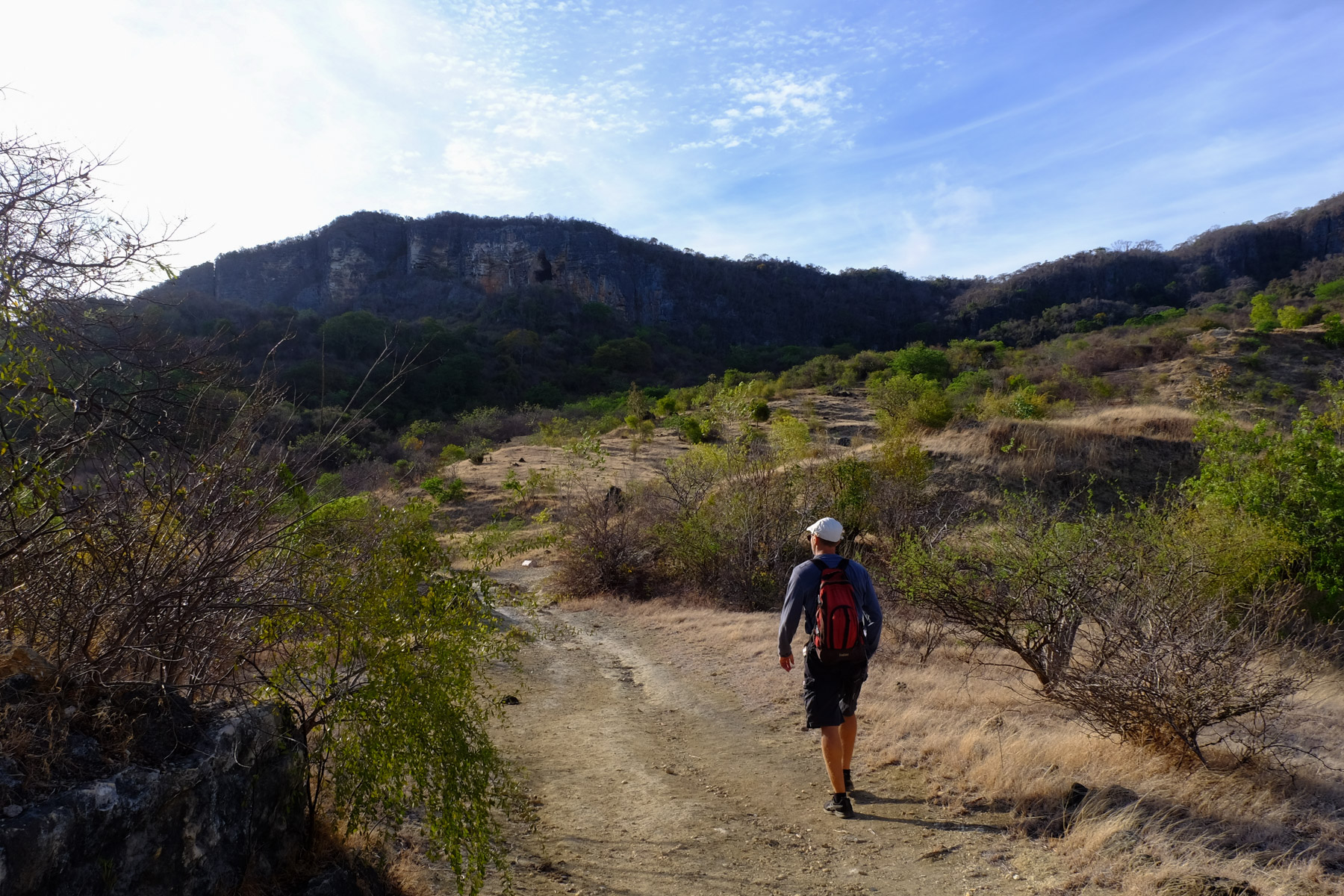
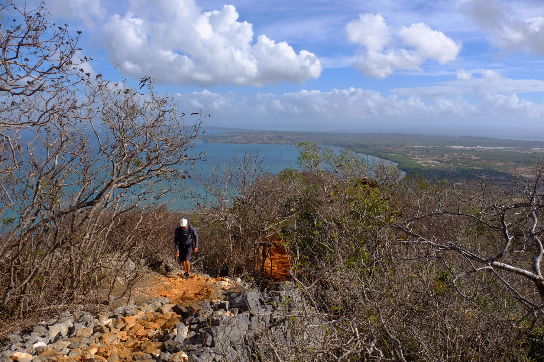
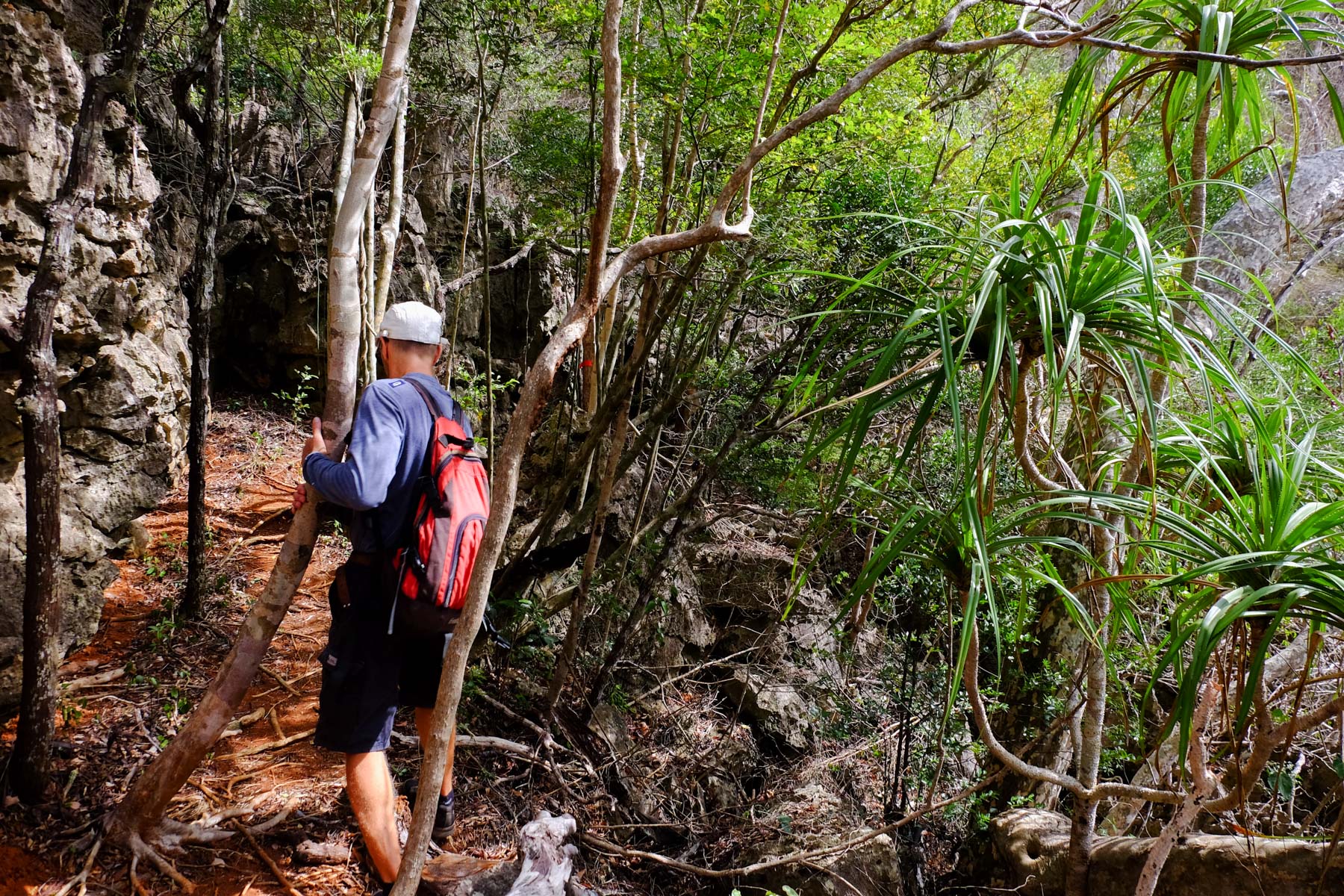
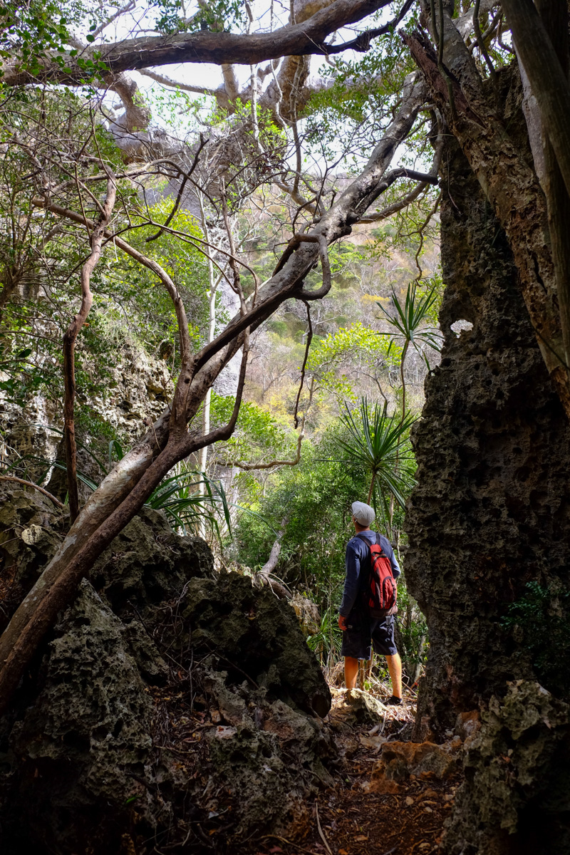
We descend a little into the undergrowth, before gradually entering a denser jungle zone. The Tsingys appear and progress becomes slower as you move over the rock. Then the passages become increasingly narrow and steep. An incredible baobab stands here. A few metres further down, a corridor of Tsingys opens up an Indiana Jones-style passage to follow a huge root on the ground. At the bottom, we're at the foot of a huge trunk, and our baobab, lord of the Tsingys, rises some 30m.
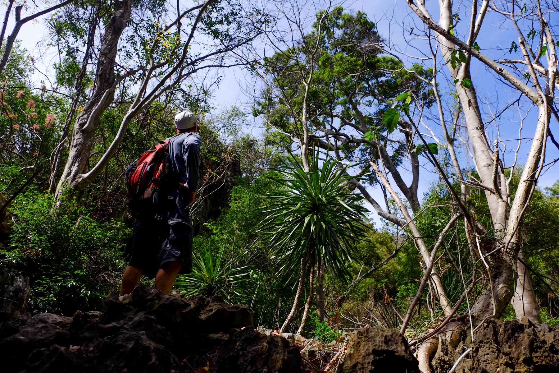
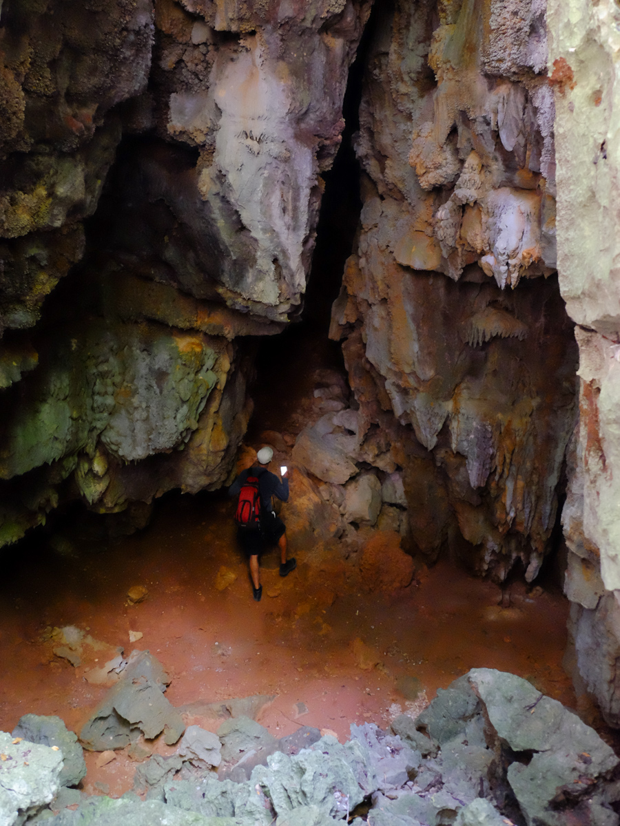
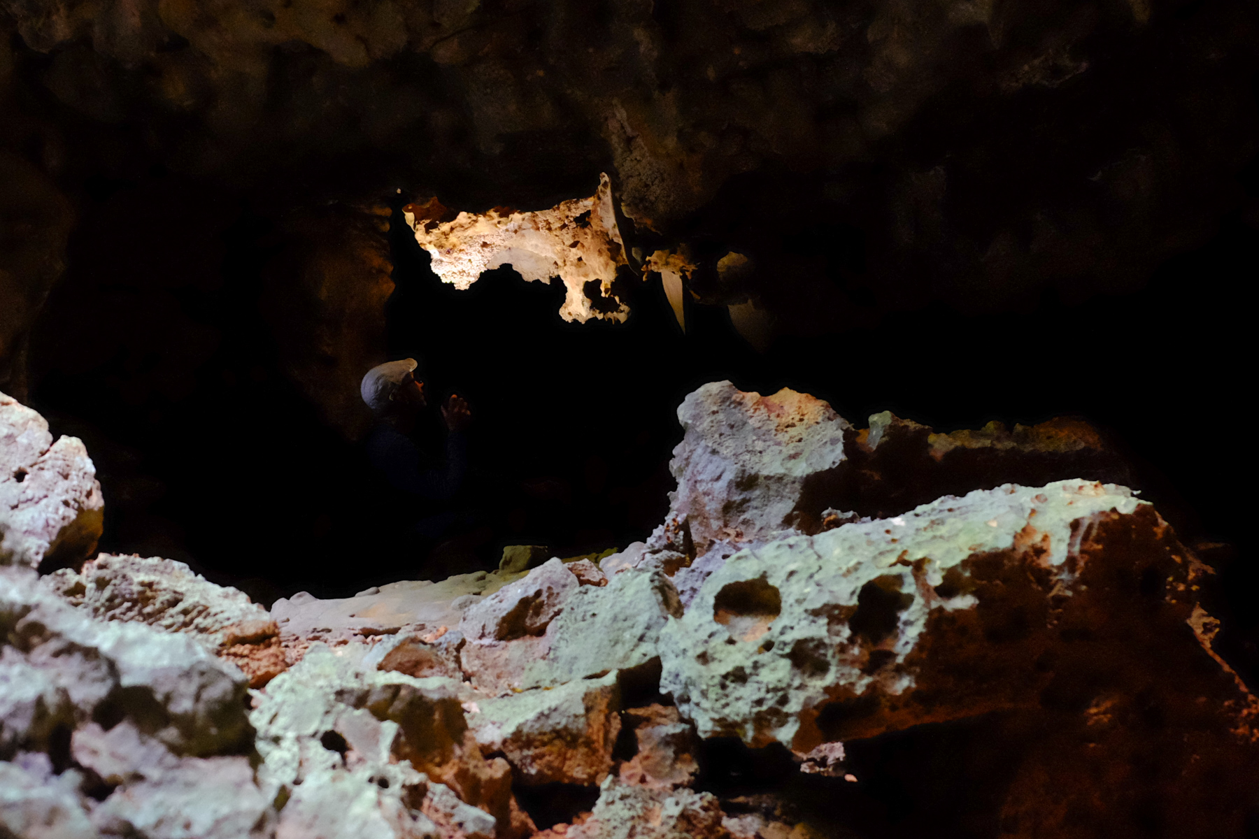
The rest is great, with more corridors, underground passages and even a cave to explore. We then enter the final passage, along a series of walls equipped for climbing, and at the top, on the horizon, the incredible silhouette of a gigantic baobab. At the end of this defile, the trail descends and emerges into a completely different landscape. Savannah, zebus, tall grass, jagged cliffs. This is the entrance to the Valley of the Parrots.
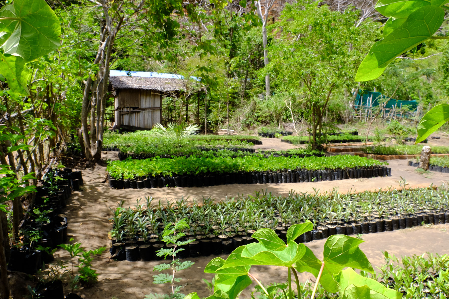
If the parrots aren't really there, the crossing of the valley is quite magical. The baobabs, the lush vegetation and the tropical ambience are all there. The trail, which starts out in the open, then plunges into the forest, emerging in places. Further down, there's a 1st nursery, then a second.
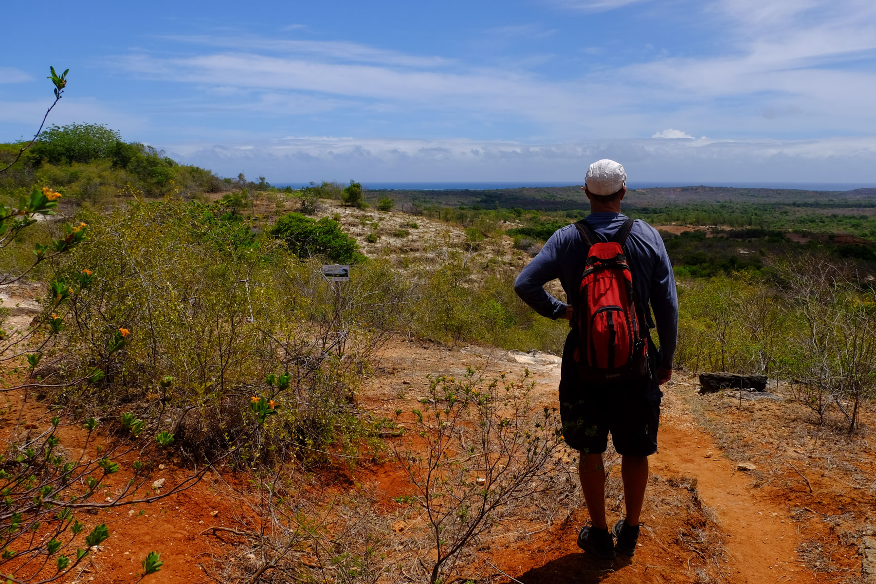
Then, suddenly, you're out in the open. In the distance, the Indian Ocean. Undulating red earth. End of the route.
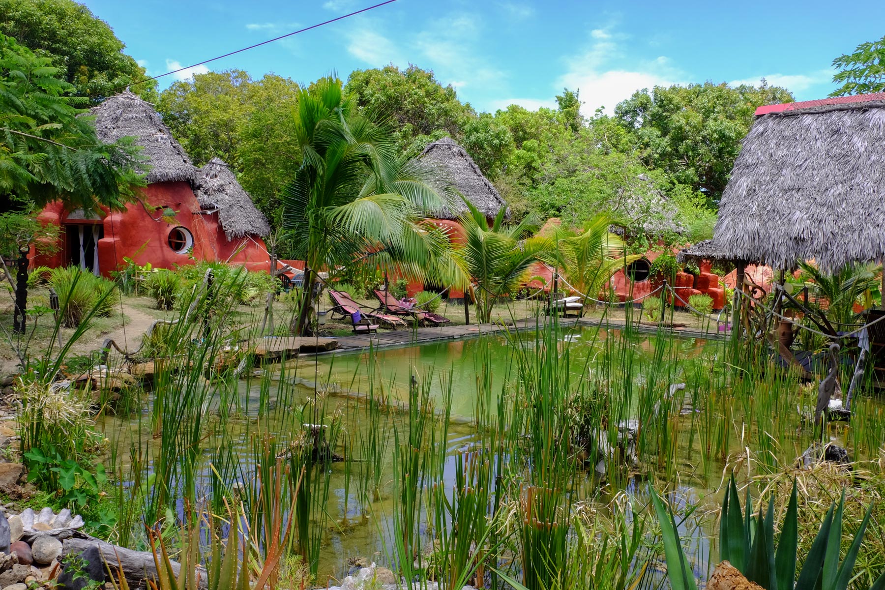
Take a leisurely descent to the plain below, which leads to Jungle Park, well worth the detour to cool off and immerse yourself for a moment in wonderland. Then pick up the trail again, heading north-east, and pick up a wider track which this time heads due west (not easy, as there are a lot of mini-trails in the bush).
Following this track, it climbs a little, and at one point you have to avoid an area of bush to continue further, the idea being to keep a westerly course and aim as close as possible to the northern cliffs of the French mountain.
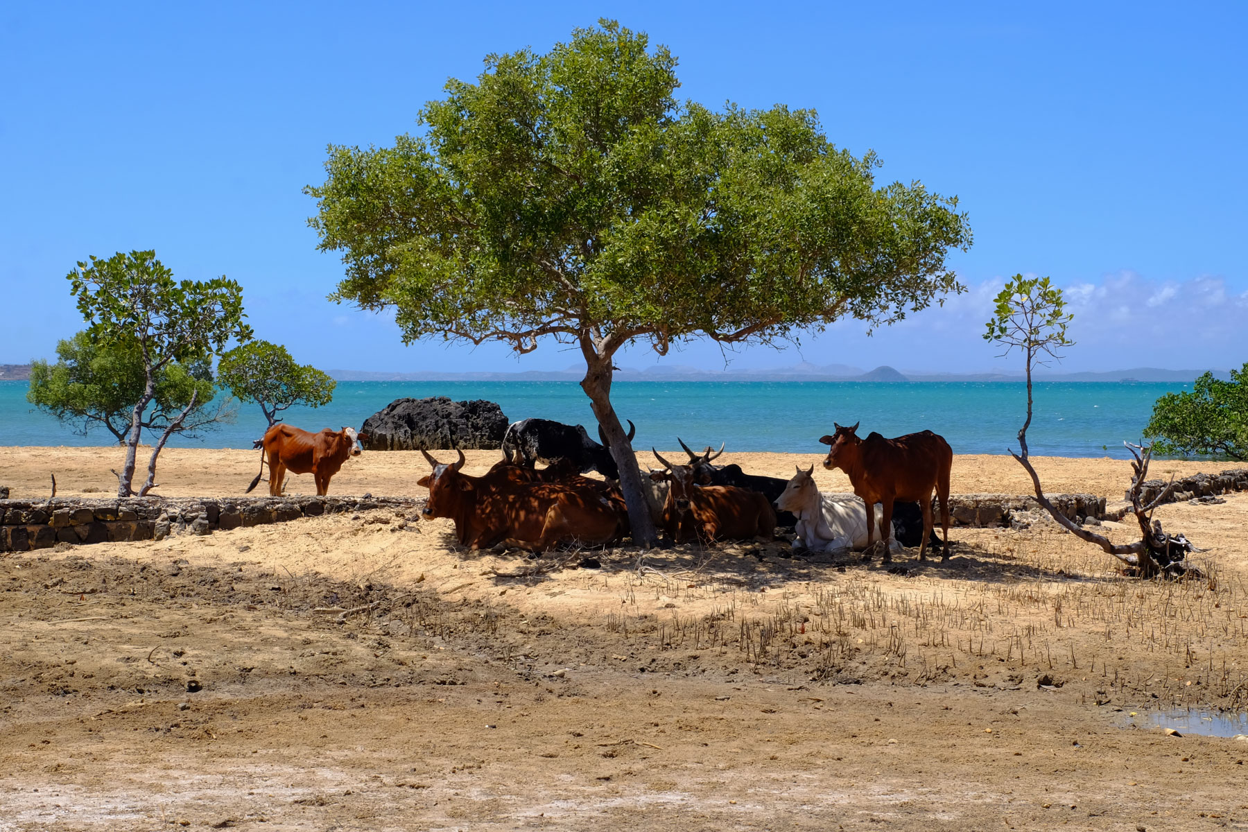
Eventually, the trail turns around and we finish the walk with a beautiful view of Diego Bay. Before returning to the parking lot, you can take a dip in the water, in the company of a few zebus, facing the Pain de Sucre.


Leave a Reply