


TOPO Hiking | CLIMBING7.COM
Publié le
 Partager sur WhatsApp
 Partager sur Twitter
Partager sur Instagram
Partager sur Twitter
Partager sur Instagram

 Partager sur Facebook
 Imprimer le topo
 Laisser un commentaire
End of the route: after Monte Perdido, the Faja de los Flores, an original return on a new, no less aerial route leading west under the Gabietou to cross the Forquete de Gabietou, a narrow, steep natural gap that leads into the valley of the barranco Lapazosa and finally to the Col de Boucharo or Puerto de Bajaruelo. A shorter stage, with less ascent, but once again with numerous aerial passages and not so easy access to the forquete. A fine final stage despite the weather, which wasn't there this time.
❱❱ Technical summary
Type ✦ Itinerant trek
Location ✦ Ordesa Park and Monte Perdido
Region ✦ Aragon
Country ✦ Spain
Length ✦ 8.5km
Elevation gain ✦ 420m
Difficulty ✦ MD
Max altitude ✦ 2730m
Duration ✦ 4h to 4h30
Interest ✦ ★★
❱❱ Access to the place
Day 3 starts from the second bivouac at Aguas Tuertas, at the exit of the Faja de los Flores.
❱❱ Map & topo
On the layout: Day 1 in yellow, Day 2 in blue, Day 3 in green
❱❱ Itinéraire
The route is fairly easy to follow, with a well-marked path and cairns, but still unmarked. 1 or 2 climbing pitches (III/IV) not hard but a little exposed to reach the Forquete and a very airy path on the ridge but not very exposed.
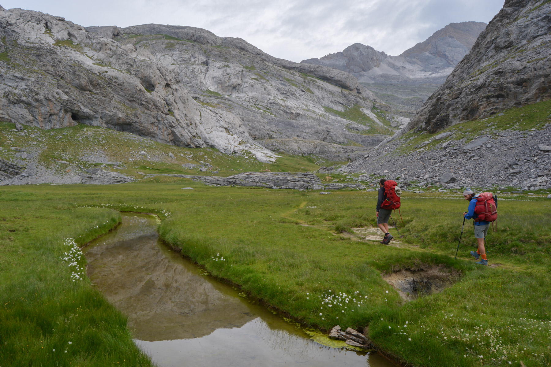
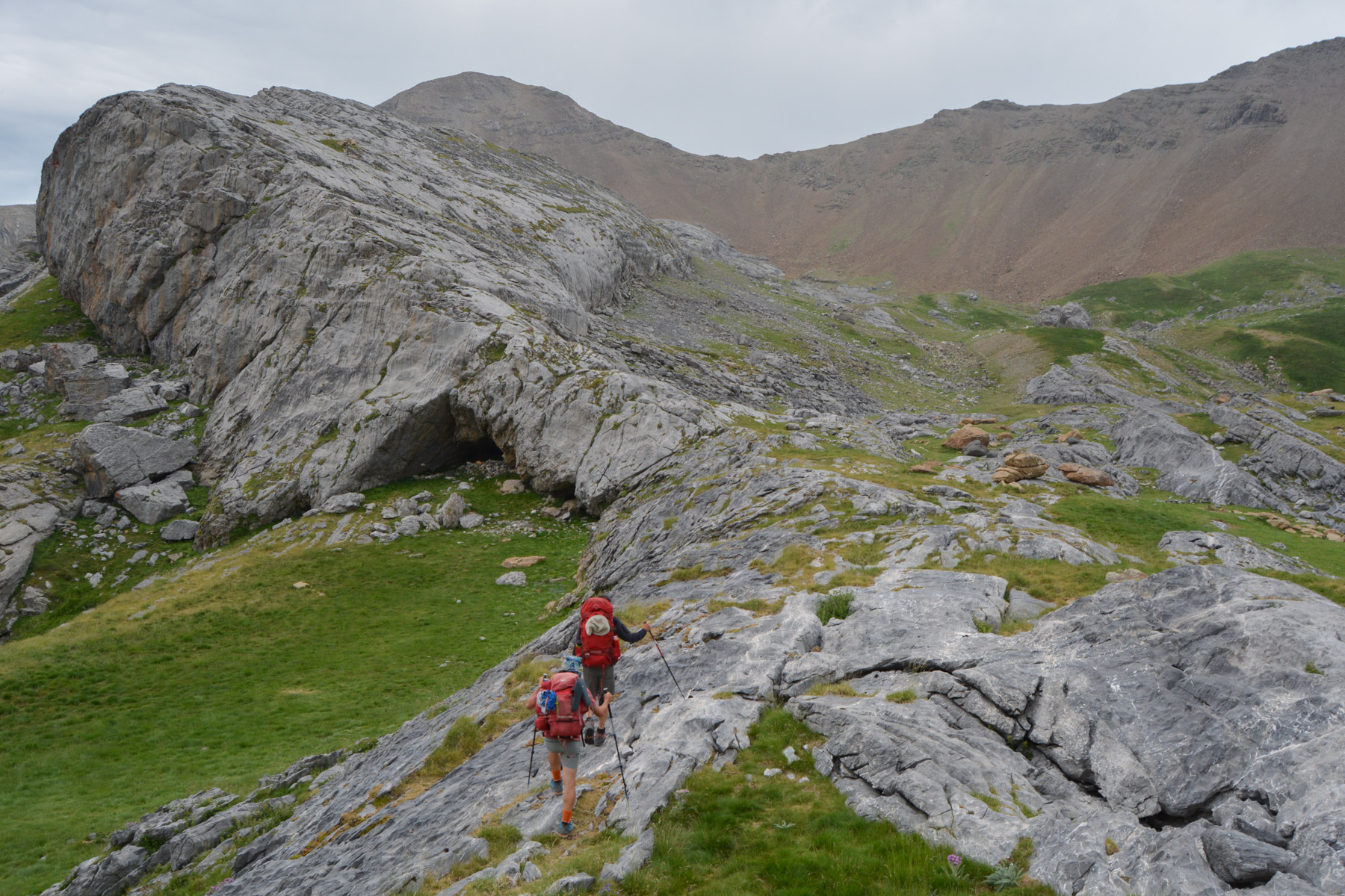
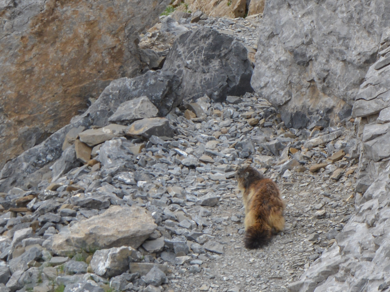
From the bivouac on Aguas Tuertas, follow the pretty path up the central couloir, crossing a large waterfall via a small couloir in the rock. Above our heads, the isards on the ridges watch our passage. Climb up again, past more small jumps, and come to a rocky ledge with a huge rounded cairn, facing the Llanos de Salarons dominated by the Gabietou North and South peaks.
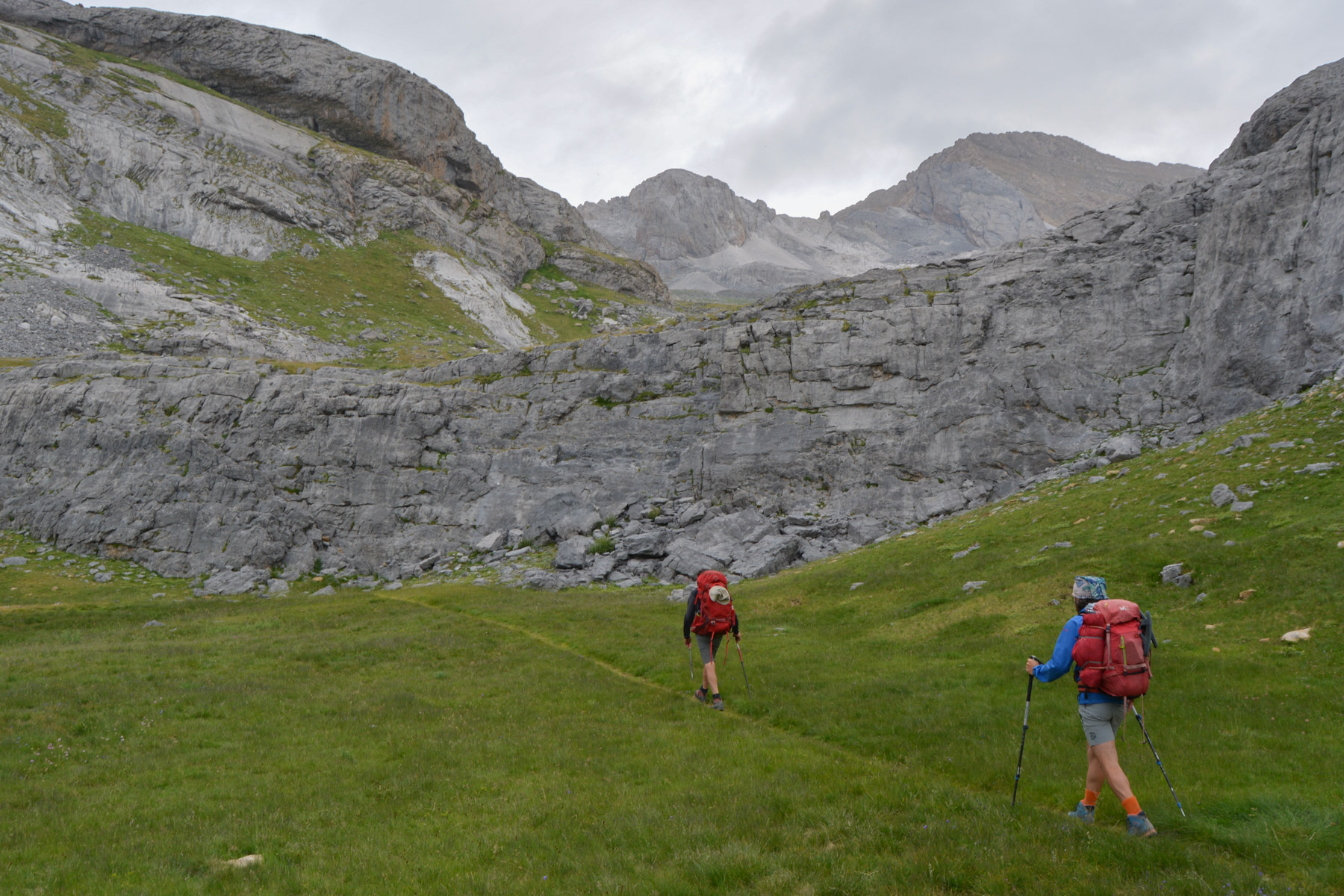
From here, head due west for the pass that can be seen on the ridge, at the top of a large red-brown scree. Follow the cairns and tackle the steep scree, winding or straight up to reach Collado Escuzana at 2730m. View of the Bujaruelo valley on the west side.
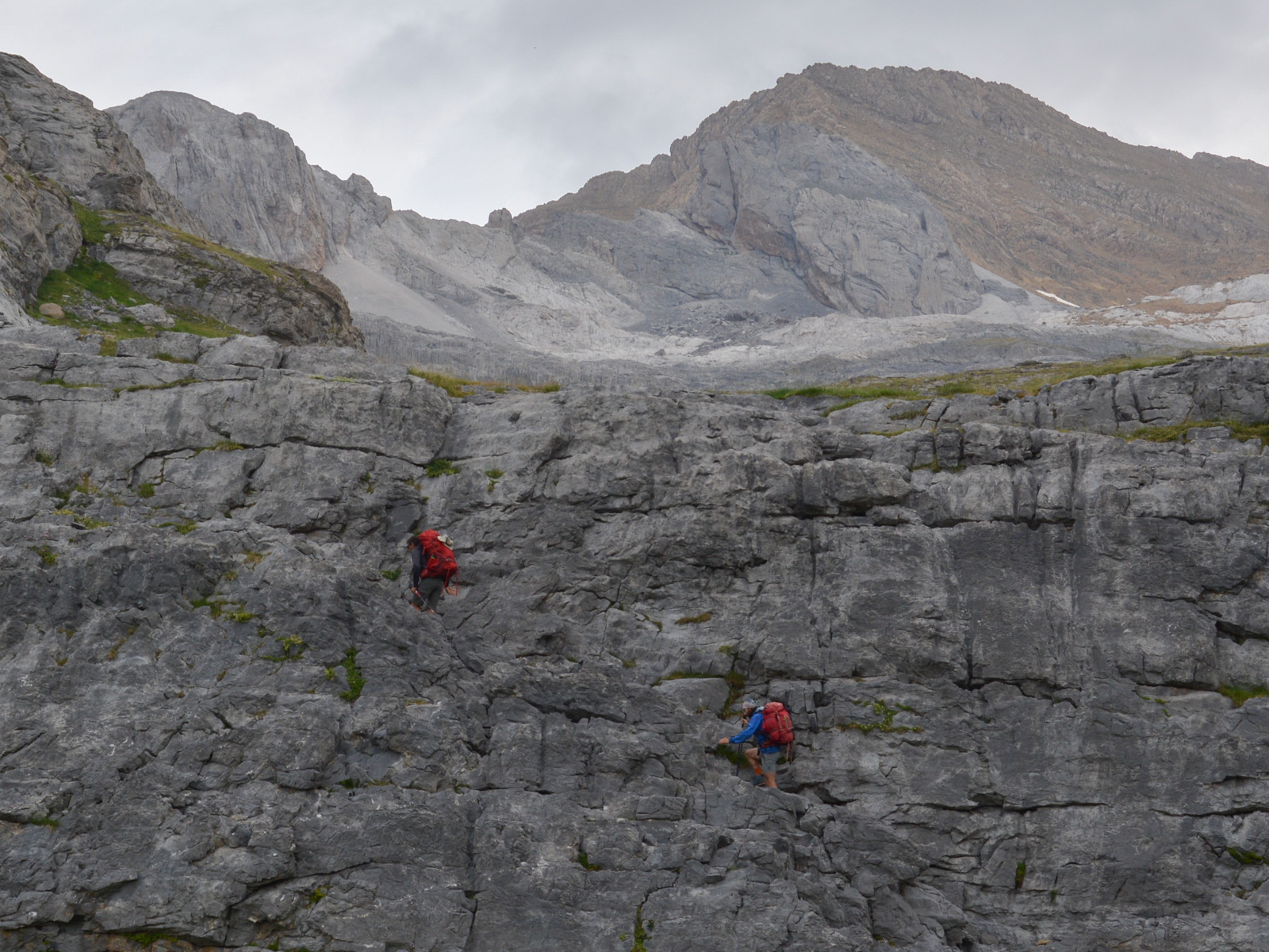
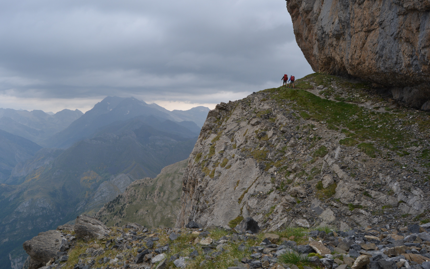
Descend steeply in the scree on the west side to emerge on a ledge above the valley. Turn right to the north, following the small cairned path below the upper wall. The rest of the itinerary follows a superb grassy or stony route along the side of the wall, winding and following the contours of the cliffs, descending or ascending to sneak along, staying just above 2500m until you reach the foot of Gabietou Sud.
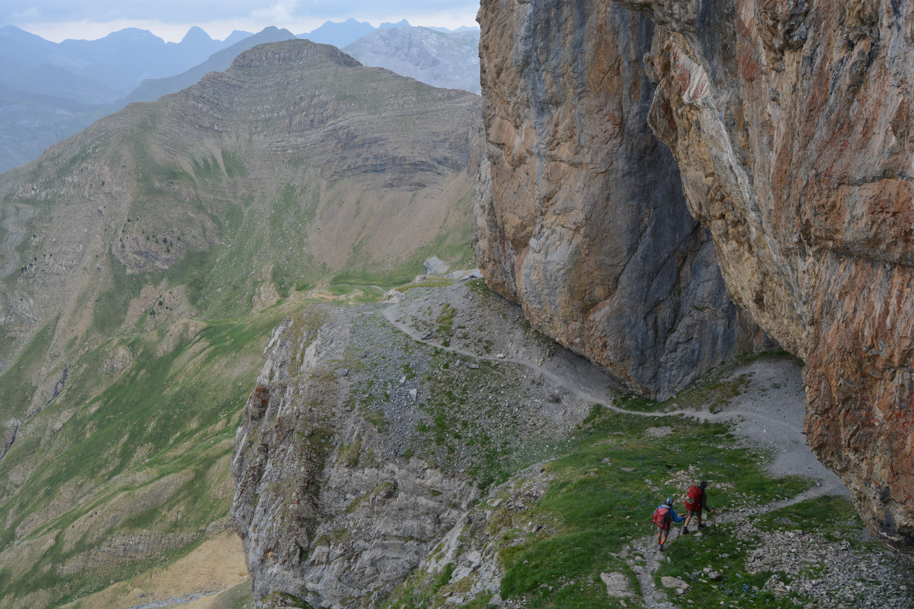
Here, the path crosses the stone corridor, and in the center you can see the clear division between grey and red limestone, which follows the dividing line between the 2 massifs (cf. photo). Continue westwards on a path that becomes more exposed, but with white dots and painted arrows to indicate the route to the Forquete. Be careful not to climb too high, and don't miss the last arrow, which indicates a passage with one or two steps of III/IV climbing, leading to the brèche at 2515m.
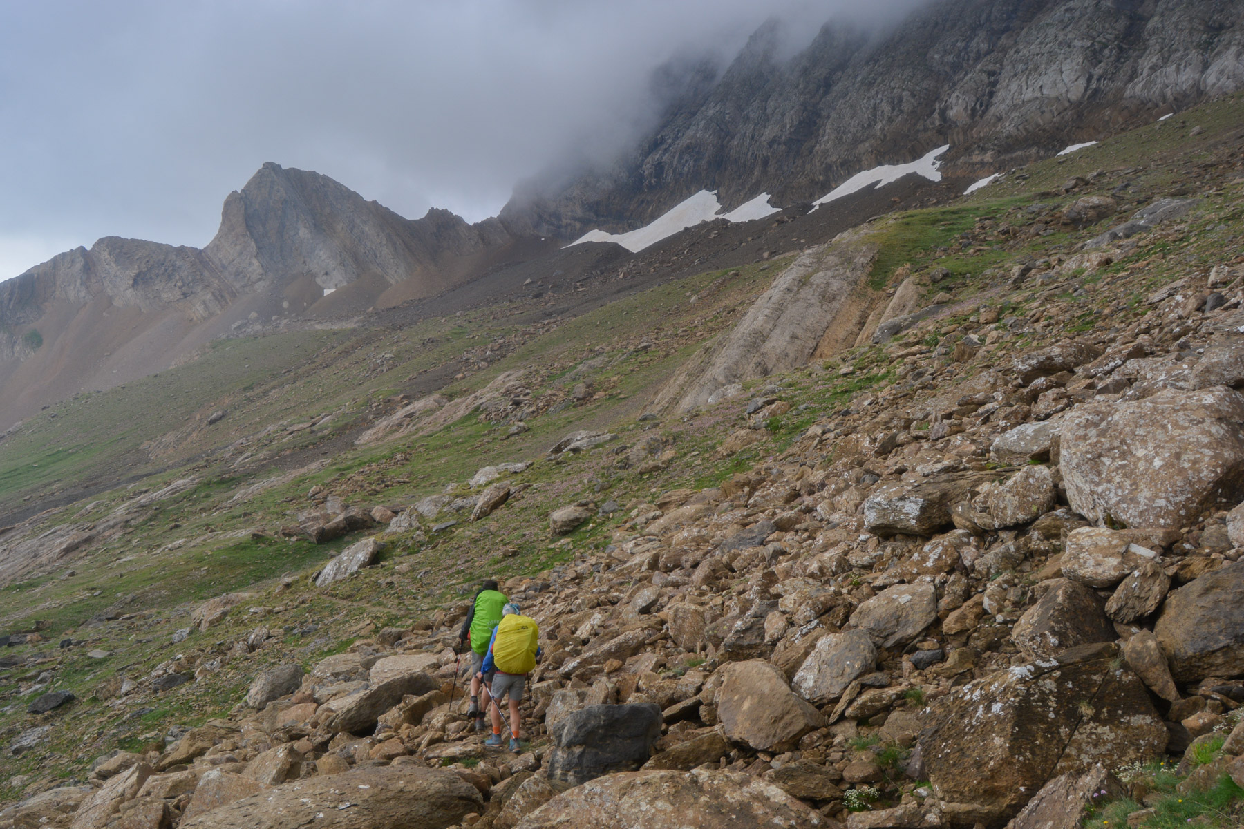
Tilt over and descend on the north side into a narrow stony corridor. From here, you can make out the Col de Boucharo and even the Col des Tentes between the reliefs in the distance. At the bottom, simply follow the easy path down from 2400m to 2273m to the Col de Boucharo or Puerto de Bujaruelo.
From the Col de Boucharo, return along the trail to the Col des Tentes parking lot.


Leave a Reply