


TOPO Via ferrata | CLIMBING7.COM
Publié le
 Partager sur WhatsApp
 Partager sur Twitter
Partager sur Instagram
Partager sur Twitter
Partager sur Instagram

 Partager sur Facebook
 Imprimer le topo
 Laisser un commentaire
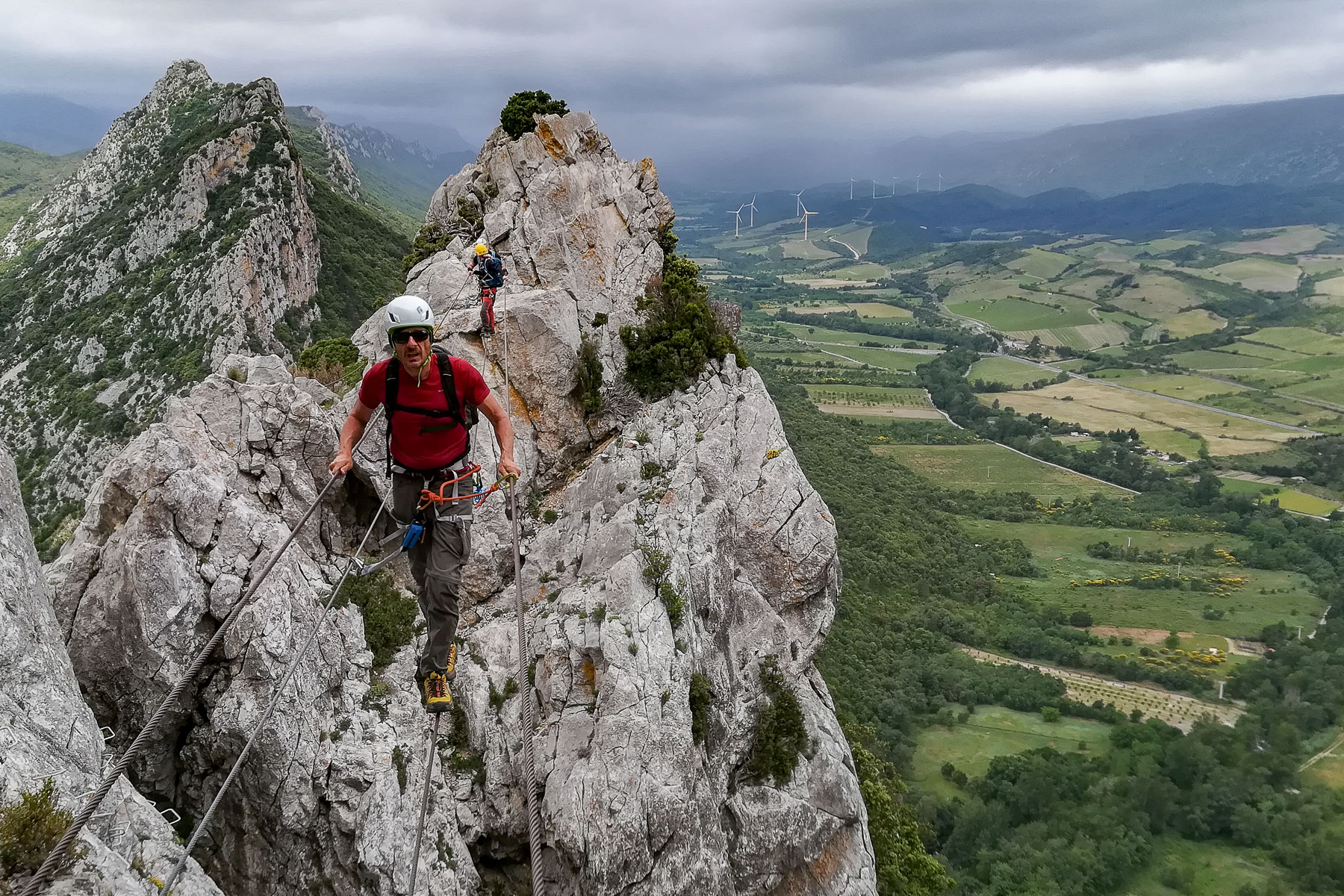
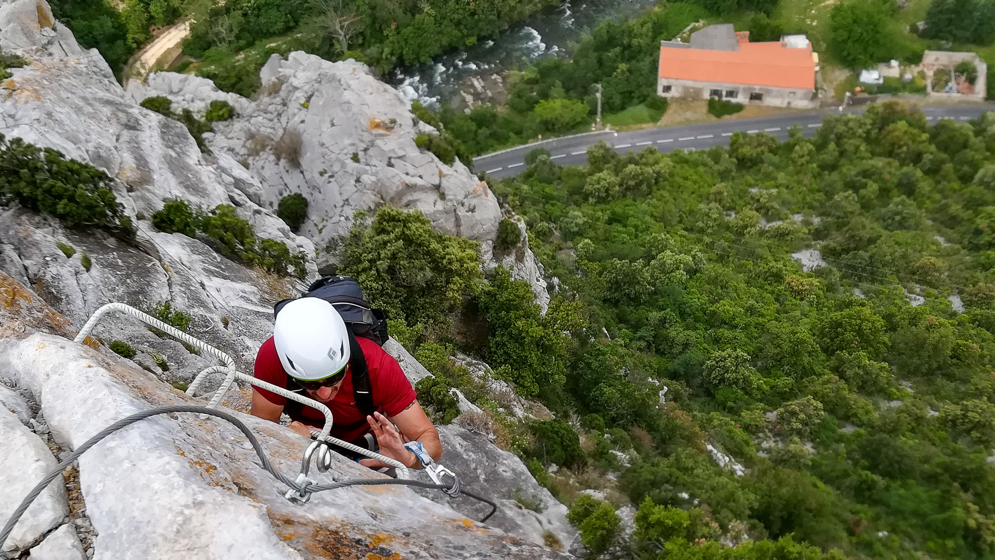
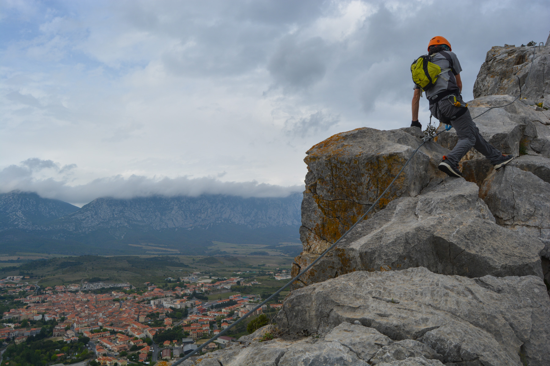
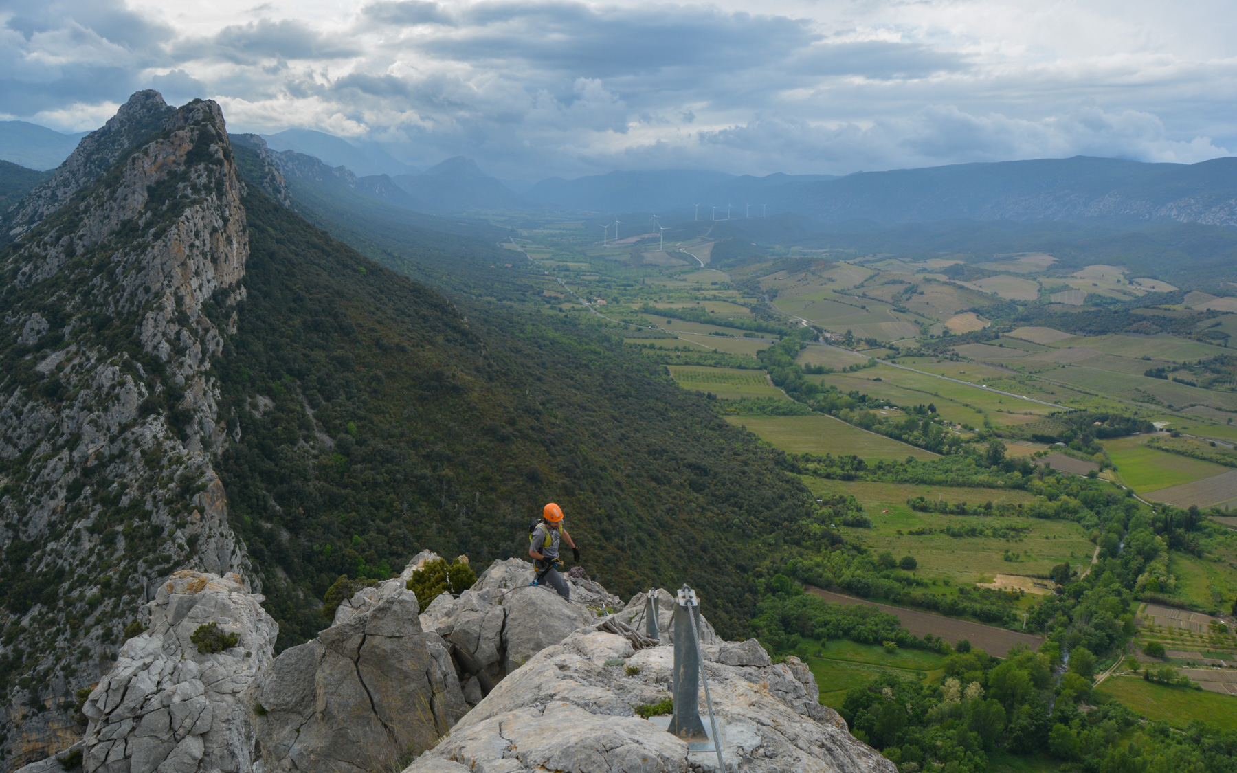
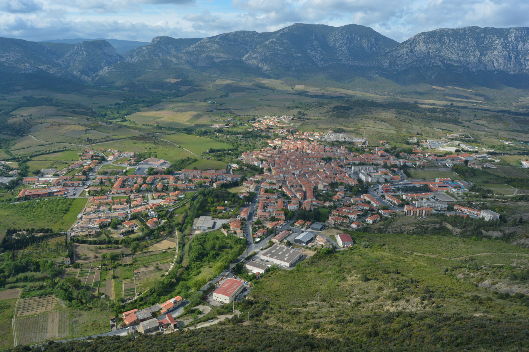
The via ferrata La Panoramique offers a spectacular route over a long rocky ridge in the southern Corbières, overlooking the village of Saint-Paul de Fenouillet. The route is interesting, aerial and varied, with a choice of an easy option for beginners, the Pichona, and a slightly more athletic and Arian option, the Panoramique. The day can be ideally rounded off with a descent of the Gorges de Galamus canyon, just a few kilometers away.
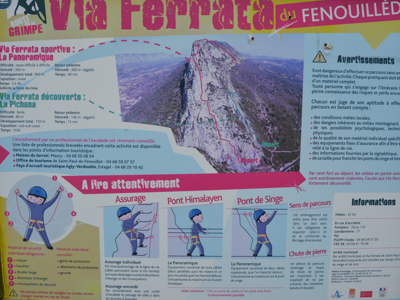
❱❱ Technical summary
The data below concerns the panoramic view (AD to D)
■ Departure point: parking de la Clue de la Fou, Saint-Paul de Fenouillet, Pyrénnées-Orientales (66)
■ Type of route: via ferrata
■ Direction: west
■ Length: 900 m
■ Vertical rise: +230 m
■ Estimated total time: 2h30 to 3h
■ Min and max altitude: 250 m / 480 m
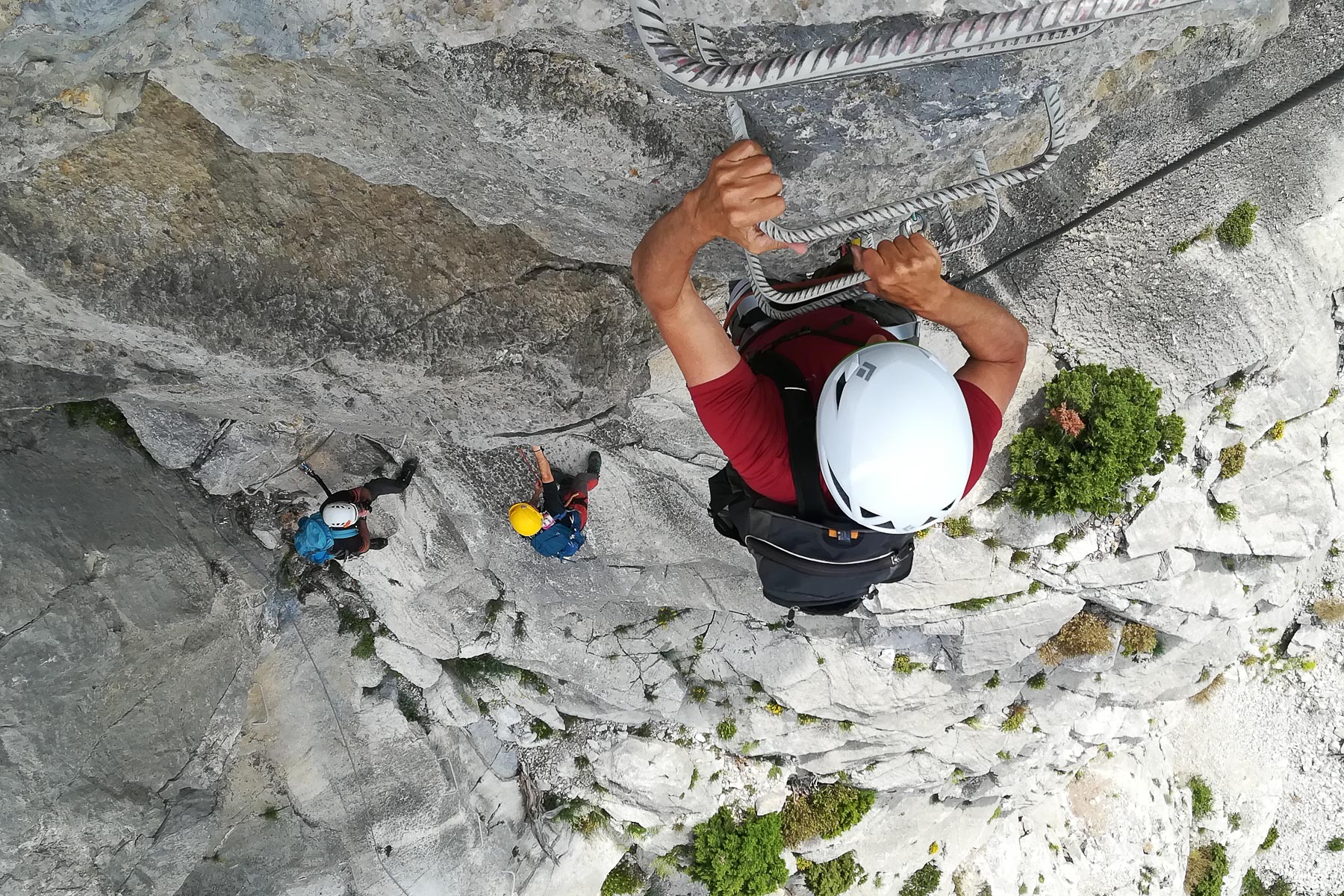
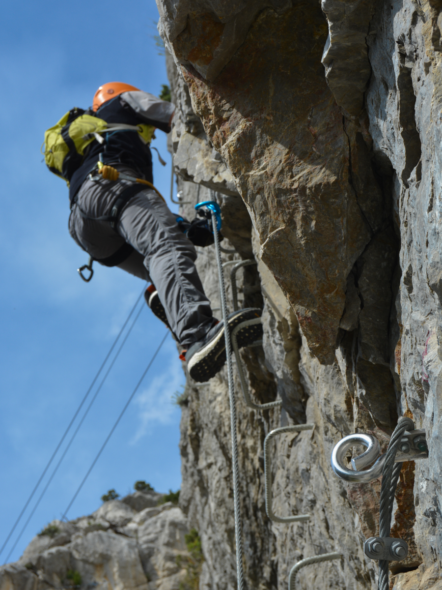
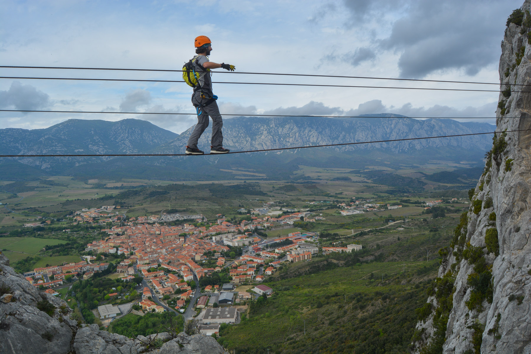
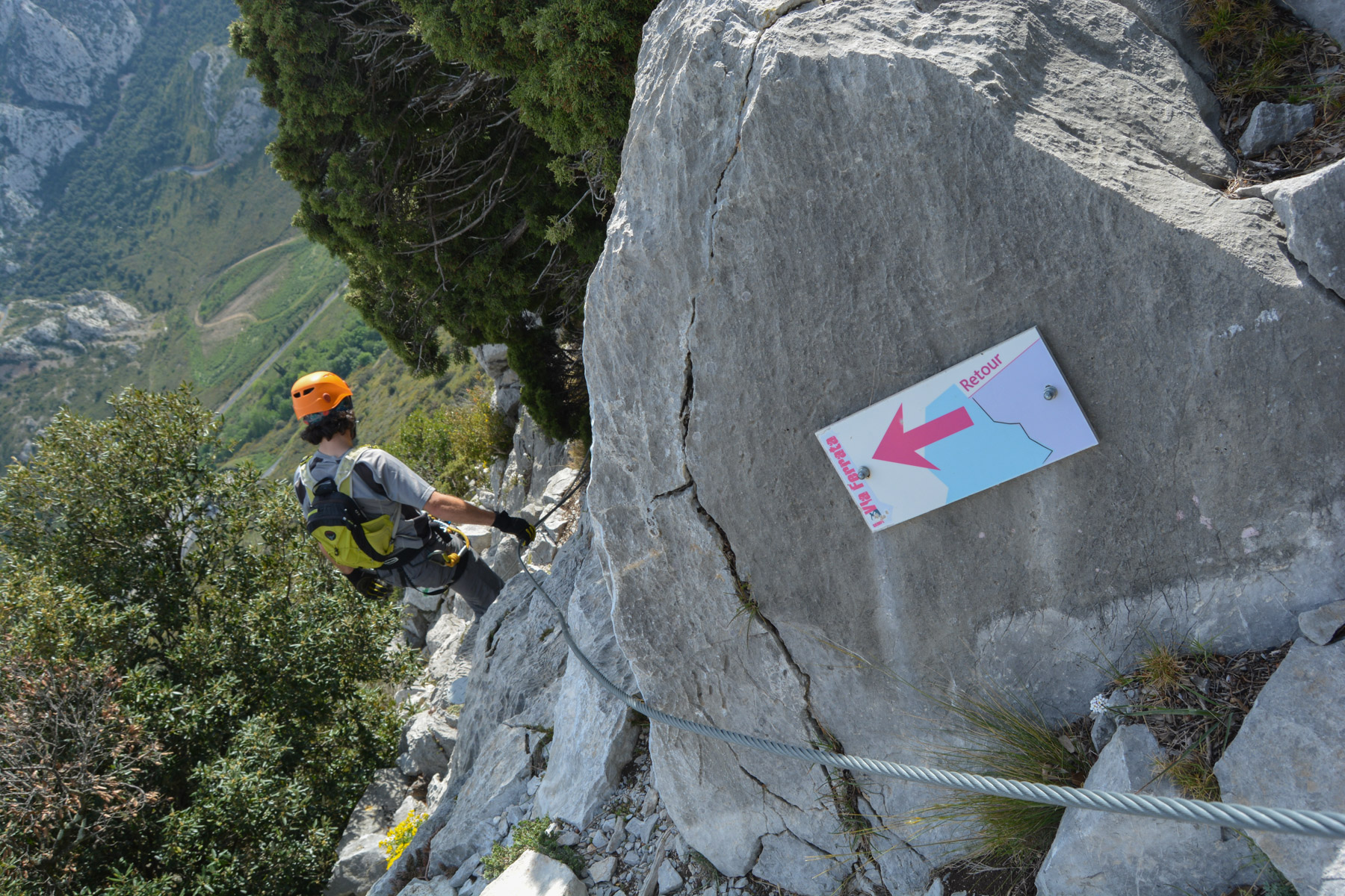
■ Equipment in place: excellent and generous in bars, 2 monkey bridges and 1 himalayan bridge
■ Equipment required: standard equipment
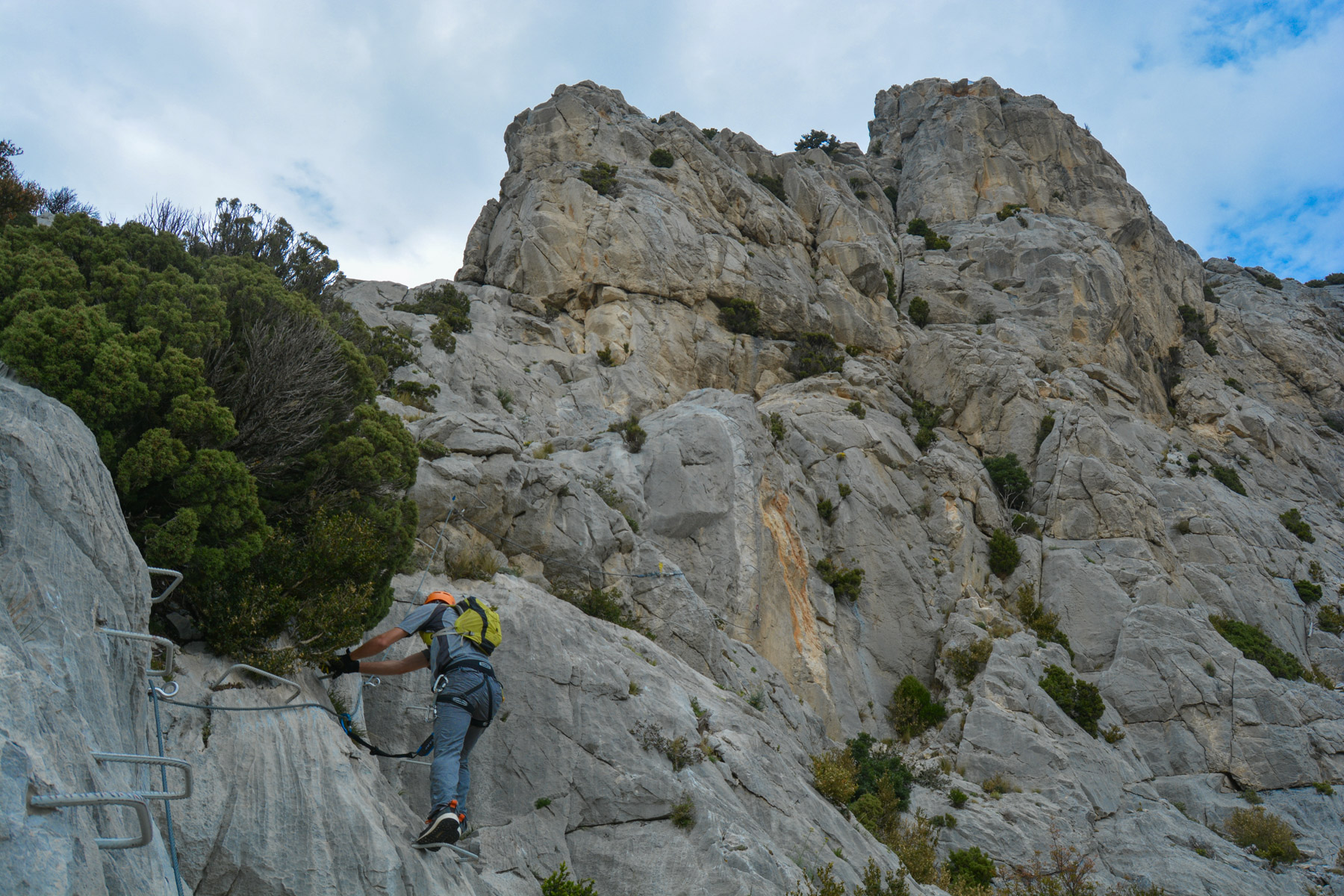
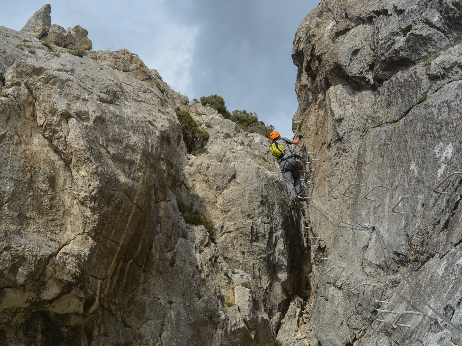
Difficulties: AD+ or K3+, the difficulties are concentrated in the 1st part with a few vertical walls to negotiate, then it's the aerial dimension that can impress.
❱❱ Access to the place
Saint-Paul de Fenouillet is on the D117 between Quillian and Perpignan, on the border between Aude and Pyrénées-Orientales. In the village, head south on the D619 towards the Clue de la Fou. Pass through this natural gateway between 2 walls and park either on the right or left of one of the 2 ferrata parking lots. Signposts from the village.
❱❱ Map & topo
❱❱ Itinéraire
From the parking lots, walk back to the D619 towards Saint-Paul. The start is there on the east side, in an open space at the foot of the wall. Once again, a topo sign and indications for the 2 ferrata options: easy and difficult.
There are 2 options: the petite ferrata "Pichona", really easy but great for children or beginners (1h) and the large "Panoramique", described below, quite difficult (K3) and longer.
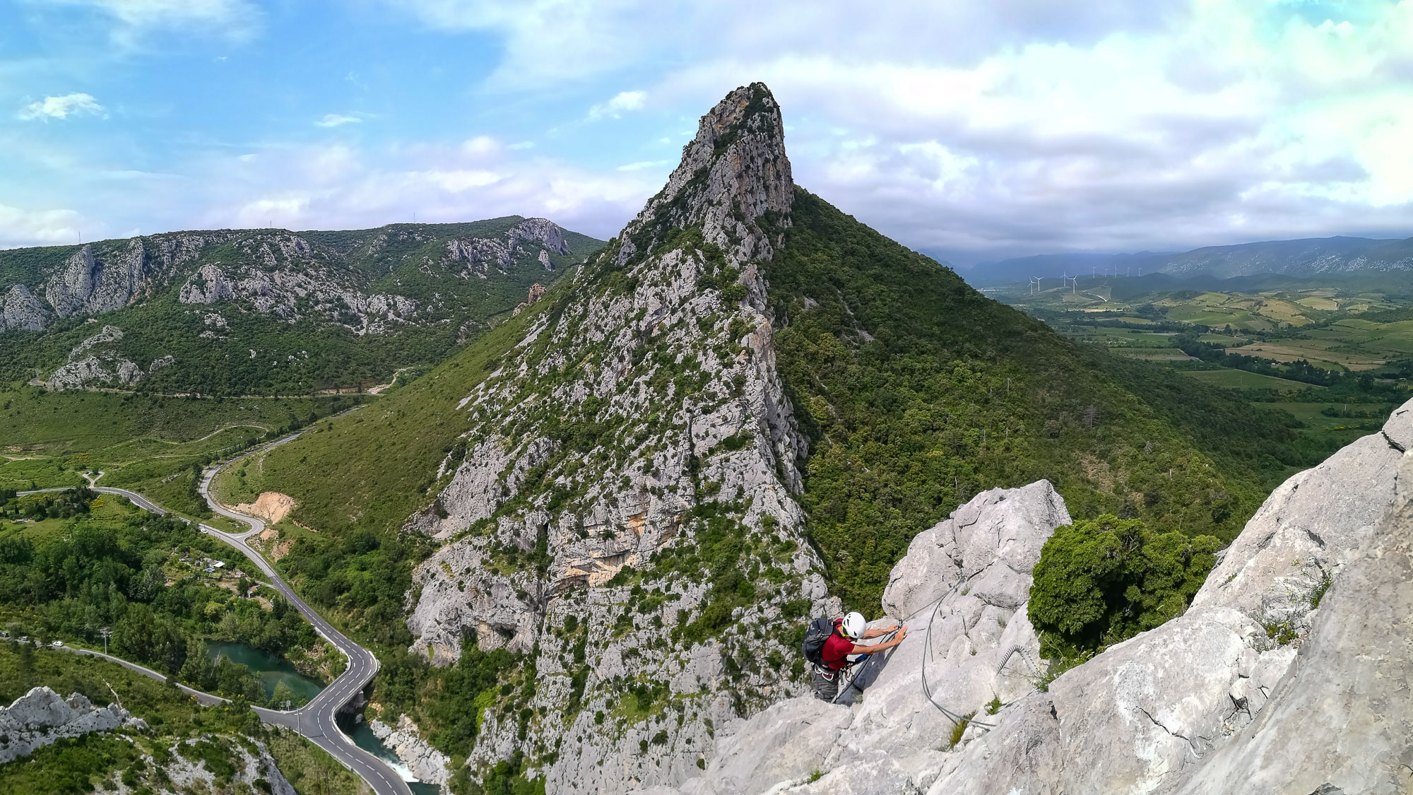
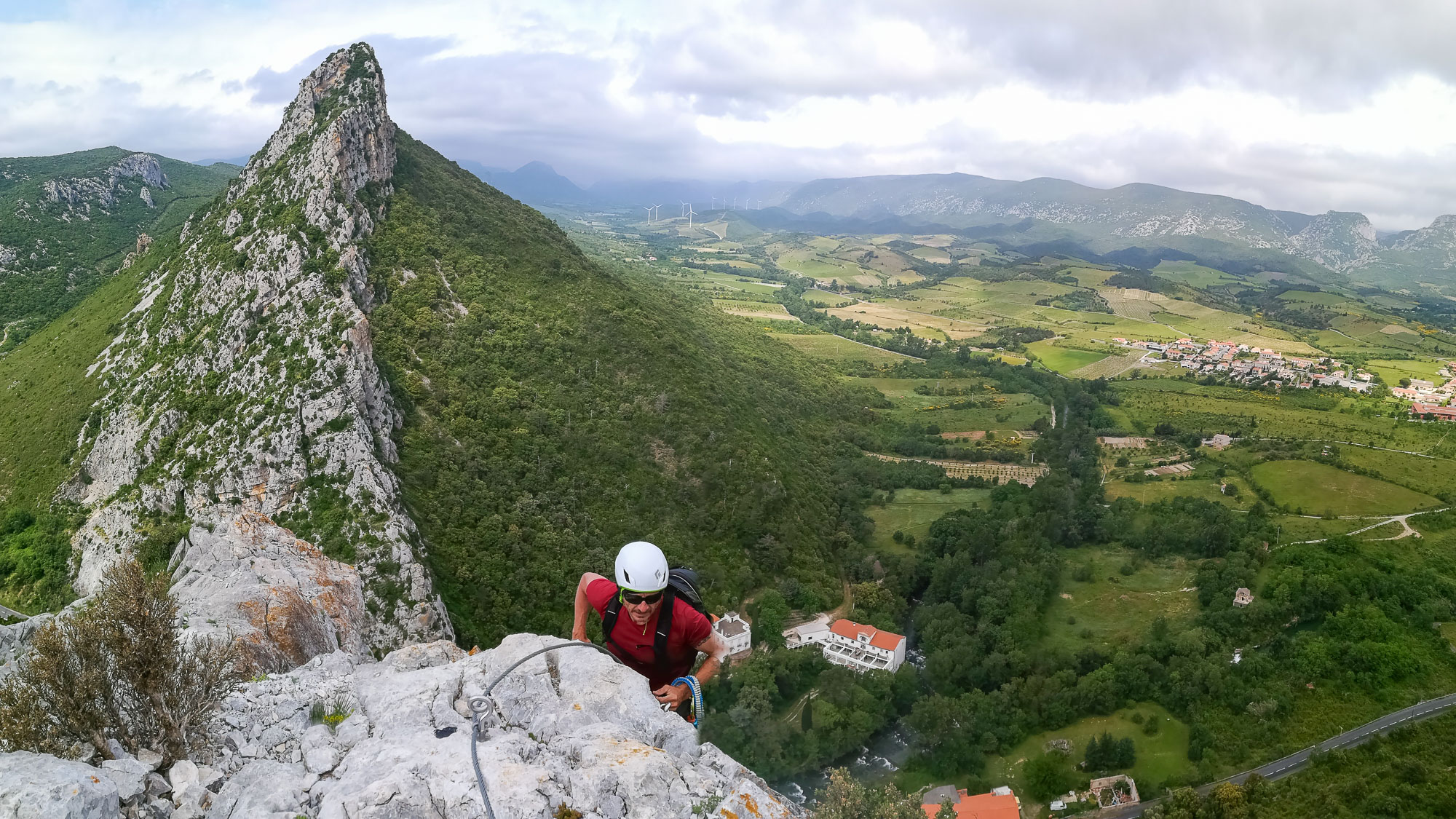
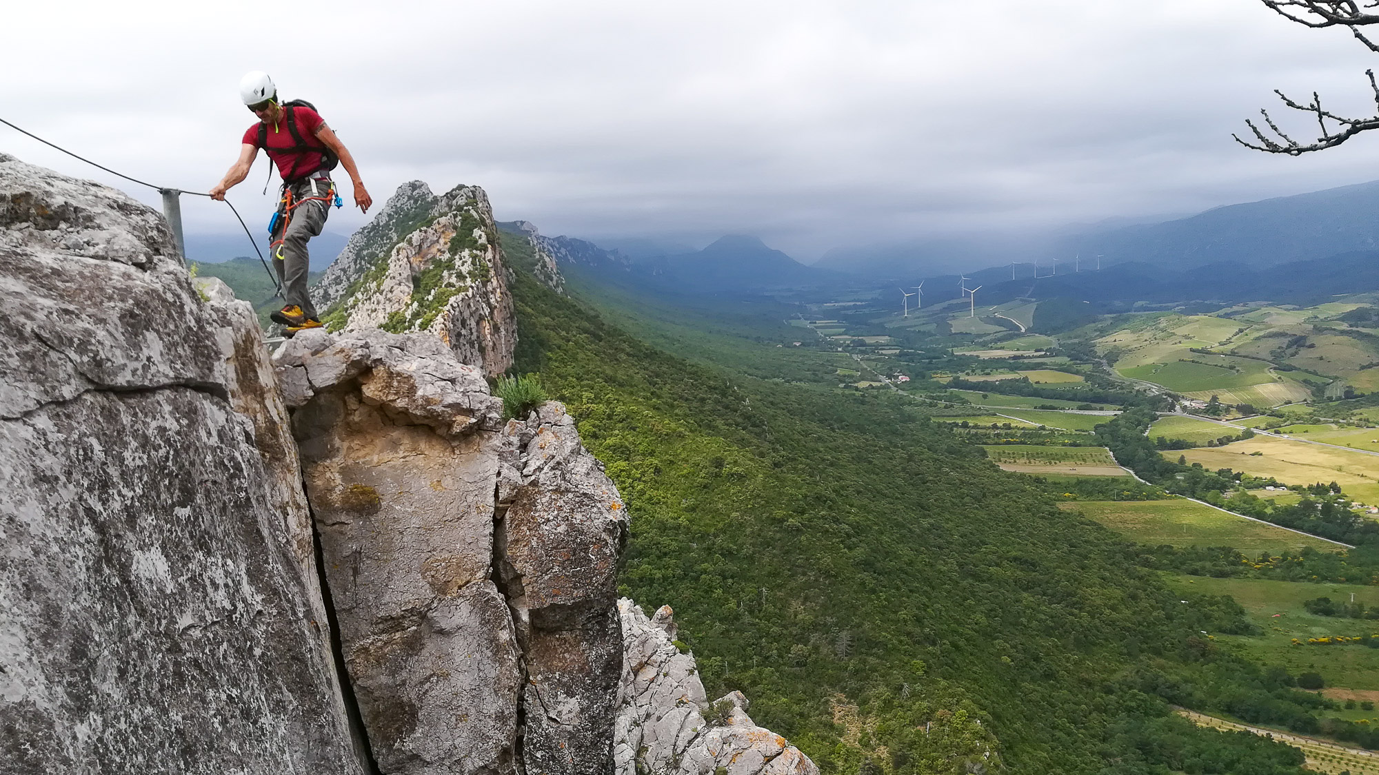
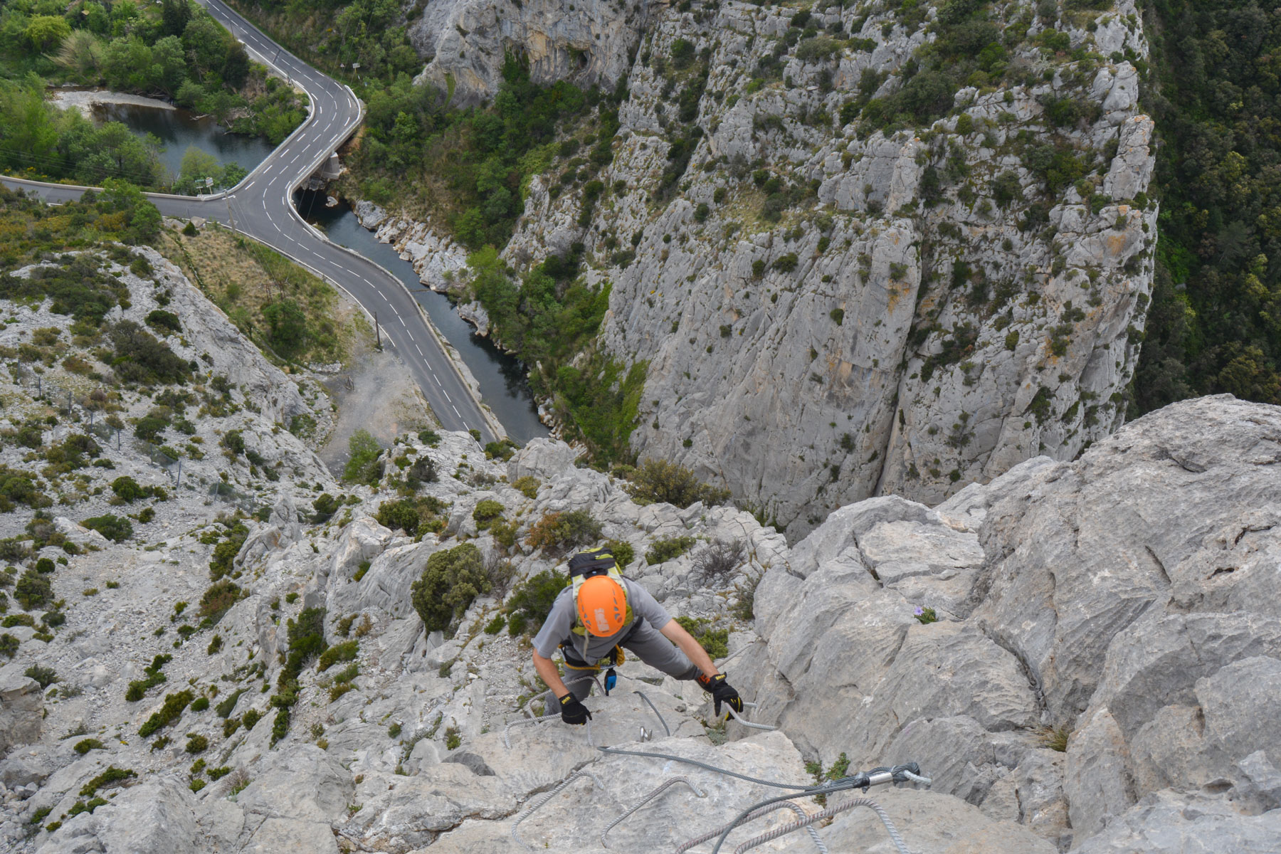
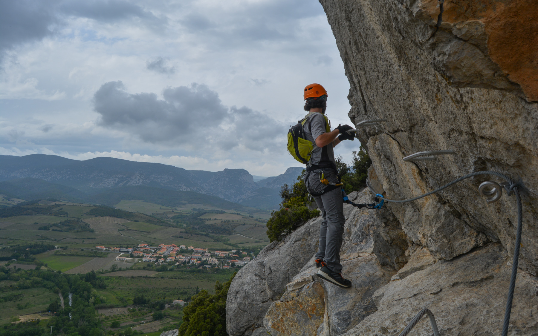
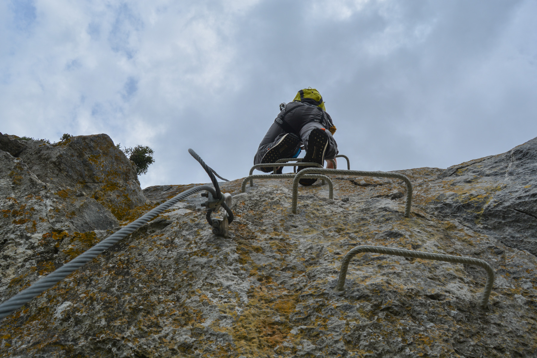
The route starts on the south face, then crosses over to the north side and follows the ridge to the end. There are 2 monkey bridges and 1 Himalayan bridge. The equipment consists of a large number of rungs.
The difficulty is concentrated in the 1st section, with several more than vertical walls to negotiate, either by climbing or traversing. There are a few more technical steps where you need to position yourself well to save your arms. Once past this rather physical start, the difficulty eases and you alternate between walking and small walls. The sequence around and on the ridge is not difficult, but impressive and aerial. The panoramic views over the valley to the north and the peaks to the south are spectacular.
From the ridge, wind down to the south, then continue westwards to return fairly quickly above the parking lot.
Topo of the Panoramique ferrata on the Deandar website (Spanish)


Leave a Reply