


TOPO Canyoning | CLIMBING7.COM
Publié le
 Partager sur WhatsApp
 Partager sur Twitter
Partager sur Instagram
Partager sur Twitter
Partager sur Instagram

 Partager sur Facebook
 Imprimer le topo
 Laisser un commentaire

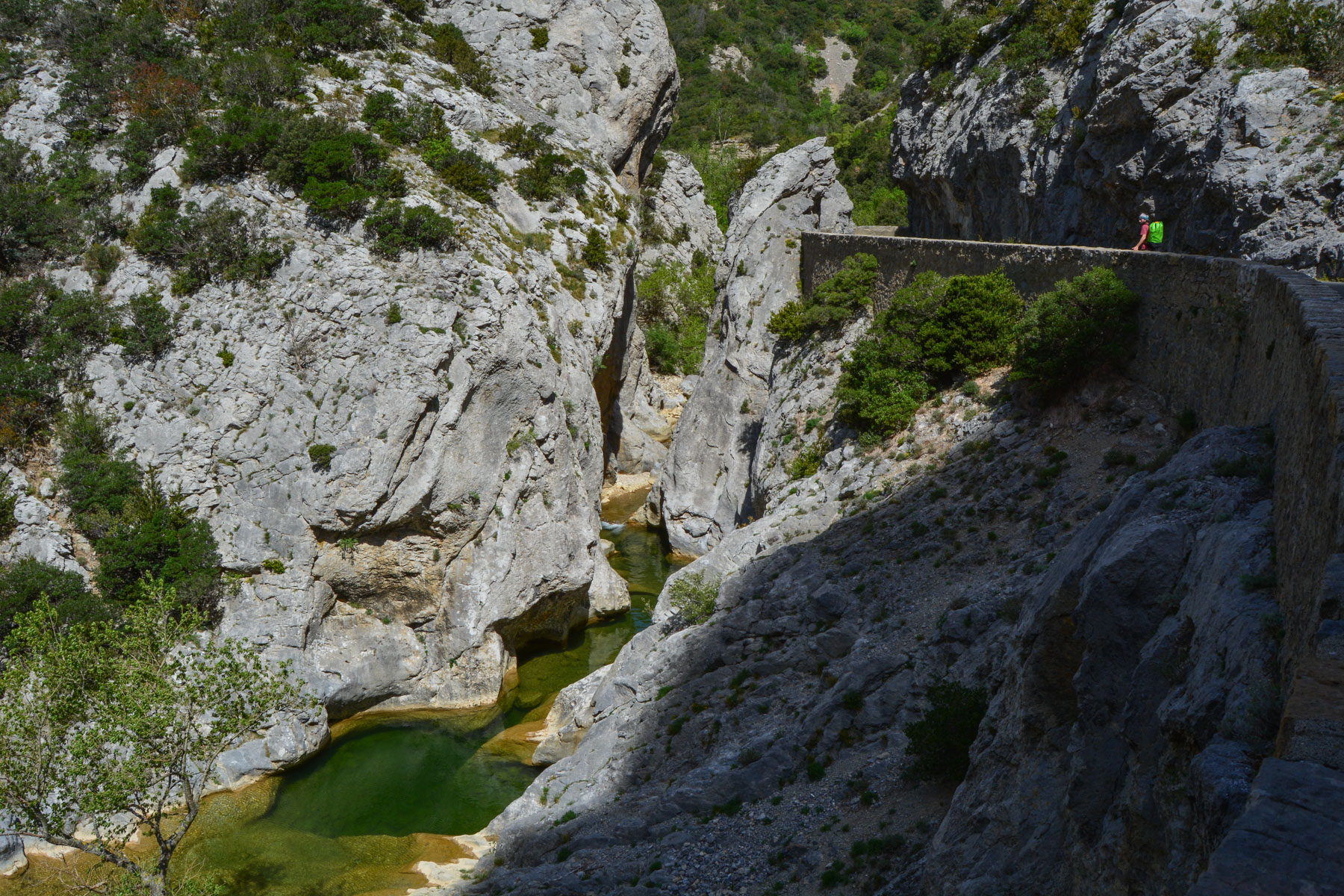
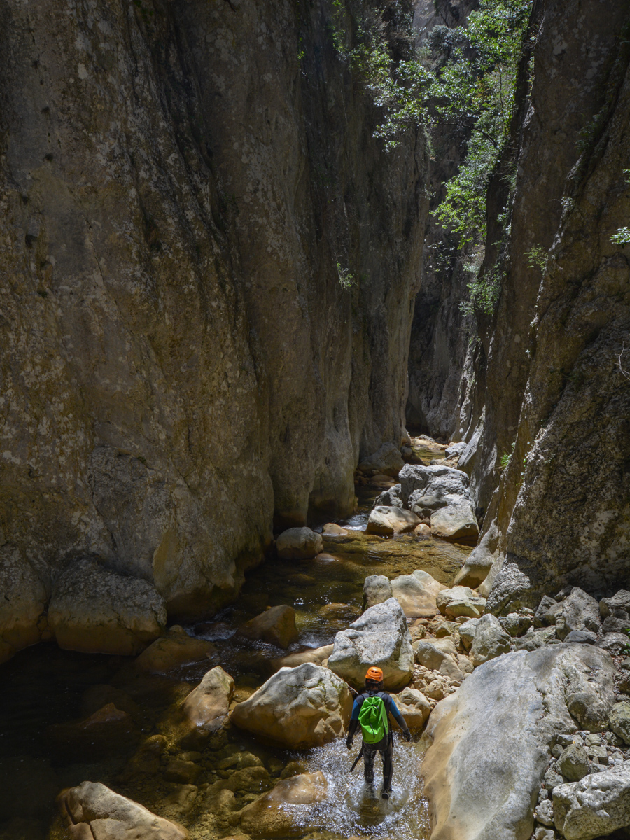
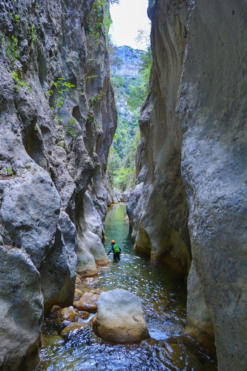
In the heart of the Corbières, straddling the Aude and Pyrénées-Orientales departments, the Gorges de Galamus form an impressive limestone gorge over 100 m deep. The descent of the river Agly, which runs through the deepest part of the gorge, offers a pleasant and fun aquatic hike, without difficulty, in a wild atmosphere. To round off the day, a few kilometers further south, you can climb the via ferrata at Saint-Paul de Fenouillet and enjoy a series of aerial panoramas over the region.
❱❱ Technical summary
Type ✦ Water canyon
Location ✦ Saint-Paul de Fenouillet
Region ✦ Pyrénées Orientales (66)
Country ✦ Spain
Length ✦ 1600m
Vertical drop ✦ 70m
Difficulty ✦ v2-a3-III
Max recall ✦ None
Duration ✦ 1h30 to 2h
Interest ✦ ★
❱❱ Access to the place
Saint-Paul de Fenouillet is on the D117 between Quillan and Perpignan, on the border between Aude and Pyrénées-Orientales. From the village, head north on the D7 towards Cubières-sur-Cinoble. Park in the parking lot overlooking the gorge at the southern entrance, where you'll find a small café and the trailhead to the Saint-Antoine de Galamus hermitage.
❱❱ Map & topo
Voir en plein écran
❱❱ Itinéraire
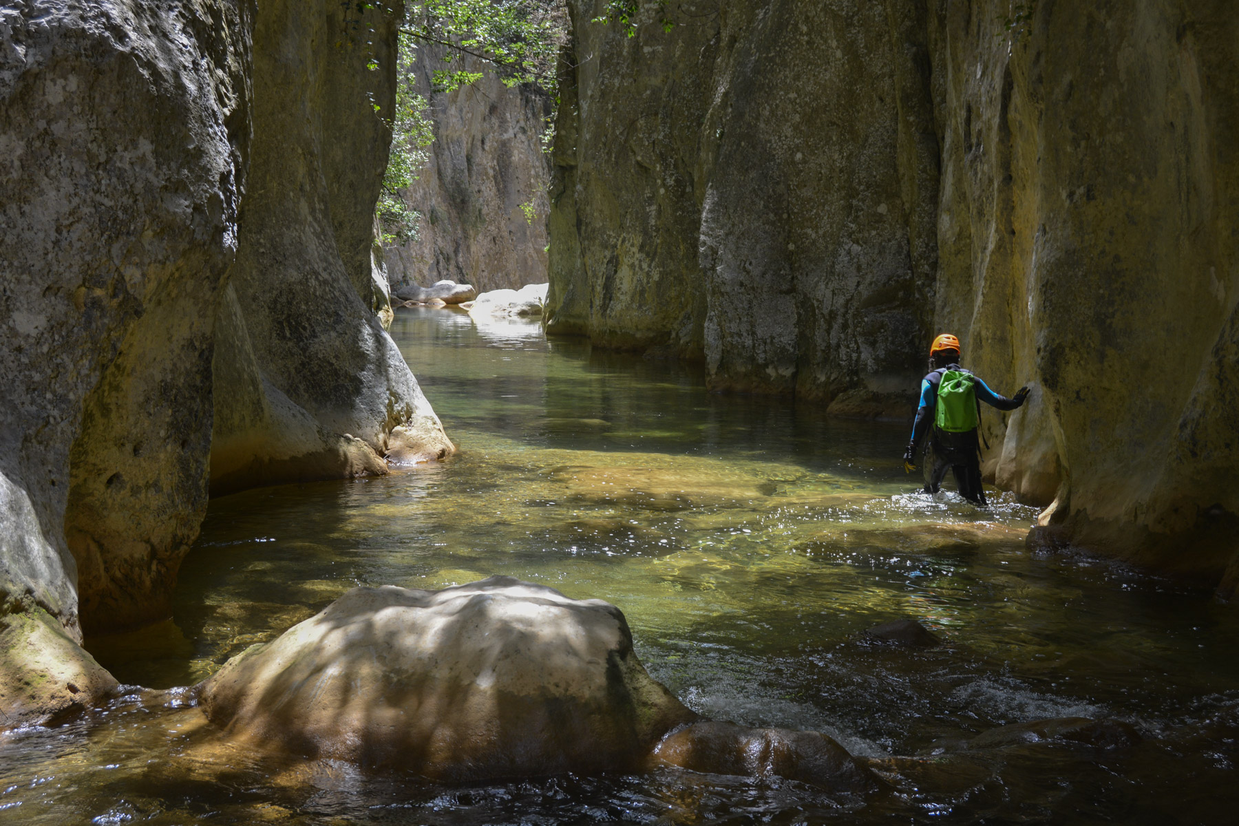
Walk up the gorge on the impressive road cut into the rock, overhanging the Agly torrent by more than 100m. The road is almost horizontal, but as the torrent rises in altitude, you reach it at the end of the gorge at a characteristic gap above a basin.
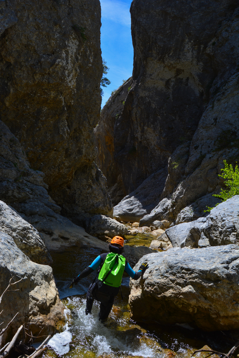
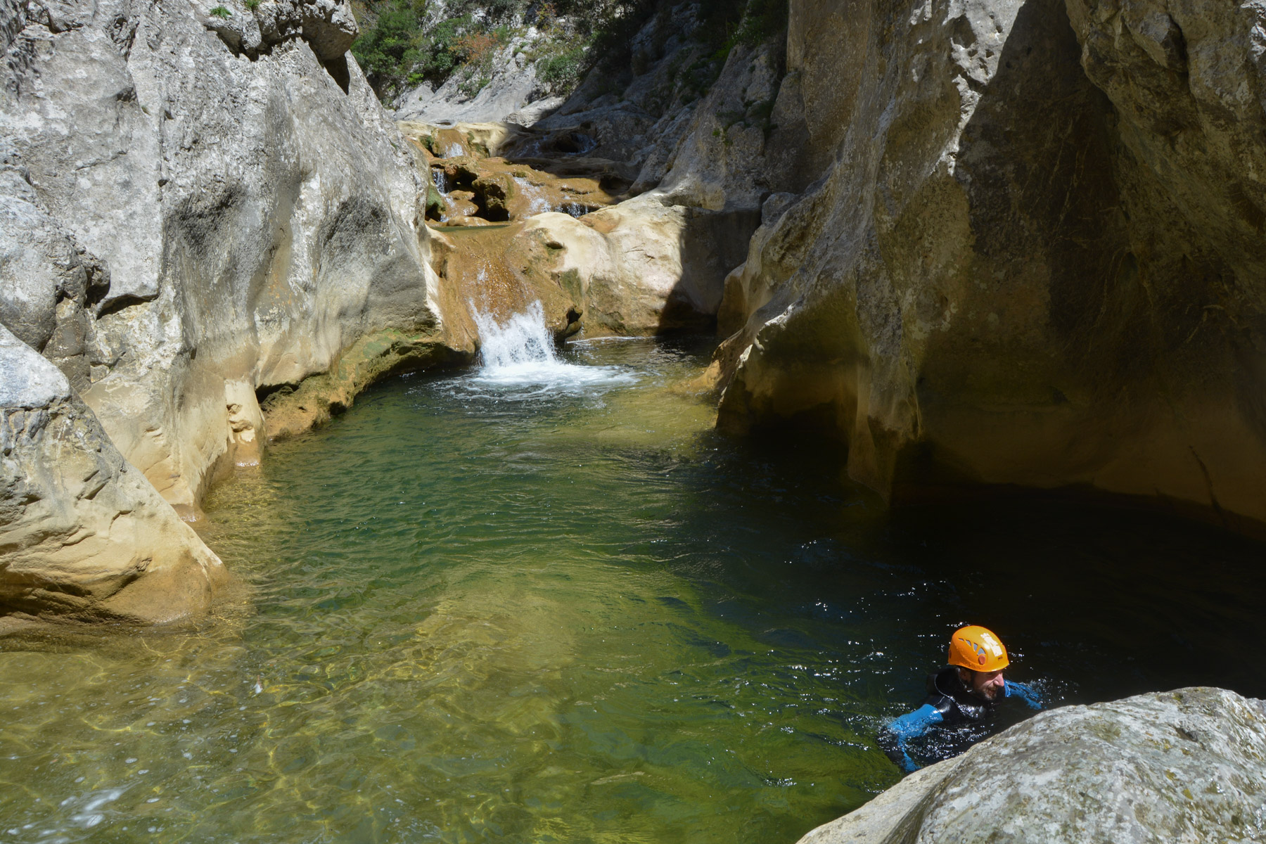
There are no specific obstacles to overcome, but the descent does require a few small descents and a passage equipped to avoid a waterfall. No equipment is required, apart from a wetsuit (given the water temperature), a helmet and a piece of rope to help. There's no escape once you've entered the gorge.
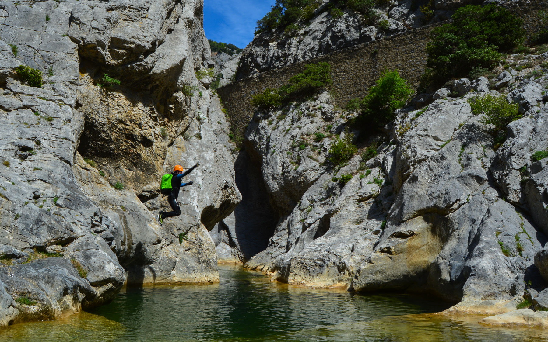
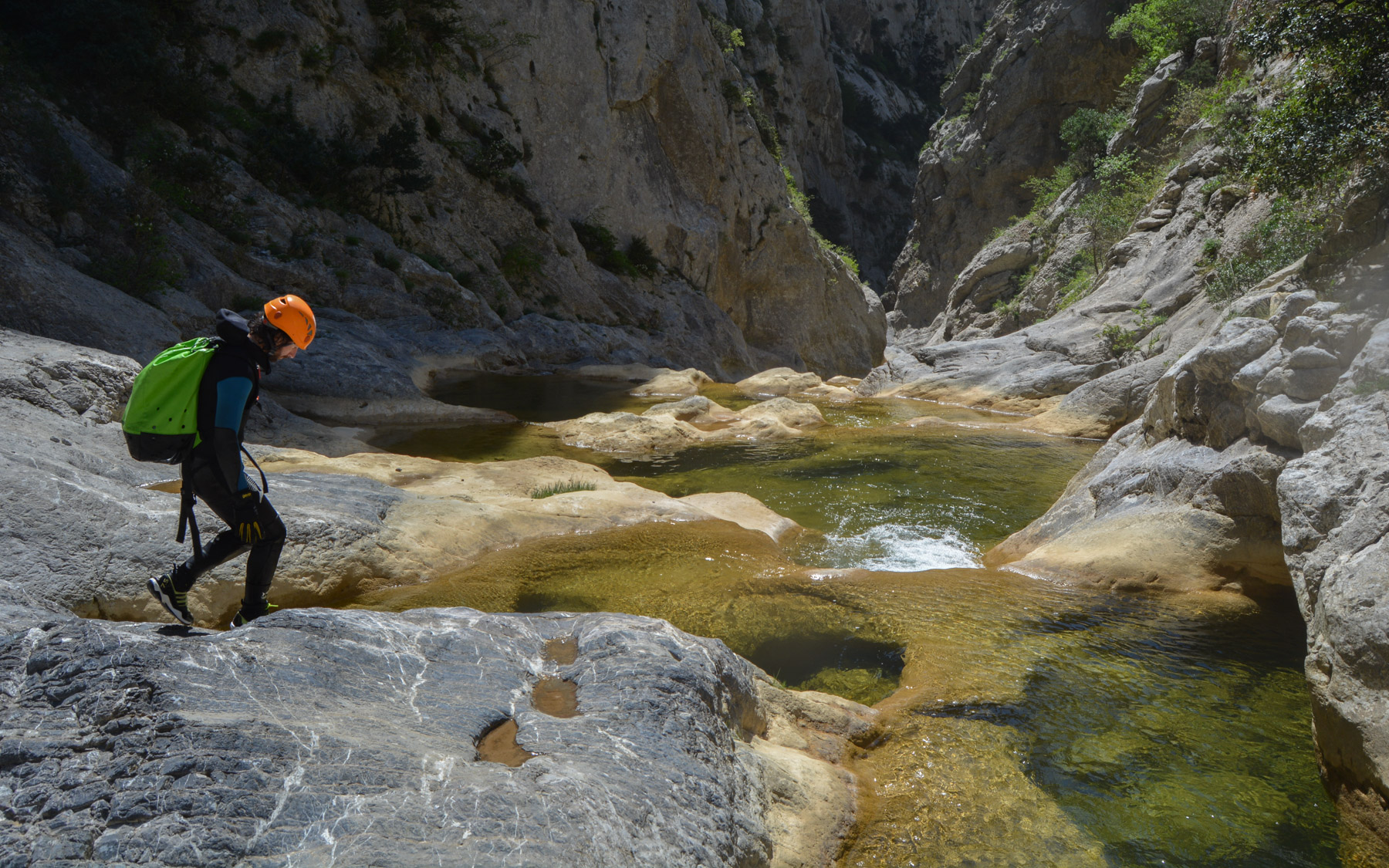
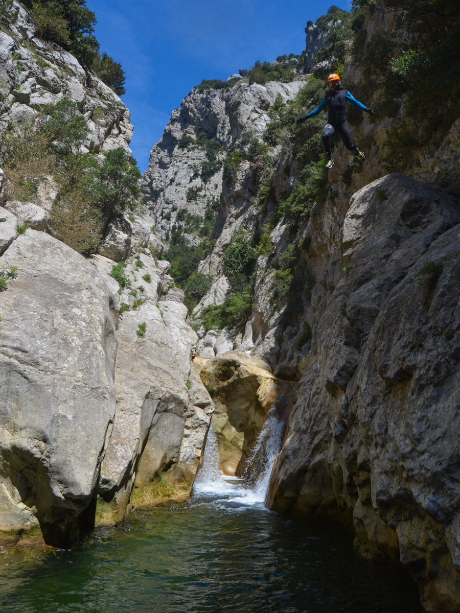
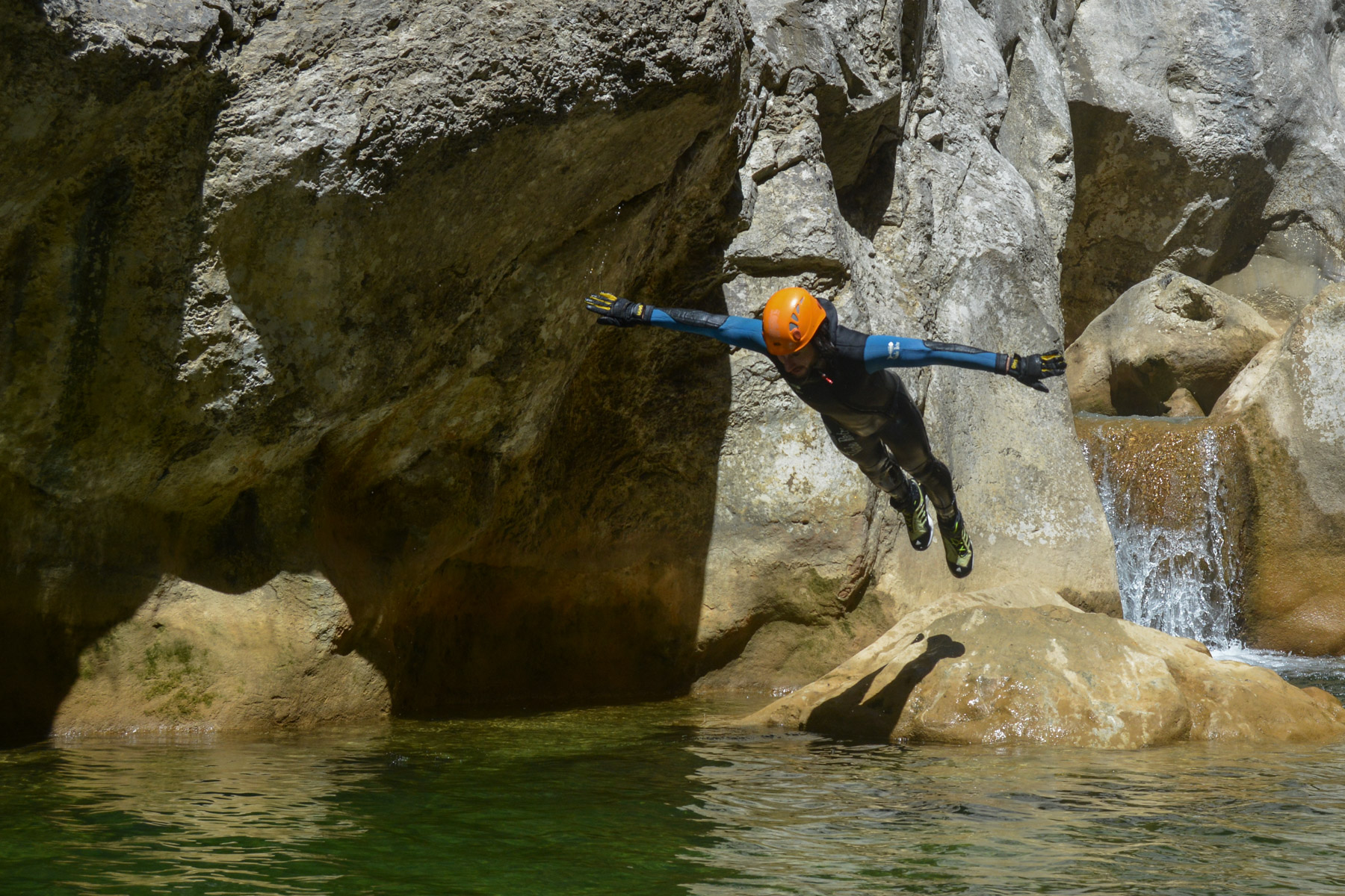
The first part is open, with pools and a few jumps to negotiate. The second part is increasingly steep, ending in a series of biefs forming rocky corridors for swimming. There are several jump-off points between 1m and 3m, and a waterfall on the left bank with a cable ledge from which a 6 or 7m jump-off is possible.
The final corridor leads to an opening where the left bank exit sign can be found.
Climb steeply on the path which, after a series of switchbacks, passes under the hermitage and returns to the starting parking lot.


Leave a Reply