


TOPO Hiking | CLIMBING7.COM
Publié le
 Partager sur WhatsApp
 Partager sur Twitter
Partager sur Instagram
Partager sur Twitter
Partager sur Instagram

 Partager sur Facebook
 Imprimer le topo
 Laisser un commentaire

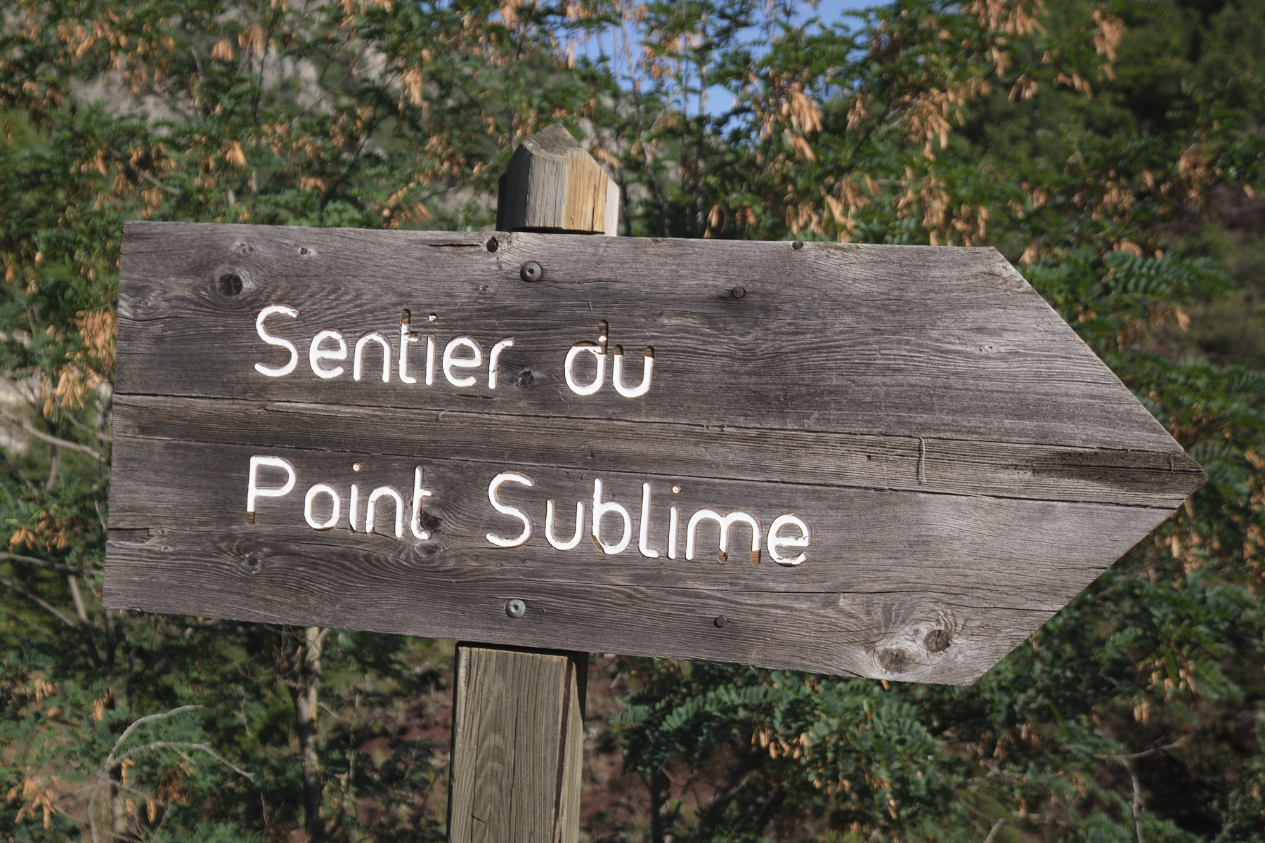
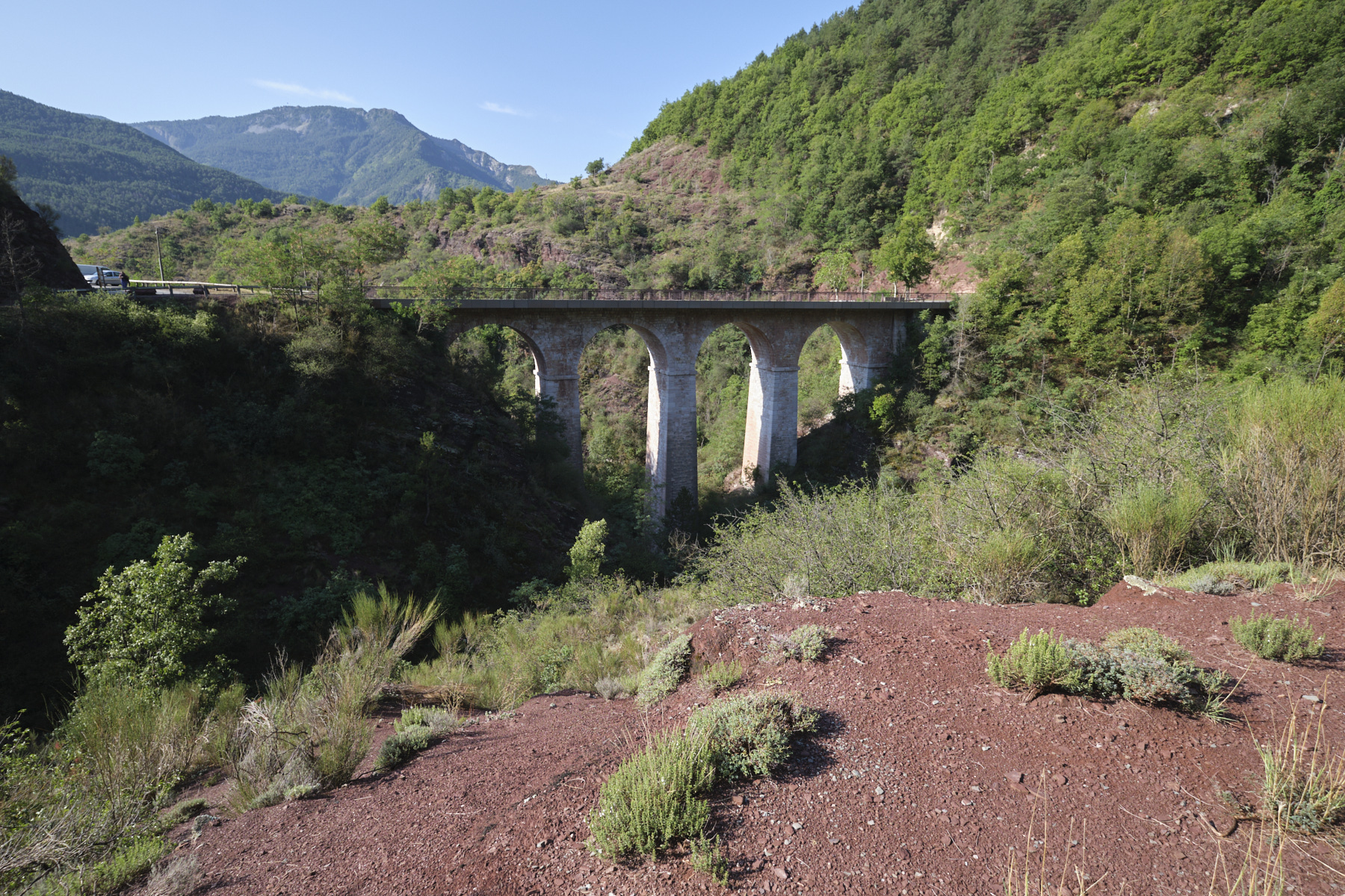
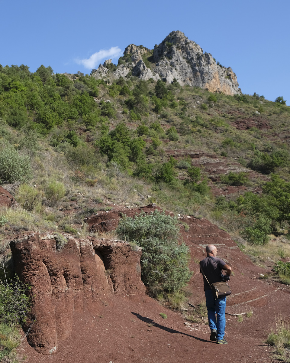
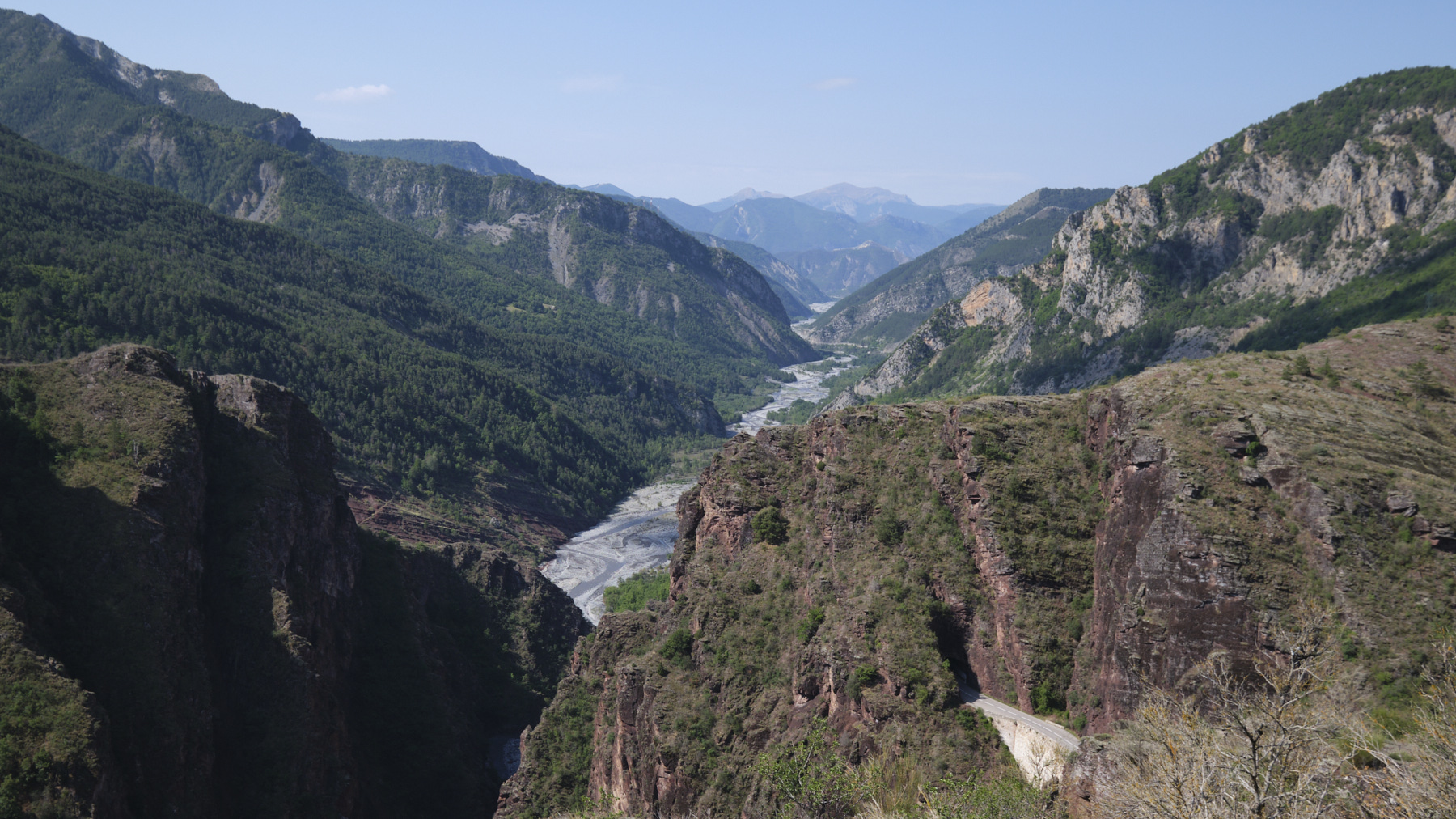
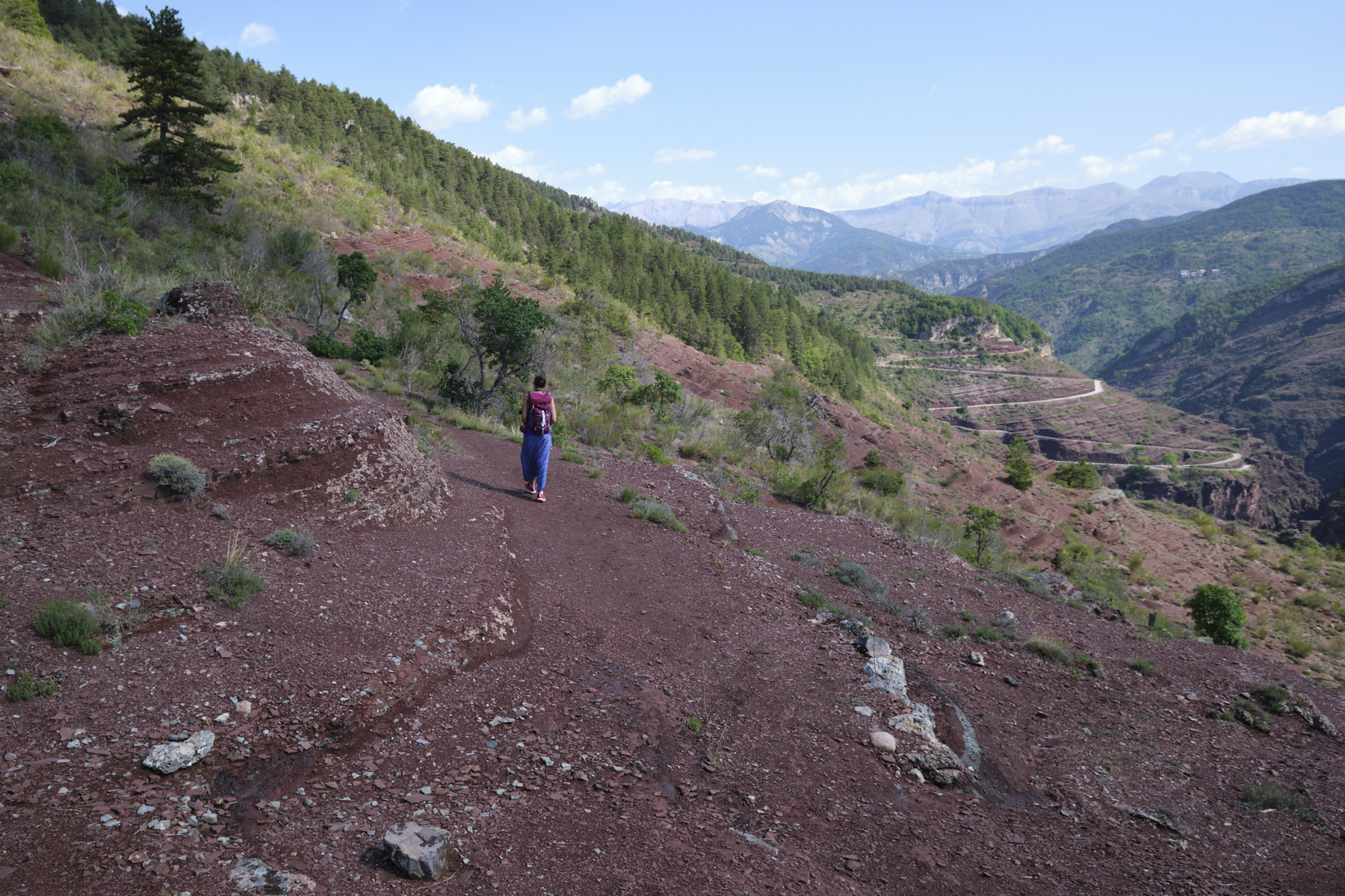
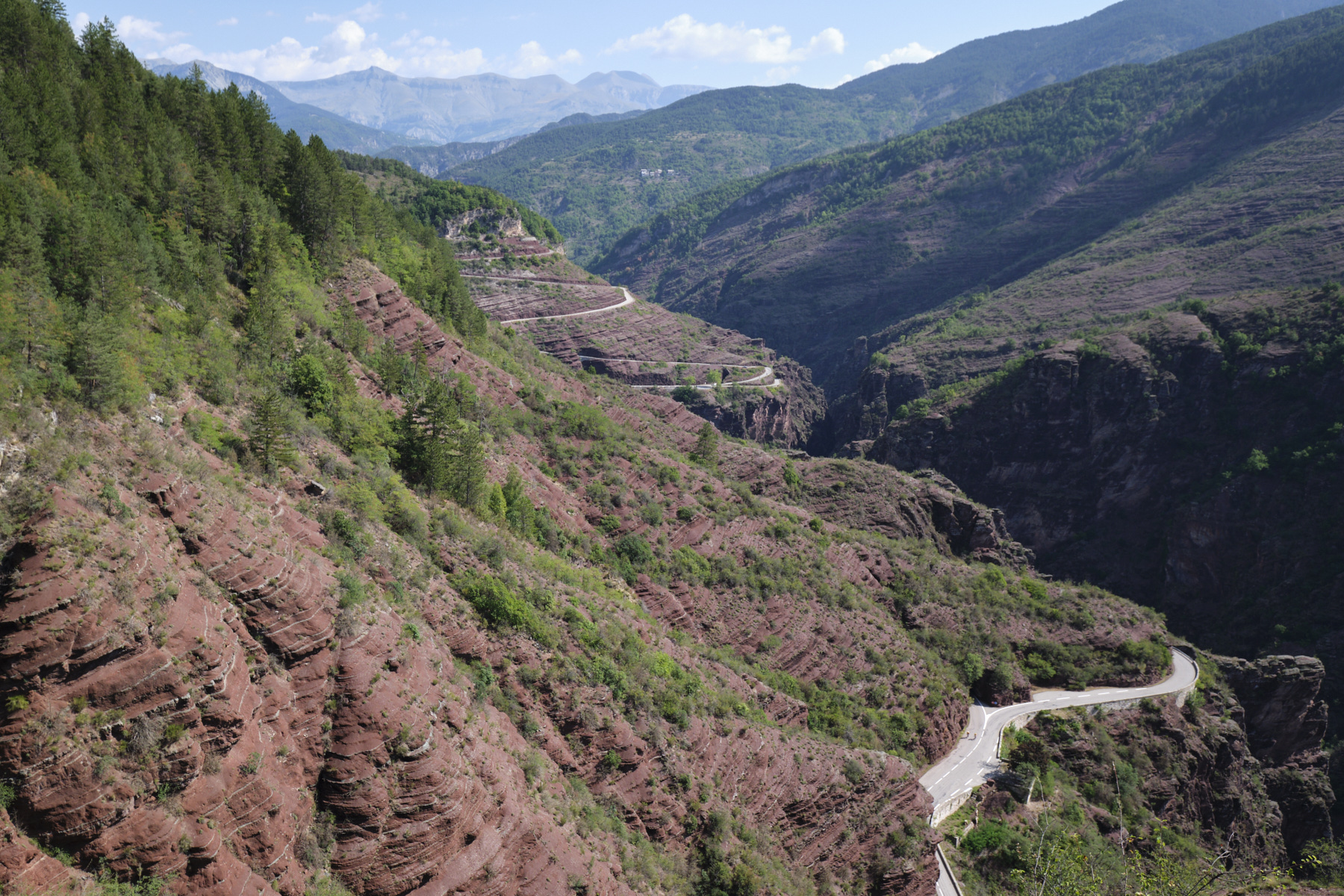
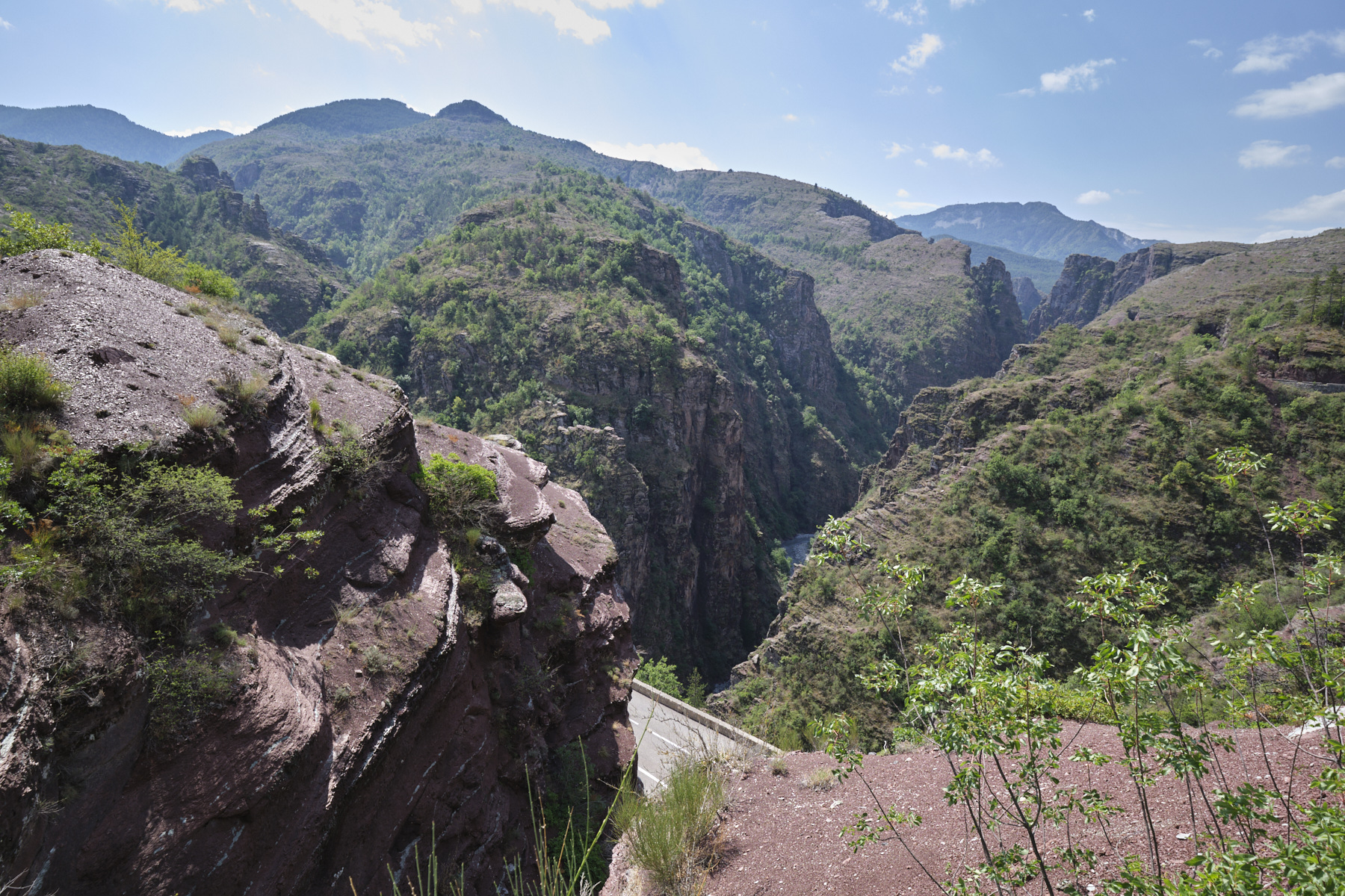
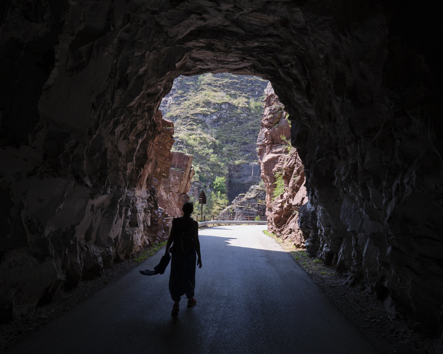
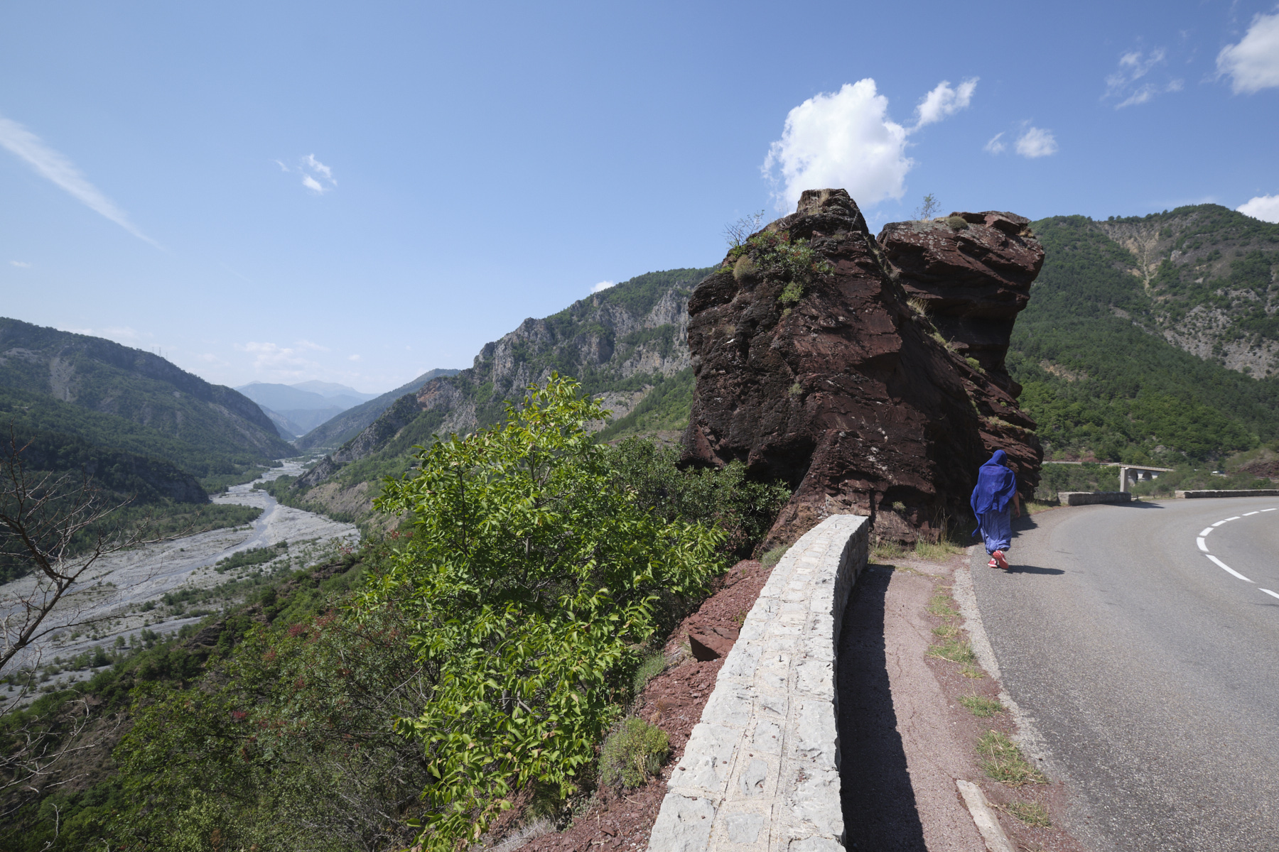
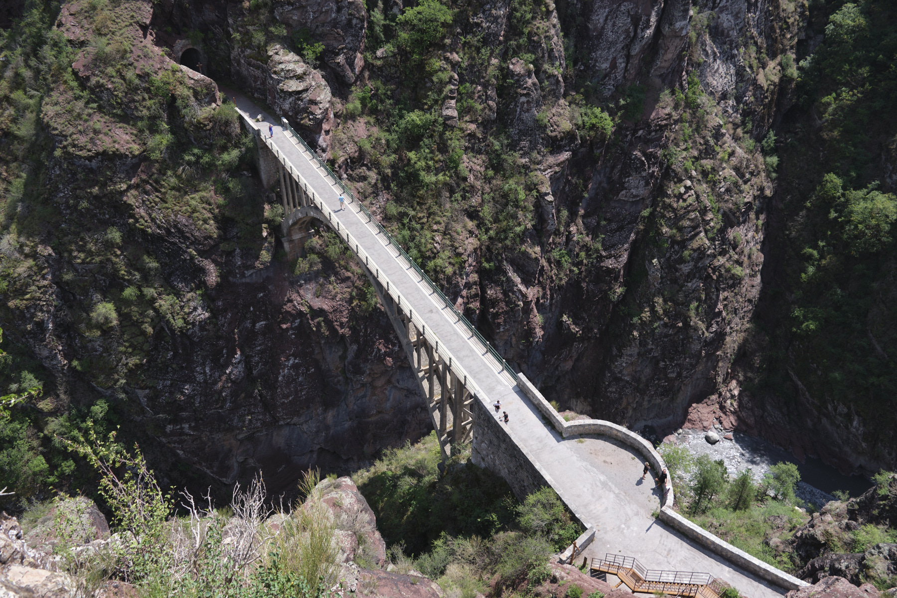
A short but spectacular hike to discover the Gorges de Daluis, an impressive gorge formed by the Var river, over 250m deep, and featuring magnificent red geological formations known as pelites, which give the site its unique character. The loop through the heart of the nature reserve leads to Point Sublime, a promontory high above the Gorges, before following the road and its series of tunnels, carved into the edge of the void, allowing you to appreciate the site from different angles and viewpoints. The route can be completed at the entrance to the Gorges, where you'll find the Pont et Belvédère de la Mariée (Bride's Bridge and Viewpoint), before contemplating the descent of the Clue d'Amen, the local canyon, also carved out of red pelite.
❱❱ Technical summary
► Field and environnement : Open rocky or dirt trail, road section on return.
■ Departure point: Pont de Berthéou, Réserve Naturelle des Gorges de Daluis, Alpes-Maritimes (04).
■ Type of route: mid-mountain loop hike
■ Distance: 8.7 km
■ Cumulative elevation gain: +392 m
■ Cumulative negative elevation gain: -392 m
■ Estimated total time: 2h30 to 4h
■ Min and max altitude: 780 m / 984 m
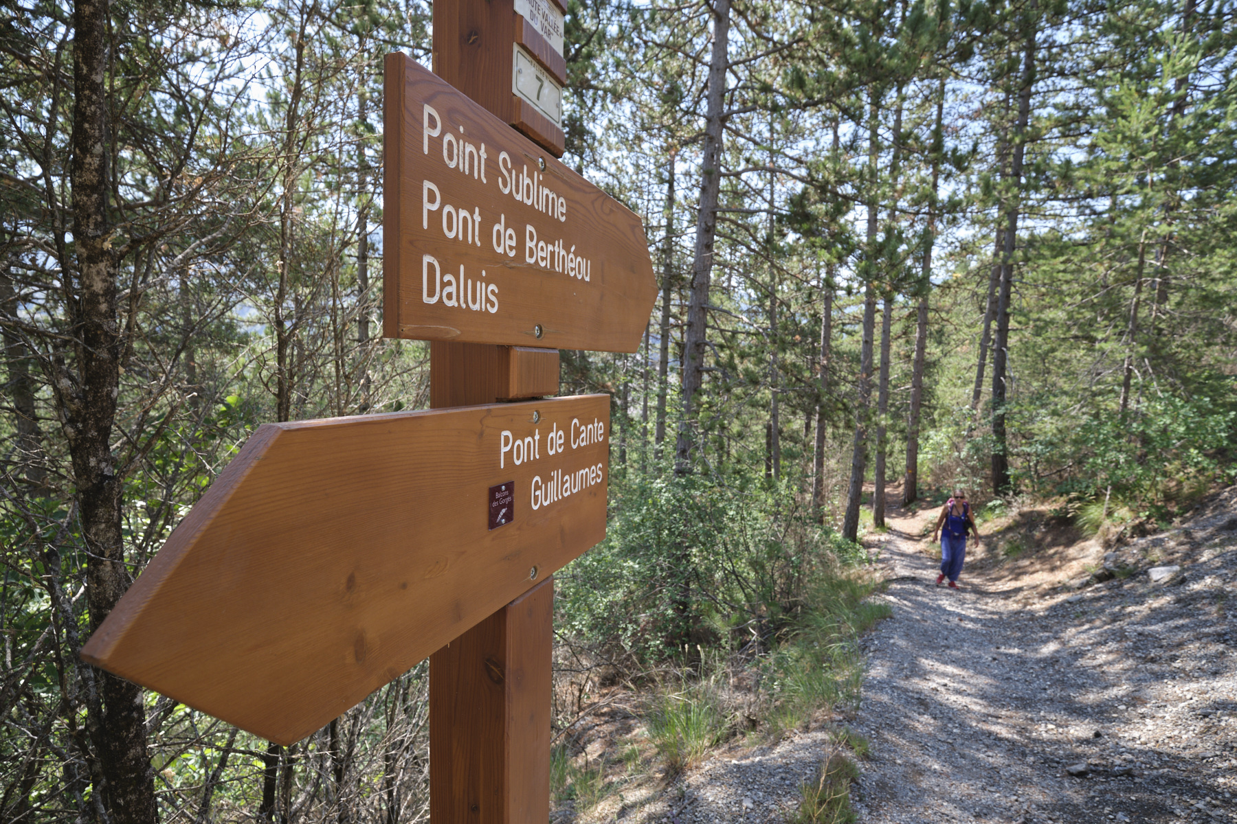
■ Marking: marked trail
■ Equipment: none
■ Equipment required: none
Difficulties: none on the trail, but take care on the road back.
❱❱ Access to the place
The location is lost in the heart of the département, close to the Valberg ski resort. Go up or down the D2202, which generally follows the Var in a north-south direction. South of the town of Guillaumes, you quickly enter the Gorges and the road passes through a series of small tunnels. After the last tunnel and a rock in the shape of a Tête de Femme, there's a parking area just before the bridge over the Berthéou. This is the starting point for the loop.
❱❱ Map & topo
Voir en plein écran❱❱ Itinéraire
As the walking itinerary is inside the Gorges de Daluis Nature Reserve, progress is made only on the marked path, with rangers on hand to call us to order at the slightest deviation (!).


Leave a Reply