


TOPO Via ferrata | CLIMBING7.COM
Publié le
 Partager sur WhatsApp
 Partager sur Twitter
Partager sur Instagram
Partager sur Twitter
Partager sur Instagram

 Partager sur Facebook
 Imprimer le topo
 Laisser un commentaire

Au-dessus d'Arvieux et sous le col de l'Izoard, la via ferrata des crêtes de Combe la Roche propose un parcours soutenu, sportif et athlétique pour accéder aux alpages de Clapeyto à plus de 2100m d'altitude, où se trouvent de magnifiques chalets traditionnels du Queyras. La difficulté va croissante et la paroi finale oblige à enchainer des passages de plus en plus aériens avec quelques petites sections déversantes. La via ferrata de Pra Premier toute proche, plus facile et accessible, peut compléter la journée dans le coin en guise d'échauffement ou de décrassage.
❱❱ Fiche technique
■ Lieu de départ : au dessus du camping de l’Izoard, Brunissard, Queyras, Hautes-Alpes (05)
■ Type de parcours : via ferrata de haute montagne
■ Orientation : nord-est
■ Longueur équipée : 500 m
■ Dénivelé positif équipé : +300m
■ Durée totale estimée : 2h à 3h
■ Altitude min et max : 1900 m / 2320 m
■ Équipement en place : barreaux, 2 ponts de singe
■ Matériel à prévoir : matériel classique
Difficultés : D+ ou K4, sections finales athlétiques et très aériennes avec passages en léger dévers
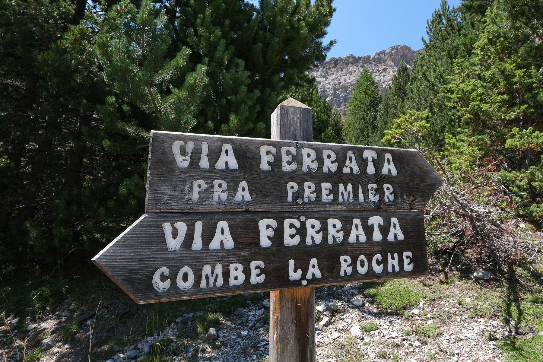
❱❱ Accès au site
Depuis Guillestre, en entrant dans le Queyras, monter vers Chateau-Queyras et Saint-Véran par la D902. Avant Chateau-Queyras, bifurquer vers Arvieux en restant sur la D902. Passer Arvieux, La Chapl et dans Brunissard, tourner en direction du camping de l'Izoard et des ferratas qui sont indiquées. La route remonte la vallée étroite, on traverse littéralement le camping pour plus haut se garer avant les virages en épingles dans la piste. Le départ de l'approche se fait de là, pour les 2 ferratas.
❱❱ Carte & topo
Le tracé des ferratas en rouge et du début du retour depuis le haut sont indicatifs.

❱❱ Itinéraire
Depuis le parking, prendre le petit sentier en forêt et suivre les indications. On rejoint plus bas une piste à suivre à droite et après un grand virage et une petite ligne droite on trouve le panneau d'information. Il reste à monter sur le petit sentier assez raide le long d'un pierrier pour rejoindre la base de la paroi et le départ de la ferrata.
La ferrata, dont l'accès est gratuit, est ouverte du 1er juin au 15 octobre.
Un premier mur vertical (D- ou K3) à franchir sans trop de difficulté, avec quelques contacts rocher pour les mains et les pieds. On débouche sur une arête que l'on remonte en marchant / grimpant plus facilement.
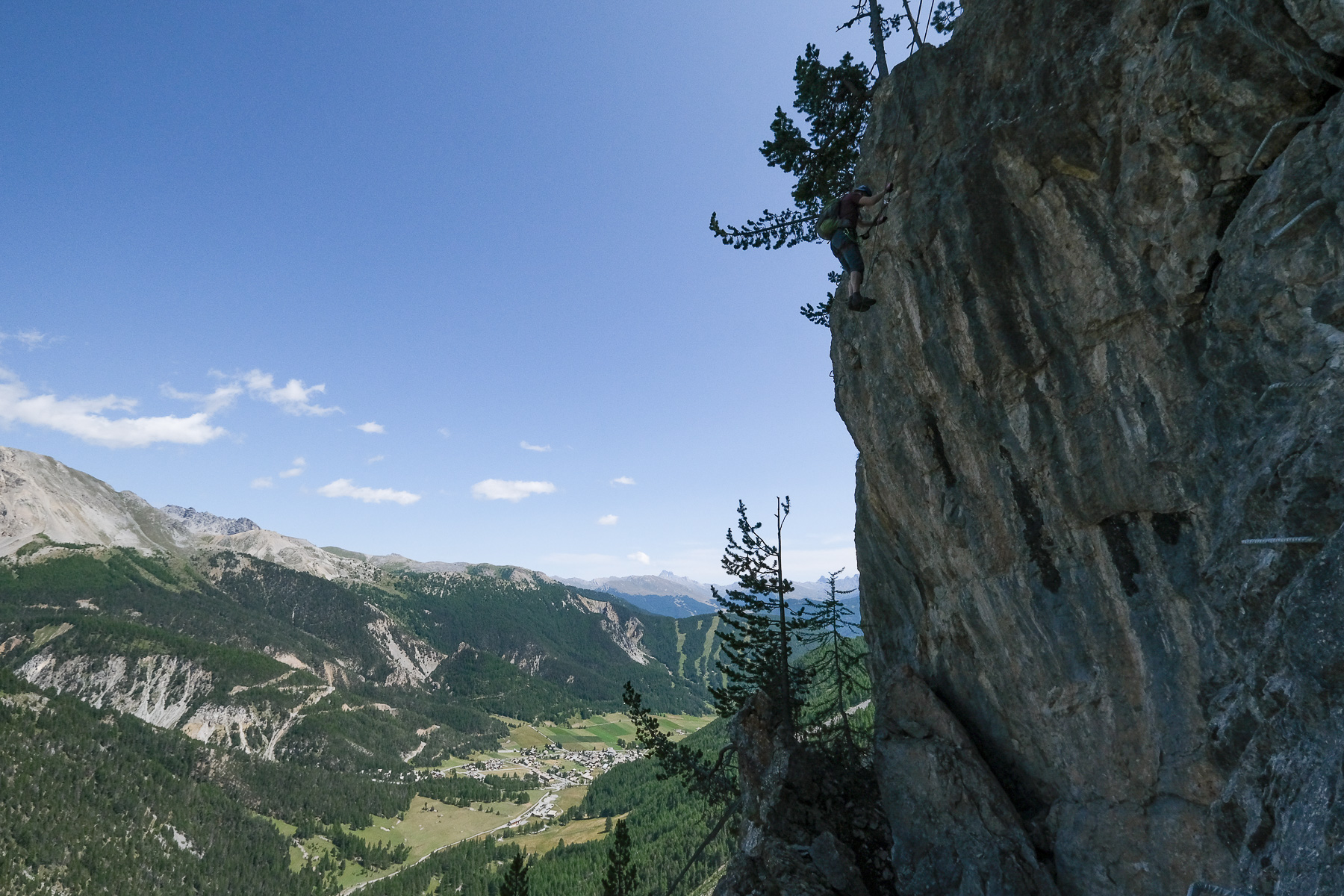
Plus haut, grimper sur une dalle inclinée aérienne, puis traverser à plusieurs endroits, parfois juste avec le rocher, et continuer à alterner marche et petits ressauts pour finir sur une petite épaule sous la paroi finale (AD ou K2).
Là, les difficultés vont monter d'un cran. Ça monte toujours en oblique vers la gauche pour rejoindre un large dièdre avec une section bien physique et très verticale, voire légèrement déversante qui tire dans les bras (10 à 12m). On enchaine au-dessus d'autres petites sections athlétique avant de trouver soit l'échappatoire à droite (ancien itinéraire), soit le final avec une traversée sur un mini pont de singe au-dessus du vide et légèrement en dévers et le pont de singe final (photo de présentation). Partie finale en D+ ou K4.
On sort sur une arête bien gazeuse mais sans difficulté pour terminer la voie et rejoindre la crête, point final de la ferrata.
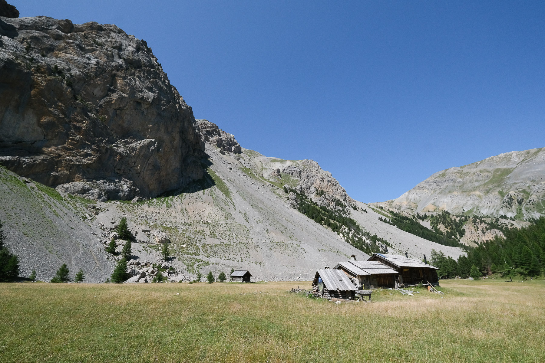
Du sommet, suivre les panneaux de bois "Retour" pour remonter la crête avant de basculer dans la cuvette derrière en forêt sur un sentier raide. En bas, on passe à coté d'une petite cabane isolée avant de rejoindre le sentier balisé vers le Pré Premier, là où se trouve le petit plan d'eau et le plateau herbeux. Suivre vers le parking de départ en descendant sur la piste puis en coupant par le sentier dans le pierrier puis en forêt.
Descriptif des 2 ferrata du coin sur altituderando.fr


Laisser un commentaire