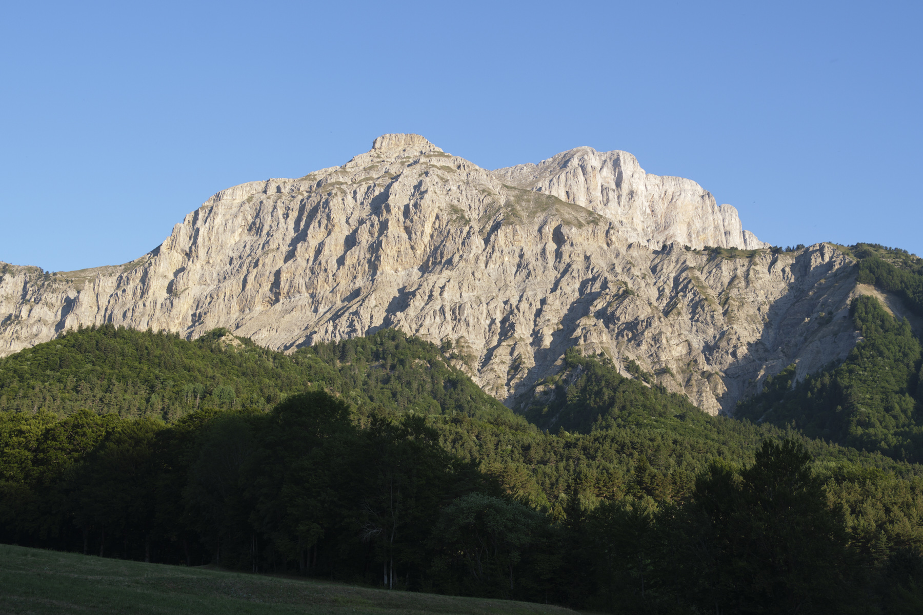
One of the most beautiful hikes in the Vercors, it climbs the Grand Veymont and offers incredible panoramic views of Mont Aiguille, Dévoluy and the Écrins massif in the distance. Once at the summit, the view of the long, steep walls of the Grande Moucherolle au Moucherotte overlooking the city of Grenoble is impressive. Starting from La Batie, combining several trails and taking the small equipped passage leading to the Pas du Fouillet, the ascent of the Grand Veymont's great cambered back is gradual, without any real difficulty but with a fairly substantial difference in altitude. A return loop via the Pas des Bachassons then the Pas de la Selle brings you back to the foot of the spectacular Mont Aiguille. It's a long, steep loop in the company of marmots and ibexes!
❱❱ Technical summary
■ S tarting point: parking lot near the village of La Batie, Saint-Michel-les-Portes, south of the Vercors massif, Isère (38)
■ Type of route: high-mountain loop hike
■ Distance: 16 km
■ Cumulative elevation gain: +1310 m
■ Cumulative negative altitude gain: -1310 m
■ Estimated total time: 5h30 to 7h ■ Min and max altitude: 1130 m / 2341 m
■ S ignposts: yellow PR at the start and return of the Col de l'Aupet, unmarked path on the rest of the itinerary.
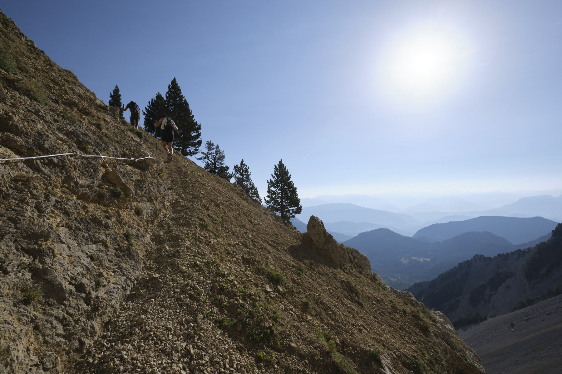
■ Equipment in place: a cable in the Pas du Fouillet
■ Equipment required: useful GPS trace
Difficulties: the Pas du Fouillet includes a section equipped with a cable on a path that crosses a very steep slope. Below the Pas de la Selle, the descent of the scree before the junction to the Col de l'Aupet is tricky.
❱❱ Access to the place
South of Grenoble, on the departmental road between Monestier-de-Clermont and Clelles, turn east towards Saint-Michel-les-Portes. Follow the route du Mont Aiguille in the direction of La Bâtie, and at a sharp right-hand bend, take the track straight ahead. At the second bend, you'll find a parking lot just before the accrobranche park and labyrinth forest.
1st part: from the parking lot to the Pas des Fouillet (1h30 to 2h)
From the parking lot, follow the trail past the accrobranche and the labyrinth forest to find the fork on the right to the Pas des Bachassons. It starts off slowly, crossing a dry stream twice, then climbs quietly through the undergrowth, with a series of switchbacks to the southeast and finally out of the forest. You can then see the passage between the walls leading to the Pas des Bachassons. The path crosses a scree slope, still climbing, steeper and with a series of switchbacks. Higher up, watch out for the path to the right that leads to the Pas du Fouillet. There's a cairn and a green/yellow cross. Yaw up under the walls and then cross over a section equipped with a cable, with no difficulty other than the very steep slope on the right-hand side. Finally, you come out higher up onto a pretty little grassy plateau facing the broad, rounded back of Grand Veymont and l'Aiguillette or Petit Veymont a little to the right. Marmots on the menu!
2nd part: from the top of the Pas du Fouillet to the summit of Grand Veymont (1h to 1h30)
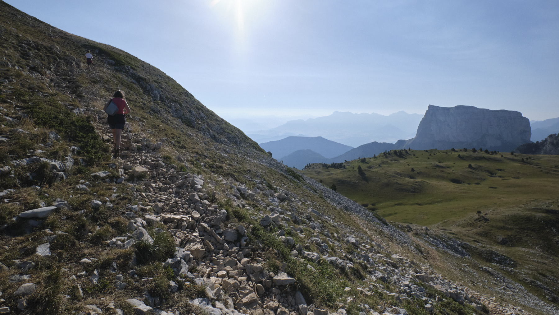
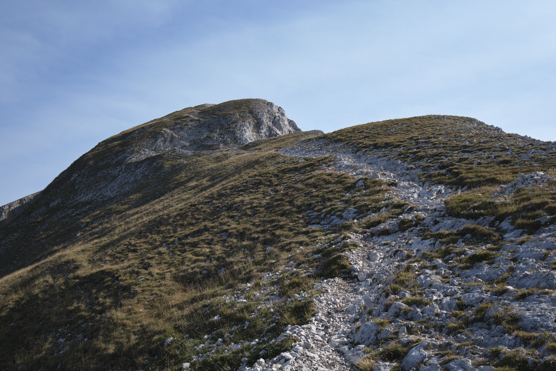
Cross the plateau, aiming for the base of the back of Grand Veymont. The zigzag route up the mountain is clearly visible in the distance. The ascent is very easy, with a succession of sometimes very short switchbacks on moderately steep slopes. You come out on the first flat area, where the first ibexes are to be seen. Continue this time, alternating between flat and steep terrain, as you make your way towards the wide summit of Grand Veymont. The view to the north as you reach the 2nd summit is impressive, with the walls undulating above Grenoble. To the east and south, Mont Aiguille, the west face of Grande Tête de l'Obiou, which marks the entrance to Dévoluy, and the Écrins massif in the background.
3rd part: from Grand Veymont, loop via Pas des Bachassons, Pas de la Selle to Col de l'Aupet opposite Mont Aiguille (1h30 to 2h).
Descend on the same path and cross the grassy plateau, keeping to the south. It climbs slightly to reach the Pas des Bachassons, where you'll find the mountain spring where you can refuel. From here, follow the small, soundly-marked path that continues to the south and take the curve around the Pic de Montaveilla. The path climbs a little before dropping down into another valley, still following the trail to the Pas de la Selle, the first natural pass visible between the walls. Part of Mont Aiguille is already visible behind us.
Descend, crossing a large scree slope, then into the gorge on a tricky, stony and decomposed path. At the bottom, before really entering the forest, don't miss the right fork in the path that leads to the Col de l'Aupet, below and facing Mont Aiguille.
4th part: from Col de l'Aupet to the start parking lot (1h to 1h30)
From the col de l'Aupet, 2 options: either continue on the signposted path which climbs a little then descends (signposted Cascade de la Pisse), or take the abandoned path still marked on the maps, which is more direct but totally overgrown (path still visible on the ground in places). Further down, the path descends into the forest with tall pine trees, then returns to a stony track that will soon take you back to the fork in the road and the parking lot.


 Partager sur WhatsApp
 Partager sur Twitter
Partager sur Instagram
Partager sur Twitter
Partager sur Instagram

 Partager sur Facebook
 Imprimer le topo
 Laisser un commentaire


Leave a Reply