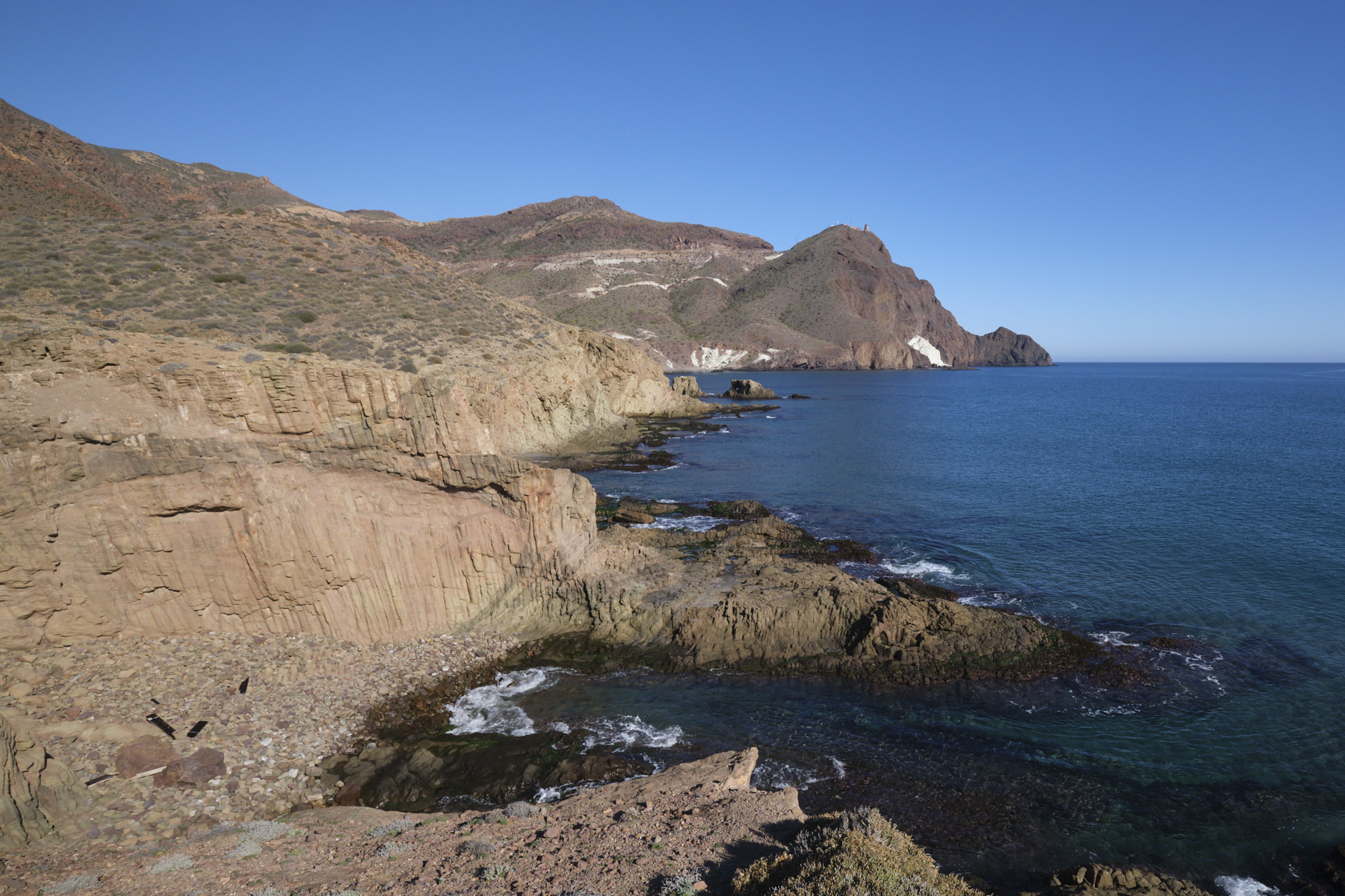
An impromptu hike from the Cabo de Gata lighthouse to explore the coastline from the Mermaid Reef (at the foot of the lighthouse) to Cala Rajada and the Finger Reef (dedo), beneath the high cliffs of the Vela Blanca. Progress at water's edge, from rocks to reefs, passing over small calas, sections above cliffs with geological formations of volcanic origin in surprising colors and shapes: clusters of organ pipes, rocky protrusions above the waves, rose-tinted spurs, white flows of sedimentary rock looking like giant meringues. There are plenty of opportunities to swim in one of the small, deserted calas, even if the water at this time of year isn't exactly warm. Climbing to the top of Punta Baja halfway along the route gives you a spectacular panoramic view of the proposed route, in one of the most beautiful corners of Cabo de Gata.
❱❱ Technical summary
Caution: progress at water level can be tricky or impossible, depending on the tide. Check times and coefficients beforehand, and prefer to go at low tide.
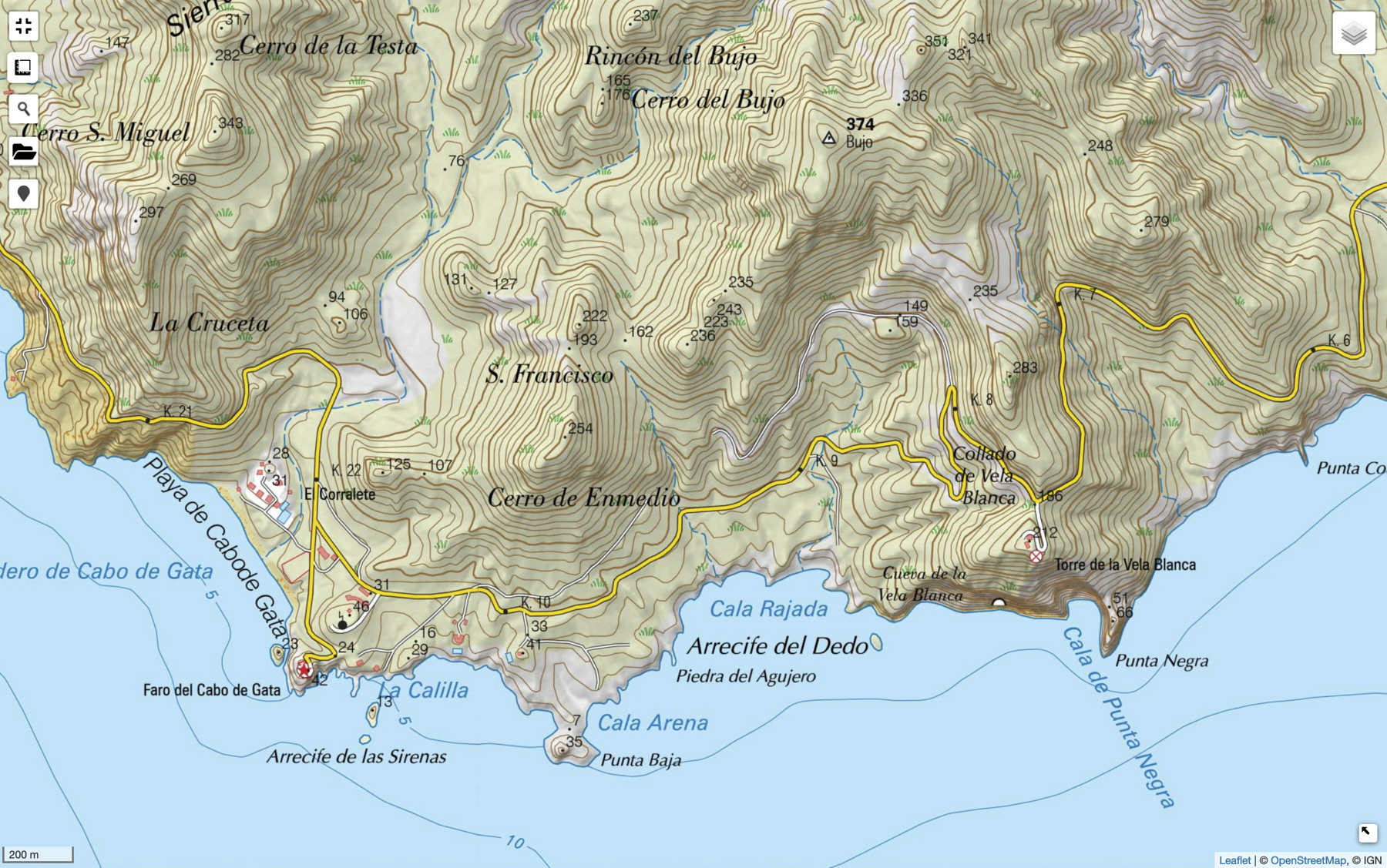
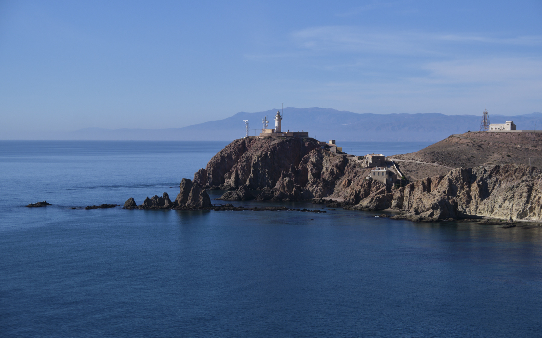
■ Departure point: Cabo de Gata lighthouse, Andalusia, Spain
■ Type of route: coastal loop hike
■ Distance: 5 km
■ Cumulative elevation gain: +60 m
■ Cumulative negative elevation gain: -60 m
■ Estimated total time: 3h to 4h ■ Min and max altitude: 0 m / 50 m
■ Marking: none, no trail either except on the upper parts.
■ Equipment in place: none
■ Equipment required: swimsuit
Difficulties: progress on the rocks is not very hard, but you have to use your hands in places.
❱❱ Access to the place
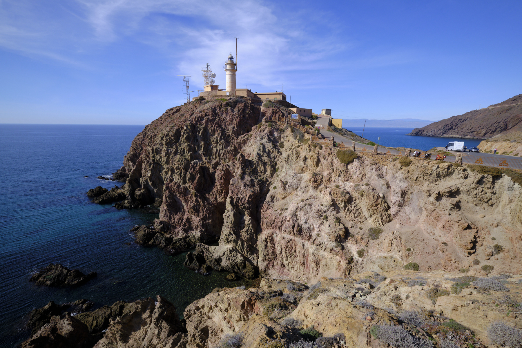
Go to the village of Cabo de Gata, to the south of the Natural Park, and take the road that runs along the salt flats to the end. Park just before the lighthouse or in the lighthouse parking lot.
❱❱ Map & topo
The route has been recorded along the way, but remains indicative.
Part 1: From the Sirenas reef to the summit of Punta Baja
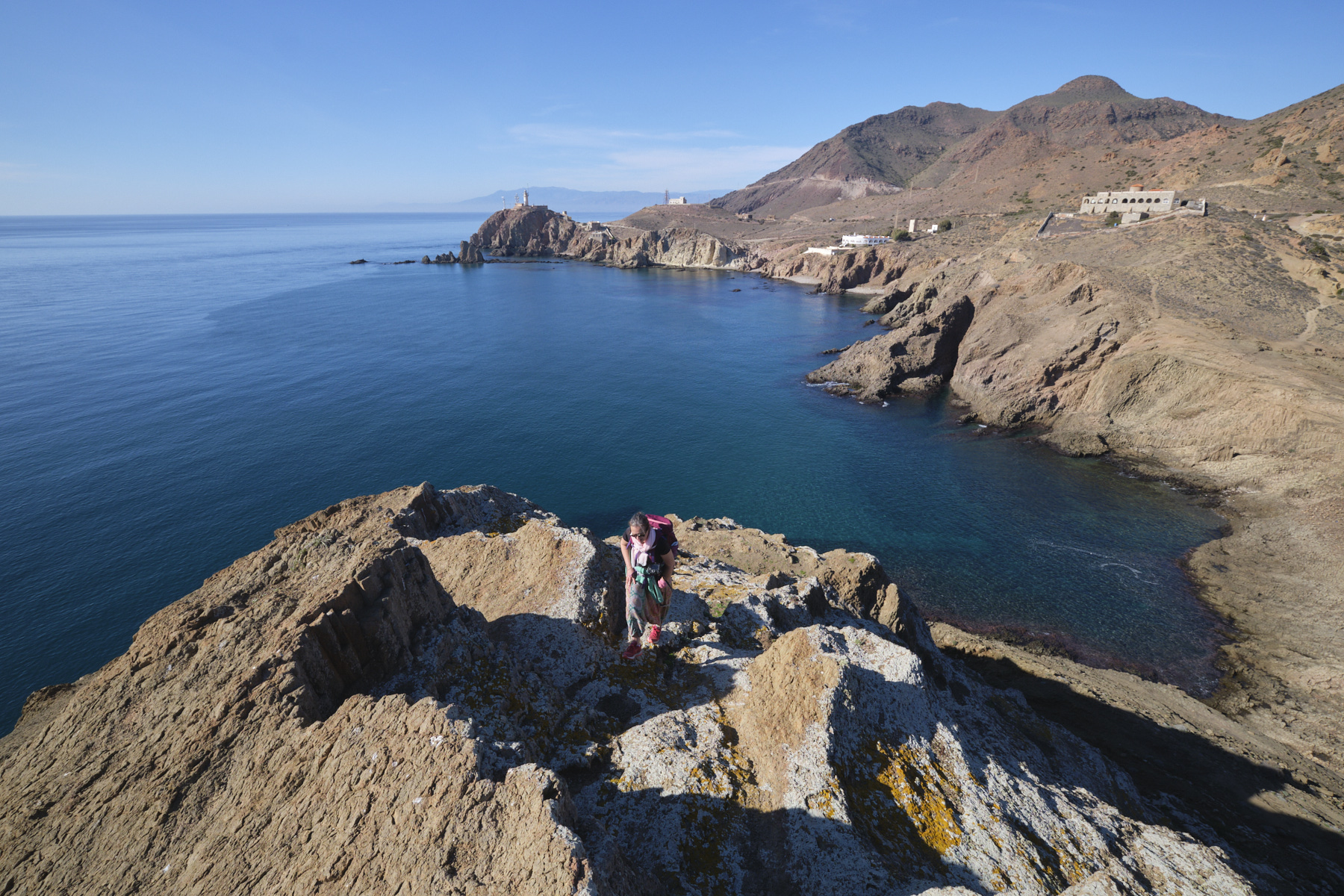
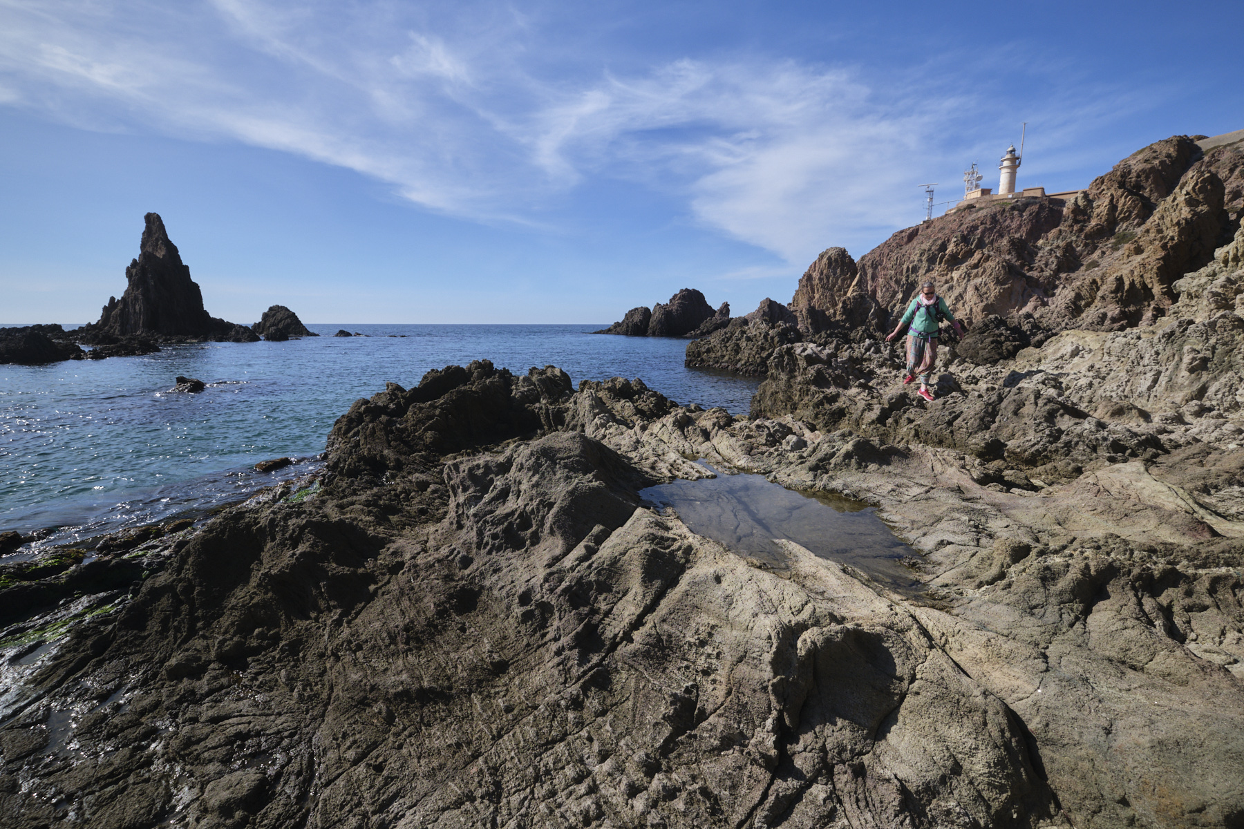
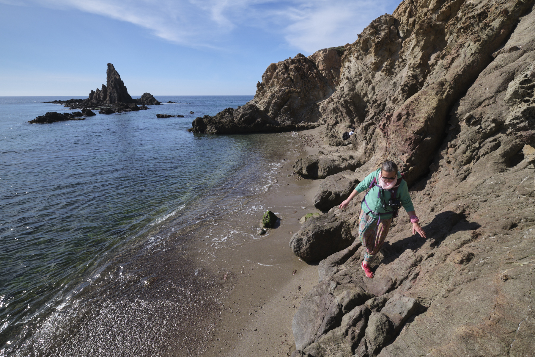
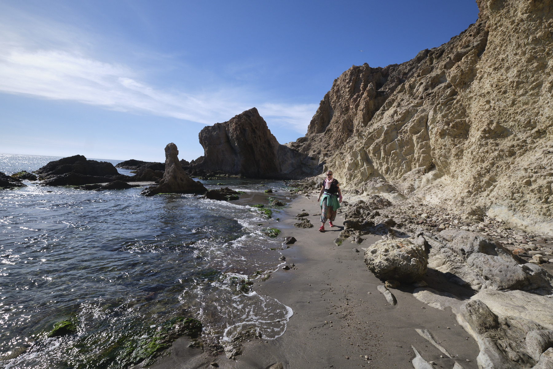
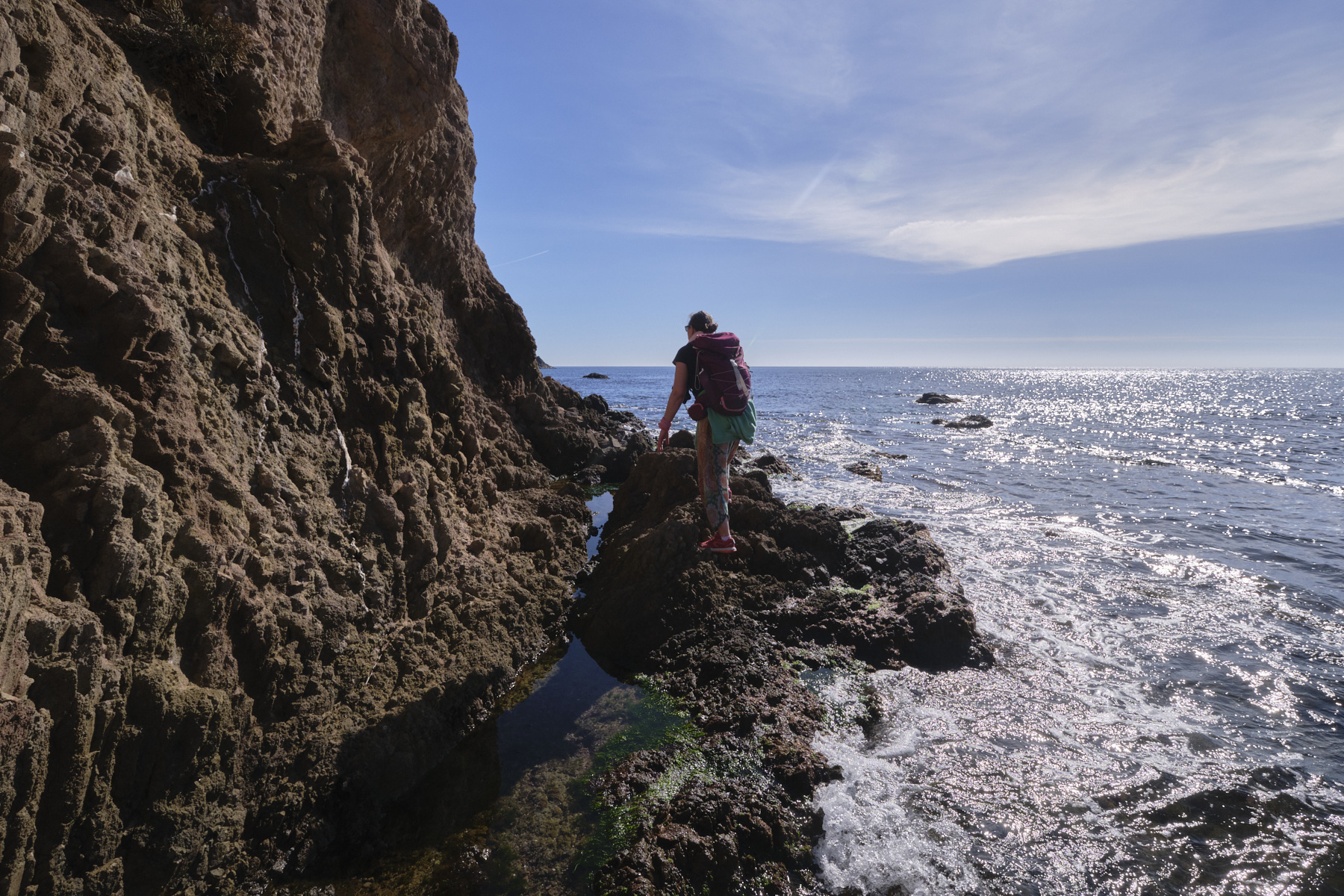
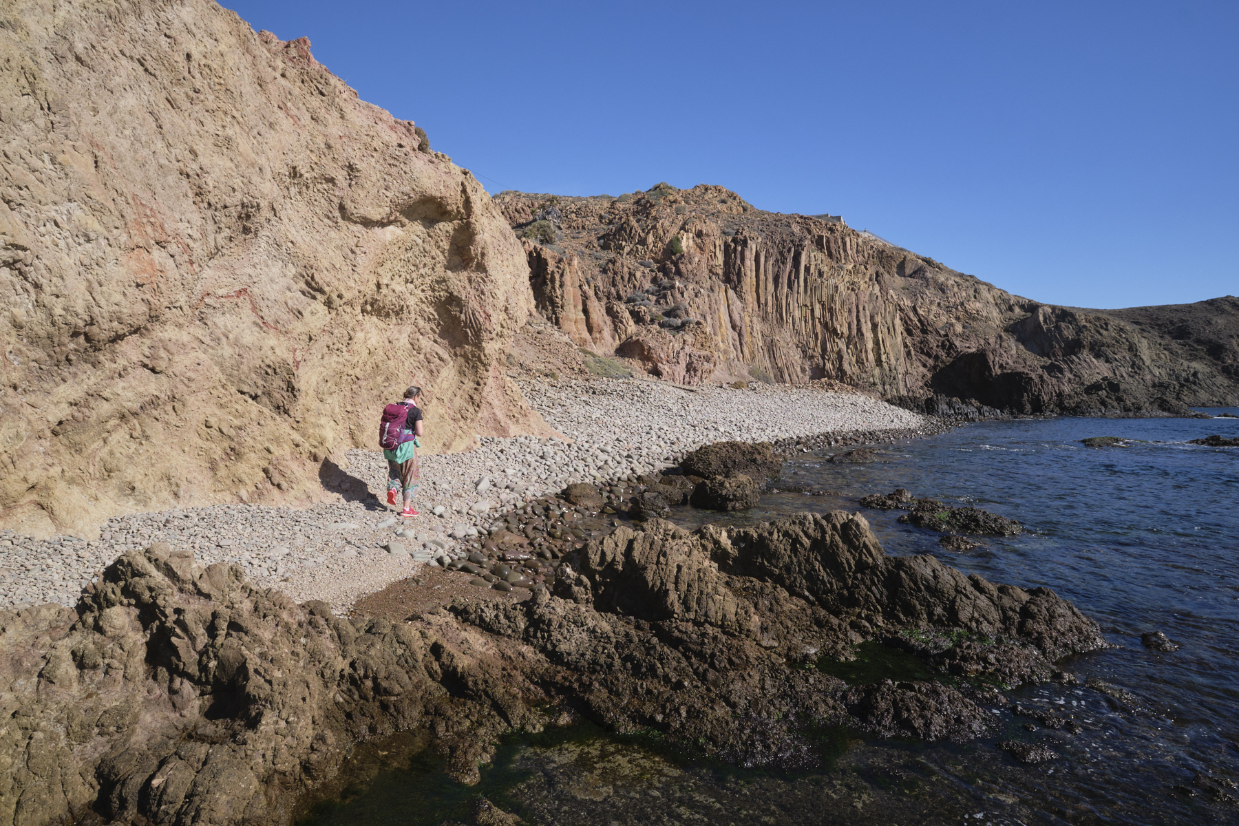
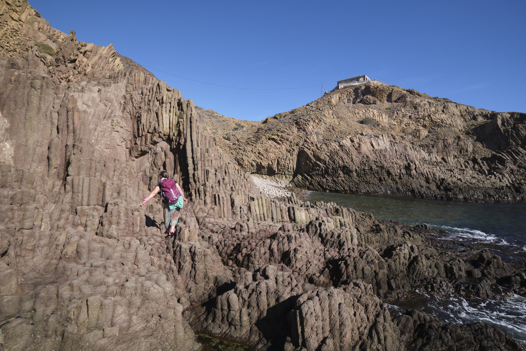
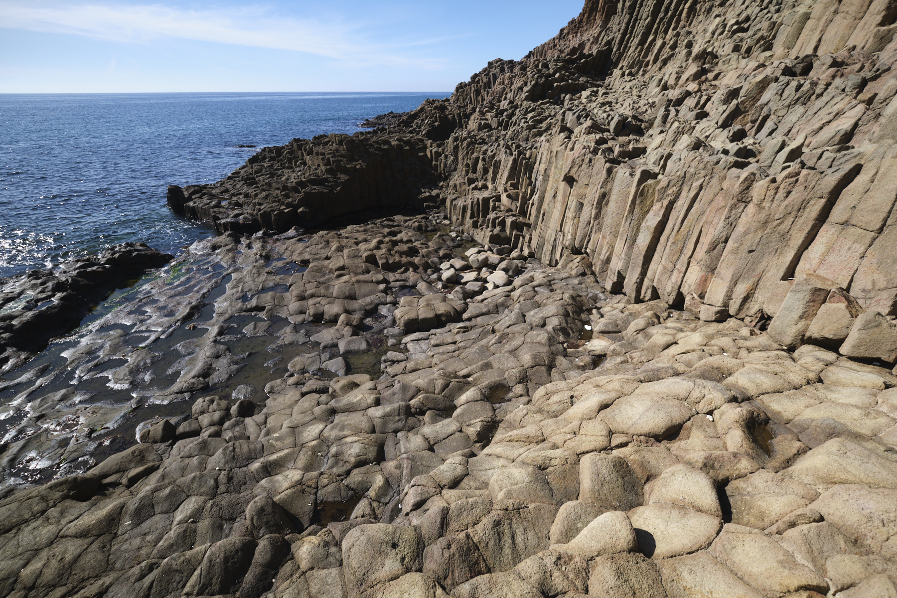
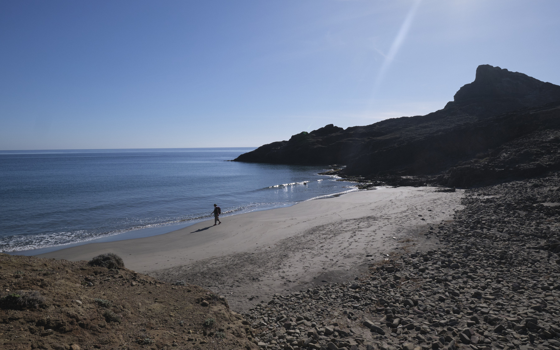
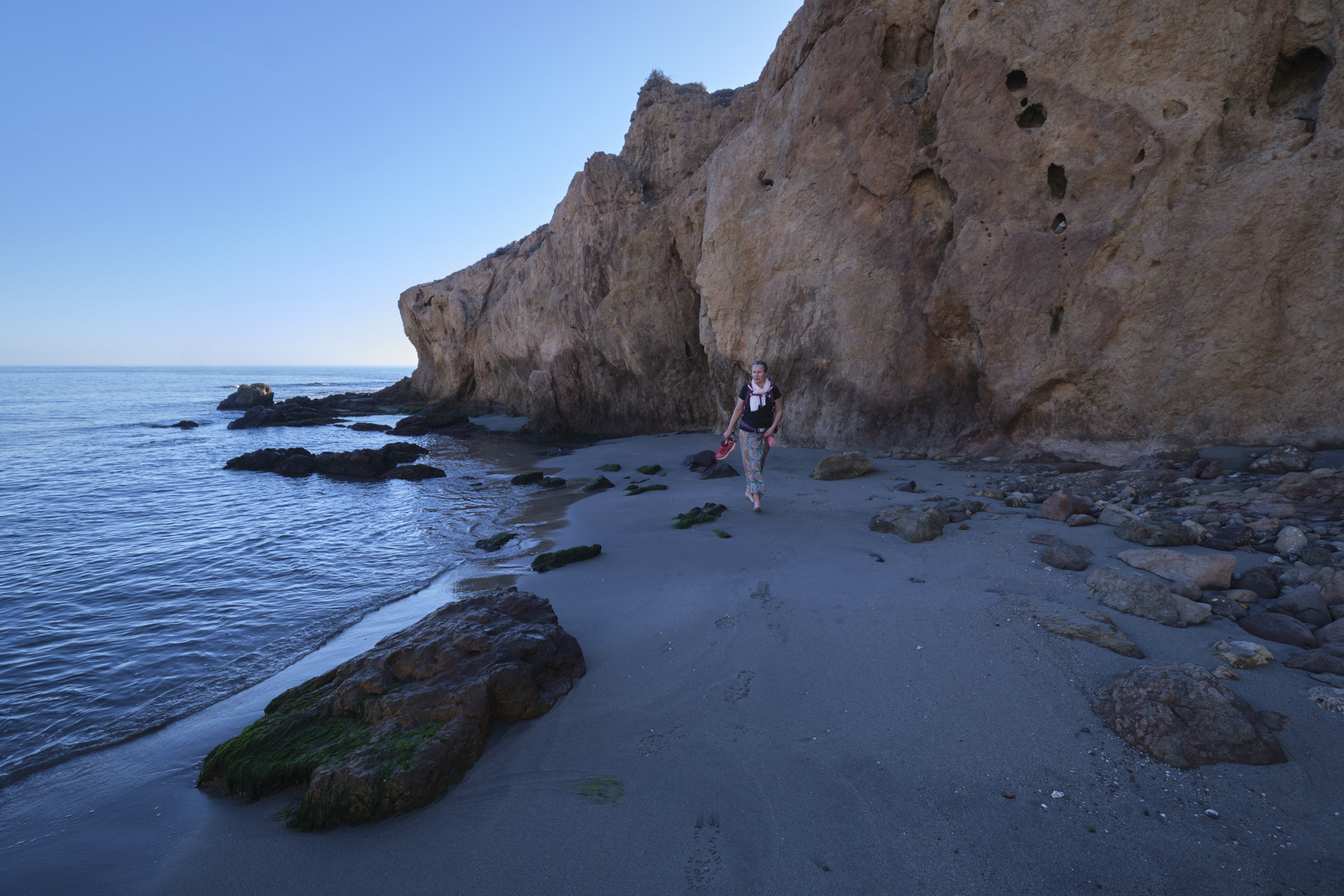
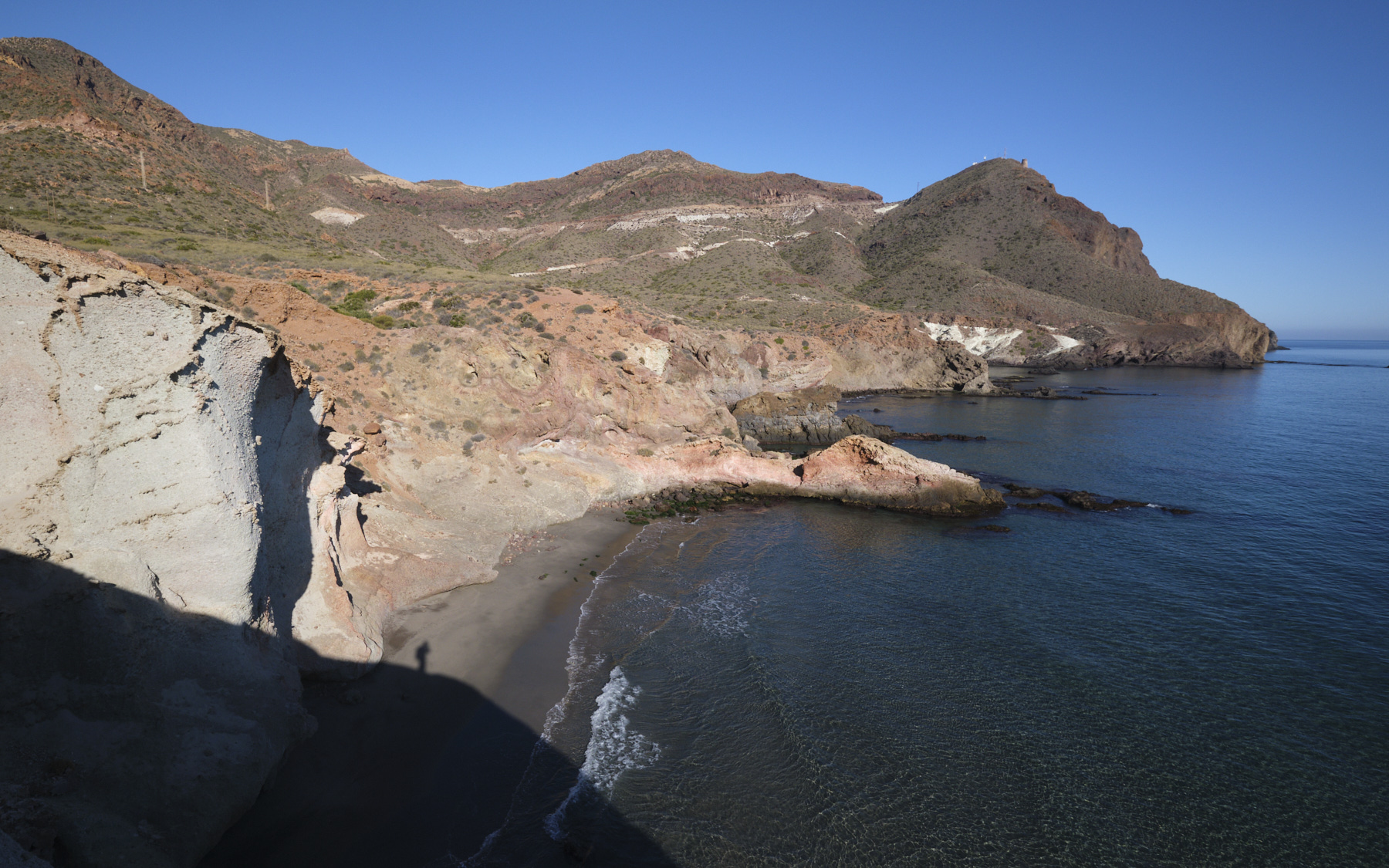
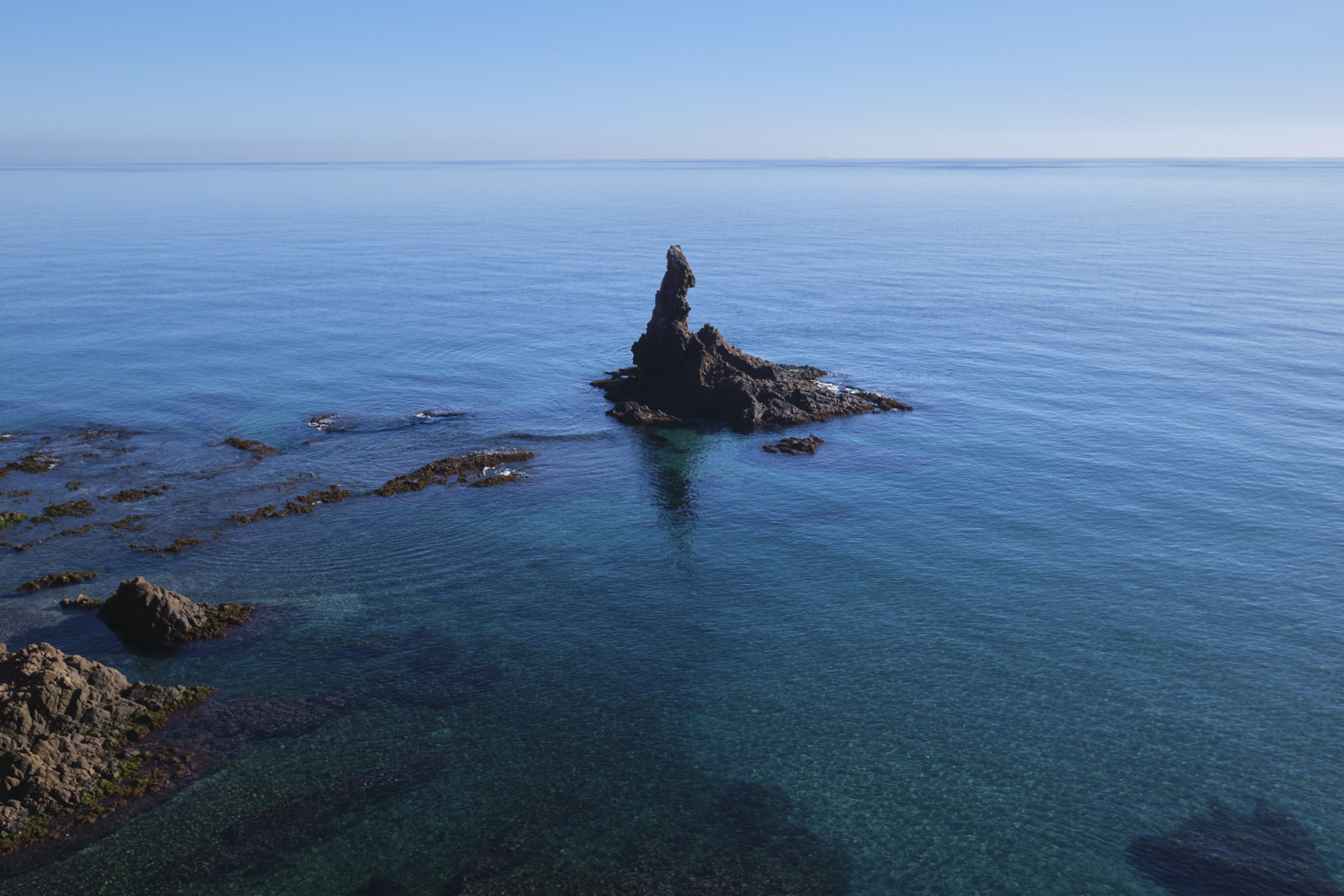
From the lighthouse, descend to the water's edge via a small rocky corridor, at the start of the Sirenas Reef. From this point, the idea is to head eastwards along the shore, staying as close as possible to the water's edge. Cross over the rocks, pass the Sirenas reef and, after rounding the rocks, walk on the sand of the 1st small cove. Then return to the rocks to skirt around a second overhang and pass over another, longer cove.
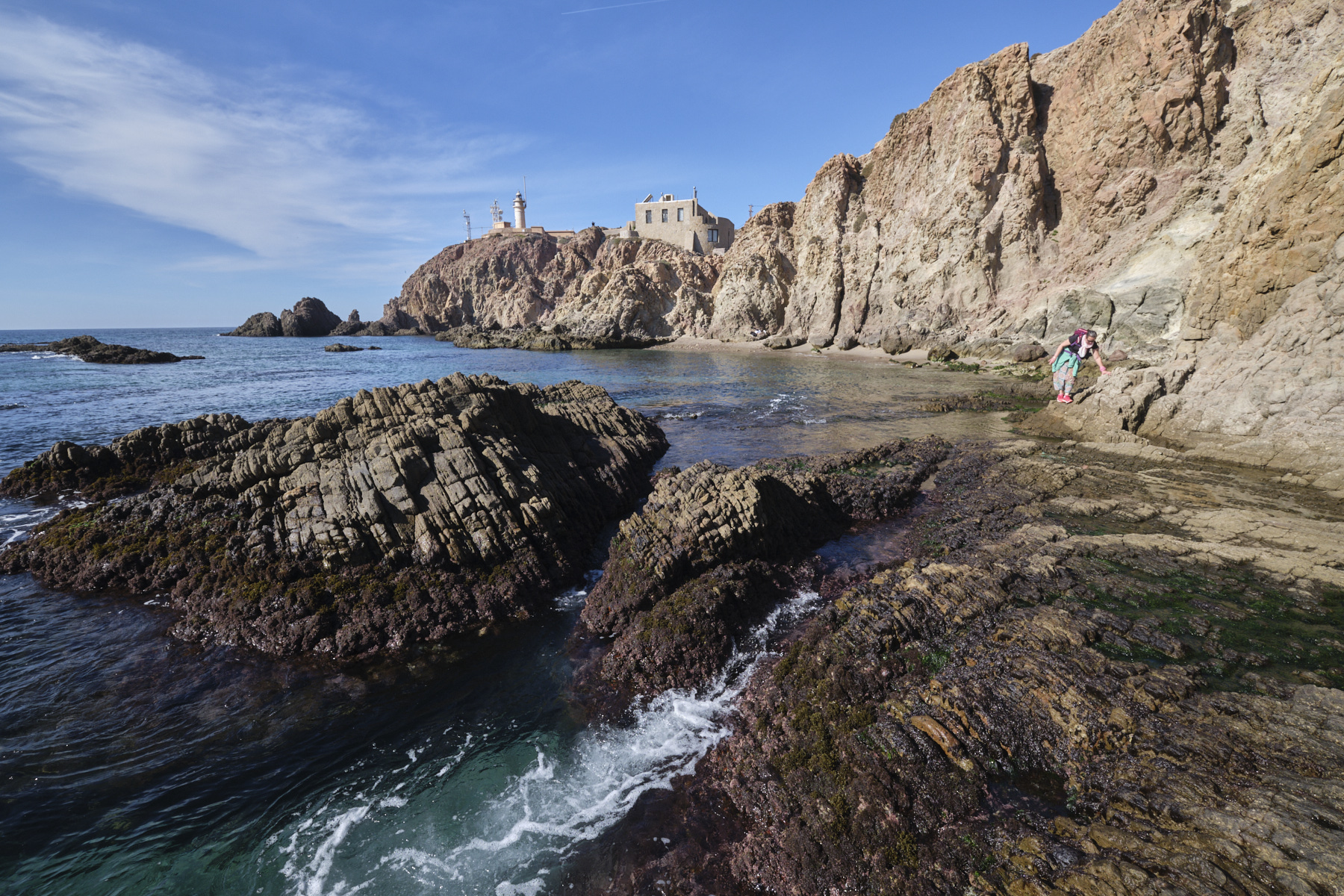
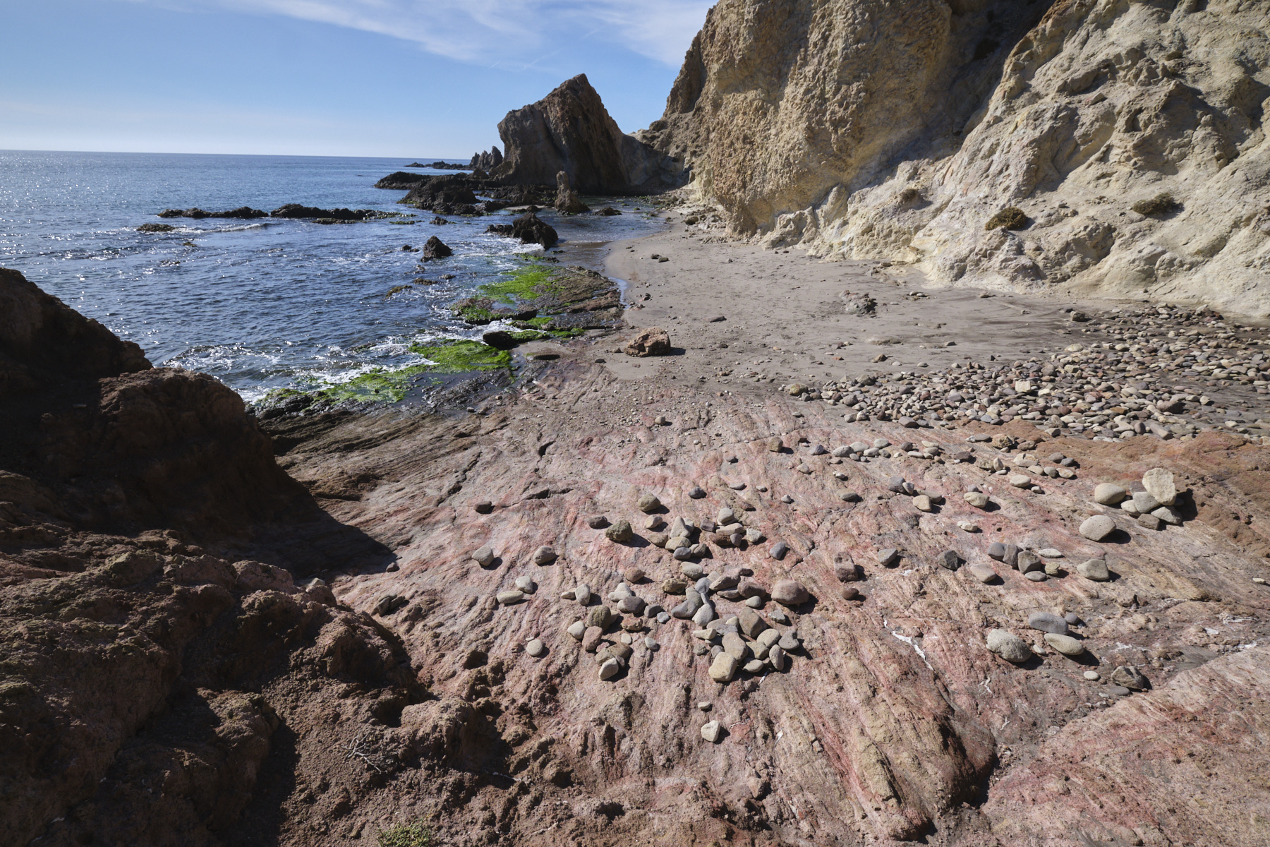
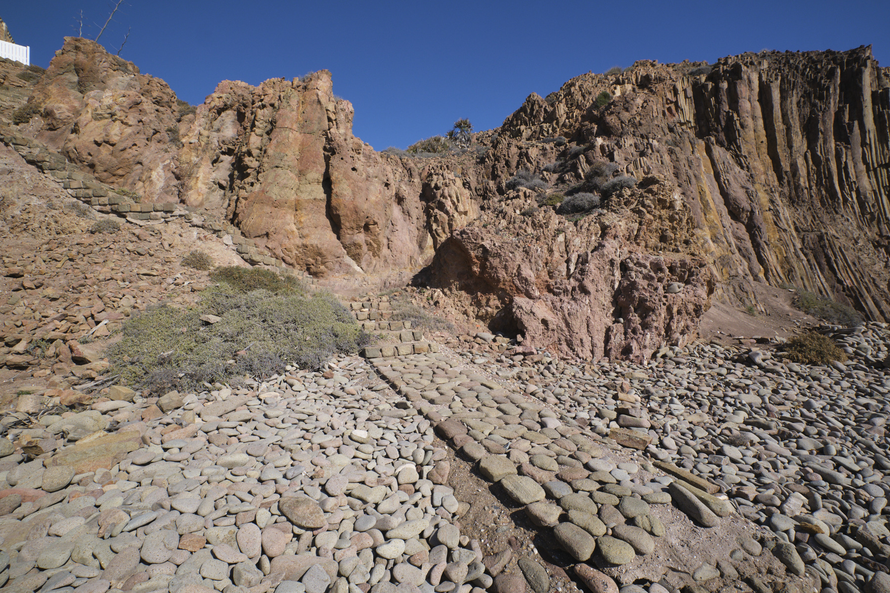
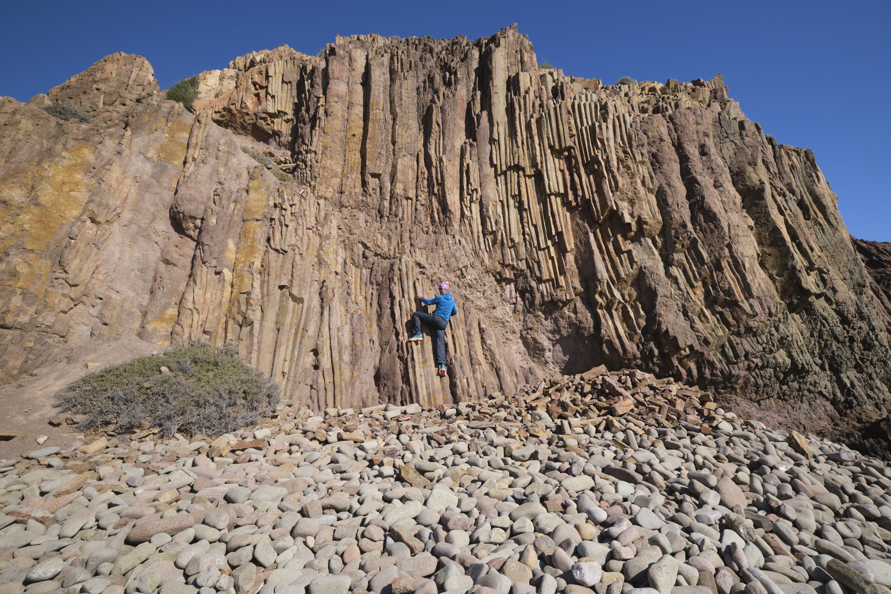
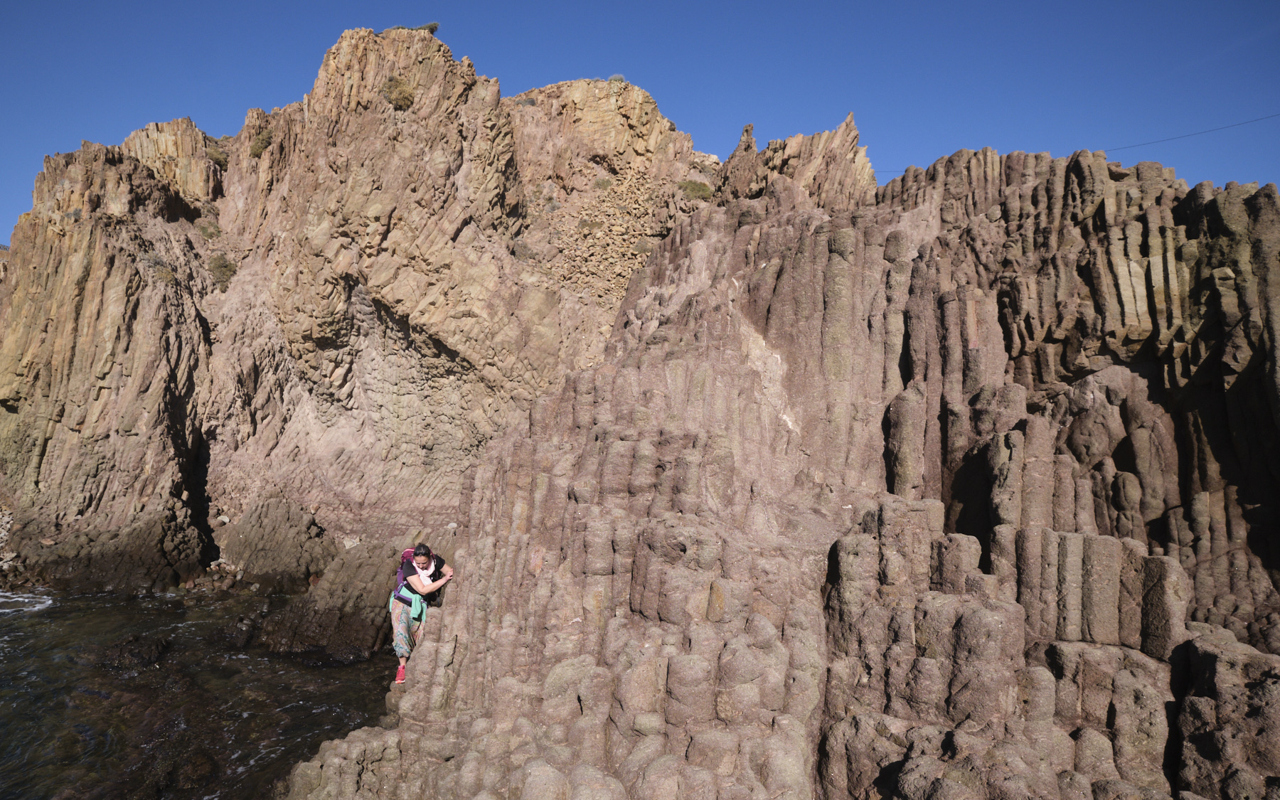
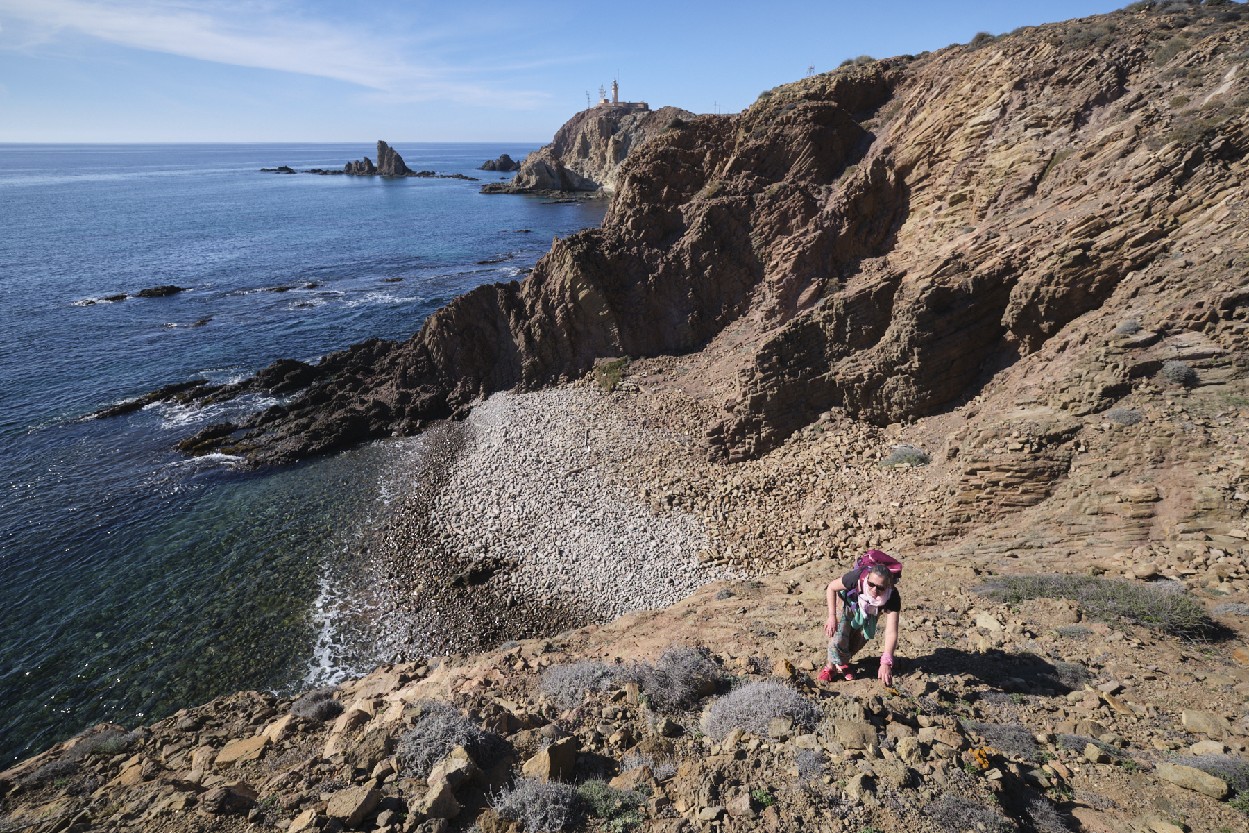
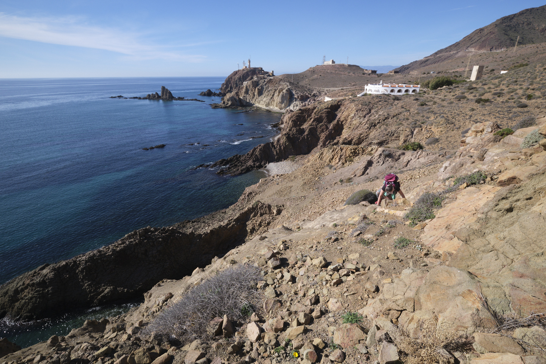
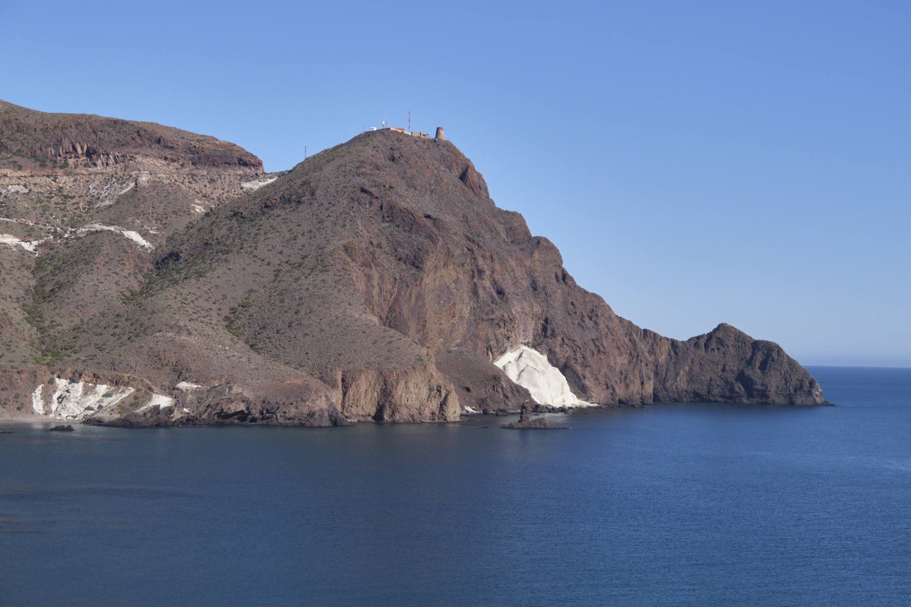
Continue, alternating between walking on the sand or pebbles and skirting the rocky outcrops at water level. You pass under an orange cliff entirely sculpted with organ-pipe columns. Then climb around a final section of rock, also entirely sculpted, to emerge onto a small pebbled cove beneath a building that can be seen above.
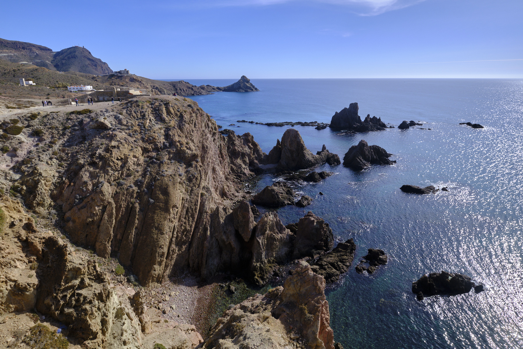
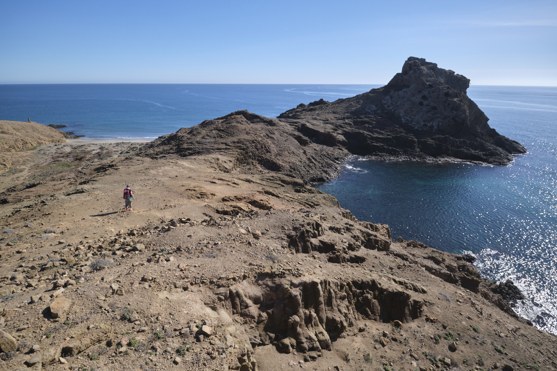
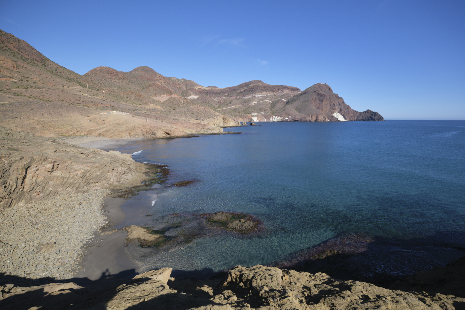
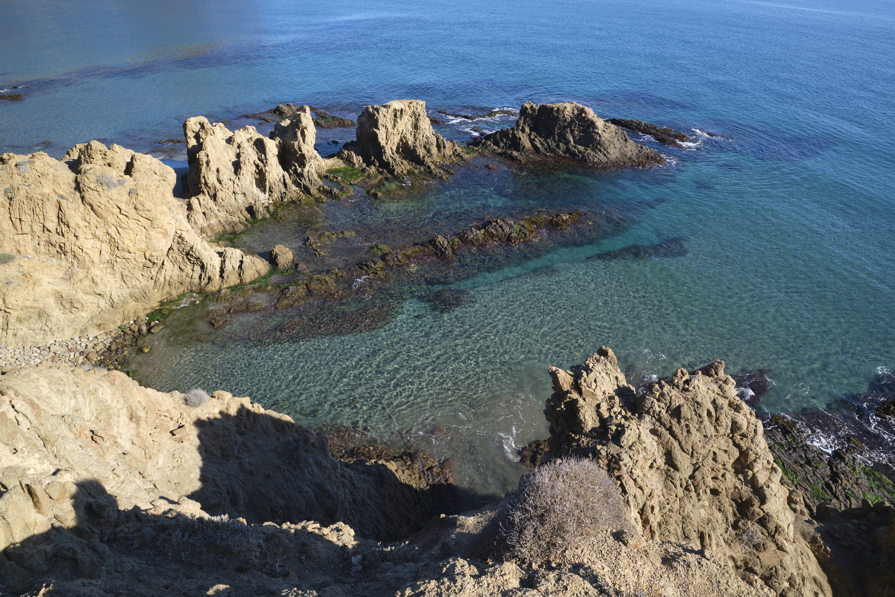
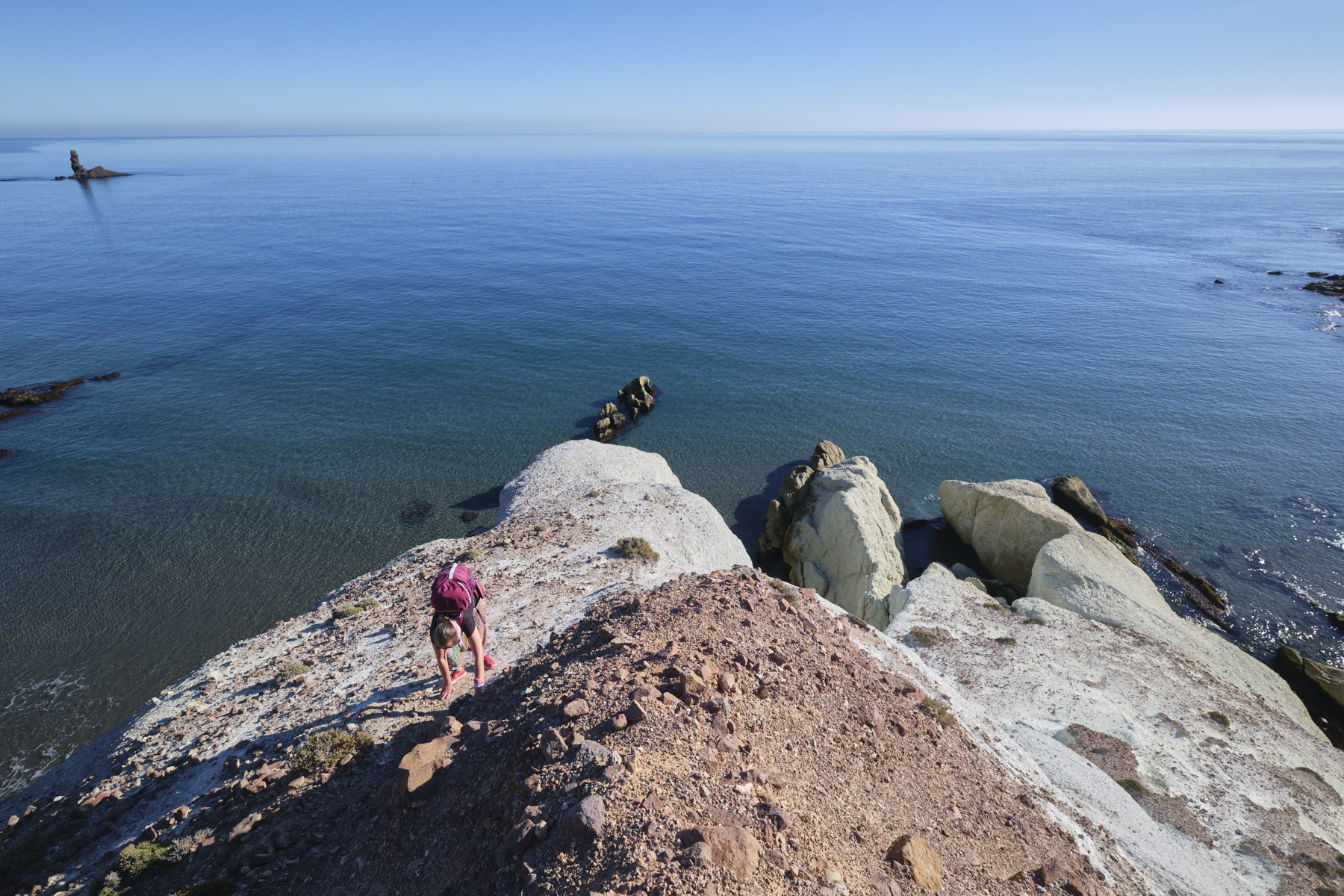
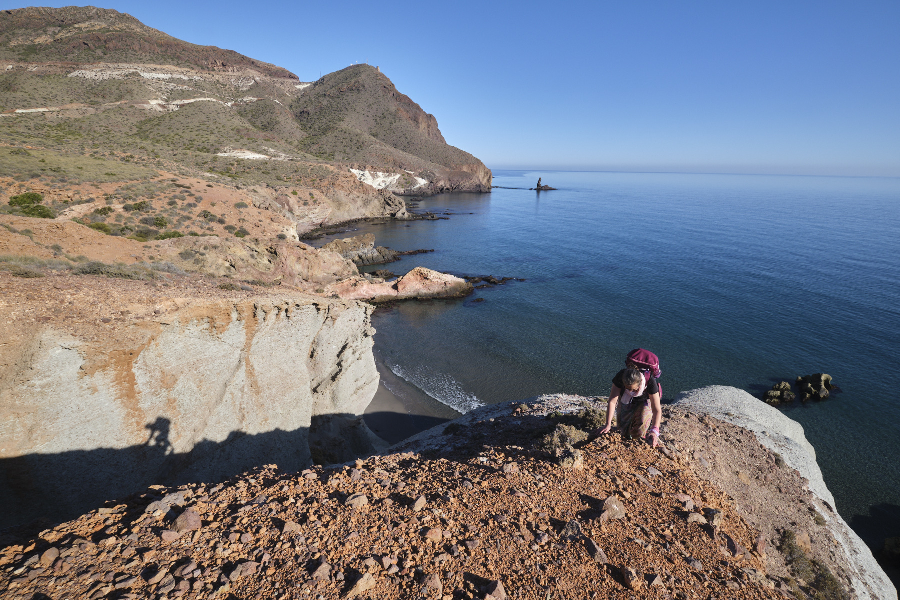
At this point, progress over the water is more complicated, so climb up the cliff at the most accessible point to come out almost under the dwelling. Cross over to the other side and find a path that descends easily to the tip of Punta Baja. You can descend a little further to the right to explore a basin formed by a thousand and one small volcanic columns before climbing back up to Punta Baja.
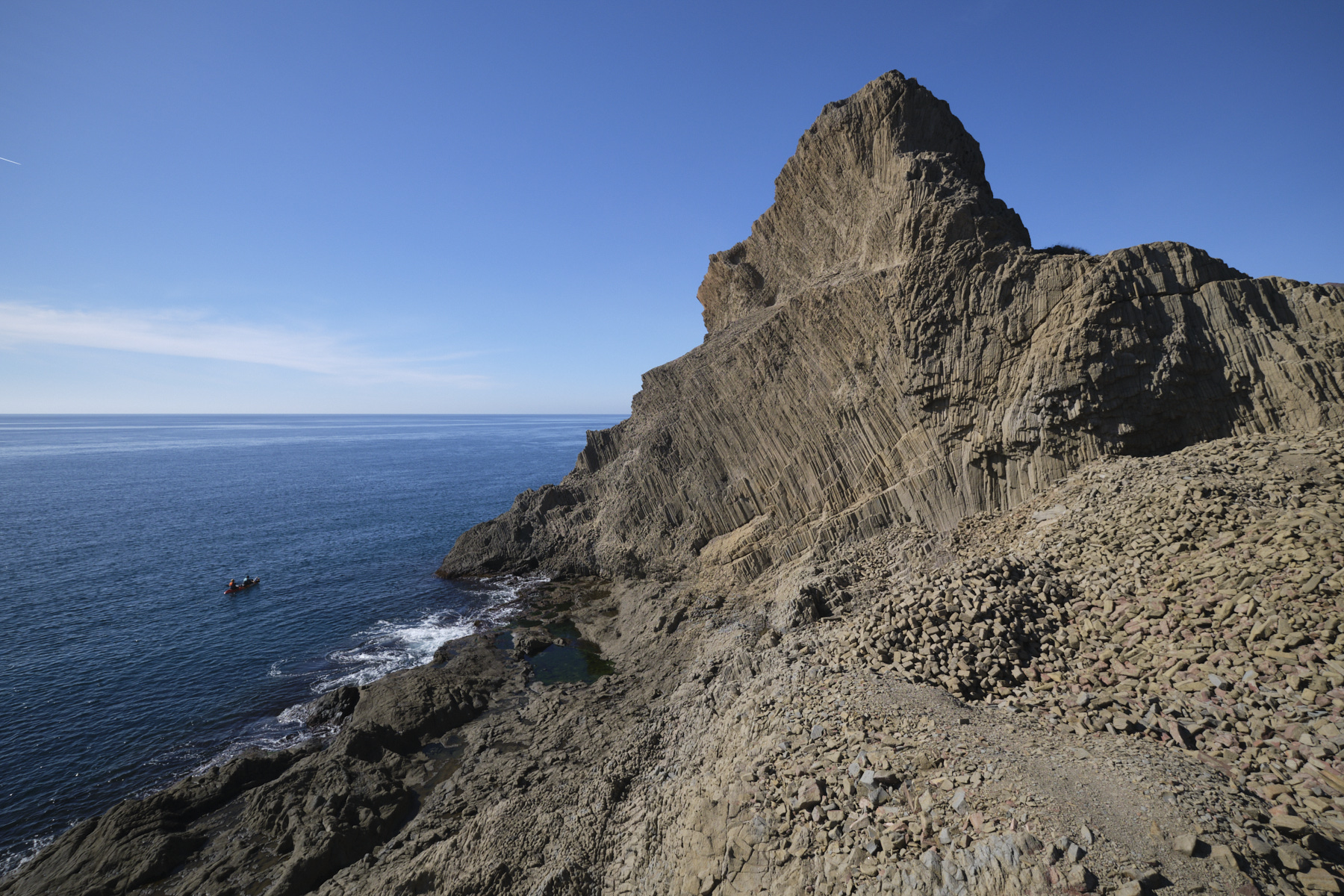
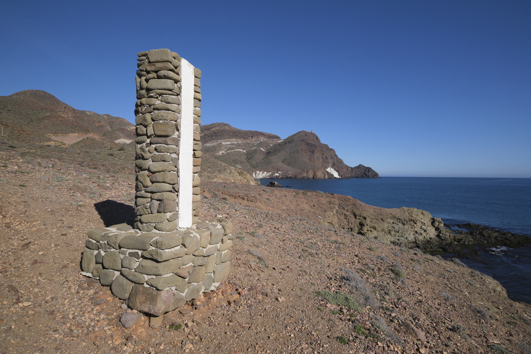
Climbing up to the left, you reach the first viewpoint on the second part of the route: from Cala Arena to the Dedo reef. It is also possible to summit Punta Baja, without any real difficulty, by passing along the northern slope and then ascending the western ridge. The panoramic view of this part of the coast, from the lighthouse to the Vela Blanca, is splendid.
Part 2: Punta Baja to Cala Rajada
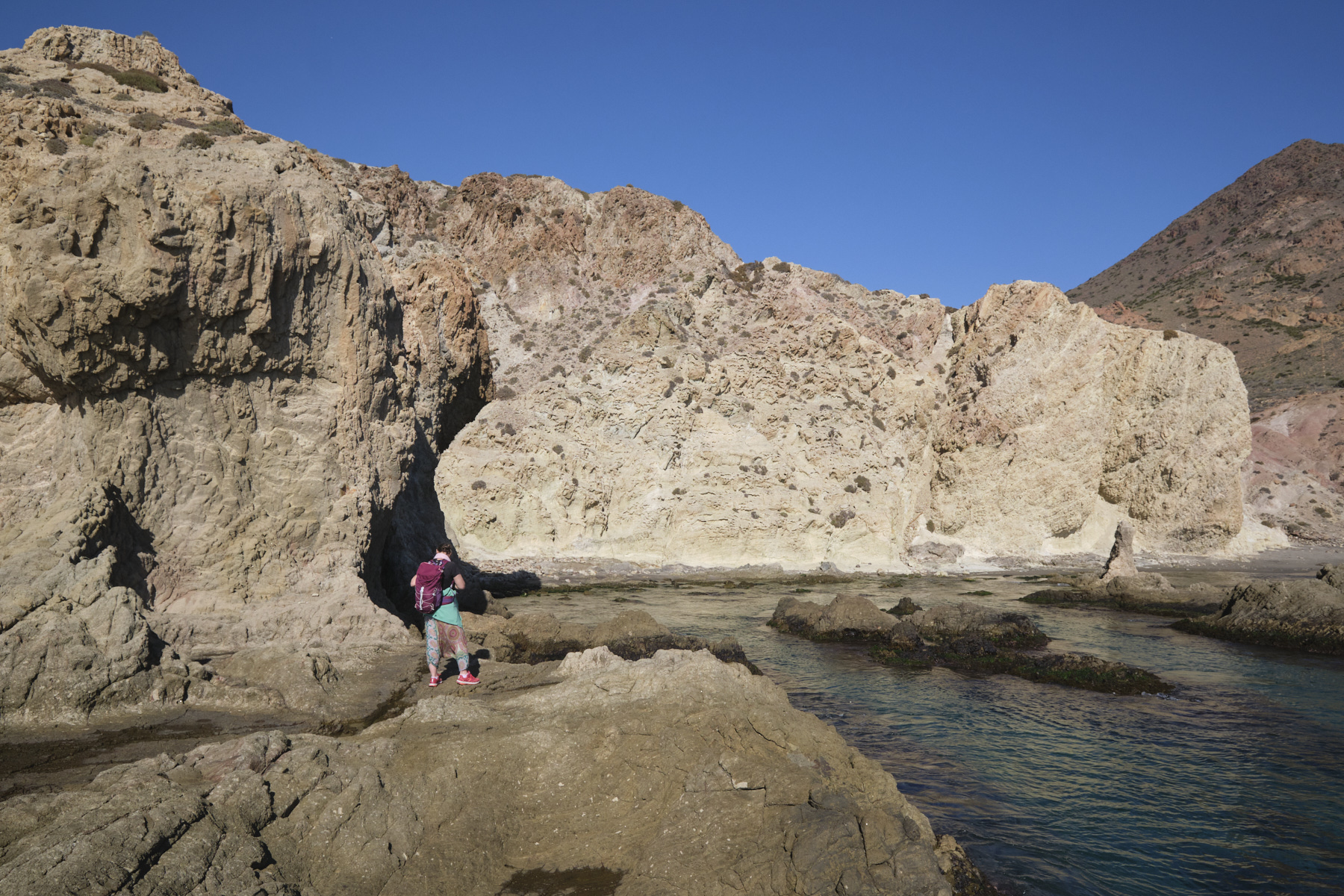
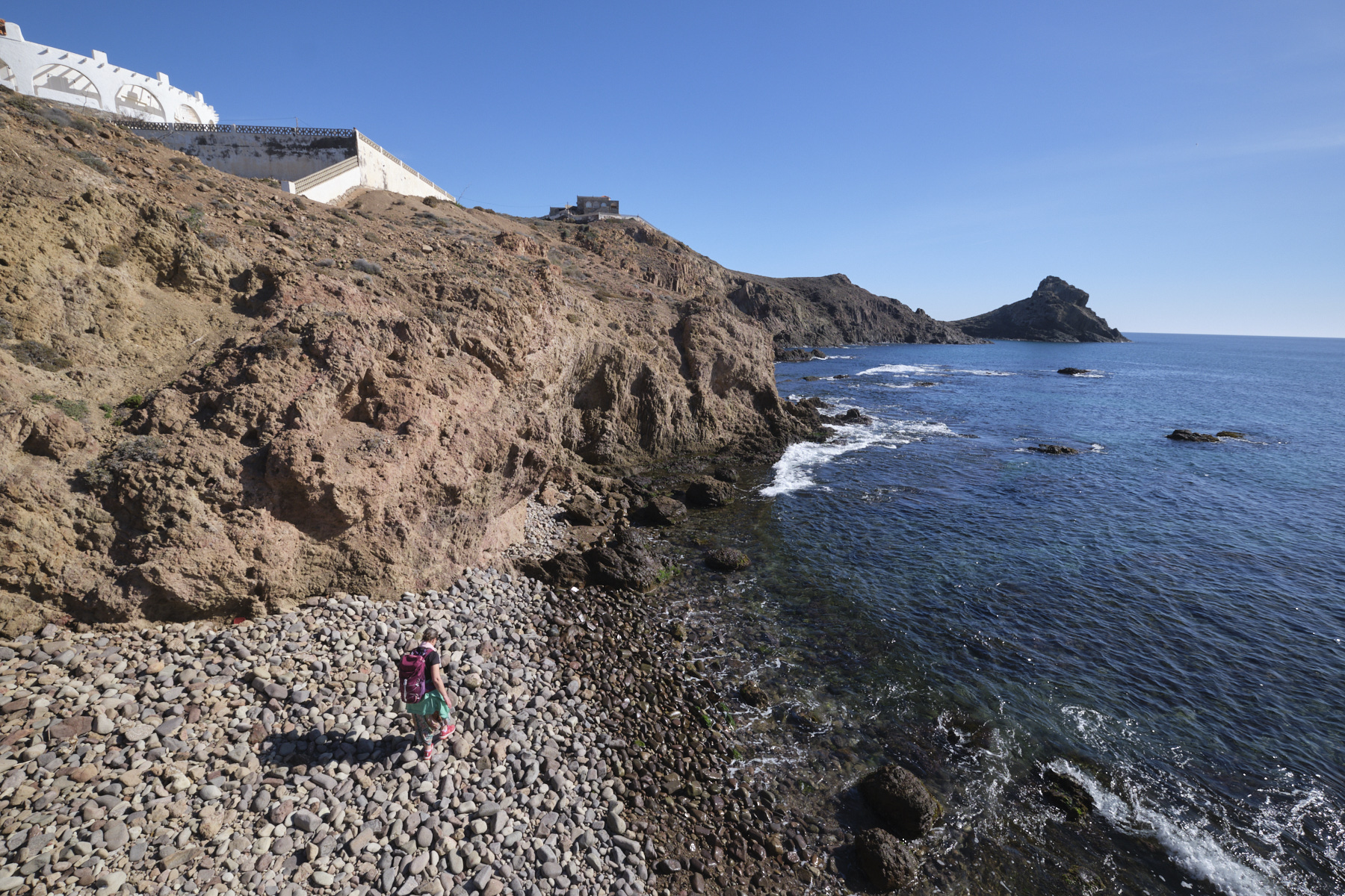
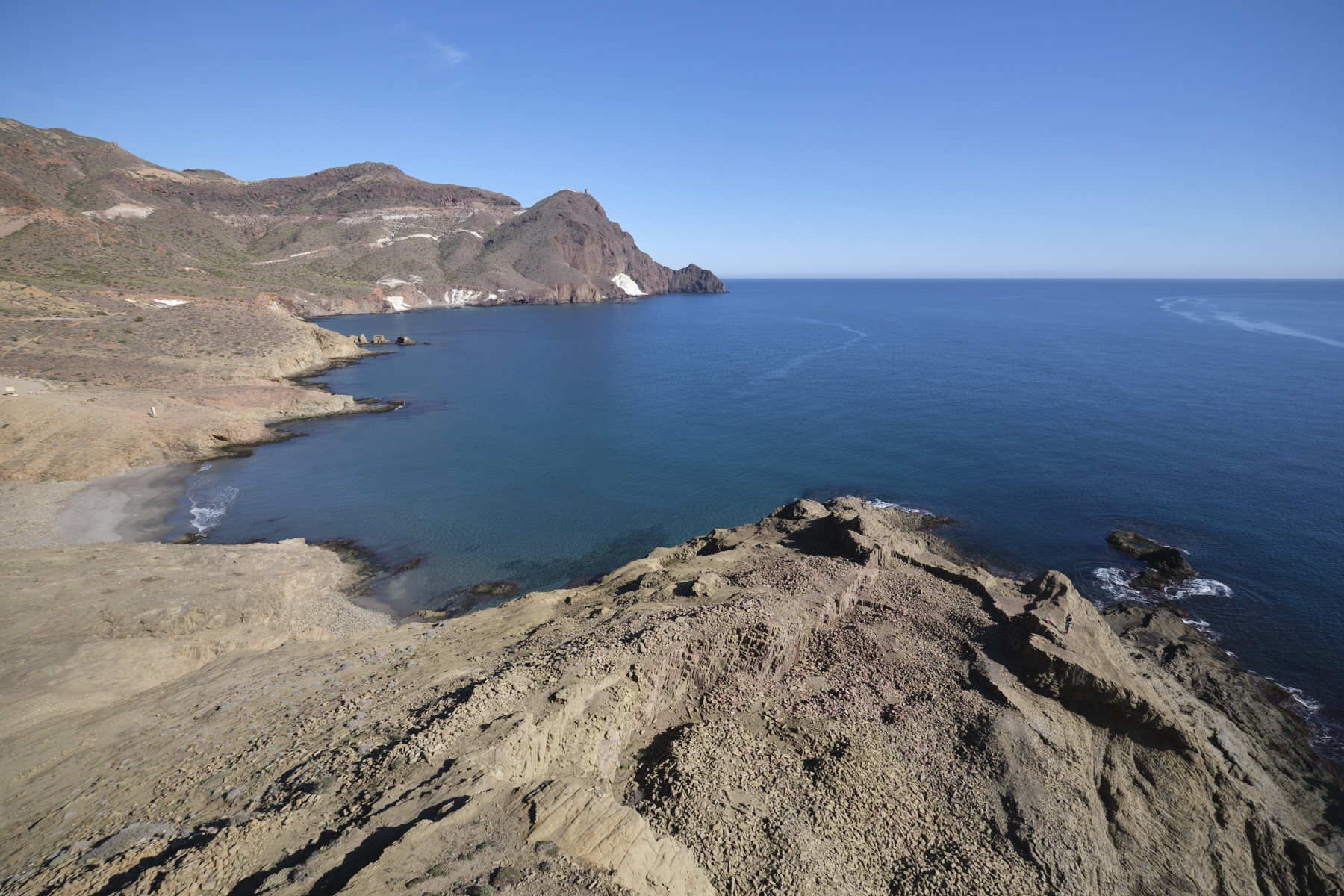
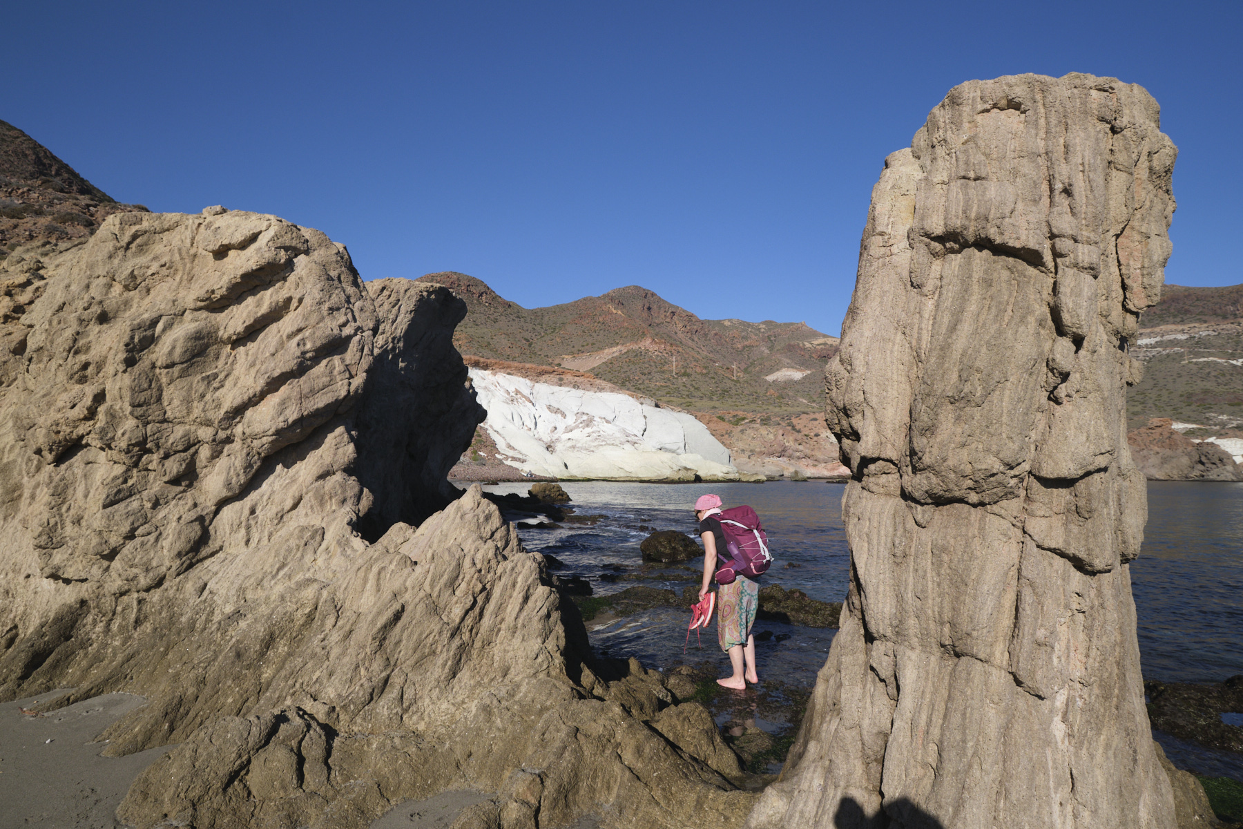
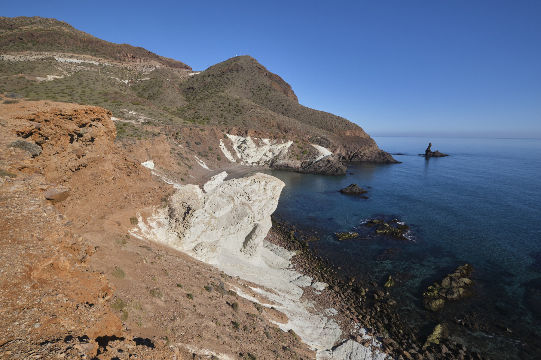
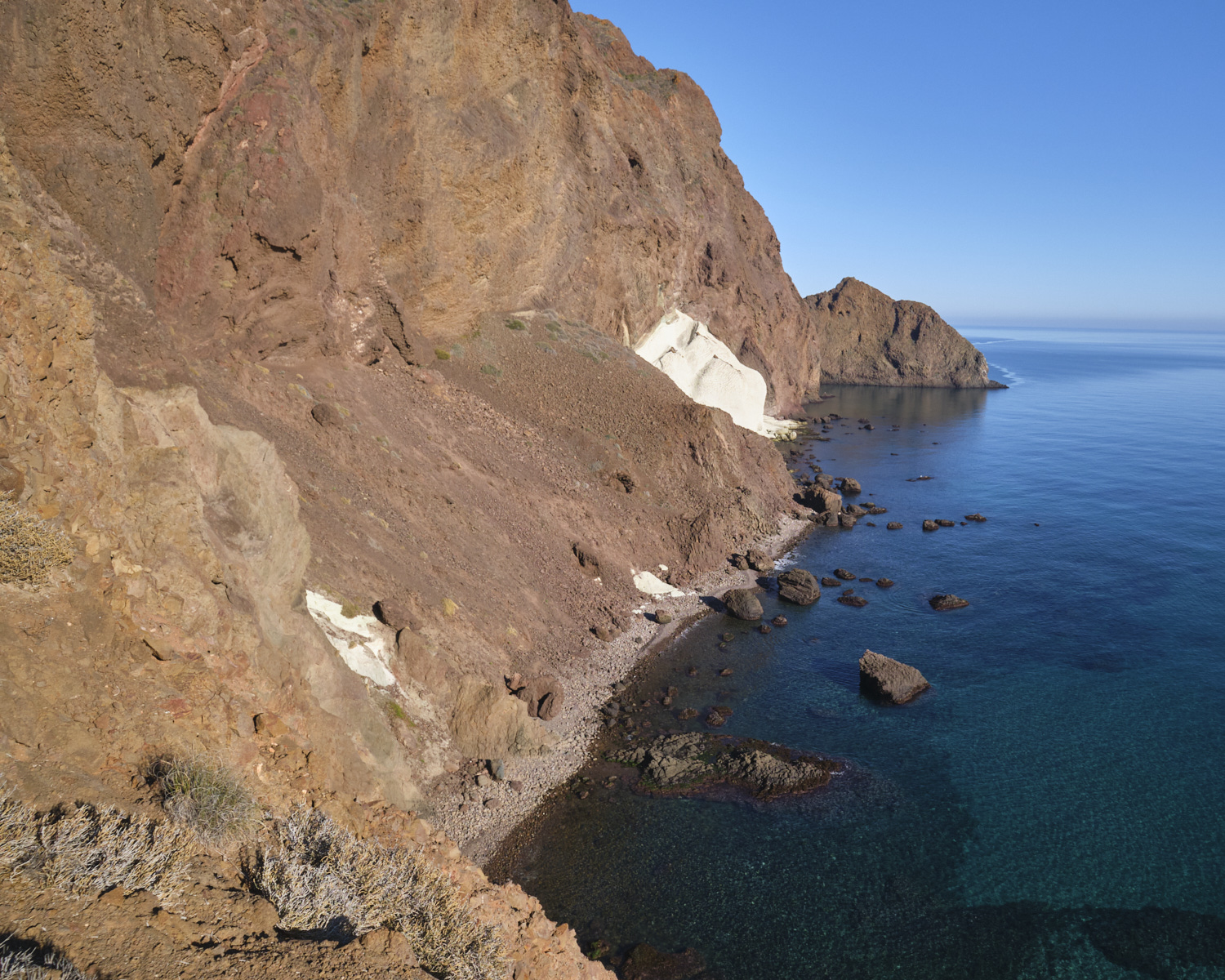
Retrace your steps from the summit of Punta Baja and this time head straight for the Cala Arena beach. Cross the beach and climb the upper path, which follows the rocky shoreline. In some places, you have to climb higher to cross small ravines, before finally descending to the water's edge just before the meringue zone. Walk along the shore on slightly submerged rocky slabs, crossing the cala that leads to the white formation resembling huge white meringue flows.
At this point, you climb back up the meringue to exit at the top, but the climb is tricky as the ground is a little slippery underfoot (you can exit beforehand to pass over the meringue). Once above the meringue, continue on the upper path to Cala Rajada, where the path joins the Dedo trail. Here, optionally, continue on the trail to come to rest almost above the Dedo reef and exit at the top to return to Cala Rajada.
Part 3: return to Cabo de Gata lighthouse via the trail
From cala Rajada, head up the Dedo track, which crosses the road just after it that leads directly back to the lighthouse. We repeat the whole itinerary but much more quickly on the road to get back to the lighthouse without difficulty.


 Partager sur WhatsApp
 Partager sur Twitter
Partager sur Instagram
Partager sur Twitter
Partager sur Instagram

 Partager sur Facebook
 Imprimer le topo
 Laisser un commentaire


Leave a Reply