

TOPO Hiking | CLIMBING7.COM
Publié le

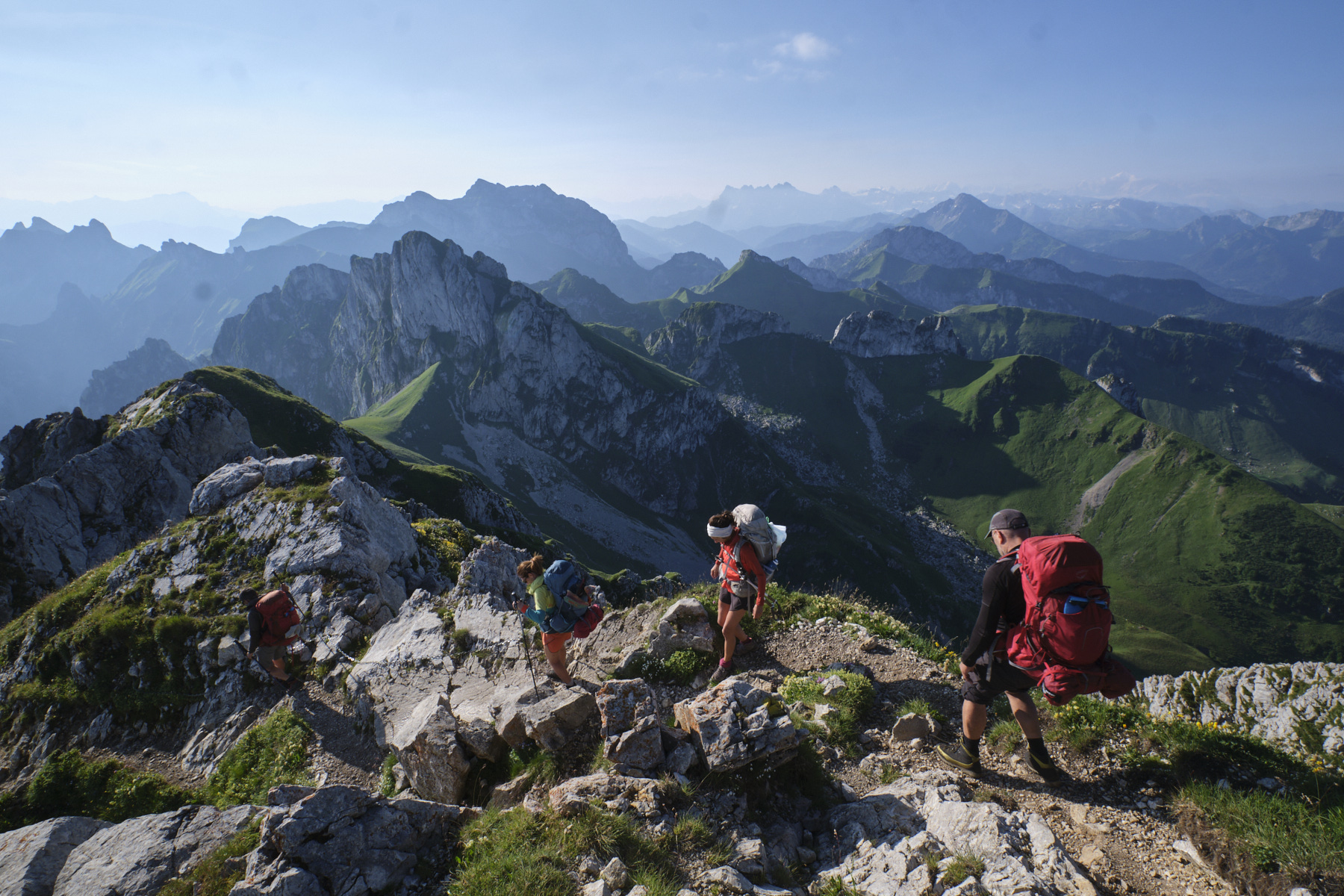
Starting from La Meillerie on the southern shores of Lake Geneva, here are the first two stages of the Trans'Alpes. The ascent to the Dent d'Oche is a long and physically demanding first stage, which takes us up high to contemplate Lake Geneva and offer the first glimpses of the Mont Blanc massif. The second stage is exceptional, with a first part on the crests and numerous equipped sections to reach the Portes d'Oche and further on the Col de Bise. The ridges of the Tête de Charousse, populated by numerous ibex, lead to the Col d'Urgeon, before entering Switzerland and ascending to the Pas de Chaudin. From here, a return trip to the summit of the Cornettes de Bise can, weather permitting, offer a spectacular 360° panorama before descending to La Chapelle d'Abondance.
❱❱ Technical summary
The data below corresponds to the first two stages of the Trans'Alpes.
► S tarting point: La Meillerie, Haute-Savoie (73)
► Type of route: high-mountain touring hike
► Distance: 14 km (J1) / 14.5 km (J2)
► Cumulative elevation gain: +1880 m (D1) / +955 m (D2)
► Cumulative negative altitude gain: -240 m (D1) / -1745m (D2)
► Estimated total time: 6h to 8h (D1) / 6h to 8h (D2)
► Max altitude: 2114 m (D1) / 2432 m (D2)
► Signposting: alternating GR, GRP and PR trails
► Equipment in place: chains and bars to access the Dent d'Oche refuge, the summit of Dent d'Oche and on the ridges to the Col de Planchamp.
► Equipment to bring: GPS track may be useful.
Difficulties: steep slopes, equipped sections, aerial ridges, unstable terrain.
Jérome Bonneaux's topo guide, TransAlpes, Montrouch 2010 edition, is very useful for detailed stage descriptions and extensive information on refuges or other contact numbers.
❱❱ Access to the place
Drive to the village of La Meillerie on the southern shores of Lac Léman, past Thonon-les-Bains and Évian-les-Bains towards the Swiss border. Drop you off at the top of the village, near the cemetery and church, where the forest trail begins.
❱❱ Map & topo
Move the mouse over the orange circles to see the legend for the crossing points (pass, summit, springs, etc.).
❱❱ Itinéraire
For a more detailed description, please refer to Jérôme Bonneaux's TransAlpes topo guide.
STAGE 1: from La Meillerie to the dent d'Oche refuge
The stage begins with a steep, sustained ascent through the forest to Les Reboux and then the hamlet of Lajoux. From here, a more gradual ascent through the forest leads to the bottom of one of the Thonon-les-Mémises resort slopes. Climb steeply up the slope to the upper basin, where there are 2 lakes, and climb a little higher, before descending to Les Lanches. You can already see the Dent d'Oche and the road ahead.
Climb up from Les Lanches to the Col de Neuva. From here, follow the path south-east for a long traverse over the balcony of Lake Geneva, with superb views. Before a short steep climb over a shoulder, there's a spring on the left. Continue on to the Col de Rebollion, which takes you to the other side of the valley. There are superb views of the Dents du Midi and the Mont Blanc massif in the distance.
All that remains is to climb the steep walls that form the southern buttress of the Dent d'Oche. A steep and well-equipped path (including a rung and chain) leads directly to the rocky outcrop where the superb Dent d'Oche refuge was built in 1914, below the summit of the same name. Exceptional panoramic view!
STEP 2: from the Dent d'Oche refuge to the Chalets de Chevenne
A demanding but incredible stage! From the refuge, climb the rocky, equipped path to the summit of Dent d'Oche. From here, with aerial views of both Lake Geneva and the Mont Blanc Massif, follow the ridge eastwards on a steep and committed route, but equipped in the most exposed parts. You then reach the Col de Planchamp at the foot of the Château d'Oche.
From here, descend to the south-west towards the basin with the Lac de la Case, but fork off beforehand to climb back eastwards on the GR5 until you pass the Portes d'Oche to the left of the Aiguilles de Darbon. Then cross level under the southern walls of the Château d'Oche on the opposite side of the Lac de Darbon to the Col de Pavis.
Follow the GR north-eastwards, but soon leave it on a faint path that climbs a grassy slope and then descends between small rocky teeth to reach the Col de Bise. This is the start of the superb Tête de Charousse ridge, which forms a large V pointing south. At the exit, you pass under the Dent du Velan, then the trail crosses the border into Switzerland before passing the Col d'Ugeon.
Crossing the pass, staying more or less level, you pass below the eastern ridge of the Tête de Lanche Naire before climbing up a closed combe below the Cornettes de Bise to the Pas de Chaudin (aerial finish). From here, it's a 45' round trip to the summit of the Cornettes de Bise for an exceptional 360° panorama (unless there's a big cloud at the time, as was the case...).
Return to the Pas de Chaudin and descend across the grassy slopes to the Cabane de la Calaz, then head due south to land at the Col de Vernaz. There then remains a long descent of the Chevenne brook valley along the path and then the track to end stage 2 at the Chalets de Chevenne, where a bivouac is possible (water in the Séchet brook).
Leave a Reply