

TOPO Climbing | CLIMBING7.COM
Publié le

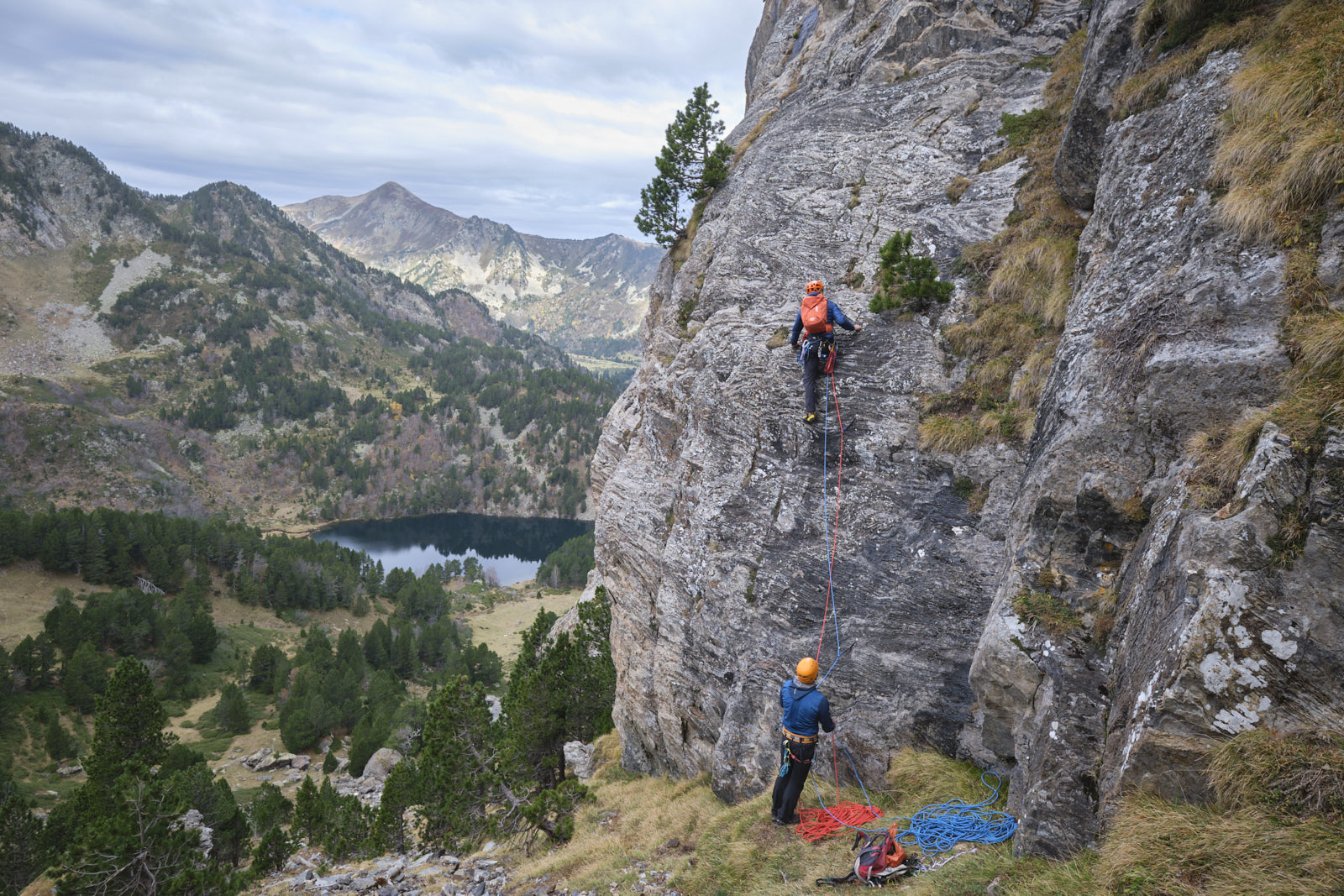
Lost in the heart of Donezan, Roc de la Musique offers an interesting north and west face to climb, opposite Pic de Balbonne and in front of Couillade des Bourriques. This unnamed route winds its way up the face, following the most accessible route. The rock is good overall, even if a little shaky in places, and the 4 pitches are uneven. The 3rd pitch is the most beautiful to climb and also the most difficult section (5c). There are also some not-so-reassuring wet spots and passages between grassy flats and shrub trunks. We finish on the airy, panoramic summit ridge to enjoy the view.
❱❱ Technical summary
► S tarting point: parking de la Restanque, Donezan, Mijanes, Ariège (09)
► Type of route: equipped long route
► Length : 140m in 4 pitches (35m, 35m, 35m, 35m)
► Rock: limestone, beware it moves in places!
► Direction: south-west
► A pproach/return time: 1h45 (500m d+) / 2h30 (rappels + walk)
► Min and max altitude: 1590 m / 2238 m
► Equipment in place: placards, equipped belays, linked (ropes and chains), final belay on a tree. A few passages that would benefit from intermediate points.
► Equipment required: 10 quickdraws, 2x60m rope.
Difficulty: 5c (not mandatory in L3), 5b/b+ for the rest. Climbing grade: D.
❱❱ Access to the place
On the D25 road between Col de Pailhères and Mijanès, turn south-west onto the Bruyante forest road. The road/trail descends for a good while, ending at the final Restanque parking lot.
❱❱ Map & topo
The routes for the approach to the foot of the route and the return from the pass under the Roc de la Musique (after abseiling) to the Balbonne pond are indicative (off-piste).
❱❱ Itinéraire
Climb the track to Jasse de la Restanque, cross the Bruyante stream and follow the yellow-marked path. After a long forest passage on the right bank of the ruisseau de Balbonne, the path takes you to the left bank and then back to the right bank. Here, the path attacks the Balbonne ladder, climbing steeply and steadily to pass the upper lock and reach the banks of the Balbonne pond. Walk along the water's edge and, in the south-east corner of the pond, climb to the left towards Ric de la Musique in a fairly steep, grassy, off-trail valley. Once at the base of the wall, skirt around to the west and climb the steep slopes again to find the start of the route at around 2100m altitude on the south-west face. There's another route to the right (6a+). The landmark is a large fir tree set into the wall at around 10m, with our route on the left and a hanging garden 50m above it.
L1 (35m, 5b+, 8 quickdraws)
Start on small rocky ridges, then higher up pass a more vertical ledge (not 5b+) under a boulder that forms a small dihedral. Continue more easily in a couloir to emerge on an upper ledge. A first roped belay and a second chained belay by traversing 5m to the right.
L2 (35m, 5b+, 8 quickdraws)
Finish the traverse and climb the right-hand flank of a wide black dihedral moistened by resurgent water. At the top of the dihedral, we have to switch back to the left side, not the most difficult of the length (5b+), with wet rock that is not very reassuring and well-spaced points. Exit above onto a small hanging garden. Walk across to find the chained belay.
L3 (35m, 5c, 9 quickdraws)
The most beautiful pitch, with straight lines and impeccable rock. Climb straight up an easy ramp to negotiate the thin vertical section (5c). Above, it's still vertical but with good holds up to a large tree trunk where the belay is located.
L4 (35m, 5b+, 10 quickdraws)
Exit onto an incline and go left, then right again in a wide bend. Be careful, there's a bit of movement here. It's quite vertical and you have to weave in and out of small grassy flats and shrub trunks. Finish on the summit ridge, belaying on a tree trunk (suspicious straps, better to mount your belay).
From the final belay point, climb the summit ridge on a tight rope (II, 5 equipped points, 2 plates and 3 tree straps). We arrive at the 25m abseil equipped on a tree, to reach the small col.
From here, descend the steep grassy slopes to the south, aiming for the Etang de la Musique. Before you reach it, you may want to cut back to return directly to the entrance to the Balbonne pond (see proposed route). You then have to retrace the Balbonne ladder and the Ruisseau de la Bruyante path back to the Restanque parking lot.
0 Responses to “Le Roc de la Musique from the Restanque, Mijanes”
amazing