


TOPO Hiking | CLIMBING7.COM
Publié le
 Partager sur WhatsApp
 Partager sur Twitter
Partager sur Instagram
Partager sur Twitter
Partager sur Instagram

 Partager sur Facebook
 Imprimer le topo
 Laisser un commentaire

Nice long endurance loop in the Ripollés region of Catalunya. The hike, although quite steep, is not at all difficult. The route is easy to follow on the way up, and a little more challenging on the descent to the resort of Nuria. The Torreneules summit is at 2711m. We're not far from the Carlit and Puigmal peaks, with magnificent views all around and a relaxing, natural atmosphere.
❱❱ Technical summary
❱❱ Access to the place
From the village of Queralbs, on the Barcelona-Vic-Ripoll axis, head towards Puigcerda-Bourg-madame. In the village, turn right at the river and head for the Daió power station. Small parking lot and starting point for the hike. Arrive by train from Barcelona Sants, direction Ripoll-Vic, stop at Ribes de Freser station and take the cogwheel train to Queralbs, then walk to the Daió power station. You can park in the small parking lot. Cross the bridge to start the hike to the right towards the Coma de Vaca refuge.
❱❱ Map & topo
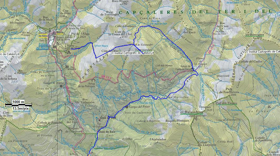
❱❱ Itinéraire
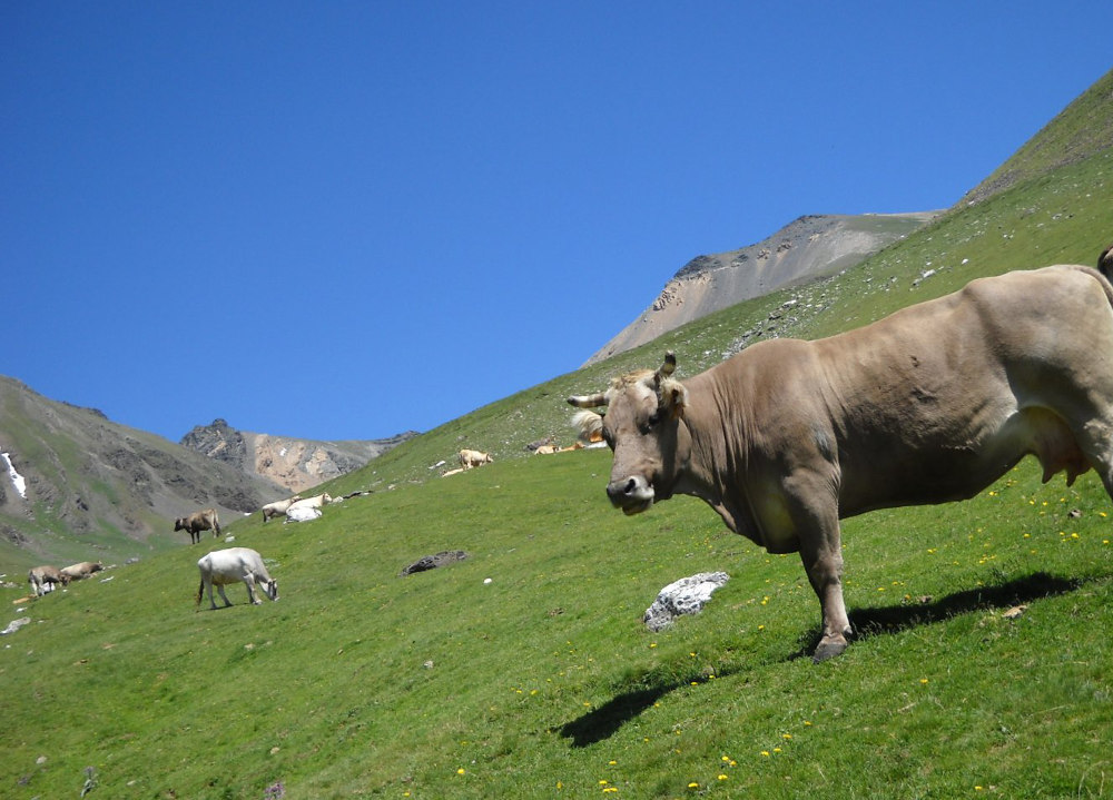
Walk along the mountainside, gaining height above El Freser to reach the Coma de Vaca high-altitude valley, a veritable cow meadow, green and luminous, bursting with water and color, at just 2000m altitude. A refuge is set up here, the starting point for climbing the surrounding peaks (Torreneules, Bastinents and even Puigmal).
The trek has a 1500m ascent (positive and negative added up over the whole loop) and includes a loop from the Daió power station. Allow around 3 hours.
From the refuge, the path continues up the wide valley to the left, which embraces the Coma de Vaca torrent, between the 2 serras: Torreneules and Vaca. Marmots spot us. Tarpaulins watch us. Before reaching the end of the combe (coma = combe?), the path forks left to run straight ahead at 45° to the Col de Torreneules at 2563m. It takes 2 hours from the Coma de vaca hut to reach the pass. The first climb is Torreneules 2711m, then back over the pass to Cim de la Coma del Clot 2726, the highest point of the walk. The ridge continues on towards France, past the Col d'Eina, the Col de la Carança and the Col de la Vaca. The peak of Carlit, almost 3000m, stands out in the distance, still covered in snow, and closer up, the stony dome of Puigmal can be seen, which has lost all its winter allure.
Crossing over to the other side of the Cim de la Coma del Clot, we join the ridge path of the serrat de la Coma del Clot, which leads to the ski resort of Núria. Nothing to say about the resort, except that the valley is essentially home to the sanctuary of the Virgin of Núria, where Catalonia's first Statute of Autonomy was drawn up in 1931. Then it's down the Núria Gorge, taking the GR 11 to the Cremal bridge, after about 40 minutes, where you turn left onto the narrow path to Daió. The path is very steep, bordering the cliff and often bushy. When you reach the siphon, the path twists and turns back to the small parking lot at the start.


Leave a Reply