


TOPO Climbing | CLIMBING7.COM
Publié le
 Partager sur WhatsApp
 Partager sur Twitter
Partager sur Instagram
Partager sur Twitter
Partager sur Instagram

 Partager sur Facebook
 Imprimer le topo
 Laisser un commentaire

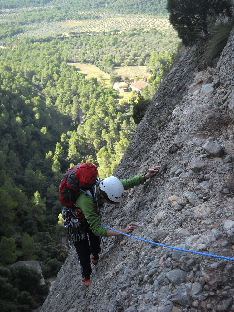
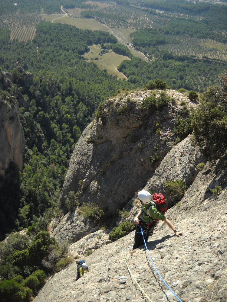
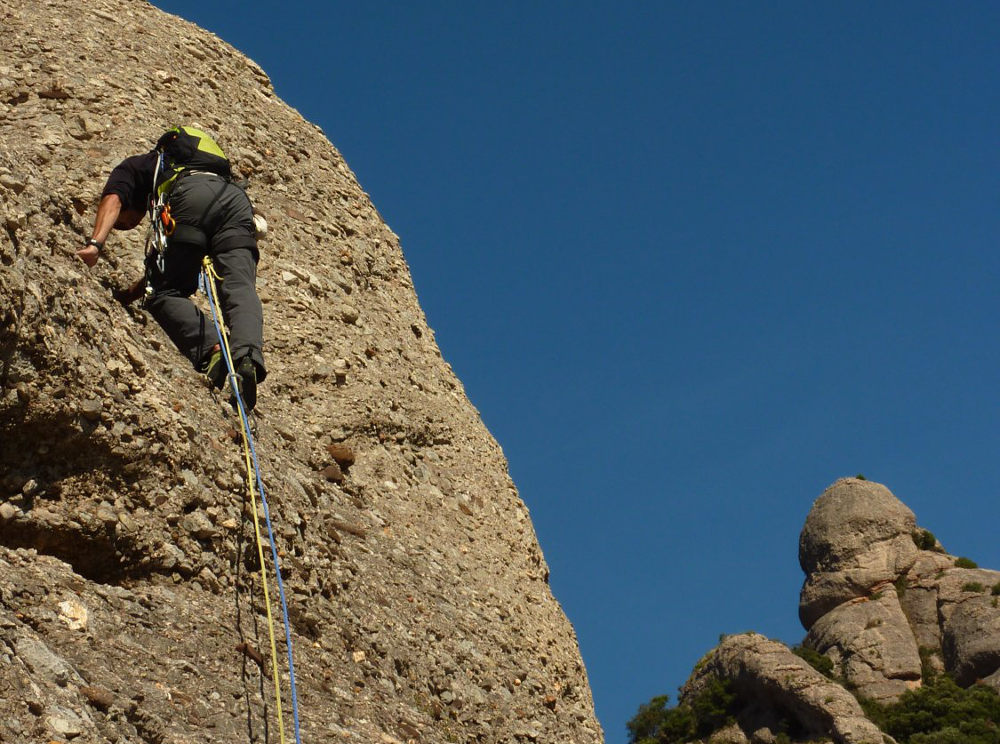
Montserrat south face, Can Jorba sector, at the entrance to the Joc de l'Oca. This great route unites the Bego-Kush and Miguel-Kush to form a very accessible route, albeit requiring stamina. Ideally located on the south face of l'Aguille Can Jorba for an autumn or winter outing, the rock is very good, the equipment recent and the climbing is fine and pleasant IV+/V. Several other routes start from this needle: via Sol Solet further to the left and via Escabroni-Escapullini, which take practically the same route up to R2, this time finishing on the huge yellow roof above us in the 3rd pitch. A long, pleasant route for a gentle recovery.
❱❱ Technical summary
❱❱ Access to the place
Take the A2 from Barcelona towards Leida and exit at Bruc. Go through the residential area and take a track through the forest and olive groves. Reach Can Jorba further west than Vinya Nova. This is a building with a small parking lot under the trees, almost at the foot of the first cliffs.
❱❱ Map & topo

❱❱ Itinéraire
From the parking lot, take the narrow path behind the house, which goes deep into the undergrowth. It climbs and you soon find yourself skirting the foot of the rock faces, even passing under them in places. Keep following the few yellow dots that indicate the way to the start of the Joc de l'Oca. The path then begins to climb up the bed of the Migdia torrent, full of rocks. After a 10-minute walk, you come to a small clearing where the Joc de l'Oca starts and continues up the torrent. L'agulla de Can Jorba rises just to the left. The route starts a few metres higher up, under the trees. The leftmost start is for Sol Solet, and to the right for Escabroni Escapullini and Bego-Miguel_Kush (first 2 shared nails).
The route, opened in 1999 and 2005 for the last 3 pitches, is south-east facing and 240m long in 6 pitches (45m, 35m, 40m, 50m, 30m, 40m). Equipment is good (bolts), but 12 quickdraws and 1 small pin (L1) may be required. Maximum level is V.
L1 (45m, V/IV+)
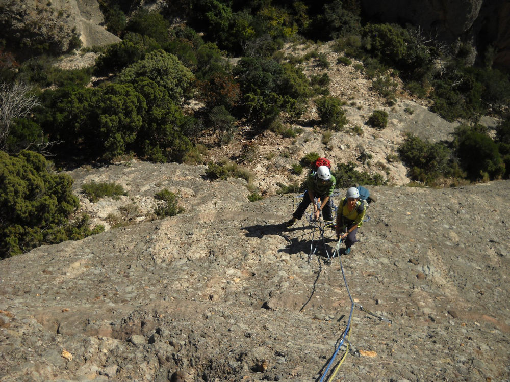
The first steps under the trees are tricky in V, but once you're cold and past the small tree, it's easier (IV+). We quickly get out into the sun (if there is any!) and find 2 lines of nails from the 3rd point. Normally straight ahead is the B.M.K. and to the right the Escabroni. But on arrival at the first relay it's the same thing, as the 2 meetings are set 3 m apart. Comfortable R1 belay with a landing area.
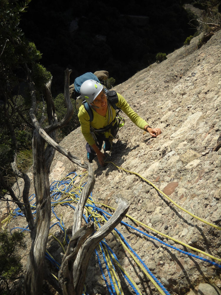
L2 (35m, IV+)
Go right diagonally to approach the trees and climb straight up. There is a more difficult step to overcome a break that forms a slight overhang. But good holds and you end up on a comfortable R2 belay between the trees. If you go straight on from R1, it's the via Escabroni-Escapullini which goes to the same place anyway.
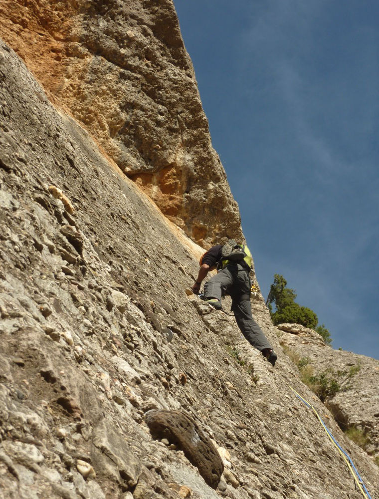
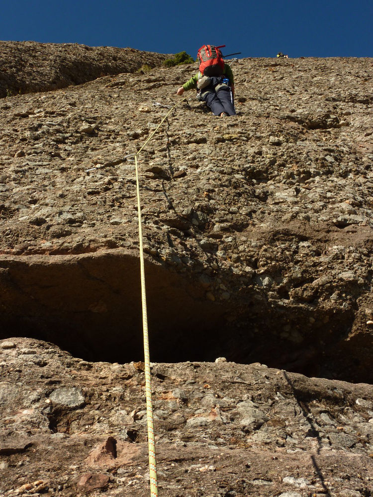
L3 (40m, V/IV+)
Exit the belay diagonally to the right. Above you can see the huge pyramid-shaped break that we'll skirt to the right. An easy, pleasant traverse leads to an inclined dihedral. There's a belay here that you can use to cut the length in 2. It's better to continue up the dihedral, cross the right-hand edge of the big roof and finish by walking to exit on a wooded flat where you'll find the R3 belay.
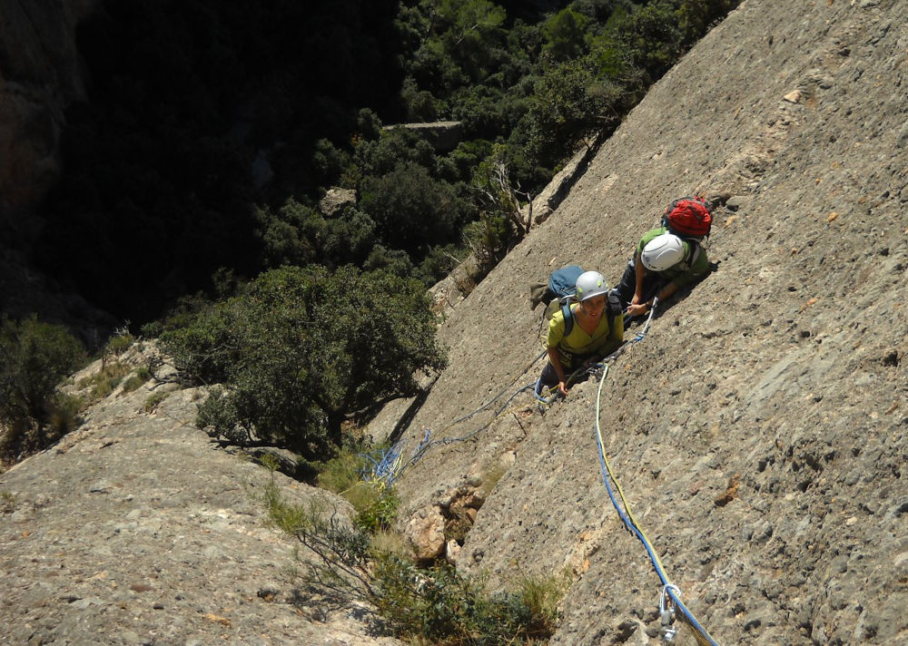
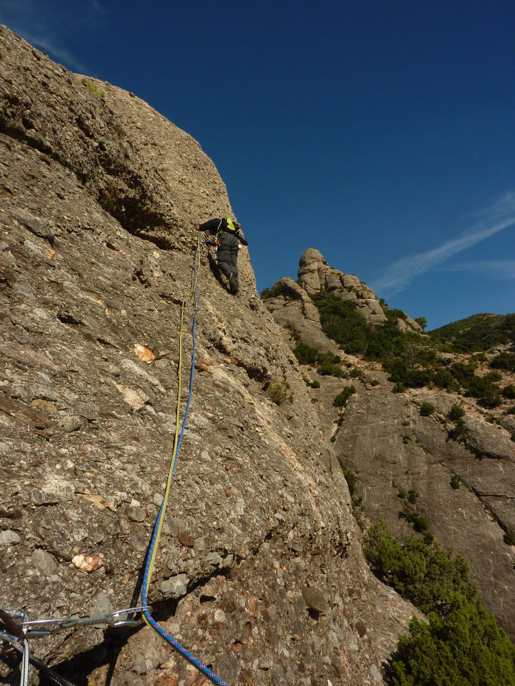
L4 (50m, III/IV)
Turn left on a small rocky ramp, then right to tackle the large sloping plate. Look for the first point very high up, then zigzag upwards to find 2 or 3 other belay points (watch out for the draft). Relay R4 is located below a wide horizontal lip, a little to the right.
L5 (30m, V-/IV+)
A step at the start to cross the lip, but good holds and 2 protective nails to get out. Continue straight on, following the left-hand dihedral in parallel to reach R5. Plates are well spaced here (10 meters).
L6 (40m, IV/III)
Exit diagonally to the right to find the first nail, then climb straight up to the summit. A large flat area then the last few easy metres to R6, almost on top of the needle.
Cross to the other side of the summit and descend to the left along the rocky outcrop, skirting it from below and skirting it to the left (flush). This almost takes you all the way round to a small ridge overlooking the Joc de l'oca canal gorge on the right. Follow this passage until you come to a small, steep canal which runs straight down to the Joc de l'Osa. Once in the canal, climb up to the left, then turn right at the first T junction. This is the Migdia canal, which you need to climb for 15′ to find the return path on the right (a small path with an illegible wooden sign on a tree). Follow this track (10′) until you come to el Cami de los Franceses, which you turn right onto. A steep and fairly long descent to the Collbato-Can Jorba track.


Leave a Reply