


TOPO Hiking | CLIMBING7.COM
Publié le
 Partager sur WhatsApp
 Partager sur Twitter
Partager sur Instagram
Partager sur Twitter
Partager sur Instagram

 Partager sur Facebook
 Imprimer le topo
 Laisser un commentaire
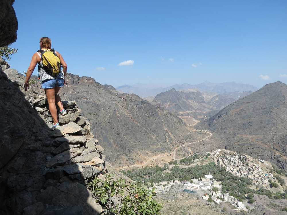
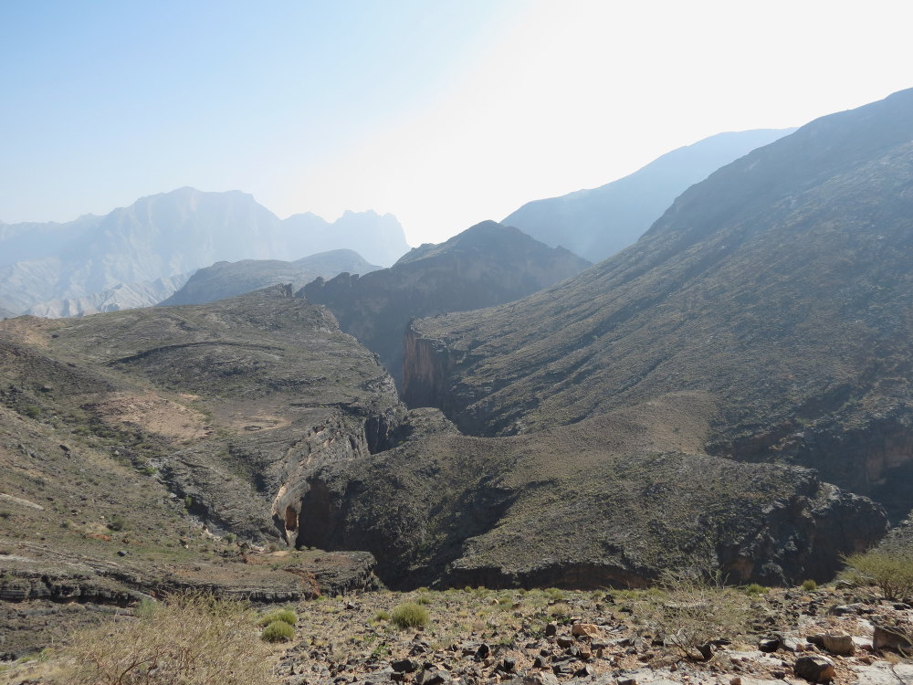
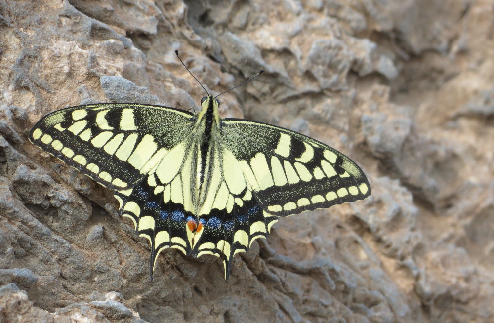
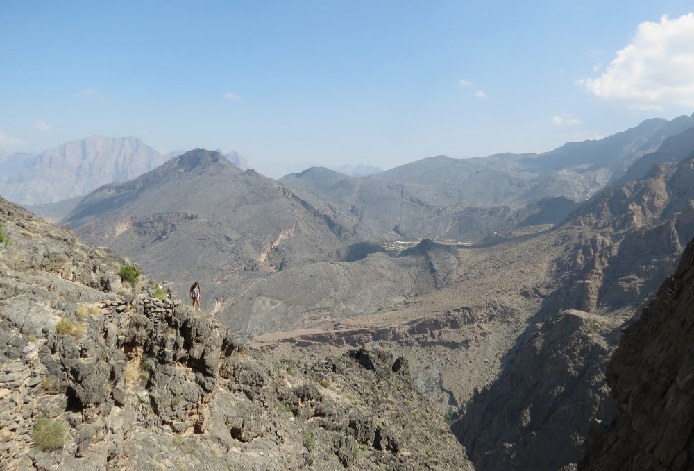
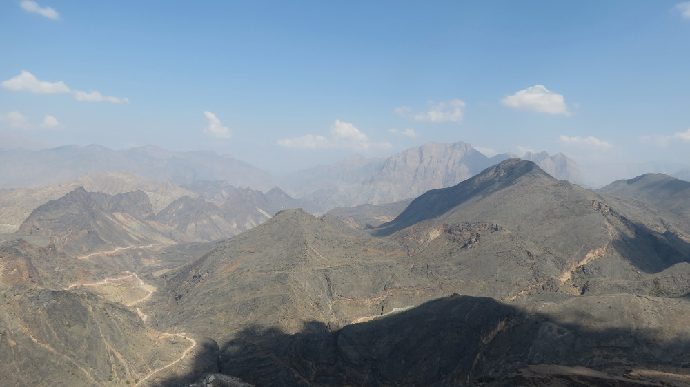
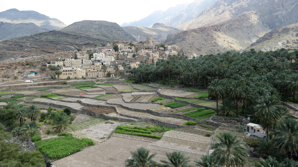
After a day's climbing on Hadash and a bivouac in the heart of Wadi Mistall, a short hour in the 4×4 is enough to reach Wadi Bani Awf a little further west. The road, then the track, plunges into a narrow defile, between impressive walls, before rising above the Snake Canyon to reach the Gorgette camp, just below Bilad Seet. Cross the incredible limestone gorge to reach the village, its terraced fields and palm grove. The W8 trek starts at the top of the village and heads straight for the imposing barrier of Jebel Sham's. Perfectly signposted with the unmistakable triple red-white-yellow stripe, the trail soon gains height. There's no difficulty except for the heat, the steep slope and a few exposed passages on steps built on the edge of the void. The view becomes more and more impressive: the village, then the whole of Wadi Bani Awf, splendid. After 1h30 of climbing, we turn back, as the ridge above us is still a long way off. A pretty flying specimen approaches us during the break. A dizzying descent back to the village. We return via the Gorgette to land in the peace and quiet just a few metres from the entrance to Snake Canyon, on the agenda for the following day.
❱❱ Technical summary
❱❱ Access to the place
It's not very complicated, but a 4×4 is absolutely necessary to climb the Gorgette. On route 13 between El Awabi and Rustaq, enter the Wadi Bani Awf. A few km of tarmac road before the track that winds up the bed of the Wadi. Follow Bilad Seet. Pass Zemmah, which marks the exit from the Snake canyon. Here the track becomes much steeper and climbs to the right, skirting the canyon. Take a detour around one of the canyon's branches, 2 or 3 aerial passages at the edge of the void. Leave the fork towards Bilad Seet and continue towards Hat. It descends again to reach a small corridor leading to the Gorgette. Here, on the right, there are terraces for bivouacs, a base camp for the area. About 30 km from the exit of route 13.
❱❱ Map & topo

❱❱ Itinéraire
The trek can start from here, entering the Gorgette gorge and turning either right (direct access to the village) or left (access to the terraces) at the fork. In the village, climb up towards the mountains, above the mosque, to reach a basketball court. The 1st W8 markers are easy to find. After a climb through rocky terrain, the path attacks the 1st cliffs. Small staircases fashioned by the villagers, some emptiness, but no technical difficulty. It continues like this for a while, winding along. Then the path crosses the ridges and you lose sight of the village. You can now see the top of the ridge. It's probably another 1h30 walk to the pass.
So we retrace our steps this time, admiring the impressive overall view, a second pass through the village, up to the dominating tower, for a glimpse of the palm grove, before rejoining the camp, terraced under the Gorgette.


Leave a Reply