


TOPO Hiking | CLIMBING7.COM
Publié le
 Partager sur WhatsApp
 Partager sur Twitter
Partager sur Instagram
Partager sur Twitter
Partager sur Instagram

 Partager sur Facebook
 Imprimer le topo
 Laisser un commentaire

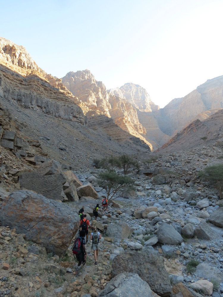
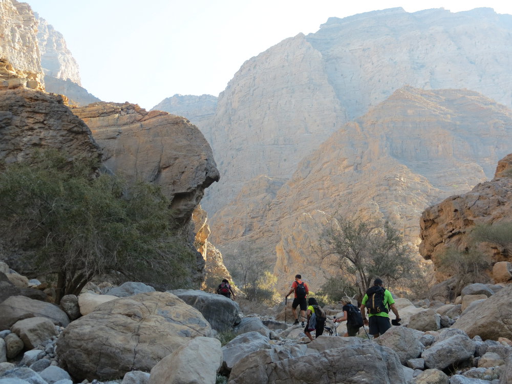
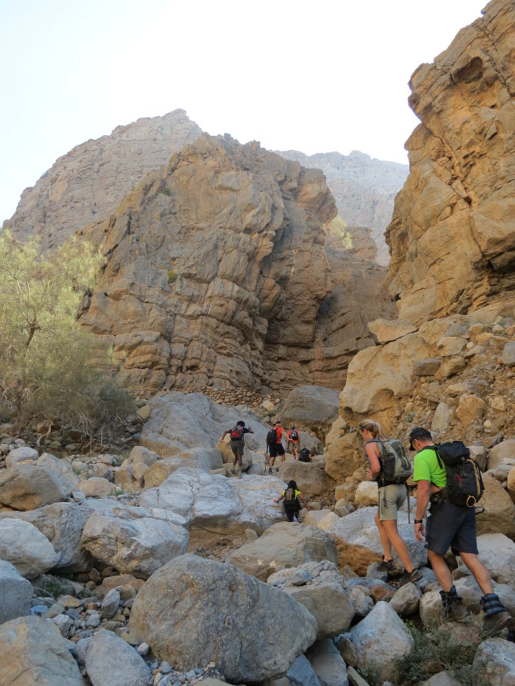
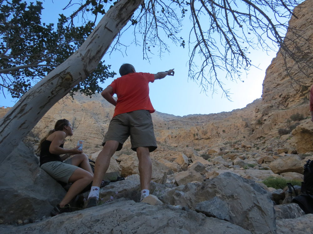
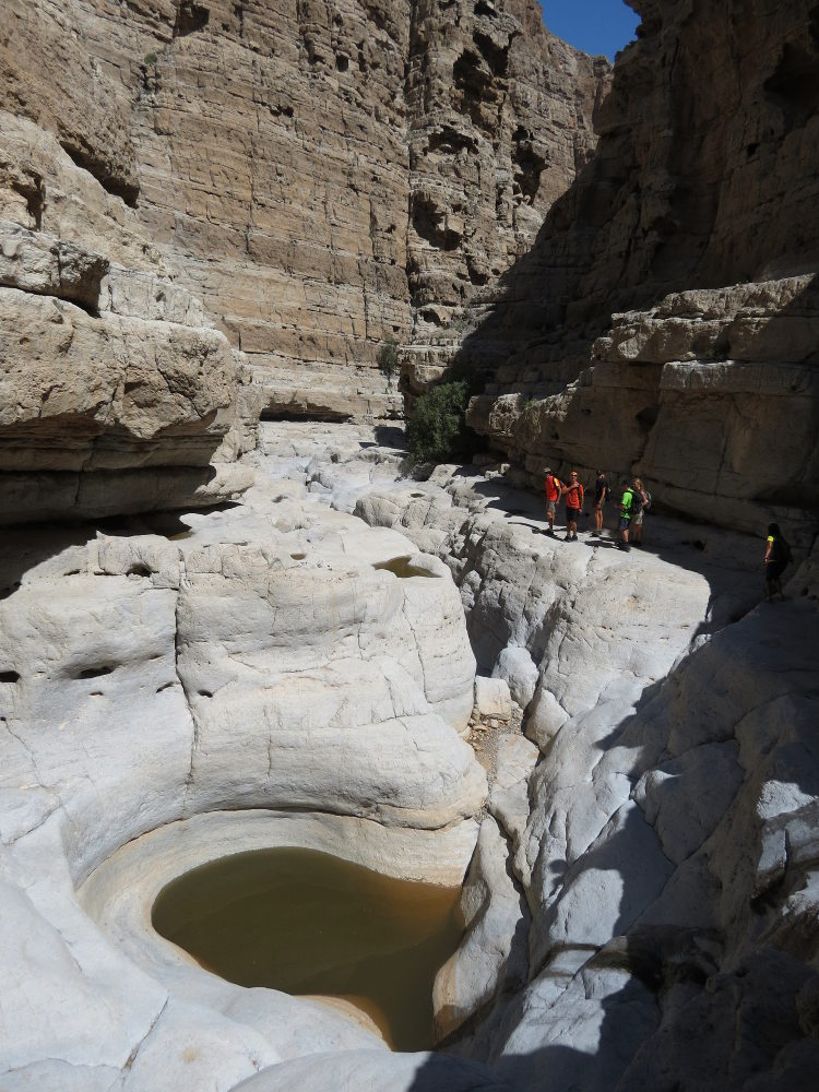
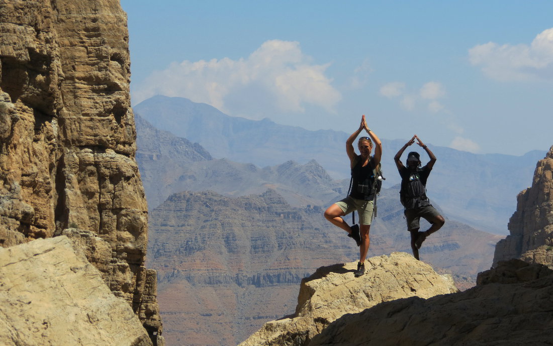
Starting from RAK, at the very bottom of the wadi Qada'a, after a little over 2 hours' climb, we reach a narrow canyon named after the last (?) leopard killed in the region, whose remains were left there, on a ledge at the top of the canyon, on a tree branch. If I'm not mistaken in my reconnaissance of the route, the canyon is theoretically in Oman, the virtual border being at the level of the high plateau. The wadi is dry but very steep, with a few beautiful natural pools below, filled by the improbable rains. The trail passes from one side to the other, mostly upstream of the torrent bed, with a few exposed traverses or climbs to be de-escalated. A series of switchbacks on the jagged strata overhanging the canyon takes you deeper until you finally catch a glimpse of the exit onto wadi Bih, where you can take a break at the edge of the central cascades, where the largest pools are located. After climbing the entire Leopard Canyon, the return loop via the high plateau and the descent to the top of wadi Qada'a is well worth the detour. A big outing, 7 to 8 hours of walking, quite a bit of ascent and descent, for a beautiful trip off the beaten track. Thanks to John Y. for guiding us and helping us discover this superb walk.
❱❱ Technical summary
❱❱ Access to the place
From RAK take the Wadi Bih road. Turn right after the antenna to follow the track past Sentinel and Roadside Area (see map in UAE climbing guide). 7 or 8 kms of good stony track to reach almost the end of the wadi Qada'a valley. Park at the foot of the border control tower, just before the last village.
❱❱ Map & topo

❱❱ Itinéraire
It's long, with a big vertical drop (2000m?) and a few scrambling passages, not too difficult but exposed. It's a loop with an out-and-back in Leopard Canyon, which can be shortened if necessary. Orientation is fairly straightforward once you're on the plateau, but be careful on the climb, where you mustn't miss one or two junctions.
Part 1: access to the plateau (2h30)
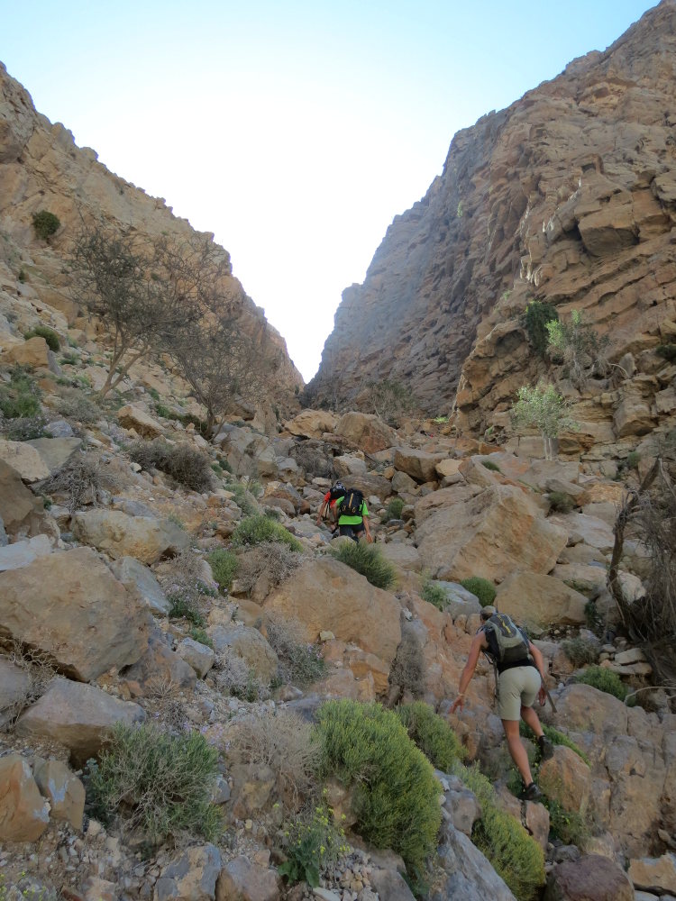
From the parking lot, continue along the track and at the end, after the last houses, turn left into the wadi bed. Walk about 30′ more to the left over the bed, to a kind of fork with a nice tree. Turn left (right is the way back). Keep going up, it's steeper, and higher up the path veers to the right in front of a large scree (logical bend). You're almost at the top, it seems closed, but as you climb further up the right flank, you'll discover a small gully that gives access to the high plateau. There's a short climb (easy) and you're on the plateau, above an abandoned village with a few terraces.
Part 2: Leopard Canyon (2h)
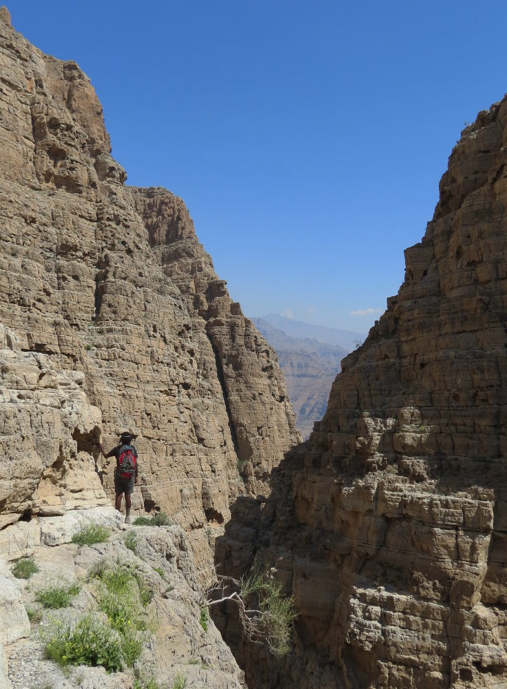
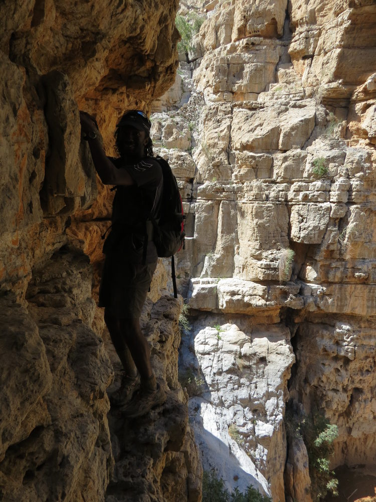
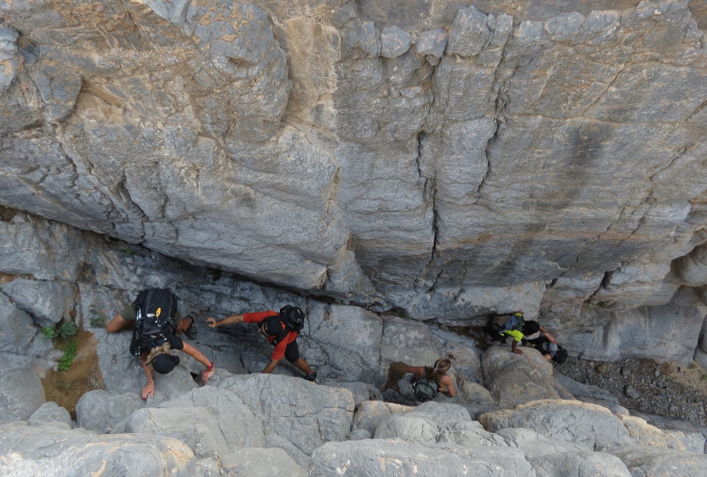
Descend onto the terraces, then follow the slope to the left before climbing up the left flank. There's a small ridge to cross and then you see the entrance to the Leopard Canyon, which runs almost in the opposite direction. Enter the wadi by walking on the ledges to the left or right, as appropriate. The 1st passage on the left is an arien and exposed climb, but easy enough to avoid a waterfall and descend on the other side, with steps up to the top of a second waterfall. For the descent, there is an option along the axis (1 climbing step) and an option by going to the right (traverse expo) then de-escalating in a corner. The route then widens out, and you follow the ledges up to a stone table, continuing on (depending on your mood) to a viewpoint where you catch your first glimpse of the exit to wadi Bih. From here, you can descend to reach the bed of the wadi (an easy but very exposed descent). We're on large slabs polished by the waters. There are some pools, but the water is a bit stagnant, so we just stare at them... shame!
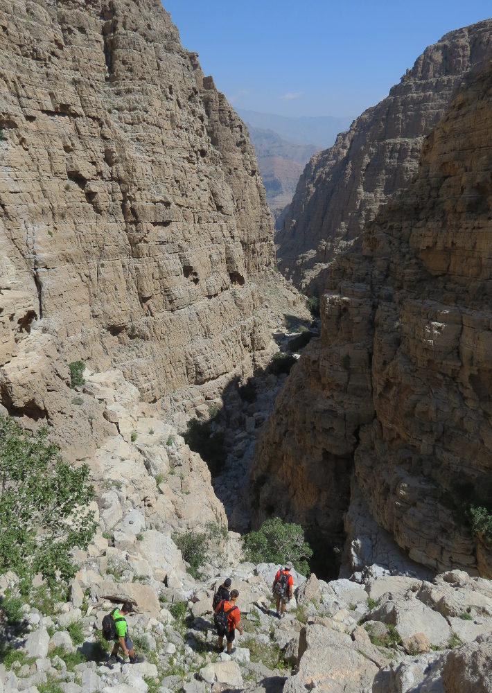
Go back up the entire wadi in the opposite direction and, on exiting, climb diagonally onto the plateau. Once on the plateau, reach the edge to admire the impressive view of the great depression. At the bottom, you can already see the entrance to the descent canyon, with its fine grey slab. Follow the rim to the left to reach a gully a little further on, after the small white stele. The descent is long and demanding, with a number of waterfalls to be avoided either to the right or left, some with a little de-escalation to end up in the wadi bed at the very bottom, which we assume to be the top of Wadi Qada'a. Descend to the grey slab at the top of a magnificent 30m waterfall, giving access to the exit canyon. To avoid jumping, take the small passage to the left of the waterfall (with a step) and then follow the surprising natural corridor. There are several beautiful waterfalls, all of which can be avoided or bypassed. The last, impressive waterfall, which opens onto the valley floor, can be bypassed on the right by descending one floor on the left. Rejoin the path on the right-hand side and you're back at the start fork and parking lot.


Leave a Reply