


TOPO Via ferrata | CLIMBING7.COM
Publié le
 Partager sur WhatsApp
 Partager sur Twitter
Partager sur Instagram
Partager sur Twitter
Partager sur Instagram

 Partager sur Facebook
 Imprimer le topo
 Laisser un commentaire

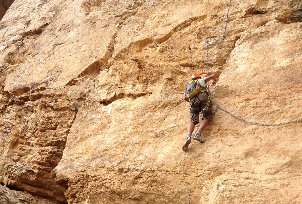
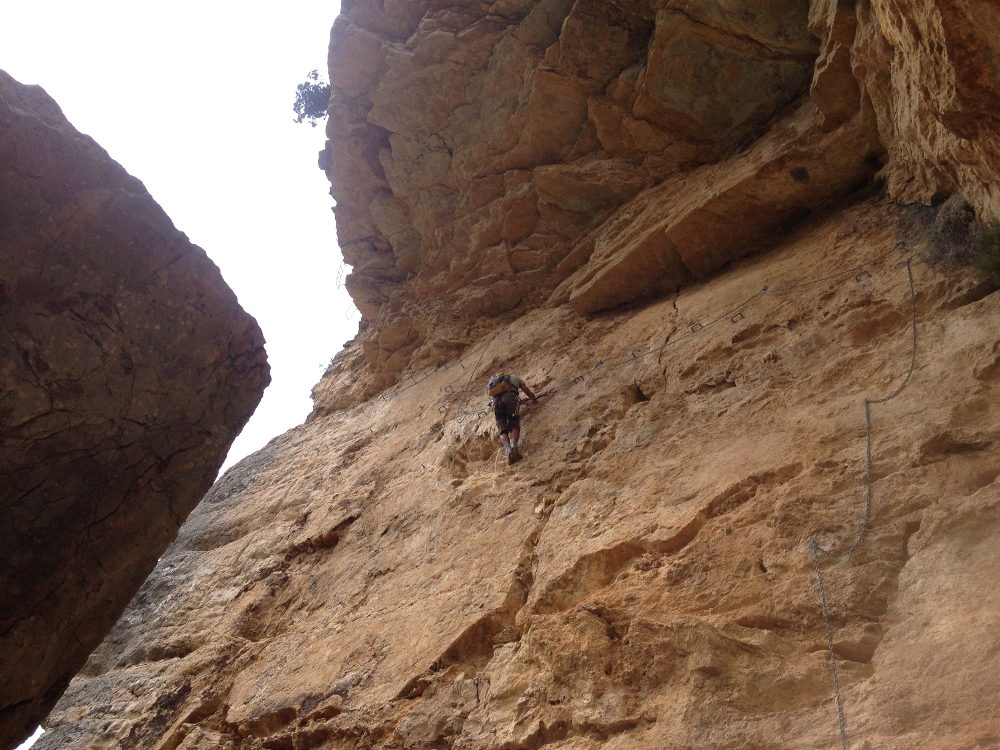
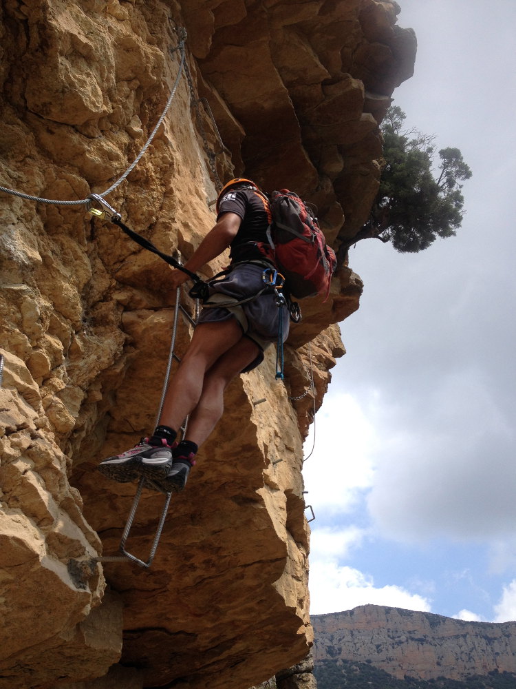
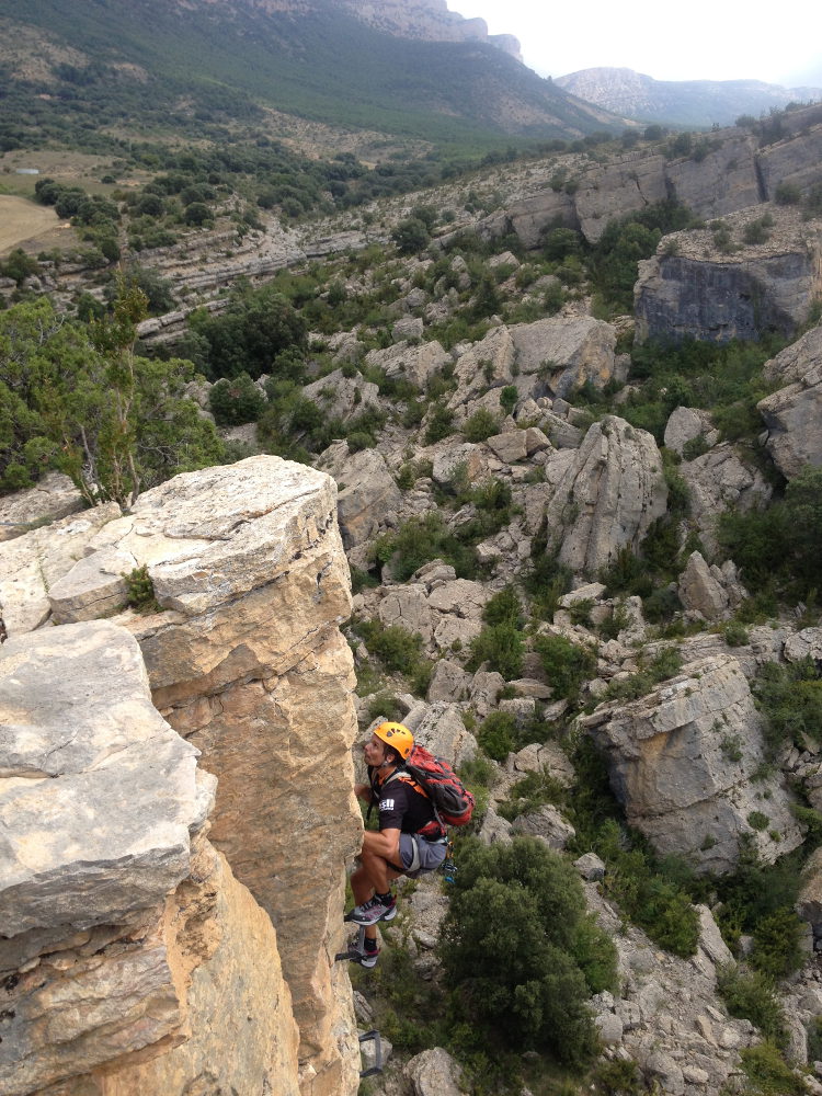
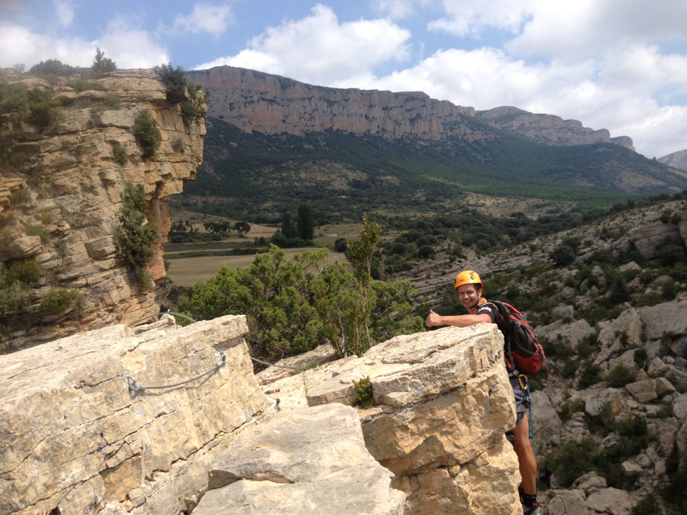
As you move deeper into the Pardina barranc, with the majestic Montrebeï congost as a backdrop, the route equipped with its latest new pitch is much more challenging than before! It's a seamless transition from TD to ED, with a very vertical finale to climb, a roof with a ladder suspended in the void to pass, and a very physical overhang before exiting onto the plateau. The gentle loop back to the congost is as magnificent as ever, rounding off a beautiful, long run of over 4 hours.
❱❱ Technical summary
Location ✦ Corça, Ager
Region ✦ Montrebei, Catalunya
Country ✦ Spain
Type ✦ Via ferrata
Vertical rise ✦ 190m
Difficulty ✦ K5
Distance ✦ 250m
Duration ✦ 3h to 3h30
❱❱ Access to the place
40km before Leida (coming from Barcelona on the A2), turn north to Balaguer and then Ager, on the edge of Catalonia. Drive to the village of Corça, 7 km from Ager. As you enter Corça, turn right onto the semi-bitumen track towards La Pertusa and its hermitage. After a few hairpin bends and a few minutes, you come to a cul de sac at the top of the Pertusa rock, just above the pantano de Canelles. Parking here is the starting point for the approach walk.
❱❱ Map & topo

❱❱ Itinéraire
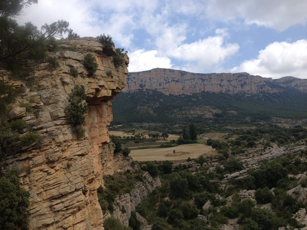
From the parking lot, follow the GR 1 north towards the congosto. After about 15′ of walking, there's a fork to the right in a left-hand bend (and before the path descends) towards the ferrata. There's a signpost and further on, red and white waypoints. The trail heads east along the mountainside, gradually descending into the Pardina barranc. On the left, on the other side, you can admire a large, multi-storey rock bar in yellow and grey, formed of wide vertical undulations. This is where the barrancos de la Sarah and de la Piula start, and you can follow them on your way back. The path finally joins the torrent bed, and we find a 1st chain that takes us to the foot of the ferrata start point: cascada Silvia.
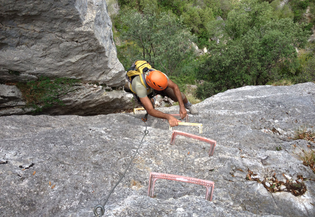
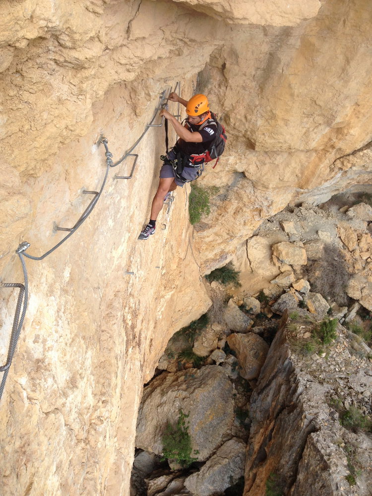
The via ferrata, opened in 1997, faces south-east and has a vertical drop of 190m. The equipment, though old, is good and solid. The final section 4 is much more recent (2011), with generous equipment, and raises the level of the route significantly (TD).
Reach the top of the path (or follow it for the light option), which is perfectly marked with red and white dots and takes around 1 hour to reach the Mas Carlet refuge, passing beneath the ruins of the castle. From here, at the refuge, turn left onto the GR to return to the Pertusa parking lot in a further 1h. Other options are obviously more fun, but more challenging: descend the Pardina barranc, the Sara barranc or the Piula barranc.


Leave a Reply