


TOPO Hiking | CLIMBING7.COM
Publié le
 Partager sur WhatsApp
 Partager sur Twitter
Partager sur Instagram
Partager sur Twitter
Partager sur Instagram

 Partager sur Facebook
 Imprimer le topo
 Laisser un commentaire
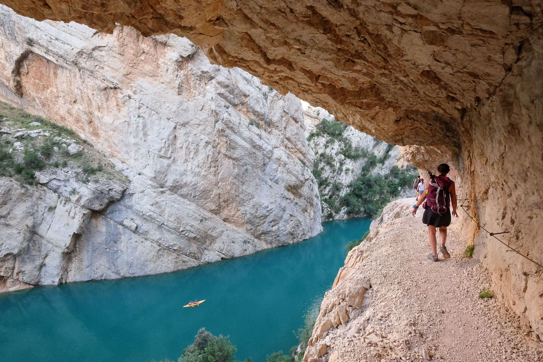
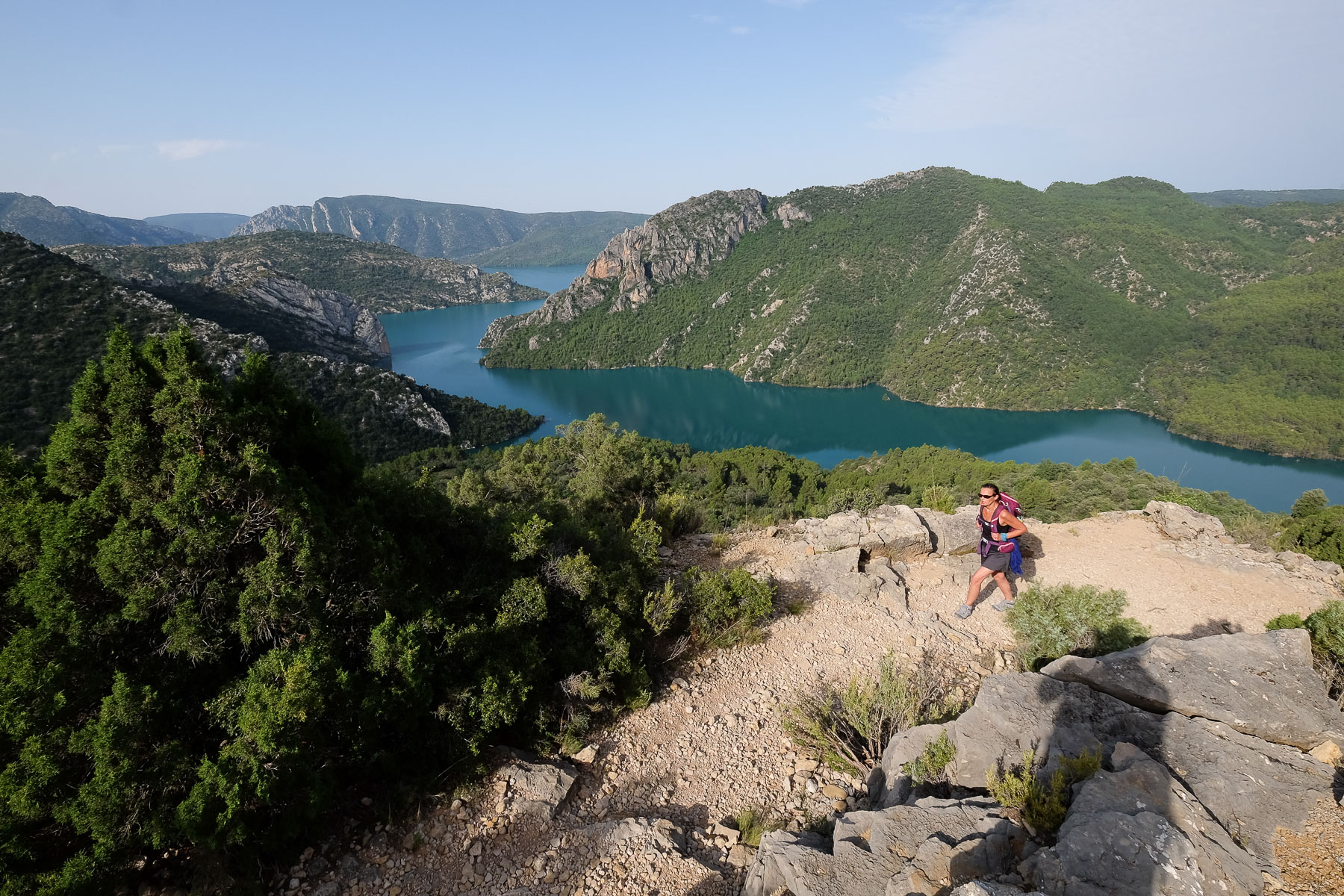
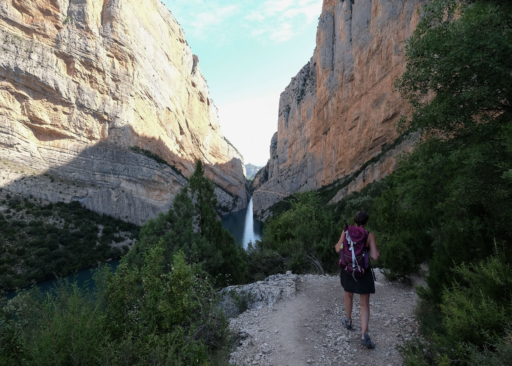
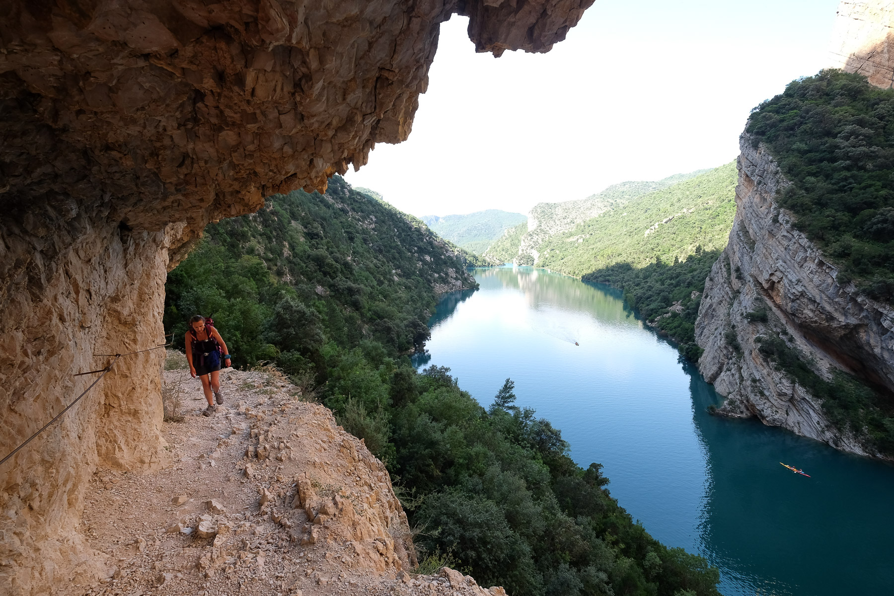
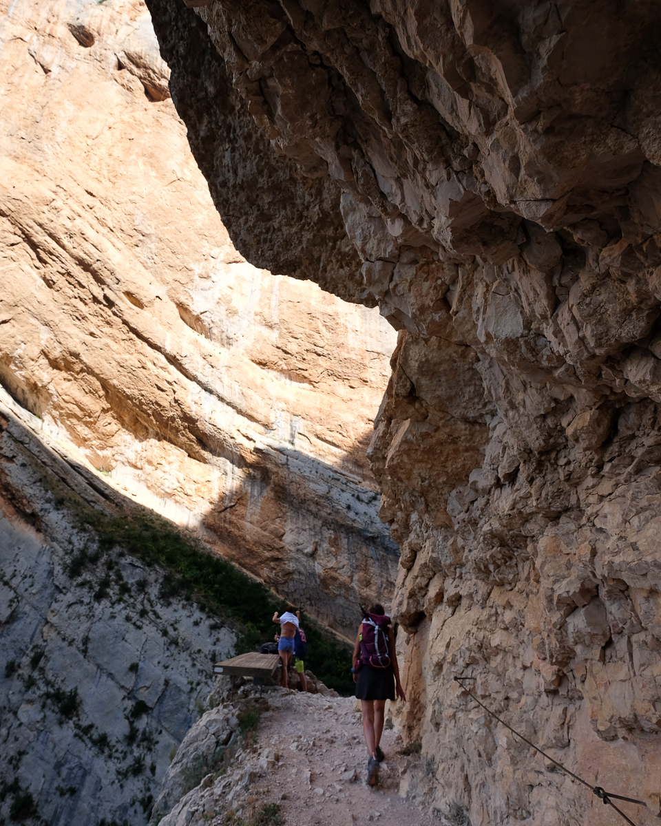
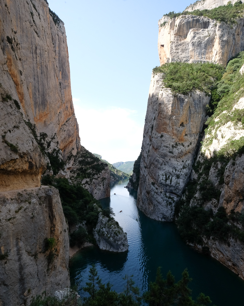
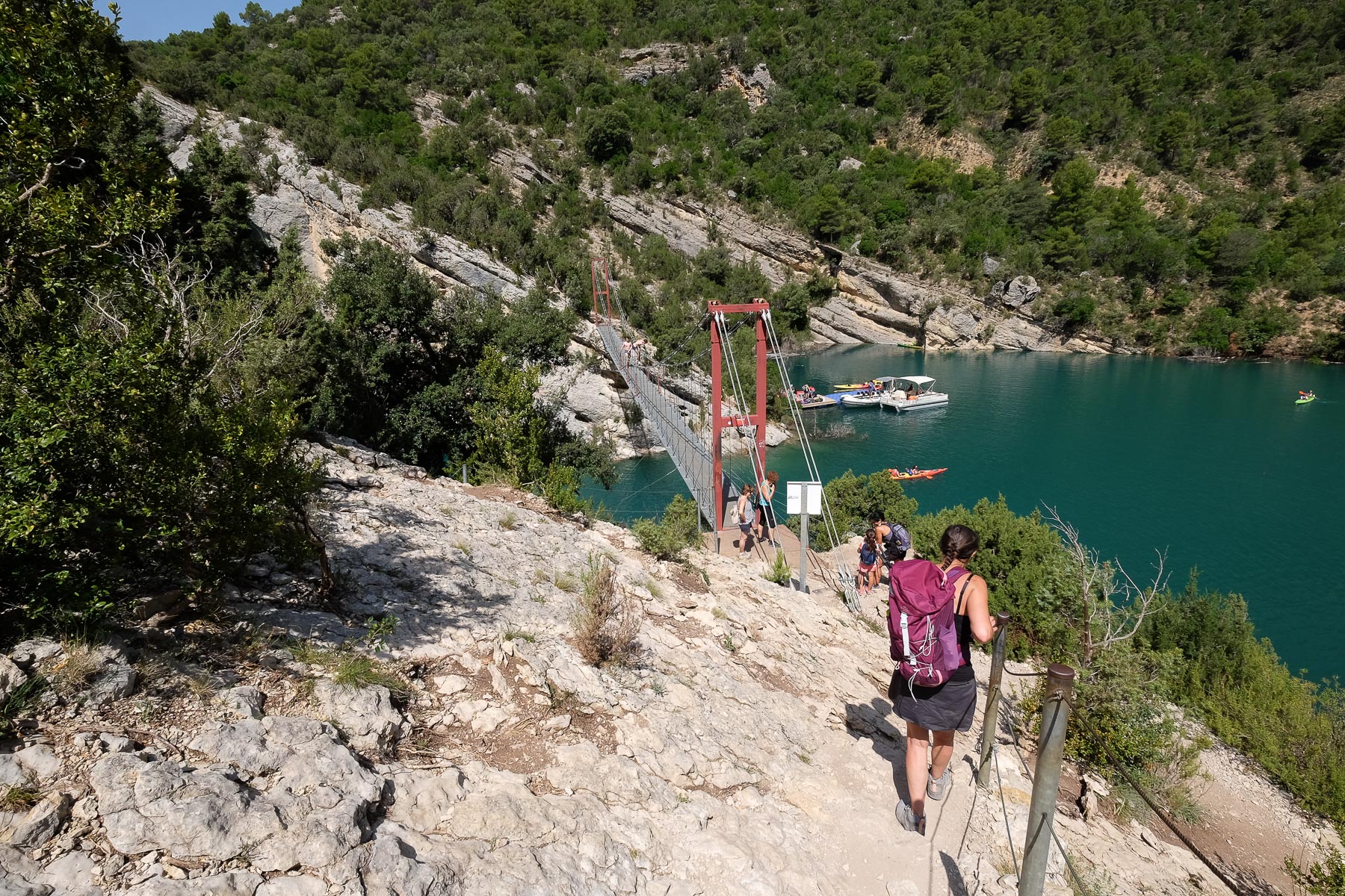
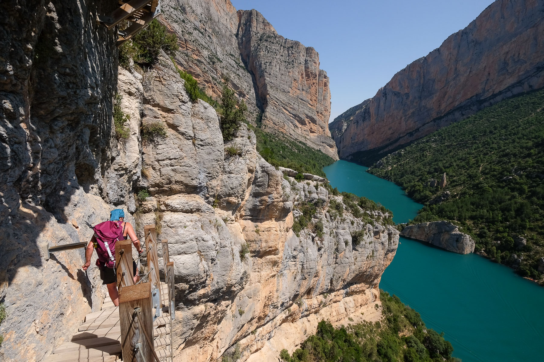
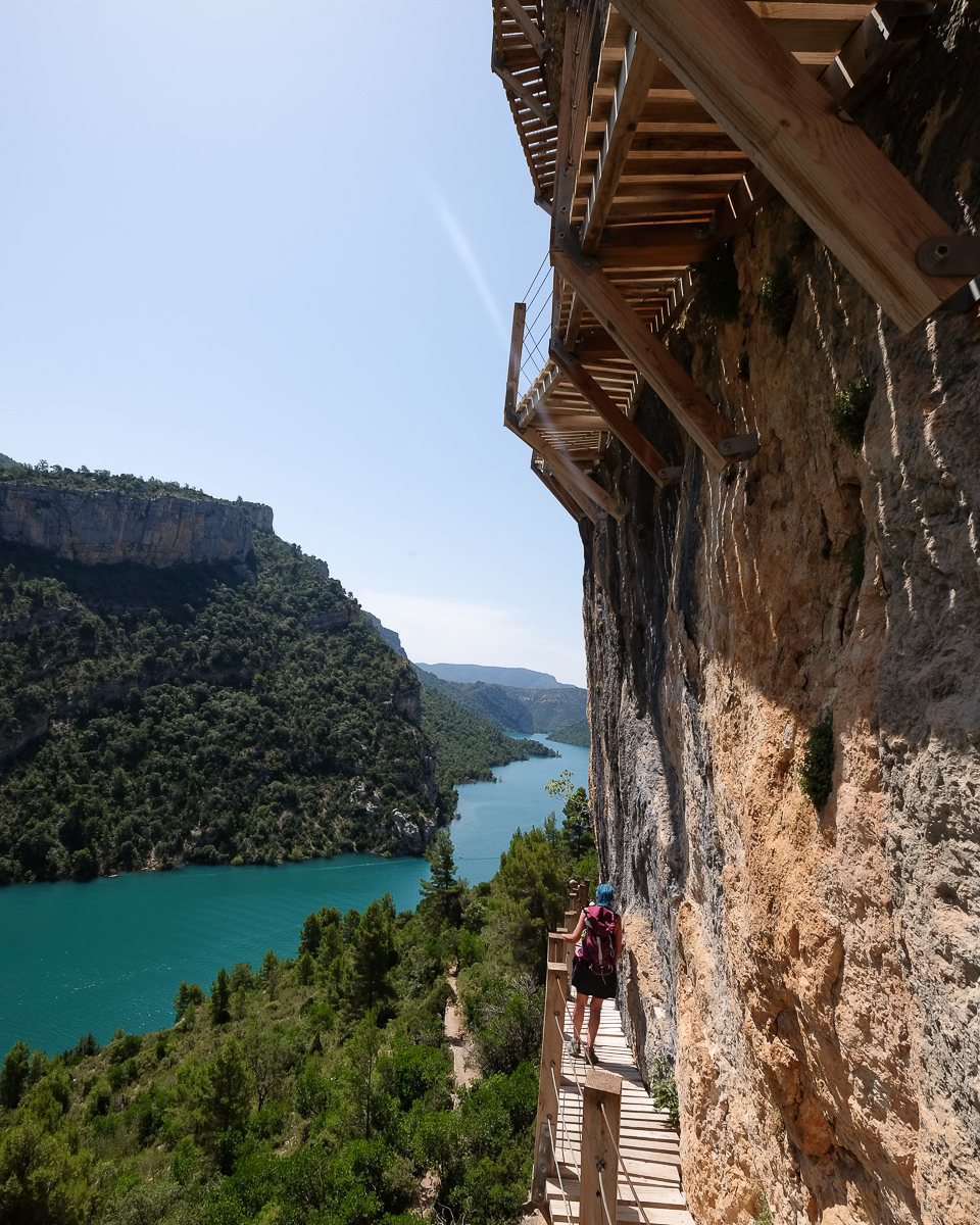
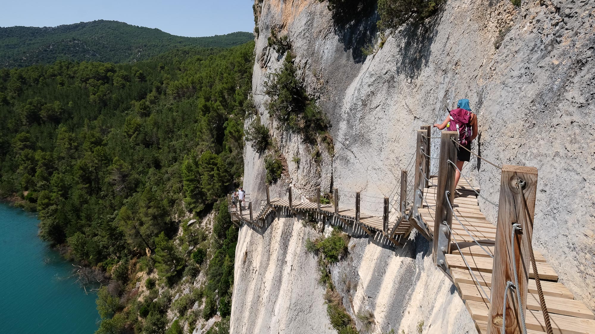
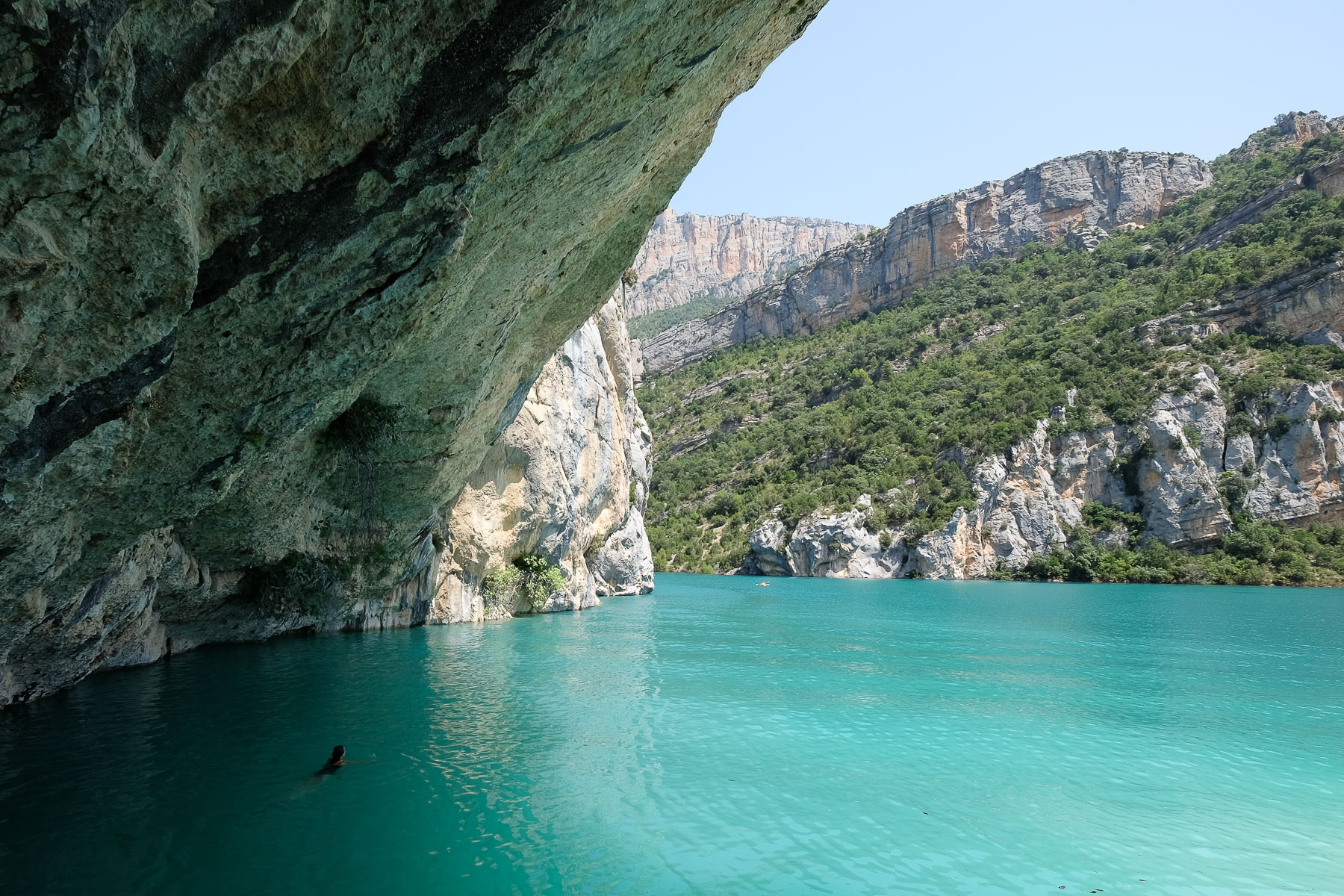
The congost de Montrebei forms an impressive gorge between 2 immense rock faces, allowing the limpid waters of the Noguera Ribagorçana, the natural border between the provinces of Catalunya and Aragon, to flow through. An equipped path in the cliff on the Catalan side, following the GR1 itinerary, takes you from Corça in the south to Pont de Montanyana in the north of the congost. To complete the picture, a small suspension bridge on the Aragonese side leads to the Pasarelas de Montfalco, an aerial route suspended from the high cliffs overlooking the Pantano de Canelles. The scenery is spectacular, the views over the gorge splendid and the route easy but very aerial. The only drawback is that the area is very busy, especially in summer, both on the rock and in the water, with many kayakers also paddling through the gorges from below. An exceptional place, where you can also discover superb via ferratas and dry canyons in the Pardina barranc.
❱❱ Technical summary
Type ✦ Hiking, equipped trail
Location ✦ Corça, Ager
Region ✦ Catalunya
Country ✦ Spain
Orientation ✦ South
Max altitude ✦ 800m
Distance ✦ 17.5km
Dénivelé ✦ 1120m
Difficulty ✦ E3 / T3 / R2
Duration ✦ 6h to 7h
Interest ✦ ★★
❱❱ Access to the place
The option chosen here is to start on the Catalan side, from La Pertusa. Go to Ager on the C12 linking Tremp to Leida and turn off onto a very small road that leads to the village of Corça. From here, continue towards Ermita de la Pertusa. The road is very narrow and in poor condition in places. Before the hermitage, park below on the left in a large parking lot.
❱❱ Map & topo

❱❱ Itinéraire
From the parking lot, walk west along the road for a few minutes to reach the end, in the form of a parking lot, at the cliff where the Pertusa hermitage is perched.
The itinerary is long and includes 2 round trips: the equipped gorge trail and the optional Montfalco footbridges. The GR1 up to the entrance to the gorges is the most physical and least frequented part. After that, it's crowded, with little change in altitude, but the most spectacular part. We made a U-turn in the gorge just as we exited the narrow passage and it opened up to exit to the north. The gorge path is equipped with a lifeline (cable) along its entire length, but is not protected at all on the empty side. The footbridges, on the other hand, are built with a railing on the empty side, which doesn't make the route any less aerial and vertiginous, but it's more reassuring.
From the end of the footbridges (or from the bridge or the GR1/bridge junction), you have to go in the opposite direction. The climb back up to the Pardina barranc is fairly long, and after passing the ruins of the Mas Carlet refuge again, there's a final steep climb to the Pertusa parking lot.
Topo of the route on topopyrenees.com from the Montfalco refuge.
Topo des Pasarelas de Montfalco from the Aragonese side.
Topos of the Montrebei via ferratas, from the Pertusa.
Topos des canyons secs du barranc de la Pardina, from La Pertusa.


Leave a Reply