


TOPO Climbing | CLIMBING7.COM
Publié le
 Partager sur WhatsApp
 Partager sur Twitter
Partager sur Instagram
Partager sur Twitter
Partager sur Instagram

 Partager sur Facebook
 Imprimer le topo
 Laisser un commentaire

The Pic (Pique?) Rouge de Bassiès faces the Montcalm and Estat peaks, two 3000m peaks on the border with Catalunya. The route, which starts at almost 2000m, climbs a splendid spur of grey granite in an impressive high-mountain atmosphere. The entire route, between 10 and 12 hours, is physical and challenging, combining hiking and adventure climbing. It's probably the most accessible route in this climbing sector, although on the 4th pitch, we embarked on a more difficult variant which, in the end, results in a TD inf route.
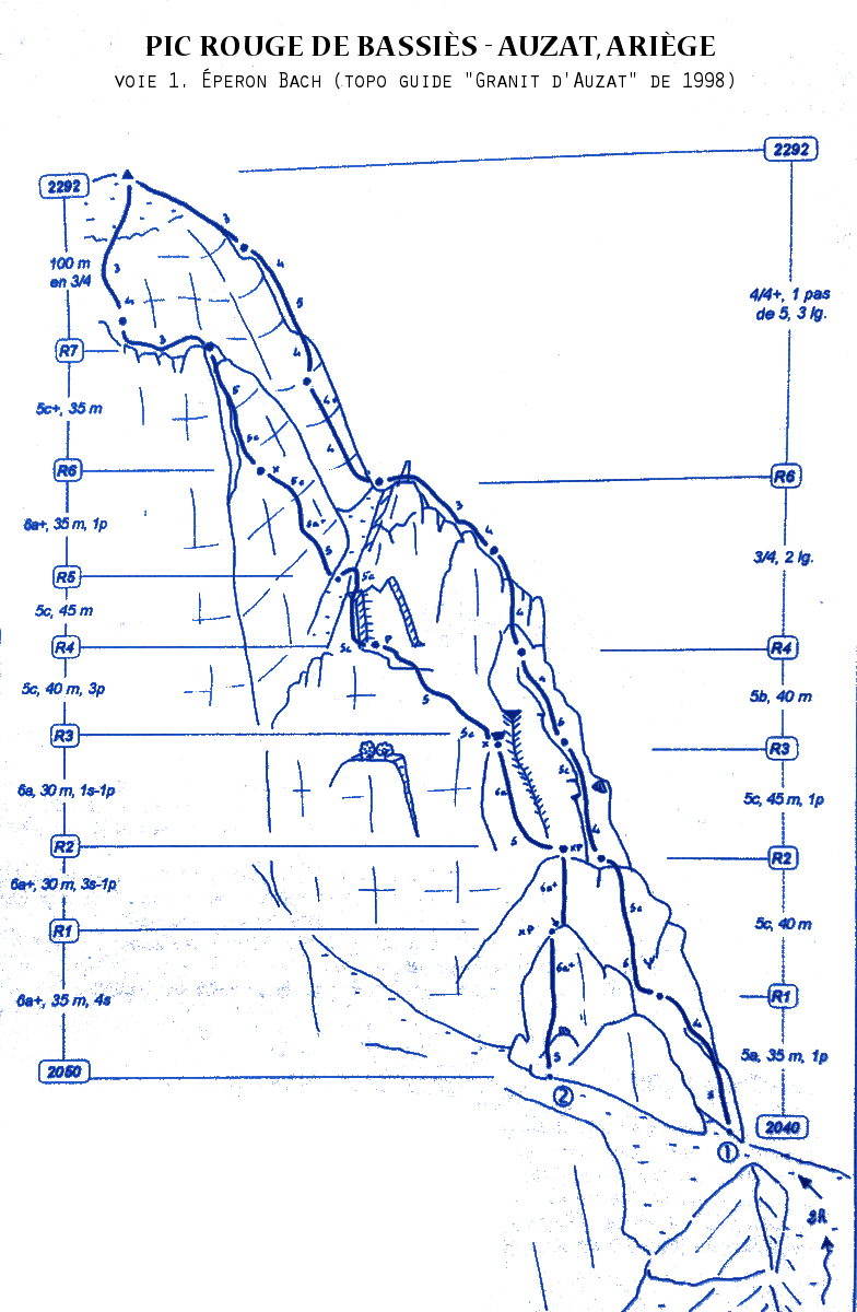
❱❱ Technical summary
❱❱ Access to the place
At Tarascon, take the road to Vicdessos and Auzat. After these 2 towns, continue climbing towards Marc and Lartigues. The road then crosses the torrent and climbs the right-hand side to reach the Montcalm parking lot, the starting point for the approach.
❱❱ Map & topo
❱❱ Itinéraire
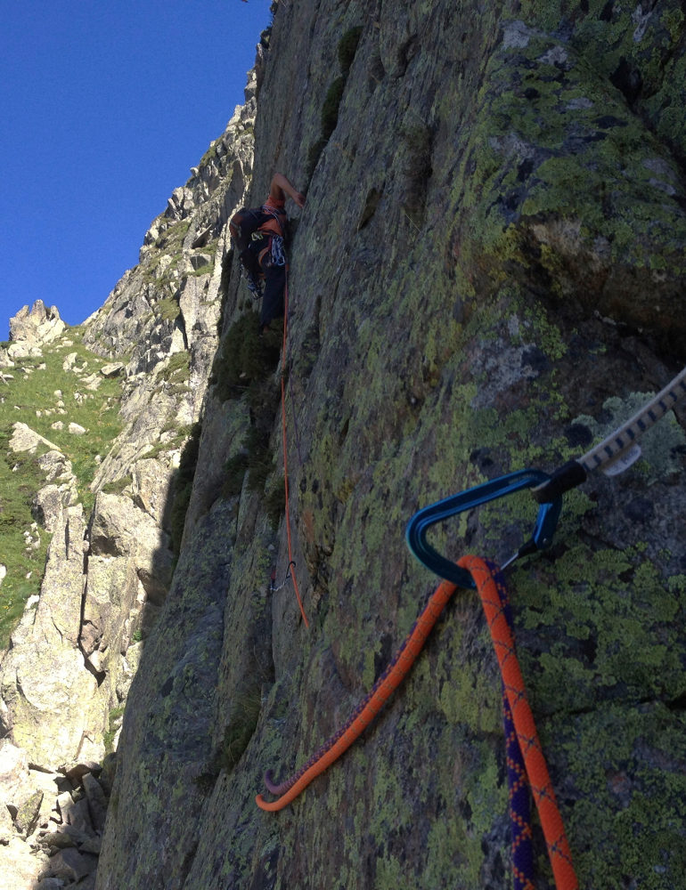
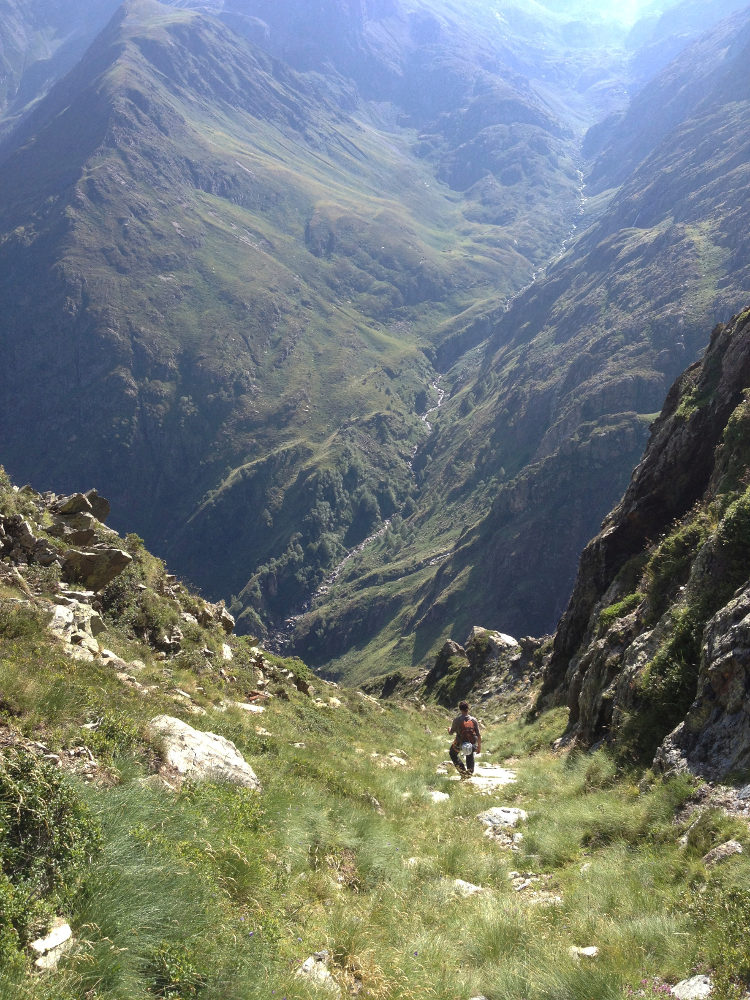
Follow the GR towards the Pinet refuge. After 2 or 3 hairpin bends, the path climbs steeply through the forest, then follows the curve of the slope to a stream and a small bridge. Here, fork right to follow the yellow markers. The path from here on is minimal, very narrow and sometimes overgrown, with a few exposed passages. It climbs up to the Raspe de Bassiès, with wide switchbacks and a superb waterfall. You can see the spur, which is easily recognizable. Keep climbing until you can improvise a passage that cuts across and joins the base of the rock (there are a few small, but not very well-defined paths). The end of the approach is a little tricky. When you reach the foot of the rock, pass on the west side. You can see 2 old pitons at 3m near the ridge. Climb another 2 or 3m to start with a crack. To the left of the start, a large, recognizable trangular stone blade.
Opened in 1975, the route faces west at first, then south, and is around 320m long in 7 pitches (30m, 40m, 50m, 50m, 40m, 40m + 50m, 20m). The 1998 topo lists 9 pitches. Adventure terrain, virtually no equipment in place apart from a blocked friend on L2 and a piton on L4 (well, what we saw). You'll need 15 long quickdraws and a full set of friends, doubling from 0.3 to 1, a set of jammers and a few loose straps. Overall, the protection is easy to install. The level of the route with the L4 variant could be TD inf (6a obligatory), otherwise D sup (V+ obligatory).
L1 (30m, V)
Take the small crack to climb the rocky piton next to the main spur (V, not easy to protect). Then climb IV up the ridge to the R1 belay on the top of the piton, under a cracked slab.
L2 (40m, V+)
Cross to reach a narrow dihedral 10m to the left, which leads directly up to the summit. 1 friend blocked under a boulder to overcome (not difficult, V+/6a?) and above finish vertically following the passage between the boulders. R2 belay on a 1st flat, 1st part of the spur.
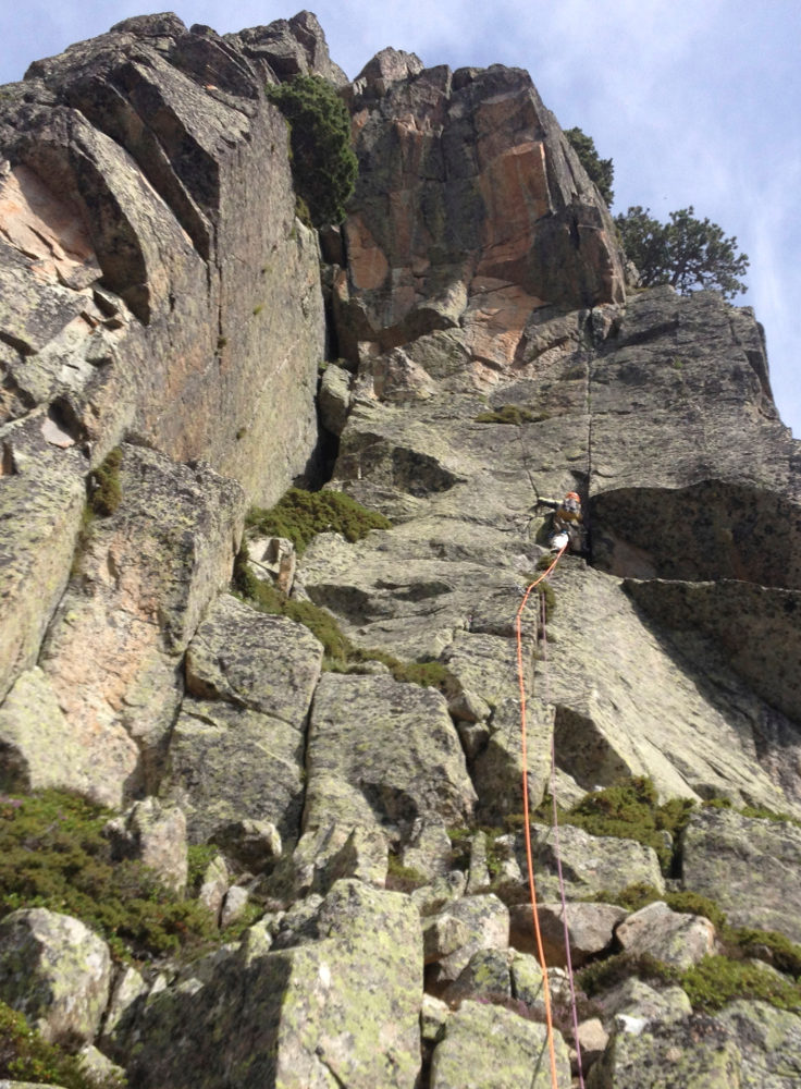
L3 (50m, V+)
Climb the easy ramp, then tackle a clear crack leading to the roof. Fine steps and an increasingly vertical wall. Below the roof, the difficult step is aerial to exit right onto the ridge. Continue on the east face, passing to the left of a 1st tree (in the branches) then finishing on a stepped slab up to the 2d tree. Very comfortable R3 belay.
L4 (50m, 6a)
Simpler variant of the left-hand passage (V). Go straight up the middle to a small orange dihedral. A good technical step leads to a small overhang with a finger crack (6a), then higher up, the difficult orange dihedral in opposition with little footing (6a, 1 piton at the exit). The rest is easier in IV/V, as we climb the ridge, which becomes narrower. Relay R4 less comfortable, on the ridge.
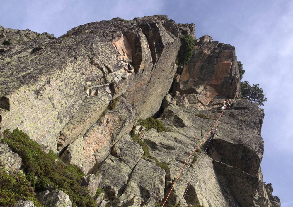
L5 (40m, IV+)
An easy, very airy length, where you follow the ridge balancing on standing plates. A characteristic rock point at the end. Relay R5 before descending to a new small pass, the end of the 2nd part of the spur.
L6 (40m + 50m, III then IV+)
Walk on the grass to reach a slightly steep ramp on the left (40m, II/III). Climb up the couloir to reach the end of the spur. Relay R6 under a last small wall.
L7 (20m, V)
Exit on a mini-chimney with a small step, then finish on a sloping slab to the near-summit relat.
Finish the ridge to descend to a small pass with the next spur. Descend to the pastures on the right, then look for a path below which crosses to reach the base of the dihedral (path not very well defined. .). Finish by joining the yellow-marked path, then at the bottom the GR to the parking lot.


Leave a Reply