


TOPO Hiking | CLIMBING7.COM
Publié le
 Partager sur WhatsApp
 Partager sur Twitter
Partager sur Instagram
Partager sur Twitter
Partager sur Instagram

 Partager sur Facebook
 Imprimer le topo
 Laisser un commentaire

A good warm-up on Monte Oro to start the discovery of the Gulf of Orosei, on Sardinia's east coast. The little loop starts from the village of Santa Maria Navarrese and reaches a summit overlooking the entire coast to the south, with beautiful views of Tortoli, Arbatax and the peaks of central Sardinia. No particular difficulty, easy to follow and with a reasonable gradient. There's still the heat to contend with in midsummer, so water supplies are a must. The return via Pedra Longa allows you to cool off in the transparent waters of the calanques and admire the fabulous Punta Giradili wall, your next hiking objective.
❱❱ Technical summary
❱❱ Access to the place
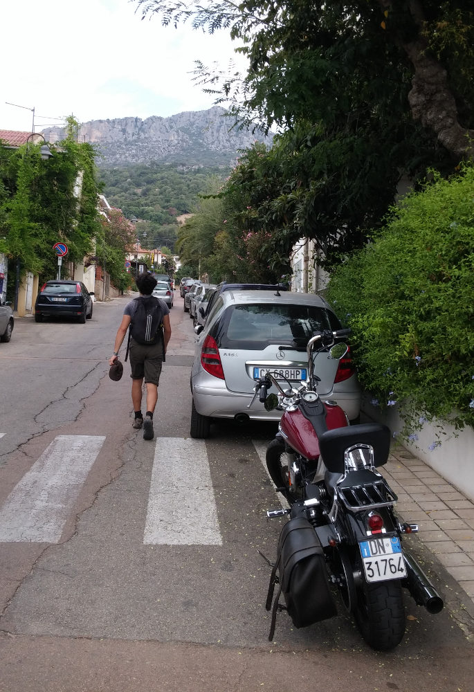
Once in the village of Santa Maria Navarrese, go to the upper part, above the small harbor at the Il Pozzo restaurant, where you can park.
❱❱ Map & topo
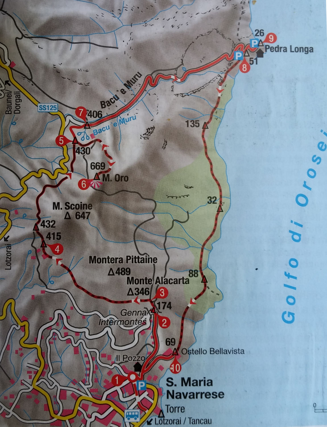
❱❱ Itinéraire
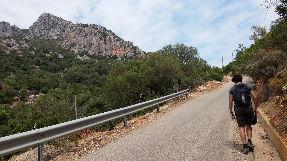
From the restaurant, take the Via Pedra Longa, which heads uphill. After a left-hand bend further up, take the road which drops off to the left and climbs steeply. The slope is steep, and further up you come to a track, pass through a gate and go left until you come to the start of a path which goes off to the left into the scrubland marked with a red dot. This is the starting point.
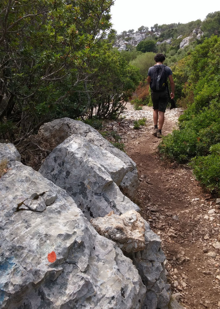
The reference guide we used was Rother's Sardinia hiking guide. The indications are precise (sometimes so detailed that you get lost), but the sketch is sufficient, as the route is obvious. There's little shade on the path, and little difficulty apart from a bit of III/IV climbing on the final section to the summit.
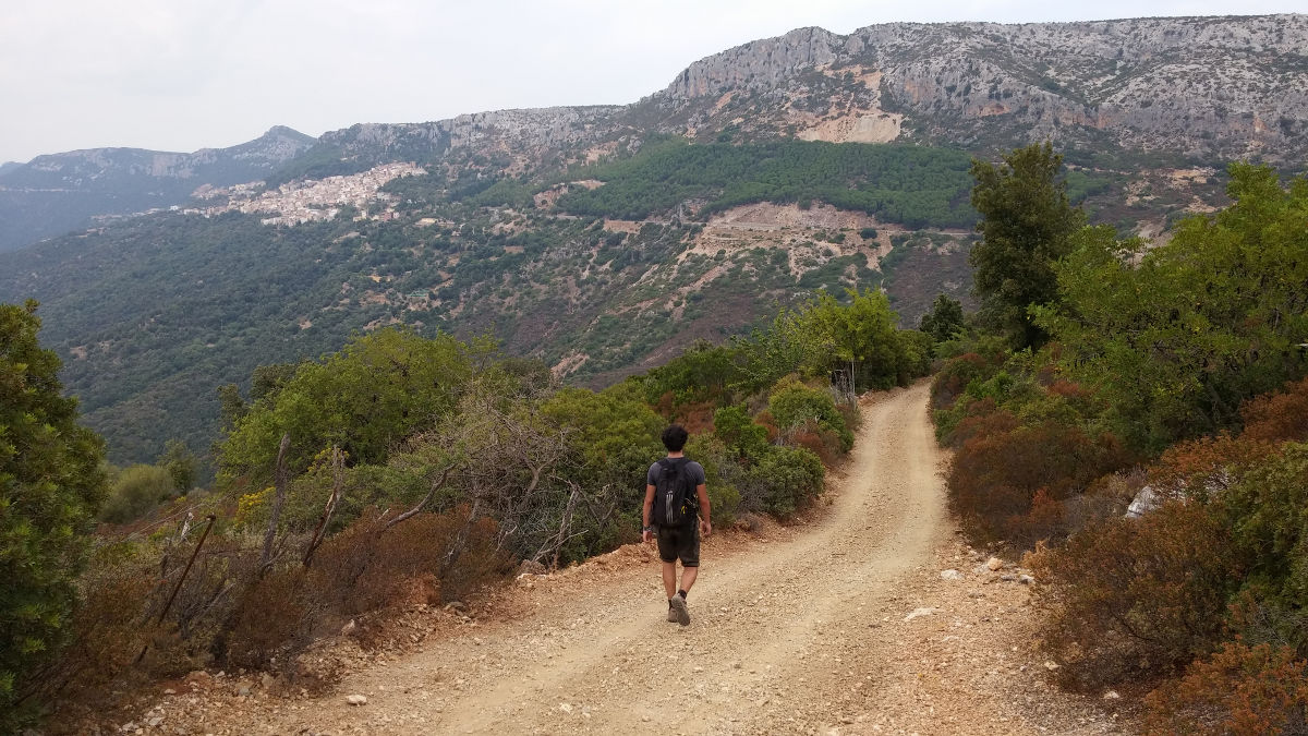
Follow the small, unproblematic path and pass under rocky bars. The view of the village and beyond is already superb. You soon arrive below Mont Scoine, a climbing area by the way, and continue on a wider track that skirts around it until you catch sight of Baunei, a village clinging to the mountain to the west. The track finally passes just above the asphalt road to cross a sort of pass, this time with Monte Oro on the left.
From the pass, take the obvious track up to the right and, after a few hairpin bends, go left on a path marked by a fine cairn. After a few more hairpin bends, take the left-hand path marked with a nice cairn. Ç grippe harder, and you'll enter a narrower natural gully (the only obvious passage) well marked with numerous cairns. A small fence to cross and finish to reach the summit and the steep south face. Splendid views over the valley and coast.
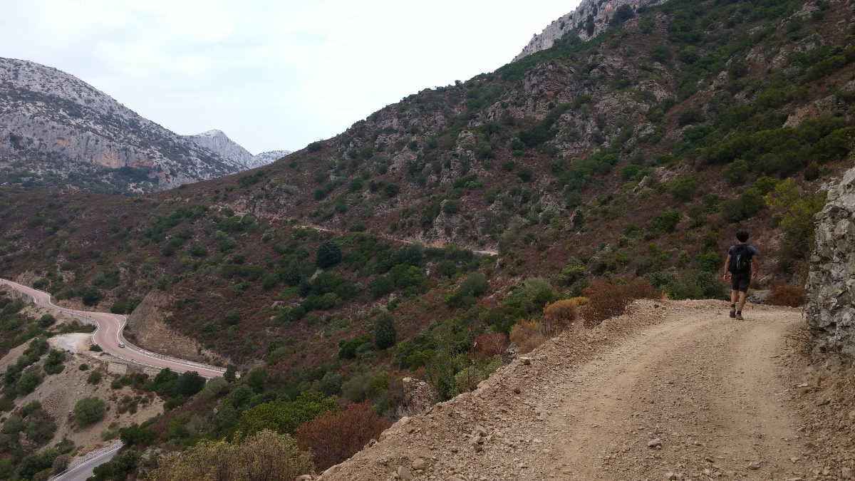
This is the least interesting part. After heading back down the path, we reach the pass and then descend to the road. There are a few kilometers to go, but soon you can see Pedra Longa above the sea. Swimming is possible from the parking lot on the left. Impressive view of Punta Giradili and the wild coastline of the Gulf of Orosei.
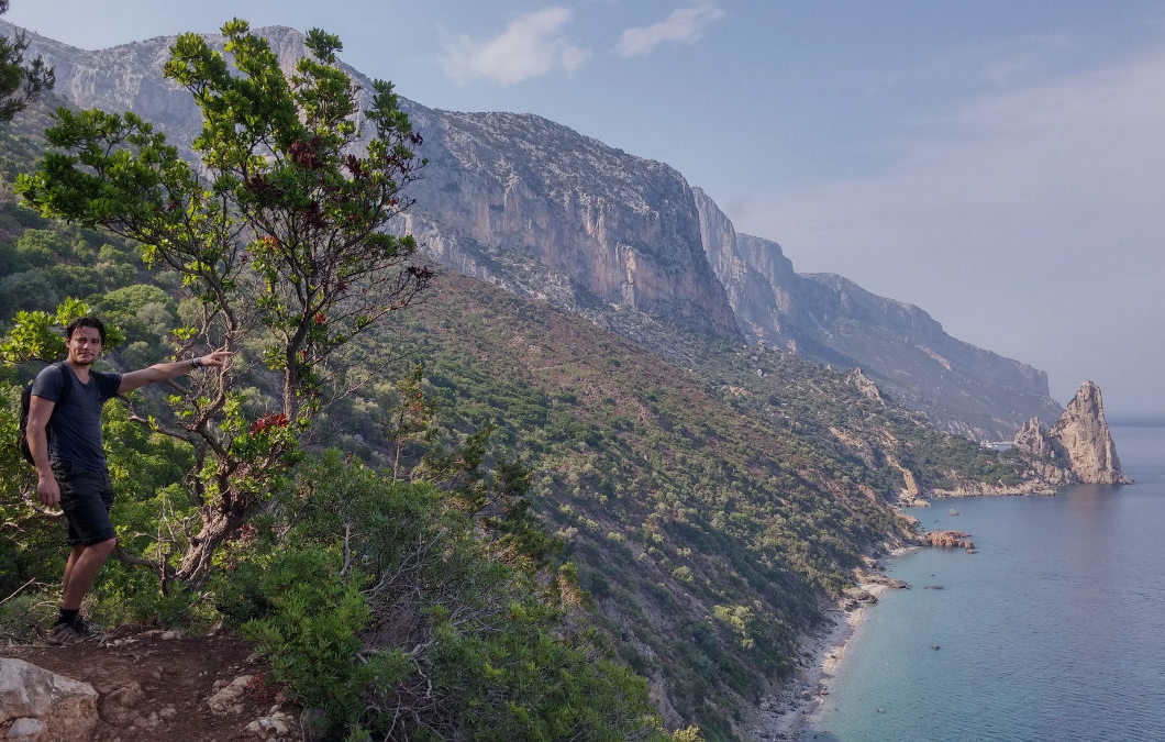
Climb up a little to the level of a small orange electivity house (or higher up in the next bend) to catch the well-marked coastal path that leads back to the village, overlooking the calanques all the way. It's quite long, but the view is superb. At the end, we pick up the Via Pedra Longa to reach the Il Pozzo restaurant, our starting point.


![2017-08-01_10-56-03 [Crête de Pinu]](https://climbing7.com/wp-content/uploads/2017/09/2017-08-01_10-56-03-crc3aate-de-pinu-e1580117578105-1024x683.jpg "The Pinu ridges, Cap Corse")
Leave a Reply